Blore

Settlement in Staffordshire Staffordshire Moorlands

England

Blore

Signpost on the Manifold Way Approaching Coldwall Bridge with the River Dove currently over to the left.
Signpost on the Manifold Way Credit: Bill Boaden

Blore is a small village located in the county of Staffordshire, England. Situated in the Staffordshire Moorlands district, it lies around 6 miles north of the market town of Ashbourne and approximately 18 miles southwest of the city of Derby.

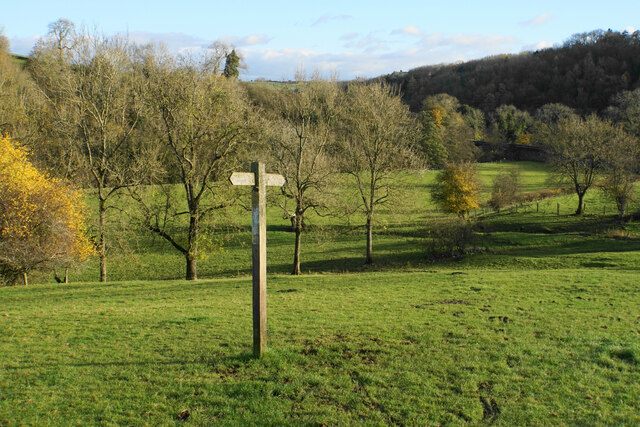
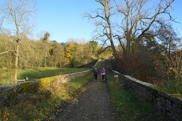
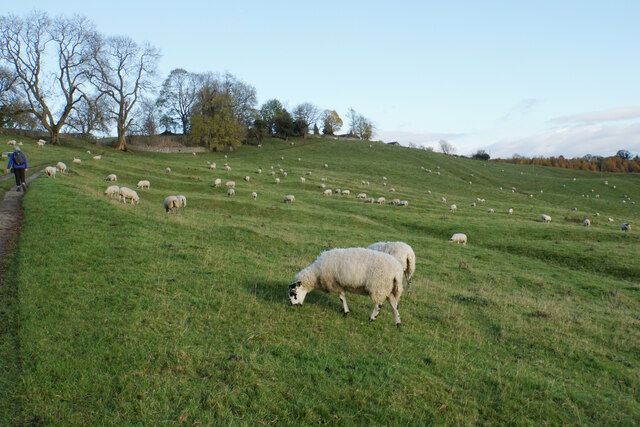
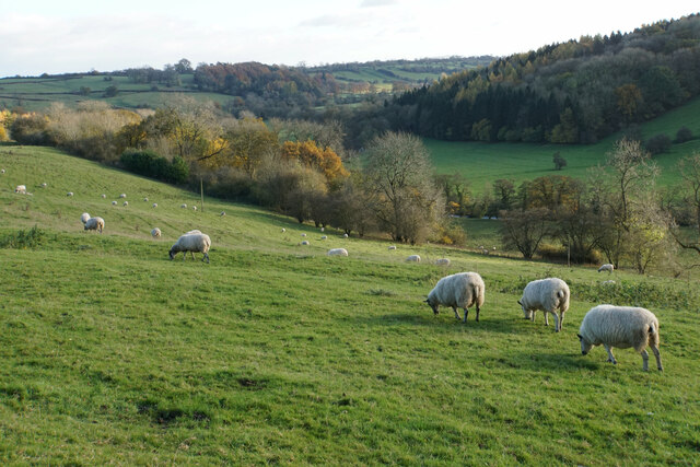
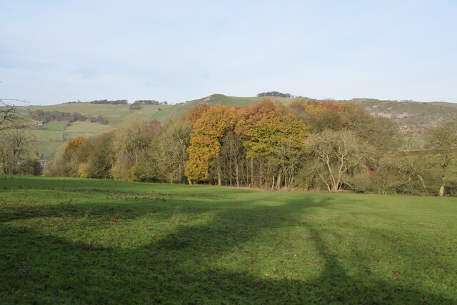
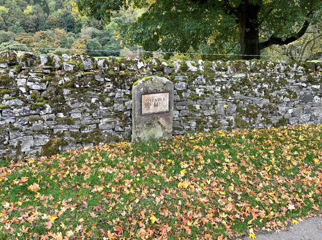
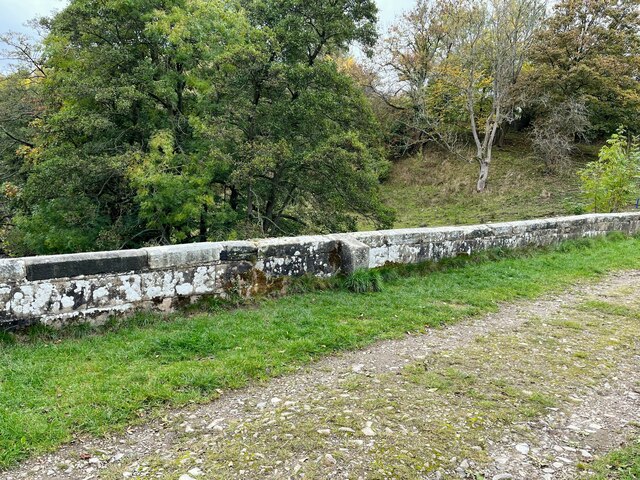
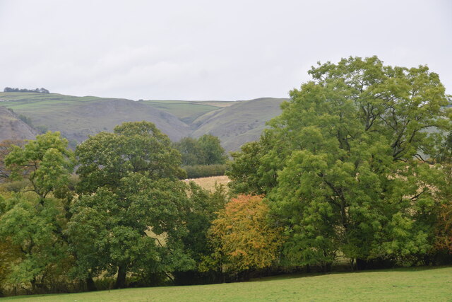
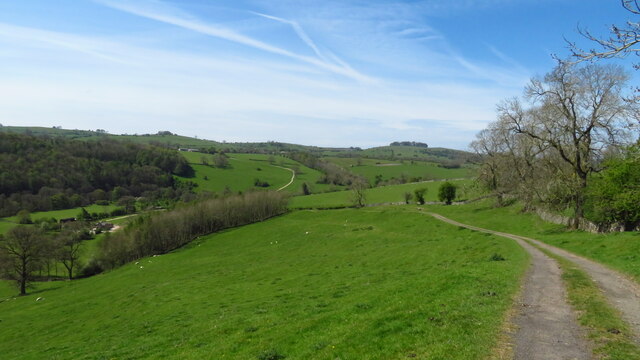
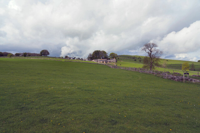
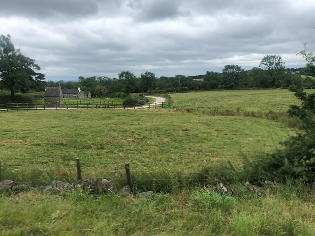
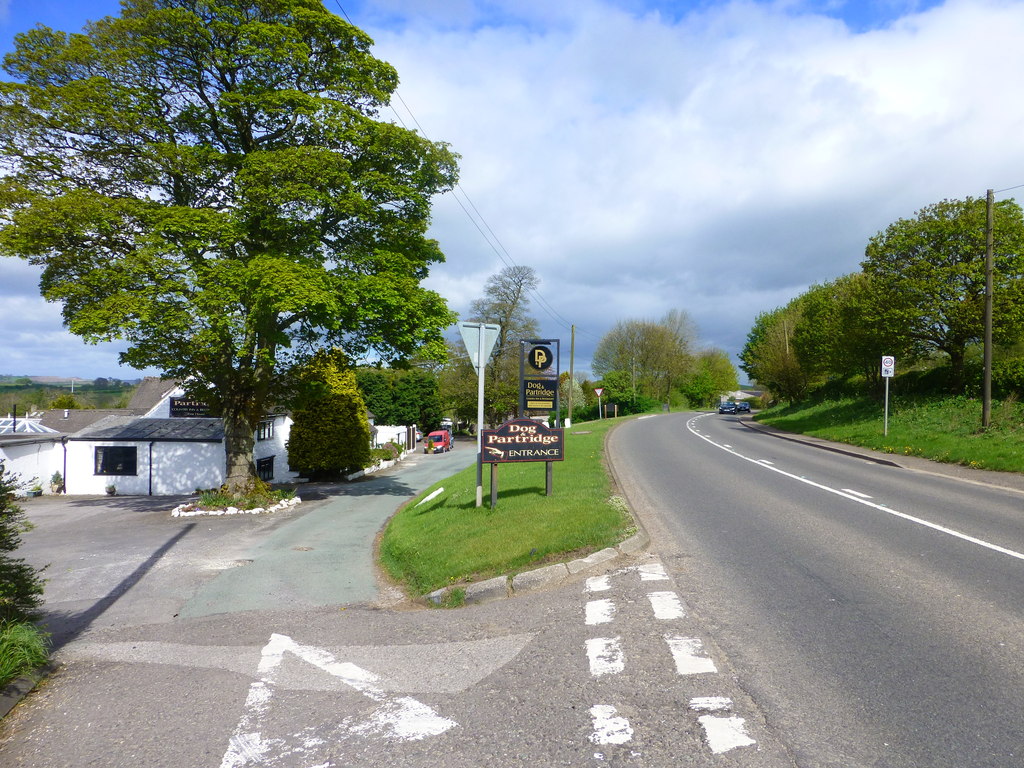
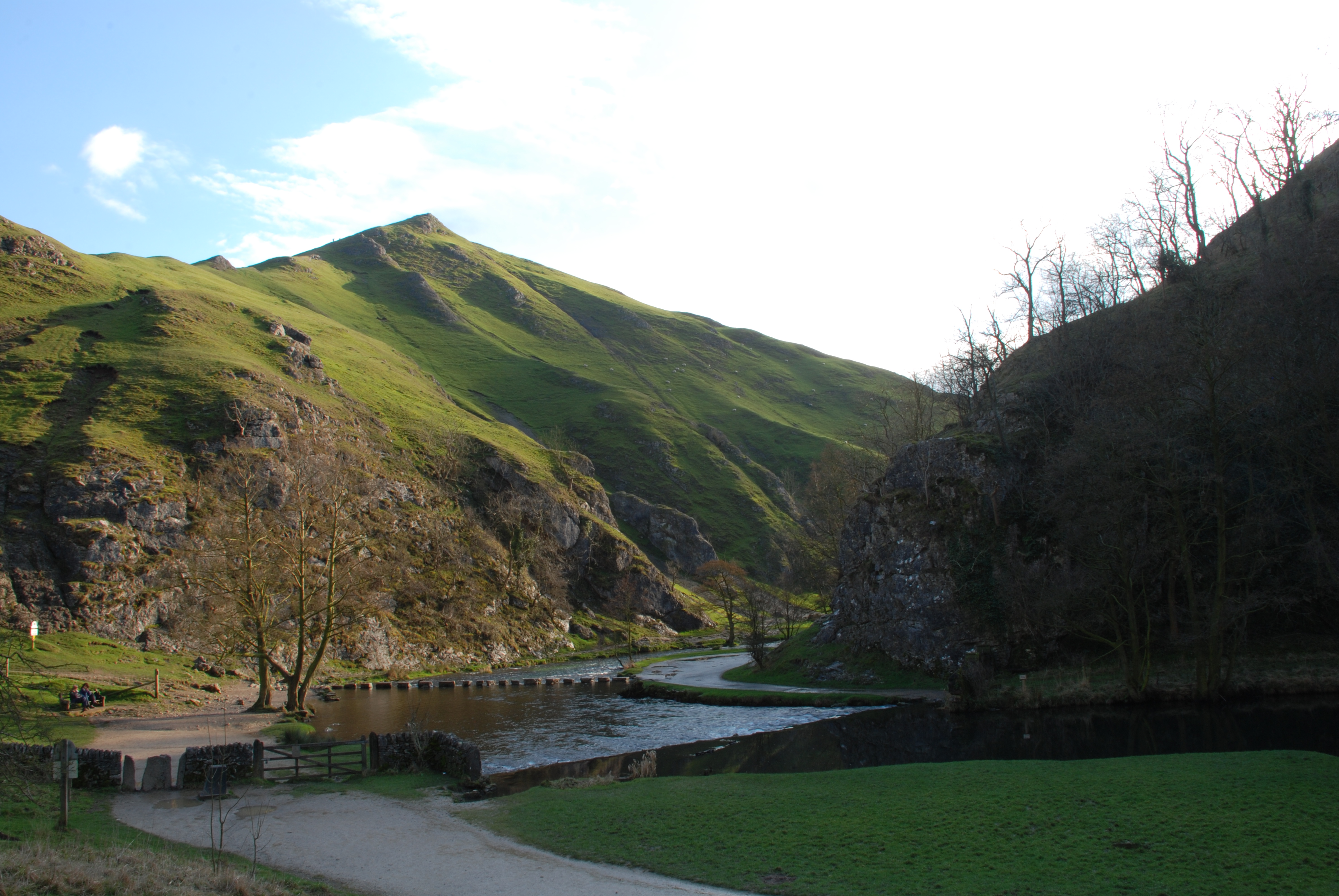
The village is known for its picturesque surroundings and tranquil atmosphere. Blore is surrounded by beautiful countryside, with rolling hills and lush green fields dominating the landscape. The nearby River Dove flows through the area, offering stunning views and opportunities for outdoor activities such as fishing and walking.

Historically, Blore has been a significant settlement with evidence of human habitation dating back to the Roman era. The village is home to St. Bartholomew's Church, a Grade I listed building with origins dating back to the 12th century. The church features a distinctive octagonal spire and is renowned for its architectural beauty.

Blore also boasts a number of charming cottages and traditional stone houses, adding to its quaint and idyllic charm. The village has a close-knit community and a strong sense of community spirit. Residents take pride in their village and actively participate in various local events and initiatives.

A notable landmark in Blore is Blore Hall, a historic manor house built in the 17th century. The hall is a private residence and is not open to the public, but its impressive architecture can still be admired from a distance.

Overall, Blore offers a peaceful retreat from the hustle and bustle of urban life, with its stunning natural surroundings and rich historical heritage. It is a place where residents and visitors can enjoy the beauty of the countryside and experience a sense of tranquility.

If you have any feedback on the listing, please let us know in the comments section below.

Blore Images

Images are sourced within 2km of 53.042092/-1.79636 or Grid Reference SK1349. Thanks to Geograph Open Source API. All images are credited.

Signpost on the Manifold Way Approaching Coldwall Bridge with the River Dove currently over to the left.
Signpost on the Manifold Way
Approaching Coldwall Bridge with the River Dove currently over to the left.
Track onto Coldwall Bridge Part of the Limestone Way which will cross the River Dove.
Track onto Coldwall Bridge
Part of the Limestone Way which will cross the River Dove.
Sheep-dotted hillside The Limestone Way climbs a farm track on the left to the village of Thorpe which is at the top of the hill.
Sheep-dotted hillside
The Limestone Way climbs a farm track on the left to the village of Thorpe which is at the top of the hill.
Sheep above the River Dove Looking down the valley from a hillside near Thorpe.
Sheep above the River Dove
Looking down the valley from a hillside near Thorpe.
Autumn view from Blore Pastures  Taken from Blore Pastures Picnic site looking across towards Bunster Hill and the mouth of Dovedale.
Autumn view from Blore Pastures
Taken from Blore Pastures Picnic site looking across towards Bunster Hill and the mouth of Dovedale.
Benchmark, Coldwall Bridge Detail of the Ordnance Survey rivet benchmark on the north parapet of Coldwall Bridge. The rivet is missing and the cut arrow is unusually elaborate. The benchmark is located on the county boundary of Staffordshire and Derbyshire, it marks a height of 135.0173m above mean sea level (Ordnance Datum Newlyn) last verified in 1949 (location photograph <a href="https://www.geograph.org.uk/photo/7326506">SK1449 : Boundary stone, Coldwall Bridge</a>).
Benchmark, Coldwall Bridge
Detail of the Ordnance Survey rivet benchmark on the north parapet of Coldwall Bridge. The rivet is missing and the cut arrow is unusually elaborate. The benchmark is located on the county boundary of Staffordshire and Derbyshire, it marks a height of 135.0173m above mean sea level (Ordnance Datum Newlyn) last verified in 1949 (location photograph SK1449 : Boundary stone, Coldwall Bridge).
Speed Camera Warning Signage
Dog & Partridge - Swinscoe
Speed Limit change
Speed Limit change
Milepost, Coldwall Lane This Grade II listed stone milepost, still bearing its cast iron plate reading Cheadle 11, was erected following construction of the Blythe Marsh, Oakamoor to Thorpe turnpike road.  Turnpike trusts had a legal obligation to erect milestones or mileposts along all roads for which they were responsible.
This section of the road, now in places only used as a farm track, fell into disuse as early motor vehicles struggled with the gradients, road users preferring to use alternative routes.
Milepost, Coldwall Lane
This Grade II listed stone milepost, still bearing its cast iron plate reading Cheadle 11, was erected following construction of the Blythe Marsh, Oakamoor to Thorpe turnpike road. Turnpike trusts had a legal obligation to erect milestones or mileposts along all roads for which they were responsible. This section of the road, now in places only used as a farm track, fell into disuse as early motor vehicles struggled with the gradients, road users preferring to use alternative routes.
Boundary stone, Coldwall Bridge Coldwall Bridge carried the Blythe Marsh, Oakamoor to Thorpe turnpike road over the River Dove.  The county boundary between Staffordshire and Derbyshire which follows the centre of the River is marked by the projecting boundary stone, upon the top of which is an Ordnance Survey rivet benchmark (detail photograph <a href="https://www.geograph.org.uk/photo/7087421">SK1449 : Benchmark, Coldwall Bridge</a>).
This section of the turnpike road, now in places only used as a farm track, fell into disuse as early motor vehicles struggled with the gradients, road users preferring to use alternative routes.
Boundary stone, Coldwall Bridge
Coldwall Bridge carried the Blythe Marsh, Oakamoor to Thorpe turnpike road over the River Dove. The county boundary between Staffordshire and Derbyshire which follows the centre of the River is marked by the projecting boundary stone, upon the top of which is an Ordnance Survey rivet benchmark (detail photograph SK1449 : Benchmark, Coldwall Bridge). This section of the turnpike road, now in places only used as a farm track, fell into disuse as early motor vehicles struggled with the gradients, road users preferring to use alternative routes.
View towards Dove Dale  Taken from the picnic area on Blore Pasture.
View towards Dove Dale
Taken from the picnic area on Blore Pasture.
Track leading down to Coldwall Bridge from Thorpe
The Waterings Farm The farm is off Blore Lane and has a good view across and down the valley.
The Waterings Farm
The farm is off Blore Lane and has a good view across and down the valley.
Looking along Blore Lane Looking back down the road from the position of the previous submission <a href="https://www.geograph.org.uk/photo/7479439">SK1249 : The Waterings Farm</a>.
Looking along Blore Lane
Looking back down the road from the position of the previous submission SK1249 : The Waterings Farm.
Dog and Partridge Inn On the edge of the Peak District National Park
Dog and Partridge Inn
On the edge of the Peak District National Park
Drive to Little Moor Cottage
The Dog and Partridge at Swinscoe
Show me another place!

Blore is located at Grid Ref: SK1349 (Lat: 53.042092, Lng: -1.79636)

Administrative County: Staffordshire

District: Staffordshire Moorlands

Police Authority: Staffordshire

What 3 Words

///equipping.sunflower.senses. Near Ashbourne, Derbyshire

Nearby Locations

Blore Blore with Swinscoe

Related Wikis

Blore with Swinscoe

Blore with Swinscoe is a civil parish north-west of Ashbourne, in the Staffordshire Moorlands district of Staffordshire, England, on the edge of the Peak...

Ilam, Staffordshire

Ilam ( ) is a village in the Staffordshire Peak District of England, lying on the River Manifold. The population of the civil parish as taken at the 2011...

River Manifold

The River Manifold is a river in Staffordshire, England. It is a tributary of the River Dove (which also flows through the Peak District, forming the boundary...

Ilam Park

Ilam Park is a 158-acre (0.64 km2) country park situated in Ilam, on both banks of the River Manifold five miles (8 km) north west of Ashbourne, England...

White Peak Estate

The White Peak Estate (previously known as the South Peak Estate) of the National Trust comprises several land holdings in the Southern Peak District....

Blore

Blore (grid reference SK137493) is a small village and parish in the Staffordshire Moorlands District of England. It is on an acclivity above Dovedale...

Swinscoe

Swinscoe is a small hamlet within the Staffordshire Moorlands in Staffordshire, England. Administratively, the hamlet is part of the civil parish of Blore...

Thorpe Cloud

Thorpe Cloud is an isolated limestone hill (a reef knoll) lying between the villages of Thorpe and Ilam on the Derbyshire/Staffordshire border at the southern...

Nearby Amenities

Located within 500m of 53.042092,-1.79636
Bus Stop
Blore Crossroads
Bus: yes
Naptan AtcoCode: 3800C802600
Naptan Bearing: SE
Naptan CommonName: Blore Crossroads
Naptan Indicator: Adj
Naptan Landmark: Crossroads
Naptan Street: Yerley Hill
Naptan Verified: no
Public Transport: platform
Source: naptan_import
Lat/Long: 53.0421351/-1.7954659
Bus Stop
Blore Crossroads
Bus: yes
Naptan AtcoCode: 3800C802601
Naptan Bearing: W
Naptan CommonName: Blore Crossroads
Naptan Indicator: Adj
Naptan Landmark: Crossroads
Naptan Street: Blore Hall
Naptan Verified: no
Public Transport: platform
Source: naptan_import
Lat/Long: 53.0420273/-1.7954814
Post Box
Brand: Royal Mail
Brand Wikidata: Q638098
Operator: Royal Mail
Operator Wikidata: Q638098
Ref: DE6 848
Lat/Long: 53.041775/-1.794493
Ele: 209.4514160
Lat/Long: 53.0407785/-1.7892436
Blore
Ele: 217.0000000
Place: hamlet
Source Name: OS_OpenData_StreetView;Name on church
Lat/Long: 53.0410459/-1.7960081
Ele: 213
Lat/Long: 53.0384231/-1.7941179
Barrier: stile
Material: wood
Source: survey;gps
Stile: stepover
Lat/Long: 53.0452797/-1.7993808
Barrier: stile
Material: wood
Source: survey;gps
Steps: 1
Stile: stepover
Lat/Long: 53.0427005/-1.8029596
Barrier: stile
Material: stone
Source: survey;gps
Stile: squeezer
Lat/Long: 53.0383708/-1.7997466
Barrier: stile
Material: stone
Source: survey;gps
Stile: squeezer
Lat/Long: 53.0397023/-1.798551
Barrier: stile
Material: stone
Source: survey;gps
Stile: stepover
Lat/Long: 53.040629/-1.7974826
Barrier: stile
Material: stone
Source: survey;gps
Steps: 3
Stile: stepover
Lat/Long: 53.0418097/-1.8038068
Barrier: stile
Steps: 3
Stile: wall
Lat/Long: 53.042288/-1.799768
Barrier: stile
Material: stone
Source: survey;gps
Stile: squeezer
Lat/Long: 53.0426235/-1.80301
Barrier: stile
Material: wood
Source: survey;gps
Stile: stepover
Lat/Long: 53.0383163/-1.7969486
Barrier: stile
Material: stone
Stile: squeezer
Lat/Long: 53.0407596/-1.7970276
Barrier: stile
Steps: 3
Stile: wall
Lat/Long: 53.0415516/-1.7994986
Barrier: stile
Material: stone
Source: survey;gps
Stile: stepover
Lat/Long: 53.0419005/-1.7903341
Blore Hall
Description: Holiday Property Bond - holiday accommodation for bondholders only
Lat/Long: 53.0416397/-1.795695
Check Date: 2021-08-10
Leisure: picnic_table
Lat/Long: 53.0450526/-1.7987403
HPB Blore Hall
Tourism: hotel
Lat/Long: 53.0415327/-1.7952909
Colour: brown
Covered: no
Leisure: picnic_table
Material: wood
Lat/Long: 53.0457161/-1.7992013
The data included in this document is from www.openstreetmap.org. The data is made available under ODbL.

Have you been to Blore?

Leave your review of Blore below (or comments, questions and feedback).