South Ferriby

Settlement in Lincolnshire

England

South Ferriby

Hedgerow  and  rough  grass  alongside  Middlegate  Lane  (track) Over field double power lines cross
Hedgerow and rough grass alongside Middlegate Lane (track) Credit: Martin Dawes

South Ferriby is a small village located in the North Lincolnshire district of Lincolnshire, England. Situated on the southern bank of the River Humber, it lies approximately 11 miles northwest of the town of Barton-upon-Humber and 14 miles east of the city of Scunthorpe. The village has a population of around 600 residents.

South Ferriby has a rich history that dates back to Roman times, with evidence of Roman settlements and artifacts found in the area. It was also an important Viking trading post, as it provided access to the River Humber. Today, remnants of a Viking longhouse can still be seen in the village.

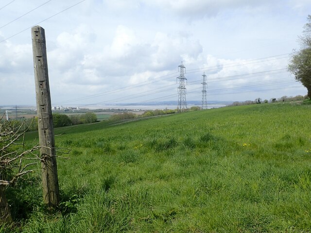
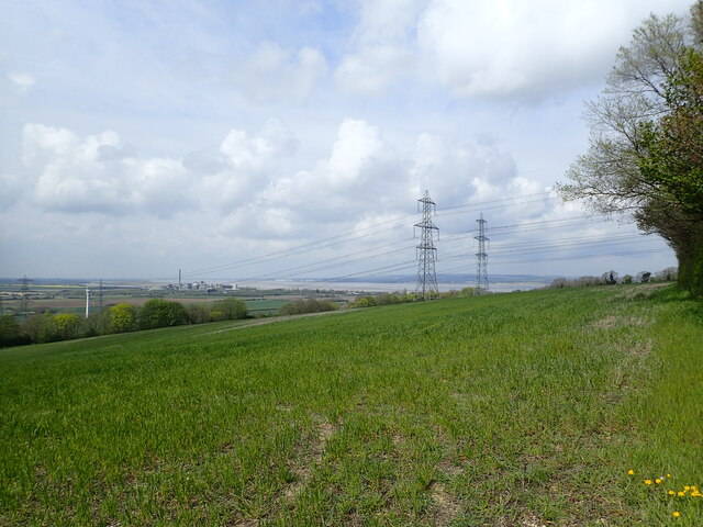
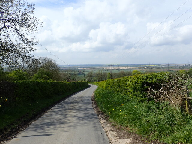
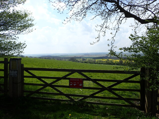
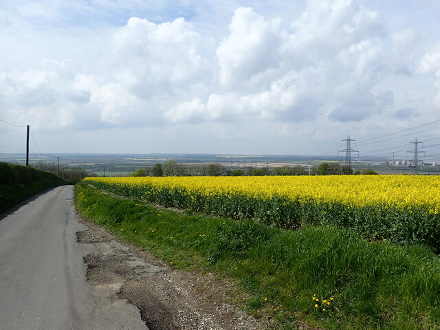
The village is known for its picturesque setting, surrounded by rolling hills and lush countryside. It offers stunning views of the Humber Estuary and the Humber Bridge, which connects Lincolnshire to East Yorkshire. The village is popular with visitors who enjoy outdoor activities such as hiking, cycling, and birdwatching.

South Ferriby is home to a number of amenities, including a primary school, a village hall, a church, and a pub. The local community is close-knit and actively participates in various events and festivals throughout the year.

In recent years, the village has become known for its cement industry, with a large cement plant operated by CEMEX located nearby. This has brought employment opportunities to the area and supports the local economy.

Overall, South Ferriby is a charming and historic village, offering a peaceful and scenic environment for both residents and visitors to enjoy.

If you have any feedback on the listing, please let us know in the comments section below.

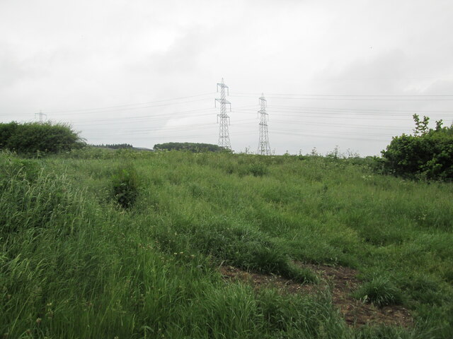
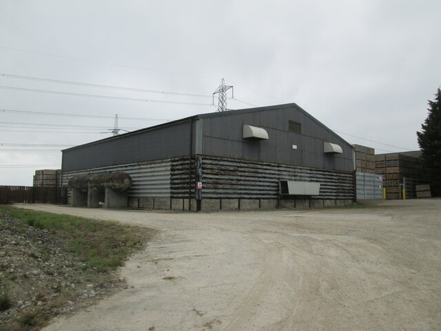
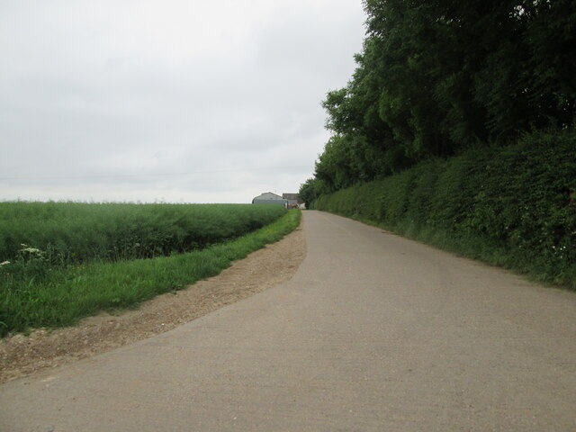
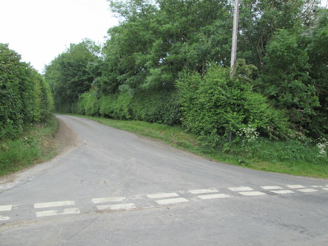
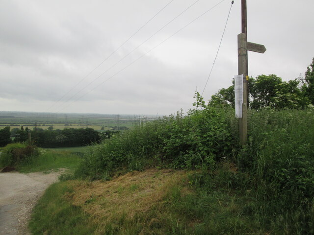
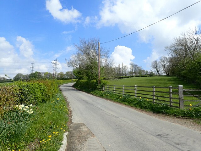
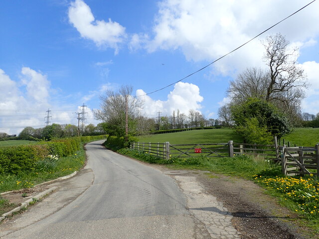
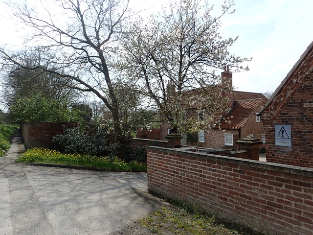
South Ferriby Images

Images are sourced within 2km of 53.6745/-0.506238 or Grid Reference SE9820. Thanks to Geograph Open Source API. All images are credited.

Hedgerow  and  rough  grass  alongside  Middlegate  Lane  (track) Over field double power lines cross
Hedgerow and rough grass alongside Middlegate Lane (track)
Over field double power lines cross
Large  barns  alongside  Horkstow  Road With all the open crates stacked around I would say they are for potato storage
Large barns alongside Horkstow Road
With all the open crates stacked around I would say they are for potato storage
Access  road  to  Manor  Wold  Farm
Access road to Manor Wold Farm
Horkstow  Road  going  downhill  to  B1204  and  village Middlegate Lane crosses  here, to the left it is a country lane, to the right a grassed  track
Horkstow Road going downhill to B1204 and village
Middlegate Lane crosses here, to the left it is a country lane, to the right a grassed track
Middlegate  Lane  going  south  from  Horkstow  Road
Middlegate Lane going south from Horkstow Road
Fingerpost  Viking  Way  to  South  Ferriby  via  Middlegate  Lane Horkstow Road and Middlegate Lane junction
Fingerpost Viking Way to South Ferriby via Middlegate Lane
Horkstow Road and Middlegate Lane junction
Horkstow Road Horkstow Road leads quite steeply up on to the Lincolnshire Wolds with views of the River Humber at the top.
Horkstow Road
Horkstow Road leads quite steeply up on to the Lincolnshire Wolds with views of the River Humber at the top.
Pylons in a field of oilseed rape This is next to Horkstow Road on the top of the Lincolnshire Wolds.
Pylons in a field of oilseed rape
This is next to Horkstow Road on the top of the Lincolnshire Wolds.
Horkstow Road Horkstow Road leads quite steeply up on to the Lincolnshire Wolds with views of the River Humber at the top.
Horkstow Road
Horkstow Road leads quite steeply up on to the Lincolnshire Wolds with views of the River Humber at the top.
Hall Farm This is at the bottom of Horkstow Road, just north of Horkstow Hall.
Hall Farm
This is at the bottom of Horkstow Road, just north of Horkstow Hall.
View of the Humber This view is from Horkstow Road at the top of the hill leading up from Hall Farm. The buildings next to the Humber Estuary towards the left are at Ferriby Sluice.
View of the Humber
This view is from Horkstow Road at the top of the hill leading up from Hall Farm. The buildings next to the Humber Estuary towards the left are at Ferriby Sluice.
Looking down Horkstow Road This is at the top of the hill seen at <a title="www.geograph.org.uk/photo/7481344" href="https://www.geograph.org.uk/photo/7481344">Link</a> and looks down to the flatlands of the Ancholme Valley.
Looking down Horkstow Road
This is at the top of the hill seen at Link and looks down to the flatlands of the Ancholme Valley.
Looking to the Ancholme Valley This is at the top of the hill seen at <a title="www.geograph.org.uk/photo/7481344" href="https://www.geograph.org.uk/photo/7481344">Link</a> and looks down to the flatlands of the Ancholme Valley.
Looking to the Ancholme Valley
This is at the top of the hill seen at Link and looks down to the flatlands of the Ancholme Valley.
Looking to the Ancholme Valley This is at the top of the hill seen at <a title="www.geograph.org.uk/photo/7481344" href="https://www.geograph.org.uk/photo/7481344">Link</a> and looks down to the flatlands of the Ancholme Valley. Scunthorpe Steelworks are on the horizon, slightly left of centre.
Looking to the Ancholme Valley
This is at the top of the hill seen at Link and looks down to the flatlands of the Ancholme Valley. Scunthorpe Steelworks are on the horizon, slightly left of centre.
Looking down Horkstow Road This is at the top of the hill seen at <a title="www.geograph.org.uk/photo/7481344" href="https://www.geograph.org.uk/photo/7481344">Link</a> and looks down to the flatlands of the Ancholme Valley. The buildings towards the far right are at Ferriby Sluice, next to the Humber Estuary.
Looking down Horkstow Road
This is at the top of the hill seen at Link and looks down to the flatlands of the Ancholme Valley. The buildings towards the far right are at Ferriby Sluice, next to the Humber Estuary.
Pylons in a field of oilseed rape This view is from Horkstow Road at the top of the hill leading up from Hall Farm. The buildings next to the Humber Estuary towards the left are at Ferriby Sluice.
Pylons in a field of oilseed rape
This view is from Horkstow Road at the top of the hill leading up from Hall Farm. The buildings next to the Humber Estuary towards the left are at Ferriby Sluice.
Pylons in a field of oilseed rape This is next to Horkstow Road on the top of the Lincolnshire Wolds.
Pylons in a field of oilseed rape
This is next to Horkstow Road on the top of the Lincolnshire Wolds.
Show me another place!

South Ferriby is located at Grid Ref: SE9820 (Lat: 53.6745, Lng: -0.506238)

Division: Parts of Lindsey

Unitary Authority: North Lincolnshire

Police Authority: Humberside

What 3 Words

///strain.kingdom.glassware. Near Barton upon Humber, Lincolnshire

Related Wikis

St Nicholas' Church, South Ferriby

St Nicholas' Church is an Anglican church and Grade II* listed building in South Ferriby, North Lincolnshire, England. == History == The nave dates to...

South Ferriby

South Ferriby is a village in North Lincolnshire, England. It is situated on the south bank of the Humber Estuary and 3 miles (5 km) west from the Humber...

Ferriby Sluice

Ferriby Sluice is a hamlet situated near the lock complex on the Humber and River Ancholme, Lincolnshire, England. It is now part of the village of South...

River Ancholme

The River Ancholme is a river in Lincolnshire, England, and a tributary of the Humber. It rises at Ancholme Head, a spring just north of the village of...

Nearby Amenities

Located within 500m of 53.6745,-0.506238
Bus Stop
School Lane
Alt Name: St Nicholas Church
Naptan AltCommonName: St Nicholas Church
Naptan AltIndicator: opp
Naptan AltStreet: High Street
Naptan AtcoCode: 227000010269
Naptan Bearing: S
Naptan CommonName: School Lane
Naptan Indicator: opp church
Naptan NaptanCode: scuatat
Naptan Street: High Street
Naptan Verified: no
Source: naptan_import
Lat/Long: 53.6746633/-0.5060425
Bus Stop
Black Smiths
Alt Name: High Street
Naptan AltCommonName: High Street
Naptan AltIndicator: o/s blacksmiths
Naptan AltStreet: High Street
Naptan AtcoCode: 227000010629
Naptan Bearing: N
Naptan CommonName: Black Smiths
Naptan Indicator: o/s
Naptan NaptanCode: scujmdw
Naptan Street: High Street
Naptan Verified: no
Source: naptan_import
Lat/Long: 53.6764357/-0.5047231
Bus Stop
Black Smiths
Alt Name: High Street
Bench: yes
Bin: yes
Bus: yes
Departures Board: timetable
Ferry: no
Light Rail: no
Monorail: no
Naptan AltCommonName: High Street
Naptan AltIndicator: opp blacksmiths
Naptan AltStreet: High Street
Naptan AtcoCode: 227000010630
Naptan Bearing: S
Naptan CommonName: Black Smiths
Naptan Indicator: opp
Naptan NaptanCode: scujpdw
Naptan Street: High Street
Naptan Verified: no
Shelter: yes
Source: naptan_import
Subway: no
Tactile Paving: no
Train: no
Tram: no
Trolleybus: no
Lat/Long: 53.6763094/-0.5046822
Bus Stop
Low Street
Alt Name: Elm Farm
Naptan AltCommonName: Elm Farm
Naptan AltIndicator: o/s
Naptan AltStreet: Sluice Road
Naptan AtcoCode: 227000010637
Naptan Bearing: E
Naptan CommonName: Low Street
Naptan Indicator: opp
Naptan NaptanCode: scumtdw
Naptan Street: Sluice Road
Naptan Verified: no
Source: naptan_import
Lat/Long: 53.6766661/-0.5073342
Bus Stop
Low Street
Alt Name: Elm Farm
Bench: no
Bin: no
Naptan AltCommonName: Elm Farm
Naptan AltIndicator: adj
Naptan AltStreet: Sluice Road
Naptan AtcoCode: 227000010638
Naptan Bearing: W
Naptan CommonName: Low Street
Naptan Indicator: adj
Naptan NaptanCode: scumwdw
Naptan Street: Sluice Road
Naptan Verified: no
Shelter: no
Source: naptan_import
Tactile Paving: no
Lat/Long: 53.6766144/-0.5075177
Bus Stop
Old Warp Lane
Naptan AtcoCode: 227000010639
Naptan Bearing: E
Naptan CommonName: Old Warp Lane
Naptan Indicator: opp
Naptan NaptanCode: scupadw
Naptan Street: Sluice Road
Naptan Verified: no
Source: naptan_import
Lat/Long: 53.676836/-0.5126586
Bus Stop
Old Warp Lane
Naptan AtcoCode: 227000010640
Naptan Bearing: W
Naptan CommonName: Old Warp Lane
Naptan Indicator: adj
Naptan NaptanCode: scupgdw
Naptan Street: Sluice Road
Naptan Verified: no
Source: naptan_import
Lat/Long: 53.6767477/-0.5124487
Post Office
South Ferriby Post Office
Addr City: Barton-upon-Humber
Addr Postcode: DN18 6JA
Addr Street: Sluice Road
Addr Suburb: South Ferriby
Branch: South Ferriby
Brand: Post Office
Brand Wikidata: Q1783168
Check Date: 2022-05-27
Contact Website: https://www.postoffice.co.uk/branch-finder/3693112/south-ferriby
Opening Hours: Mo-Fr 07:00-15:00; Sa 07:00-13:00
Ref Pol Id: 13945
Lat/Long: 53.6765237/-0.5065046
Ferriby Hill
Place: locality
Source: Bing
Lat/Long: 53.6775719/-0.5018941
Woodside Farm
Place: farm
Source: Bing
Lat/Long: 53.6782814/-0.5053059
Manor House Farm
Place: farm
Source: Bing
Lat/Long: 53.6740285/-0.5093723
The Grange
Place: farm
Source: Bing
Lat/Long: 53.6719739/-0.5101514
Post Box
Post Box Type: lamp
Lat/Long: 53.6723081/-0.5079472
Leisure: playground
Lat/Long: 53.6763501/-0.5095941
Power: pole
Lat/Long: 53.6706039/-0.5079246
Power: pole
Lat/Long: 53.6713222/-0.5077529
Power: pole
Lat/Long: 53.6711347/-0.5086541
Power: pole
Lat/Long: 53.6710965/-0.510183
Generator Method: photovoltaic
Generator Output Electricity: yes
Generator Source: solar
Generator Type: solar_photovoltaic_panel
Location: roof
Power: generator
Lat/Long: 53.6784279/-0.5049513
Generator Method: photovoltaic
Generator Output Electricity: yes
Generator Source: solar
Generator Type: solar_photovoltaic_panel
Location: roof
Power: generator
Lat/Long: 53.6784176/-0.5049191
Generator Method: photovoltaic
Generator Output Electricity: yes
Generator Source: solar
Generator Type: solar_photovoltaic_panel
Location: roof
Power: generator
Lat/Long: 53.6784005/-0.5048695
Generator Method: photovoltaic
Generator Output Electricity: yes
Generator Source: solar
Generator Type: solar_photovoltaic_panel
Location: roof
Power: generator
Lat/Long: 53.6783608/-0.5047703
Generator Method: photovoltaic
Generator Output Electricity: yes
Generator Source: solar
Generator Type: solar_photovoltaic_panel
Location: roof
Power: generator
Lat/Long: 53.6772105/-0.5048554
Generator Method: photovoltaic
Generator Output Electricity: yes
Generator Source: solar
Generator Type: solar_photovoltaic_panel
Location: roof
Power: generator
Lat/Long: 53.677261/-0.5048139
Generator Method: photovoltaic
Generator Output Electricity: yes
Generator Source: solar
Generator Type: solar_photovoltaic_panel
Location: roof
Power: generator
Lat/Long: 53.6772884/-0.5048642
Generator Method: photovoltaic
Generator Output Electricity: yes
Generator Source: solar
Generator Type: solar_photovoltaic_panel
Location: roof
Power: generator
Lat/Long: 53.6769055/-0.5050278
Generator Method: photovoltaic
Generator Output Electricity: yes
Generator Source: solar
Generator Type: solar_photovoltaic_panel
Location: roof
Power: generator
Lat/Long: 53.6769341/-0.5051109
Generator Method: photovoltaic
Generator Output Electricity: yes
Generator Source: solar
Generator Type: solar_photovoltaic_panel
Location: roof
Power: generator
Lat/Long: 53.6769992/-0.5053443
Generator Method: photovoltaic
Generator Output Electricity: yes
Generator Source: solar
Generator Type: solar_photovoltaic_panel
Location: roof
Power: generator
Lat/Long: 53.6770612/-0.5054462
Generator Method: photovoltaic
Generator Output Electricity: yes
Generator Source: solar
Generator Type: solar_photovoltaic_panel
Location: roof
Power: generator
Lat/Long: 53.6771263/-0.5056474
Generator Method: photovoltaic
Generator Output Electricity: yes
Generator Source: solar
Generator Type: solar_photovoltaic_panel
Location: roof
Power: generator
Lat/Long: 53.6770993/-0.5055481
Generator Method: photovoltaic
Generator Output Electricity: yes
Generator Source: solar
Generator Type: solar_photovoltaic_panel
Location: roof
Power: generator
Lat/Long: 53.6772788/-0.5066237
Generator Method: photovoltaic
Generator Output Electricity: yes
Generator Source: solar
Generator Type: solar_photovoltaic_panel
Location: roof
Power: generator
Lat/Long: 53.6765115/-0.5064547
Generator Method: photovoltaic
Generator Output Electricity: yes
Generator Source: solar
Generator Type: solar_photovoltaic_panel
Location: roof
Power: generator
Lat/Long: 53.6756392/-0.5079246
Generator Method: photovoltaic
Generator Output Electricity: yes
Generator Source: solar
Generator Type: solar_photovoltaic_panel
Location: roof
Power: generator
Lat/Long: 53.6756519/-0.5079648
Generator Method: photovoltaic
Generator Output Electricity: yes
Generator Source: solar
Generator Type: solar_photovoltaic_panel
Location: roof
Power: generator
Lat/Long: 53.676235/-0.5083537
Generator Method: photovoltaic
Generator Output Electricity: yes
Generator Source: solar
Generator Type: solar_photovoltaic_panel
Location: roof
Power: generator
Lat/Long: 53.6762668/-0.508453
Generator Method: photovoltaic
Generator Output Electricity: yes
Generator Source: solar
Generator Type: solar_photovoltaic_panel
Location: roof
Power: generator
Lat/Long: 53.6761683/-0.508799
Generator Method: photovoltaic
Generator Output Electricity: yes
Generator Source: solar
Generator Type: solar_photovoltaic_panel
Location: roof
Power: generator
Lat/Long: 53.6759744/-0.5085361
Generator Method: photovoltaic
Generator Output Electricity: yes
Generator Source: solar
Generator Type: solar_photovoltaic_panel
Location: roof
Power: generator
Lat/Long: 53.6763208/-0.5124629
Generator Method: photovoltaic
Generator Output Electricity: yes
Generator Source: solar
Generator Type: solar_photovoltaic_panel
Location: roof
Power: generator
Lat/Long: 53.6763208/-0.5125353
Generator Method: photovoltaic
Generator Output Electricity: yes
Generator Source: solar
Generator Type: solar_photovoltaic_panel
Location: roof
Power: generator
Lat/Long: 53.6762938/-0.5122349
Generator Method: photovoltaic
Generator Output Electricity: yes
Generator Source: solar
Generator Type: solar_photovoltaic_panel
Location: roof
Power: generator
Lat/Long: 53.6762636/-0.5119988
Generator Method: photovoltaic
Generator Output Electricity: yes
Generator Source: solar
Generator Type: solar_photovoltaic_panel
Location: roof
Power: generator
Lat/Long: 53.6759331/-0.5118701
Generator Method: photovoltaic
Generator Output Electricity: yes
Generator Source: solar
Generator Type: solar_photovoltaic_panel
Location: roof
Power: generator
Lat/Long: 53.6757472/-0.5122778
Telephone
Defibrillator
Booth: K6
Covered: booth
Defibrillator Location: inside old red phone box, High Street, South Ferriby
Emergency: defibrillator
Man Made: telephone_box
Lat/Long: 53.6757557/-0.5051537
Bench
Lat/Long: 53.6761449/-0.5048425
The data included in this document is from www.openstreetmap.org. The data is made available under ODbL.

Have you been to South Ferriby?

Leave your review of South Ferriby below (or comments, questions and feedback).