Ferriby Sluice

Settlement in Lincolnshire

England

Ferriby Sluice

Hedgerow  and  rough  grass  alongside  Middlegate  Lane  (track) Over field double power lines cross
Hedgerow and rough grass alongside Middlegate Lane (track) Credit: Martin Dawes

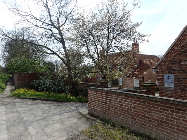
Ferriby Sluice is a small village located in the East Riding of Yorkshire, England. Situated in the county of Lincolnshire, it lies on the banks of the River Humber and is approximately 5 miles west of the town of Hessle.

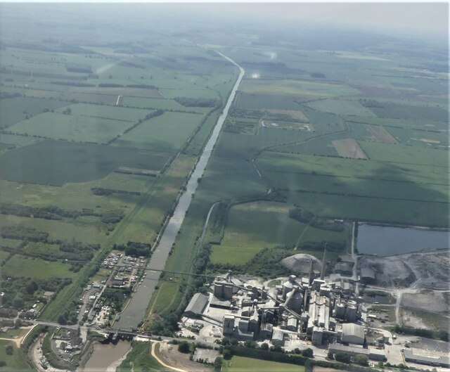
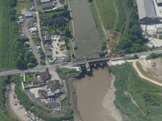
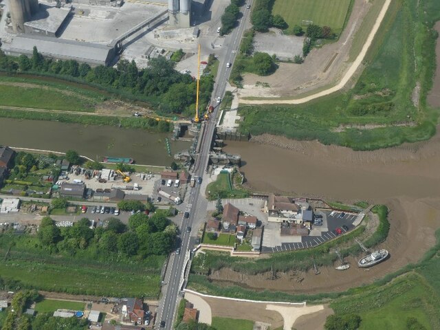
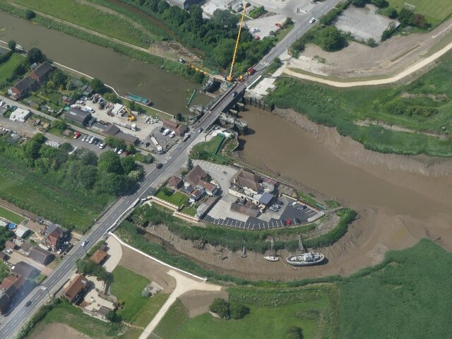
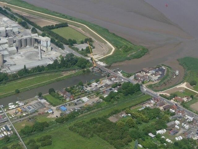
The village takes its name from the historic sluice gate that was built to control the water level of the River Humber. The Ferriby Sluice, constructed in the mid-19th century, served as an important mechanism for regulating the flow of water and preventing flooding in the surrounding areas.

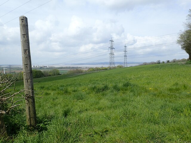
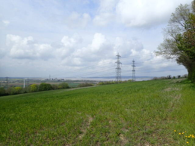
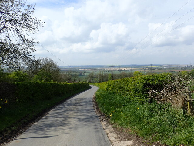
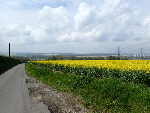
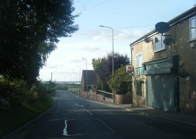
Today, Ferriby Sluice is primarily a residential area, with a small population of around 300 inhabitants. The village offers a peaceful and picturesque setting, surrounded by beautiful countryside and farmland. Its proximity to the River Humber provides residents with opportunities for outdoor activities such as fishing and boating.

The village has limited amenities, with a pub and a few local shops catering to the needs of the community. However, with the town of Hessle nearby, residents have easy access to a wider range of services, including schools, healthcare facilities, and shopping centers.

Ferriby Sluice is also well-connected by road, with the A63 running close by, providing convenient access to Hull and the wider region. The nearby Hessle railway station offers rail connections to various destinations, making it an accessible location for commuters.

Overall, Ferriby Sluice is a charming village with a rich history, offering a tranquil lifestyle for its residents amidst the natural beauty of Lincolnshire.

If you have any feedback on the listing, please let us know in the comments section below.

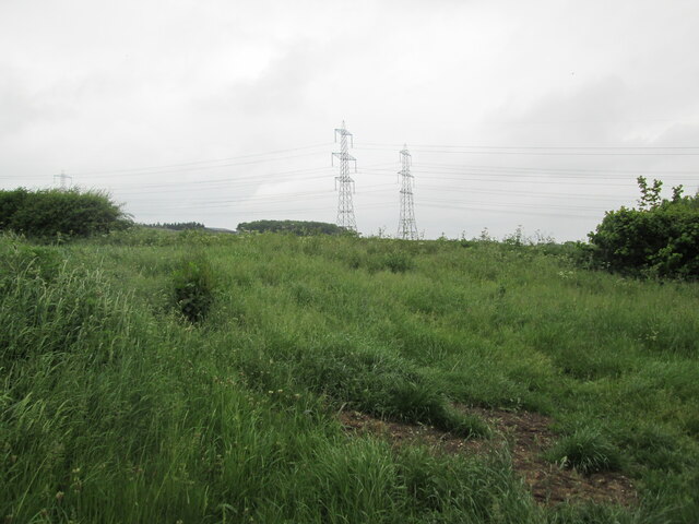
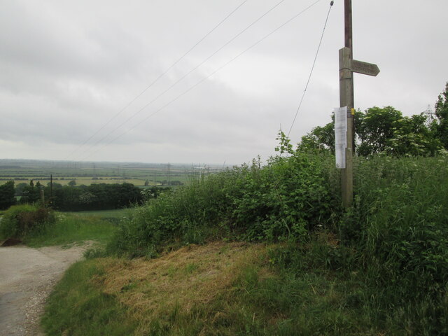
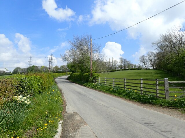
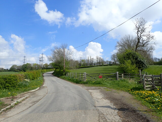
Ferriby Sluice Images

Images are sourced within 2km of 53.675639/-0.51777594 or Grid Reference SE9820. Thanks to Geograph Open Source API. All images are credited.

Hedgerow  and  rough  grass  alongside  Middlegate  Lane  (track) Over field double power lines cross
Hedgerow and rough grass alongside Middlegate Lane (track)
Over field double power lines cross
Horkstow  Road  going  downhill  to  B1204  and  village Middlegate Lane crosses  here, to the left it is a country lane, to the right a grassed  track
Horkstow Road going downhill to B1204 and village
Middlegate Lane crosses here, to the left it is a country lane, to the right a grassed track
Fingerpost  Viking  Way  to  South  Ferriby  via  Middlegate  Lane Horkstow Road and Middlegate Lane junction
Fingerpost Viking Way to South Ferriby via Middlegate Lane
Horkstow Road and Middlegate Lane junction
Horkstow Road Horkstow Road leads quite steeply up on to the Lincolnshire Wolds with views of the River Humber at the top.
Horkstow Road
Horkstow Road leads quite steeply up on to the Lincolnshire Wolds with views of the River Humber at the top.
Horkstow Road Horkstow Road leads quite steeply up on to the Lincolnshire Wolds with views of the River Humber at the top.
Horkstow Road
Horkstow Road leads quite steeply up on to the Lincolnshire Wolds with views of the River Humber at the top.
Hall Farm This is at the bottom of Horkstow Road, just north of Horkstow Hall.
Hall Farm
This is at the bottom of Horkstow Road, just north of Horkstow Hall.
View of the Humber This view is from Horkstow Road at the top of the hill leading up from Hall Farm. The buildings next to the Humber Estuary towards the left are at Ferriby Sluice.
View of the Humber
This view is from Horkstow Road at the top of the hill leading up from Hall Farm. The buildings next to the Humber Estuary towards the left are at Ferriby Sluice.
Looking down Horkstow Road This is at the top of the hill seen at <a title="www.geograph.org.uk/photo/7481344" href="https://www.geograph.org.uk/photo/7481344">Link</a> and looks down to the flatlands of the Ancholme Valley.
Looking down Horkstow Road
This is at the top of the hill seen at Link and looks down to the flatlands of the Ancholme Valley.
Looking down Horkstow Road This is at the top of the hill seen at <a title="www.geograph.org.uk/photo/7481344" href="https://www.geograph.org.uk/photo/7481344">Link</a> and looks down to the flatlands of the Ancholme Valley. The buildings towards the far right are at Ferriby Sluice, next to the Humber Estuary.
Looking down Horkstow Road
This is at the top of the hill seen at Link and looks down to the flatlands of the Ancholme Valley. The buildings towards the far right are at Ferriby Sluice, next to the Humber Estuary.
Pylons in a field of oilseed rape This view is from Horkstow Road at the top of the hill leading up from Hall Farm. The buildings next to the Humber Estuary towards the left are at Ferriby Sluice.
Pylons in a field of oilseed rape
This view is from Horkstow Road at the top of the hill leading up from Hall Farm. The buildings next to the Humber Estuary towards the left are at Ferriby Sluice.
Horkstow  Hall  mid  Georgian  1776  and  later From Horkstow Road
Horkstow Hall mid Georgian 1776 and later
From Horkstow Road
South Ferriby: aerial 2021 (1)
South Ferriby: aerial 2021 (2)
South Ferriby: aerial 2021 (3)
South Ferriby: aerial 2021 (4)
South Ferriby: aerial 2021 (5)
A1077 Sluice Road, South Ferriby
Show me another place!

Ferriby Sluice is located at Grid Ref: SE9820 (Lat: 53.675639, Lng: -0.51777594)

Division: Parts of Lindsey

Unitary Authority: North Lincolnshire

Police Authority: Humberside

What 3 Words

///commuted.cabbage.grows. Near Barton upon Humber, Lincolnshire

Related Wikis

Ferriby Sluice

Ferriby Sluice is a hamlet situated near the lock complex on the Humber and River Ancholme, Lincolnshire, England. It is now part of the village of South...

River Ancholme

The River Ancholme is a river in Lincolnshire, England, and a tributary of the Humber. It rises at Ancholme Head, a spring just north of the village of...

South Ferriby

South Ferriby is a village in North Lincolnshire, England. It is situated on the south bank of the Humber Estuary and 3 miles (5 km) west from the Humber...

St Nicholas' Church, South Ferriby

St Nicholas' Church is an Anglican church and Grade II* listed building in South Ferriby, North Lincolnshire, England. == History == The nave dates to...

Nearby Amenities

Located within 500m of 53.675639,-0.51777594
Bus Stop
Andrew Road
Naptan AtcoCode: 227000010633
Naptan Bearing: E
Naptan CommonName: Andrew Road
Naptan Indicator: opp
Naptan NaptanCode: scumadw
Naptan Street: Sluice Road
Naptan Verified: no
Source: naptan_import
Lat/Long: 53.6766775/-0.5169326
Bus Stop
Andrew Road
Naptan AtcoCode: 227000010634
Naptan Bearing: W
Naptan CommonName: Andrew Road
Naptan Indicator: adj
Naptan NaptanCode: scumgdw
Naptan Street: Sluice Road
Naptan Verified: no
Source: naptan_import
Lat/Long: 53.6766101/-0.5172983
Bus Stop
Ferriby Sluice
Alt Name: Hope and Anchor Pub
Naptan AltCommonName: Hope and Anchor Pub
Naptan AltIndicator: o/s
Naptan AltStreet: Sluice Road
Naptan AtcoCode: 227000010635
Naptan Bearing: E
Naptan CommonName: Ferriby Sluice
Naptan Indicator: opp
Naptan NaptanCode: scumjdw
Naptan Street: Sluice Road
Naptan Verified: no
Source: naptan_import
Lat/Long: 53.6770083/-0.5240671
Bus Stop
Ferriby Sluice
Alt Name: Hope and Anchor Pub
Naptan AltCommonName: Hope and Anchor Pub
Naptan AltCrossing: Red Lane
Naptan AltIndicator: opp
Naptan AltStreet: Sluice Road
Naptan AtcoCode: 227000010636
Naptan Bearing: W
Naptan CommonName: Ferriby Sluice
Naptan Indicator: o/s
Naptan NaptanCode: scumpdw
Naptan Street: Sluice Road
Naptan Verified: no
Source: naptan_import
Lat/Long: 53.6768921/-0.5241166
Bus Stop
Old Warp Lane
Naptan AtcoCode: 227000010639
Naptan Bearing: E
Naptan CommonName: Old Warp Lane
Naptan Indicator: opp
Naptan NaptanCode: scupadw
Naptan Street: Sluice Road
Naptan Verified: no
Source: naptan_import
Lat/Long: 53.676836/-0.5126586
Bus Stop
Old Warp Lane
Naptan AtcoCode: 227000010640
Naptan Bearing: W
Naptan CommonName: Old Warp Lane
Naptan Indicator: adj
Naptan NaptanCode: scupgdw
Naptan Street: Sluice Road
Naptan Verified: no
Source: naptan_import
Lat/Long: 53.6767477/-0.5124487
Seamark Small Craft Facility Category: chandler
Seamark Type: small_craft_facility
Lat/Long: 53.675524/-0.5251249
Pub
Hope and Anchor
Addr City: Barton-upon-Humber
Addr Housename: Hope and Anchor
Addr Postcode: DN18 6JQ
Addr Street: Sluice Road
Addr Suburb: Ferriby Sluice
Website: https://www.hope-and-anchor.co.uk/
Lat/Long: 53.6774563/-0.524439
Ferriby Sluice
Place: hamlet
Source: Bing
Wikidata: Q5445331
Lat/Long: 53.6765342/-0.5202695
Power: pole
Lat/Long: 53.6728889/-0.5236423
Power: pole
Lat/Long: 53.6724344/-0.5225641
Power: pole
Lat/Long: 53.6721007/-0.5216897
Power: pole
Lat/Long: 53.6715923/-0.5205363
Seamark Name: South Ferriby
Seamark Radio Station Mmsi: 992351279
Seamark Type: virtual_aton
Seamark Virtual Aton Category: special_purpose
Lat/Long: 53.6771/-0.5248
Generator Method: photovoltaic
Generator Output Electricity: yes
Generator Source: solar
Generator Type: solar_photovoltaic_panel
Location: roof
Power: generator
Lat/Long: 53.6763208/-0.5124629
Generator Method: photovoltaic
Generator Output Electricity: yes
Generator Source: solar
Generator Type: solar_photovoltaic_panel
Location: roof
Power: generator
Lat/Long: 53.6763208/-0.5125353
Generator Method: photovoltaic
Generator Output Electricity: yes
Generator Source: solar
Generator Type: solar_photovoltaic_panel
Location: roof
Power: generator
Lat/Long: 53.6762938/-0.5122349
Generator Method: photovoltaic
Generator Output Electricity: yes
Generator Source: solar
Generator Type: solar_photovoltaic_panel
Location: roof
Power: generator
Lat/Long: 53.6762636/-0.5119988
Generator Method: photovoltaic
Generator Output Electricity: yes
Generator Source: solar
Generator Type: solar_photovoltaic_panel
Location: roof
Power: generator
Lat/Long: 53.6759331/-0.5118701
Generator Method: photovoltaic
Generator Output Electricity: yes
Generator Source: solar
Generator Type: solar_photovoltaic_panel
Location: roof
Power: generator
Lat/Long: 53.6757472/-0.5122778
Generator Method: photovoltaic
Generator Output Electricity: yes
Generator Source: solar
Generator Type: solar_photovoltaic_panel
Location: roof
Power: generator
Lat/Long: 53.6761286/-0.5181585
Generator Method: photovoltaic
Generator Output Electricity: yes
Generator Source: solar
Generator Type: solar_photovoltaic_panel
Location: roof
Power: generator
Lat/Long: 53.6753866/-0.5171232
Generator Method: photovoltaic
Generator Output Electricity: yes
Generator Source: solar
Generator Type: solar_photovoltaic_panel
Location: roof
Power: generator
Lat/Long: 53.6753778/-0.517036
Generator Method: photovoltaic
Generator Output Electricity: yes
Generator Source: solar
Generator Type: solar_photovoltaic_panel
Location: roof
Power: generator
Lat/Long: 53.6758068/-0.5170079
Generator Method: photovoltaic
Generator Output Electricity: yes
Generator Source: solar
Generator Type: solar_photovoltaic_panel
Location: roof
Power: generator
Lat/Long: 53.6758545/-0.5173297
Generator Method: photovoltaic
Generator Output Electricity: yes
Generator Source: solar
Generator Type: solar_photovoltaic_panel
Location: roof
Power: generator
Lat/Long: 53.676127/-0.5169851
Generator Method: photovoltaic
Generator Output Electricity: yes
Generator Source: solar
Generator Type: solar_photovoltaic_panel
Location: roof
Power: generator
Lat/Long: 53.6763001/-0.5169877
Generator Method: photovoltaic
Generator Output Electricity: yes
Generator Source: solar
Generator Type: solar_photovoltaic_panel
Location: roof
Power: generator
Lat/Long: 53.6763844/-0.5169636
Generator Method: photovoltaic
Generator Output Electricity: yes
Generator Source: solar
Generator Type: solar_photovoltaic_panel
Location: roof
Power: generator
Lat/Long: 53.676467/-0.5194125
Generator Method: photovoltaic
Generator Output Electricity: yes
Generator Source: solar
Generator Type: solar_photovoltaic_panel
Location: roof
Power: generator
Lat/Long: 53.676467/-0.5194473
Generator Method: photovoltaic
Generator Output Electricity: yes
Generator Source: solar
Generator Type: solar_photovoltaic_panel
Location: roof
Power: generator
Lat/Long: 53.6765051/-0.5205363
Generator Method: photovoltaic
Generator Output Electricity: yes
Generator Source: solar
Generator Type: solar_photovoltaic_panel
Location: roof
Power: generator
Lat/Long: 53.6765146/-0.5205685
Generator Method: photovoltaic
Generator Output Electricity: yes
Generator Source: solar
Generator Type: solar_photovoltaic_panel
Location: roof
Power: generator
Lat/Long: 53.6758489/-0.5246589
The data included in this document is from www.openstreetmap.org. The data is made available under ODbL.

Have you been to Ferriby Sluice?

Leave your review of Ferriby Sluice below (or comments, questions and feedback).