Adwalton

Settlement in Yorkshire

England

Adwalton

Oakwell Hall Country Park Parts of Oakwell Hall date from the 15th century but the present building is largely due to John Batt in 1583, with some further modifications in the 17th century. In the 19th century it was used as a boarding school. When Charlotte Bronte lived at nearby Hartshead, she allegedly used Oakwell as the basis for 'Fieldhead' in the novel 'Shirley' (Fieldhead is in fact a local name for part of Birstall). The hall and its outbuildings are listed grade I (list entry 11344609) and now operated as a museum by Kirklees council (open at weekends). 

The grounds, along with the site of a former colliery and railway line, form Oakwell Country Park covering 45 hectares of woodland and open fields, which has a separate free car park. There are nature trails and a mountain bike route.
Oakwell Hall Country Park Credit: habiloid

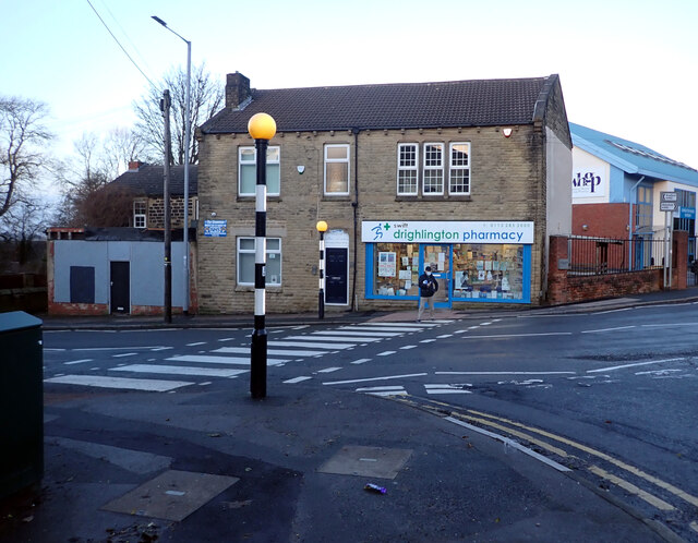
Adwalton is a small village located in the metropolitan borough of Bradford, West Yorkshire, England. Situated approximately 10 miles south of Bradford city center, it lies between the towns of Drighlington and Birstall. Adwalton is part of the civil parish of Birkenshaw.

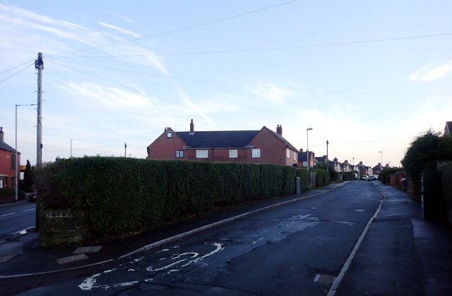
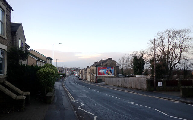
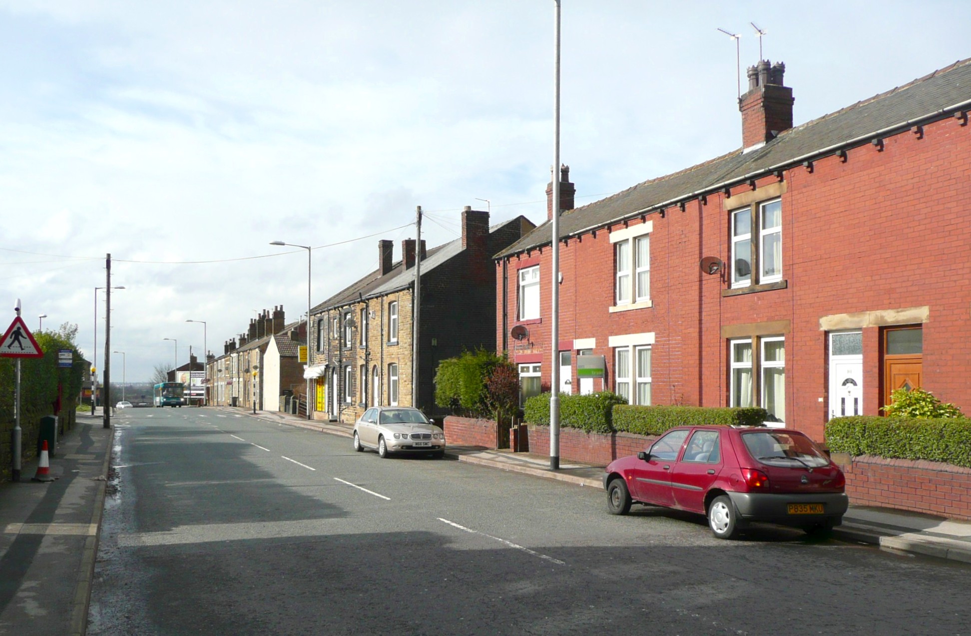
With a population of around 1,000 residents, Adwalton is a peaceful and tight-knit community. The village is primarily residential, consisting of a mix of detached and semi-detached houses, as well as a few small businesses. The architecture showcases a blend of traditional and modern designs, reflecting the village's development over the years.

Adwalton benefits from its proximity to both urban amenities and the natural beauty of the Yorkshire countryside. The village is well-connected to nearby towns and cities, with good transportation links including bus services and easy access to the M62 motorway.

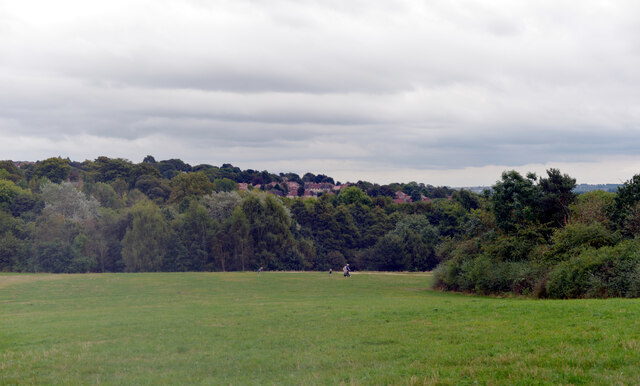
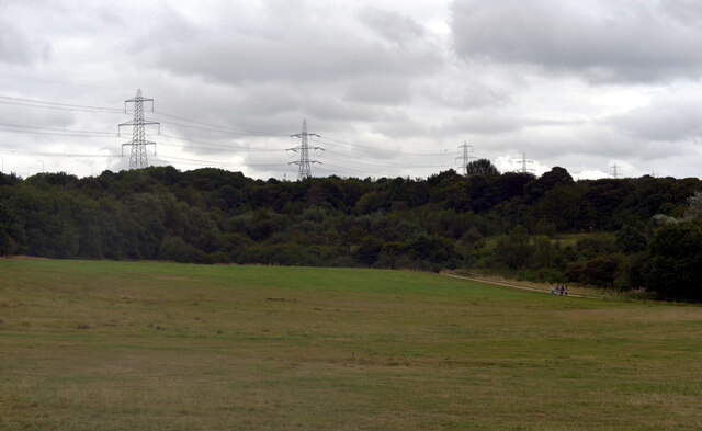
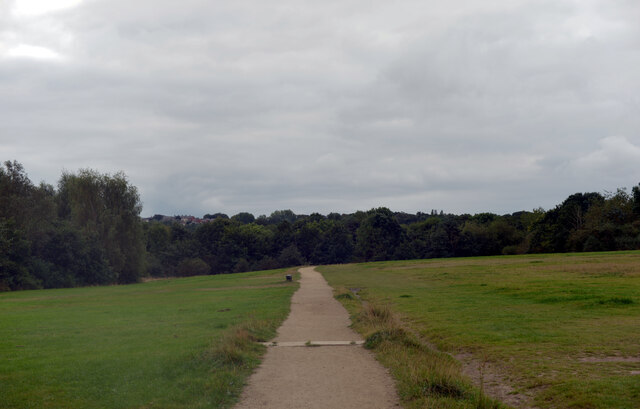
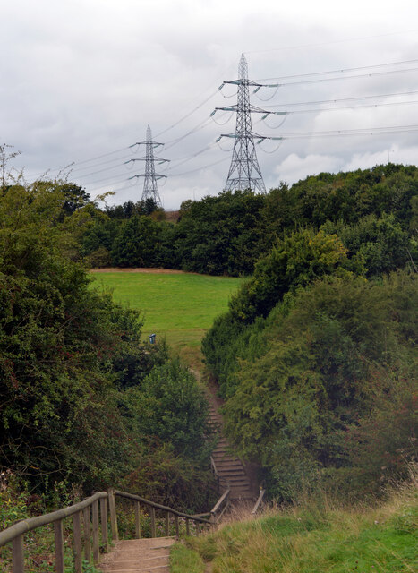
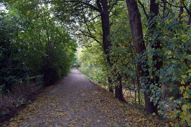
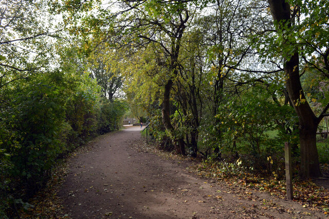
The village is surrounded by picturesque landscapes, offering residents and visitors opportunities for outdoor activities. There are several walking and cycling routes in the area, making it popular among nature enthusiasts. Additionally, Adwalton is close to the popular Birkenshaw Park, which provides recreational facilities such as playgrounds and sports fields.

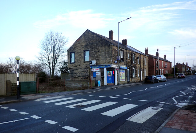
For everyday needs, Adwalton has a few local shops and services, including a convenience store, a post office, and a pub. While not having a wide range of amenities, residents can easily access a broader selection of services in nearby towns.

Overall, Adwalton provides a tranquil and friendly living environment, with a strong sense of community and a balance between rural charm and urban convenience.

If you have any feedback on the listing, please let us know in the comments section below.
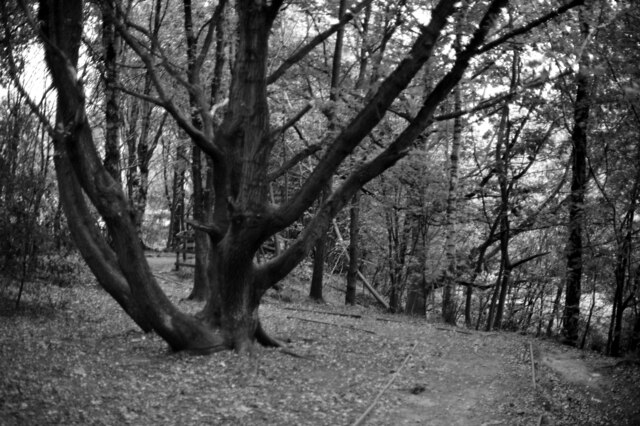
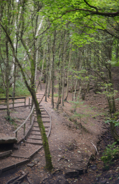
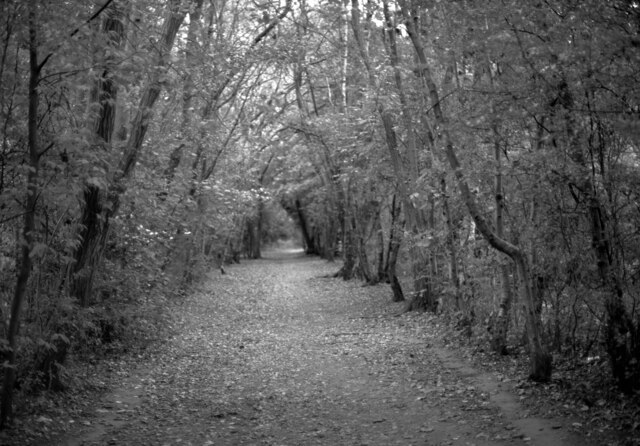
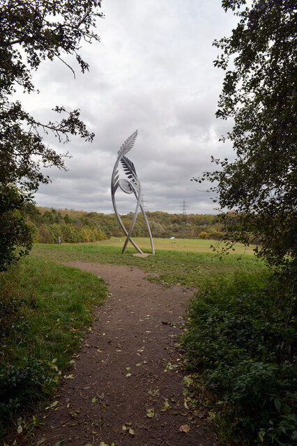
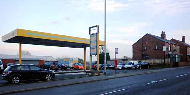
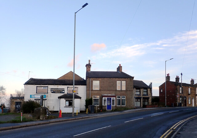
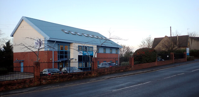
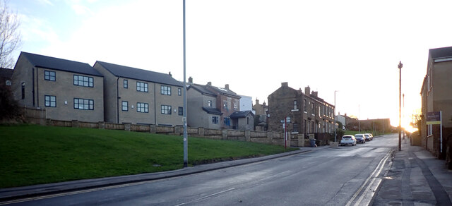
Adwalton Images

Images are sourced within 2km of 53.749507/-1.660825 or Grid Reference SE2228. Thanks to Geograph Open Source API. All images are credited.

Oakwell Hall Country Park Parts of Oakwell Hall date from the 15th century but the present building is largely due to John Batt in 1583, with some further modifications in the 17th century. In the 19th century it was used as a boarding school. When Charlotte Bronte lived at nearby Hartshead, she allegedly used Oakwell as the basis for 'Fieldhead' in the novel 'Shirley' (Fieldhead is in fact a local name for part of Birstall). The hall and its outbuildings are listed grade I (list entry 11344609) and now operated as a museum by Kirklees council (open at weekends). 

The grounds, along with the site of a former colliery and railway line, form Oakwell Country Park covering 45 hectares of woodland and open fields, which has a separate free car park. There are nature trails and a mountain bike route.
Oakwell Hall Country Park
Parts of Oakwell Hall date from the 15th century but the present building is largely due to John Batt in 1583, with some further modifications in the 17th century. In the 19th century it was used as a boarding school. When Charlotte Bronte lived at nearby Hartshead, she allegedly used Oakwell as the basis for 'Fieldhead' in the novel 'Shirley' (Fieldhead is in fact a local name for part of Birstall). The hall and its outbuildings are listed grade I (list entry 11344609) and now operated as a museum by Kirklees council (open at weekends). The grounds, along with the site of a former colliery and railway line, form Oakwell Country Park covering 45 hectares of woodland and open fields, which has a separate free car park. There are nature trails and a mountain bike route.
Path, Oakwell Hall Country Park Parts of Oakwell Hall date from the 15th century but the present building is largely due to John Batt in 1583, with some further modifications in the 17th century. In the 19th century it was used as a boarding school. When Charlotte Bronte lived at nearby Hartshead, she allegedly used Oakwell as the basis for 'Fieldhead' in the novel 'Shirley' (Fieldhead is in fact a local name for part of Birstall). The hall and its outbuildings are listed grade I (list entry 11344609) and now operated as a museum by Kirklees council (open at weekends). 

The grounds, along with the site of a former colliery and railway line, form Oakwell Country Park covering 45 hectares of woodland and open fields, which has a separate free car park. There are nature trails and a mountain bike route.
Path, Oakwell Hall Country Park
Parts of Oakwell Hall date from the 15th century but the present building is largely due to John Batt in 1583, with some further modifications in the 17th century. In the 19th century it was used as a boarding school. When Charlotte Bronte lived at nearby Hartshead, she allegedly used Oakwell as the basis for 'Fieldhead' in the novel 'Shirley' (Fieldhead is in fact a local name for part of Birstall). The hall and its outbuildings are listed grade I (list entry 11344609) and now operated as a museum by Kirklees council (open at weekends). The grounds, along with the site of a former colliery and railway line, form Oakwell Country Park covering 45 hectares of woodland and open fields, which has a separate free car park. There are nature trails and a mountain bike route.
Path and pylons, Oakwell Hall Country Park Parts of Oakwell Hall date from the 15th century but the present building is largely due to John Batt in 1583, with some further modifications in the 17th century. In the 19th century it was used as a boarding school. When Charlotte Bronte lived at nearby Hartshead, she allegedly used Oakwell as the basis for 'Fieldhead' in the novel 'Shirley' (Fieldhead is in fact a local name for part of Birstall). The hall and its outbuildings are listed grade I (list entry 11344609) and now operated as a museum by Kirklees council (open at weekends). 

The grounds, along with the site of a former colliery and railway line, form Oakwell Country Park covering 45 hectares of woodland and open fields, which has a separate free car park. There are nature trails and a mountain bike route.
Path and pylons, Oakwell Hall Country Park
Parts of Oakwell Hall date from the 15th century but the present building is largely due to John Batt in 1583, with some further modifications in the 17th century. In the 19th century it was used as a boarding school. When Charlotte Bronte lived at nearby Hartshead, she allegedly used Oakwell as the basis for 'Fieldhead' in the novel 'Shirley' (Fieldhead is in fact a local name for part of Birstall). The hall and its outbuildings are listed grade I (list entry 11344609) and now operated as a museum by Kirklees council (open at weekends). The grounds, along with the site of a former colliery and railway line, form Oakwell Country Park covering 45 hectares of woodland and open fields, which has a separate free car park. There are nature trails and a mountain bike route.
Oakwell Hall Country Park Parts of Oakwell Hall date from the 15th century but the present building is largely due to John Batt in 1583, with some further modifications in the 17th century. In the 19th century it was used as a boarding school. When Charlotte Bronte lived at nearby Hartshead, she allegedly used Oakwell as the basis for 'Fieldhead' in the novel 'Shirley' (Fieldhead is in fact a local name for part of Birstall). The hall and its outbuildings are listed grade I (list entry 11344609) and now operated as a museum by Kirklees council (open at weekends). 

The grounds, along with the site of a former colliery and railway line, form Oakwell Country Park covering 45 hectares of woodland and open fields, which has a separate free car park. There are nature trails and a mountain bike route.
Oakwell Hall Country Park
Parts of Oakwell Hall date from the 15th century but the present building is largely due to John Batt in 1583, with some further modifications in the 17th century. In the 19th century it was used as a boarding school. When Charlotte Bronte lived at nearby Hartshead, she allegedly used Oakwell as the basis for 'Fieldhead' in the novel 'Shirley' (Fieldhead is in fact a local name for part of Birstall). The hall and its outbuildings are listed grade I (list entry 11344609) and now operated as a museum by Kirklees council (open at weekends). The grounds, along with the site of a former colliery and railway line, form Oakwell Country Park covering 45 hectares of woodland and open fields, which has a separate free car park. There are nature trails and a mountain bike route.
Path through the woods, Oakwell Hall Country Park
Route of an old railway line passing through the woods, Oakwell Hall Country Park Parts of Oakwell Hall date from the 15th century but the present building is largely due to John Batt in 1583, with some further modifications in the 17th century. In the 19th century it was used as a boarding school. When Charlotte Bronte lived at nearby Hartshead, she allegedly used Oakwell as the basis for 'Fieldhead' in the novel 'Shirley' (Fieldhead is in fact a local name for part of Birstall). The hall and its outbuildings are listed grade I (list entry 11344609) and now operated as a museum by Kirklees council (open at weekends). 

The grounds, along with the site of a former colliery and railway line, form Oakwell Country Park covering 45 hectares of woodland and open fields, which has a separate free car park. There are nature trails and a mountain bike route.
Route of an old railway line passing through the woods, Oakwell Hall Country Park
Parts of Oakwell Hall date from the 15th century but the present building is largely due to John Batt in 1583, with some further modifications in the 17th century. In the 19th century it was used as a boarding school. When Charlotte Bronte lived at nearby Hartshead, she allegedly used Oakwell as the basis for 'Fieldhead' in the novel 'Shirley' (Fieldhead is in fact a local name for part of Birstall). The hall and its outbuildings are listed grade I (list entry 11344609) and now operated as a museum by Kirklees council (open at weekends). The grounds, along with the site of a former colliery and railway line, form Oakwell Country Park covering 45 hectares of woodland and open fields, which has a separate free car park. There are nature trails and a mountain bike route.
"Fiddlehead and Fernblades" by Adrian Moakes, Oakwell Hall Country Park "Fiddlehead and Fernblades" is a sculpture by Adrian Moakes (2008). It stands at the highest point of the colliery field of Oakwell Hall Country park, Birstall. The colliery field is the landscape site of Gomersal Pit which closed in 1973. The sculpture depicts ferns which formed the coal mined there.
It is 6.5m high and is formed from galvanized tubular and sheet steel. It was officially opened on 19th October 2008.
"Fiddlehead and Fernblades" by Adrian Moakes, Oakwell Hall Country Park
"Fiddlehead and Fernblades" is a sculpture by Adrian Moakes (2008). It stands at the highest point of the colliery field of Oakwell Hall Country park, Birstall. The colliery field is the landscape site of Gomersal Pit which closed in 1973. The sculpture depicts ferns which formed the coal mined there. It is 6.5m high and is formed from galvanized tubular and sheet steel. It was officially opened on 19th October 2008.
Route of an old railway line passing through the woods, Oakwell Hall Country Park
Warrens Lane, Oakwell Hall Country Park
Wakefield Road (B6135), Drighlington
Fairfax Avenue, Drighlington
Car Wash, Wakefield Road (B6135), Drighlington
Wakefield Road (B6135), Drighlington
Adwalton House Surgery, Wakefield Road (B6135), Drighlington
Moorside Road, Drighlington
Drighlington Pharmacy, King Street (B6135), Drighlington
King Street (B6135), Drighlington
Show me another place!

Adwalton is located at Grid Ref: SE2228 (Lat: 53.749507, Lng: -1.660825)

Division: West Riding

Unitary Authority: Leeds

Police Authority: West Yorkshire

What 3 Words

///caged.trees.longer. Near Drighlington, West Yorkshire

Related Wikis

Battle of Adwalton Moor

The Battle of Adwalton Moor occurred on 30 June 1643 at Adwalton, West Yorkshire, during the First English Civil War. In the battle, the Royalists loyal...

Drighlington and Adwalton railway station

Drighlington and Adwalton railway station served the village of Drighlington, West Yorkshire, England from 1856 to 1962 on the Leeds, Bradford and Halifax...

West Yorkshire

West Yorkshire is a metropolitan and ceremonial county in the Yorkshire and the Humber region of England. It borders North Yorkshire to the north and east...

Adwalton

Adwalton is a village in the City of Leeds metropolitan borough, West Yorkshire, England. It is 6 miles (9.7 km) south west of Leeds and is now generally...

Nearby Amenities

Located within 500m of 53.749507,-1.660825
Tattoo shop
Addr Street: Moorside Approach
Shop: convenience
Lat/Long: 53.7522831/-1.6584764
Place Of Worship
Moorside Church
Religion: christian
Lat/Long: 53.7519254/-1.6590461
Turning Circle
Lat/Long: 53.7488416/-1.6611033
Turning Circle
Lat/Long: 53.7485441/-1.6632111
Turning Circle
Lat/Long: 53.7485195/-1.6617363
Post Box
Operator: Royal Mail
Post Box Type: lamp
Ref: BD11 456
Lat/Long: 53.7527554/-1.6657936
Drighlington and Adwalton
Abandoned Railway: station
Railway: site
Wikidata: Q48815487
Wikipedia: en:Drighlington and Adwalton railway station
Lat/Long: 53.7484579/-1.6651262
Adwalton Junction
Railway: junction
Lat/Long: 53.7471425/-1.6616455
Bus Stop
Station Road Moortop
Local Ref: 45011800
Naptan AtcoCode: 450011800
Naptan Bearing: S
Naptan CommonName: Station Road Moortop
Naptan Crossing: Moortop
Naptan Indicator: Stop 45011800
Naptan PlusbusZoneRef: LEEDS
Naptan ShortCommonName: Moortop
Naptan Street: Station Road
Naptan Verified: yes
Source: naptan_import
Timetable: yes
Lat/Long: 53.752303/-1.6657164
Bus Stop
Station Road West Street
Local Ref: 45011801
Naptan AtcoCode: 450011801
Naptan Bearing: N
Naptan CommonName: Station Road West Street
Naptan Crossing: West Street
Naptan Indicator: Stop 45011801
Naptan PlusbusZoneRef: LEEDS
Naptan ShortCommonName: West Street
Naptan Street: Station Road
Naptan Verified: yes
Source: naptan_import
Timetable: yes
Lat/Long: 53.7524455/-1.6657878
Bus Stop
Drighlington Common Station Road
Local Ref: 45011802
Naptan AtcoCode: 450011802
Naptan Bearing: S
Naptan CommonName: Drighlington Common Station Road
Naptan Crossing: Moorside Road
Naptan Indicator: Stop 45011802
Naptan PlusbusZoneRef: LEEDS
Naptan ShortCommonName: Drighlington Common
Naptan Street: Station Road
Naptan Verified: yes
Shelter: no
Source: naptan_import
Timetable: yes
Lat/Long: 53.7493355/-1.6652395
Bus Stop
Drighlington Common Drighlington
Local Ref: 45011803
Naptan AtcoCode: 450011803
Naptan Bearing: NE
Naptan CommonName: Drighlington Common Drighlington
Naptan Crossing: Station Road
Naptan Indicator: Stop 45011803
Naptan PlusbusZoneRef: LEEDS
Naptan ShortCommonName: Moorside Road
Naptan Street: Moorside Road
Naptan Verified: yes
Shelter: no
Source: naptan_import
Time: y
Timetable: yes
Lat/Long: 53.7492618/-1.6646184
Bus Stop
Drighlington Common Drighlington
Local Ref: 45011804
Naptan AtcoCode: 450011804
Naptan Bearing: SW
Naptan CommonName: Drighlington Common Drighlington
Naptan Crossing: Station Road
Naptan Indicator: Stop 45011804
Naptan Landmark: Railway PH
Naptan PlusbusZoneRef: LEEDS
Naptan ShortCommonName: Moorside Road
Naptan Street: Moorside Road
Naptan Verified: yes
Source: naptan_import
Timetable: yes
Lat/Long: 53.7490735/-1.6647715
Bus Stop
Moorside Road Moorside Mount
Bench: yes
Local Ref: 45011805
Naptan AtcoCode: 450011805
Naptan Bearing: NE
Naptan CommonName: Moorside Road Moorside Mount
Naptan Crossing: Moorside Mount
Naptan Indicator: Stop 45011805
Naptan PlusbusZoneRef: LEEDS
Naptan ShortCommonName: Moorside Mount
Naptan Street: Moorside Road
Naptan Verified: yes
Shelter: yes
Source: naptan_import
Timetable: yes
Towards: Gildersome, Leeds, Morley, New Farnley, Wakefield
Lat/Long: 53.7509364/-1.6614505
Bus Stop
Moorside Road Moorside Mount
Local Ref: 45011806
Naptan AtcoCode: 450011806
Naptan Bearing: SW
Naptan CommonName: Moorside Road Moorside Mount
Naptan Crossing: Moorside Mount
Naptan Indicator: Stop 45011806
Naptan PlusbusZoneRef: LEEDS
Naptan ShortCommonName: Moorside Mount
Naptan Street: Moorside Road
Naptan Verified: no
Shelter: no
Source: naptan_import
Timetable: yes
Lat/Long: 53.7511031/-1.6609488
Bus Stop
Moorside Road Moorside Approach
Local Ref: 45023827
Naptan AtcoCode: 450023827
Naptan Bearing: SW
Naptan CommonName: Moorside Road Moorside Approach
Naptan Crossing: Moorside Approach
Naptan Indicator: Stop 45023827
Naptan PlusbusZoneRef: LEEDS
Naptan ShortCommonName: Moorside Approach
Naptan Street: Moorside Road
Naptan Verified: yes
Source: naptan_import
Timetable: yes
Lat/Long: 53.7525157/-1.6582834
Bus Stop
Moorside Road Kingsway
Local Ref: 45023828
Naptan AtcoCode: 450023828
Naptan Bearing: NE
Naptan CommonName: Moorside Road Kingsway
Naptan Crossing: Kingsway
Naptan Indicator: Stop 45023828
Naptan Notes: OSR taken place 311005
Naptan PlusbusZoneRef: LEEDS
Naptan ShortCommonName: Kingsway
Naptan Street: Moorside Road
Naptan Verified: yes
Shelter: yes
Source: naptan_import
Timetable: yes
Lat/Long: 53.7532853/-1.6570791
Bus Stop
Moorside Road Moorside Approach
Local Ref: 45023912
Naptan AtcoCode: 450023912
Naptan Bearing: NE
Naptan CommonName: Moorside Road Moorside Approach
Naptan Crossing: Moorside Approach
Naptan Indicator: Stop 45023912
Naptan PlusbusZoneRef: LEEDS
Naptan ShortCommonName: Moorside Approach
Naptan Street: Moorside Road
Naptan Verified: yes
Source: naptan_import
Timetable: yes
Lat/Long: 53.7524001/-1.6587242
Bus Stop
Station Road Drightlington Common
Local Ref: 45028114
Naptan AtcoCode: 450028114
Naptan Bearing: N
Naptan CommonName: Station Road Drightlington Common
Naptan Crossing: Hodgson Lane
Naptan Indicator: Stop 45028114
Naptan Landmark: The Railway Pub
Naptan PlusbusZoneRef: LEEDS
Naptan ShortCommonName: Drighlington Common
Naptan Street: Station Road
Naptan Verified: yes
Shelter: no
Source: naptan_import
Timetable: yes
Lat/Long: 53.749417/-1.6654512
Bus Stop
Moorside Road Moorside Methodist Church
Local Ref: 45027887
Naptan AtcoCode: 450027887
Naptan Bearing: SW
Naptan CommonName: Moorside Road Moorside Methodist Church
Naptan Crossing: Moorside Approach
Naptan Indicator: Stop 45027887
Naptan Landmark: Moorside Methodist Church
Naptan PlusbusZoneRef: LEEDS
Naptan ShortCommonName: Moorside Approach
Naptan Street: Moorside Road
Naptan Verified: no
Source: naptan_import
Lat/Long: 53.7518896/-1.6593804
Post Box
Operator: Royal Mail
Ref: BD11 458
Lat/Long: 53.748355/-1.6645781
Barrier: stile
Lat/Long: 53.7482095/-1.6658487
Barrier: bollard
Foot: yes
Lat/Long: 53.7497707/-1.6679821
Bench
Backrest: yes
Lat/Long: 53.7513086/-1.6608414
Bench
Backrest: yes
Lat/Long: 53.7516652/-1.6611177
Kindergarten
Rainbow Pre-School
Addr City: Bradford
Addr Housename: Drighlington Meeting Hall
Addr Postcode: BD11 1JZ
Addr Street: Moorland Road
Addr Suburb: Drighlington
Fhrs Id: 467431
Lat/Long: 53.7526813/-1.6630273
Waste Basket
Ref UK Leedscc Bin: 2192
Lat/Long: 53.753157/-1.657067
Waste Basket
Ref UK Leedscc Bin: 6202
Lat/Long: 53.752222/-1.658292
Waste Basket
Ref UK Leedscc Bin: 2195
Lat/Long: 53.751559/-1.660008
Waste Basket
Ref UK Leedscc Bin: 2179
Lat/Long: 53.75295/-1.662582
Waste Basket
Ref UK Leedscc Bin: 2185
Lat/Long: 53.75333/-1.663736
Waste Basket
Ref UK Leedscc Bin: 6200
Lat/Long: 53.750644/-1.662342
Waste Basket
Ref UK Leedscc Bin: 6198
Lat/Long: 53.75233/-1.6656
Waste Basket
Ref UK Leedscc Bin: 6199
Lat/Long: 53.752418/-1.665982
Waste Basket
Ref UK Leedscc Bin: 6201
Lat/Long: 53.749375/-1.66468
Generator Method: photovoltaic
Generator Output Electricity: small_installation
Generator Source: solar
Generator Type: solar_photovoltaic_panel
Location: roof
Power: generator
Lat/Long: 53.7506719/-1.6554071
Generator Method: photovoltaic
Generator Output Electricity: small_installation
Generator Source: solar
Generator Type: solar_photovoltaic_panel
Location: roof
Power: generator
Lat/Long: 53.7507163/-1.6549887
Generator Method: photovoltaic
Generator Output Electricity: small_installation
Generator Source: solar
Generator Type: solar_photovoltaic_panel
Location: roof
Power: generator
Lat/Long: 53.7507417/-1.654864
Generator Method: photovoltaic
Generator Output Electricity: small_installation
Generator Source: solar
Generator Type: solar_photovoltaic_panel
Location: roof
Power: generator
Lat/Long: 53.7506846/-1.6540875
Adwalton
Place: village
Wikidata: Q602899
Lat/Long: 53.751115/-1.6590774
The data included in this document is from www.openstreetmap.org. The data is made available under ODbL.

Have you been to Adwalton?

Leave your review of Adwalton below (or comments, questions and feedback).