Bromley, South

Settlement in Middlesex

England

Bromley, South

Royal Victoria Dock, London, E16 Looking west along the Royal Victoria Dock, this image is taken from the High footbridge which links the housing development at Britannia Village (behind the cranes) with the Dockland Light Railway station on the north side of the dock. Canary Wharf is visible on the horizon.
Royal Victoria Dock, London, E16 Credit: Peter Jordan

Bromley, South, Middlesex is a suburban district located in the southeastern part of London, England. It is situated within the larger London Borough of Bromley, which is one of the largest boroughs in Greater London. The district is bordered by other vibrant areas such as Beckenham, Bickley, and Chislehurst.

Bromley is known for its picturesque surroundings, with plenty of green spaces and parks. It boasts a mix of architectural styles, from Victorian and Edwardian houses to modern apartment complexes. The area offers a range of housing options, catering to different needs and preferences.

The town center of Bromley is a bustling hub, featuring a variety of high street shops, restaurants, cafes, and entertainment venues. The Glades, a popular shopping center, offers a wide range of retail options for residents and visitors alike. The town also has a thriving arts and cultural scene, with the Churchill Theatre hosting a diverse range of performances throughout the year.

Transportation in Bromley is well-connected, with several train stations providing easy access to central London and other parts of the city. Commuters can reach London Victoria or London Bridge stations in approximately 20 minutes. The district also benefits from a reliable bus network, making it easy to navigate the local area and travel to neighboring towns.

Overall, Bromley, South, Middlesex is a vibrant and sought-after district that offers a balanced lifestyle, combining the tranquility of suburban living with the convenience of urban amenities.

If you have any feedback on the listing, please let us know in the comments section below.

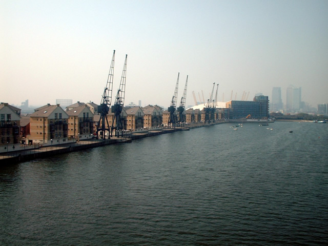
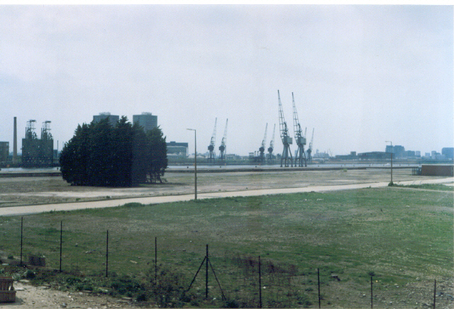
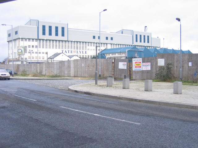
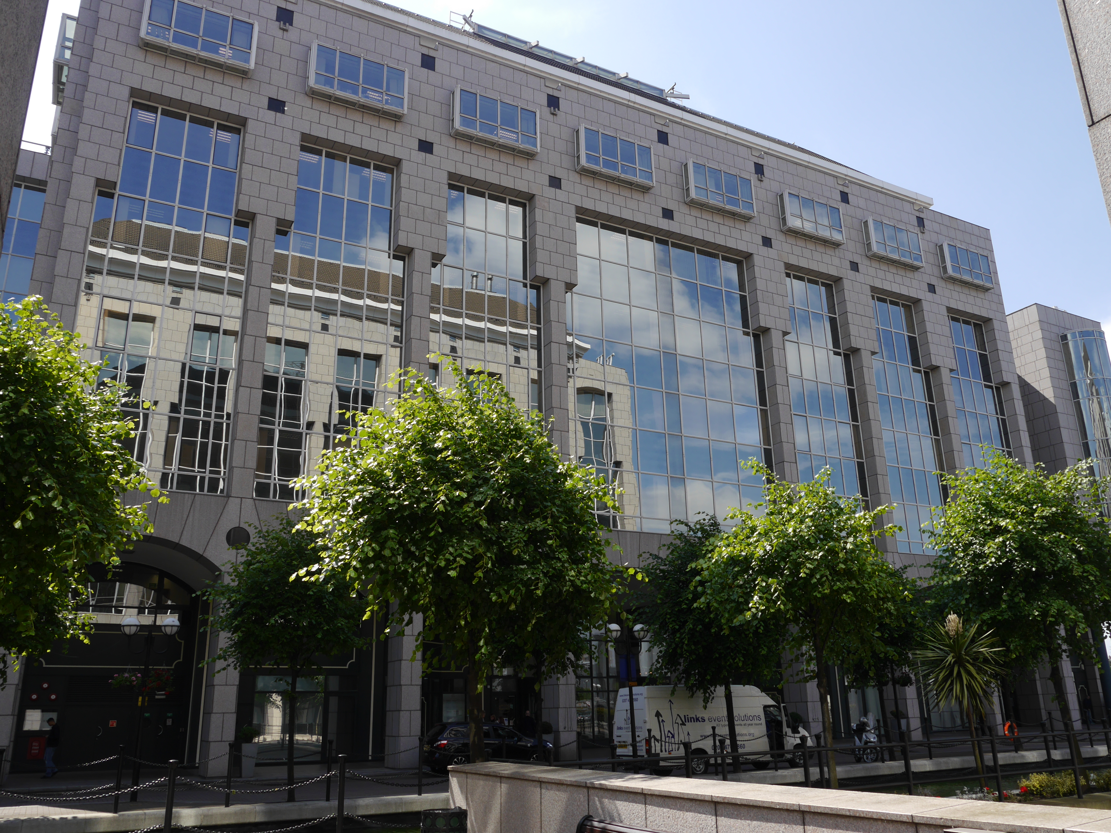
Bromley, South Images

Images are sourced within 2km of 51.510432/-0.004128 or Grid Reference TQ3880. Thanks to Geograph Open Source API. All images are credited.

Royal Victoria Dock, London, E16 Looking west along the Royal Victoria Dock, this image is taken from the High footbridge which links the housing development at Britannia Village (behind the cranes) with the Dockland Light Railway station on the north side of the dock. Canary Wharf is visible on the horizon.
Royal Victoria Dock, London, E16
Looking west along the Royal Victoria Dock, this image is taken from the High footbridge which links the housing development at Britannia Village (behind the cranes) with the Dockland Light Railway station on the north side of the dock. Canary Wharf is visible on the horizon.
Royal Victoria. Royal Victoria Dock taken from the D.L.R., in the vicinity of Royal Victoria Station.
Royal Victoria.
Royal Victoria Dock taken from the D.L.R., in the vicinity of Royal Victoria Station.
Tate & Lyle refinery, Canning Town The Tate & Lyle refinery (shown on some maps as a brewery) viewed from under the nearby DLR viaduct.  Note the 'golden syrup tin' on the NW corner (green blob at this resolution!) With an easterly wind the refinery can clearly be smelt in Greenwich.
Tate & Lyle refinery, Canning Town
The Tate & Lyle refinery (shown on some maps as a brewery) viewed from under the nearby DLR viaduct. Note the 'golden syrup tin' on the NW corner (green blob at this resolution!) With an easterly wind the refinery can clearly be smelt in Greenwich.
Royal Victoria Dock This is taken from the Royal Victoria Dock footbridge, looking west towards central London.
Royal Victoria Dock
This is taken from the Royal Victoria Dock footbridge, looking west towards central London.
Canning Town: Normandy Terrace, E16 Community shops at the southern end of Freemasons Road.
Canning Town: Normandy Terrace, E16
Community shops at the southern end of Freemasons Road.
Custom House for ExCeL DLR station On the left is the Custom House for ExCeL DLR Station with the ExCeL Exhibition Centre beyond. On the right is the now closed section of Network Rail's former North London Line, showing the platforms at the western end of Custom House station. Beyond that to the right is Victoria Dock Road with the two buses. DLR Unit No. 79 is about to leave with an eastbound train for Beckton. Despite the line having been closed since December 2006 the Network Rail signal at the end of the westbound platform is still lit and showing red. 

Note that the location of the DLR station on the Ordnance Survey 1:50,000 scale map shown with this image, as marked with a yellow circle, is grossly wrong by at least a hundred metres eastwards from its true location. The OS 1:25,000 scale mapping is better, although not perfect.
Custom House for ExCeL DLR station
On the left is the Custom House for ExCeL DLR Station with the ExCeL Exhibition Centre beyond. On the right is the now closed section of Network Rail's former North London Line, showing the platforms at the western end of Custom House station. Beyond that to the right is Victoria Dock Road with the two buses. DLR Unit No. 79 is about to leave with an eastbound train for Beckton. Despite the line having been closed since December 2006 the Network Rail signal at the end of the westbound platform is still lit and showing red. Note that the location of the DLR station on the Ordnance Survey 1:50,000 scale map shown with this image, as marked with a yellow circle, is grossly wrong by at least a hundred metres eastwards from its true location. The OS 1:25,000 scale mapping is better, although not perfect.
Royal Victoria DLR station No. 93 is the trailing unit in this westbound train about to depart Royal Victoria DLR station.
Royal Victoria DLR station
No. 93 is the trailing unit in this westbound train about to depart Royal Victoria DLR station.
Munday Road, E16 Near Appleby Road.
Munday Road, E16
Near Appleby Road.
Appleby Road, E16 Near Munday Road.
Appleby Road, E16
Near Munday Road.
Royal Victoria Dock Royal Victoria Dock, with the Millennium Dome & Canary Wharf skyscrapers in the background. Taken from outside the Excel Arena.
Royal Victoria Dock
Royal Victoria Dock, with the Millennium Dome & Canary Wharf skyscrapers in the background. Taken from outside the Excel Arena.
Yachting in Royal Victoria Dock
Royal Victoria Dock View looking from Western Gateway across Royal Victoria Dock towards Britannia Gate.
Royal Victoria Dock
View looking from Western Gateway across Royal Victoria Dock towards Britannia Gate.
Western Gateway Western gateway on Royal Victoria Dock.
Western Gateway
Western gateway on Royal Victoria Dock.
Sir Henry Johnson Pub/Restaurant in the Royal Victoria Docks near the Excel Centre and sailing school.
Sir Henry Johnson
Pub/Restaurant in the Royal Victoria Docks near the Excel Centre and sailing school.
The modern dock scene Hotel Ibis, Novotel at the Royal Docks, Custom House. Even the plaza has uplighters, a far cry from the gas lights of a hundred years ago.
The modern dock scene
Hotel Ibis, Novotel at the Royal Docks, Custom House. Even the plaza has uplighters, a far cry from the gas lights of a hundred years ago.
London Excel, Woolwich Welcome to the London Excel Exhibition Centre! This is the main entrance to the site viewed from the roundabout. I'm unsure of the exact location of this image as I don't know the area that well, so if anybody can help identify the correct location, I'd be very grateful!
London Excel, Woolwich
Welcome to the London Excel Exhibition Centre! This is the main entrance to the site viewed from the roundabout. I'm unsure of the exact location of this image as I don't know the area that well, so if anybody can help identify the correct location, I'd be very grateful!
Artistic street lighting on the roundabout to the Excel Centre Now this is artistic! On the last roundabout before the Excel Centre is a dome-shaped structure with yellow girders (apologies to the designer, I couldn't think of any better word for them!) with standard road lamps fitted to them! Very contemporary and original indeed! View looking northwest from the roundabout, but I'm unsure of the exact location.
Artistic street lighting on the roundabout to the Excel Centre
Now this is artistic! On the last roundabout before the Excel Centre is a dome-shaped structure with yellow girders (apologies to the designer, I couldn't think of any better word for them!) with standard road lamps fitted to them! Very contemporary and original indeed! View looking northwest from the roundabout, but I'm unsure of the exact location.
Tate & Lyle building A Tate & Lyle owned building taken from underneath the Docklands Light Railway line. This structure carries an advert for "LYLE'S GOLDEN SYRUP" on its corner.
Tate & Lyle building
A Tate & Lyle owned building taken from underneath the Docklands Light Railway line. This structure carries an advert for "LYLE'S GOLDEN SYRUP" on its corner.
Show me another place!

Bromley, South is located at Grid Ref: TQ3880 (Lat: 51.510432, Lng: -0.004128)

Unitary Authority: Tower Hamlets

Police Authority: Metropolitan

What 3 Words

///cabin.class.sums. Near Poplar, London

Related Wikis

Republic (office campus)

Republic is an education and office campus in London, England, situated in the London Borough of Tower Hamlets, near Canary Wharf and Canning Town. It...

London Internet Exchange

The London Internet Exchange ("LINX") is a mutually governed Internet exchange point (IXP) that provides peering services and public policy representation...

East India Dock House

East India Dock House is a Grade II* listed building in Poplar and is in the London Borough of Tower Hamlets. It was originally built in 1988 as a printworks...

Mulberry Place

Mulberry Place, formerly Tower Hamlets Town Hall, is a building in Nutmeg Lane, Blackwall, London. It was the headquarters of Tower Hamlets London Borough...

Nearby Amenities

Located within 500m of 51.510432,-0.004128
Crossing
Button Operated: yes
Crossing: traffic_signals
Crossing Island: yes
Crossing Ref: pelican
Tactile Paving: yes
Lat/Long: 51.5113507/-0.010755
Traffic Signals
Crossing: no
Traffic Signals: pedestrian_crossing
Traffic Signals Direction: forward
Lat/Long: 51.5119856/-0.0042193
Traffic Signals
Traffic Signals Direction: forward
Lat/Long: 51.5075339/-0.0075078
Traffic Signals
Crossing: no
Traffic Signals: traffic_lights
Traffic Signals Direction: forward
Lat/Long: 51.5071368/-0.0079312
Crossing
Button Operated: yes
Crossing: traffic_signals
Crossing Ref: pelican
Tactile Paving: yes
Traffic Signals Sound: no
Traffic Signals Vibration: yes
Lat/Long: 51.5117491/0.0002368
Motorway Junction
Lat/Long: 51.5138224/-0.0080841
Motorway Junction
Lat/Long: 51.512308/-0.0082552
Crossing
Button Operated: yes
Crossing: traffic_signals
Crossing Island: yes
Crossing Ref: pelican
Tactile Paving: yes
Traffic Signals Sound: yes
Traffic Signals Vibration: yes
Lat/Long: 51.5115306/-0.008718
Blackwall Platform 1
Light Rail: yes
Network: Docklands Light Railway
Public Transport: stop_position
Railway: stop
Ref: 1
Lat/Long: 51.5080368/-0.0066576
East India Platform 1
Light Rail: yes
Network: Docklands Light Railway
Public Transport: stop_position
Railway: stop
Ref: 1
Lat/Long: 51.5095016/-0.0016327
Blackwall
Is In: Tower hamlets, London
Place: suburb
Wikidata: Q122767
Wikipedia: en:Blackwall, London
Lat/Long: 51.5065004/-0.0064024
Created By: YahooApplet 1.0
Lat/Long: 51.507691/-0.0058757
Traffic Signals
Traffic Signals Direction: forward
Lat/Long: 51.5074888/-0.0073441
Motorway Junction
Lat/Long: 51.5085725/-0.0038845
Created By: YahooApplet 1.0
Lat/Long: 51.5101258/-0.0021716
Motorway Junction
Lat/Long: 51.5092689/-0.0033463
Crossing
Bicycle: yes
Button Operated: yes
Check Date: 2024-04-17
Crossing: traffic_signals
Crossing Island: yes
Crossing Markings: dots
Crossing Signals: yes
Crossing Ref: toucan
Segregated: no
Tactile Paving: yes
Lat/Long: 51.5103616/0.0015454
Motorway Junction
Lat/Long: 51.5102695/0.0024088
Blackwall
Rcn: yes
Rcn Name: Blackwall DLR
Lat/Long: 51.5088773/-0.0069133
Mini Roundabout
Direction: clockwise
Lat/Long: 51.5110133/-0.0004894
Crossing
Bicycle: yes
Crossing: marked
Crossing Island: yes
Tactile Paving: yes
Lat/Long: 51.510987/-6.98E-5
Crossing
Bicycle: yes
Button Operated: yes
Check Date: 2024-04-17
Crossing: traffic_signals
Crossing Island: yes
Crossing Markings: dots
Crossing Signals: yes
Crossing Ref: toucan
Segregated: no
Tactile Paving: yes
Lat/Long: 51.5104993/0.0017219
Crossing
Crossing: unmarked
Crossing Island: yes
Tactile Paving: yes
Lat/Long: 51.5102298/0.0008518
Crossing
Crossing: unmarked
Crossing Island: yes
Tactile Paving: yes
Lat/Long: 51.5102414/0.0006931
Ref GB Tflcid: RWG073038
Traffic Calming: hump
Lat/Long: 51.5090853/0.0011796
Ref GB Tflcid: RWG071003
Traffic Calming: hump
Lat/Long: 51.5089678/0.0012053
Crossing
Crossing: unmarked
Crossing Island: no
Tactile Paving: no
Lat/Long: 51.5083974/-0.0016385
Mini Roundabout
Direction: clockwise
Lat/Long: 51.5069217/-0.0066049
Traffic Signals
Traffic Signals: signal
Traffic Signals Direction: forward
Lat/Long: 51.5067492/-0.007378
Ref GB Tflcid: RWG070991
Traffic Calming: hump
Lat/Long: 51.5084069/-0.0018503
Traffic Signals
Traffic Signals: signal
Traffic Signals Direction: forward
Lat/Long: 51.5069953/-0.0078827
Crossing
Bicycle: yes
Button Operated: yes
Crossing: traffic_signals
Crossing Island: no
Crossing Ref: toucan
Lat/Long: 51.5070233/-0.0079271
Mini Roundabout
Direction: clockwise
Lat/Long: 51.5067633/-0.0064109
Crossing
Crossing: unmarked
Crossing Island: separate
Tactile Paving: no
Lat/Long: 51.5082419/-0.0085107
Check Date: 2021-06-14
Source: bing
Traffic Calming: bump
Lat/Long: 51.5146914/-0.0045961
Check Date: 2017-06-06
Ref GB Tflcid: RWG071727
Surface: asphalt
Traffic Calming: table
Lat/Long: 51.5098902/-0.0108797
Tactile Paving: yes
Lat/Long: 51.5089095/-0.0094753
Crossing
Button Operated: yes
Crossing: traffic_signals
Crossing Island: yes
Crossing Ref: pelican
Tactile Paving: yes
Traffic Signals Sound: yes
Traffic Signals Vibration: yes
Lat/Long: 51.5101533/-0.010356
Barrier: bollard
Lat/Long: 51.5111412/-0.0095414
Crossing
Button Operated: yes
Crossing: traffic_signals
Crossing Island: yes
Crossing Ref: toucan
Tactile Paving: yes
Lat/Long: 51.5133237/0.0005701
Londis
Addr City: London
Addr Housenumber: 45-47
Addr Postcode: E14 0NU
Addr Street: Aberfeldy Street
Brand: Londis
Brand Wikidata: Q21008564
Brand Wikipedia: en:Londis (United Kingdom)
Fhrs Id: 82521
Opening Hours: "as and when they wish to open"
Shop: convenience
Source Addr: FHRS Open Data
Lat/Long: 51.5135378/-0.0057825
Post Box
Brand: Royal Mail
Brand Wikidata: Q638098
Collection Times: Mo-Fr 09:00; Sa 07:00
Drive Through: no
Note: Security plate
Operator: Royal Mail
Operator Wikidata: Q638098
Post Box Design: type_a
Post Box Type: pillar
Ref: E14 29D
Royal Cypher: GR
Royal Cypher Wikidata: Q33102273
Source: survey
Lat/Long: 51.513522/-0.0055399
Pharmacy
Britannia Pharmacy
Addr City: London
Addr Housenumber: 35
Addr Postcode: E14 0NU
Addr Street: Aberfeldy Street
Fhrs Id: 362283
Healthcare: pharmacy
Wheelchair: yes
Lat/Long: 51.5132928/-0.0056669
Post Box
Brand: Royal Mail
Brand Wikidata: Q638098
Collection Times: Mo-Fr 09:00; Sa 07:00
Drive Through: no
Operator: Royal Mail
Operator Wikidata: Q638098
Post Box Design: type_a
Post Box Type: pillar
Ref: E14 40D
Royal Cypher: GVIR
Royal Cypher Wikidata: Q33102169
Source: survey
Lat/Long: 51.5133962/-0.0035573
Recycling
Lat/Long: 51.5121682/-0.0056976
Barrier: cycle_barrier
Lat/Long: 51.5132751/-0.0087356
Fast Food
Perfect Fried Chicken
Addr City: London
Addr Housenumber: 25
Addr Postcode: E14 0NU
Addr Street: Aberfeldy Street
Cuisine: kebab
Fhrs Id: 79484
Toilets Wheelchair: no
Wheelchair: yes
Lat/Long: 51.5130451/-0.0055603
Traffic Signals
Traffic Signals: signal
Traffic Signals Direction: forward
Lat/Long: 51.5117545/-0.0086276
Crossing
Button Operated: yes
Crossing: traffic_signals
Crossing Ref: pelican
Tactile Paving: yes
Traffic Signals Sound: no
Traffic Signals Vibration: yes
Lat/Long: 51.5116234/-0.0087361
Traffic Signals
Traffic Signals: signal
Traffic Signals Direction: forward
Lat/Long: 51.5129422/-0.0081475
Traffic Signals
Traffic Signals: signal
Traffic Signals Direction: forward
Lat/Long: 51.5128755/-0.007957
Crossing
Crossing: traffic_signals
Crossing Island: yes
Crossing Ref: pelican
Lat/Long: 51.5118218/-0.0076484
Traffic Signals
Traffic Signals: signal
Traffic Signals Direction: forward
Lat/Long: 51.5115364/-0.0084095
Traffic Signals
Traffic Signals: signal
Traffic Signals Direction: forward
Lat/Long: 51.5118019/-0.0074603
Traffic Signals
Traffic Signals: signal
Traffic Signals Direction: forward
Lat/Long: 51.5131408/-0.008445
Crossing
Button Operated: yes
Crossing: traffic_signals
Crossing Island: yes
Crossing Ref: pelican
Tactile Paving: yes
Lat/Long: 51.5110973/-0.0106542
Crossing
Button Operated: yes
Crossing: traffic_signals
Crossing Island: yes
Crossing Ref: pelican
Tactile Paving: yes
Lat/Long: 51.5112536/-0.0108594
Crossing
Button Operated: yes
Crossing: traffic_signals
Crossing Island: yes
Crossing Ref: pelican
Tactile Paving: yes
Lat/Long: 51.5113557/-0.0103677
Traffic Signals
Traffic Signals: signal
Traffic Signals Direction: forward
Lat/Long: 51.5111758/-0.0101382
Traffic Signals
Crossing: no
Traffic Signals: traffic_lights
Traffic Signals Direction: forward
Lat/Long: 51.5080695/-0.0083297
Crossing
Crossing: uncontrolled
Crossing Markings: yes
Lat/Long: 51.5123214/0.0017045
Ref GB Tflcid: RWG070935
Surface: sett
Traffic Calming: hump
Lat/Long: 51.5120348/0.0017538
Crossing
Button Operated: yes
Crossing: traffic_signals
Crossing Ref: pelican
Tactile Paving: yes
Traffic Signals Sound: no
Traffic Signals Vibration: yes
Lat/Long: 51.5115834/-0.0089383
Traffic Signals
Crossing: no
Traffic Signals: traffic_lights
Traffic Signals Direction: forward
Lat/Long: 51.5079374/-0.0083873
Bus Stop
Blackwall Station
Bench: yes
Bin: yes
Bus: yes
Lit: yes
Local Ref: AP
Naptan AtcoCode: 490002018AP
Naptan Bearing: S
Naptan CommonName: Blackwall
Naptan Indicator: Stop AP
Naptan Street: DITCHBURN STREET
Public Transport: platform
Ref: 76101
Shelter: no
Tactile Paving: no
Wheelchair: yes
Lat/Long: 51.5083005/-0.0069622
Bus Stop
Blackwall Station
Bench: yes
Bin: yes
Bus: yes
Lit: yes
Local Ref: P
Naptan AtcoCode: 490002018P
Naptan Bearing: N
Naptan CommonName: Blackwall
Naptan Indicator: Stop P
Naptan Street: DITCHBURN STREET
Public Transport: platform
Ref: 56655
Shelter: yes
Tactile Paving: no
Wheelchair: yes
Lat/Long: 51.5083098/-0.0073903
Bus Stop
Abbott Road
Bench: yes
Bin: yes
Bus: yes
Lit: yes
Naptan AtcoCode: 490003047E
Naptan Bearing: E
Naptan CommonName: Abbott Rd East India Dock Rd
Naptan Street: EAST INDIA DOCK ROAD
Public Transport: platform
Ref: 59391
Shelter: yes
Tactile Paving: no
Lat/Long: 51.5127838/-0.0009412
Bus Stop
Abbott Road
Bench: yes
Bin: yes
Bus: yes
Lit: yes
Naptan AtcoCode: 490003047W
Naptan Bearing: W
Naptan CommonName: Abbott Rd East India Dock Rd
Naptan Street: EAST INDIA DOCK ROAD
Public Transport: platform
Ref: 73689
Shelter: yes
Tactile Paving: no
Lat/Long: 51.5125191/-0.0009579
Abbott Road
Bus: yes
Public Transport: stop_position
Lat/Long: 51.5125739/-0.0009961
Bus Stop
Ettrick Street
Bench: yes
Bin: yes
Bus: yes
Lit: yes
Naptan AtcoCode: 490003056N
Naptan Bearing: N
Naptan CommonName: Ettrick Street
Naptan Indicator: Stop
Naptan Street: ABERFELDY STREET
Naptan Verified: no
Public Transport: platform
Ref: 51132
Shelter: yes
Tactile Paving: no
Lat/Long: 51.5140995/-0.005931
Bus Stop
Ettrick Street
Bench: yes
Bus: yes
Naptan AtcoCode: 490003056S
Naptan Bearing: S
Naptan CommonName: Ettrick Street
Naptan Indicator: Stop
Naptan Street: ABERFELDY STREET
Naptan Verified: no
Public Transport: platform
Ref: 58398
Shelter: yes
Lat/Long: 51.5142571/-0.0058638
Blackwall Tunnel / East India Dock Road
Bus: yes
Local Ref: L
Public Transport: stop_position
Lat/Long: 51.5119718/-0.0081321
Blackwall Tunnel / East India Dock Road
Bus: yes
Local Ref: M
Public Transport: stop_position
Lat/Long: 51.5111091/-0.0073301
Bus Stop
Blackwall Tunnel
Bus: yes
Local Ref: D
Naptan AtcoCode: 490004084D
Naptan Bearing: N
Naptan CommonName: Blackwall Tunnel
Naptan Indicator: D
Naptan Street: EAST INDIA DOCK ROAD
Naptan Verified: no
Public Transport: platform
Ref: 47848
Shelter: yes
Wheelchair: yes
Lat/Long: 51.511403/-0.0078836
Bus Stop
Nutmeg Lane
Bench: yes
Bin: yes
Bus: yes
Lit: yes
Local Ref: F
Naptan AtcoCode: 490004532F
Naptan Bearing: N
Naptan CommonName: Nutmeg Lane
Naptan Indicator: Stop F
Naptan Street: EAST INDIA DOCK ROAD
Public Transport: platform
Ref: 54820
Shelter: yes
Tactile Paving: no
Lat/Long: 51.5122619/-0.0037477
Bus Stop
Cotton Street
Bench: yes
Bin: yes
Bus: yes
Lit: yes
Local Ref: CO
Naptan AtcoCode: 490005635N
Naptan Bearing: S
Naptan CommonName: Poplar High Street
Naptan Indicator: Stop CO
Naptan Street: COTTON STREET
Public Transport: platform
Shelter: yes
Tactile Paving: no
Lat/Long: 51.5099039/-0.0101398
Bus Stop
Poplar High Street
Bench: yes
Bin: yes
Bus: yes
Lit: yes
Local Ref: CX
Naptan AtcoCode: 490005635O
Naptan Bearing: N
Naptan CommonName: Poplar High Street
Naptan Indicator: Stop CX
Naptan Street: COTTON STREET
Public Transport: platform
Shelter: yes
Tactile Paving: no
Lat/Long: 51.5094482/-0.0100084
Bus Stop
Goodway Gardens
Bench: no
Bin: no
Bus: yes
Lit: yes
Naptan AtcoCode: 490007296S
Naptan Bearing: N
Naptan CommonName: Goodway Gardens
Naptan Street: BLAIR STREET
Naptan Verified: no
Public Transport: platform
Ref: 59233
Shelter: no
Tactile Paving: no
Lat/Long: 51.5133143/-0.0037104
Bus Stop
Brunswick Road
Bench: yes
Bin: yes
Bus: yes
Local Ref: E
Naptan AtcoCode: 490007047E
Naptan Bearing: N
Naptan CommonName: F T Building
Naptan Indicator: E
Public Transport: platform
Ref: 51790
Shelter: yes
Wheelchair: yes
Lat/Long: 51.5118594/-0.0059423
Bus Stop
Aberfeldy Street
Bench: no
Bin: yes
Bus: yes
Lit: yes
Naptan AtcoCode: 490008964W
Naptan Bearing: N
Naptan CommonName: Lansbury Gardens
Naptan Street: BLAIR STREET
Naptan Verified: no
Public Transport: platform
Ref: 76901
Shelter: no
Tactile Paving: no
Lat/Long: 51.5129965/-0.0050237
Bus Stop
Poplar / All Saints Church
Bench: no
Bus: yes
Local Ref: Z
Naptan AtcoCode: 490011107Z
Naptan Bearing: N
Naptan CommonName: Poplar All Saints Church
Naptan Indicator: Z
Naptan Street: BAZELY STREET
Public Transport: platform
Ref: 54994
Shelter: no
Tactile Paving: no
Lat/Long: 51.510866/-0.0112407
Bus Stop
Poplar High Street / Blackwall
Bench: no
Bin: yes
Bus: yes
Lit: yes
Local Ref: S
Naptan AtcoCode: 490011111W1
Naptan Bearing: W
Naptan CommonName: Poplar High Street Blackwall
Naptan Indicator: Stop
Public Transport: platform
Ref: 76615
Shelter: no
Tactile Paving: no
Lat/Long: 51.5087212/-0.0100851
Bus Stop
East India Dock Road
Bench: yes
Bin: yes
Bus: yes
Lit: yes
Naptan AtcoCode: 490015117S
Naptan Bearing: S
Naptan CommonName: East India Dock Rd Abbott Rd
Naptan Street: ABBOTT ROAD
Naptan Verified: no
Public Transport: platform
Ref: 54300
Shelter: yes
Tactile Paving: no
Lat/Long: 51.5136724/-0.0004338
Bus Stop
Abbott Road
Bench: yes
Bin: yes
Bus: yes
Lit: yes
Naptan AtcoCode: 490015117W
Naptan Bearing: W
Naptan CommonName: East India Dock Rd Abbott Rd
Naptan Street: BLAIR STREET
Naptan Verified: no
Public Transport: platform
Ref: 73568
Shelter: yes
Tactile Paving: no
Lat/Long: 51.5136073/-0.0018795
Crossing
Button Operated: yes
Crossing: traffic_signals
Crossing Ref: pelican
Tactile Paving: yes
Traffic Signals Sound: no
Traffic Signals Vibration: yes
Lat/Long: 51.5118486/0.0004143
Traffic Calming: table
Lat/Long: 51.5118572/0.0016456
Noexit: yes
Lat/Long: 51.5093655/-0.003533
Check Date: 2017-09-07
Ref GB Tflcid: RWG072875
Surface: asphalt
Traffic Calming: hump
Lat/Long: 51.5092827/-0.0076376
Ref GB Tflcid: RWG072873
Traffic Calming: hump
Lat/Long: 51.5098392/-0.0076794
Noexit: yes
Lat/Long: 51.5100412/-0.007719
Barrier: lift_gate
Lat/Long: 51.5115345/-0.004564
Crossing
Crossing: uncontrolled
Crossing Island: no
Crossing Ref: zebra
Source: bing
Tactile Paving: yes
Lat/Long: 51.5137728/-0.0009627
Traffic Signals
Traffic Signals Direction: forward
Lat/Long: 51.5128616/0.0002652
Kindergarten
Aberfeldy Sure Start Children's Centre
Addr City: London
Addr Housename: Aberfeldy Neighbourhood Centre
Addr Postcode: E14 0NU
Addr Street: Aberfeldy Street
Lat/Long: 51.5140007/-0.006067
Man Made: chimney
Lat/Long: 51.5125288/-0.0073417
Crossing
Bicycle: yes
Button Operated: yes
Crossing: traffic_signals
Crossing Island: yes
Crossing Ref: toucan
Kerb: lowered
Segregated: no
Source: bing
Tactile Paving: yes
Traffic Signals Sound: yes
Traffic Signals Vibration: yes
Lat/Long: 51.5104098/8.4E-5
Crossing
Crossing: unmarked
Crossing Island: no
Tactile Paving: yes
Lat/Long: 51.5103699/-0.003762
Crossing
Bicycle: yes
Button Operated: yes
Crossing: traffic_signals
Crossing Island: yes
Crossing Ref: toucan
Horse: no
Supervised: no
Tactile Paving: yes
Lat/Long: 51.5125608/0.000252
Crossing
Bicycle: yes
Button Operated: yes
Crossing: traffic_signals
Crossing Island: yes
Crossing Ref: toucan
Horse: no
Supervised: no
Tactile Paving: yes
Lat/Long: 51.5125285/-0.0002861
Crossing
Bicycle: yes
Button Operated: yes
Crossing: traffic_signals
Crossing Island: yes
Crossing Ref: toucan
Horse: no
Supervised: no
Tactile Paving: yes
Lat/Long: 51.5125848/6.25E-5
Crossing
Bicycle: yes
Button Operated: yes
Crossing: traffic_signals
Crossing Island: yes
Crossing Ref: toucan
Horse: no
Supervised: no
Tactile Paving: yes
Lat/Long: 51.5125607/-0.0001146
Description: Proven micro-turbine mounted on the Proton tower
Generator Output Electricity: 2.5 kW
Generator Source: wind
Location: roof
Power: generator
Lat/Long: 51.5097829/-0.0010148
Description: Schueco PV panels mounted on the Elektron tower
Generator Method: photovoltaic
Generator Output Electricity: 2 kW
Generator Source: solar
Generator Type: solar_photovoltaic_panel
Location: roof
Power: generator
Lat/Long: 51.5097862/-0.0020217
Description: Proven micro-turbine mounted on the Neutron tower
Generator Output Electricity: 2.5 kW
Generator Source: wind
Location: roof
Power: generator
Lat/Long: 51.5099026/-0.000399
Description: Schueco PV panels mounted on the Proton tower
Generator Method: photovoltaic
Generator Output Electricity: 2 kW
Generator Source: solar
Generator Type: solar_photovoltaic_panel
Location: roof
Power: generator
Lat/Long: 51.5099558/-0.0012026
Description: Schueco PV panels mounted on the Neutron tower
Generator Method: photovoltaic
Generator Output Electricity: 2 kW
Generator Source: solar
Generator Type: solar_photovoltaic_panel
Location: roof
Power: generator
Lat/Long: 51.5100324/-0.0006075
Description: Proven micro-turbine mounted on the Elektron tower
Generator Output Electricity: 2.5 kW
Generator Source: wind
Location: roof
Power: generator
Lat/Long: 51.5098157/-0.0016886
The New Blackwall Tunnel
Board Type: information
Information: board
Inscription: The New Blackwall Tunel was opened by Mr Desmond Plummer TD JP, Leader of the Greater London Council, 2nd August 1967.
Lat/Long: 51.5091084/-0.0065727
Give Way
Direction: forward
Give Way Direction: forward
Source: survey;Bing aerial imagery
Traffic Sign: GB:1003B
Lat/Long: 51.5102146/0.0006463
Crossing
Bicycle: yes
Button Operated: yes
Crossing: traffic_signals
Crossing Island: yes
Crossing Ref: toucan
Kerb: lowered
Segregated: no
Source: bing
Tactile Paving: yes
Traffic Signals Sound: yes
Traffic Signals Vibration: yes
Lat/Long: 51.5106504/-1.67E-5
Crossing
Bicycle: yes
Crossing: unmarked
Crossing Island: yes
Tactile Paving: no
Lat/Long: 51.5102192/0.0007034
Crossing
Bicycle: yes
Crossing: unmarked
Crossing Island: yes
Tactile Paving: no
Lat/Long: 51.5102143/0.0008483
Post Box
Brand: Royal Mail
Brand Wikidata: Q638098
Collection Times: Mo-Fr 17:00; Sa 10:30
Drive Through: no
Operator: Royal Mail
Operator Wikidata: Q638098
Post Box Apertures: 2
Post Box Design: type_c
Post Box Type: pillar
Ref: E14 56;E14 156
Royal Cypher: EIIR
Royal Cypher Wikidata: Q33102113
Source: survey
Lat/Long: 51.5095357/-0.0035927
Post Box
Brand: Royal Mail
Brand Wikidata: Q638098
Collection Times: Mo-Fr 17:00; Sa 10:30
Drive Through: no
Operator: Royal Mail
Operator Wikidata: Q638098
Post Box Type: parcel
Ref: E14 55P
Royal Cypher: no
Source: survey
Lat/Long: 51.5095357/-0.003585
Post Box
Brand: Royal Mail
Brand Wikidata: Q638098
Collection Times: Mo-Fr 09:00; Sa 07:00
Drive Through: no
Operator: Royal Mail
Operator Wikidata: Q638098
Post Box Design: type_a
Post Box Type: pillar
Ref: E14 60D
Royal Cypher: EIIR
Royal Cypher Wikidata: Q33102113
Source: survey
Lat/Long: 51.5068105/-0.0067913
Crossing
Button Operated: yes
Crossing: traffic_signals
Crossing Ref: pelican
Lat/Long: 51.5133565/0.0003798
Barrier: cycle_barrier
Cycle Barrier: double
Cycle Barrier Installation: fixed
Foot: yes
Lat/Long: 51.5067337/-0.0081679
Barrier: cycle_barrier
Cycle Barrier: double
Cycle Barrier Installation: fixed
Foot: yes
Lat/Long: 51.5068378/-0.0082724
Poplar Wines and Spirits
Addr City: London
Addr Housenumber: 243
Addr Postcode: E14 0BE
Addr Street: Poplar High Street
Check Date: 2023-07-17
Fhrs Id: 150683
Fhrs Local Authority Id: 9895
Level: 0
Shop: alcohol
Source Addr: FHRS Open Data
Source Addr Housenumber: interpolation
Source Name: FHRS Open Data
Lat/Long: 51.5088861/-0.010401
Pharmacy
Britannia Pharmacy
Addr City: London
Addr Housenumber: 257-259
Addr Postcode: E14 0BE
Addr Street: Poplar High Street
Check Date: 2023-07-17
Dispensing: yes
Fhrs Id: 362583
Healthcare: pharmacy
Level: 0
Medical Supply: yes
Shop: chemist
Source: survey
Source Addr Housenumber: interpolation
Lat/Long: 51.5089138/-0.0097939
Poplar DIY
Addr City: London
Addr Housenumber: 249
Addr Postcode: E14 0BE
Addr Street: Poplar High Street
Check Date: 2023-07-17
Level: 0
Shop: doityourself
Source: survey
Source Addr Housenumber: interpolation
Lat/Long: 51.5088972/-0.0101582
Addr City: London
Addr Housenumber: 263
Addr Postcode: E14 0BE
Addr Street: Poplar High Street
Disused Shop: yes
Level: 0
Lat/Long: 51.508923/-0.0095916
Robert E Lee Hair & Beauty
Addr City: London
Addr Housenumber: 261
Addr Postcode: E14 0BE
Addr Street: Poplar High Street
Check Date: 2023-07-17
Contact Phone: +44 20 7515 5372
Level: 0
Shop: hairdresser
Source: survey
Source Addr Housenumber: interpolation
Lat/Long: 51.5089193/-0.0096725
Cafe
Poplar Cafe
Addr City: London
Addr Housenumber: 251-253
Addr Postcode: E14 0BE
Addr Street: Poplar High Street
Check Date: 2023-07-17
Fhrs Id: 91239
Fhrs Local Authority Id: 25110
Level: 0
Source Addr: FHRS Open Data
Lat/Long: 51.5089027/-0.0100367
Crossing
Button Operated: yes
Crossing: traffic_signals
Crossing Island: yes
Crossing Ref: pelican
Tactile Paving: yes
Lat/Long: 51.5111538/-0.0104935
Blackwall Platform 2
Light Rail: yes
Network: Docklands Light Railway
Public Transport: stop_position
Railway: stop
Ref: 2
Lat/Long: 51.5078647/-0.0075456
Level: 0
Railway: subway_entrance
Wheelchair: yes
Lat/Long: 51.5080573/-0.0068769
Check Date: 2021-06-06
Source: bing
Traffic Calming: bump
Lat/Long: 51.5130909/-0.0047036
Ref GB Tflcid: RWG071545
Traffic Calming: table
Lat/Long: 51.5133121/-0.0035439
Check Date: 2021-05-31
Source: bing
Traffic Calming: bump
Lat/Long: 51.5133548/-0.0033228
Check Date: 2021-05-31
Source: bing
Traffic Calming: bump
Lat/Long: 51.5137507/-0.0012668
Crossing
Crossing: uncontrolled
Crossing Island: yes
Crossing Ref: zebra
Source: bing
Tactile Paving: yes
Lat/Long: 51.5141271/-0.0022541
Source: bing
Traffic Calming: bump
Lat/Long: 51.5141506/-0.0046506
Check Date: 2021-07-07
Source: bing
Traffic Calming: bump
Lat/Long: 51.5143143/-0.003777
Traffic Signals
Traffic Signals: signal
Traffic Signals Direction: forward
Lat/Long: 51.5134581/0.0006709
Check Date: 2021-07-04
Source: bing
Traffic Calming: bump
Lat/Long: 51.5142838/-0.000956
Ref GB Tflcid: RWG071568
Traffic Calming: cushion
Lat/Long: 51.5144211/-0.0014509
Check Date: 2021-07-07
Source: bing
Traffic Calming: bump
Lat/Long: 51.5146122/-0.0040205
Check Date: 2021-07-04
Source: bing
Traffic Calming: bump
Lat/Long: 51.5146695/-0.0023504
Crossing
Crossing: uncontrolled
Crossing Island: yes
Crossing Ref: zebra
Source: bing
Tactile Paving: yes
Traffic Calming: bump
Lat/Long: 51.5148507/-0.0048658
Crossing
Button Operated: yes
Crossing: traffic_signals
Crossing Ref: pelican
Source: bing
Tactile Paving: yes
Traffic Signals Sound: no
Traffic Signals Vibration: yes
Lat/Long: 51.5117854/2.0E-5
Barrier: bollard
Bollard: fixed
Foot: yes
Lat/Long: 51.5068996/-0.0078939
Restaurant
Il Bianco
Addr City: London
Addr Housename: Michigan Building
Addr Housenumber: 2
Addr Postcode: E14 9QT
Addr Street: Biscayne Avenue
Cuisine: italian
Fhrs Id: 100227
Fhrs Local Authority Id: 32104
Smoking: outside
Source Addr: FHRS Open Data
Takeaway: yes
Website: https://ilbianco.co.uk/
Lat/Long: 51.5066487/-0.0062482
Childcare
East India Dock Day Nursery
Addr City: London
Addr Housename: My Nursery
Addr Housenumber: 3
Addr Postcode: E14 2ED
Addr Street: Newport Avenue
Fhrs Id: 66657
Fhrs Local Authority Id: 149703
Fhrs Name: My Nursery Kitchen
Operator: Bright Horizons
Source Addr: FHRS Open Data
Lat/Long: 51.508916/-0.001861
Access: yes
Barrier: lift_gate
Maxheight: 4.7
Lat/Long: 51.5098062/-0.0068714
Traffic Signals
Traffic Signals: signal
Traffic Signals Direction: forward
Lat/Long: 51.510343/-0.0070256
East India Docks
Historic: monument
Lat/Long: 51.5111314/-0.0069683
Crossing
Crossing: unmarked
Crossing Island: no
Tactile Paving: yes
Lat/Long: 51.5083736/-0.0088964
Give Way
Direction: forward
Lat/Long: 51.5083833/-0.0088448
Atm
Cash In: no
Check Date: 2021-04-03
Covered: no
Drive Through: no
Fee: no
Indoor: no
Lit: yes
Opening Hours: 24/7
Operator: Tesco
Wheelchair: yes
Lat/Long: 51.5086867/-0.0094035
Clinic
The Aberfeldy Practice
No
Addr City: London
Addr Housenumber: 2A
Addr Postcode: E14 0PU
Addr Street: Ettrick Street
Emergency: no
Healthcare: clinic
Toilets Wheelchair: yes
Wheelchair: yes
Lat/Long: 51.5143573/-0.0052836
Crossing
Crossing: traffic_signals
Crossing Island: yes
Crossing Ref: pelican
Lat/Long: 51.511779/-0.0073313
Crossing
Button Operated: yes
Crossing: traffic_signals
Crossing Island: no
Crossing Ref: pelican
Lat/Long: 51.5068474/-0.0075027
Crossing
Bicycle: yes
Button Operated: yes
Crossing: traffic_signals
Crossing Island: no
Crossing Ref: toucan
Lat/Long: 51.5067368/-0.0074387
Crossing
Bicycle: yes
Button Operated: yes
Crossing: traffic_signals
Crossing Island: no
Crossing Ref: toucan
Lat/Long: 51.5068017/-0.0076213
Atm
Fee: £1.75
Source: locator.link.co.uk
Lat/Long: 51.5090646/-0.0019988
Crossing
Button Operated: yes
Crossing: traffic_signals
Crossing Island: separate
Crossing Markings: dots
Crossing Ref: pelican
Tactile Paving: yes
Traffic Signals Sound: no
Traffic Signals Vibration: yes
Lat/Long: 51.5089025/-0.0094487
M&S Storage
Lat/Long: 51.5088634/-0.0051445
Shine Repairs Centre
Lat/Long: 51.5088957/-0.0051494
Give Way
Direction: backward
Give Way Direction: backward
Source: survey;ESRI World Imagery (Clarity) Beta
Traffic Sign: GB:1003A
Lat/Long: 51.5088923/-0.006844
Operator: UK Power Networks
Power: substation
Ref: 63135
Source: survey
Lat/Long: 51.5092984/-0.0035696
Barrier: lift_gate
Lat/Long: 51.51085/-0.0043964
Crossing
Bicycle: yes
Crossing: unmarked
Crossing Island: no
Lat/Long: 51.5117881/-0.0047327
Crossing
Button Operated: yes
Crossing: traffic_signals
Crossing Ref: pelican
Kerb: lowered
Tactile Paving: yes
Traffic Signals Sound: no
Traffic Signals Vibration: yes
Lat/Long: 51.5120599/-0.0044702
Entrance: main
Lat/Long: 51.5137707/-0.0089031
Crossing
Button Operated: yes
Crossing: traffic_signals
Crossing Island: no
Crossing Ref: pelican
Tactile Paving: yes
Traffic Signals Sound: yes
Traffic Signals Vibration: yes
Lat/Long: 51.5113871/-0.0070252
Crossing
Button Operated: yes
Crossing: traffic_signals
Crossing Island: yes
Crossing Ref: pelican
Tactile Paving: yes
Traffic Signals Sound: yes
Traffic Signals Vibration: yes
Lat/Long: 51.5113057/-0.0085213
Traffic Signals
Traffic Signals: signal
Traffic Signals Direction: forward
Lat/Long: 51.5113083/-0.0084616
Motorway Junction
Lat/Long: 51.509631/-0.007042
Traffic Signals
Traffic Signals: crossing
Traffic Signals Direction: forward
Lat/Long: 51.5114238/-0.0069804
Traffic Signals
Traffic Signals: signal
Traffic Signals Direction: forward
Lat/Long: 51.510307/-0.0069067
Crossing
Button Operated: yes
Crossing: traffic_signals
Tactile Paving: yes
Traffic Signals Sound: no
Traffic Signals Vibration: yes
Lat/Long: 51.5117406/-0.0085736
Crossing
Button Operated: yes
Crossing: traffic_signals
Crossing Island: yes
Crossing Ref: pelican
Tactile Paving: yes
Traffic Signals Sound: yes
Traffic Signals Vibration: yes
Lat/Long: 51.5113803/-0.008603
Crossing
Crossing: traffic_signals
Crossing Island: yes
Crossing Ref: pelican
Lat/Long: 51.511769/-0.0074551
Barrier: kerb
Kerb: lowered
Tactile Paving: yes
Lat/Long: 51.5113388/-0.0085906
Traffic Signals
Traffic Signals: crossing
Traffic Signals Direction: forward
Lat/Long: 51.5117915/-0.007681
Traffic Signals
Traffic Signals: signal
Traffic Signals Direction: forward
Lat/Long: 51.512969/-0.0079944
Traffic Signals
Traffic Signals: signal
Traffic Signals Direction: forward
Lat/Long: 51.5113893/-0.0085552
Traffic Signals
Traffic Signals: signal
Traffic Signals Direction: forward
Lat/Long: 51.5131223/-0.0083119
Crossing
Button Operated: yes
Crossing: traffic_signals
Crossing Island: yes
Crossing Ref: pelican
Tactile Paving: yes
Lat/Long: 51.5111586/-0.010177
Traffic Signals
Traffic Signals: signal
Traffic Signals Direction: forward
Lat/Long: 51.5113517/-0.0108228
Crossing
Button Operated: yes
Crossing: traffic_signals
Crossing Island: yes
Crossing Ref: pelican
Tactile Paving: yes
Lat/Long: 51.5112466/-0.0103022
Traffic Signals
Traffic Signals: signal
Traffic Signals Direction: forward
Lat/Long: 51.5110663/-0.0106479
Traffic Signals
Traffic Signals: signal
Traffic Signals Direction: forward
Lat/Long: 51.5112497/-0.0102378
Traffic Signals
Traffic Signals: signal
Traffic Signals Direction: forward
Lat/Long: 51.5118121/-0.0073399
Traffic Signals
Traffic Signals: signal
Traffic Signals Direction: forward
Lat/Long: 51.5115105/-0.0087616
Traffic Signals
Traffic Signals: signal
Traffic Signals Direction: forward
Lat/Long: 51.5114905/-0.0073426
Traffic Signals
Traffic Signals: signal
Traffic Signals Direction: forward
Lat/Long: 51.5117007/-0.0075332
Traffic Signals
Traffic Signals: signal
Traffic Signals Direction: forward
Lat/Long: 51.5115609/-0.008946
Crossing
Crossing: traffic_signals
Crossing Island: yes
Crossing Markings: dots
Crossing Ref: pelican
Tactile Paving: yes
Lat/Long: 51.5087847/-0.0088312
Crossing
Button Operated: yes
Crossing: traffic_signals
Crossing Island: separate
Crossing Markings: dots
Crossing Ref: pelican
Tactile Paving: yes
Traffic Signals Sound: no
Traffic Signals Vibration: yes
Lat/Long: 51.5087032/-0.008776
Traffic Signals
Crossing: no
Traffic Signals: traffic_lights
Traffic Signals Direction: backward
Lat/Long: 51.5087975/-0.0086511
Crossing
Crossing: unmarked
Crossing Island: separate
Tactile Paving: no
Lat/Long: 51.50705/-0.0086875
Crossing
Crossing: unmarked
Crossing Island: separate
Tactile Paving: no
Lat/Long: 51.5069857/-0.0085057
Crossing
Crossing: traffic_signals
Crossing Island: yes
Crossing Markings: dots
Crossing Ref: pelican
Tactile Paving: yes
Lat/Long: 51.5088133/-0.0094097
Traffic Signals
Traffic Signals: signal
Traffic Signals Direction: forward
Lat/Long: 51.5124901/-0.0002243
Traffic Signals
Traffic Signals: signal
Traffic Signals Direction: forward
Lat/Long: 51.51251/-9.01E-5
Traffic Signals
Traffic Signals: signal
Traffic Signals Direction: forward
Lat/Long: 51.5125997/0.0002848
Traffic Signals
Traffic Signals: signal
Traffic Signals Direction: forward
Lat/Long: 51.5126795/0.0001598
Traffic Signals
Traffic Signals: signal
Traffic Signals Direction: forward
Lat/Long: 51.5128167/-0.0005256
Traffic Signals
Traffic Signals: signal
Traffic Signals Direction: forward
Lat/Long: 51.5127494/-0.0004969
Crossing
Bicycle: yes
Button Operated: yes
Crossing: traffic_signals
Crossing Island: yes
Crossing Ref: toucan
Horse: no
Kerb: lowered
Supervised: no
Tactile Paving: yes
Lat/Long: 51.5127563/-0.0004316
Crossing
Bicycle: yes
Button Operated: yes
Crossing: traffic_signals
Crossing Island: yes
Crossing Ref: toucan
Horse: no
Supervised: no
Tactile Paving: yes
Lat/Long: 51.5126541/-0.0002896
Crossing
Bicycle: yes
Button Operated: yes
Crossing: traffic_signals
Crossing Island: yes
Crossing Ref: toucan
Horse: no
Kerb: lowered
Supervised: no
Tactile Paving: yes
Lat/Long: 51.5128279/-0.0004681
Traffic Signals
Traffic Signals: signal
Traffic Signals Direction: forward
Lat/Long: 51.5068734/-0.0075451
Street Lamp
Lat/Long: 51.5072801/-0.0085777
Street Lamp
Lat/Long: 51.5080188/-0.0084879
Street Lamp
Lat/Long: 51.5073961/-0.0077973
Crossing
Crossing: unmarked
Crossing Island: separate
Tactile Paving: no
Lat/Long: 51.5081928/-0.0087295
Tactile Paving: yes
Lat/Long: 51.506799/-0.007665
Street Lamp
Lat/Long: 51.5104636/0.0006625
Street Lamp
Lat/Long: 51.5108793/1.07E-5
Street Lamp
Lat/Long: 51.5109803/0.0008341
Street Lamp
Lat/Long: 51.5105964/0.00127
Street Lamp
Lat/Long: 51.5103969/-0.0009684
Street Lamp
Lat/Long: 51.5101782/-0.002237
Elevator
Level: 0;1
Lat/Long: 51.5096029/-0.0032266
Barrier: kerb
Kerb: lowered
Source: survey;Bing aerial imagery
Tactile Paving: yes
Lat/Long: 51.5107086/-3.94E-5
Traffic Signals
Traffic Signals: signal
Traffic Signals Direction: forward
Lat/Long: 51.5065897/-0.007701
Give Way
Direction: forward
Lat/Long: 51.5067673/-0.0070459
Tactile Paving: yes
Lat/Long: 51.5067691/-0.0074479
Traffic Signals
Traffic Signals: signal
Traffic Signals Direction: forward
Lat/Long: 51.5068378/-0.0076283
Tactile Paving: yes
Lat/Long: 51.5070573/-0.0078818
Blackwall Station
Bus: yes
Local Ref: AP
Public Transport: stop_position
Lat/Long: 51.5082996/-0.0070076
Blackwall Station
Bus: yes
Local Ref: P
Public Transport: stop_position
Lat/Long: 51.5083133/-0.0073183
Motorcycle Parking
Capacity: 6
Covered: no
Lat/Long: 51.5088848/-0.0078039
Poplar / All Saints Church
Bus: yes
Local Ref: Z
Public Transport: stop_position
Lat/Long: 51.5108686/-0.0111521
Poplar / All Saints Church
Bus: yes
Local Ref: H
Public Transport: stop_position
Lat/Long: 51.5110711/-0.0112166
Poplar High Street / Blackwall
Bus: yes
Local Ref: S
Public Transport: stop_position
Lat/Long: 51.5087769/-0.0100919
Nutmeg Lane
Bus: yes
Local Ref: F
Public Transport: stop_position
Lat/Long: 51.5121858/-0.0037541
Sandmartin Bank
Natural: wetland
Source Name: local_information
Lat/Long: 51.5112852/0.0026417
Bench
Backrest: no
Lat/Long: 51.5115797/0.0028176
Blackwall Tunnel
Bus: yes
Local Ref: D
Public Transport: stop_position
Lat/Long: 51.5114726/-0.0078821
Brunswick Road
Bus: yes
Local Ref: E
Public Transport: stop_position
Lat/Long: 51.5117969/-0.0058413
Abbott Road
Bus: yes
Public Transport: stop_position
Lat/Long: 51.5127032/-0.0009798
Abbott Road
Bus: yes
Public Transport: stop_position
Lat/Long: 51.5136265/-0.0019056
East India Dock Road
Bus: yes
Public Transport: stop_position
Lat/Long: 51.5136392/-0.0004549
Bus Stop
Blackwall Tunnel / East India Dock Road
Bus: yes
Local Ref: L
Naptan AtcoCode: 490004082L
Naptan Bearing: N
Naptan CommonName: Poplar Blackwall Tunnel
Naptan Indicator: Stop L
Naptan Street: BLACKWALL TUNNEL NORTHERN APPROACH
Public Transport: platform
Ref: 72535
Wheelchair: no
Lat/Long: 51.5119492/-0.0081991
Bus Stop
Blackwall Tunnel / East India Dock Road
Bench: yes
Bus: yes
Local Ref: M
Naptan AtcoCode: 490004082M
Naptan Bearing: N
Naptan CommonName: Poplar Blackwall Tunnel
Naptan Indicator: M
Naptan Street: BLACKWALL TUNNEL NORTHERN APPROACH
Public Transport: platform
Ref: 73038
Shelter: yes
Wheelchair: no
Lat/Long: 51.5111125/-0.0072765
Addr City: London
Addr Housenumber: 11
Addr Postcode: E14 0EX
Addr Street: Mountague Place
Lat/Long: 51.5097669/-0.011048
Addr Housenumber: 243
Addr Street: Poplar High Street
Lat/Long: 51.5089093/-0.010403
Addr Housenumber: 263
Addr Street: Poplar High Street
Lat/Long: 51.508942/-0.009588
Fast Food
E Burger
Addr City: London
Addr Housenumber: 258
Addr Postcode: E14 0BB
Addr Street: Poplar High Street
Fhrs Id: 1261574
Level: 0
Source Addr Postcode: FHRS Open Data
Lat/Long: 51.5086865/-0.0103824
Restaurant
FOGG's
Addr City: London
Addr Housenumber: 1
Addr Postcode: E14 9PE
Addr Street: Baffin Way
Delivery: no
Description: Restaurant of the Ibis hotel
Fhrs Id: 73371
Internet Access: wlan
Operator: Ibis
Outdoor Seating: yes
Smoking: outside
Lat/Long: 51.50693/-0.006985
Barrier: lift_gate
Bicycle: permissive
Motor Vehicle: private
Note: Private estate road? bicycle=permissive - not sure if there is an actual right of way here, despite being used by NCN 15 / C3
Lat/Long: 51.5108736/-0.0011301
Addr City: London
Addr Housenumber: 1
Addr Postcode: E14 2DE
Addr Street: Jamestown Way
Lat/Long: 51.5080307/-0.0007955
Addr City: London
Addr Housenumber: 55
Addr Postcode: E14 2DE
Addr Street: Jamestown Way
Lat/Long: 51.5083814/0.0011199
Crossing
Lat/Long: 51.5112665/-0.0043441
Crossing
Button Operated: yes
Crossing: traffic_signals
Crossing Ref: pelican
Kerb: lowered
Tactile Paving: yes
Traffic Signals Sound: no
Traffic Signals Vibration: yes
Lat/Long: 51.5119736/-0.0042788
Entrance: yes
Lat/Long: 51.512416/-0.0035826
Kerb: lowered
Tactile Paving: yes
Lat/Long: 51.5117881/-0.0047861
Kerb: lowered
Tactile Paving: yes
Lat/Long: 51.5118097/-0.0045709
Give Way
Direction: forward
Lat/Long: 51.5117882/-0.0047085
Crossing
Bicycle: yes
Crossing: unmarked
Crossing Island: no
Lat/Long: 51.5118013/-0.0046139
Give Way
Direction: backward
Lat/Long: 51.5117921/-0.0046605
Area: yes
Source: OS_OpenData_Streetview
Surface: sand
Tidal: yes
Lat/Long: 51.5074281/-0.0017091
Ettrick Street
Bus: yes
Public Transport: stop_position
Lat/Long: 51.5142522/-0.0059207
Ettrick Street
Bus: yes
Public Transport: stop_position
Lat/Long: 51.5141186/-0.0058555
Aberfeldy Street
Bus: yes
Public Transport: stop_position
Lat/Long: 51.5130278/-0.0050345
Goodway Gardens
Bus: yes
Public Transport: stop_position
Lat/Long: 51.5132837/-0.0036974
Crossing
Crossing: uncontrolled
Crossing Markings: yes
Lat/Long: 51.5127524/0.001738
Crossing
Crossing: uncontrolled
Crossing Markings: yes
Lat/Long: 51.5128899/0.0018236
Silvocea Wharf
Historic: yes
Place: locality
Lat/Long: 51.5106827/0.0017564
Orchard Wharf
Historic: yes
Place: locality
Lat/Long: 51.5114423/0.0016786
Bus Stop
Baffin Way
Bench: yes
Bin: no
Bus: yes
Lit: yes
Local Ref: BA
Naptan AtcoCode: 490000804Y
Naptan NaptanCode: 92234
Public Transport: platform
Ref: 92234
Shelter: yes
Tactile Paving: no
Lat/Long: 51.506889/-0.0068892
Bus Stop
Baffin Way
Bench: yes
Bin: yes
Bus: yes
Lit: yes
Local Ref: BD
Naptan AtcoCode: 490000804Z
Naptan NaptanCode: 92235
Public Transport: platform
Ref: 92235
Shelter: yes
Tactile Paving: no
Lat/Long: 51.5076503/-0.0052798
Bus Stop
East India Station
Bench: yes
Bin: yes
Bus: yes
Lit: yes
Local Ref: O
Naptan AtcoCode: 490002033Y
Naptan NaptanCode: 92236
Public Transport: platform
Ref: 92236
Shelter: yes
Tactile Paving: no
Lat/Long: 51.509137/-0.0026025
Bus Stop
East India Station
Bench: yes
Bin: yes
Bus: yes
Lit: yes
Local Ref: X
Naptan AtcoCode: 490002033Z
Naptan NaptanCode: 92237
Public Transport: platform
Ref: 92237
Shelter: yes
Tactile Paving: no
Lat/Long: 51.5090859/-0.0023616
Bus Stop
Leamouth Road
Bench: no
Bin: no
Bus: yes
Lit: yes
Local Ref: BB
Naptan AtcoCode: 490000805Z;490000805Y
Naptan NaptanCode: 92238;92239
Public Transport: platform
Ref: 92238
Shelter: no
Tactile Paving: no
Lat/Long: 51.5097998/0.0003263
Bus Stop
Leamouth Road
Bench: yes
Bin: yes
Bus: yes
Lit: yes
Local Ref: BC
Naptan AtcoCode: 490000805Z
Public Transport: platform
Ref: 92239
Shelter: yes
Tactile Paving: no
Lat/Long: 51.5101076/0.0008986
Baffin Way
Bus: yes
Local Ref: BA
Public Transport: stop_position
Lat/Long: 51.5068487/-0.0068742
Baffin Way
Bus: yes
Local Ref: BD
Public Transport: stop_position
Lat/Long: 51.5077057/-0.0053066
East India Station
Bus: yes
Local Ref: O
Public Transport: stop_position
Lat/Long: 51.5090729/-0.0025307
East India Station
Bus: yes
Local Ref: X
Public Transport: stop_position
Lat/Long: 51.5089985/-0.0026998
Leamouth Road
Bus: yes
Local Ref: BB
Public Transport: stop_position
Lat/Long: 51.5097834/0.0003666
Leamouth Road
Bus: yes
Local Ref: BC
Public Transport: stop_position
Lat/Long: 51.5101084/0.0008255
Crossing
Button Operated: yes
Crossing: traffic_signals
Crossing Ref: pelican
Tactile Paving: yes
Traffic Signals Sound: no
Traffic Signals Vibration: yes
Lat/Long: 51.5134191/0.0004189
Crossing
Button Operated: yes
Crossing: traffic_signals
Crossing Island: no
Tactile Paving: yes
Traffic Signals Vibration: yes
Lat/Long: 51.5134285/0.0006178
Traffic Signals
Traffic Signals: signal
Traffic Signals Direction: forward
Lat/Long: 51.5132325/0.0004331
Crossing
Button Operated: yes
Crossing: traffic_signals
Crossing Island: yes
Crossing Ref: toucan
Tactile Paving: yes
Lat/Long: 51.5132945/0.0004312
Tesco Express
Addr City: London
Addr Housenumber: 262
Addr Postcode: E14 0BB
Addr Street: Poplar High Street
Brand: Tesco Express
Brand Wikidata: Q98456772
Contact Website: https://www.tesco.com/store-locator/london/262-poplar-high-st
Fhrs Id: 66016
Level: 0
Name Fa: تسکو اکسپرس
Not Addr Postcode: E14 9RL
Opening Hours: Mo-Su 06:00-23:00
Shop: convenience
Lat/Long: 51.5086348/-0.0095522
Barrier: kerb
Kerb: lowered
Source: survey;Bing aerial imagery
Tactile Paving: yes
Lat/Long: 51.5106064/4.0E-7
Bicycle Rental
East India DLR
Bicycle Rental: docking_station
Brand: Santander Cycles
Brand Wikidata: Q807961
Local: Blackwall
Network: tfl_cycle_hire
Official Name: East India DLR, Blackwall
Official Ref: 547
Operator: Serco
Lat/Long: 51.5094354/-0.0024191
Bicycle Rental
Naval Row
Bicycle Rental: docking_station
Brand: Santander Cycles
Brand Wikidata: Q807961
Capacity: 20
Local: Blackwall
Network: tfl_cycle_hire
Official Name: Naval Row, Blackwall
Official Ref: 538
Operator: Serco
Lat/Long: 51.5089529/-0.0069093
Tactile Paving: yes
Lat/Long: 51.5068057/-0.0075779
Barrier: bollard
Foot: yes
Lat/Long: 51.508087/-0.007212
Barrier: cycle_barrier
Cycle Barrier: double
Cycle Barrier Installation: fixed
Foot: yes
Lat/Long: 51.5068157/-0.0080542
Tactile Paving: yes
Lat/Long: 51.5067095/-0.007431
Camera Mount: pole
Camera Type: panning
Man Made: surveillance
Surveillance: outdoor
Surveillance Type: camera
Lat/Long: 51.5093054/-0.0062803
Tactile Paving: yes
Lat/Long: 51.5068235/-0.0075323
Barrier: kerb
Kerb: lowered
Tactile Paving: no
Lat/Long: 51.5070334/-0.0086131
Barrier: kerb
Kerb: lowered
Tactile Paving: no
Lat/Long: 51.5070111/-0.0085637
Kerb: lowered
Tactile Paving: yes
Lat/Long: 51.5127296/-0.0004204
Kerb: lowered
Tactile Paving: yes
Lat/Long: 51.512861/-0.0004854
Noexit: yes
Lat/Long: 51.5094931/-0.000133
Crossing
Crossing: unmarked
Crossing Island: yes
Tactile Paving: yes
Lat/Long: 51.5109101/-0.0009449
Tactile Paving: yes
Lat/Long: 51.5068734/-0.0074705
Kerb: lowered
Tactile Paving: yes
Lat/Long: 51.5128059/-0.0004562
Kerb: lowered
Tactile Paving: yes
Lat/Long: 51.5127856/-0.0004462
Cycleway: asl
Direction: forward
Source: survey
Lat/Long: 51.5088641/-0.0094991
Cycleway: asl
Direction: forward
Lat/Long: 51.5088115/-0.0094727
Description: NCN 13
Source: survey
Traffic Sign: GB:2602.2[13]
Lat/Long: 51.5088052/-0.0091611
Direction: forward
Maxspeed: 20 mph
Source: survey
Traffic Sign: GB:670[20 mph]
Lat/Long: 51.5088058/-0.0096206
Waste Basket
Source: survey
Lat/Long: 51.5088783/-0.009666
Street Lamp
Source: survey
Lat/Long: 51.5088691/-0.0097233
Post Box
Brand: Royal Mail
Brand Wikidata: Q638098
Collection Times: Mo-Fr 09:00; Sa 07:00
Drive Through: no
Note: Security plate
Operator: Royal Mail
Operator Wikidata: Q638098
Post Box Design: type_a
Post Box Type: pillar
Ref: E14 28D
Royal Cypher: GR
Royal Cypher Wikidata: Q33102273
Source: survey
Lat/Long: 51.5088568/-0.0098779
Bicycle Parking
Bicycle Parking: stands
Capacity: 4
Covered: no
Source: survey
Lat/Long: 51.5088727/-0.0097612
Bicycle Parking
Bicycle Parking: stands
Capacity: 4
Covered: no
Source: survey
Lat/Long: 51.5088647/-0.0099255
Street Lamp
Source: survey
Lat/Long: 51.5088489/-0.0101595
Waste Basket
Source: survey
Lat/Long: 51.5088506/-0.0101736
Waste Basket
Source: survey
Lat/Long: 51.5088368/-0.010415
Coral
Addr City: London
Addr Housenumber: 255
Addr Postcode: E14 0BE
Addr Street: Poplar High Street
Brand: Coral
Brand Wikidata: Q54621344
Level: 0
Shop: bookmaker
Source: survey
Source Addr Housenumber: interpolation
Lat/Long: 51.5089083/-0.0099153
Poplar Spares Centre
Addr City: London
Addr Housenumber: 247
Addr Postcode: E14 0BE
Addr Street: Poplar High Street
Check Date: 2023-07-17
Level: 0
Shop: car_parts
Source: survey
Source Addr Housenumber: interpolation
Lat/Long: 51.5088935/-0.0102391
Restaurant
Cravings Dessert
Addr City: London
Addr Housenumber: 245
Addr Postcode: E14 0BE
Addr Street: Poplar High Street
Check Date: 2023-07-17
Fhrs Id: 783993
Fhrs Local Authority Id: 194997
Level: 0
Source Addr: FHRS Open Data
Lat/Long: 51.5088898/-0.01032
Give Way
Direction: backward
Give Way Direction: backward
Source: survey;ESRI World Imagery (Clarity) Beta
Traffic Sign: GB:1003A
Lat/Long: 51.5088048/-0.0105071
Give Way
Direction: backward
Give Way Direction: backward
Source: survey;ESRI World Imagery (Clarity) Beta
Traffic Sign: GB:1003A
Lat/Long: 51.5091675/-0.0050023
Barrier: bollard
Bollard: fixed
Traffic Sign: GB:2602.2[13]
Traffic Sign Direction: forward
Lat/Long: 51.5095291/-0.0035978
Description: NCN 13
Direction: forward
Source: survey
Traffic Sign: GB:2602.2[13]
Lat/Long: 51.508905/-0.0068098
Give Way
Direction: forward
Give Way Direction: forward
Source: survey;ESRI World Imagery (Clarity) Beta
Traffic Sign: GB:1003A
Lat/Long: 51.508977/-0.0073265
Barrier: kerb
Kerb: lowered
Source: survey;Bing aerial imagery
Tactile Paving: yes
Lat/Long: 51.5102195/0.0009796
Barrier: kerb
Kerb: lowered
Source: survey;Bing aerial imagery
Tactile Paving: yes
Lat/Long: 51.5102436/0.0006457
Barrier: kerb
Kerb: lowered
Source: survey;Bing aerial imagery
Tactile Paving: yes
Lat/Long: 51.5102366/0.0007812
Barrier: kerb
Kerb: lowered
Source: survey;Bing aerial imagery
Tactile Paving: yes
Lat/Long: 51.510239/0.0007457
Barrier: kerb
Kerb: lowered
Source: survey;Bing aerial imagery
Tactile Paving: yes
Lat/Long: 51.5103708/8.63E-5
Give Way
Direction: backward
Give Way Direction: backward
Source: survey;Bing aerial imagery
Traffic Sign: GB:1003B
Lat/Long: 51.5102007/0.0009342
Give Way
Direction: forward
Give Way Direction: forward
Source: survey;Bing aerial imagery
Traffic Sign: GB:1003B
Lat/Long: 51.5102195/0.0007811
Give Way
Direction: backward
Give Way Direction: backward
Source: survey;Bing aerial imagery
Traffic Sign: GB:1003B
Lat/Long: 51.5102225/0.0007359
Barrier: kerb
Kerb: lowered
Source: survey;Bing aerial imagery
Tactile Paving: yes
Lat/Long: 51.5104559/8.38E-5
Give Way
Direction: forward
Give Way Direction: forward
Source: survey;Bing aerial imagery
Traffic Sign: GB:1003A
Lat/Long: 51.5109226/0.0001784
Give Way
Direction: forward
Give Way Direction: forward
Source: survey
Traffic Sign: GB:1003B
Lat/Long: 51.5109462/-0.0001046
Give Way
Direction: forward
Give Way Direction: forward
Source: survey
Traffic Sign: GB:1003B
Lat/Long: 51.5108869/-0.0009341
Traffic Calming: island
Lat/Long: 51.5107176/-0.0019486
Life Ring
Emergency: life_ring
Source: survey;Bing aerial imagery
Lat/Long: 51.5105682/-0.0023982
Bench
Backrest: yes
Source: survey;Bing aerial imagery
Lat/Long: 51.5105561/-0.002499
Give Way
Direction: forward
Give Way Direction: forward
Source: survey;Bing aerial imagery
Traffic Sign: GB:1003A
Lat/Long: 51.5106554/-0.0024629
Street Lamp
Layer: 1
Light Count: 2
Source: survey;Bing aerial imagery
Lat/Long: 51.5101673/0.0027519
Street Lamp
Light Count: 2
Source: survey;Bing aerial imagery
Lat/Long: 51.5102824/0.0021619
Street Lamp
Source: survey;Bing aerial imagery
Lat/Long: 51.5100275/0.0025424
East India Platform 2
Light Rail: yes
Network: Docklands Light Railway
Public Transport: stop_position
Railway: stop
Ref: 2
Lat/Long: 51.5092843/-0.0026431
Blackwall
Light Rail: yes
Naptan AtcoCode: 940GZZDLBLA
Network: Docklands Light Railway
Operator: KeolisAmey Docklands Ltd
Platforms: 2
Public Transport: station
Railway: station
Station: light_rail
Wheelchair: yes
Wikidata: Q880956
Wikipedia: en:Blackwall DLR station
Lat/Long: 51.5079378/-0.0071843
East India
Light Rail: yes
Naptan AtcoCode: 940GZZDLEIN
Network: Docklands Light Railway
Operator: KeolisAmey Docklands Ltd
Platforms: 2
Public Transport: station
Railway: station
Source Ref: http://en.wikipedia.org/wiki/List_of_Docklands_Light_Railway_stations
Station: light_rail
Wheelchair: yes
Wikidata: Q168557
Wikipedia: en:East India DLR station
Lat/Long: 51.5093835/-0.0021873
Street Lamp
Lamp Model: Philips SGS203
Lamp Type: SON
Source: Local knowledge
Lat/Long: 51.5072768/-0.0091829
Check Date: 2017-07-03
Material: plastic
Ref GB Tflcid: RWG070948
Traffic Calming: cushion
Lat/Long: 51.5103441/-0.005457
Crossing: informal
Lat/Long: 51.509726/-0.0055628
Crossing
Crossing: unmarked
Crossing Island: no
Tactile Paving: no
Lat/Long: 51.5102438/-0.0057924
Bicycle Parking
Bicycle Parking: stands
Capacity: 10
Covered: yes
Lat/Long: 51.5080725/-0.0069124
Bicycle Parking
Bicycle Parking: stands
Capacity: 12
Covered: no
Lat/Long: 51.5087128/-0.0095339
Bicycle Parking
Bicycle Parking: stands
Capacity: 4
Covered: yes
Lat/Long: 51.5087019/-0.0102101
Bicycle Parking
Bicycle Parking: stands
Capacity: 10
Covered: no
Lat/Long: 51.509091/-0.0027005
Bicycle Parking
Bicycle Parking: stands
Capacity: 10
Covered: yes
Lat/Long: 51.509253/-0.0024089
Post Box
Brand: Royal Mail
Brand Wikidata: Q638098
Collection Times: Mo-Fr 09:00; Sa 07:00
Drive Through: no
Operator: Royal Mail
Operator Wikidata: Q638098
Post Box Design: type_b
Post Box Type: pillar
Ref: E14 33D
Royal Cypher: GR
Royal Cypher Wikidata: Q33102273
Source: survey
Lat/Long: 51.5090683/-0.0024006
London Shoot Fighters
Addr City: London
Addr Housename: Wharfside Point South
Addr Postcode: E14 9EX
Addr Street: Prestons Road
Leisure: fitness_centre
Website: londonshootfighterseast.com
Lat/Long: 51.5082383/-0.0091559
Bicycle Parking
Bicycle Parking: stands
Capacity: 6
Covered: no
Lat/Long: 51.5094473/-0.0035159
Recycling
Operator: Scope
Recycling Cans: yes
Recycling Glass Bottles: yes
Recycling Paper: yes
Recycling Type: container
Lat/Long: 51.508761/-0.002611
Leisure: bird_hide
Lat/Long: 51.5098443/0.0013323
Waste Basket
Waste: dog_excrement
Lat/Long: 51.5089931/0.0018136
Bench
Backrest: yes
Lat/Long: 51.5088304/0.0024325
Motorcycle Parking
Capacity: 8
Covered: no
Lat/Long: 51.5093195/-0.0016988
Car Sharing
Operator: Zipcar
Operator Wikidata: Q1069924
Website: https://www.zipcar.co.uk/
Lat/Long: 51.5065483/-0.0064402
Car Sharing
Operator: Ubeeqo
Website: https://www.ubeeqo.com/
Lat/Long: 51.5087781/-0.0031747
Telephone
Booth: KX100
Check Date: 2023-07-17
Covered: booth
Lat/Long: 51.5089392/-0.0095498
Bench
Backrest: yes
Lat/Long: 51.5081955/-0.0068376
Bench
Backrest: yes
Lat/Long: 51.5081406/-0.0068413
Bicycle Parking
Bicycle Parking: stands
Capacity: 8
Covered: no
Lat/Long: 51.5091668/-0.0064153
Bench
Backrest: no
Lat/Long: 51.5103139/-0.0035096
Bench
Backrest: no
Lat/Long: 51.5100834/-0.0035655
Bench
Backrest: yes
Lat/Long: 51.5098697/-0.0036717
Bench
Backrest: no
Lat/Long: 51.509974/-0.0035539
Bicycle Parking
Bicycle Parking: stands
Capacity: 58
Covered: yes
Lat/Long: 51.5104845/-0.0041886
Bench
Backrest: yes
Lat/Long: 51.5097472/-0.003609
Bench
Backrest: no
Lat/Long: 51.510271/-0.0034906
Bench
Backrest: yes
Lat/Long: 51.5103976/-0.0033571
Bench
Backrest: yes
Lat/Long: 51.5105095/-0.0027483
Parking Entrance
Lat/Long: 51.5117266/0.0015018
Bicycle Parking
Bicycle Parking: stands
Capacity: 10
Covered: no
Lat/Long: 51.508707/-0.0084529
Bench
Backrest: no
Lat/Long: 51.5089648/0.0017367
Waste Basket
Waste: dog_excrement
Lat/Long: 51.508359/-0.001335
Entrance: yes
Lat/Long: 51.5069147/-0.0070761
Bench
Backrest: no
Lat/Long: 51.5090582/0.0016872
Bench
Backrest: no
Lat/Long: 51.508945/0.0016516
Bench
Backrest: no
Lat/Long: 51.5090404/0.0016008
Entrance: yes
Lat/Long: 51.5074019/-0.0070903
Bicycle Rental
Aberfeldy Street
Bicycle Rental: docking_station
Brand: Santander Cycles
Brand Wikidata: Q807961
Covered: no
Fee: yes
Local: Poplar
Network: tfl_cycle_hire
Official Name: Aberfeldy Street, Poplar
Official Ref: 554
Operator: Serco
Operator Type: public
Lat/Long: 51.5135496/-0.0056515
Childcare
East India Dock Preschool
Addr City: London
Addr Housename: Elektron Tower
Addr Housenumber: 10
Addr Postcode: E14 9GB
Addr Street: Blackwall Way
Addr Unit: Unit 1
Fhrs Id: 548583
Operator: Bright Horizons
Lat/Long: 51.5097335/-0.0017032
Cafe
La Mook
Addr City: London
Addr Housename: New Providence Wharf
Addr Housenumber: 1
Addr Postcode: E14 9PJ
Addr Street: Fairmont Avenue
Addr Unit: Unit 7
Fhrs Id: 66410
Opening Hours: Mo-Fr 07:00-22:00; Sa 09:00-18:00; Su 09:00-16:00
Lat/Long: 51.5064134/-0.0050311
Cafe
The Gentlemen Baristas
Addr City: London
Addr Housename: Import Building
Addr Housenumber: 2
Addr Postcode: E14 2BE
Addr Street: Clove Crescent
Brand: The Gentlemen Baristas
Brand Wikidata: Q111658743
Cuisine: coffee_shop
Fhrs Id: 1101824
Internet Access: wlan
Internet Access Fee: customers
Opening Hours: Mo-Fr 07:30-16:00; Sa 09:00-14:00
Outdoor Seating: yes
Takeaway: yes
Lat/Long: 51.5100377/-0.0045906
Cafe
Sandwich Plus
Addr City: London
Addr Housename: Lighterman House
Addr Housenumber: 3
Addr Postcode: E14 2BB
Addr Street: Clove Crescent
Check Date: 2023-07-16
Fhrs Id: 77108
Not Addr Postcode: E14 2BG
Lat/Long: 51.5094862/-0.0058828
Restaurant
Bar Salento
Addr City: London
Addr Housename: Lighterman House
Addr Housenumber: 3
Addr Postcode: E14 2BB
Addr Street: Clove Crescent
Check Date: 2023-07-16
Fhrs Id: 87315
Not Addr Postcode: E14 2BG
Lat/Long: 51.5095329/-0.005384
Jay's Off Licence
Addr City: London
Addr Housenumber: 43
Addr Postcode: E14 0LR
Addr Street: Abbott Road
Fhrs Id: 39789
Shop: convenience
Lat/Long: 51.5138601/-0.0008236
Fast Food
Perfect Taste
Addr City: London
Addr Housenumber: 47c
Addr Postcode: E14 0NA
Addr Street: Abbott Road
Fhrs Id: 97162
Lat/Long: 51.5140904/-0.0011481
Cafe
Aberfeldy Cafe
Addr City: London
Addr Housename: Aberfeldy Neighbourhood Centre
Addr Postcode: E14 0NU
Addr Street: Aberfeldy Street
Fhrs Id: 530852
Opening Hours: Mo-Fr 07:00-15:00
Outdoor Seating: yes
Lat/Long: 51.5140419/-0.0059724
Pub
The Tommy Flowers
Addr City: London
Addr Housenumber: 50
Addr Postcode: E14 0NU
Addr Street: Aberfeldy Street
Lat/Long: 51.513588/-0.0053807
Barry's Newsagent & Off Licence
Addr City: London
Addr Housenumber: 31
Addr Postcode: E14 0NU
Addr Street: Aberfeldy Street
Fhrs Id: 362470
Shop: convenience
Lat/Long: 51.51317/-0.0056117
Addr City: London
Addr Housenumber: 55
Addr Postcode: E14 0NU
Addr Street: Aberfeldy Street
Disused Shop: yes
Lat/Long: 51.5137959/-0.0059041
Umar Grocers
Addr City: London
Addr Housenumber: 42-44
Addr Postcode: E14 0NU
Addr Street: Aberfeldy Street
Fhrs Id: 61702
Shop: convenience
Lat/Long: 51.5134671/-0.0053193
Bench
Backrest: yes
Lat/Long: 51.5101185/-0.0111653
Bench
Backrest: yes
Lat/Long: 51.5100488/-0.0111689
Fast Food
The Ottoman Doner
Addr City: London
Addr Housenumber: 235
Addr Postcode: E14 0EG
Addr Street: East India Dock Road
Fhrs Id: 1394618
Lat/Long: 51.5114743/-0.0108284
Fast Food
Top Hat Pizza
Addr City: London
Addr Housenumber: 237
Addr Postcode: E14 0EG
Addr Street: East India Dock Road
Fhrs Id: 76235
Lat/Long: 51.5114801/-0.0107412
Fast Food
Grill & Shakes
Addr City: London
Addr Housenumber: 239
Addr Postcode: E14 0EG
Addr Street: East India Dock Road
Fhrs Id: 904009
Lat/Long: 51.5114835/-0.0106567
Fast Food
Perfect Fried Chicken
Addr City: London
Addr Housenumber: 241
Addr Postcode: E14 0EG
Addr Street: East India Dock Road
Fhrs Id: 84850
Lat/Long: 51.5114893/-0.0105656
Cafe
Banoful
Addr City: London
Addr Housenumber: 249
Addr Postcode: E14 0EG
Addr Street: East India Dock Road
Fhrs Id: 696131
Lat/Long: 51.5115077/-0.0101713
East India Cash & Carry
Addr City: London
Addr Housenumber: 251e
Addr Postcode: E14 0EG
Addr Street: East India Dock Road
Fhrs Id: 77414
Shop: convenience
Lat/Long: 51.5115294/-0.0098588
Fast Food
Papa John's
Addr City: London
Addr Housenumber: 255-259
Addr Postcode: E14 0EG
Addr Street: East India Dock Road
Brand: Papa John's
Brand Wikidata: Q2759586
Brand Wikipedia: en:Papa John's
Cuisine: pizza
Fhrs Id: 84995
Takeaway: yes
Website: https://www.papajohns.co.uk/stores/london-docklands
Lat/Long: 51.5115377/-0.0096657
Restaurant
TMG
Addr City: London
Addr Housenumber: 263
Addr Postcode: E14 0EG
Addr Street: East India Dock Road
Alt Name: The Madina Grill
Fhrs Id: 449753
Lat/Long: 51.5115436/-0.0094511
Fast Food
Asia Villa
Addr City: London
Addr Housenumber: 267
Addr Postcode: E14 0EG
Addr Street: East India Dock Road
Fhrs Id: 77934
Lat/Long: 51.5115461/-0.0093156
Eggfree Cake Box
Addr City: London
Addr Housenumber: 251e
Addr Postcode: E14 0EG
Addr Street: East India Dock Road
Brand: Cake Box
Brand Wikidata: Q110057905
Diet Lacto Vegetarian: yes
Diet Vegetarian: yes
Fhrs Id: 925312
Shop: pastry
Lat/Long: 51.5115277/-0.0099124
Deliveroo SP Ltd
Addr City: London
Addr Housename: Naval Row Car Park
Addr Postcode: E14 9QE
Addr Street: Prestage Way
Craft: caterer
Fhrs Id: 1340845
Lat/Long: 51.5086171/-0.0050721
Motu Indian Kitchen
Addr City: London
Addr Housename: Naval Row Car Park
Addr Postcode: E14 9QE
Addr Street: Prestage Way
Craft: caterer
Fhrs Id: 960846
Lat/Long: 51.5085937/-0.0052532
RBM
Addr City: London
Addr Housename: Naval Row Car Park
Addr Postcode: E14 9QE
Addr Street: Prestage Way
Craft: caterer
Fhrs Id: 914800
Lat/Long: 51.508587/-0.0053149
Yun Restaurant
Addr City: London
Addr Housename: Naval Row Car Park
Addr Postcode: E14 9QE
Addr Street: Prestage Way
Craft: caterer
Fhrs Id: 1176550
Lat/Long: 51.5085829/-0.0053685
Tasty Korea
Addr City: London
Addr Housename: Naval Row Car Park
Addr Postcode: E14 9QE
Addr Street: Prestage Way
Craft: caterer
Fhrs Id: 1092755
Lat/Long: 51.508577/-0.0054288
Busaba Eathai
Addr City: London
Addr Housename: Naval Row Car Park
Addr Postcode: E14 9QE
Addr Street: Prestage Way
Craft: caterer
Fhrs Id: 954238
Lat/Long: 51.5086103/-0.0051392
Yoobi Sushi
Addr City: London
Addr Housename: Naval Row Car Park
Addr Postcode: E14 9QE
Addr Street: Prestage Way
Craft: caterer
Fhrs Id: 960849
Lat/Long: 51.508602/-0.0051981
Bench
Backrest: yes
Lat/Long: 51.5083693/-0.0074798
Bench
Backrest: yes
Lat/Long: 51.5084162/-0.0074701
Bench
Backrest: yes
Lat/Long: 51.5082412/-0.0068471
Bench
Backrest: yes
Lat/Long: 51.5084884/-0.007477
Bench
Lat/Long: 51.5084766/-0.0077626
Bench
Backrest: yes
Lat/Long: 51.5081899/-0.0075738
Bench
Backrest: no
Lat/Long: 51.5085003/-0.0076248
Bench
Backrest: yes
Lat/Long: 51.5081981/-0.0076546
Bicycle Parking
Bicycle Parking: stands
Capacity: 10
Covered: no
Lat/Long: 51.508332/-0.0083203
Bicycle Parking
Bicycle Parking: stands
Capacity: 6
Covered: no
Lat/Long: 51.5086018/-0.0075435
Bench
Backrest: yes
Lat/Long: 51.5083629/-0.008076
Bench
Backrest: yes
Lat/Long: 51.5084045/-0.0081738
Covered: yes
Leisure: picnic_table
Lat/Long: 51.5098697/-0.0049521
Covered: yes
Leisure: picnic_table
Lat/Long: 51.5098808/-0.0048862
Bicycle Parking
Bicycle Parking: stands
Capacity: 8
Covered: no
Lat/Long: 51.5069893/-0.0065255
Bench
Backrest: no
Lat/Long: 51.5080722/0.0007743
Bench
Backrest: no
Lat/Long: 51.508048/0.0006446
Bench
Backrest: no
Lat/Long: 51.5081022/0.000639
Bench
Backrest: no
Lat/Long: 51.507912/-0.0001109
Bench
Backrest: no
Lat/Long: 51.5078872/-0.0002436
Bench
Backrest: no
Lat/Long: 51.5079593/-0.0001564
Leisure: bird_hide
Lat/Long: 51.509323/0.0015403
Bench
Backrest: no
Lat/Long: 51.5079444/-0.0002396
Bench
Backrest: no
Lat/Long: 51.5079348/-0.0002902
Bench
Backrest: no
Lat/Long: 51.5080951/0.0006005
Bench
Backrest: no
Lat/Long: 51.5081222/0.000727
Barrier: bollard
Lat/Long: 51.5087862/0.0021938
Barrier: bollard
Lat/Long: 51.509781/0.0012826
Barrier: bollard
Lat/Long: 51.5097995/0.0013732
Leisure: bird_hide
Lat/Long: 51.5095109/0.0016512
Barrier: bollard
Lat/Long: 51.5098042/0.0014211
Barrier: entrance
Foot: yes
Motor Vehicle: no
Wheelchair: yes
Lat/Long: 51.509675/0.0009884
Board Type: wildlife
Information: board
Tourism: information
Lat/Long: 51.5094306/0.0016428
Life Ring
Emergency: life_ring
Lat/Long: 51.5099039/0.0012415
Information: map
Map Size: local
Map Type: street
Tourism: information
Lat/Long: 51.5101617/0.0009807
Waste Basket
Lat/Long: 51.5089887/0.0017721
Barrier: bollard
Lat/Long: 51.5088475/0.002338
Barrier: bollard
Lat/Long: 51.5083095/0.0019563
Barrier: bollard
Lat/Long: 51.5085079/0.0020506
Barrier: bollard
Lat/Long: 51.5086749/0.002146
Direction: 75
Tourism: viewpoint
Lat/Long: 51.5090309/0.0017415
Country: US
Flag Name: United States
Flag Type: national
Flag Wikidata: Q42537
Man Made: flagpole
Subject: United States
Subject Wikidata: Q30
Lat/Long: 51.5079317/0.0001954
Country: GB
Flag Name: Union Jack
Flag Type: national
Flag Wikidata: Q83278
Man Made: flagpole
Subject: United Kingdom
Subject Wikidata: Q145
Lat/Long: 51.5079408/0.0002465
Man Made: flagpole
Lat/Long: 51.5079519/0.0003085
Flag Type: regional
Man Made: flagpole
Note: English flag
Lat/Long: 51.5079603/0.0003549
Camera Direction: 90
Camera Mount: pole
Camera Type: panning
Man Made: surveillance
Surveillance: public
Surveillance Type: camera
Surveillance Zone: traffic
Lat/Long: 51.5101562/0.0019984
Camera Direction: 35
Camera Mount: wall
Camera Type: fixed
Man Made: surveillance
Surveillance: public
Surveillance Type: camera
Surveillance Zone: traffic
Lat/Long: 51.5084538/-0.004298
Camera Direction: 240
Camera Mount: wall
Camera Type: fixed
Man Made: surveillance
Surveillance: public
Surveillance Type: camera
Surveillance Zone: traffic
Lat/Long: 51.5084408/-0.0043198
Camera Direction: 35
Camera Mount: wall
Camera Type: fixed
Man Made: surveillance
Surveillance: public
Surveillance Type: camera
Surveillance Zone: traffic
Lat/Long: 51.5083133/-0.0040912
Camera Direction: 45
Camera Mount: wall
Camera Type: fixed
Man Made: surveillance
Surveillance: public
Surveillance Type: camera
Surveillance Zone: traffic
Lat/Long: 51.5103697/-0.0014088
Camera Direction: 330
Camera Mount: pole
Camera Type: fixed
Man Made: surveillance
Surveillance: public
Surveillance Type: camera
Lat/Long: 51.5102357/-0.0016036
Camera Direction: 250
Camera Mount: pole
Camera Type: fixed
Man Made: surveillance
Surveillance: public
Surveillance Type: camera
Lat/Long: 51.5102289/-0.0016058
Direction: 50
Man Made: surveillance
Surveillance: public
Surveillance Type: ALPR
Surveillance Zone: traffic
Lat/Long: 51.5101844/-0.0022254
Camera Direction: 45
Camera Mount: wall
Camera Type: fixed
Man Made: surveillance
Surveillance: public
Surveillance Type: camera
Surveillance Zone: traffic
Lat/Long: 51.5098713/-0.0025993
Camera Direction: 45
Camera Mount: wall
Camera Type: fixed
Man Made: surveillance
Surveillance: public
Surveillance Type: camera
Surveillance Zone: traffic
Lat/Long: 51.5098647/-0.00259
Bench
Backrest: no
Lat/Long: 51.5079714/-0.0001065
Bench
Backrest: no
Lat/Long: 51.5081299/0.0007796
Barrier: bollard
Bollard: light
Lat/Long: 51.5078383/-0.0003277
Barrier: bollard
Bollard: light
Lat/Long: 51.5078646/-0.0001921
Barrier: bollard
Bollard: light
Lat/Long: 51.5078872/-5.24E-5
Barrier: bollard
Bollard: light
Lat/Long: 51.5079128/8.32E-5
Barrier: bollard
Bollard: light
Lat/Long: 51.5080604/0.0008885
Barrier: bollard
Bollard: light
Lat/Long: 51.5080352/0.0007458
Barrier: bollard
Bollard: light
Lat/Long: 51.5080081/0.0006097
Barrier: bollard
Bollard: light
Lat/Long: 51.5079855/0.0004711
Barrier: bollard
Bollard: light
Lat/Long: 51.5080297/0.0004471
Barrier: bollard
Bollard: light
Lat/Long: 51.5079577/5.97E-5
Barrier: bollard
Lat/Long: 51.5080114/7.96E-5
Barrier: bollard
Lat/Long: 51.5080195/0.0001313
Barrier: bollard
Lat/Long: 51.5080282/0.0001794
Barrier: bollard
Lat/Long: 51.5080366/0.0002299
Barrier: bollard
Lat/Long: 51.5080465/0.000281
Barrier: bollard
Lat/Long: 51.5080545/0.0003297
Barrier: bollard
Lat/Long: 51.5080633/0.0003761
Barrier: bollard
Lat/Long: 51.5109612/0.0017058
Barrier: bollard
Lat/Long: 51.5111507/0.0017272
Barrier: bollard
Lat/Long: 51.5117169/0.0018489
Barrier: bollard
Lat/Long: 51.5118825/0.0017926
Barrier: bollard
Lat/Long: 51.5118741/0.0017633
Barrier: bollard
Lat/Long: 51.511792/0.0017418
Barrier: bollard
Lat/Long: 51.5117787/0.0017204
Barrier: bollard
Lat/Long: 51.5117513/0.0017114
Bench
Backrest: yes
Material: wood
Lat/Long: 51.5118994/0.0018568
Bench
Backrest: yes
Material: wood
Lat/Long: 51.5114987/0.001708
Bench
Backrest: yes
Material: wood
Lat/Long: 51.5112012/0.0016663
Bench
Backrest: no
Lat/Long: 51.5106543/0.001828
Compass
Tourism: artwork
Lat/Long: 51.5075619/-0.001631
F45 Training
Addr City: London
Addr Housenumber: 2
Addr Postcode: E14 2BE
Addr Street: Clove Crescent
Branch: Blackwall
Brand: F45 Training
Brand Wikidata: Q64390973
Brand Wikipedia: en:F45 Training
Description: F45 Training Studio. Group personal training. Strength, cardio and hybrid HIIT workouts. Incredible team of coaches to guide you & motivate you.
Email: blackwall@f45training.co.uk
Leisure: fitness_centre
Opening Hours: Mo-Sa 06:00-20:00, Su 09:00-12:00
Phone: +44 7774 082260
Short Name: F45
Sport: fitness;hiit;athletics
Website: https://f45training.co.uk/blackwall/home
Lat/Long: 51.509856/-0.0042345
Bicycle Parking
Bicycle Parking: stands
Capacity: 6
Covered: no
Lat/Long: 51.5115163/-0.0092383
Oxbow Gym
Leisure: fitness_centre
Lat/Long: 51.5134435/-0.0002247
Camera Mount: pole
Camera Type: dome
Man Made: surveillance
Surveillance: public
Surveillance Type: camera
Lat/Long: 51.5140112/-0.0057448
Atm
Lat/Long: 51.5134623/-0.0054103
Communication Mobile Phone: yes
Man Made: mast
Tower Type: communication
Lat/Long: 51.5119744/-0.0072702
Barrier: bollard
Motor Vehicle: no
Lat/Long: 51.513622/-0.005478
Barrier: bollard
Motor Vehicle: no
Lat/Long: 51.5136289/-0.0054826
Barrier: bollard
Motor Vehicle: no
Lat/Long: 51.5136384/-0.0054906
Tommy Flowers
Artist Name: Jimmy C
Artwork Type: mural
Tourism: artwork
Lat/Long: 51.5136114/-0.0054487
Barrier: bollard
Motor Vehicle: no
Lat/Long: 51.5136784/-0.0052941
Barrier: bollard
Motor Vehicle: no
Lat/Long: 51.5136664/-0.0052867
Communication Mobile Phone: yes
Location: roof
Man Made: tower
Tower Type: communication
Lat/Long: 51.5120776/-0.001756
Communication Mobile Phone: yes
Location: roof
Man Made: mast
Tower Type: communication
Lat/Long: 51.5121423/-0.0013645
Cafe
Dock Coffee
Addr City: London
Addr Housenumber: 21
Addr Postcode: E14 0RG
Addr Street: Goddard Way
Addr Unit: Unit 9
Fhrs Id: 1331836
Internet Access: wlan
Internet Access Fee: customers
Lat/Long: 51.5085574/-0.0077856
Fast Food
Mooboo
Addr City: London
Addr Housename: Blackwall Reach
Addr Housenumber: 295
Addr Postcode: E14 0BB
Addr Street: Poplar High Street
Addr Unit: Unit 7
Cuisine: bubble_tea
Fhrs Id: 1283586
Not Addr Postcode: E14 9QE
Opening Hours: Mo-Su 11:00-21:00
Lat/Long: 51.5087148/-0.0079281
Blackwall Line
Artist Name: Jo Chapman
Artwork Type: sculpture
Material: steel
Tourism: artwork
Website: https://www.jochapmanart.co.uk/projects/blackwall-line
Lat/Long: 51.5083715/-0.0076749
Bicycle Parking
Bicycle Parking: stands
Capacity: 24
Covered: no
Lat/Long: 51.5102409/-0.0065435
Parking Entrance
Lat/Long: 51.5097329/-0.0054899
Crossing
Crossing: unmarked
Crossing Island: no
Tactile Paving: no
Lat/Long: 51.5101464/-0.0039012
Aerobic
Artist Name: Allen Jones
Artwork Type: installation
Tourism: artwork
Lat/Long: 51.5108742/0.0010463
Entrance: yes
Lat/Long: 51.5127211/-0.0095379
Entrance: yes
Lat/Long: 51.5126958/-0.0096704
Honest Burgers Ltd
Addr City: London
Addr Housename: Naval Row Car Park
Addr Postcode: E14 9QE
Addr Street: Prestage Way
Craft: caterer
Fhrs Id: 1288569
Lat/Long: 51.5085734/-0.0054838
Rosas Thai
Addr City: London
Addr Housename: Naval Row Car Park
Addr Postcode: E14 9QE
Addr Street: Prestage Way
Craft: caterer
Fhrs Id: 1336562
Lat/Long: 51.5086227/-0.0050037
Fast Food
Tossed
Addr City: London
Addr Housename: New Providence Wharf
Addr Housenumber: 1
Addr Postcode: E14 9PW
Addr Street: Fairmont Avenue
Addr Unit: Unit G12
Brand: Tossed
Brand Wikidata: Q25183519
Cuisine: salad
Fhrs Id: 1349796
Takeaway: yes
Lat/Long: 51.506364/-0.0043751
Elasko
Addr City: London
Addr Housename: Ontario Tower
Addr Housenumber: 4
Addr Postcode: E14 9JB
Addr Street: Fairmont Avenue
Leisure: fitness_centre
Website: https://elasko.com/
Lat/Long: 51.5068218/-0.0047664
Courthouse
East London Employment Tribunal
Addr City: London
Addr Housename: Import Building
Addr Housenumber: 2
Addr Postcode: E14 2BE
Addr Street: Clove Crescent
Lat/Long: 51.5102443/-0.0045793
Traffic Signals
Crossing: no
Traffic Signals: traffic_lights
Traffic Signals Direction: forward
Lat/Long: 51.510504/0.0014048
Traffic Signals
Traffic Signals: crossing
Traffic Signals Direction: forward
Lat/Long: 51.5104124/0.0001736
Barrier: kerb
Kerb: flush
Tactile Paving: yes
Lat/Long: 51.5103995/0.0015762
Traffic Signals
Crossing: no
Traffic Signals: traffic_lights
Traffic Signals Direction: forward
Lat/Long: 51.5103424/0.0016129
Traffic Signals
Crossing: no
Traffic Signals: pedestrian_crossing
Traffic Signals Direction: forward
Lat/Long: 51.5105502/0.001664
Barrier: kerb
Kerb: flush
Tactile Paving: yes
Lat/Long: 51.5104622/0.0016488
Barrier: kerb
Kerb: lowered
Tactile Paving: yes
Lat/Long: 51.5105204/0.0017681
Traffic Signals
Traffic Signals: signal
Traffic Signals Direction: forward
Lat/Long: 51.5106206/0.0002083
Traffic Signals
Traffic Signals: signal
Traffic Signals Direction: forward
Lat/Long: 51.5106325/-6.66E-5
Barrier: bollard
Bollard: removable
Lat/Long: 51.5105343/0.0017964
Traffic Signals
Traffic Signals: signal
Traffic Signals Direction: forward
Lat/Long: 51.5116956/0.0002624
Traffic Signals
Traffic Signals: crossing
Traffic Signals Direction: forward
Lat/Long: 51.5118827/0.0003978
Traffic Signals
Traffic Signals: signal
Traffic Signals Direction: forward
Lat/Long: 51.5117619/-1.59E-5
Barrier: kerb
Kerb: lowered
Tactile Paving: no
Lat/Long: 51.5069603/-0.0084478
Barrier: kerb
Kerb: lowered
Tactile Paving: no
Lat/Long: 51.5070666/-0.0087618
Bicycle Parking
Bicycle Parking: stands
Capacity: 10
Covered: yes
Lat/Long: 51.5105852/-0.0076382
Traffic Signals
Crossing: no
Traffic Signals: traffic_lights
Traffic Signals Direction: forward
Lat/Long: 51.5088069/-0.0095891
Cycleway: asl
Direction: forward
Lat/Long: 51.5087356/-0.0087381
Cycleway: asl
Direction: backward
Lat/Long: 51.5087855/-0.0087622
Ice Cream
Gelato a Casa
Addr City: London
Addr Housename: Export Building
Addr Housenumber: 1
Addr Postcode: E14 2BA
Addr Street: Clove Crescent
Drive Through: no
Fhrs Id: 1387679
Opening Hours: Mo-Su 11:00-21:00
Outdoor Seating: yes
Source Addr: FHRS Open Data
Takeaway: yes
Website Menu: https://www.gelatoacasa.co.uk
Lat/Long: 51.5096568/-0.003798
The Chairman
Addr City: London
Addr Housenumber: 300
Addr Postcode: E14 0BB
Addr Street: Poplar High Street
Shop: hairdresser
Lat/Long: 51.5087535/-0.0076591
Bench
Backrest: yes
Lat/Long: 51.5131293/-0.0010522
Bench
Backrest: yes
Lat/Long: 51.5131207/-0.0010962
Bench
Backrest: yes
Lat/Long: 51.5130578/-0.0014183
Bench
Backrest: yes
Lat/Long: 51.5130662/-0.0013747
Bench
Backrest: yes
Lat/Long: 51.513311/-0.0005456
Bench
Backrest: yes
Lat/Long: 51.5130943/-0.0018276
Waste Basket
Lat/Long: 51.5130557/-0.0017956
Waste Basket
Lat/Long: 51.513037/-0.001786
Waste Basket
Lat/Long: 51.5130751/-0.0020033
Waste Basket
Lat/Long: 51.5130594/-0.0019951
Waste Basket
Lat/Long: 51.5131948/-0.0018625
Waste Basket
Lat/Long: 51.5132013/-0.0018907
Waste Basket
Lat/Long: 51.5133587/-0.0018718
Waste Basket
Lat/Long: 51.5133643/-0.0018424
Waste Basket
Lat/Long: 51.5134077/-0.0006762
Waste Basket
Lat/Long: 51.5134232/-0.0006654
Bench
Lat/Long: 51.5129668/-0.0020822
Bench
Lat/Long: 51.5129582/-0.0021259
Bench
Lat/Long: 51.5128551/-0.0026559
Bench
Lat/Long: 51.5128457/-0.0026992
Waste Basket
Lat/Long: 51.5129811/-0.0031722
Waste Basket
Lat/Long: 51.5129662/-0.0031637
Waste Basket
Lat/Long: 51.5127122/-0.0030161
Waste Basket
Lat/Long: 51.5126969/-0.0030063
Entrance: yes
Lat/Long: 51.511774/0.000759
Entrance: yes
Lat/Long: 51.511298/-0.0005003
Waste Basket
Waste: recycling
Lat/Long: 51.5084879/-0.0079877
Waste Basket
Waste: recycling
Lat/Long: 51.5085038/-0.0080122
Waste Basket
Lat/Long: 51.5085214/-0.0080376
Waste Basket
Lat/Long: 51.5085367/-0.0080618
Waste Basket
Waste: recycling
Lat/Long: 51.508242/-0.0077679
Waste Basket
Waste: recycling
Lat/Long: 51.5082626/-0.0077861
Waste Basket
Lat/Long: 51.5082796/-0.0078014
Waste Basket
Lat/Long: 51.5082979/-0.0078167
Dream Nails
Addr City: London
Addr Housenumber: 16
Addr Postcode: E14 0RE
Addr Street: Arniston Way
Beauty: nails
Shop: beauty
Website: https://www.dreamnailsbeauty.com/blackwallreach
Lat/Long: 51.5084736/-0.0081399
More Yoga
Addr City: London
Addr Housenumber: 10
Addr Postcode: E14 0RE
Addr Street: Arniston Way
Leisure: fitness_centre
Sport: yoga
Website: https://www.moreyoga.co.uk/
Lat/Long: 51.5085682/-0.0082107
Myoset
Addr City: London
Addr Housenumber: 2
Addr Postcode: E14 2BE
Addr Street: Clove Crescent
Healthcare: physiotherapist
Healthcare Speciality: pilates;physiotherapy;massage_therapy
Phone: +44 7534 456724
Website: https://www.myoset.co.uk/
Lat/Long: 51.5100783/-0.0043545
Barrier: cycle_barrier
Lat/Long: 51.5108486/-0.0011141
Operator: UK Power Networks
Power: substation
Ref: 62311
Lat/Long: 51.5104658/-0.0044623
Barrier: bollard
Bollard: foldable
Lat/Long: 51.5101689/-0.0039115
Bench
Backrest: yes
Colour: black
Material: metal
Lat/Long: 51.5106084/-0.0018892
Bench
Backrest: yes
Colour: black
Material: metal
Lat/Long: 51.5106249/-0.001917
Bench
Backrest: yes
Colour: black
Material: metal
Lat/Long: 51.5106147/-0.0019735
Bench
Backrest: yes
Colour: black
Material: metal
Lat/Long: 51.5105871/-0.0019958
Bench
Backrest: yes
Colour: black
Material: metal
Lat/Long: 51.510553/-0.001979
Bench
Backrest: yes
Colour: black
Material: metal
Lat/Long: 51.5105764/-0.0018797
Fountain
Lat/Long: 51.510439/-0.0023545
Bench
Backrest: no
Lat/Long: 51.5099917/-0.0035147
Communication Mobile Phone: yes
Location: roof
Man Made: mast
Tower Type: communication
Lat/Long: 51.5121295/-0.0014019
Barrier: kerb
Kerb: flush
Tactile Paving: yes
Lat/Long: 51.5087112/-0.0088042
Barrier: kerb
Kerb: flush
Tactile Paving: yes
Lat/Long: 51.508736/-0.0088288
Barrier: kerb
Kerb: lowered
Tactile Paving: yes
Lat/Long: 51.5086942/-0.0088808
Barrier: lift_gate
Lat/Long: 51.5115008/-0.0045473
Check Date: 2017-03-06
Colour: black;yellow
Material: plastic
Ref GB Tflcid: RWG070951
Traffic Calming: bump
Lat/Long: 51.510678/-0.0041618
Barrier: lift_gate
Lat/Long: 51.5109205/-0.0044275
Street Lamp
Lat/Long: 51.5103674/-0.0035322
Street Lamp
Lat/Long: 51.5104165/-0.0032578
Street Lamp
Lat/Long: 51.5104585/-0.0030352
Street Lamp
Lat/Long: 51.5104974/-0.0028296
Street Lamp
Lat/Long: 51.5105439/-0.0025816
Street Lamp
Lat/Long: 51.5105854/-0.0024249
Street Lamp
Lat/Long: 51.5106073/-0.002251
Street Lamp
Lat/Long: 51.5106116/-0.0019903
Street Lamp
Lat/Long: 51.5105744/-0.0019716
Street Lamp
Lat/Long: 51.5105897/-0.0018895
Street Lamp
Lat/Long: 51.5106292/-0.0019071
Street Lamp
Lat/Long: 51.5106916/-0.0017626
Street Lamp
Lat/Long: 51.5107161/-0.0015946
Street Lamp
Lat/Long: 51.5107473/-0.0014293
Street Lamp
Lat/Long: 51.5107838/-0.0012667
Street Lamp
Lat/Long: 51.5108293/-0.0011439
Street Lamp
Lat/Long: 51.5108464/-0.0009426
Street Lamp
Lat/Long: 51.5109794/-0.0007456
Street Lamp
Lat/Long: 51.5108409/-0.0014767
Street Lamp
Lat/Long: 51.5107743/-0.0018308
Street Lamp
Lat/Long: 51.5107088/-0.0021753
Street Lamp
Lat/Long: 51.5106167/-0.0026828
Street Lamp
Lat/Long: 51.5105588/-0.0030729
Street Lamp
Lat/Long: 51.5104977/-0.0033937
Street Lamp
Lat/Long: 51.5104093/-0.0038074
Camera Mount: pole
Camera Type: dome
Man Made: surveillance
Surveillance: public
Surveillance Type: camera
Lat/Long: 51.510417/-0.0038889
Camera Mount: pole
Camera Type: dome
Man Made: surveillance
Surveillance: public
Surveillance Type: camera
Lat/Long: 51.510669/-0.0025846
Street Lamp
Lat/Long: 51.5102907/-0.0034982
Street Lamp
Lat/Long: 51.5102527/-0.0037047
Street Lamp
Lat/Long: 51.5102143/-0.0038483
Information: guidepost
Tourism: information
Lat/Long: 51.5102887/-0.0038095
Street Lamp
Lat/Long: 51.5103315/-0.004042
Street Lamp
Lat/Long: 51.5105651/-0.0040322
Kerb: lowered
Lat/Long: 51.5119343/-0.0042586
Nisa
Addr City: London
Addr Housenumber: 1
Addr Postcode: E14 2ED
Addr Street: Newport Avenue
Contact Website: https://www.nisalocally.co.uk/stores/greater-london/london/1-newport-ave
Fhrs Id: 96577
Fhrs Local Authority Id: 29490
Opening Hours: Mo-Sa 06:00-23:00; Su 09:00-21:00
Shop: supermarket
Lat/Long: 51.5091331/-0.0020627
Parcel Locker
Latimer
Brand: Amazon Hub
Brand Wikidata: Q16974764
Indoor: no
Operator: Amazon
Operator Wikidata: Q3884
Operator Wikipedia: en:Amazon (company)
Lat/Long: 51.5088831/-0.001998
Parking
Visitor Parking
Access: yes
Fee: yes
Layer: -1
Parking: underground
Lat/Long: 51.5099792/-0.0054247
Covered: no
Leisure: picnic_table
Lat/Long: 51.509991/-0.0043057
Covered: yes
Leisure: picnic_table
Lat/Long: 51.5099771/-0.0043683
Covered: yes
Leisure: picnic_table
Lat/Long: 51.509934/-0.0045332
Parking
Layer: -1
Parking: underground
Lat/Long: 51.5097847/-0.0059166
Parking
Fee: yes
Layer: -1
Parking: underground
Lat/Long: 51.5095472/-0.0052151
Covered: yes
Leisure: picnic_table
Lat/Long: 51.5098113/-0.0051769
Man Made: waterfall
Waterway: waterfall
Lat/Long: 51.5100387/-0.0040673
PureGym
Brand: PureGym
Brand Wikidata: Q18345898
Leisure: fitness_centre
Lat/Long: 51.5104589/-0.0045703
Electron
Artist Name: Bob Allen
Artwork Type: installation
Tourism: artwork
Lat/Long: 51.5096392/-0.0016877
Tati
Shop: clothes
Lat/Long: 51.509623/-0.0058024
Addr City: London
Addr Housenumber: 2
Addr Postcode: E14 2BE
Addr Street: Clove Crescent
Shop: vacant
Website: https://www.blackrock.bar/
Lat/Long: 51.5099147/-0.0052798
Shadow Play
Artist Name: Dave King
Artwork Type: sculpture
Material: steel;bronze
Start Date: 1992
Tourism: artwork
Lat/Long: 51.5103604/-0.0059298
Bench
Backrest: yes
Material: wood
Lat/Long: 51.5094769/-0.0062958
Bench
Backrest: yes
Material: wood
Lat/Long: 51.5094671/-0.0062609
Bench
Backrest: yes
Material: wood
Lat/Long: 51.5094119/-0.0062014
Bench
Backrest: yes
Material: wood
Lat/Long: 51.5093783/-0.0062148
Waste Basket
Lat/Long: 51.5093916/-0.0062057
Waste Basket
Lat/Long: 51.5093985/-0.0062024
Operator: UK Power Networks
Operator Wikidata: Q7864927
Power: substation
Ref: 62310
Lat/Long: 51.5099166/-0.0064614
Addr City: London
Addr Housename: East India DLR Station
Addr Postcode: E14 9QN
Addr Street: Blackwall Way
Addr Unit: Unit 1
Disused Shop: dry_cleaning
Old Name: Gold Star Dry Cleaners
Lat/Long: 51.5093279/-0.0024821
Simply Fresh
Addr City: London
Addr Housenumber: 2
Addr Postcode: E14 2BE
Addr Street: Clove Crescent
Fhrs Id: 1495335
Opening Hours: 07:00-19:00
Shop: convenience
Source Addr: FHRS Open Data
Lat/Long: 51.5101394/-0.0040379
Noexit: yes
Lat/Long: 51.5094995/-0.0034187
Barrier: entrance
Lat/Long: 51.5095167/-0.0036472
The Greenhouse
Office: coworking
Operator: The Trampery
Lat/Long: 51.5097368/-0.0048435
Defibrillator
Defibrillator Location: Inside F45 Training
Emergency: defibrillator
Indoor: yes
Operator: F45 Training
Lat/Long: 51.5098567/-0.0042316
Childcare
Docklands Village Nursery
Addr City: London
Addr Housenumber: 95
Addr Postcode: E14 9AA
Addr Street: Blackwall Way
Lat/Long: 51.5065442/-0.0060737
Catherine Nails Blackwall
Addr City: London
Addr Housenumber: 126
Addr Postcode: E14 9BA
Addr Street: Blackwall Way
Beauty: nails
Shop: beauty
Website: https://kubiti.org/nail-trends/?q=Catherine+Nails+Blackwall
Lat/Long: 51.5067374/-0.0066101
Entrance: yes
Lat/Long: 51.5069855/-0.0061737
Addr City: London
Addr Postcode: E14 9AU
Addr Street: Biscayne Avenue
Entrance: yes
Lat/Long: 51.506903/-0.0063252
Entrance: yes
Lat/Long: 51.5072825/-0.0058981
Give Way
Direction: backward
Lat/Long: 51.5117462/-0.0001282
Traffic Signals
Maxspeed: 20 mph
Traffic Signals: signal
Traffic Signals Direction: forward
Lat/Long: 51.5088087/-0.0095518
Barrier: kerb
Kerb: lowered
Tactile Paving: yes
Lat/Long: 51.5088562/-0.0094085
Barrier: kerb
Kerb: lowered
Tactile Paving: yes
Lat/Long: 51.5089405/-0.0093511
Crossing
Button Operated: yes
Crossing: traffic_signals
Crossing Island: separate
Crossing Markings: dots
Crossing Ref: pelican
Tactile Paving: yes
Traffic Signals Sound: no
Traffic Signals Vibration: yes
Lat/Long: 51.5089536/-0.0093028
Barrier: kerb
Kerb: lowered
Tactile Paving: yes
Lat/Long: 51.5088949/-0.0094198
Barrier: kerb
Kerb: lowered
Tactile Paving: yes
Lat/Long: 51.5089634/-0.0092667
Barrier: kerb
Kerb: lowered
Tactile Paving: yes
Lat/Long: 51.5089266/-0.0091847
Crossing
Button Operated: yes
Crossing: traffic_signals
Crossing Island: separate
Crossing Markings: dots
Crossing Ref: pelican
Tactile Paving: yes
Traffic Signals Sound: no
Traffic Signals Vibration: yes
Lat/Long: 51.5089399/-0.0091397
Traffic Signals
Crossing: no
Traffic Signals: traffic_lights
Traffic Signals Direction: forward
Lat/Long: 51.5090153/-0.0092089
Cycleway: asl
Direction: forward
Lat/Long: 51.508979/-0.0091688
Crossing
Button Operated: yes
Crossing: traffic_signals
Crossing Island: separate
Crossing Markings: dots
Crossing Ref: pelican
Tactile Paving: yes
Traffic Signals Sound: no
Traffic Signals Vibration: yes
Lat/Long: 51.50868/-0.0089216
Cycleway: asl
Direction: forward
Lat/Long: 51.5086441/-0.0090387
Traffic Signals
Crossing: no
Traffic Signals: traffic_lights
Traffic Signals Direction: forward
Lat/Long: 51.5086033/-0.009004
Barrier: kerb
Kerb: lowered
Tactile Paving: yes
Lat/Long: 51.5086922/-0.0090263
Barrier: kerb
Kerb: lowered
Tactile Paving: yes
Lat/Long: 51.5086648/-0.0089649
Crossing
Button Operated: yes
Crossing: traffic_signals
Crossing Island: separate
Crossing Markings: dots
Crossing Ref: pelican
Tactile Paving: yes
Traffic Signals Sound: no
Traffic Signals Vibration: yes
Lat/Long: 51.5086778/-0.0090673
Addr City: London
Addr Housenumber: 25
Addr Postcode: E14 0PY
Addr Street: Dee Street
Entrance: home
Lat/Long: 51.5141637/-0.0041562
Addr City: London
Addr Housenumber: 23
Addr Postcode: E14 0PN
Addr Street: Goodway Gardens
Entrance: home
Lat/Long: 51.5141308/-0.0040771
Addr City: London
Addr Housenumber: 1
Addr Postcode: E14 0PN
Addr Street: Goodway Gardens
Entrance: home
Lat/Long: 51.5134121/-0.0037304
Addr City: London
Addr Housenumber: 30
Addr Street: Blair Street
Entrance: home
Lat/Long: 51.513355/-0.003771
Bicycle Parking
Bicycle Parking: stands
Capacity: 12
Lat/Long: 51.5110533/-0.0099568
Bicycle Parking
Bicycle Parking: stands
Capacity: 10
Covered: no
Lat/Long: 51.5105334/-0.0087678
Bicycle Parking
Bicycle Parking: stands
Capacity: 8
Covered: no
Lat/Long: 51.5104738/-0.0083872
Bicycle Parking
Bicycle Parking: stands
Capacity: 8
Lat/Long: 51.5119346/-0.009617
Bicycle Parking
Bicycle Parking: stands
Capacity: 6
Lat/Long: 51.5125333/-0.0101961
Bicycle Parking
Bicycle Parking: stands
Capacity: 2
Covered: no
Lat/Long: 51.5138271/-0.0058052
Bicycle Parking
Bicycle Parking: stands
Capacity: 2
Covered: no
Lat/Long: 51.5130935/-0.0054337
Bicycle Parking
Bicycle Parking: stands
Capacity: 4
Lat/Long: 51.5139757/-0.0058935
Bicycle Parking
Bicycle Parking: stands
Capacity: 2
Covered: no
Lat/Long: 51.513207/-0.0055011
Bicycle Parking
Bicycle Parking: stands
Capacity: 2
Lat/Long: 51.5131111/-0.0053325
Bicycle Parking
Bicycle Parking: stands
Capacity: 2
Covered: no
Lat/Long: 51.5132285/-0.0053889
Bicycle Parking
Bicycle Parking: stands
Capacity: 8
Lat/Long: 51.5133615/-0.000564
Bicycle Parking
Bicycle Parking: stands
Capacity: 12
Lat/Long: 51.5065541/-0.00667
Tactile Paving: yes
Lat/Long: 51.5118947/0.0004954
Crossing
Crossing: unmarked
Crossing Island: no
Crossing Markings: no
Lat/Long: 51.5120273/0.0004257
Crossing
Bicycle: yes
Crossing: unmarked
Crossing Island: yes
Tactile Paving: no
Lat/Long: 51.5111693/0.0012704
Cloisters
Addr City: London
Addr Housename: St. Frideswides
Addr Housenumber: 3
Addr Postcode: E14 6LY
Addr Street: Lodore Street
Entrance: yes
Lat/Long: 51.5122471/-0.010147
Chancel
Addr City: London
Addr Housename: St. Frideswides
Addr Housenumber: 3
Addr Postcode: E14 6LY
Addr Street: Lodore Street
Entrance: yes
Lat/Long: 51.5122312/-0.0101391
Basirs Bakery
Addr City: London
Addr Housenumber: 227
Addr Postcode: E14 0EG
Addr Street: East India Dock Road
Fhrs Id: 1363160
Shop: bakery
Lat/Long: 51.5114566/-0.0111222
World Communications
Addr City: London
Addr Housenumber: 229
Addr Postcode: E14 0EG
Addr Street: East India Dock Road
Shop: mobile_phone
Lat/Long: 51.5114591/-0.0110672
Money Transfer
Shahjalal Express
Addr City: London
Addr Housenumber: 231
Addr Postcode: E14 0EG
Addr Street: East India Dock Road
Lat/Long: 51.5114642/-0.0109961
Fast Food
Ertugrul Mangal
Addr City: London
Addr Housenumber: 233
Addr Postcode: E14 0EG
Addr Street: East India Dock Road
Cuisine: turkish
Fhrs Id: 1515347
Lat/Long: 51.5114692/-0.0109116
Taj Solicitors
Addr City: London
Addr Housenumber: 243-247
Addr Postcode: E14 0EG
Addr Street: East India Dock Road
Office: lawyer
Lat/Long: 51.511495/-0.0103819
Empire Cuts & Style
Addr City: London
Addr Housenumber: 249A
Addr Postcode: E14 0EG
Addr Street: East India Dock Road
Shop: hairdresser
Lat/Long: 51.5115067/-0.010225
Flawless
Addr City: London
Addr Housenumber: 251
Addr Postcode: E14 0EG
Addr Street: East India Dock Road
Shop: beauty
Lat/Long: 51.5115201/-0.0100305
Rehan Barber Shop
Addr City: London
Addr Housenumber: 261
Addr Postcode: E14 0EG
Addr Street: East India Dock Road
Shop: hairdresser
Lat/Long: 51.5115409/-0.0095115
Awas Styles
Addr City: London
Addr Housenumber: 265
Addr Postcode: E14 0EG
Addr Street: East India Dock Road
Shop: hairdresser
Lat/Long: 51.5115476/-0.0093828
Barrier: bollard
Check Date: 2017-03-06
Ref GB Tflcid: RWG070937
Lat/Long: 51.5118147/0.0005709
Crossing
Fixme: The pedestrian crossing of the side road here may be either via a speed table or a "Copenhagen Crossing" (not checked when imported) #tflcid #surveyme
Lat/Long: 51.5138022/-0.0011866
Crossing
Fixme: The pedestrian crossing of the side road here may be either via a speed table or a "Copenhagen Crossing" (not checked when imported) #tflcid #surveyme
Lat/Long: 51.5130212/-0.0053202
Crossing
Fixme: The pedestrian crossing of the side road here may be either via a speed table or a "Copenhagen Crossing" (not checked when imported) #tflcid #surveyme
Lat/Long: 51.5142694/-0.000904
Crossing
Fixme: The pedestrian crossing of the side road here may be either via a speed table or a "Copenhagen Crossing" (not checked when imported) #tflcid #surveyme
Lat/Long: 51.5144388/-0.0058775
Crossing
Check Date: 2017-07-07
Crossing: unmarked
Crossing Island: no
Ref GB Tflcid: RWG071977
Ref GB Usrn: 22702897;22700134
Surface: asphalt
Tactile Paving: yes
Traffic Calming: table
Lat/Long: 51.5088383/-0.0105143
Crossing
Fixme: The pedestrian crossing of the side road here may be either via a speed table or a "Copenhagen Crossing" (not checked when imported) #tflcid #surveyme
Lat/Long: 51.5138666/-0.0011263
Crossing
Bicycle: yes
Crossing: unmarked
Crossing Island: yes
Tactile Paving: no
Lat/Long: 51.5111168/0.0013708
Barrier: kerb
Kerb: lowered
Tactile Paving: yes
Lat/Long: 51.510319/0.0015108
Tactile Paving: yes
Lat/Long: 51.5124909/0.0002911
Barrier: lift_gate
Lat/Long: 51.5118689/0.0015634
Addr City: London
Addr Housenumber: 11
Addr Postcode: E14 0GB
Addr Street: Oliphant Street
Entrance: yes
Lat/Long: 51.510498/-0.0099425
Addr City: London
Addr Housenumber: 4
Addr Postcode: E14 0FX
Addr Street: Pomfret Place
Entrance: home
Lat/Long: 51.5106707/-0.010107
Addr City: London
Addr Housenumber: 9
Addr Postcode: E14 0FZ
Addr Street: Webber Path
Entrance: yes
Lat/Long: 51.5110422/-0.0100004
Addr City: London
Addr Housenumber: 6
Addr Postcode: E14 0FZ
Addr Street: Webber Path
Entrance: yes
Lat/Long: 51.5110327/-0.0098665
Addr City: London
Addr Housenumber: 7
Addr Postcode: E14 0FX
Addr Street: Pomfret Place
Entrance: yes
Lat/Long: 51.5107852/-0.010064
Addr City: London
Addr Housenumber: 51
Addr Postcode: E14 0FQ
Addr Street: Cotton Street
Entrance: yes
Lat/Long: 51.5104759/-0.0101543
The Nest
Addr City: London
Addr Housenumber: 284-286
Addr Postcode: E14 0BB
Addr Street: Poplar High Street
Fhrs Id: 1543992
Shop: supermarket
Source Addr: FHRS Open Data
Lat/Long: 51.5086392/-0.0084965
Kerb: lowered
Lat/Long: 51.5095003/-0.0035843
Barrier: entrance
Lat/Long: 51.5095183/-0.0036399
Barrier: entrance
Lat/Long: 51.5095276/-0.0035972
Give Way
Direction: backward
Note: Remains maked with a give_way despite being signed as oneway
Lat/Long: 51.511608/-0.0007161
Traffic Signals
Crossing: no
Traffic Signals: signal
Traffic Signals Direction: forward
Lat/Long: 51.5131534/0.0006659
Traffic Signals
Traffic Signals: signal
Traffic Signals Direction: forward
Lat/Long: 51.5132213/0.0004984
Traffic Signals
Traffic Signals: signal
Traffic Signals Direction: forward
Lat/Long: 51.5134362/0.0003504
Kerb: lowered
Tactile Paving: yes
Lat/Long: 51.5120178/-0.0044507
Kerb: lowered
Lat/Long: 51.5120185/-0.0043018
Traffic Signals
Crossing: no
Traffic Signals: pedestrian_crossing
Traffic Signals Direction: forward
Lat/Long: 51.5120471/-0.0045454
Give Way
Direction: forward
Lat/Long: 51.5118276/-0.0048191
Crossing
Crossing: unmarked
Crossing Island: no
Kerb: lowered
Tactile Paving: yes
Lat/Long: 51.5118176/-0.0046064
Kerb: lowered
Tactile Paving: yes
Lat/Long: 51.5118332/-0.0046769
Kerb: lowered
Lat/Long: 51.5118382/-0.0047058
Kerb: lowered
Tactile Paving: yes
Lat/Long: 51.511827/-0.0047295
Crossing
Crossing: unmarked
Crossing Island: no
Kerb: lowered
Tactile Paving: yes
Lat/Long: 51.5118075/-0.0047578
Kerb: lowered
Tactile Paving: yes
Lat/Long: 51.5121022/-0.0044897
Barrier: bollard
Bollard: fixed
Lat/Long: 51.5127932/-0.0008517
Addr City: London
Addr Housenumber: 11
Addr Postcode: E14 0ND
Addr Street: New Village Avenue
Entrance: home
Lat/Long: 51.5130833/-0.000907
Addr City: London
Addr Housenumber: 13
Addr Postcode: E14 0ND
Addr Street: New Village Avenue
Entrance: home
Lat/Long: 51.5130139/-0.0009954
Addr City: London
Addr Housenumber: 15
Addr Postcode: E14 0ND
Addr Street: New Village Avenue
Entrance: home
Lat/Long: 51.5129836/-0.0011447
Addr City: London
Addr Housenumber: 17
Addr Postcode: E14 0ND
Addr Street: New Village Avenue
Entrance: home
Lat/Long: 51.5129569/-0.0012925
Addr City: London
Addr Housenumber: 19
Addr Postcode: E14 0ND
Addr Street: New Village Avenue
Entrance: home
Lat/Long: 51.51298/-0.0014407
Addr City: London
Addr Housenumber: 23
Addr Postcode: E14 0LD
Addr Street: New Village Avenue
Entrance: home
Lat/Long: 51.5129235/-0.0019913
Addr City: London
Addr Housenumber: 25
Addr Postcode: E14 0LD
Addr Street: New Village Avenue
Entrance: home
Lat/Long: 51.5128793/-0.0022144
Addr City: London
Addr Housenumber: 29
Addr Postcode: E14 0LD
Addr Street: New Village Avenue
Entrance: home
Lat/Long: 51.5127665/-0.002211
Addr City: London
Addr Housenumber: 37
Addr Postcode: E14 0LD
Addr Street: New Village Avenue
Entrance: home
Lat/Long: 51.5127003/-0.0026017
Addr City: London
Addr Housenumber: 39
Addr Postcode: E14 0LD
Addr Street: New Village Avenue
Entrance: home
Lat/Long: 51.5127821/-0.0027055
Addr City: London
Addr Housenumber: 41
Addr Postcode: E14 0LD
Addr Street: New Village Avenue
Entrance: home
Lat/Long: 51.5127429/-0.0029066
Addr City: London
Addr Housenumber: 4
Addr Postcode: E14 0GG
Addr Street: Deauville Close
Entrance: home
Lat/Long: 51.5133454/-0.0021486
Addr City: London
Addr Housenumber: 4
Addr Postcode: E14 0GG
Addr Street: Deauville Close
Entrance: home
Lat/Long: 51.5132755/-0.0021139
Addr City: London
Addr Housenumber: 68
Addr Postcode: E14 0JL
Addr Street: Blair Street
Entrance: home
Lat/Long: 51.5134654/-0.0022083
Addr City: London
Addr Housenumber: 64
Addr Postcode: E14 0JL
Addr Street: Blair Street
Entrance: home
Lat/Long: 51.5134604/-0.002396
Parking
Layer: -1
Parking: underground
Lat/Long: 51.5131798/-0.0029266
Crossing
Crossing: unmarked
Crossing Island: no
Kerb: lowered
Tactile Paving: no
Lat/Long: 51.514046/-0.0078747
Kerb: lowered
Tactile Paving: no
Lat/Long: 51.5140815/-0.0078923
Poplar
Historic Railway: station
Railway: site
Wikidata: Q7229433
Wikipedia: en:Poplar railway station
Lat/Long: 51.5080152/-0.006353
Blackwall
Historic Railway: station
Railway: site
Wikidata: Q4923511
Wikipedia: en:Blackwall railway station
Lat/Long: 51.5083756/0.0001158
Crossing
Crossing: unmarked
Crossing Island: no
Traffic Calming: table
Lat/Long: 51.5137905/-0.0011967
Crossing
Crossing: unmarked
Crossing Island: no
Traffic Calming: table
Lat/Long: 51.5138846/-0.0011132
Barrier: bollard
Bollard: rising
Motor Vehicle: private
Lat/Long: 51.5134698/-0.0020996
Barrier: bollard
Bollard: rising
Motor Vehicle: private
Lat/Long: 51.5135673/-0.0004684
Restaurant
Scoff & Banter
Air Conditioning: yes
Bar: yes
Outdoor Seating: yes
Lat/Long: 51.5065619/-0.0038616
Aim Windows
Addr City: London
Addr Housename: Unit A07, Poplar Business Park
Addr Housenumber: 10
Addr Postcode: E14 9RL
Addr Street: Prestons Road
Contact Email: info@aimwindows.co.uk
Contact Phone: +44 20 7537 0852
Website: https://www.aimwindows.co.uk/
Lat/Long: 51.5080267/-0.0099494
Barrier: kerb
Kerb: lowered
Tactile Paving: yes
Lat/Long: 51.50866/-0.0091176
Tactile Paving: yes
Lat/Long: 51.5086952/-0.0087479
Tactile Paving: yes
Lat/Long: 51.5088334/-0.0088336
Tactile Paving: yes
Lat/Long: 51.5089587/-0.0090765
Barrier: kerb
Kerb: lowered
Tactile Paving: yes
Lat/Long: 51.5087529/-0.0094114
Crossing
Button Operated: yes
Crossing: traffic_signals
Crossing Island: yes
Crossing Ref: pelican
Tactile Paving: yes
Traffic Signals Sound: yes
Traffic Signals Vibration: yes
Lat/Long: 51.510247/-0.0102739
Traffic Signals
Traffic Signals: crossing
Lat/Long: 51.5101183/-0.0103448
Traffic Signals
Traffic Signals: crossing
Lat/Long: 51.5102885/-0.0102857
Man Made: surveillance
Surveillance Type: camera
Lat/Long: 51.5077044/-0.0081863
Street Lamp
Lat/Long: 51.5073833/-0.0082902
Street Lamp
Lat/Long: 51.5072816/-0.0082861
Toilets
Fee: no
Lat/Long: 51.5067035/-0.0040222
Entrance: yes
Lat/Long: 51.5066285/-0.00426
Bench
Backrest: no
Seats: 3
Lat/Long: 51.5064313/-0.003707
Bicycle Parking
Delivery Bike Parking
Access: permissive
Bicycle Parking: stands
Capacity: 2
Covered: no
Lat/Long: 51.5066332/-0.0055023
Bicycle Parking
Bicycle Parking: stands
Capacity: 2
Covered: no
Lat/Long: 51.5068949/-0.0071647
Street Lamp
Lat/Long: 51.5074578/-0.0082882
Street Lamp
Lat/Long: 51.5076404/-0.0082184
Man Made: surveillance
Surveillance Type: camera
Lat/Long: 51.5073326/-0.0082925
Street Lamp
Lat/Long: 51.5075525/-0.00825
Bench
Backrest: yes
Lat/Long: 51.5069903/-0.0072637
Fast Food
Subway (Nisa)
Addr City: London
Addr Housenumber: 1
Addr Postcode: E14 2ED
Addr Street: Newport Avenue
Brand: Subway
Brand Wikidata: Q244457
Contact Website: https://restaurants.subway.com/united-kingdom/en/london/1-newport-avenue
Cuisine: sandwich
Opening Hours: Mo-Sa 07:00-21:00; Su 09:00-20:00
Takeaway: yes
Lat/Long: 51.5091139/-0.0020405
Vending Machine
Costa Express
Brand Wikidata: Q113556385
Indoor: yes
Vending: coffee
Lat/Long: 51.5086471/-0.0094939
Charging Station
Capacity: 6
Covered: yes
Fee: yes
Lat/Long: 51.5114165/-0.0001887
Bicycle Parking
Access: yes
Bicycle Parking: stands
Capacity: 18
Covered: yes
Fee: no
Indoor: no
Level: 0
Lit: yes
Lat/Long: 51.5112769/-0.0003784
Life Ring
Emergency: life_ring
Lat/Long: 51.5088296/0.0025927
Bench
Backrest: no
Lat/Long: 51.5096754/-0.0063106
Barrier: lift_gate
Lat/Long: 51.5087531/-0.0021383
Waste Basket
Waste: dog_excrement
Lat/Long: 51.5080424/0.0009253
Waste Basket
Waste: dog_excrement
Lat/Long: 51.5075783/-0.0017371
Waste Basket
Waste: dog_excrement
Lat/Long: 51.5078105/-0.0003512
Entrance: yes
Lat/Long: 51.5089066/-0.0088135
Crossing
Lat/Long: 51.5092364/-0.0020454
Elevator
Level: 0;1;2
Lat/Long: 51.5093971/-0.002528
Elevator
Level: 0;1;2
Lat/Long: 51.5092596/-0.0024606
Entrance: main
Lat/Long: 51.5116683/0.0014805
Ref GB Tflcid: RWG072874
Traffic Calming: hump
Lat/Long: 51.5096184/-0.0076386
Ref GB Tflcid: RWG072902
Traffic Calming: hump
Lat/Long: 51.5127961/-0.0062741
Ref GB Tflcid: RWG071560
Traffic Calming: cushion
Lat/Long: 51.5145628/-0.0060706
Ref GB Tflcid: RWG070942
Traffic Calming: cushion
Lat/Long: 51.5098862/-0.0044553
Ref GB Tflcid: RWG070941
Traffic Calming: cushion
Lat/Long: 51.5099458/-0.0041076
Ref GB Tflcid: RWG071553
Traffic Calming: hump
Lat/Long: 51.5140439/-0.0030586
Ref GB Tflcid: RWG071576
Traffic Calming: cushion
Lat/Long: 51.5137756/0.0005312
Ref GB Tflcid: RWG070949
Traffic Calming: cushion
Lat/Long: 51.5104399/-0.004918
Ref GB Tflcid: RWG073037
Traffic Calming: hump
Lat/Long: 51.5092106/0.001119
Ref GB Tflcid: RWG071558
Traffic Calming: hump
Lat/Long: 51.514575/-0.0051558
Ref GB Tflcid: RWG072901
Traffic Calming: cushion
Lat/Long: 51.512943/-0.0054837
Ref GB Tflcid: RWG070944
Traffic Calming: cushion
Lat/Long: 51.5098087/-0.0049076
Ref GB Tflcid: RWG072885
Traffic Calming: cushion
Lat/Long: 51.5140813/-0.0009696
Ref GB Tflcid: RWG071554
Traffic Calming: hump
Lat/Long: 51.5137814/-0.0029392
Bench
Backrest: no
Lat/Long: 51.5110662/-0.010772
Waste Basket
Lat/Long: 51.510967/-0.0107441
Bench
Backrest: no
Lat/Long: 51.5109935/-0.0107279
Bicycle Parking
Access: yes
Bicycle Parking: stands
Board Type: notice
Capacity: 8
Covered: no
Fee: no
Indoor: no
Level: 0
Lit: yes
Lat/Long: 51.508885/-0.0086287
Fire Hydrant
Emergency: fire_hydrant
Lat/Long: 51.5087025/-0.0091715
Crossing
Crossing: uncontrolled
Crossing Island: no
Crossing Markings: zebra
Not Crossing Ref: zebra
Lat/Long: 51.5083598/-0.0094176
Crossing
Crossing: uncontrolled
Crossing Island: no
Crossing Markings: zebra
Not Crossing Ref: zebra
Lat/Long: 51.5084131/-0.0093964
Crossing
Crossing: uncontrolled
Crossing Island: no
Crossing Markings: zebra
Not Crossing Ref: zebra
Lat/Long: 51.5084695/-0.0098757
Barrier: kerb
Kerb: lowered
Tactile Paving: yes
Lat/Long: 51.5084065/-0.0089135
Information: guidepost
Tourism: information
Lat/Long: 51.5084345/-0.0085817
Barrier: kerb
Kerb: lowered
Tactile Paving: yes
Lat/Long: 51.5083385/-0.0088781
Barrier: kerb
Kerb: lowered
Tactile Paving: no
Lat/Long: 51.5082238/-0.0085755
Barrier: kerb
Kerb: lowered
Tactile Paving: no
Lat/Long: 51.5081996/-0.0086827
Give Way
Direction: forward
Lat/Long: 51.5076432/-0.0090246
Check Date: 2017-07-03
Material: plastic
Ref GB Tflcid: RWG070950
Traffic Calming: cushion
Lat/Long: 51.5105421/-0.0043997
Check Date: 2017-07-03
Colour: black;yellow
Material: plastic
Ref GB Tflcid: RWG070945
Traffic Calming: cushion
Lat/Long: 51.5097425/-0.0055937
Crossing
Crossing: unmarked
Crossing Island: no
Tactile Paving: yes
Lat/Long: 51.5090181/-0.0104945
Check Date: 2017-09-08
Ref GB Tflcid: RWG072909
Surface: asphalt
Traffic Calming: hump
Lat/Long: 51.5090189/-0.0104797
Check Date: 2017-03-06
Ref GB Tflcid: RWG070934
Surface: sett
Traffic Calming: hump
Lat/Long: 51.5119319/0.0016864
Give Way
Direction: backward
Lat/Long: 51.5112585/-0.0043823
Check Date: 2017-09-09
Colour: black;yellow
Material: plastic
Ref GB Tflcid: RWG072975
Traffic Calming: hump
Lat/Long: 51.5110422/-0.0043265
Crossing
Crossing: unmarked
Crossing Island: no
Tactile Paving: yes
Lat/Long: 51.5106704/-0.0022115
Check Date: 2017-07-03
Colour: black;yellow
Material: plastic
Ref GB Tflcid: RWG070946
Traffic Calming: cushion
Lat/Long: 51.5101447/-0.0058219
Crossing
Crossing: unmarked
Crossing Island: no
Tactile Paving: yes
Lat/Long: 51.5098789/-0.0109563
Give Way
Direction: forward
Lat/Long: 51.5098839/-0.0109222
Barrier: bollard
Bollard: rising
Motor Vehicle: private
Lat/Long: 51.5129099/-0.0052466
Give Way
Direction: forward
Lat/Long: 51.5114302/-0.0075707
Kerb: lowered
Lat/Long: 51.5135382/-0.0076807
Barrier: cycle_barrier
Lat/Long: 51.5131988/-0.0092441
Bicycle Parking
Access: yes
Bicycle Parking: stands
Capacity: 8
Covered: no
Fee: no
Lat/Long: 51.5088481/-0.0073962
Bicycle Parking
Access: yes
Bicycle Parking: stands
Capacity: 12
Covered: no
Fee: no
Lat/Long: 51.5093696/-0.0090551
Crossing
Crossing: uncontrolled
Crossing Markings: yes
Lat/Long: 51.512581/0.0010802
Crossing
Crossing: uncontrolled
Crossing Markings: yes
Lat/Long: 51.5127408/0.001459
Crossing
Crossing: uncontrolled
Crossing Markings: yes
Lat/Long: 51.5123551/0.0013565
Crossing
Crossing: uncontrolled
Crossing Markings: yes
Lat/Long: 51.512155/0.0005994
Barrier: bollard
Bollard: removable
Lat/Long: 51.5107707/0.0016512
Waste Basket
Lat/Long: 51.5131001/-0.009532
Waste Basket
Waste: dog_excrement
Lat/Long: 51.5128165/-0.0091839
Bench
Backrest: no
Lat/Long: 51.5134806/-0.0091537
Barrier: cycle_barrier
Lat/Long: 51.5130917/-0.0097982
Leisure: fitness_station
Sport: fitness
Lat/Long: 51.5098542/-0.0091648
Entrance: yes
Lat/Long: 51.5096005/-0.0053992
Give Way
Direction: backward
Lat/Long: 51.5109636/-0.0076505
Give Way
Direction: forward
Lat/Long: 51.5111061/-0.0076495
Compressed Air
Fee: yes
Lat/Long: 51.5106985/-0.0109343
Bench
Backrest: yes
Lat/Long: 51.5126181/-0.0051367
Bench
Backrest: yes
Lat/Long: 51.5127841/-0.0052168
E14 Bikes
Service Bicycle Ebike: yes
Service Bicycle Parts: yes
Service Bicycle Rental: no
Service Bicycle Repair: yes
Service Bicycle Retail: yes
Service Bicycle Sales: yes
Service Bicycle Second Hand: yes
Service Bicycle Service: yes
Service Bicycle Tools: yes
Shop: bicycle
Website: https://www.instagram.com/e14bikerepair/?hl=en
Lat/Long: 51.5134156/-0.0057241
Bicycle Parking
Access: yes
Bicycle Parking: stands
Capacity: 16
Covered: no
Fee: no
Indoor: no
Level: 0
Lit: yes
Lat/Long: 51.5127082/-0.0051867
Bench
Backrest: yes
Material: metal
Lat/Long: 51.5141078/-0.0057756
Bench
Backrest: no
Lat/Long: 51.5148237/-0.005046
Bench
Backrest: no
Lat/Long: 51.5148742/-0.0052268
Bench
Lat/Long: 51.5112141/-0.0003541
Bench
Lat/Long: 51.5112073/-0.0003202
Bench
Lat/Long: 51.5111999/-0.0003437
Bench
Lat/Long: 51.5111989/-0.0003651
Bench
Backrest: no
Lat/Long: 51.5112143/0.000114
Bench
Backrest: no
Lat/Long: 51.5113003/0.0001482
Bench
Backrest: no
Lat/Long: 51.5111392/-3.4E-6
Bench
Lat/Long: 51.511173/-0.0003406
Bench
Lat/Long: 51.5112206/-0.0004446
Entrance: yes
Lat/Long: 51.5112882/-0.0004751
Crossing
Crossing: uncontrolled
Crossing Markings: zebra
Lat/Long: 51.5112258/-0.0001185
Board Type: map
Information: board
Tourism: information
Lat/Long: 51.5100625/-0.0039556
Waste Basket
Lat/Long: 51.5088047/-0.0075865
Parking
Access: yes
Door: no
Entrance: yes
Lat/Long: 51.5100087/-0.0040098
Waste Basket
Lat/Long: 51.5089423/-0.0068284
Information: board
Tourism: information
Lat/Long: 51.5094555/-0.0062396
Bicycle Parking
Access: yes
Capacity: 10
Covered: no
Fee: no
Indoor: no
Level: 0
Lit: yes
Lat/Long: 51.5135148/-0.0020783
Bench
Backrest: no
Lat/Long: 51.5135649/-0.0026559
Bench
Backrest: no
Lat/Long: 51.5138081/-0.0027645
Bench
Backrest: no
Lat/Long: 51.5135783/-0.0025918
Bench
Backrest: yes
Lat/Long: 51.5132863/-0.0005316
Bench
Backrest: yes
Lat/Long: 51.5125387/-0.0044544
Barrier: bollard
Bollard: foldable
Lat/Long: 51.5125192/-0.0040413
Bicycle Parking
Access: yes
Capacity: 6
Covered: no
Fee: no
Indoor: no
Level: 0
Lit: yes
Lat/Long: 51.5128036/-0.0039513
Bicycle Parking
Access: yes
Capacity: 4
Covered: no
Fee: no
Indoor: no
Level: 0
Lit: yes
Lat/Long: 51.5126314/-0.0031832
Bicycle Parking
Access: yes
Capacity: 6
Covered: no
Fee: no
Indoor: no
Level: 0
Lit: yes
Lat/Long: 51.5130035/-0.0019497
Playground: climbingframe
Lat/Long: 51.5137345/-0.0022742
Leisure: picnic_table
Lit: no
Material: wood
Lat/Long: 51.5132336/-0.0011293
Bicycle Parking
Access: yes
Capacity: 6
Covered: no
Fee: no
Indoor: no
Level: 0
Lit: yes
Lat/Long: 51.5126482/-0.0041567
Bicycle Parking
Access: yes
Capacity: 4
Covered: no
Fee: no
Indoor: no
Level: 0
Lit: yes
Lat/Long: 51.5132074/-0.0032771
Fountain
Covered: no
Drinking Water: no
Indoor: no
Level: 0
Lit: yes
Lat/Long: 51.5134408/-0.000358
Fountain
Covered: no
Drinking Water: no
Indoor: no
Level: 0
Lit: yes
Lat/Long: 51.5134836/-0.000318
Bench
Backrest: yes
Lat/Long: 51.5135133/-0.0004479
Bicycle Parking
Access: yes
Capacity: 6
Covered: no
Fee: no
Indoor: no
Level: 0
Lit: yes
Lat/Long: 51.513034/-0.0031979
Leisure: picnic_table
Lit: no
Material: wood
Lat/Long: 51.5131558/-0.001296
Fountain
Covered: no
Drinking Water: no
Indoor: no
Level: 0
Lit: yes
Lat/Long: 51.5134777/-0.0003993
Leisure: picnic_table
Lit: no
Material: wood
Lat/Long: 51.5131879/-0.0011909
Parking
Layer: -1
Parking: underground
Lat/Long: 51.5135823/-0.0013704
Bench
Backrest: yes
Lat/Long: 51.5125034/-0.0044383
Fountain
Covered: no
Drinking Water: no
Indoor: no
Level: 0
Lit: yes
Lat/Long: 51.5133827/-0.0003996
Fountain
Covered: no
Drinking Water: no
Indoor: no
Level: 0
Lit: yes
Lat/Long: 51.5134248/-0.0004206
Bench
Backrest: yes
Lat/Long: 51.5126375/-0.0034678
Bench
Backrest: yes
Lat/Long: 51.5130618/-0.0017514
Bench
Backrest: yes
Lat/Long: 51.5130366/-0.0017384
Bench
Backrest: yes
Lat/Long: 51.5132633/-0.0005151
Man Made: surveillance
Surveillance Type: camera
Lat/Long: 51.5126814/-0.0044362
Bench
Backrest: yes
Lat/Long: 51.5134322/-0.0005077
Bicycle Parking
Access: yes
Capacity: 6
Covered: no
Fee: no
Indoor: no
Level: 0
Lit: yes
Lat/Long: 51.5128565/-0.0032938
Bicycle Parking
Access: yes
Capacity: 6
Covered: no
Fee: no
Indoor: no
Level: 0
Lit: yes
Lat/Long: 51.5124697/-0.0044215
Leisure: picnic_table
Lit: no
Material: wood
Lat/Long: 51.5131634/-0.0013865
Bench
Backrest: yes
Lat/Long: 51.5125752/-0.0044757
Bench
Backrest: yes
Lat/Long: 51.5126181/-0.003563
Bicycle Parking
Access: yes
Capacity: 6
Covered: no
Fee: no
Indoor: no
Level: 0
Lit: yes
Lat/Long: 51.5130483/-0.0040687
Bench
Backrest: yes
Lat/Long: 51.5097017/-0.0035899
Fountain
Covered: no
Drinking Water: no
Indoor: no
Level: 0
Lit: no
Lat/Long: 51.5099873/-0.0033374
Life Ring
Emergency: life_ring
Lat/Long: 51.509656/-0.0034822
Life Ring
Emergency: life_ring
Lat/Long: 51.5104869/-0.0029023
Life Ring
Emergency: life_ring
Lat/Long: 51.5101831/-0.0035291
Atm
Drive Through: no
Lat/Long: 51.5107518/-0.0107376
Vending Machine
Costa Express
Brand: Costa Express
Brand Wikidata: Q113556385
Indoor: yes
Vending: coffee
Lat/Long: 51.5107883/-0.0107689
Kenseikai East London Dojo
Club: sport
Opening Hours: Tu 20:00-22:00
Sport: Kendo
Lat/Long: 51.5140416/-0.0060856
Chess Club
Access: yes
Club: sport
Email: docklandschess@yahoo.co.uk
Opening Hours: Sa 10:30-18:00
Lat/Long: 51.5140795/-0.0061041
Vietnamese Lunch Club
Access: yes
Club: yes
Opening Hours: Mo,Th 12:00-14:00
Lat/Long: 51.5139613/-0.0060482
Man Made: surveillance
Surveillance Type: camera
Lat/Long: 51.508656/-0.0049758
Bench
Backrest: no
Material: wood
Lat/Long: 51.5110628/0.0016179
Man Made: surveillance
Surveillance Type: camera
Lat/Long: 51.5081652/-0.0077325
Bench
Backrest: yes
Lat/Long: 51.5094882/-0.0018674
Bench
Backrest: yes
Lat/Long: 51.5095151/-0.0017381
Bench
Backrest: yes
Lat/Long: 51.5095392/-0.0016142
Bench
Backrest: yes
Lat/Long: 51.5094102/-0.0018373
Crossing
Crossing: unmarked
Crossing Island: no
Crossing Markings: no
Tactile Paving: no
Traffic Calming: no
Lat/Long: 51.5133062/-0.0054661
Bench
Backrest: yes
Material: metal
Lat/Long: 51.5134911/-0.0055258
Crossing
Crossing: unmarked
Crossing Island: no
Crossing Markings: no
Tactile Paving: no
Traffic Calming: no
Lat/Long: 51.5135407/-0.0055762
Bicycle Parking
Access: yes
Bicycle Parking: stands
Capacity: 2
Covered: no
Fee: no
Indoor: no
Level: 0
Lat/Long: 51.5134446/-0.0054932
Aberfeldy Tailor & Fabrics
Addr Housenumber: 46
Opening Hours: Mo-Fr 10:00-17:00
Shop: tailor
Lat/Long: 51.5135041/-0.0053384
Community Centre
Making Space
Addr Housenumber: 48
Opening Hours: Th-Sa 11:00-16:00
Lat/Long: 51.5135452/-0.0053597
Crossing
Crossing: unmarked
Crossing Island: no
Crossing Markings: no
Tactile Paving: yes
Traffic Calming: yes
Lat/Long: 51.5144322/-0.005914
Parking
Lat/Long: 51.5143846/-0.0056092
Bench
Backrest: yes
Material: metal
Lat/Long: 51.5141441/-0.0057905
Waste Basket
Waste: dog_excrement
Lat/Long: 51.5145794/-0.0057535
Bench
Backrest: no
Lat/Long: 51.5146257/-0.0058702
Community Centre
Aberfeldy Community Centre
Lat/Long: 51.5125769/-0.0052809
Crossing
Crossing: unmarked
Crossing Island: yes
Crossing Markings: no
Tactile Paving: yes
Traffic Calming: yes
Lat/Long: 51.5146126/-0.0040221
Tactile Paving: yes
Lat/Long: 51.5070009/-0.0079599
Bench
Backrest: yes
Material: wood
Lat/Long: 51.5124169/0.0022152
University of The West of Scotland
Addr City: London
Addr Housename: 6th Floor, Import Building
Addr Housenumber: 2
Addr Postcode: E14 2BE
Addr Street: Clove Crescent
Internet Access: yes
Internet Access Fee: customers
Operator: University of the West of Scotland
Website: https://www.uwslondon.ac.uk/
Lat/Long: 51.5100436/-0.0047661
Bicycle Rental
Operator: Brompton
Lat/Long: 51.5086145/-0.0032154
Hiking: yes
Information: guidepost
Tourism: information
Lat/Long: 51.5117919/0.0005307
Hiking: yes
Information: guidepost
Tourism: information
Lat/Long: 51.5118089/0.001877
Hiking: yes
Information: guidepost
Tourism: information
Lat/Long: 51.51177/0.000124
Barrier: bollard
Bicycle: yes
Bollard: removable
Foot: yes
Motor Vehicle: private
Lat/Long: 51.5118275/0.0018026
Bicycle: yes
Hiking: yes
Information: guidepost
Tourism: information
Lat/Long: 51.5109211/-0.0001245
Bicycle: yes
Hiking: yes
Information: guidepost
Tourism: information
Lat/Long: 51.510278/0.0014843
Bicycle: yes
Hiking: yes
Information: guidepost
Tourism: information
Lat/Long: 51.5103357/8.75E-5
Hiking: yes
Information: guidepost
Tourism: information
Lat/Long: 51.5106169/0.0019708
Barrier: block
Bicycle: yes
Check Date: 2024-04-17
Foot: yes
Lat/Long: 51.5111036/0.0015102
Barrier: kerb
Kerb: lowered
Lat/Long: 51.5113746/0.001461
Orchard Wharf Copperas Works
Board Type: history
Information: board
Tourism: information
Lat/Long: 51.5114304/0.0014133
The data included in this document is from www.openstreetmap.org. The data is made available under ODbL.

Have you been to Bromley, South?

Leave your review of Bromley, South below (or comments, questions and feedback).