South Brewham

Settlement in Somerset South Somerset

England

South Brewham

Wildflowers, South Brewham The lovely wildflowers are to be found growing beside the wall of the Church of St John the Baptist.

The flowers include Ox Eye Daisy, Valerian and Nettle.
Wildflowers, South Brewham Credit: Maigheach-gheal

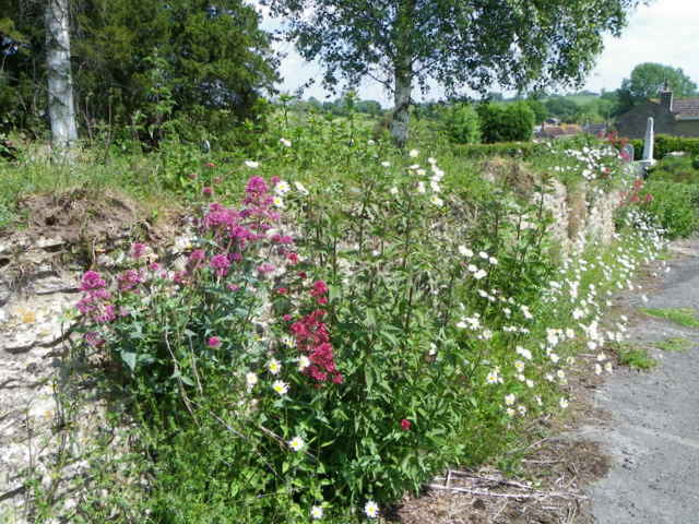
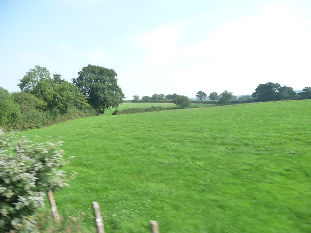
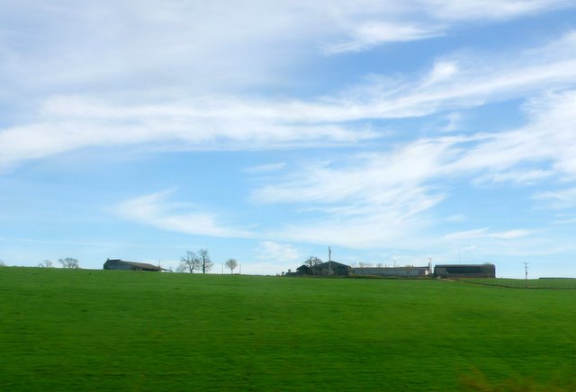
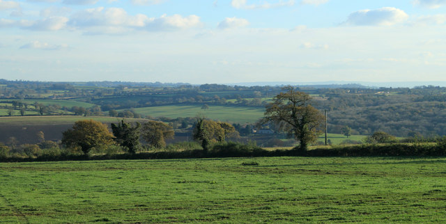
South Brewham is a small village located in the county of Somerset, England. Situated about 5 miles east of the town of Bruton, it falls within the administrative district of Mendip. The village is nestled in a picturesque rural setting, surrounded by rolling hills and lush green fields.

With a population of around 200 residents, South Brewham maintains a close-knit community atmosphere. The village is known for its charming and well-preserved traditional stone cottages, which add to its quaint and idyllic character. The architecture reflects the village's long history, dating back to the medieval period.

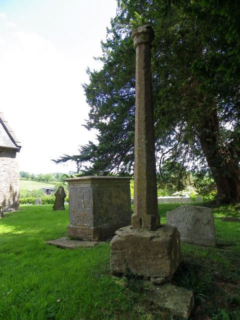
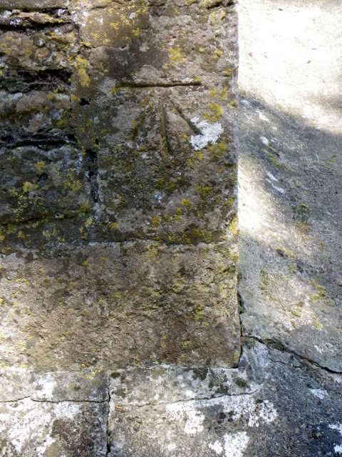
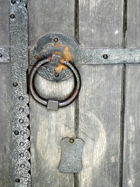
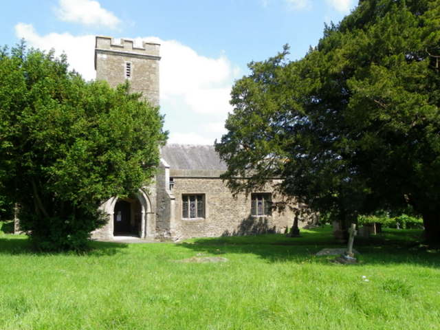
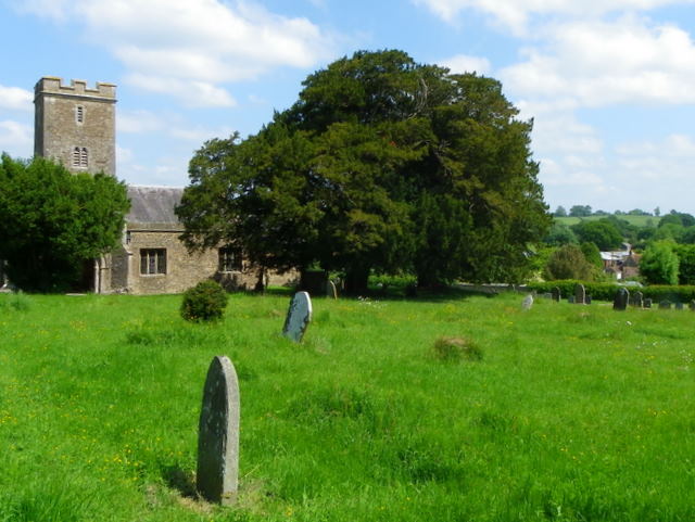
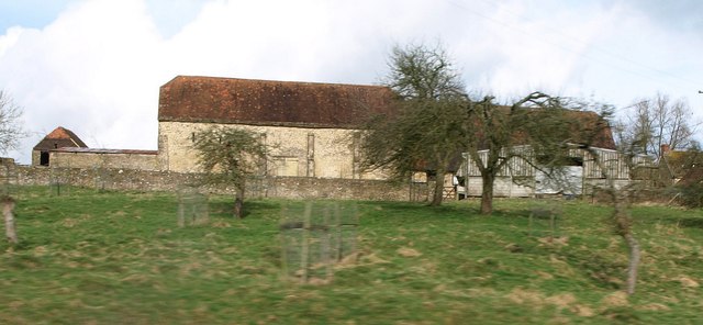
The village is home to St. John the Baptist Church, a Grade II* listed building, which stands as a prominent landmark. The church, dating back to the 13th century, features beautiful stained glass windows and a unique octagonal spire.

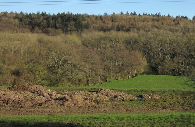
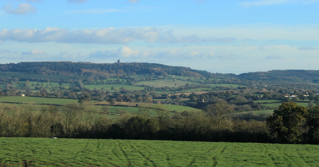
South Brewham benefits from its proximity to the surrounding countryside, offering ample opportunities for outdoor activities such as hiking, cycling, and horse riding. The village is also within easy reach of the Cranborne Chase Area of Outstanding Natural Beauty, a designated protected landscape known for its diverse wildlife and scenic landscapes.

While South Brewham does not have its own school or shops, it benefits from easy access to amenities in nearby towns such as Bruton and Frome. The village holds regular community events and gatherings, fostering a strong sense of unity among its residents.

Overall, South Brewham offers a peaceful and picturesque setting, ideal for those seeking a tranquil rural lifestyle amidst the beauty of the Somerset countryside.

If you have any feedback on the listing, please let us know in the comments section below.

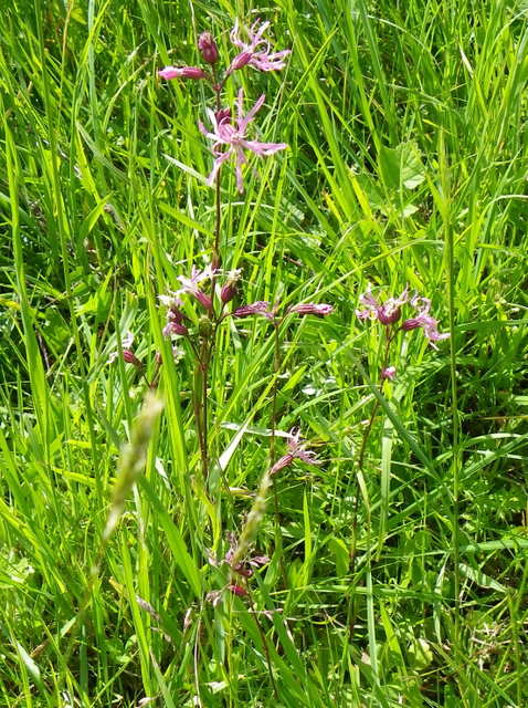
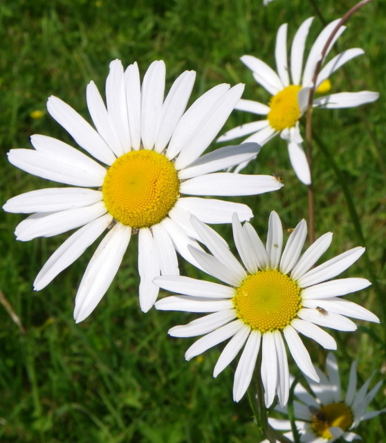
South Brewham Images

Images are sourced within 2km of 51.123155/-2.404632 or Grid Reference ST7136. Thanks to Geograph Open Source API. All images are credited.

Wildflowers, South Brewham The lovely wildflowers are to be found growing beside the wall of the Church of St John the Baptist.

The flowers include Ox Eye Daisy, Valerian and Nettle.
Wildflowers, South Brewham
The lovely wildflowers are to be found growing beside the wall of the Church of St John the Baptist. The flowers include Ox Eye Daisy, Valerian and Nettle.
War Memorial, South Brewham The memorial honours the men of the village who lost their lives in two World Wars.  It stands just within the churchyard.

We will remember them.
War Memorial, South Brewham
The memorial honours the men of the village who lost their lives in two World Wars. It stands just within the churchyard. We will remember them.
Yew tree in the churchyard, South Brewham This tree is one of two large yew trees in the churchyard of the Church of St John the Baptist.

The yew is not a death tree in that it causes death, although some lore does suggest that death will soon follow if certain yews are irreverently plucked, rather it is regarded as a “gentle guardian of the dead”. The yew has been a common churchyard tree for this reason. In Wales, it was sacrilegious to burn or cut down a yew.  The yews association with death made it an unlucky tree that was not to be taken into the home.
Yew tree in the churchyard, South Brewham
This tree is one of two large yew trees in the churchyard of the Church of St John the Baptist. The yew is not a death tree in that it causes death, although some lore does suggest that death will soon follow if certain yews are irreverently plucked, rather it is regarded as a “gentle guardian of the dead”. The yew has been a common churchyard tree for this reason. In Wales, it was sacrilegious to burn or cut down a yew. The yews association with death made it an unlucky tree that was not to be taken into the home.
Yew tree in the churchyard, South Brewham The ancient tradition that this evergreen sheltered the first Christian missionaries to Britain before their churches were built is one of the many explanations put forward to account for the large numbers of yews found in country churchyards.  The yew is also a life symbol, and was sometimes scattered on graves.  The longbows of medieval archers came from straight, knot-free lengths cut from tall, selected trees.  But these were unlikely to be churchyard yews – the best bow staves were imported from Spain.
Yew tree in the churchyard, South Brewham
The ancient tradition that this evergreen sheltered the first Christian missionaries to Britain before their churches were built is one of the many explanations put forward to account for the large numbers of yews found in country churchyards. The yew is also a life symbol, and was sometimes scattered on graves. The longbows of medieval archers came from straight, knot-free lengths cut from tall, selected trees. But these were unlikely to be churchyard yews – the best bow staves were imported from Spain.
Cross, The Church of St John the Baptist The churchyard cross dates from the 14th century and is made from Doulting stone.
Cross, The Church of St John the Baptist
The churchyard cross dates from the 14th century and is made from Doulting stone.
Bench Mark, The Church of St John the Baptist The bench mark is to be found on the south east angle of the south face of the church.  For a wider view of the church <a href="https://www.geograph.org.uk/photo/2438867">ST7136 : The Church of St John the Baptist, South Brewham</a> and for further information on the cut mark and others in the area <span class="nowrap"><a title="http://www.bench-marks.org.uk/bm38167" rel="nofollow ugc noopener" href="http://www.bench-marks.org.uk/bm38167">Link</a><img style="margin-left:2px;" alt="External link" title="External link - shift click to open in new window" src="https://s1.geograph.org.uk/img/external.png" width="10" height="10"/></span>
Bench Mark, The Church of St John the Baptist
The bench mark is to be found on the south east angle of the south face of the church. For a wider view of the church ST7136 : The Church of St John the Baptist, South Brewham and for further information on the cut mark and others in the area LinkExternal link
Detail, The Church of St John the Baptist This is the handle and lock to the south door of the church.  For a wider view of the church <a href="https://www.geograph.org.uk/photo/2438867">ST7136 : The Church of St John the Baptist, South Brewham</a>
Detail, The Church of St John the Baptist
This is the handle and lock to the south door of the church. For a wider view of the church ST7136 : The Church of St John the Baptist, South Brewham
The Church of St John the Baptist, South Brewham The church has its origins in the 13th century with a great deal of rebuilding in the late 19th century.  It is built of local stone with Doulting stone dressings.
The Church of St John the Baptist, South Brewham
The church has its origins in the 13th century with a great deal of rebuilding in the late 19th century. It is built of local stone with Doulting stone dressings.
Ragged-robbin (Lychnis flos-cuculi) This distinctive perennial is to be found in the churchyard of St John the Baptist's Church.  

The name Ragged refers to the appearance of its pretty reddish pink flowers, which appear in May to June.  The ragged robin seems to have many 'nicknames' - you may see it called any one of the following - Meadow Spink, Polly Baker, Crow Flower, Shaggy Jacks, Thunder Flower or Bachelor's Buttons.

In days gone by gentlemen carried the plant in their pockets and if the plant survived it was deemed that they would be successful in love.  In the 17th century girls placed the plant in their aprons, giving each plant a name of a local gent - the flower that opened first would bear the name of the man she would marry.
Ragged-robbin (Lychnis flos-cuculi)
This distinctive perennial is to be found in the churchyard of St John the Baptist's Church. The name Ragged refers to the appearance of its pretty reddish pink flowers, which appear in May to June. The ragged robin seems to have many 'nicknames' - you may see it called any one of the following - Meadow Spink, Polly Baker, Crow Flower, Shaggy Jacks, Thunder Flower or Bachelor's Buttons. In days gone by gentlemen carried the plant in their pockets and if the plant survived it was deemed that they would be successful in love. In the 17th century girls placed the plant in their aprons, giving each plant a name of a local gent - the flower that opened first would bear the name of the man she would marry.
Ox Eye Daisy, St John the Baptist's Churchyard The name daisy is derived from 'day's eye', a reference to the fact that the flower opens wide during the day, and closes up again at night. Daisies are part of a much larger group of plants called the Compositae, or composite flower, because each bloom is made up of dozens of tiny florets.
Ox Eye Daisy, St John the Baptist's Churchyard
The name daisy is derived from 'day's eye', a reference to the fact that the flower opens wide during the day, and closes up again at night. Daisies are part of a much larger group of plants called the Compositae, or composite flower, because each bloom is made up of dozens of tiny florets.
The Church of St John the Baptist, South Brewham The churchyard contains burials from many generations, showing the Church's concern for its parishioners in this life and beyond the grave.  The stones tell the history of the Parish and reflect changing attitudes and fashions.

The churchyard grass is left uncut as it is a wildlife conservation area.
The Church of St John the Baptist, South Brewham
The churchyard contains burials from many generations, showing the Church's concern for its parishioners in this life and beyond the grave. The stones tell the history of the Parish and reflect changing attitudes and fashions. The churchyard grass is left uncut as it is a wildlife conservation area.
Mendip : Grassy Field A grassy field in Somerset as seen from a passing train.
Mendip : Grassy Field
A grassy field in Somerset as seen from a passing train.
Goodedge Farm The farm is a large mixed and dairy farm close to the village of North Brewham. Photo taken from a Yeovil to Bristol train.
Goodedge Farm
The farm is a large mixed and dairy farm close to the village of North Brewham. Photo taken from a Yeovil to Bristol train.
Barn at Batt's Farm I always look out for this fine old barn when on the train northeast of Bruton and attempted a photo this time. Seen across an old orchard with young guarded trees, it has C16 origins and retains a clay tile roof and three buttresses <span class="nowrap"><a title="http://www.britishlistedbuildings.co.uk/en-261506-the-barn-20-metres-south-of-batt-s-farmh" rel="nofollow ugc noopener" href="http://www.britishlistedbuildings.co.uk/en-261506-the-barn-20-metres-south-of-batt-s-farmh">Link</a><img style="margin-left:2px;" alt="External link" title="External link - shift click to open in new window" src="https://s1.geograph.org.uk/img/external.png" width="10" height="10"/></span> . "Said to have been a tithe barn of Bruton Abbey ... apparently
church services were held in the barn until the 1940's". The half-hipped roof end can be seen in <a href="https://www.geograph.org.uk/photo/1244543">ST7137 : 2009 : Outbuilding at Batt's Farm</a>.
Barn at Batt's Farm
I always look out for this fine old barn when on the train northeast of Bruton and attempted a photo this time. Seen across an old orchard with young guarded trees, it has C16 origins and retains a clay tile roof and three buttresses LinkExternal link . "Said to have been a tithe barn of Bruton Abbey ... apparently church services were held in the barn until the 1940's". The half-hipped roof end can be seen in ST7137 : 2009 : Outbuilding at Batt's Farm.
Cogley Wood The River Brue runs along the edge of this wood, which climbs a steep hill beyond. Piles of midden, or earth, in the foreground. View from a train on the main railway line between Westbury and Bruton.
Cogley Wood
The River Brue runs along the edge of this wood, which climbs a steep hill beyond. Piles of midden, or earth, in the foreground. View from a train on the main railway line between Westbury and Bruton.
Hardway: The Bull Inn The pub's history extends back to about 1650
Hardway: The Bull Inn
The pub's history extends back to about 1650
2012 : South of east from the A359 Near Copplesbury Farm.
Wet weather throughout last summer has left the ground wet resulting in wheel ruts made by a tractor.
The view beyond is to Alfred's Tower <a href="https://www.geograph.org.uk/gridref/ST7435">ST7435</a> and surrounding woods. A church tower to the right nearer the camera is at South Brewham.
2012 : South of east from the A359
Near Copplesbury Farm. Wet weather throughout last summer has left the ground wet resulting in wheel ruts made by a tractor. The view beyond is to Alfred's Tower ST7435 and surrounding woods. A church tower to the right nearer the camera is at South Brewham.
2012 : South from the A359 near Copplesbury Farm After scanning a slice of Somerset we move into the depths of Dorset.
Some interesting hills in the distance, not an area I know well.
2012 : South from the A359 near Copplesbury Farm
After scanning a slice of Somerset we move into the depths of Dorset. Some interesting hills in the distance, not an area I know well.
Show me another place!

South Brewham is located at Grid Ref: ST7136 (Lat: 51.123155, Lng: -2.404632)

Administrative County: Somerset

District: South Somerset

Police Authority: Avon and Somerset

What 3 Words

///caravan.teaching.meatball. Near Redlynch, Somerset

Related Wikis

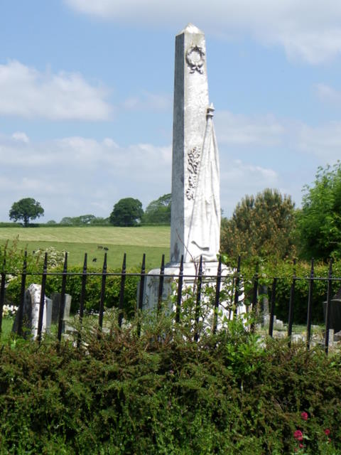
Church of Saint John the Baptist, South Brewham

The Anglican Church of Saint John the Baptist in South Brewham, within the English county of Somerset, has 13th-century origins, however the current building...

Brewham

Brewham is a civil parish in Somerset, England, consisting of the villages of North Brewham and South Brewham, on either side of the river in the Brue...

Cogley Wood

Cogley Wood (grid reference ST703345) is a 60.7 hectare biological Site of Special Scientific Interest east of Bruton in Somerset, notified in 1987. The...

Redlynch, Somerset

Redlynch is a village and former manor in the civil parish of Bruton, in the South Somerset district of Somerset, England. The 18th-century church and...

King Alfred's Tower

Alfred's Tower is a folly in Somerset, England, on the edge of the border with Wiltshire, on the Stourhead estate. The tower stands on Kingsettle Hill...

North Brewham Meadows

North Brewham Meadows (grid reference ST743379) is an 8.9 hectare (21.9 acre) biological Site of Special Scientific Interest at North Brewham in Somerset...

Nozarego

Nozarego is a village in the commune of Santa Margherita Ligure in Liguria, Italy. It is a natural terrace over the Bay of Tigullio. Here there is the...

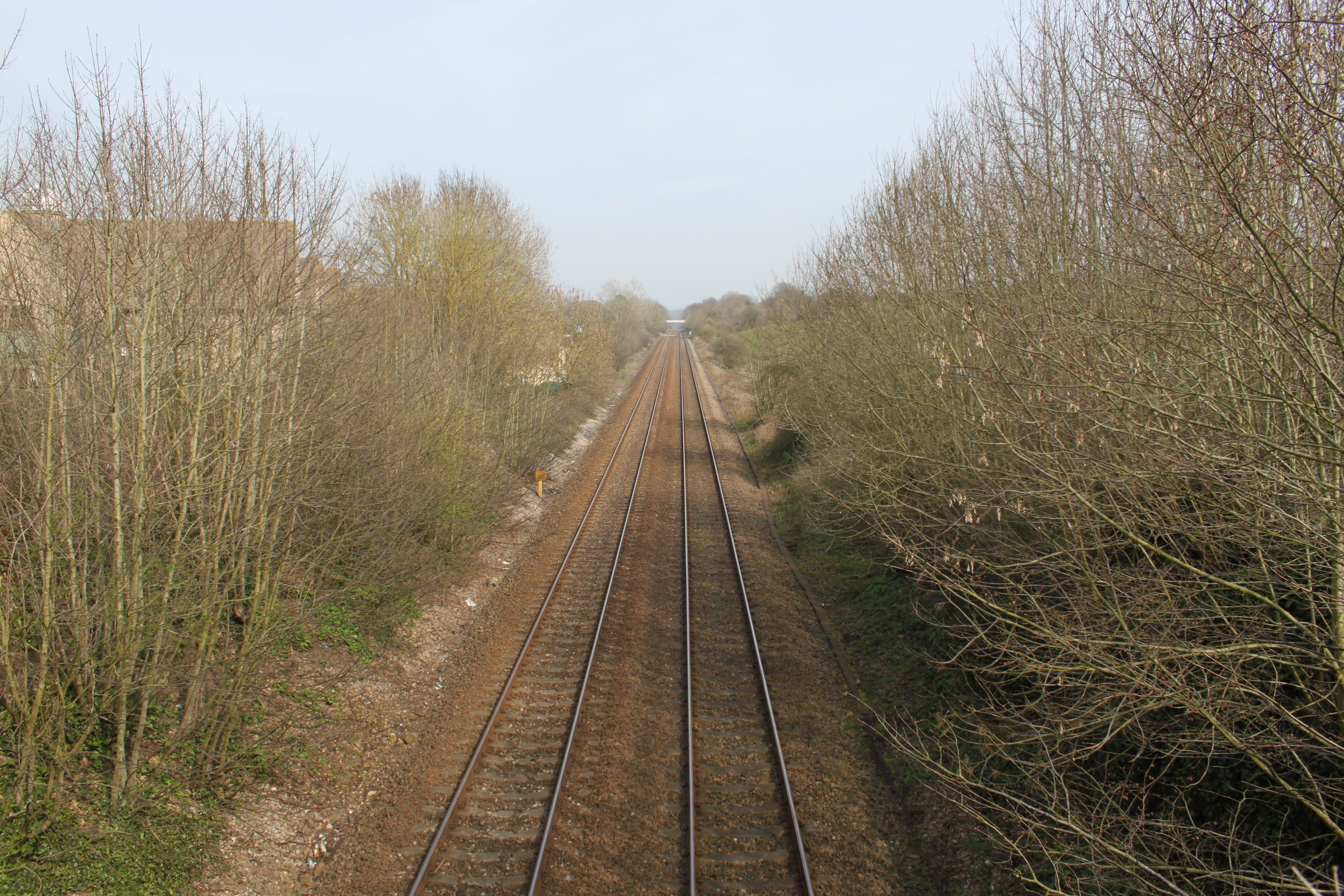
Bruton railway cutting

Bruton Railway Cutting is a 1.7 hectare geological Site of Special Scientific Interest at Bruton in Somerset, notified in 1971. The geology exposed in...

Nearby Amenities

Located within 500m of 51.123155,-2.404632
South Brewham
Place: village
Lat/Long: 51.123314/-2.4006285
The data included in this document is from www.openstreetmap.org. The data is made available under ODbL.

Have you been to South Brewham?

Leave your review of South Brewham below (or comments, questions and feedback).