South Benwell

Settlement in Northumberland

England

South Benwell

Sunset behind Scotswood bridge A sunset behind Scotswood bridge, the bridge sits next to Vickers/BAE systems factory.
Sunset behind Scotswood bridge Credit: Stefan Carlton

South Benwell is a small village located in the county of Northumberland, in the northeast region of England. Situated approximately 3 miles west of Newcastle upon Tyne, it forms part of the wider Benwell area.

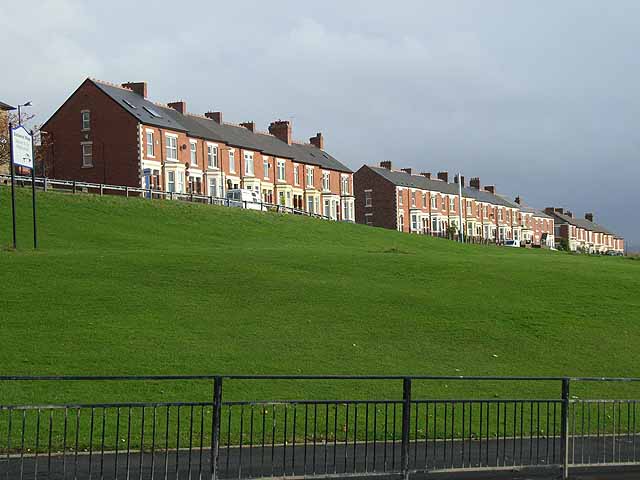
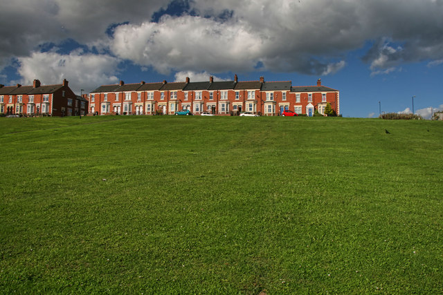
The village is known for its peaceful and close-knit community, offering a quiet and welcoming atmosphere to its residents. South Benwell is primarily a residential area, characterized by rows of terraced houses, some of which have been standing for over a century. These properties provide affordable housing options, attracting families and individuals looking for a tight-knit community.

Although South Benwell is primarily a residential area, it benefits from its proximity to Newcastle upon Tyne. Residents have easy access to the city's amenities, including shopping centers, restaurants, and cultural attractions. The village is well-connected to the city center through regular bus services, providing convenient transportation options for commuters.

South Benwell is also home to a number of green spaces and parks, offering opportunities for outdoor activities and leisurely walks. Nearby attractions include the picturesque Benwell Nature Park, which features woodland areas, wildlife habitats, and a tranquil lake.

Overall, South Benwell offers a peaceful and affordable living environment with easy access to the amenities of Newcastle upon Tyne. Its strong sense of community and natural surroundings make it an attractive place to reside for those seeking a quieter lifestyle within close proximity to a bustling city.

If you have any feedback on the listing, please let us know in the comments section below.

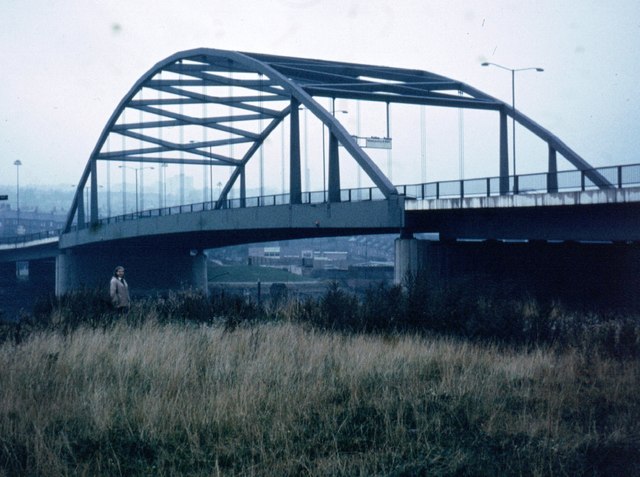
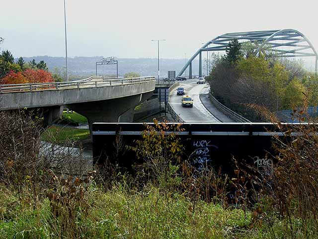
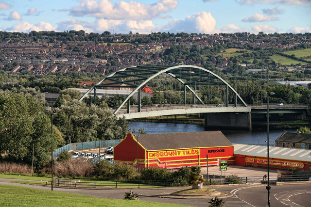
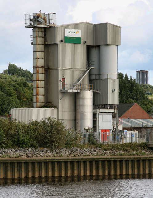
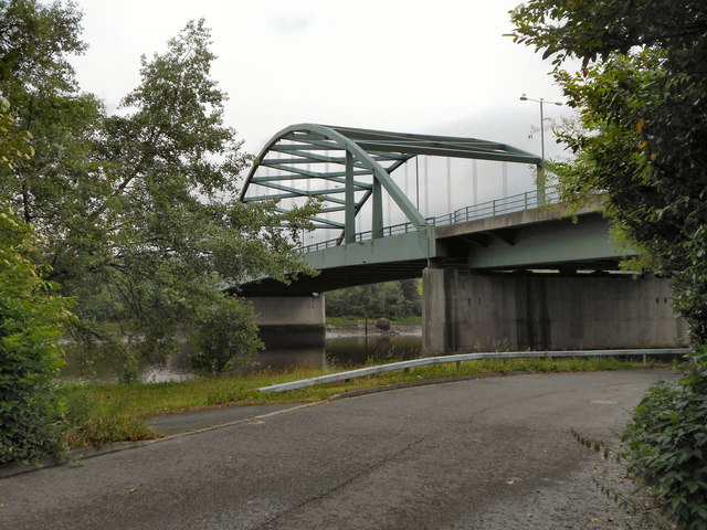
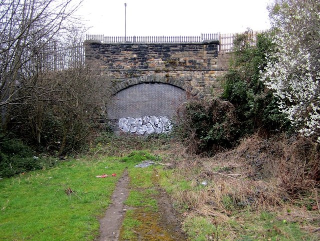
South Benwell Images

Images are sourced within 2km of 54.968102/-1.661008 or Grid Reference NZ2163. Thanks to Geograph Open Source API. All images are credited.

Sunset behind Scotswood bridge A sunset behind Scotswood bridge, the bridge sits next to Vickers/BAE systems factory.
Sunset behind Scotswood bridge
A sunset behind Scotswood bridge, the bridge sits next to Vickers/BAE systems factory.
Scotswood Bridge
Scotswood Bridge
Northern approach to Scotswood Bridge Before the construction of the Newcastle By-pass, A1, Scotswood Bridge was the principal crossing of the River Tyne upstream from Newcastle city centre. Seen from Hadrian's Way, a path from Wylam to Newcastle along the north bank of the Tyne which carries both Hadrian's Cycleway 
<span class="nowrap"><a title="http://www.cycle-routes.org/HADRIANSCYCLEWAY/and" rel="nofollow ugc noopener" href="http://www.cycle-routes.org/HADRIANSCYCLEWAY/and">Link</a><img style="margin-left:2px;" alt="External link" title="External link - shift click to open in new window" src="https://s1.geograph.org.uk/img/external.png" width="10" height="10"/></span> Hadrian's Wall National 
Trail <span class="nowrap"><a title="http://www.nationaltrail.co.uk/hadrianswall/" rel="nofollow ugc noopener" href="http://www.nationaltrail.co.uk/hadrianswall/">Link</a><img style="margin-left:2px;" alt="External link" title="External link - shift click to open in new window" src="https://s1.geograph.org.uk/img/external.png" width="10" height="10"/></span>.
Northern approach to Scotswood Bridge
Before the construction of the Newcastle By-pass, A1, Scotswood Bridge was the principal crossing of the River Tyne upstream from Newcastle city centre. Seen from Hadrian's Way, a path from Wylam to Newcastle along the north bank of the Tyne which carries both Hadrian's Cycleway LinkExternal link Hadrian's Wall National Trail LinkExternal link.
Terraced houses on Whitfield Road Seen from Hadrian's Way, a path from Wylam to Newcastle along the north bank of the Tyne which carries both Hadrian's Cycleway 
<span class="nowrap"><a title="http://www.cycle-routes.org/HADRIANSCYCLEWAY/and" rel="nofollow ugc noopener" href="http://www.cycle-routes.org/HADRIANSCYCLEWAY/and">Link</a><img style="margin-left:2px;" alt="External link" title="External link - shift click to open in new window" src="https://s1.geograph.org.uk/img/external.png" width="10" height="10"/></span> Hadrian's Wall National Trail <span class="nowrap"><a title="http://www.nationaltrail.co.uk/hadrianswall/" rel="nofollow ugc noopener" href="http://www.nationaltrail.co.uk/hadrianswall/">Link</a><img style="margin-left:2px;" alt="External link" title="External link - shift click to open in new window" src="https://s1.geograph.org.uk/img/external.png" width="10" height="10"/></span>.
Terraced houses on Whitfield Road
Seen from Hadrian's Way, a path from Wylam to Newcastle along the north bank of the Tyne which carries both Hadrian's Cycleway LinkExternal link Hadrian's Wall National Trail LinkExternal link.
Whitfield Road Terraced houses on Whitfield Road in Scotswood seen from Fowberry Road.
Whitfield Road
Terraced houses on Whitfield Road in Scotswood seen from Fowberry Road.
Scotswood Bridge View of Scotswood Bridge from Whitfield Road.
Scotswood Bridge
View of Scotswood Bridge from Whitfield Road.
Tarmac Topmix Scotswood Plant
'Yesterday, Today, Forever', Fowberry Road, Scotswood As described here <a href="https://www.geograph.org.uk/photo/3034725">NZ1963 : 'Yesterday, Today, Forever', Fowberry Road, Scotswood</a>
'Yesterday, Today, Forever', Fowberry Road, Scotswood
Scotswood Bridge and the Keelman's Way Scotswood Road Bridge was opened in 1967 replacing an earlier 18th century bridge. The Keelman's Way (National Cycle Network route 14/141) is a riverside foot- and cycle-path which runs the full length of Gateshead Borough along the south bank of the Tyne.
Scotswood Bridge and the Keelman's Way
Scotswood Road Bridge was opened in 1967 replacing an earlier 18th century bridge. The Keelman's Way (National Cycle Network route 14/141) is a riverside foot- and cycle-path which runs the full length of Gateshead Borough along the south bank of the Tyne.
Scotswood Bridge
Scotswood Bridge
Scotswood Bridge Bridge taking the A69 over the River Tyne.
Scotswood Bridge
Bridge taking the A69 over the River Tyne.
River Tyne, Scotswood Bridge
River Tyne, Scotswood Looking across the Tyne from the southern bank towards the northern bank, between Scotswood road and railway bridges.
River Tyne, Scotswood
Looking across the Tyne from the southern bank towards the northern bank, between Scotswood road and railway bridges.
Scotswood Bridge and the River Tyne
Scotswood Bridge Replaced the original narrow Scotswood road bridge which had been built in 1831 and known as the Chain Bridge <span class="nowrap"><a title="http://isee.gateshead.gov.uk/detail.php?t=objects&type=all&f=&s=scotswood&record=2" rel="nofollow ugc noopener" href="http://isee.gateshead.gov.uk/detail.php?t=objects&type=all&f=&s=scotswood&record=2">Link</a><img style="margin-left:2px;" alt="External link" title="External link - shift click to open in new window" src="https://s1.geograph.org.uk/img/external.png" width="10" height="10"/></span>
The modern bridge has a steel arch which suspends a box girder deck carrying two road lanes in each direction. It was designed by Mott, Hay and Anderson and constructed by Mitchell Construction/Dorman Long, 1964-67.
<span class="nowrap"><a title="http://www.bridgesonthetyne.co.uk/scots.html" rel="nofollow ugc noopener" href="http://www.bridgesonthetyne.co.uk/scots.html">Link</a><img style="margin-left:2px;" alt="External link" title="External link - shift click to open in new window" src="https://s1.geograph.org.uk/img/external.png" width="10" height="10"/></span>
Scotswood Bridge
Replaced the original narrow Scotswood road bridge which had been built in 1831 and known as the Chain Bridge LinkExternal link The modern bridge has a steel arch which suspends a box girder deck carrying two road lanes in each direction. It was designed by Mott, Hay and Anderson and constructed by Mitchell Construction/Dorman Long, 1964-67. LinkExternal link
Disused railway tunnel, Scotswood The railway line was built for the Scotswood, Newburn & Wylam Railway which linked with the existing Newcastle to Carlisle Railway (N&CR) at each end. The tunnel is just west of the former Scotswood Station where the N&CR line crossed the River Tyne prior to 1982 <a href="https://www.geograph.org.uk/photo/2830184">NZ1963 : Scotswood Railway Bridge</a>
Construction of the line between Scotswood and Newburn was started in 1872 and completed in July 1875, with the extension to Wylam being opened as a single line in 1876 with a second track laid later the same year.
The west end of the tunnel is just west of Denton Road.
Disused railway tunnel, Scotswood
The railway line was built for the Scotswood, Newburn & Wylam Railway which linked with the existing Newcastle to Carlisle Railway (N&CR) at each end. The tunnel is just west of the former Scotswood Station where the N&CR line crossed the River Tyne prior to 1982 NZ1963 : Scotswood Railway Bridge Construction of the line between Scotswood and Newburn was started in 1872 and completed in July 1875, with the extension to Wylam being opened as a single line in 1876 with a second track laid later the same year. The west end of the tunnel is just west of Denton Road.
Former approach to Scotswood Railway Bridge, Scotswood Road The fenced off area across the busy Scotswood Road dual carriageway, west of Scotswood Road Bridge, is the remaining part of the viaduct approach of the Newcastle & Carlisle Railway to the Scotswood Railway Bridge across the River Tyne.
There is another photo of the adjacent Tarmac concrete plant here <a href="https://www.geograph.org.uk/photo/2037856">NZ1963 : Tarmac Topmix Scotswood Plant</a>
This was formerly the site of the ceramic works of Charles and Moses Adams who made sanitary ware under the trade mark, Adamsez, still be seen in public and private conveniences round the world, from 1902. Unable to compete with plastic fittings, the factory closed in 1975 <span class="nowrap"><a title="http://www.twsitelines.info/Siteline.nsf/8f71f680ce308c9a802573a80061c133/0b8a8e4f78447e72802576af003e6703" rel="nofollow ugc noopener" href="http://www.twsitelines.info/Siteline.nsf/8f71f680ce308c9a802573a80061c133/0b8a8e4f78447e72802576af003e6703">Link</a><img style="margin-left:2px;" alt="External link" title="External link - shift click to open in new window" src="https://s1.geograph.org.uk/img/external.png" width="10" height="10"/></span>
On both these photos you can just see the owl that sits on top of the highest point of the cement silo to scare the seagulls and pigeons. It leans slightly to one side and seems to move as you pass by on bicycle or car. A zoom photo showed the hook on top to prove a fake (that and the fact that it hadn't moved for 10 years!)
Former approach to Scotswood Railway Bridge, Scotswood Road
The fenced off area across the busy Scotswood Road dual carriageway, west of Scotswood Road Bridge, is the remaining part of the viaduct approach of the Newcastle & Carlisle Railway to the Scotswood Railway Bridge across the River Tyne. There is another photo of the adjacent Tarmac concrete plant here NZ1963 : Tarmac Topmix Scotswood Plant This was formerly the site of the ceramic works of Charles and Moses Adams who made sanitary ware under the trade mark, Adamsez, still be seen in public and private conveniences round the world, from 1902. Unable to compete with plastic fittings, the factory closed in 1975 LinkExternal link On both these photos you can just see the owl that sits on top of the highest point of the cement silo to scare the seagulls and pigeons. It leans slightly to one side and seems to move as you pass by on bicycle or car. A zoom photo showed the hook on top to prove a fake (that and the fact that it hadn't moved for 10 years!)
Bricklane Restaurant, Scotswood
Show me another place!

South Benwell is located at Grid Ref: NZ2163 (Lat: 54.968102, Lng: -1.661008)

Unitary Authority: Newcastle upon Tyne

Police Authority: Northumbria

What 3 Words

///float.miss.scar. Near Benwell, Tyne & Wear

Related Wikis

Elswick railway station

Elswick railway station was a railway station in the Elswick area of Newcastle upon Tyne, England. It was located on the former route of the Newcastle...

Benwell Dene

Benwell Dene is a Victorian building in the suburb of Benwell, Newcastle Upon Tyne, England. It was designed by Alfred Waterhouse for Dr Thomas Hodgkin...

Benwell

Benwell is an area in the West End of Newcastle upon Tyne, England. == History == The place-name 'Benwell' is first attested in the Historia de Sancto...

Benwell and Scotswood

Benwell and Scotswood is an electoral ward of Newcastle upon Tyne in North East England. The ward encompasses the Benwell and Scotswood housing areas,...

Nearby Amenities

Located within 500m of 54.968102,-1.661008
Source: PGS
Lat/Long: 54.9646001/-1.6639597
Source: PGS
Lat/Long: 54.9643741/-1.6616967
Source: PGS
Lat/Long: 54.9643299/-1.6612205
Source: PGS
Lat/Long: 54.9642398/-1.6599871
Source: PGS
Lat/Long: 54.9640522/-1.6586977
Mini Roundabout
Direction: clockwise
Lat/Long: 54.9670394/-1.6636508
Traffic Signals
Traffic Signals: signal
Lat/Long: 54.9709807/-1.6606047
Traffic Signals
Traffic Signals: signal
Lat/Long: 54.969187/-1.6628758
Bus Stop
SCOTSWOOD ROAD-WHITEHOUSE ROAD-W/B
Bench: yes
Bin: no
Lit: yes
Local Ref: W
Naptan AtcoCode: 410000014665
Naptan Bearing: W
Naptan CommonName: SCOTSWOOD ROAD-WHITEHOUSE ROAD-W/B
Naptan Indicator: W
Naptan Landmark: EAST OF WHITEHOUSE ROAD ROUNDABOUT
Naptan NaptanCode: twrdamdw
Naptan PlusbusZoneRef: NWCSTLE
Naptan Street: SCOTSWOOD ROAD
Naptan Verified: no
Shelter: yes
Source: naptan_import;Bing
Tactile Paving: no
Lat/Long: 54.9655651/-1.6657217
Bus Stop
SOUTH BENWELL ATKINSON ROAD
Local Ref: E
Naptan AtcoCode: 410000014998
Naptan Bearing: E
Naptan CommonName: SOUTH BENWELL ATKINSON ROAD
Naptan Indicator: E
Naptan Landmark: ATKINSON ROAD/ARMSTRONG ROAD JUNCTION
Naptan NaptanCode: twrgwmpw
Naptan PlusbusZoneRef: NWCSTLE
Naptan Street: ARMSTRONG ROAD
Naptan Verified: no
Public Transport: platform
Source: naptan_import
Lat/Long: 54.9691261/-1.6620929
Bus Stop
BENWELL SHOPS
Local Ref: E
Naptan AtcoCode: 410000014562
Naptan Bearing: E
Naptan CommonName: BENWELL SHOPS
Naptan Indicator: E
Naptan Landmark: OUTSIDE THE ADELAIDE CENTRE
Naptan NaptanCode: twrdagpt
Naptan PlusbusZoneRef: NWCSTLE
Naptan Street: ADELAIDE TERRACE
Naptan Verified: no
Source: naptan_import
Lat/Long: 54.969871/-1.6553384
Bus Stop
BENWELL SHOPS
Bench: no
Covered: no
Local Ref: W
Naptan AtcoCode: 410000014563
Naptan Bearing: W
Naptan CommonName: BENWELL SHOPS
Naptan Indicator: W
Naptan Landmark: OPPOSITE THE ADELAIDE CENTRE
Naptan NaptanCode: twrdagpw
Naptan PlusbusZoneRef: NWCSTLE
Naptan Street: ADELAIDE TERRACE
Naptan Verified: no
Shelter: no
Source: naptan_import
Lat/Long: 54.9696889/-1.6545313
Bus Stop
ADELAIDE TERRACE-E/B
Bench: yes
Covered: yes
Local Ref: E
Naptan AtcoCode: 410000014564
Naptan Bearing: E
Naptan CommonName: ADELAIDE TERRACE-E/B
Naptan Indicator: E
Naptan Landmark: OPPOSITE CLARA STREET
Naptan NaptanCode: twrdagta
Naptan PlusbusZoneRef: NWCSTLE
Naptan Street: ADELAIDE TERRACE
Naptan Verified: no
Shelter: yes
Source: naptan_import
Lat/Long: 54.9702015/-1.6578952
Bus Stop
ADELAIDE TERRACE-W/B
Bench: yes
Covered: yes
Local Ref: W
Naptan AtcoCode: 410000014565
Naptan Bearing: W
Naptan CommonName: ADELAIDE TERRACE-W/B
Naptan Indicator: W
Naptan Landmark: OPPOSITE BOND MEMORIAL METHODIST CHURCH
Naptan NaptanCode: twrdagtd
Naptan PlusbusZoneRef: NWCSTLE
Naptan Street: ADELAIDE TERRACE
Naptan Verified: no
Shelter: yes
Source: naptan_import
Lat/Long: 54.9705922/-1.6593156
Bus Stop
BENWELL LANE-CONDERCUM ROAD
Local Ref: SE
Naptan AtcoCode: 410000014566
Naptan Bearing: SE
Naptan CommonName: BENWELL LANE-CONDERCUM ROAD
Naptan Indicator: SE
Naptan Landmark: OPPOSITE ST JAMES' CHURCH
Naptan NaptanCode: twrdagtg
Naptan PlusbusZoneRef: NWCSTLE
Naptan Street: BENWELL LANE
Naptan Verified: no
Source: naptan_import
Lat/Long: 54.9711181/-1.6610139
Bus Stop
BENWELL LANE-ATKINSON ROAD
Local Ref: NW
Naptan AtcoCode: 410000014567
Naptan Bearing: NW
Naptan CommonName: BENWELL LANE-ATKINSON ROAD
Naptan Indicator: NW
Naptan Landmark: OUTSIDE ST JAMES' CHURCH
Naptan NaptanCode: twrdagtj
Naptan PlusbusZoneRef: NWCSTLE
Naptan Street: BENWELL LANE
Naptan Verified: no
Source: naptan_import
Lat/Long: 54.9711376/-1.6615449
Bus Stop
BENWELL LANE-HODGKIN PARK ROAD-E/B
Local Ref: W
Naptan AtcoCode: 410000014568
Naptan Bearing: W
Naptan CommonName: BENWELL LANE-HODGKIN PARK ROAD-E/B
Naptan Indicator: W
Naptan Landmark: OPPOSITE BENWELL GRANGE
Naptan NaptanCode: twrdagtm
Naptan PlusbusZoneRef: NWCSTLE
Naptan Street: BENWELL LANE
Naptan Verified: no
Source: naptan_import
Lat/Long: 54.9719907/-1.664584
Bus Stop
BENWELL LANE-BENWELL CLOSE-W/B
Local Ref: NW
Naptan AtcoCode: 410000014569
Naptan Bearing: NW
Naptan CommonName: BENWELL LANE-BENWELL CLOSE-W/B
Naptan Indicator: NW
Naptan Landmark: OUTSIDE BENWELL GRANGE
Naptan NaptanCode: twrdagtp
Naptan PlusbusZoneRef: NWCSTLE
Naptan Street: BENWELL LANE
Naptan Verified: no
Source: naptan_import
Lat/Long: 54.9718921/-1.6646473
Bus Stop
ATKINSON ROAD-ST JAMES CRESCENT-N/B
Local Ref: NE
Naptan AtcoCode: 410000014597
Naptan Bearing: NE
Naptan CommonName: ATKINSON ROAD-ST JAMES CRESCENT-N/B
Naptan Indicator: NE
Naptan Landmark: SOUTH OF LIBRARY
Naptan NaptanCode: twrdajdp
Naptan PlusbusZoneRef: NWCSTLE
Naptan Street: ATKINSON ROAD
Naptan Verified: no
Source: naptan_import
Lat/Long: 54.9698443/-1.6618369
Bus Stop
ATKINSON ROAD-ST JAMES CRESCENT-S/B
Local Ref: S
Naptan AtcoCode: 410000014598
Naptan Bearing: S
Naptan CommonName: ATKINSON ROAD-ST JAMES CRESCENT-S/B
Naptan Indicator: S
Naptan Landmark: OPPOSITE ST JAMES CRESCENT
Naptan NaptanCode: twrdajdt
Naptan PlusbusZoneRef: NWCSTLE
Naptan Street: ATKINSON ROAD
Naptan Verified: no
Source: naptan_import
Lat/Long: 54.9697185/-1.6618224
Bus Stop
SOUTH BENWELL BUDDLE ROAD
Local Ref: W
Naptan AtcoCode: 410000014613
Naptan Bearing: W
Naptan CommonName: SOUTH BENWELL BUDDLE ROAD
Naptan Indicator: W
Naptan Landmark: OUTSIDE BENWELL EVANGELICAL CHURCH
Naptan NaptanCode: twrdajmt
Naptan PlusbusZoneRef: NWCSTLE
Naptan Street: BUDDLE ROAD
Naptan Verified: no
Public Transport: platform
Source: naptan_import
Lat/Long: 54.9662832/-1.6545412
Bus Stop
SOUTH BENWELL
Local Ref: E
Naptan AtcoCode: 410000014614
Naptan Bearing: E
Naptan CommonName: SOUTH BENWELL
Naptan Indicator: E
Naptan Landmark: OUTSIDE BENWELL EVANGELICAL CHURCH
Naptan NaptanCode: twrdajmw
Naptan PlusbusZoneRef: NWCSTLE
Naptan Street: BUDDLE ROAD
Naptan Verified: no
Source: naptan_import
Lat/Long: 54.966363/-1.6541657
Bus Stop
Buddle Road-Merton Court
Bus: yes
Local Ref: W
Naptan AtcoCode: 410000014615
Naptan Bearing: W
Naptan Indicator: W-Bound
Naptan Landmark: Outside Community Centre
Naptan NaptanCode: twrdajpa
Naptan PlusbusZoneRef: NWCSTLE
Naptan Street: Buddle Road
Naptan Verified: no
Public Transport: platform
Source: naptan_import
Lat/Long: 54.9663537/-1.6572584
Bus Stop
BUDDLE ROAD-MERTON COURT-E/B
Local Ref: E
Naptan AtcoCode: 410000014616
Naptan Bearing: E
Naptan CommonName: BUDDLE ROAD-MERTON COURT-E/B
Naptan Indicator: E
Naptan Landmark: OPPOSITE COMMUNITY CENTRE
Naptan NaptanCode: twrdajpd
Naptan PlusbusZoneRef: NWCSTLE
Naptan Street: BUDDLE ROAD
Naptan Verified: no
Source: naptan_import
Lat/Long: 54.9664536/-1.6576169
Bus Stop
Buddle Road-Violet Close
Bench: yes
Bus: yes
Covered: yes
Local Ref: W
Naptan AtcoCode: 410000014617
Naptan Bearing: W
Naptan Indicator: W-Bound
Naptan Landmark: Opposite Club/ Joan Street
Naptan NaptanCode: twrdajpg
Naptan PlusbusZoneRef: NWCSTLE
Naptan Street: Buddle Road
Naptan Verified: no
Public Transport: platform
Shelter: yes
Source: naptan_import
Lat/Long: 54.9668079/-1.6622061
Bus Stop
BUDDLE ROAD-VIOLET CLOSE-E/B
Local Ref: E
Naptan AtcoCode: 410000014618
Naptan Bearing: E
Naptan CommonName: BUDDLE ROAD-VIOLET CLOSE-E/B
Naptan Indicator: E
Naptan Landmark: WEST OF CLUB AND JOAN STREET
Naptan NaptanCode: twrdajpj
Naptan PlusbusZoneRef: NWCSTLE
Naptan Street: BUDDLE ROAD
Naptan Verified: no
Source: naptan_import
Lat/Long: 54.9669796/-1.6625327
Bus Stop
St Johns Road
Bus: yes
Local Ref: N
Naptan AtcoCode: 410000014619
Naptan Bearing: N
Naptan Indicator: N-Bound
Naptan Landmark: North Of Benwell Evangelical Church
Naptan NaptanCode: twrdajpm
Naptan PlusbusZoneRef: NWCSTLE
Naptan Street: St Johns Road
Naptan Verified: no
Public Transport: platform
Source: naptan_import
Lat/Long: 54.967044/-1.6534882
Bus Stop
ARMSTRONG ROAD-CAROLINE STREET-E/B
Local Ref: E
Naptan AtcoCode: 410000014620
Naptan Bearing: E
Naptan CommonName: ARMSTRONG ROAD-CAROLINE STREET-E/B
Naptan Indicator: E
Naptan Landmark: OPPOSITE SOUTH BENWELL PRIMARY SCHOOL
Naptan NaptanCode: twrdajpt
Naptan PlusbusZoneRef: NWCSTLE
Naptan Street: ARMSTRONG ROAD
Naptan Verified: no
Public Transport: platform
Source: naptan_import
Lat/Long: 54.9683037/-1.6540553
Bus Stop
ARMSTRONG ROAD-CAROLINE STREET-W/B
Local Ref: W
Naptan AtcoCode: 410000014621
Naptan Bearing: W
Naptan CommonName: ARMSTRONG ROAD-CAROLINE STREET-W/B
Naptan Indicator: W
Naptan Landmark: OUTSIDE SOUTH BENWELL PRIMARY SCHOOL
Naptan NaptanCode: twrdajpw
Naptan PlusbusZoneRef: NWCSTLE
Naptan Street: ARMSTRONG ROAD
Naptan Verified: no
Public Transport: platform
Source: naptan_import
Lat/Long: 54.9682598/-1.6544149
Bus Stop
ARMSTRONG ROAD-HUGH GARDENS-E/B
Local Ref: E
Naptan AtcoCode: 410000014622
Naptan Bearing: E
Naptan CommonName: ARMSTRONG ROAD-HUGH GARDENS-E/B
Naptan Indicator: E
Naptan Landmark: OUTSIDE HUGH GARDENS
Naptan NaptanCode: twrdajta
Naptan PlusbusZoneRef: NWCSTLE
Naptan Street: ARMSTRONG ROAD
Naptan Verified: no
Public Transport: platform
Source: naptan_import
Lat/Long: 54.9686091/-1.6571611
Bus Stop
ARMSTRONG ROAD-ETHEL STREET-W/B
Local Ref: W
Naptan AtcoCode: 410000014623
Naptan Bearing: W
Naptan CommonName: ARMSTRONG ROAD-ETHEL STREET-W/B
Naptan Indicator: W
Naptan Landmark: OUTSIDE RIVERVIEW LODGE
Naptan NaptanCode: twrdajtd
Naptan PlusbusZoneRef: NWCSTLE
Naptan Street: ARMSTRONG ROAD
Naptan Verified: no
Public Transport: platform
Source: naptan_import
Lat/Long: 54.9687228/-1.6592377
Bus Stop
ARMSTRONG ROAD-BISHOPS ROAD-E/B
Local Ref: E
Naptan AtcoCode: 410000014624
Naptan Bearing: E
Naptan CommonName: ARMSTRONG ROAD-BISHOPS ROAD-E/B
Naptan Indicator: E
Naptan Landmark: OPPOSITE ATKINSON ROAD PRIMARY SCHOOL
Naptan NaptanCode: twrdajtg
Naptan PlusbusZoneRef: NWCSTLE
Naptan Street: ARMSTRONG ROAD
Naptan Verified: no
Public Transport: platform
Source: naptan_import
Lat/Long: 54.9694188/-1.6639181
Bus Stop
ARMSTRONG ROAD-ATKINSON ROAD-W/B
Local Ref: W
Naptan AtcoCode: 410000014625
Naptan Bearing: W
Naptan CommonName: ARMSTRONG ROAD-ATKINSON ROAD-W/B
Naptan Indicator: W
Naptan Landmark: OUTSIDE ATKINSON ROAD PRIMARY SCHOOL
Naptan NaptanCode: twrdajtj
Naptan PlusbusZoneRef: NWCSTLE
Naptan Street: ARMSTRONG ROAD
Naptan Verified: no
Public Transport: platform
Source: naptan_import
Lat/Long: 54.9691922/-1.663217
Bus Stop
SCOTSWOOD ROAD-AMELIA WALK-W/B
Bench: yes
Bin: no
Lit: yes
Local Ref: W
Naptan AtcoCode: 410000014663
Naptan Bearing: W
Naptan CommonName: SCOTSWOOD ROAD-AMELIA WALK-W/B
Naptan Indicator: W
Naptan Landmark: OPPOSITE REG VARDY JAGUAR GARAGE
Naptan NaptanCode: twrdamdp
Naptan PlusbusZoneRef: NWCSTLE
Naptan Street: SCOTSWOOD ROAD
Naptan Verified: no
Shelter: yes
Source: naptan_import;Bing
Tactile Paving: no
Lat/Long: 54.9646658/-1.6579869
Bus Stop
Scotswood Road
Bench: yes
Bin: no
Bus: yes
Departures Board: timetable
Lit: yes
Local Ref: E
Naptan AtcoCode: 410000014664
Naptan Bearing: E
Naptan CommonName: SCOTSWOOD ROAD-WHITEHOUSE ROAD-E/B
Naptan Indicator: E
Naptan Landmark: 100M EAST OF WHITEHOUSE ROAD
Naptan NaptanCode: twrdamdt
Naptan PlusbusZoneRef: NWCSTLE
Naptan Street: SCOTSWOOD ROAD
Naptan Verified: no
Public Transport: platform
Shelter: yes
Source: naptan_import;Bing
Tactile Paving: no
Lat/Long: 54.9652001/-1.6604787
Barrier: bollard
Lat/Long: 54.9689244/-1.6591878
Barrier: bollard
Lat/Long: 54.9694929/-1.6641155
Post Office
Benwell Post Office
Addr City: Newcastle upon Tyne
Addr Housenumber: 63
Addr Postcode: NE4 8BN
Addr Street: Adelaide Terrace
Addr Village: Benwell
Brand: Post Office
Brand Wikidata: Q1783168
Opening Hours: Mo-Fr 08:30-17:30; Sa 09:00-14:00
Ref Pol Id: 4898
Source: OS OpenData StreetView
Website: https://www.postoffice.co.uk/branch-finder/1753290/benwell
Lat/Long: 54.9698782/-1.6574187
Noexit: yes
Lat/Long: 54.9695357/-1.6554706
Traffic Signals
Traffic Signals: signal
Lat/Long: 54.968699/-1.658302
Location Transition: yes
Power: tower
Lat/Long: 54.9640869/-1.6583218
Traffic Signals
Source: Bing
Lat/Long: 54.96471/-1.6568033
Traffic Signals
Source: Bing
Traffic Signals: signal
Traffic Signals Direction: forward
Lat/Long: 54.9657809/-1.6673408
Crossing
Lat/Long: 54.9658845/-1.6666333
Barrier: yes
Lat/Long: 54.9650363/-1.6560039
Traffic Signals
Source: Bing
Traffic Signals: signal
Traffic Signals Direction: forward
Lat/Long: 54.9653493/-1.6634081
Barrier: yes
Lat/Long: 54.966083/-1.6576015
Barrier: cycle_barrier
Bicycle: yes
Cycle Barrier: single
Cycle Barrier Installation: fixed
Foot: yes
Source: survey
Lat/Long: 54.9659814/-1.6667752
Traffic Signals
Source: Bing
Traffic Signals: signal
Traffic Signals Direction: forward
Lat/Long: 54.9654764/-1.6643489
Traffic Signals
Source: Bing
Traffic Signals: signal
Traffic Signals Direction: forward
Lat/Long: 54.9655603/-1.6641691
Traffic Signals
Source: Bing
Traffic Signals: signal
Traffic Signals Direction: forward
Lat/Long: 54.9656076/-1.6636847
Barrier: kerb
Kerb: lowered
Tactile Paving: yes
Lat/Long: 54.9656502/-1.6639142
Traffic Signals
Source: Bing
Traffic Signals: signal
Traffic Signals Direction: forward
Lat/Long: 54.9655906/-1.6635441
Crossing
Bicycle: no
Button Operated: yes
Check Date Crossing: 2021-10-03
Crossing: traffic_signals
Crossing Ref: pelican
Source: Bing;survey
Tactile Paving: yes
Lat/Long: 54.9653689/-1.6635507
Elswick
Historic Railway: station
Railway: site
Wikidata: Q5367774
Wikipedia: en:Elswick railway station
Lat/Long: 54.9645275/-1.6581307
Entrance: main
Lat/Long: 54.9716218/-1.6619338
Noexit: yes
Lat/Long: 54.9688333/-1.6567748
Noexit: yes
Lat/Long: 54.969205/-1.6559854
Asda
Addr City: Newcastle upon Tyne
Addr Country: GB
Addr Postcode: NE4 8BE
Addr Street: Adelaide Shopping Centre
Brand: Asda
Brand Wikidata: Q297410
Brand Wikipedia: en:Asda
Contact Facebook: https://www.facebook.com/asda/
Contact Twitter: asda
Contact Website: https://storelocator.asda.com/north-east/benwell/the-adelaide-centre
Fhrs Id: 236459
Opening Hours: 07:00-11:00
Operator: Asda Stores Ltd
Shop: supermarket
Lat/Long: 54.9701533/-1.6557496
Iceland
Addr City: Newcastle upon Tyne
Addr Housename: The Adelaide Centre
Addr Postcode: NE4 8BE
Addr Street: Adelaide Terrace
Brand: Iceland
Brand Wikidata: Q721810
Brand Wikipedia: en:Iceland (supermarket)
Contact Website: https://www.iceland.co.uk/store-finder/store?StoreID=793&StoreName=BENWELL
Fhrs Id: 235668
Opening Hours: 08:00-18:30
Operator: Iceland
Shop: frozen_food
Source Addr: FHRS Open Data
Lat/Long: 54.9701152/-1.6554421
Barratt Homes
Addr City: Newcastle Upon Tyne
Addr Street: Violet Close
Office: yes
Lat/Long: 54.9653202/-1.6582254
Nixon Hire
Addr City: Newcastle Upon Tyne
Addr Street: Violet Close
Office: yes
Lat/Long: 54.9654157/-1.6590995
Mercedes Benz - Used
Shop: car
Lat/Long: 54.9656347/-1.6567927
Mercedes-Benz Of Newcastle
Addr City: Newcastle upon Tyne
Addr Postcode: NE4 7DF
Addr Street: Scotswood Road
Phone: +44 191 447 6454
Shop: car
Website: https://www.sytner.co.uk/mercedes-benz/dealer-locator/mercedes-benz-of-newcastle/
Lat/Long: 54.9656773/-1.6562734
Smart Of Newcastle
Addr City: Newcastle upon Tyne
Addr Postcode: NE4 7DF
Addr Street: Scotswood Road
Phone: +44 191 447 9165
Shop: car
Website: http://www.smartofnewcastle.co.uk/
Lat/Long: 54.9656383/-1.655659
Premier
Addr City: Newcastle Upon Tyne
Addr Street: Saint John's Road
Brand: Premier
Brand Wikidata: Q7240340
Shop: convenience
Website: https://www.premier-stores.co.uk/our-stores/toors-discount-store
Lat/Long: 54.9682789/-1.6532915
Traffic Signals
Traffic Signals: signal
Lat/Long: 54.9700189/-1.6574882
Cafe
Pepe & Libby's Cafe
Addr City: Newcastle Upon Tyne
Addr Street: Elswick Road
Lat/Long: 54.9695024/-1.6535787
Legends Barber Shop
Addr City: Newcastle Upon Tyne
Addr Street: Elswick Road
Shop: hairdresser
Lat/Long: 54.9695117/-1.6536672
Sami Swoi - Polish Convenience & Butcher
Addr City: Newcastle upon Tyne
Addr Housenumber: 369
Addr Postcode: NE4 8DY
Addr Street: Elswick Road
Fhrs Id: 438695
Shop: convenience
Source Addr: FHRS Open Data
Lat/Long: 54.9695271/-1.6537637
Pre-Loved Items
Shop: furniture
Lat/Long: 54.9695455/-1.6538576
Restaurant
Tony's Kitchen
Addr City: Newcastle upon Tyne
Addr Housenumber: 377
Addr Postcode: NE4 8DY
Addr Street: Elswick Road
Cuisine: african
Fhrs Id: 236352
Phone: +44 191 273 5666
Source Addr: FHRS Open Data
Takeaway: yes
Lat/Long: 54.9695548/-1.6539649
The Ambassador
Addr City: Newcastle Upon Tyne
Addr Street: Elswick Road
Shop: convenience
Lat/Long: 54.9695686/-1.6540749
Restaurant
Ahura
Addr City: Newcastle upon Tyne
Addr Housenumber: 385
Addr Postcode: NE4 8DY
Addr Street: Elswick Road
Fhrs Id: 1181948
Source Addr: FHRS Open Data
Lat/Long: 54.9696077/-1.6543885
Funky Vapour
Addr City: Newcastle Upon Tyne
Addr Street: Elswick Road
Shop: e-cigarette
Lat/Long: 54.9696402/-1.6545413
Noexit: yes
Lat/Long: 54.9694534/-1.6565731
Fast Food
King Shawarma
Addr City: Newcastle Upon Tyne
Addr Street: Adelaide Terrace
Delivery: yes
Drive Through: no
Phone: +44 191 27 37 374
Takeaway: only
Lat/Long: 54.9698018/-1.6566563
Computer & Mobile Solutions
Addr City: Newcastle Upon Tyne
Addr Street: Adelaide Terrace
Shop: computer
Lat/Long: 54.9698159/-1.6567826
Drinks Express
Addr City: Newcastle upon Tyne
Addr Housenumber: 49 - 53
Addr Postcode: NE4 8BN
Addr Street: Adelaide Terrace
Fhrs Id: 1158017
Shop: convenience
Source Addr: FHRS Open Data
Lat/Long: 54.9698371/-1.6569028
Bench
Backrest: yes
Lat/Long: 54.9698735/-1.6572212
Bench
Backrest: yes
Lat/Long: 54.9698142/-1.6572359
Pharmacy
Benwell Pharmacy
Addr City: Newcastle Upon Tyne
Addr Street: Adelaide Terrace
Phone: +44 191 447 1723
Website: www.ukchemist.co.uk
Lat/Long: 54.969865/-1.6573253
Atm
Lat/Long: 54.9699409/-1.6573959
Waste Basket
Lat/Long: 54.9699547/-1.6574442
Hollie's Deli
Addr City: Newcastle Upon Tyne
Addr Street: Adelaide Terrace
Shop: deli
Lat/Long: 54.9698972/-1.6575413
Tait Farrier Graham
Office: lawyer
Lat/Long: 54.9699812/-1.6577508
Kenechi Food African & European
Addr City: Newcastle Upon Tyne
Addr Street: Clara Street
Shop: wholesale
Lat/Long: 54.9698954/-1.6577924
Sarah Marie Fairley
Addr City: Newcastle Upon Tyne
Addr Street: Adelaide Terrace
Shop: charity
Lat/Long: 54.9700914/-1.6581055
Polo Market - European Food Store
Addr City: Newcastle upon Tyne
Addr Housenumber: 79
Addr Postcode: NE4 8BB
Addr Street: Adelaide Terrace
Fhrs Id: 504451
Shop: convenience
Source Addr: FHRS Open Data
Lat/Long: 54.9701278/-1.6581919
The Patchwork Project
Addr City: Newcastle Upon Tyne
Addr Street: Adelaide Terrace
Office: charity
Phone: +44 191 273 9700
Lat/Long: 54.9701702/-1.6582937
Fast Food
Adelaide Fish Bar
Addr City: Newcastle upon Tyne
Addr Housenumber: 87
Addr Postcode: NE4 8BB
Addr Street: Adelaide Terrace
Cuisine: fish_and_chips
Drive Through: no
Fhrs Id: 236915
Source Addr: FHRS Open Data
Takeaway: only
Lat/Long: 54.9702051/-1.6583923
Fast Food
China Star
Addr City: Newcastle upon Tyne
Addr Housenumber: 89
Addr Postcode: NE4 8BB
Addr Street: Adelaide Terrace
Cuisine: chinese
Drive Through: no
Fhrs Id: 236456
Phone: +44 191 272 2772
Source Addr: FHRS Open Data
Takeaway: only
Lat/Long: 54.9702386/-1.6584833
DJ's Barbers
Addr City: Newcastle Upon Tyne
Addr Street: Adelaide Terrace
Shop: hairdresser
Lat/Long: 54.9702735/-1.6585651
The Village Supermarket
Addr City: Newcastle upon Tyne
Addr Housenumber: 103
Addr Postcode: NE4 8BB
Addr Street: Adelaide Terrace
Fhrs Id: 958180
Shop: convenience
Source Addr: FHRS Open Data
Lat/Long: 54.9703539/-1.6588555
Fast Food
Star Pizza
Addr City: Newcastle upon Tyne
Addr Housenumber: 105
Addr Postcode: NE4 8BB
Addr Street: Adelaide Terrace
Cuisine: pizza
Delivery: yes
Drive Through: no
Fhrs Id: 1104678
Phone: +44 191 273 7272
Source Addr: FHRS Open Data
Takeaway: only
Lat/Long: 54.9703912/-1.6589531
Thomas Stores Ltd
Addr City: Newcastle Upon Tyne
Addr Street: Adelaide Terrace
Shop: convenience
Lat/Long: 54.9704402/-1.6590791
Land Of Furniture
Addr City: Newcastle Upon Tyne
Addr Street: Adelaide Terrace
Shop: furniture
Lat/Long: 54.9705172/-1.65938
Carols Hairdresser
Addr City: Newcastle Upon Tyne
Addr Street: Adelaide Terrace
Shop: hairdresser
Lat/Long: 54.9706155/-1.6598273
Fast Food
Happiness
Addr City: Newcastle upon Tyne
Addr Housenumber: 113A
Addr Postcode: NE4 9JP
Addr Street: Adelaide Terrace
Cuisine: chinese
Drive Through: no
Fhrs Id: 981712
Phone: +44 161 273 4717
Source Addr: FHRS Open Data
Takeaway: only
Lat/Long: 54.9707042/-1.6600979
VapeAZ
Addr City: Newcastle Upon Tyne
Addr Street: Adelaide Terrace
Shop: e-cigarette
Lat/Long: 54.970727/-1.6602016
Post Box
Ref: NE4 459
Lat/Long: 54.9699245/-1.6573906
Fast Food
Fred's Pizzas
Addr City: Newcastle Upon Tyne
Addr Housenumber: 125
Addr Street: Adelaide Terrace
Cuisine: pizza
Delivery: yes
Drive Through: no
Opening Hours: Su-Th 16:00-23:45; Fr-Sa 16:00-00:45
Phone: +44 191 27 22 555
Takeaway: only
Website: https://fredspizzas.co.uk/
Lat/Long: 54.9707571/-1.6602827
Post Box
Ref: NE4 182
Lat/Long: 54.9708186/-1.6601911
Fast Food
FoodCycle Benwell
Addr City: Newcastle upon Tyne
Addr Housename: Carnegie Building
Addr Housenumber: 127
Addr Postcode: NE4 8XS
Addr Street: Adelaide Terrace
Cuisine: cantonese
Fhrs Id: 1360247
Lat/Long: 54.9707719/-1.6603781
Castle Computer Repair
Addr City: Newcastle Upon Tyne
Addr Street: Adelaide Terrace
Phone: +44 191 272 4657
Shop: computer
Website: www.castlecomputerrepairs.co.uk
Lat/Long: 54.9707941/-1.660494
Barndrres
Addr City: Newcastle upon Tyne
Addr Housenumber: 188
Addr Postcode: NE4 8XR
Addr Street: Atkinson Road
Fhrs Id: 235436
Shop: newsagent
Source Addr: FHRS Open Data
Lat/Long: 54.9707544/-1.6605143
Kazy's Store
Addr City: Newcastle upon Tyne
Addr Housenumber: 154
Addr Postcode: NE4 8QB
Addr Street: Armstrong Road
Fhrs Id: 237245
Shop: convenience
Lat/Long: 54.9690251/-1.6602386
Fast Food
Poppy Knot
Addr City: Newcastle Upon Tyne
Addr Street: Armstrong Road
Cuisine: sandwich
Lat/Long: 54.9689824/-1.6598882
Bench
Backrest: yes
Lat/Long: 54.9688748/-1.6592299
Doctors
Holmside Medical Centre
Addr City: Newcastle upon Tyne
Addr Housenumber: 142
Addr Postcode: NE4 8XT
Addr Street: Armstrong Road
Phone: +44 191 273 4009
Website: https://www.holmsidemedicalgroup.nhs.uk/
Lat/Long: 54.9689479/-1.6595059
Pharmacy
Clyde - Farah Chemist
Addr City: Newcastle upon Tyne
Addr Postcode: NE4 8PR
Addr Street: Armstrong Road
Phone: +44 191 273 5065
Website: https://www.farahchemists.com/index.php?option=com_branch&view=branchlist&layout=branch_detail&store=418&Itemid=136
Lat/Long: 54.9688666/-1.6590034
Condercum MOT Test Centre
Addr City: Newcastle Upon Tyne
Addr Street: Condercum Road
Shop: car_repair
Lat/Long: 54.9717467/-1.6605676
P.J's Tyres
Phone: +44 790 796 5840
Shop: car_repair
Lat/Long: 54.9716817/-1.6614277
Recycling
Cash 4 Clothes
Addr City: Newcastle Upon Tyne
Addr Street: Condercum Road
Recycling Clothes: yes
Recycling Shoes: yes
Recycling Type: centre
Lat/Long: 54.971131/-1.6603325
Szal One Noiy czki
Addr City: Newcastle Upon Tyne
Addr Housenumber: 2
Addr Street: Condercum Road
Shop: hairdresser
Lat/Long: 54.9710457/-1.6603705
S&L Upholstery
Addr City: Newcastle Upon Tyne
Addr Street: Adelaide Terrace
Phone: +44 191 711 5345
Shop: car_repair
Lat/Long: 54.9710204/-1.6602791
Maso/Udeniny Butchers
Addr City: Newcastle upon Tyne
Addr Housenumber: 84
Addr Postcode: NE4 9JN
Addr Street: Adelaide Terrace
Fhrs Id: 1007984
Shop: butcher
Source Addr: FHRS Open Data
Lat/Long: 54.971002/-1.6601949
Asnew Shoe Repairs
Addr City: Newcastle Upon Tyne
Addr Street: Adelaide Terrace
Craft: shoemaker
Lat/Long: 54.9709879/-1.6601271
Fashion Girl
Addr City: Newcastle Upon Tyne
Addr Street: Adelaide Terrace
Shop: clothes
Lat/Long: 54.9709684/-1.6600531
Search - Services for older people
Addr City: Newcastle Upon Tyne
Addr Street: Adelaide Terrace
Shop: yes
Lat/Long: 54.9709419/-1.6598775
The Phone Doctor
Addr City: Newcastle Upon Tyne
Addr Street: Adelaide Terrace
Shop: mobile_phone
Lat/Long: 54.9709278/-1.6598005
Cafe
Cake Time by Marie
Addr City: Newcastle Upon Tyne
Addr Street: Adelaide Terrace
Lat/Long: 54.9709065/-1.6597019
Restaurant
Baba Yaga
Addr City: Newcastle Upon Tyne
Addr Street: Adelaide Terrace
Phone: +44 191 272 3064
Lat/Long: 54.9708906/-1.6596187
Bench
Backrest: yes
Lat/Long: 54.9708416/-1.659542
Bench
Backrest: yes
Lat/Long: 54.9708309/-1.659465
Telephone
Lat/Long: 54.9705847/-1.6587319
Fine Fish
Addr City: Newcastle upon Tyne
Addr Housenumber: 68
Addr Postcode: NE4 8BD
Addr Street: Adelaide Terrace
Fhrs Id: 236532
Shop: seafood
Source Addr: FHRS Open Data
Lat/Long: 54.9705786/-1.6584806
Fine Fruit & Veg
Addr City: Newcastle Upon Tyne
Addr Street: Adelaide Terrace
Shop: greengrocer
Lat/Long: 54.9704997/-1.6585072
Adelaide News
Addr City: Newcastle upon Tyne
Addr Housenumber: 64
Addr Postcode: NE4 8BD
Addr Street: Adelaide Terrace
Fhrs Id: 1035621
Shop: newsagent
Source Addr: FHRS Open Data
Lat/Long: 54.9704718/-1.6584207
Specials
Addr City: Newcastle upon Tyne
Addr Housenumber: 56 - 62
Addr Postcode: NE4 8BD
Addr Street: Adelaide Terrace
Fhrs Id: 236568
Shop: variety_store
Source Addr: FHRS Open Data
Lat/Long: 54.9704472/-1.6583268
M&J's Hair & Beauty Salon
Addr City: Newcastle Upon Tyne
Addr Street: Adelaide Terrace
Phone: +44 191 2733111
Shop: hairdresser
Lat/Long: 54.9704164/-1.6582383
Fast Food
Toscana Pizza
Addr City: Newcastle Upon Tyne
Addr Street: Adelaide Terrace
Cuisine: pizza
Delivery: yes
Drive Through: no
Phone: +44 191 272 7070
Takeaway: only
Lat/Long: 54.9703933/-1.6581551
Cafe
Cafe Bistro & Takeaway
Addr City: Newcastle Upon Tyne
Addr Street: Adelaide Terrace
Phone: +44 191 2738 159
Lat/Long: 54.9703609/-1.658072
Bench
Backrest: yes
Lat/Long: 54.9702789/-1.6579116
Bench
Backrest: yes
Lat/Long: 54.9702601/-1.6578556
Post Box
Ref: NE4 183
Lat/Long: 54.9702668/-1.657942
Pharmacy
Farah Chemists
Addr City: Newcastle Upon Tyne
Addr Street: Adelaide Terrace
Drive Through: no
Phone: +44 191 273 0000
Lat/Long: 54.9702364/-1.6577097
Bobby's Barber
Addr City: Newcastle Upon Tyne
Addr Street: Adelaide Terrace
Shop: hairdresser
Lat/Long: 54.9701995/-1.6576158
We Sell Allsorts
Addr City: Newcastle Upon Tyne
Addr Street: Adelaide Terrace
Shop: variety_store
Lat/Long: 54.9701718/-1.6574978
Lory Nails & Beauty
Addr City: Newcastle Upon Tyne
Addr Street: Adelaide Terrace
Shop: beauty
Lat/Long: 54.9701487/-1.6573959
Second Hand Furniture Store
Addr City: Newcastle Upon Tyne
Addr Street: Adelaide Terrace
Shop: furniture
Lat/Long: 54.9701517/-1.6572564
Childcare
West Riverside Sure Start Childrens Centre
Addr City: Newcastle Upon Tyne
Addr Street: Cochrane Street
Lat/Long: 54.9701791/-1.6566748
Pub
Benwell Sports & Social Club
Addr City: Newcastle Upon Tyne
Lat/Long: 54.9705347/-1.6562841
Healthworks Newcastle
Addr City: Newcastle Upon Tyne
Addr Street: Adelaide Terrace
Office: yes
Website: https://www.healthworksnewcastle.org.uk/
Lat/Long: 54.9700837/-1.6568291
West End Community Gym
Addr City: Newcastle Upon Tyne
Addr Street: Adelaide Terrace
Leisure: fitness_centre
Lat/Long: 54.9700872/-1.6566669
Barnardo's
Addr City: Newcastle Upon Tyne
Addr Street: Adelaide Shopping Centre
Shop: charity
Lat/Long: 54.9700266/-1.6565223
Clock
Lat/Long: 54.9700112/-1.6564583
Bicycle Parking
Bicycle Parking: stands
Covered: no
Lat/Long: 54.9700622/-1.6563133
Waste Basket
Lat/Long: 54.9699995/-1.6563337
Bench
Backrest: yes
Lat/Long: 54.9699783/-1.6562691
Bench
Backrest: yes
Lat/Long: 54.9699683/-1.6561953
Bench
Backrest: yes
Lat/Long: 54.9699606/-1.6561135
Recycling
Recycling Type: container
Lat/Long: 54.9699544/-1.6560411
Waste Basket
Lat/Long: 54.9698944/-1.6555315
Betel Charity Furniture
Addr City: Newcastle Upon Tyne
Addr Street: Adelaide Shopping Centre
Shop: furniture
Lat/Long: 54.9701519/-1.656434
Thompson Opticians
Addr City: Newcastle upon Tyne
Addr Housenumber: 4
Addr Postcode: NE4 8BE
Addr Street: Adelaide Shopping Centre
Phone: +44 191 273 2663
Shop: optician
Website: https://www.thompson-opticians.com/
Lat/Long: 54.9702293/-1.6563182
Card Factory
Addr City: Newcastle Upon Tyne
Addr Street: Adelaide Shopping Centre
Shop: gift
Lat/Long: 54.9702033/-1.6561252
Ramsdens
Addr City: Newcastle Upon Tyne
Addr Street: Adelaide Shopping Centre
Shop: pawnbroker
Lat/Long: 54.9701838/-1.6559773
Fast Food
Greggs
Addr City: Newcastle upon Tyne
Addr Housename: The Adelaide Centre
Addr Postcode: NE4 8BE
Addr Street: Adelaide Terrace
Addr Unit: 9
Brand: Greggs
Brand Wikidata: Q3403981
Brand Wikipedia: en:Greggs
Contact Website: https://www.greggs.co.uk/shop-finder?shop-code=0335
Cuisine: sandwich;bakery
Fhrs Id: 235802
Shop: bakery
Source Addr: FHRS Open Data
Takeaway: yes
Lat/Long: 54.97003/-1.655204
Betfred
Addr City: Newcastle Upon Tyne
Addr Street: Adelaide Shopping Centre
Brand: Betfred
Brand Wikidata: Q4897425
Shop: bookmaker
Lat/Long: 54.9699553/-1.6552151
Ladbrokes
Addr City: Newcastle Upon Tyne
Addr Street: Adelaide Terrace
Brand: Ladbrokes
Brand Wikidata: Q1799875
Shop: bookmaker
Lat/Long: 54.9699091/-1.6550421
Fast Food
Kahn's Takeaway
Addr City: Newcastle Upon Tyne
Addr Street: Adelaide Terrace
Cuisine: fish_and_chips
Drive Through: no
Phone: +44 191 435 6731
Takeaway: only
Lat/Long: 54.969897/-1.6548553
Shop: yes
Lat/Long: 54.9698646/-1.6544854
Telco Games
Addr City: Newcastle Upon Tyne
Addr Street: Elswick Road
Shop: video_games
Lat/Long: 54.9698511/-1.6543462
Drinks Express
Addr City: Newcastle upon Tyne
Addr Housenumber: 502
Addr Postcode: NE4 8ED
Addr Street: Elswick Road
Fhrs Id: 1250352
Shop: alcohol
Source Addr: FHRS Open Data
Lat/Long: 54.9698387/-1.6542398
Atm
Drive Through: no
Lat/Long: 54.9698064/-1.6543002
Hi Lite
Addr City: Newcastle Upon Tyne
Addr Street: Elswick Road
Phone: +44 191 273 9684
Shop: hairdresser
Lat/Long: 54.9698201/-1.654041
Georgia's Filipino & Oriental Food Supply
Addr City: Newcastle upon Tyne
Addr Housenumber: 482
Addr Postcode: NE4 8ED
Addr Street: Elswick Road
Fhrs Id: 237362
Phone: +44 191 273 6779
Shop: convenience
Website: https://www.georgiafilipinoshop.com/
Lat/Long: 54.9698157/-1.6539281
Community Housing Service Benwell & Scotswood
Office: yes
Lat/Long: 54.9713729/-1.6601987
Bench
Backrest: yes
Lat/Long: 54.9721388/-1.6578763
Bench
Backrest: yes
Lat/Long: 54.9721093/-1.657846
Bench
Backrest: yes
Lat/Long: 54.9721241/-1.6577783
Bench
Backrest: yes
Lat/Long: 54.9720906/-1.6577619
Bench
Backrest: yes
Lat/Long: 54.9721174/-1.6577082
Childcare
Footsteps to Dolphin Street
Addr City: Newcastle upon Tyne
Addr Housenumber: 38
Addr Postcode: NE4 8AZ
Addr Street: Dolphin Street
Fhrs Id: 894508
Phone: +44 191 435 9084
Source Addr: FHRS Open Data
Lat/Long: 54.9720453/-1.6574692
Bench
Backrest: yes
Lat/Long: 54.9720236/-1.657188
Bench
Backrest: yes
Lat/Long: 54.9719914/-1.6571436
Noexit: yes
Lat/Long: 54.9691516/-1.6685459
Bench
Lat/Long: 54.9691755/-1.6683366
Bench
Lat/Long: 54.9691693/-1.668279
Bench
Lat/Long: 54.9692024/-1.6681771
Bench
Lat/Long: 54.9691932/-1.6679585
Playground: slide
Lat/Long: 54.9689698/-1.6684171
Generator Method: photovoltaic
Generator Output Electricity: yes
Generator Source: solar
Generator Type: solar_photovoltaic_panel
Location: roof
Power: generator
Lat/Long: 54.9693952/-1.6557035
Generator Method: photovoltaic
Generator Output Electricity: yes
Generator Source: solar
Generator Type: solar_photovoltaic_panel
Location: roof
Power: generator
Lat/Long: 54.9693436/-1.6557129
Generator Method: photovoltaic
Generator Output Electricity: yes
Generator Source: solar
Generator Type: solar_photovoltaic_panel
Location: roof
Power: generator
Lat/Long: 54.969289/-1.6557209
Generator Method: photovoltaic
Generator Output Electricity: yes
Generator Source: solar
Generator Type: solar_photovoltaic_panel
Location: roof
Power: generator
Lat/Long: 54.9692212/-1.6557357
Generator Method: photovoltaic
Generator Output Electricity: yes
Generator Source: solar
Generator Type: solar_photovoltaic_panel
Location: roof
Power: generator
Lat/Long: 54.9691681/-1.6557437
Generator Method: photovoltaic
Generator Output Electricity: yes
Generator Source: solar
Generator Type: solar_photovoltaic_panel
Location: roof
Power: generator
Lat/Long: 54.9690958/-1.6557598
Generator Method: photovoltaic
Generator Output Electricity: yes
Generator Source: solar
Generator Type: solar_photovoltaic_panel
Location: roof
Power: generator
Lat/Long: 54.9690403/-1.6557705
Generator Method: photovoltaic
Generator Output Electricity: yes
Generator Source: solar
Generator Type: solar_photovoltaic_panel
Location: roof
Power: generator
Lat/Long: 54.9693221/-1.6560575
Generator Method: photovoltaic
Generator Output Electricity: yes
Generator Source: solar
Generator Type: solar_photovoltaic_panel
Location: roof
Power: generator
Lat/Long: 54.9693282/-1.6561434
Generator Method: photovoltaic
Generator Output Electricity: yes
Generator Source: solar
Generator Type: solar_photovoltaic_panel
Location: roof
Power: generator
Lat/Long: 54.9693383/-1.6562748
Generator Method: photovoltaic
Generator Output Electricity: yes
Generator Source: solar
Generator Type: solar_photovoltaic_panel
Location: roof
Power: generator
Lat/Long: 54.9693429/-1.6563566
Generator Method: photovoltaic
Generator Output Electricity: yes
Generator Source: solar
Generator Type: solar_photovoltaic_panel
Location: roof
Power: generator
Lat/Long: 54.9692736/-1.6565417
Generator Method: photovoltaic
Generator Output Electricity: yes
Generator Source: solar
Generator Type: solar_photovoltaic_panel
Location: roof
Power: generator
Lat/Long: 54.969222/-1.6565511
Generator Method: photovoltaic
Generator Output Electricity: yes
Generator Source: solar
Generator Type: solar_photovoltaic_panel
Location: roof
Power: generator
Lat/Long: 54.969172/-1.6565631
Generator Method: photovoltaic
Generator Output Electricity: yes
Generator Source: solar
Generator Type: solar_photovoltaic_panel
Location: roof
Power: generator
Lat/Long: 54.9690896/-1.6565806
Generator Method: photovoltaic
Generator Output Electricity: yes
Generator Source: solar
Generator Type: solar_photovoltaic_panel
Location: roof
Power: generator
Lat/Long: 54.9690365/-1.65659
Generator Method: photovoltaic
Generator Output Electricity: yes
Generator Source: solar
Generator Type: solar_photovoltaic_panel
Location: roof
Power: generator
Lat/Long: 54.9689549/-1.6566034
Generator Method: photovoltaic
Generator Output Electricity: yes
Generator Source: solar
Generator Type: solar_photovoltaic_panel
Location: roof
Power: generator
Lat/Long: 54.9689002/-1.6566141
Generator Method: photovoltaic
Generator Output Electricity: yes
Generator Source: solar
Generator Type: solar_photovoltaic_panel
Location: roof
Power: generator
Lat/Long: 54.968871/-1.6557544
Generator Method: photovoltaic
Generator Output Electricity: yes
Generator Source: solar
Generator Type: solar_photovoltaic_panel
Location: roof
Power: generator
Lat/Long: 54.9688802/-1.6558389
Generator Method: photovoltaic
Generator Output Electricity: yes
Generator Source: solar
Generator Type: solar_photovoltaic_panel
Location: roof
Power: generator
Lat/Long: 54.9688871/-1.6559583
Generator Method: photovoltaic
Generator Output Electricity: yes
Generator Source: solar
Generator Type: solar_photovoltaic_panel
Location: roof
Power: generator
Lat/Long: 54.9688925/-1.6560562
Generator Method: photovoltaic
Generator Output Electricity: yes
Generator Source: solar
Generator Type: solar_photovoltaic_panel
Location: roof
Power: generator
Lat/Long: 54.9688995/-1.6561702
Generator Method: photovoltaic
Generator Output Electricity: yes
Generator Source: solar
Generator Type: solar_photovoltaic_panel
Location: roof
Power: generator
Lat/Long: 54.9689072/-1.6562641
Generator Method: photovoltaic
Generator Output Electricity: yes
Generator Source: solar
Generator Type: solar_photovoltaic_panel
Location: roof
Power: generator
Lat/Long: 54.9686778/-1.656771
Generator Method: photovoltaic
Generator Output Electricity: yes
Generator Source: solar
Generator Type: solar_photovoltaic_panel
Location: roof
Power: generator
Lat/Long: 54.9686739/-1.6566744
Generator Method: photovoltaic
Generator Output Electricity: yes
Generator Source: solar
Generator Type: solar_photovoltaic_panel
Location: roof
Power: generator
Lat/Long: 54.9686254/-1.6558859
Generator Method: photovoltaic
Generator Output Electricity: yes
Generator Source: solar
Generator Type: solar_photovoltaic_panel
Location: roof
Power: generator
Lat/Long: 54.9686318/-1.6559824
Generator Method: photovoltaic
Generator Output Electricity: yes
Generator Source: solar
Generator Type: solar_photovoltaic_panel
Location: roof
Power: generator
Lat/Long: 54.9686375/-1.6560674
Generator Method: photovoltaic
Generator Output Electricity: yes
Generator Source: solar
Generator Type: solar_photovoltaic_panel
Location: roof
Power: generator
Lat/Long: 54.9686437/-1.6561615
Generator Method: photovoltaic
Generator Output Electricity: yes
Generator Source: solar
Generator Type: solar_photovoltaic_panel
Location: roof
Power: generator
Lat/Long: 54.9686505/-1.6562637
Generator Method: photovoltaic
Generator Output Electricity: yes
Generator Source: solar
Generator Type: solar_photovoltaic_panel
Location: roof
Power: generator
Lat/Long: 54.9686594/-1.6563979
Generator Method: photovoltaic
Generator Output Electricity: yes
Generator Source: solar
Generator Type: solar_photovoltaic_panel
Location: roof
Power: generator
Lat/Long: 54.9686653/-1.6564862
Generator Method: photovoltaic
Generator Output Electricity: yes
Generator Source: solar
Generator Type: solar_photovoltaic_panel
Location: roof
Power: generator
Lat/Long: 54.9686716/-1.6565806
Crossing
Crossing: uncontrolled
Crossing Ref: zebra
Lat/Long: 54.967299/-1.6533943
Generator Method: photovoltaic
Generator Output Electricity: yes
Generator Source: solar
Generator Type: solar_photovoltaic_panel
Location: roof
Power: generator
Lat/Long: 54.9679102/-1.6540968
Generator Method: photovoltaic
Generator Output Electricity: yes
Generator Source: solar
Generator Type: solar_photovoltaic_panel
Location: roof
Power: generator
Lat/Long: 54.9679002/-1.653952
Generator Method: photovoltaic
Generator Output Electricity: yes
Generator Source: solar
Generator Type: solar_photovoltaic_panel
Location: roof
Power: generator
Lat/Long: 54.9678894/-1.6538219
Generator Method: photovoltaic
Generator Output Electricity: yes
Generator Source: solar
Generator Type: solar_photovoltaic_panel
Location: roof
Power: generator
Lat/Long: 54.9675661/-1.6536422
Generator Method: photovoltaic
Generator Output Electricity: yes
Generator Source: solar
Generator Type: solar_photovoltaic_panel
Location: roof
Power: generator
Lat/Long: 54.9672928/-1.6536194
Generator Method: photovoltaic
Generator Output Electricity: yes
Generator Source: solar
Generator Type: solar_photovoltaic_panel
Location: roof
Power: generator
Lat/Long: 54.9665645/-1.6537629
Generator Method: photovoltaic
Generator Output Electricity: yes
Generator Source: solar
Generator Type: solar_photovoltaic_panel
Location: roof
Power: generator
Lat/Long: 54.9665768/-1.6538715
Generator Method: photovoltaic
Generator Output Electricity: yes
Generator Source: solar
Generator Type: solar_photovoltaic_panel
Location: roof
Power: generator
Lat/Long: 54.9665915/-1.6539963
Generator Method: photovoltaic
Generator Output Electricity: yes
Generator Source: solar
Generator Type: solar_photovoltaic_panel
Location: roof
Power: generator
Lat/Long: 54.966844/-1.6537589
Generator Method: photovoltaic
Generator Output Electricity: yes
Generator Source: solar
Generator Type: solar_photovoltaic_panel
Location: roof
Power: generator
Lat/Long: 54.9668247/-1.6538984
Generator Method: photovoltaic
Generator Output Electricity: yes
Generator Source: solar
Generator Type: solar_photovoltaic_panel
Location: roof
Power: generator
Lat/Long: 54.9671296/-1.6538367
Generator Method: photovoltaic
Generator Output Electricity: yes
Generator Source: solar
Generator Type: solar_photovoltaic_panel
Location: roof
Power: generator
Lat/Long: 54.9672151/-1.6544415
Generator Method: photovoltaic
Generator Output Electricity: yes
Generator Source: solar
Generator Type: solar_photovoltaic_panel
Location: roof
Power: generator
Lat/Long: 54.9671034/-1.6545314
Generator Method: photovoltaic
Generator Output Electricity: yes
Generator Source: solar
Generator Type: solar_photovoltaic_panel
Location: roof
Power: generator
Lat/Long: 54.9670703/-1.6544402
Generator Method: photovoltaic
Generator Output Electricity: yes
Generator Source: solar
Generator Type: solar_photovoltaic_panel
Location: roof
Power: generator
Lat/Long: 54.9670249/-1.6542511
Generator Method: photovoltaic
Generator Output Electricity: yes
Generator Source: solar
Generator Type: solar_photovoltaic_panel
Location: roof
Power: generator
Lat/Long: 54.9668301/-1.6542216
Generator Method: photovoltaic
Generator Output Electricity: yes
Generator Source: solar
Generator Type: solar_photovoltaic_panel
Location: roof
Power: generator
Lat/Long: 54.9666353/-1.6543423
Generator Method: photovoltaic
Generator Output Electricity: yes
Generator Source: solar
Generator Type: solar_photovoltaic_panel
Location: roof
Power: generator
Lat/Long: 54.9666615/-1.6545743
Generator Method: photovoltaic
Generator Output Electricity: yes
Generator Source: solar
Generator Type: solar_photovoltaic_panel
Location: roof
Power: generator
Lat/Long: 54.966717/-1.6546856
Generator Method: photovoltaic
Generator Output Electricity: yes
Generator Source: solar
Generator Type: solar_photovoltaic_panel
Location: roof
Power: generator
Lat/Long: 54.9667277/-1.6547969
Generator Method: photovoltaic
Generator Output Electricity: yes
Generator Source: solar
Generator Type: solar_photovoltaic_panel
Location: roof
Power: generator
Lat/Long: 54.9667547/-1.6551147
Generator Method: photovoltaic
Generator Output Electricity: yes
Generator Source: solar
Generator Type: solar_photovoltaic_panel
Location: roof
Power: generator
Lat/Long: 54.9667662/-1.6552542
Generator Method: photovoltaic
Generator Output Electricity: yes
Generator Source: solar
Generator Type: solar_photovoltaic_panel
Location: roof
Power: generator
Lat/Long: 54.9668201/-1.6555747
Generator Method: photovoltaic
Generator Output Electricity: yes
Generator Source: solar
Generator Type: solar_photovoltaic_panel
Location: roof
Power: generator
Lat/Long: 54.966827/-1.6556887
Generator Method: photovoltaic
Generator Output Electricity: yes
Generator Source: solar
Generator Type: solar_photovoltaic_panel
Location: roof
Power: generator
Lat/Long: 54.9668309/-1.6557732
Generator Method: photovoltaic
Generator Output Electricity: yes
Generator Source: solar
Generator Type: solar_photovoltaic_panel
Location: roof
Power: generator
Lat/Long: 54.9668378/-1.6558577
Generator Method: photovoltaic
Generator Output Electricity: yes
Generator Source: solar
Generator Type: solar_photovoltaic_panel
Location: roof
Power: generator
Lat/Long: 54.9668448/-1.6559583
Generator Method: photovoltaic
Generator Output Electricity: yes
Generator Source: solar
Generator Type: solar_photovoltaic_panel
Location: roof
Power: generator
Lat/Long: 54.9668501/-1.6560401
Generator Method: photovoltaic
Generator Output Electricity: yes
Generator Source: solar
Generator Type: solar_photovoltaic_panel
Location: roof
Power: generator
Lat/Long: 54.9668578/-1.6561273
Generator Method: photovoltaic
Generator Output Electricity: yes
Generator Source: solar
Generator Type: solar_photovoltaic_panel
Location: roof
Power: generator
Lat/Long: 54.9674753/-1.6562037
Generator Method: photovoltaic
Generator Output Electricity: yes
Generator Source: solar
Generator Type: solar_photovoltaic_panel
Location: roof
Power: generator
Lat/Long: 54.9674783/-1.6560347
Generator Method: photovoltaic
Generator Output Electricity: yes
Generator Source: solar
Generator Type: solar_photovoltaic_panel
Location: roof
Power: generator
Lat/Long: 54.9674822/-1.6558497
Generator Method: photovoltaic
Generator Output Electricity: yes
Generator Source: solar
Generator Type: solar_photovoltaic_panel
Location: roof
Power: generator
Lat/Long: 54.9676516/-1.6560683
Generator Method: photovoltaic
Generator Output Electricity: yes
Generator Source: solar
Generator Type: solar_photovoltaic_panel
Location: roof
Power: generator
Lat/Long: 54.9676339/-1.6562198
Generator Method: photovoltaic
Generator Output Electricity: yes
Generator Source: solar
Generator Type: solar_photovoltaic_panel
Location: roof
Power: generator
Lat/Long: 54.9676154/-1.6563807
Generator Method: photovoltaic
Generator Output Electricity: yes
Generator Source: solar
Generator Type: solar_photovoltaic_panel
Location: roof
Power: generator
Lat/Long: 54.9675992/-1.6565336
Generator Method: photovoltaic
Generator Output Electricity: yes
Generator Source: solar
Generator Type: solar_photovoltaic_panel
Location: roof
Power: generator
Lat/Long: 54.9675807/-1.6566946
Generator Method: photovoltaic
Generator Output Electricity: yes
Generator Source: solar
Generator Type: solar_photovoltaic_panel
Location: roof
Power: generator
Lat/Long: 54.9675961/-1.6574308
Generator Method: photovoltaic
Generator Output Electricity: yes
Generator Source: solar
Generator Type: solar_photovoltaic_panel
Location: roof
Power: generator
Lat/Long: 54.9675969/-1.6575931
Generator Method: photovoltaic
Generator Output Electricity: yes
Generator Source: solar
Generator Type: solar_photovoltaic_panel
Location: roof
Power: generator
Lat/Long: 54.9675977/-1.6577554
Generator Method: photovoltaic
Generator Output Electricity: yes
Generator Source: solar
Generator Type: solar_photovoltaic_panel
Location: roof
Power: generator
Lat/Long: 54.9676685/-1.6580679
Generator Method: photovoltaic
Generator Output Electricity: yes
Generator Source: solar
Generator Type: solar_photovoltaic_panel
Location: roof
Power: generator
Lat/Long: 54.96768/-1.6581805
Generator Method: photovoltaic
Generator Output Electricity: yes
Generator Source: solar
Generator Type: solar_photovoltaic_panel
Location: roof
Power: generator
Lat/Long: 54.9678694/-1.6583495
Generator Method: photovoltaic
Generator Output Electricity: yes
Generator Source: solar
Generator Type: solar_photovoltaic_panel
Location: roof
Power: generator
Lat/Long: 54.967854/-1.6581912
Generator Method: photovoltaic
Generator Output Electricity: yes
Generator Source: solar
Generator Type: solar_photovoltaic_panel
Location: roof
Power: generator
Lat/Long: 54.9678409/-1.6580276
Generator Method: photovoltaic
Generator Output Electricity: yes
Generator Source: solar
Generator Type: solar_photovoltaic_panel
Location: roof
Power: generator
Lat/Long: 54.9678294/-1.6578653
Generator Method: photovoltaic
Generator Output Electricity: yes
Generator Source: solar
Generator Type: solar_photovoltaic_panel
Location: roof
Power: generator
Lat/Long: 54.9677416/-1.6568112
Generator Method: photovoltaic
Generator Output Electricity: yes
Generator Source: solar
Generator Type: solar_photovoltaic_panel
Location: roof
Power: generator
Lat/Long: 54.9677794/-1.6564733
Generator Method: photovoltaic
Generator Output Electricity: yes
Generator Source: solar
Generator Type: solar_photovoltaic_panel
Location: roof
Power: generator
Lat/Long: 54.9677932/-1.6563258
Generator Method: photovoltaic
Generator Output Electricity: yes
Generator Source: solar
Generator Type: solar_photovoltaic_panel
Location: roof
Power: generator
Lat/Long: 54.9680719/-1.6569561
Generator Method: photovoltaic
Generator Output Electricity: yes
Generator Source: solar
Generator Type: solar_photovoltaic_panel
Location: roof
Power: generator
Lat/Long: 54.9680365/-1.6571063
Generator Method: photovoltaic
Generator Output Electricity: yes
Generator Source: solar
Generator Type: solar_photovoltaic_panel
Location: roof
Power: generator
Lat/Long: 54.9679995/-1.6572632
Generator Method: photovoltaic
Generator Output Electricity: yes
Generator Source: solar
Generator Type: solar_photovoltaic_panel
Location: roof
Power: generator
Lat/Long: 54.9680588/-1.6576038
Generator Method: photovoltaic
Generator Output Electricity: yes
Generator Source: solar
Generator Type: solar_photovoltaic_panel
Location: roof
Power: generator
Lat/Long: 54.9680403/-1.6577326
Generator Method: photovoltaic
Generator Output Electricity: yes
Generator Source: solar
Generator Type: solar_photovoltaic_panel
Location: roof
Power: generator
Lat/Long: 54.9680257/-1.6579029
Generator Method: photovoltaic
Generator Output Electricity: yes
Generator Source: solar
Generator Type: solar_photovoltaic_panel
Location: roof
Power: generator
Lat/Long: 54.9680219/-1.6580705
Generator Method: photovoltaic
Generator Output Electricity: yes
Generator Source: solar
Generator Type: solar_photovoltaic_panel
Location: roof
Power: generator
Lat/Long: 54.9680311/-1.6582328
Generator Method: photovoltaic
Generator Output Electricity: yes
Generator Source: solar
Generator Type: solar_photovoltaic_panel
Location: roof
Power: generator
Lat/Long: 54.9682243/-1.6576199
Generator Method: photovoltaic
Generator Output Electricity: yes
Generator Source: solar
Generator Type: solar_photovoltaic_panel
Location: roof
Power: generator
Lat/Long: 54.9682328/-1.6577339
Generator Method: photovoltaic
Generator Output Electricity: yes
Generator Source: solar
Generator Type: solar_photovoltaic_panel
Location: roof
Power: generator
Lat/Long: 54.9682382/-1.6578412
Generator Method: photovoltaic
Generator Output Electricity: yes
Generator Source: solar
Generator Type: solar_photovoltaic_panel
Location: roof
Power: generator
Lat/Long: 54.9684337/-1.6578063
Generator Method: photovoltaic
Generator Output Electricity: yes
Generator Source: solar
Generator Type: solar_photovoltaic_panel
Location: roof
Power: generator
Lat/Long: 54.9684237/-1.6576977
Generator Method: photovoltaic
Generator Output Electricity: yes
Generator Source: solar
Generator Type: solar_photovoltaic_panel
Location: roof
Power: generator
Lat/Long: 54.9684175/-1.6575837
Bicycle Parking
Bicycle Parking: stands
Capacity: 10
Lat/Long: 54.9716255/-1.661763
Entrance: main
Lat/Long: 54.9699025/-1.6620496
Generator Method: photovoltaic
Generator Output Electricity: yes
Generator Source: solar
Generator Type: solar_photovoltaic_panel
Location: roof
Power: generator
Lat/Long: 54.9707875/-1.6660978
Generator Method: photovoltaic
Generator Output Electricity: yes
Generator Source: solar
Generator Type: solar_photovoltaic_panel
Location: roof
Power: generator
Lat/Long: 54.9707875/-1.6660495
Playground: seesaw
Lat/Long: 54.9689722/-1.6686818
Playground: swing
Lat/Long: 54.9690246/-1.6686617
Noexit: yes
Lat/Long: 54.968529/-1.6610558
Noexit: yes
Lat/Long: 54.9686525/-1.6612164
Crossing
Lat/Long: 54.9647315/-1.6561774
Crossing
Crossing: marked
Tactile Paving: yes
Lat/Long: 54.9645327/-1.6562594
Crossing
Crossing: marked
Tactile Paving: yes
Lat/Long: 54.9646405/-1.6562742
Crossing
Crossing: marked
Crossing Island: yes
Tactile Paving: yes
Lat/Long: 54.9645124/-1.6565273
Crossing
Crossing: marked
Tactile Paving: yes
Lat/Long: 54.9645843/-1.6566323
Crossing
Crossing: marked
Tactile Paving: yes
Lat/Long: 54.9646927/-1.6566633
Crossing
Button Operated: yes
Crossing: traffic_signals
Crossing Island: yes
Tactile Paving: yes
Lat/Long: 54.9647718/-1.6563811
Crossing
Crossing: marked
Tactile Paving: yes
Lat/Long: 54.9645047/-1.6567448
Traffic Signals
Traffic Signals: signal
Traffic Signals Direction: forward
Lat/Long: 54.9698726/-1.6561663
Traffic Signals
Traffic Signals: signal
Traffic Signals Direction: backward
Lat/Long: 54.9698326/-1.655759
Traffic Signals
Traffic Signals: signal
Traffic Signals Direction: backward
Lat/Long: 54.9699633/-1.6559261
Bicycle Parking
Bicycle Parking: stands
Capacity: 6
Lat/Long: 54.9688357/-1.6685311
Noexit: yes
Lat/Long: 54.9687898/-1.6616452
Crossing
Crossing: uncontrolled
Crossing Markings: yes
Lat/Long: 54.9663393/-1.6554508
Note: extent of electricity cable install/upgrade works in July 2017
Lat/Long: 54.9695113/-1.6657655
Crossing
Lat/Long: 54.9657491/-1.6666129
Crossing
Crossing Signals: yes
Tactile Paving: yes
Lat/Long: 54.965572/-1.6636984
Crossing
Crossing Signals: yes
Tactile Paving: yes
Lat/Long: 54.9656374/-1.6638343
Crossing
Crossing Signals: yes
Tactile Paving: yes
Lat/Long: 54.9654799/-1.6635788
Crossing
Crossing Signals: yes
Tactile Paving: yes
Lat/Long: 54.9655522/-1.6641037
Crossing
Crossing Signals: yes
Tactile Paving: yes
Lat/Long: 54.9654866/-1.6644234
Street Lamp
Lamp Mount: bent_mast
Lamp Type: electric
Lat/Long: 54.9650663/-1.6581802
Street Lamp
Lamp Mount: bent_mast
Lamp Type: electric
Lat/Long: 54.9652879/-1.6613405
Street Lamp
Lamp Mount: bent_mast
Lamp Type: electric
Lat/Long: 54.9657386/-1.6673641
Street Lamp
Lamp Mount: bent_mast
Lamp Type: electric
Lat/Long: 54.9650172/-1.6567547
Street Lamp
Lamp Mount: bent_mast
Lamp Type: electric
Lat/Long: 54.9650885/-1.6563651
Street Lamp
Lamp Mount: bent_mast
Lamp Type: electric
Lat/Long: 54.9651735/-1.658887
Street Lamp
Lamp Mount: bent_mast
Lamp Type: electric
Lat/Long: 54.964603/-1.6561214
Street Lamp
Lamp Mount: bent_mast
Lamp Type: electric
Lat/Long: 54.9653728/-1.6620265
Street Lamp
Lamp Mount: bent_mast
Lamp Type: electric
Lat/Long: 54.9646458/-1.6568054
Street Lamp
Lamp Mount: bent_mast
Lamp Type: electric
Lat/Long: 54.9647191/-1.6582767
Street Lamp
Lamp Mount: bent_mast
Lamp Type: electric
Lat/Long: 54.9652767/-1.6595709
Street Lamp
Lamp Mount: bent_mast
Lamp Type: electric
Lat/Long: 54.9654723/-1.6626811
Street Lamp
Lamp Mount: bent_mast
Lamp Type: electric
Lat/Long: 54.9646529/-1.6575464
Street Lamp
Lamp Mount: bent_mast
Lamp Type: electric
Lat/Long: 54.9649404/-1.6561657
Street Lamp
Lamp Mount: bent_mast
Lamp Type: electric
Lat/Long: 54.965127/-1.6621237
Street Lamp
Lamp Mount: bent_mast
Lamp Type: electric
Lat/Long: 54.9649868/-1.656523
Street Lamp
Lamp Mount: bent_mast
Lamp Type: electric
Lat/Long: 54.9654988/-1.6640609
Street Lamp
Lamp Mount: bent_mast
Lamp Type: electric
Lat/Long: 54.9648376/-1.6595366
Street Lamp
Lamp Mount: bent_mast
Lamp Type: electric
Lat/Long: 54.9654216/-1.6633713
Street Lamp
Lamp Mount: bent_mast
Lamp Type: electric
Lat/Long: 54.9649731/-1.6608875
Street Lamp
Lamp Mount: bent_mast
Lamp Type: electric
Lat/Long: 54.9649079/-1.6601765
Street Lamp
Lamp Mount: bent_mast
Lamp Type: electric
Lat/Long: 54.9647688/-1.6588677
Street Lamp
Lamp Mount: bent_mast
Lamp Type: electric
Lat/Long: 54.9652043/-1.6628126
Street Lamp
Lamp Mount: bent_mast
Lamp Type: electric
Lat/Long: 54.9650207/-1.6614456
The data included in this document is from www.openstreetmap.org. The data is made available under ODbL.

Have you been to South Benwell?

Leave your review of South Benwell below (or comments, questions and feedback).