Ambersham, South

Settlement in Sussex Chichester

England

Ambersham, South

Bridleway at Birch Copse The bridleway leaves the roadside at Birch Copse and heads northwards to meet up with the Serpent Trail.
Bridleway at Birch Copse Credit: Chris Thomas-Atkin

Ambersham is a picturesque village located in South Sussex, England. Nestled amidst the rolling hills of the South Downs National Park, this charming hamlet is renowned for its tranquil and idyllic setting. With a population of around 200 residents, it offers a peaceful retreat from the hustle and bustle of nearby towns and cities.

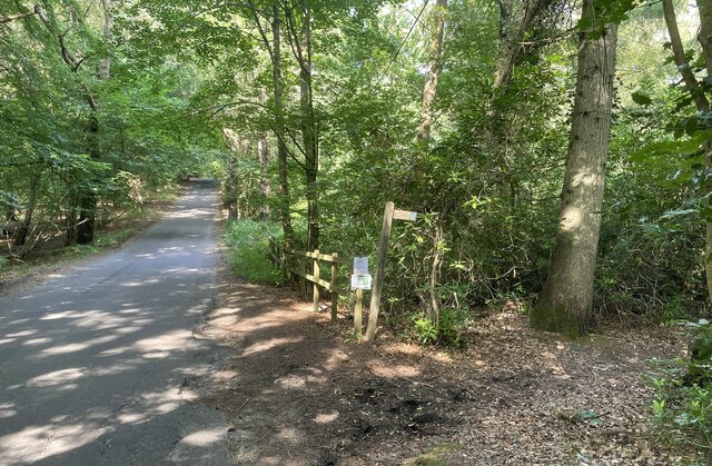
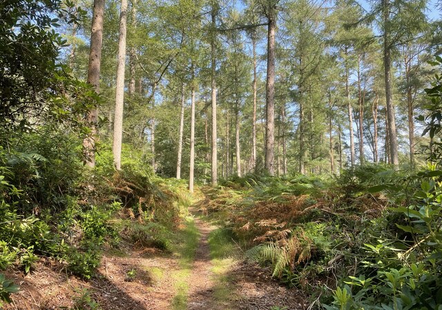
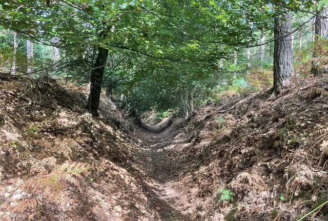
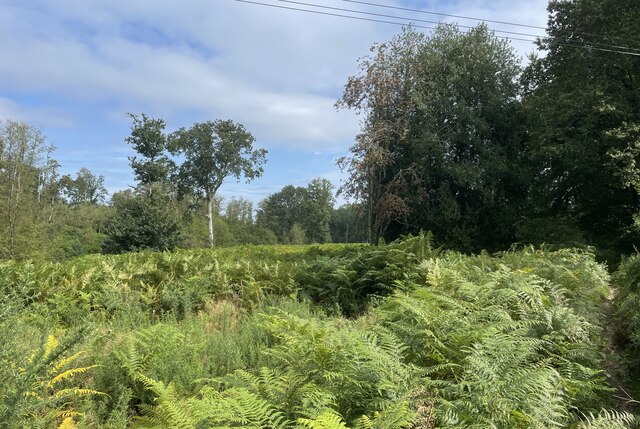
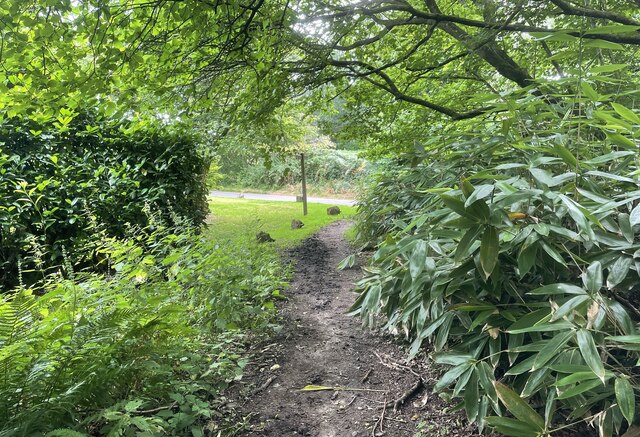
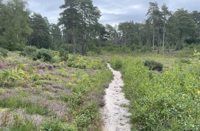
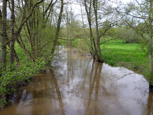
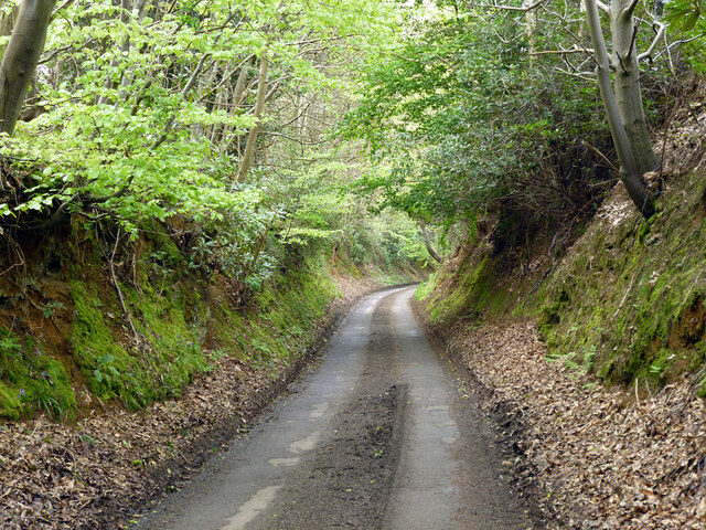
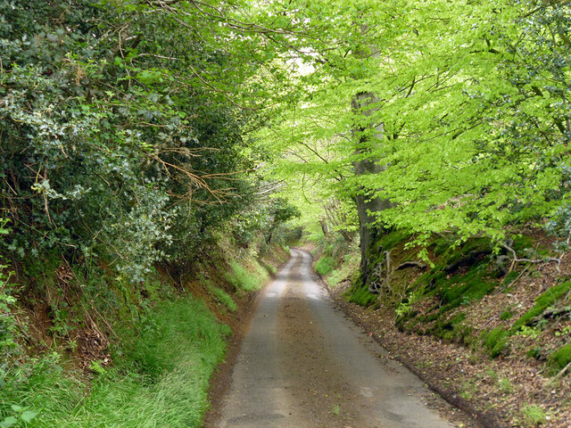
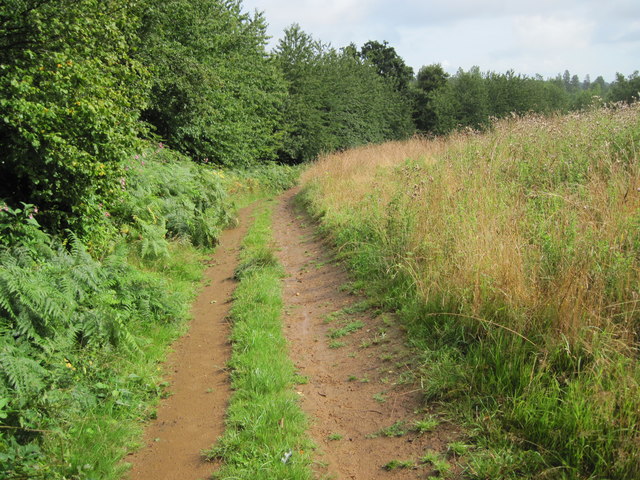
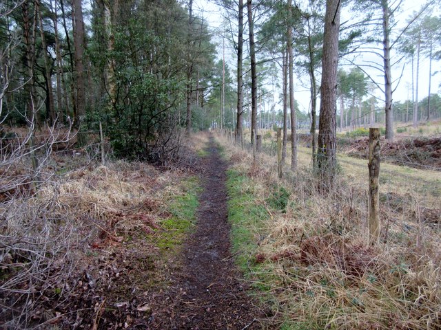
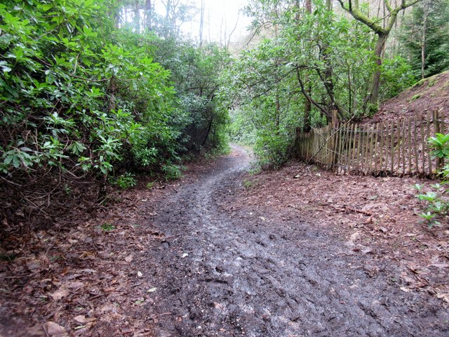
The village is surrounded by stunning natural beauty, with lush green meadows, ancient woodlands, and meandering streams. It is a haven for nature lovers and outdoor enthusiasts, providing ample opportunities for walking, hiking, and exploring the countryside. The South Downs Way, a popular long-distance footpath, passes through Ambersham, attracting many visitors throughout the year.

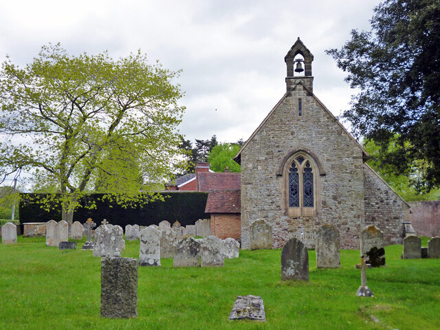
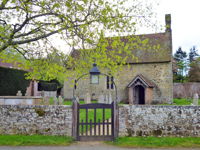
Ambersham's history dates back centuries, and the village is dotted with several historic buildings, adding to its character and charm. The 12th-century St. Michael and All Angels Church is a notable landmark, exhibiting beautiful architecture and hosting regular services. The village also boasts a traditional pub, serving delicious local cuisine and offering a warm and friendly atmosphere.

Despite its small size, Ambersham benefits from its close proximity to nearby towns such as Midhurst and Petersfield, which provide essential amenities, including shops, schools, and healthcare facilities. Additionally, the vibrant city of Chichester is within easy reach, offering a wider range of cultural and entertainment options.

In summary, Ambersham is a hidden gem in South Sussex, offering a peaceful retreat in a stunning natural setting. Its rich history, picturesque landscapes, and friendly community make it an appealing destination for both residents and visitors alike.

If you have any feedback on the listing, please let us know in the comments section below.

Ambersham, South Images

Images are sourced within 2km of 50.977362/-0.694756 or Grid Reference SU9120. Thanks to Geograph Open Source API. All images are credited.

Bridleway at Birch Copse The bridleway leaves the roadside at Birch Copse and heads northwards to meet up with the Serpent Trail.
Bridleway at Birch Copse
The bridleway leaves the roadside at Birch Copse and heads northwards to meet up with the Serpent Trail.
Birch Copse Passing through Birch Copse on the bridleway heading northwards to join with the Serpent Trail.
Birch Copse
Passing through Birch Copse on the bridleway heading northwards to join with the Serpent Trail.
Sunken Path The way ahead is between steep banks at this point.
Sunken Path
The way ahead is between steep banks at this point.
Ferns near Graffham Court The Serpent Trail makes it way through a sea of ferns at this open space near Graffham Court.
Ferns near Graffham Court
The Serpent Trail makes it way through a sea of ferns at this open space near Graffham Court.
Bridleway at Selham Common Approaching the road on bridleway number 981.
Bridleway at Selham Common
Approaching the road on bridleway number 981.
Sandy Path A Sandy path at Fir Toat.
Sandy Path
A Sandy path at Fir Toat.
"Factory" near Halfway Bridge This rather unusual and functional-looking building is labelled "factory" on the map. We need a bit of local knowledge to furnish a better description. The bulk of the building is in the square to the south of the camera, so it counts as a cross-grid shot.
"Factory" near Halfway Bridge
This rather unusual and functional-looking building is labelled "factory" on the map. We need a bit of local knowledge to furnish a better description. The bulk of the building is in the square to the south of the camera, so it counts as a cross-grid shot.
Selham church St. James's is a grade I listed building, oldest parts 11th century.
Selham church
St. James's is a grade I listed building, oldest parts 11th century.
Selham church St. James's is a grade I listed building, oldest parts 11th century.
Selham church
St. James's is a grade I listed building, oldest parts 11th century.
River Rother upstream of Ambersham Bridge
Ditch in Rother valley This runs parallel with the river for a considerable distance.
Ditch in Rother valley
This runs parallel with the river for a considerable distance.
Bridleway 3348 towards Heath End Lane The bridleway runs along the parish boundary between Easebourne (right) and Lodsworth.
Bridleway 3348 towards Heath End Lane
The bridleway runs along the parish boundary between Easebourne (right) and Lodsworth.
Bridleway 3348 around Heathend Copse The bridleway runs along the parish boundary between Easebourne (left) and Lodsworth, with the copse on the right.
Bridleway 3348 around Heathend Copse
The bridleway runs along the parish boundary between Easebourne (left) and Lodsworth, with the copse on the right.
Heath End Lane Deeply sunken, characteristic of lanes on softer wealden  sandstones on slopes where past traffic and water has shuffled sand downhill. The modern tarmac  must largely arrest this process.
Heath End Lane
Deeply sunken, characteristic of lanes on softer wealden sandstones on slopes where past traffic and water has shuffled sand downhill. The modern tarmac must largely arrest this process.
New Lipchis Way towards Selham Road
Track to Smoky House Public Bridleway 982, Graffham Common.
Track to Smoky House
Public Bridleway 982, Graffham Common.
Muddy bridleway Public Bridleway 982 to Wiblings Farm.
Muddy bridleway
Public Bridleway 982 to Wiblings Farm.
Show me another place!

Ambersham, South is located at Grid Ref: SU9120 (Lat: 50.977362, Lng: -0.694756)

Administrative County: West Sussex

District: Chichester

Police Authority: Sussex

What 3 Words

///circulate.toasted.circling. Near Midhurst, West Sussex

Related Wikis

South Ambersham

South Ambersham is a hamlet and former civil parish, now in the parish of Graffham, in the Chichester district of West Sussex, England. It lies 0.7 miles...

Fernhurst (electoral division)

Fernhurst is an electoral division of West Sussex in the United Kingdom, and returns one member to sit on West Sussex County Council. == Extent == The...

Ambersham Common

Ambersham Common is a 141.6-hectare (350-acre) biological Site of Special Scientific Interest south-east of Midhurst in West Sussex. It is a Nature Conservation...

Selham

Selham is a small village and former civil parish, now in the parish of Graffham, in the Chichester district of West Sussex, England. It lies south of...

Selham railway station

Selham railway station served the village of Selham in the county of West Sussex in England. The station was out in mostly open fields, although a public...

Graffham Common

Graffham Common is a 38-hectare (94-acre) nature reserve between Midhurst and Petworth in West Sussex. It is owned and managed by the Sussex Wildlife...

Cowdray Park, West Sussex

Cowdray Park is a country house at the centre of the 16,500-acre (6,700-hectare) Cowdray Estate in Midhurst, West Sussex. The park lies in the South Downs...

River Lod, West Sussex

The River Lod is a short river draining about 52 km2 (20 sq mi) of north west Sussex. The main source is on the Greensand Ridge at Marley Heights near...

Nearby Amenities

Located within 500m of 50.977362,-0.694756
South Ambersham
Is In: West Sussex, England, UK
Place: hamlet
Source: npe
Wikidata: Q7565943
Lat/Long: 50.9781549/-0.6963276
Bus Stop
South Ambersham
Naptan AtcoCode: 4400MO0066
Naptan Bearing: W
Naptan CommonName: South Ambersham
Naptan Indicator: South Ambersham
Naptan Landmark: South Ambersham
Naptan NaptanCode: wsxdgtjp
Naptan Street: New Road
Naptan Verified: no
Source: naptan_import
Lat/Long: 50.9780006/-0.6962551
Swath Moor Barn
Naptan AtcoCode: 4400MO0603
Naptan Bearing: NW
Naptan BusStopType: CUS
Naptan CommonName: Swath Moor Barn
Naptan Indicator: adj
Naptan Landmark: Hail & Ride
Naptan NaptanCode: wsxgdpdm
Naptan Street: Unnamed Road
Naptan Verified: no
Source: naptan_import
Lat/Long: 50.9770655/-0.6906403
Swath Moor Barn
Naptan AtcoCode: 4400MO0604
Naptan Bearing: SE
Naptan BusStopType: CUS
Naptan CommonName: Swath Moor Barn
Naptan Indicator: opp
Naptan Landmark: Hail & Ride
Naptan NaptanCode: wsxgdpdp
Naptan Street: Unnamed Road
Naptan Verified: no
Source: naptan_import
Lat/Long: 50.9771976/-0.6903944
Ambersham Moor
Naptan AtcoCode: 4400MO0605
Naptan Bearing: S
Naptan BusStopType: CUS
Naptan CommonName: Ambersham Moor
Naptan Indicator: opp
Naptan Landmark: Hail & Ride
Naptan NaptanCode: wsxgdpdt
Naptan Street: Unnamed Road
Naptan Verified: no
Source: naptan_import
Lat/Long: 50.9740467/-0.6981321
Ambersham Moor
Naptan AtcoCode: 4400MO0606
Naptan Bearing: N
Naptan BusStopType: CUS
Naptan CommonName: Ambersham Moor
Naptan Indicator: adj
Naptan Landmark: Hail & Ride
Naptan NaptanCode: wsxgdpdw
Naptan Street: Unnamed Road
Naptan Verified: no
Source: naptan_import
Lat/Long: 50.9740653/-0.698281
Barrier: stile
Lat/Long: 50.9810933/-0.69793
Post Box
Brand: Royal Mail
Brand Wikidata: Q638098
Collection Plate: CP7D
Collection Times: Mo-Fr 09:00; Sa 07:00
Note: This postbox is on the northbound side of Selham Road and is set back by the bushes outside the driveway to Beck House.
Operator: Royal Mail
Operator Wikidata: Q638098
Post Box Mounting: pier
Post Box Type: lamp
Ref: GU29 46D
Royal Cypher: EIIR
Royal Cypher Wikidata: Q33102113
Source: survey
Survey Point: 2022-08-05
Lat/Long: 50.9786786/-0.6969589
The data included in this document is from www.openstreetmap.org. The data is made available under ODbL.

Have you been to Ambersham, South?

Leave your review of Ambersham, South below (or comments, questions and feedback).