Ambersham Moor

Wood, Forest in Sussex Chichester

England

Ambersham Moor

Bridleway at Birch Copse The bridleway leaves the roadside at Birch Copse and heads northwards to meet up with the Serpent Trail.
Bridleway at Birch Copse Credit: Chris Thomas-Atkin

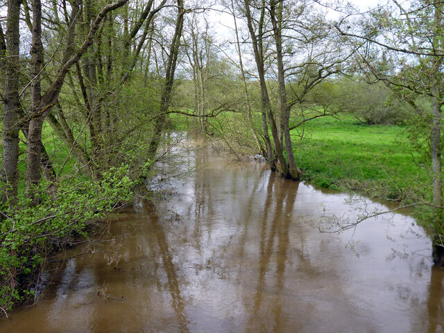
Ambersham Moor is a picturesque woodland area located in Sussex, England. Covering an expansive area of lush greenery, it is renowned for its natural beauty and scenic landscapes. The moor is situated near the village of Ambersham, in the heart of the South Downs National Park.

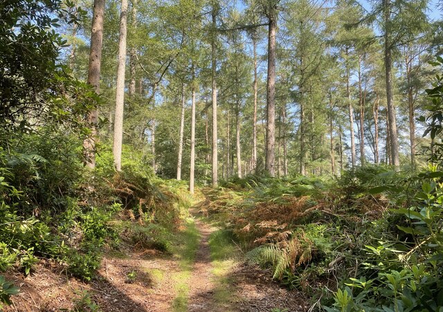
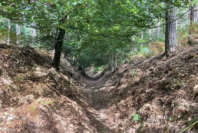
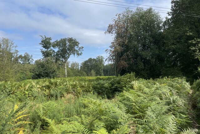
The woodland of Ambersham Moor is predominantly composed of a variety of deciduous trees, including oak, beech, and birch, creating a rich tapestry of colors throughout the seasons. The forest floor is adorned with an array of wildflowers, adding to the area's charm and biodiversity.

The moor is home to a diverse range of wildlife, making it a popular destination for nature enthusiasts and birdwatchers. Visitors may spot deer, badgers, and a plethora of bird species, including woodpeckers and nightingales.

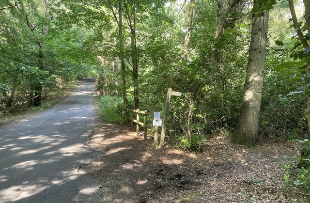
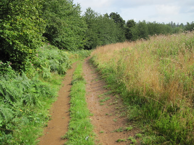
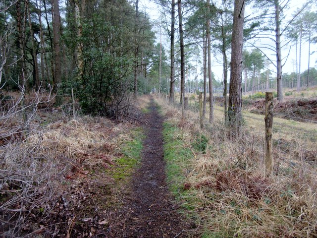
Ambersham Moor offers numerous walking trails, allowing visitors to explore its enchanting surroundings. These trails provide an opportunity to immerse oneself in the tranquility of nature and enjoy the peaceful ambiance of the forest. Additionally, the moor offers picnic areas, providing the perfect setting for a leisurely outdoor meal.

The moor is managed by the National Trust, ensuring the preservation of its natural beauty and ecological importance. The conservation efforts in place contribute to the sustainability and protection of the area's unique ecosystem.

Overall, Ambersham Moor is a haven for nature lovers, offering a serene escape from the hustle and bustle of everyday life. Its breathtaking landscapes, diverse wildlife, and well-maintained trails make it a must-visit destination for anyone seeking solace in the beauty of nature.

If you have any feedback on the listing, please let us know in the comments section below.

Ambersham Moor Images

Images are sourced within 2km of 50.975138/-0.70171921 or Grid Reference SU9120. Thanks to Geograph Open Source API. All images are credited.

Bridleway at Birch Copse The bridleway leaves the roadside at Birch Copse and heads northwards to meet up with the Serpent Trail.
Bridleway at Birch Copse
The bridleway leaves the roadside at Birch Copse and heads northwards to meet up with the Serpent Trail.
Birch Copse Passing through Birch Copse on the bridleway heading northwards to join with the Serpent Trail.
Birch Copse
Passing through Birch Copse on the bridleway heading northwards to join with the Serpent Trail.
Sunken Path The way ahead is between steep banks at this point.
Sunken Path
The way ahead is between steep banks at this point.
Ferns near Graffham Court The Serpent Trail makes it way through a sea of ferns at this open space near Graffham Court.
Ferns near Graffham Court
The Serpent Trail makes it way through a sea of ferns at this open space near Graffham Court.
River Rother upstream of Ambersham Bridge
Ditch in Rother valley This runs parallel with the river for a considerable distance.
Ditch in Rother valley
This runs parallel with the river for a considerable distance.
New Lipchis Way towards Selham Road
Track to Smoky House Public Bridleway 982, Graffham Common.
Track to Smoky House
Public Bridleway 982, Graffham Common.
Gate on The Serpent Trail Public footpath 983 to Graffham Court. The Serpent Trail is a 64 mile long distance footpath from Haslemere to Petersfield. The route is designed to join up the many heathland areas on greensand in the western Weald.
Gate on The Serpent Trail
Public footpath 983 to Graffham Court. The Serpent Trail is a 64 mile long distance footpath from Haslemere to Petersfield. The route is designed to join up the many heathland areas on greensand in the western Weald.
New kissing gate on The Serpent Trail Public bridleway 982 ahead. The Serpent Trail (Public footpath 2888 to the right) is a 64 mile long distance footpath from Haslemere to Petersfield. The route is designed to join up the many heathland areas on greensand in the western Weald.
New kissing gate on The Serpent Trail
Public bridleway 982 ahead. The Serpent Trail (Public footpath 2888 to the right) is a 64 mile long distance footpath from Haslemere to Petersfield. The route is designed to join up the many heathland areas on greensand in the western Weald.
Track on Graffham Common Public Bridleway 982.
Track on Graffham Common
Public Bridleway 982.
Bridleway Graffham Common Public bridleway 982.
Bridleway Graffham Common
Public bridleway 982.
Gate on Bridleway, Graffham Common Public bridleway 982.
Gate on Bridleway, Graffham Common
Public bridleway 982.
Bridleway crossing field Public bridleway 982 Selham Common.
Bridleway crossing field
Public bridleway 982 Selham Common.
Boggy Bridleway, Selham Common Public bridleway 981.
Boggy Bridleway, Selham Common
Public bridleway 981.
Water on bridleway Public bridleway 981 Selham Common.
Water on bridleway
Public bridleway 981 Selham Common.
Track through wood Public bridleway 981 Selham Common.
Track through wood
Public bridleway 981 Selham Common.
Searching southwards down the Bashire (14) Road dividing Upper Polecats from Lower Polecats
Searching southwards down the Bashire (14)
Road dividing Upper Polecats from Lower Polecats
Show me another place!

Ambersham Moor is located at Grid Ref: SU9120 (Lat: 50.975138, Lng: -0.70171921)

Administrative County: West Sussex

District: Chichester

Police Authority: Sussex

What 3 Words

///fearfully.then.composer. Near Midhurst, West Sussex

Related Wikis

South Ambersham

South Ambersham is a hamlet and former civil parish, now in the parish of Graffham, in the Chichester district of West Sussex, England. It lies 0.7 miles...

Fernhurst (electoral division)

Fernhurst is an electoral division of West Sussex in the United Kingdom, and returns one member to sit on West Sussex County Council. == Extent == The...

Ambersham Common

Ambersham Common is a 141.6-hectare (350-acre) biological Site of Special Scientific Interest south-east of Midhurst in West Sussex. It is a Nature Conservation...

Cowdray Park, West Sussex

Cowdray Park is a country house at the centre of the 16,500-acre (6,700-hectare) Cowdray Estate in Midhurst, West Sussex. The park lies in the South Downs...

West Lavington, West Sussex

West Lavington is a village and civil parish on the edge of Midhurst in the Chichester district of West Sussex, England. It contains a small private nursery...

Selham

Selham is a small village and former civil parish, now in the parish of Graffham, in the Chichester district of West Sussex, England. It lies south of...

Selham railway station

Selham railway station served the village of Selham in the county of West Sussex in England. The station was out in mostly open fields, although a public...

Graffham Common

Graffham Common is a 38-hectare (94-acre) nature reserve between Midhurst and Petworth in West Sussex. It is owned and managed by the Sussex Wildlife...

Nearby Amenities

Located within 500m of 50.975138,-0.70171921
Bus Stop
South Ambersham
Naptan AtcoCode: 4400MO0066
Naptan Bearing: W
Naptan CommonName: South Ambersham
Naptan Indicator: South Ambersham
Naptan Landmark: South Ambersham
Naptan NaptanCode: wsxdgtjp
Naptan Street: New Road
Naptan Verified: no
Source: naptan_import
Lat/Long: 50.9780006/-0.6962551
Ambersham Moor
Naptan AtcoCode: 4400MO0605
Naptan Bearing: S
Naptan BusStopType: CUS
Naptan CommonName: Ambersham Moor
Naptan Indicator: opp
Naptan Landmark: Hail & Ride
Naptan NaptanCode: wsxgdpdt
Naptan Street: Unnamed Road
Naptan Verified: no
Source: naptan_import
Lat/Long: 50.9740467/-0.6981321
Ambersham Moor
Naptan AtcoCode: 4400MO0606
Naptan Bearing: N
Naptan BusStopType: CUS
Naptan CommonName: Ambersham Moor
Naptan Indicator: adj
Naptan Landmark: Hail & Ride
Naptan NaptanCode: wsxgdpdw
Naptan Street: Unnamed Road
Naptan Verified: no
Source: naptan_import
Lat/Long: 50.9740653/-0.698281
The data included in this document is from www.openstreetmap.org. The data is made available under ODbL.

Have you been to Ambersham Moor?

Leave your review of Ambersham Moor below (or comments, questions and feedback).