South Alkham

Settlement in Kent Dover

England

South Alkham

Capel Farm
Capel Farm Credit: N Chadwick

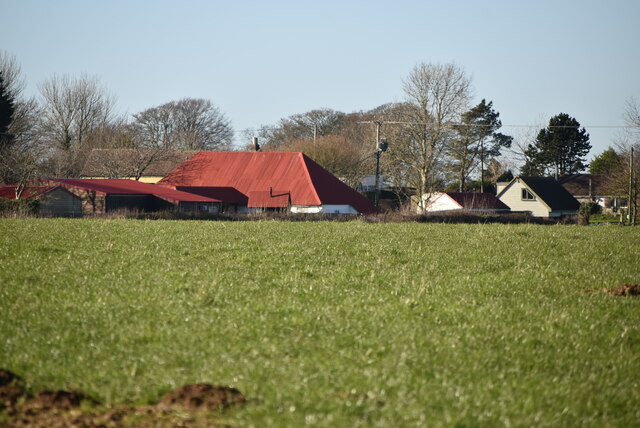
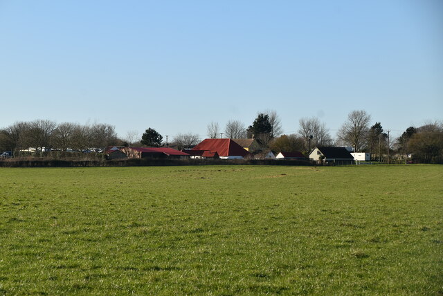
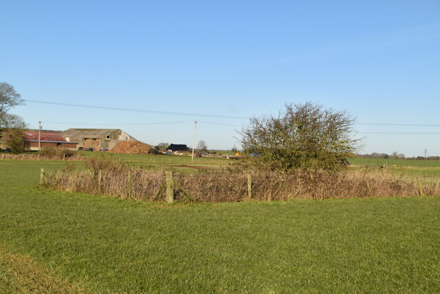
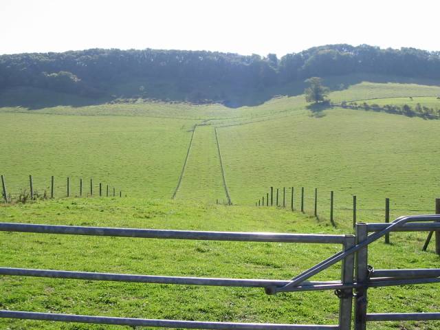
South Alkham is a small village located in the county of Kent, England. Situated in the picturesque Alkham Valley, it lies approximately 5 miles south of the city of Canterbury. The village is surrounded by rolling hills, lush farmland, and scenic countryside, making it an idyllic rural retreat.

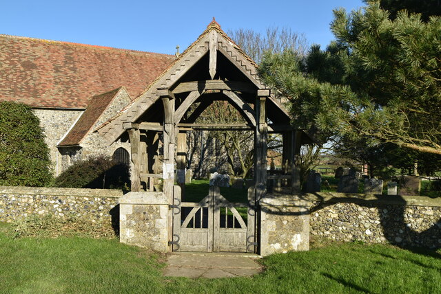
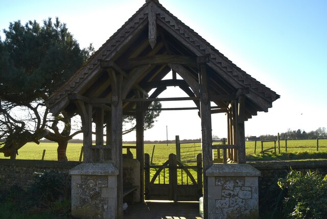
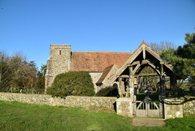
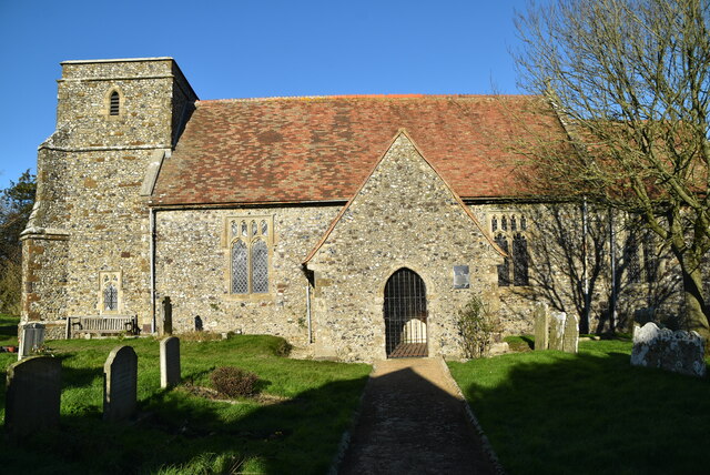
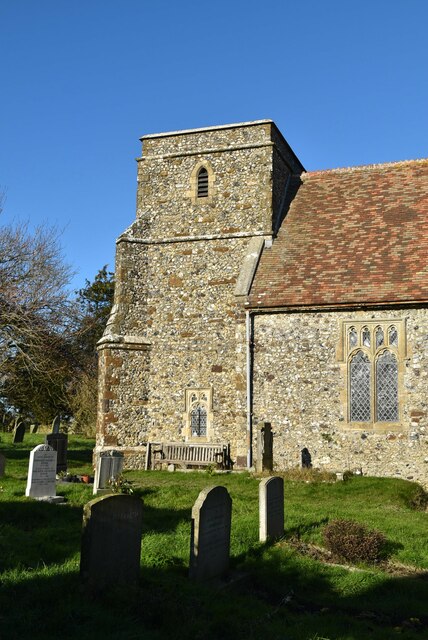
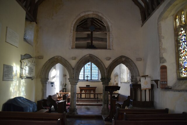
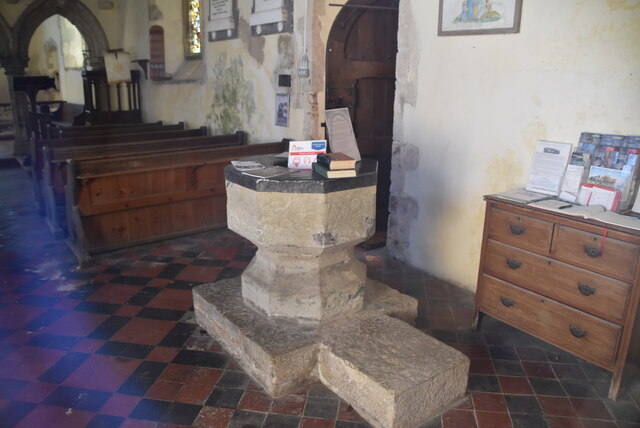
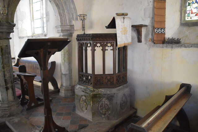
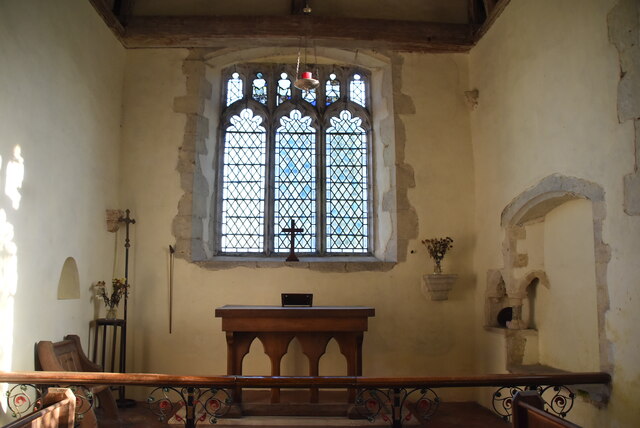
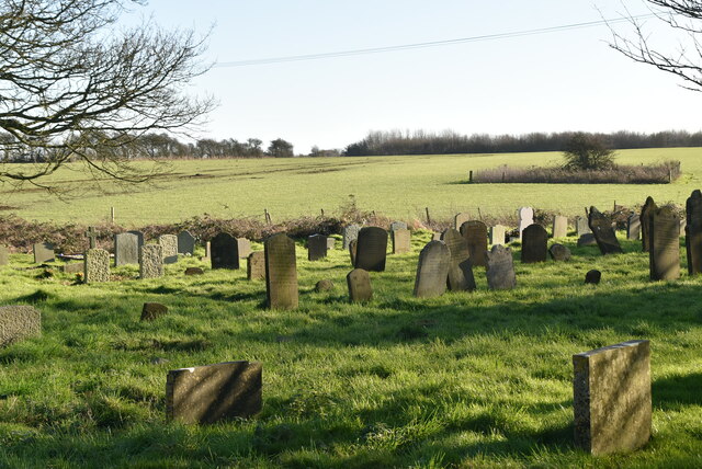
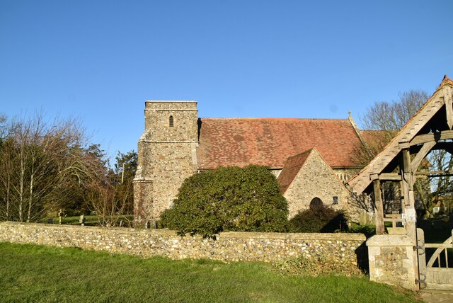
With a population of just over 300 residents, South Alkham has a close-knit community feel. The village itself features a charming mix of traditional, well-preserved cottages and modern houses, giving it a timeless appeal. The local St. Anthony's Church, dating back to the 12th century, is a prominent landmark and adds to the village's historical character.

Although small in size, South Alkham offers a range of amenities for its residents and visitors. The village boasts a well-regarded pub, The Marquis at Alkham, which offers a warm and welcoming atmosphere along with excellent food and drink. Additionally, there are several bed and breakfast establishments and holiday cottages in the area, catering to tourists who are looking to explore the beautiful surrounding countryside.

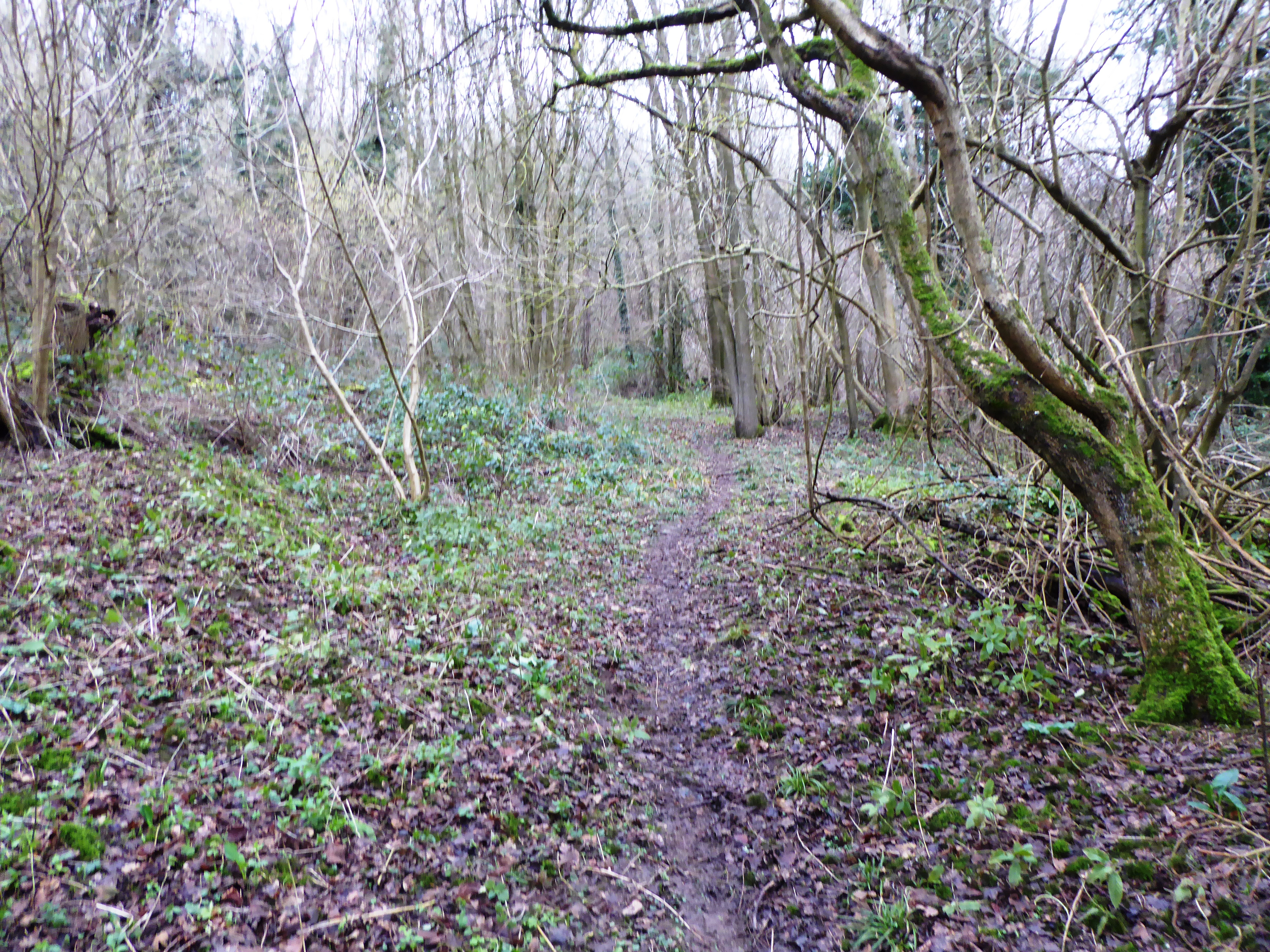
Nature enthusiasts will find plenty to enjoy in South Alkham and its surroundings. The village is located near the Kent Downs Area of Outstanding Natural Beauty, offering numerous walking and cycling trails through picturesque landscapes. The nearby Alkham Valley Vineyard is a popular destination for wine enthusiasts, offering tours and tastings of their award-winning wines.

In summary, South Alkham is a charming and tranquil village in the heart of the Kent countryside. With its stunning natural surroundings, community spirit, and amenities, it is a hidden gem for those seeking a peaceful retreat away from the hustle and bustle of city life.

If you have any feedback on the listing, please let us know in the comments section below.

South Alkham Images

Images are sourced within 2km of 51.129094/1.212235 or Grid Reference TR2441. Thanks to Geograph Open Source API. All images are credited.

Capel Farm
Capel Farm
Capel Farm
Capel Farm
Enclosed pond
Enclosed pond
Lych gate, Church of St Mary A lychgate or as two separate words lych gate, is a gateway covered with a roof found at the entrance to a traditional English churchyard. The name comes from the Old English for a corpse (lic) and was traditionally where the clergy met the corpse for burial. It was also a shelter for the pall bearers.
Lych gate, Church of St Mary
A lychgate or as two separate words lych gate, is a gateway covered with a roof found at the entrance to a traditional English churchyard. The name comes from the Old English for a corpse (lic) and was traditionally where the clergy met the corpse for burial. It was also a shelter for the pall bearers.
Lych gate, Church of St Mary St Mary's Church is a redundant Anglican church to the northeast of the village of Capel-le-Ferne. It is a Grade I listed building, and is under the care of the Churches Conservation Trust. The church stands in an isolated position adjacent to Capel Church Farm, to the north of the A20 road and 2 miles northeast of Folkestone.
Wikipedia: <span class="nowrap"><a title="https://en.wikipedia.org/wiki/St_Mary%27s_Church,_Capel-le-Ferne" rel="nofollow ugc noopener" href="https://en.wikipedia.org/wiki/St_Mary%27s_Church,_Capel-le-Ferne">Link</a><img style="margin-left:2px;" alt="External link" title="External link - shift click to open in new window" src="https://s1.geograph.org.uk/img/external.png" width="10" height="10"/></span>
Lych gate, Church of St Mary
St Mary's Church is a redundant Anglican church to the northeast of the village of Capel-le-Ferne. It is a Grade I listed building, and is under the care of the Churches Conservation Trust. The church stands in an isolated position adjacent to Capel Church Farm, to the north of the A20 road and 2 miles northeast of Folkestone. Wikipedia: LinkExternal link
A20 near Capel-le-Ferne Capel street crossing the A20.
A20 near Capel-le-Ferne
Capel street crossing the A20.
Bridge over the A20 near Capel-le-Ferne The A20 runs from the London Borough of Lewisham to Dover, Kent. It runs through the major towns of Maidstone, Ashford and Folkestone, terminating at the port of Dover.
Bridge over the A20 near Capel-le-Ferne
The A20 runs from the London Borough of Lewisham to Dover, Kent. It runs through the major towns of Maidstone, Ashford and Folkestone, terminating at the port of Dover.
Capel Church Farm
Capel Church Farm
Church of St Mary St Mary's Church is a redundant Anglican church to the northeast of the village of Capel-le-Ferne. It is a Grade I listed building, and is under the care of the Churches Conservation Trust. The church stands in an isolated position adjacent to Capel Church Farm, to the north of the A20 road and 2 miles northeast of Folkestone.
Wikipedia: <span class="nowrap"><a title="https://en.wikipedia.org/wiki/St_Mary%27s_Church,_Capel-le-Ferne" rel="nofollow ugc noopener" href="https://en.wikipedia.org/wiki/St_Mary%27s_Church,_Capel-le-Ferne">Link</a><img style="margin-left:2px;" alt="External link" title="External link - shift click to open in new window" src="https://s1.geograph.org.uk/img/external.png" width="10" height="10"/></span>
Church of St Mary
St Mary's Church is a redundant Anglican church to the northeast of the village of Capel-le-Ferne. It is a Grade I listed building, and is under the care of the Churches Conservation Trust. The church stands in an isolated position adjacent to Capel Church Farm, to the north of the A20 road and 2 miles northeast of Folkestone. Wikipedia: LinkExternal link
Ingleton
Ingleton
Church of St Mary St Mary's Church is a redundant Anglican church to the northeast of the village of Capel-le-Ferne. It is a Grade I listed building, and is under the care of the Churches Conservation Trust. The church stands in an isolated position adjacent to Capel Church Farm, to the north of the A20 road and 2 miles northeast of Folkestone.
Wikipedia: <span class="nowrap"><a title="https://en.wikipedia.org/wiki/St_Mary%27s_Church,_Capel-le-Ferne" rel="nofollow ugc noopener" href="https://en.wikipedia.org/wiki/St_Mary%27s_Church,_Capel-le-Ferne">Link</a><img style="margin-left:2px;" alt="External link" title="External link - shift click to open in new window" src="https://s1.geograph.org.uk/img/external.png" width="10" height="10"/></span>
Church of St Mary
St Mary's Church is a redundant Anglican church to the northeast of the village of Capel-le-Ferne. It is a Grade I listed building, and is under the care of the Churches Conservation Trust. The church stands in an isolated position adjacent to Capel Church Farm, to the north of the A20 road and 2 miles northeast of Folkestone. Wikipedia: LinkExternal link
church of St Mary St Mary's Church is a redundant Anglican church to the northeast of the village of Capel-le-Ferne. It is a Grade I listed building, and is under the care of the Churches Conservation Trust. The church stands in an isolated position adjacent to Capel Church Farm, to the north of the A20 road and 2 miles northeast of Folkestone.
Wikipedia: <span class="nowrap"><a title="https://en.wikipedia.org/wiki/St_Mary%27s_Church,_Capel-le-Ferne" rel="nofollow ugc noopener" href="https://en.wikipedia.org/wiki/St_Mary%27s_Church,_Capel-le-Ferne">Link</a><img style="margin-left:2px;" alt="External link" title="External link - shift click to open in new window" src="https://s1.geograph.org.uk/img/external.png" width="10" height="10"/></span>
church of St Mary
St Mary's Church is a redundant Anglican church to the northeast of the village of Capel-le-Ferne. It is a Grade I listed building, and is under the care of the Churches Conservation Trust. The church stands in an isolated position adjacent to Capel Church Farm, to the north of the A20 road and 2 miles northeast of Folkestone. Wikipedia: LinkExternal link
Font, Church of St Mary St Mary's Church is a redundant Anglican church to the northeast of the village of Capel-le-Ferne. It is a Grade I listed building, and is under the care of the Churches Conservation Trust. The church stands in an isolated position adjacent to Capel Church Farm, to the north of the A20 road and 2 miles northeast of Folkestone.
Wikipedia: <span class="nowrap"><a title="https://en.wikipedia.org/wiki/St_Mary%27s_Church,_Capel-le-Ferne" rel="nofollow ugc noopener" href="https://en.wikipedia.org/wiki/St_Mary%27s_Church,_Capel-le-Ferne">Link</a><img style="margin-left:2px;" alt="External link" title="External link - shift click to open in new window" src="https://s1.geograph.org.uk/img/external.png" width="10" height="10"/></span>
Font, Church of St Mary
St Mary's Church is a redundant Anglican church to the northeast of the village of Capel-le-Ferne. It is a Grade I listed building, and is under the care of the Churches Conservation Trust. The church stands in an isolated position adjacent to Capel Church Farm, to the north of the A20 road and 2 miles northeast of Folkestone. Wikipedia: LinkExternal link
Pulpit, Church of St Mary St Mary's Church is a redundant Anglican church to the northeast of the village of Capel-le-Ferne. It is a Grade I listed building, and is under the care of the Churches Conservation Trust. The church stands in an isolated position adjacent to Capel Church Farm, to the north of the A20 road and 2 miles northeast of Folkestone.
Wikipedia: <span class="nowrap"><a title="https://en.wikipedia.org/wiki/St_Mary%27s_Church,_Capel-le-Ferne" rel="nofollow ugc noopener" href="https://en.wikipedia.org/wiki/St_Mary%27s_Church,_Capel-le-Ferne">Link</a><img style="margin-left:2px;" alt="External link" title="External link - shift click to open in new window" src="https://s1.geograph.org.uk/img/external.png" width="10" height="10"/></span>
Pulpit, Church of St Mary
St Mary's Church is a redundant Anglican church to the northeast of the village of Capel-le-Ferne. It is a Grade I listed building, and is under the care of the Churches Conservation Trust. The church stands in an isolated position adjacent to Capel Church Farm, to the north of the A20 road and 2 miles northeast of Folkestone. Wikipedia: LinkExternal link
Altar, Church of St Mary St Mary's Church is a redundant Anglican church to the northeast of the village of Capel-le-Ferne. It is a Grade I listed building, and is under the care of the Churches Conservation Trust. The church stands in an isolated position adjacent to Capel Church Farm, to the north of the A20 road and 2 miles northeast of Folkestone.
Wikipedia: <span class="nowrap"><a title="https://en.wikipedia.org/wiki/St_Mary%27s_Church,_Capel-le-Ferne" rel="nofollow ugc noopener" href="https://en.wikipedia.org/wiki/St_Mary%27s_Church,_Capel-le-Ferne">Link</a><img style="margin-left:2px;" alt="External link" title="External link - shift click to open in new window" src="https://s1.geograph.org.uk/img/external.png" width="10" height="10"/></span>
Altar, Church of St Mary
St Mary's Church is a redundant Anglican church to the northeast of the village of Capel-le-Ferne. It is a Grade I listed building, and is under the care of the Churches Conservation Trust. The church stands in an isolated position adjacent to Capel Church Farm, to the north of the A20 road and 2 miles northeast of Folkestone. Wikipedia: LinkExternal link
Graves, Church of St Mary St Mary's Church is a redundant Anglican church to the northeast of the village of Capel-le-Ferne. It is a Grade I listed building, and is under the care of the Churches Conservation Trust. The church stands in an isolated position adjacent to Capel Church Farm, to the north of the A20 road and 2 miles northeast of Folkestone.
Wikipedia: <span class="nowrap"><a title="https://en.wikipedia.org/wiki/St_Mary%27s_Church,_Capel-le-Ferne" rel="nofollow ugc noopener" href="https://en.wikipedia.org/wiki/St_Mary%27s_Church,_Capel-le-Ferne">Link</a><img style="margin-left:2px;" alt="External link" title="External link - shift click to open in new window" src="https://s1.geograph.org.uk/img/external.png" width="10" height="10"/></span>
Graves, Church of St Mary
St Mary's Church is a redundant Anglican church to the northeast of the village of Capel-le-Ferne. It is a Grade I listed building, and is under the care of the Churches Conservation Trust. The church stands in an isolated position adjacent to Capel Church Farm, to the north of the A20 road and 2 miles northeast of Folkestone. Wikipedia: LinkExternal link
Church of St Mary St Mary's Church is a redundant Anglican church to the northeast of the village of Capel-le-Ferne. It is a Grade I listed building, and is under the care of the Churches Conservation Trust. The church stands in an isolated position adjacent to Capel Church Farm, to the north of the A20 road and 2 miles northeast of Folkestone.
Wikipedia: <span class="nowrap"><a title="https://en.wikipedia.org/wiki/St_Mary%27s_Church,_Capel-le-Ferne" rel="nofollow ugc noopener" href="https://en.wikipedia.org/wiki/St_Mary%27s_Church,_Capel-le-Ferne">Link</a><img style="margin-left:2px;" alt="External link" title="External link - shift click to open in new window" src="https://s1.geograph.org.uk/img/external.png" width="10" height="10"/></span>
Church of St Mary
St Mary's Church is a redundant Anglican church to the northeast of the village of Capel-le-Ferne. It is a Grade I listed building, and is under the care of the Churches Conservation Trust. The church stands in an isolated position adjacent to Capel Church Farm, to the north of the A20 road and 2 miles northeast of Folkestone. Wikipedia: LinkExternal link
Show me another place!

South Alkham is located at Grid Ref: TR2441 (Lat: 51.129094, Lng: 1.212235)

Administrative County: Kent

District: Dover

Police Authority: Kent

What 3 Words

///crowns.snippet.absorbing. Near Capel le Ferne, Kent

Related Wikis

Alkham Valley

The Alkham Valley is in the Kent Downs (the eastern part of the North Downs), an Area of Outstanding Natural Beauty, in South East Kent, England. The valley...

Alkham

Alkham is a village and civil parish in the Dover district of Kent, England, about five miles west of Dover. Within the parish are the settlements of Chalksole...

Drellingore

Drellingore is a village in South East Kent, England. It lies in the Alkham Valley, an area of outstanding natural beauty between Folkestone and Dover...

Hougham Without

Hougham Without is a civil parish between Dover and Folkestone in southeast England. The main settlements are the villages of Church Hougham and West Hougham...

Sladden Wood

Sladden Wood is a 7-hectare (17-acre) nature reserve north of Alkham in Kent. It is managed by the Kent Wildlife Trust.The main trees in this wood are...

St Mary's Church, Capel-le-Ferne

St Mary's Church is a redundant Anglican church to the northeast of the village of Capel-le-Ferne, Kent, England. It is recorded in the National Heritage...

Ewell Minnis

Ewell Minnis is a village near Dover in Kent, England. The population is included in the civil parish of Alkham. See Stelling Minnis for information on...

St Peter's Church, Swingfield

St Peter's Church is a redundant Anglican church in the village of Swingfield, some 3 miles (5 km) northeast of Hawkinge, Kent, England. It is recorded...

Related Videos

The simple pleasures of a walk in the countryside. Lovely!

BMcreativedigital #getoutside #walk #walking #birthday #habits #thinkingtime #steps #slimdown #toneup #mood #takenotice ...

A taste of wintry things to come. All those cobweb-removing walks ahead. Grand!

BMcreativedigital #getoutside #walk #walking #goexplore #habits #thinkingtime #steps #slimdown #toneup #mood #winter #trees ...

Birthday eve, deadline tomorrow; so I treated myself to a longish walk in the countryside. Lovely :)

BMcreativedigital #getoutside #walk #walking #birthday #habits #thinkingtime #steps #slimdown #toneup #mood #takenotice ...

Hurricane purring

beautiful bird!

Nearby Amenities

Located within 500m of 51.129094,1.212235
Post Box
Postal Code: CT15
Ref: CT15 92
Lat/Long: 51.1311115/1.2124308
Bus Stop
Meggett Lane
Bus: yes
Flag: no
Naptan AtcoCode: 240099754
Naptan Bearing: NE
Naptan BusStopType: CUS
Naptan CommonName: Meggett Lane
Naptan Indicator: opp
Naptan Landmark: Meggett Lane
Naptan NaptanCode: kntgpwgd
Naptan Street: Alkham Valley Road
Naptan Verified: no
Public Transport: platform
Source: naptan_import
Lat/Long: 51.1310925/1.2126092
Bus Stop
Meggett Lane
Bus: yes
Flag: no
Naptan AtcoCode: 240099756
Naptan Bearing: SW
Naptan BusStopType: CUS
Naptan CommonName: Meggett Lane
Naptan Indicator: adj
Naptan Landmark: Meggett Lane
Naptan NaptanCode: kntgtamw
Naptan Street: Alkham Valley Road
Naptan Verified: no
Public Transport: platform
Source: naptan_import
Lat/Long: 51.1311447/1.2133276
The data included in this document is from www.openstreetmap.org. The data is made available under ODbL.

Have you been to South Alkham?

Leave your review of South Alkham below (or comments, questions and feedback).