Drellingore

Settlement in Kent Dover

England

Drellingore

Capel Farm
Capel Farm Credit: N Chadwick

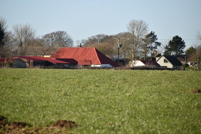
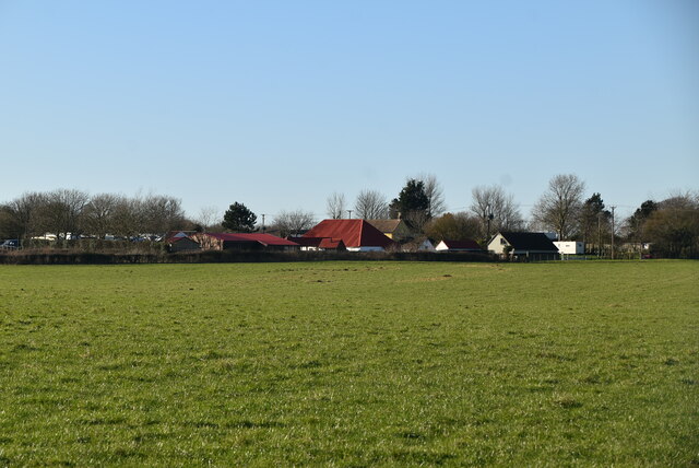
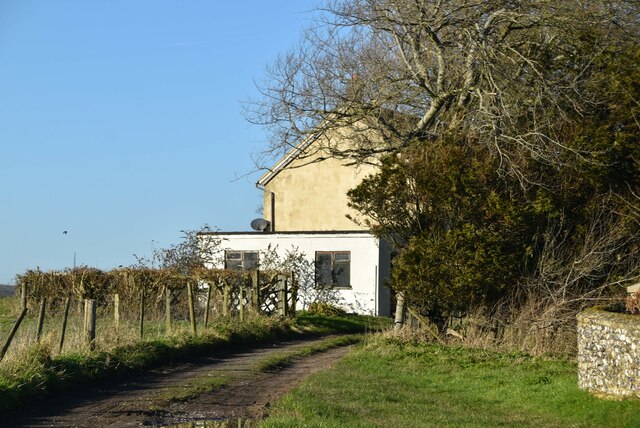
Drellingore is a small village located in the county of Kent, in southeastern England. Situated approximately 10 miles southwest of the city of Canterbury, Drellingore is a rural community surrounded by picturesque countryside and farmlands.

The village is known for its charming and tranquil atmosphere, providing residents and visitors with a peaceful escape from the hustle and bustle of city life. With a population of around 300 people, Drellingore maintains a close-knit community spirit, with various social events and gatherings organized throughout the year.

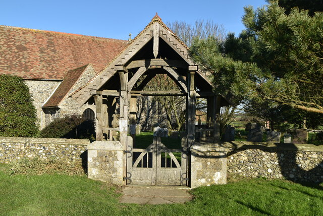
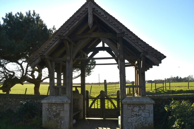
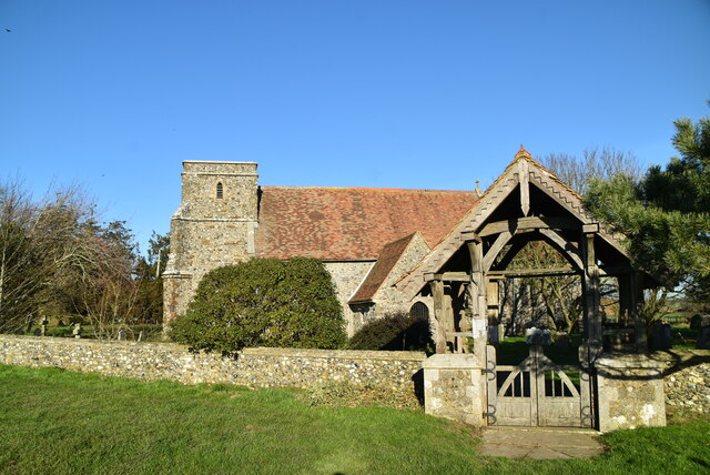
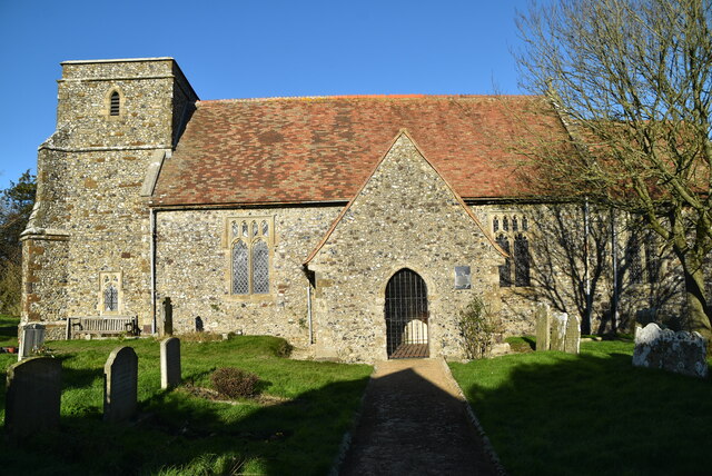
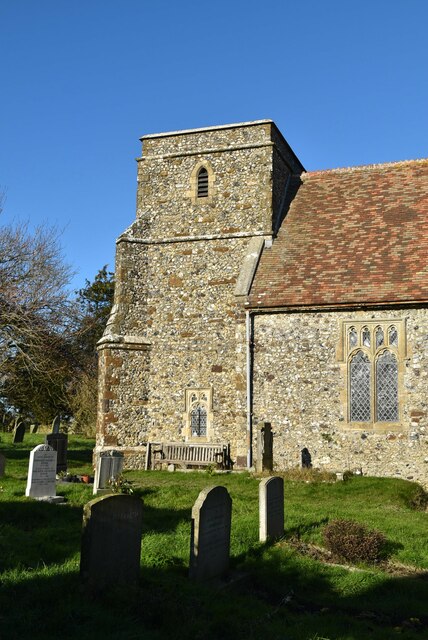
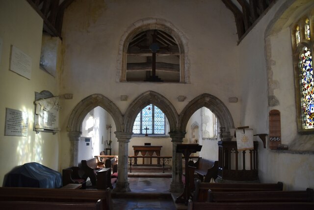
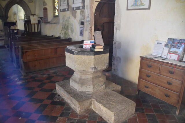
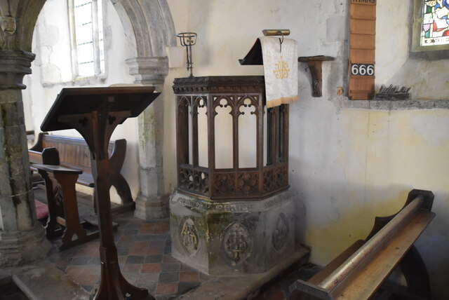
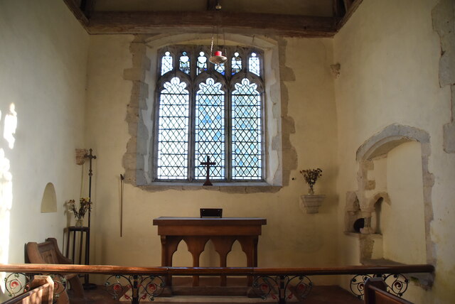
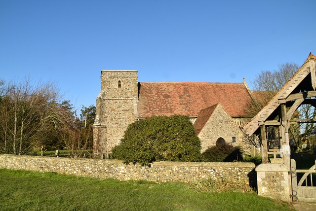
The architecture in Drellingore is predominantly traditional, with many historic buildings still standing, adding to the village's charm. The village church, St. Peter's, is a notable landmark, dating back to the 12th century and featuring stunning stained glass windows and intricate stonework.

Despite its small size, Drellingore offers several amenities to its residents. These include a local pub, The Drellingore Arms, which serves as a gathering place for villagers and visitors alike. Additionally, a village hall provides a venue for community events, meetings, and recreational activities.

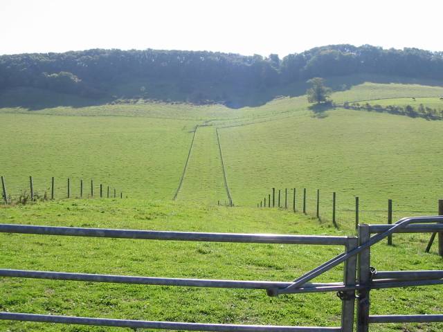
Nature enthusiasts can explore the surrounding countryside through various walking and cycling trails, offering breathtaking views of the Kentish landscape. Drellingore is also conveniently located near several larger towns and attractions, such as Canterbury Cathedral and the historic city of Dover, known for its iconic white cliffs.

Overall, Drellingore, Kent, is a charming and idyllic village, perfect for those seeking a peaceful rural retreat while still having easy access to nearby amenities and attractions.

If you have any feedback on the listing, please let us know in the comments section below.
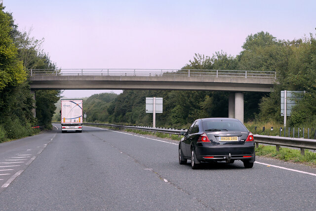
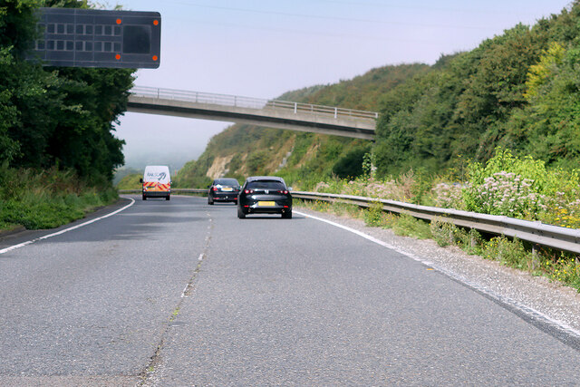
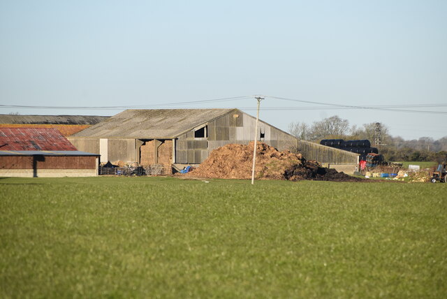
Drellingore Images

Images are sourced within 2km of 51.125494/1.2015171 or Grid Reference TR2441. Thanks to Geograph Open Source API. All images are credited.

Capel Farm
Capel Farm
Capel Farm
Capel Farm
Lych gate, Church of St Mary A lychgate or as two separate words lych gate, is a gateway covered with a roof found at the entrance to a traditional English churchyard. The name comes from the Old English for a corpse (lic) and was traditionally where the clergy met the corpse for burial. It was also a shelter for the pall bearers.
Lych gate, Church of St Mary
A lychgate or as two separate words lych gate, is a gateway covered with a roof found at the entrance to a traditional English churchyard. The name comes from the Old English for a corpse (lic) and was traditionally where the clergy met the corpse for burial. It was also a shelter for the pall bearers.
Lych gate, Church of St Mary St Mary's Church is a redundant Anglican church to the northeast of the village of Capel-le-Ferne. It is a Grade I listed building, and is under the care of the Churches Conservation Trust. The church stands in an isolated position adjacent to Capel Church Farm, to the north of the A20 road and 2 miles northeast of Folkestone.
Wikipedia: <span class="nowrap"><a title="https://en.wikipedia.org/wiki/St_Mary%27s_Church,_Capel-le-Ferne" rel="nofollow ugc noopener" href="https://en.wikipedia.org/wiki/St_Mary%27s_Church,_Capel-le-Ferne">Link</a><img style="margin-left:2px;" alt="External link" title="External link - shift click to open in new window" src="https://s1.geograph.org.uk/img/external.png" width="10" height="10"/></span>
Lych gate, Church of St Mary
St Mary's Church is a redundant Anglican church to the northeast of the village of Capel-le-Ferne. It is a Grade I listed building, and is under the care of the Churches Conservation Trust. The church stands in an isolated position adjacent to Capel Church Farm, to the north of the A20 road and 2 miles northeast of Folkestone. Wikipedia: LinkExternal link
A20 near Capel-le-Ferne Capel street crossing the A20.
A20 near Capel-le-Ferne
Capel street crossing the A20.
Bridge over the A20 near Capel-le-Ferne The A20 runs from the London Borough of Lewisham to Dover, Kent. It runs through the major towns of Maidstone, Ashford and Folkestone, terminating at the port of Dover.
Bridge over the A20 near Capel-le-Ferne
The A20 runs from the London Borough of Lewisham to Dover, Kent. It runs through the major towns of Maidstone, Ashford and Folkestone, terminating at the port of Dover.
Variable Message Sign (VMS) on the A20 near  Capel-le-Ferne Variable message signs (VMS), also sometimes referred to as matrix signs, are electronic traffic signs used on motorways (and some other major routes) to give drivers information about special events and to warn them about traffic congestion, accidents, incidents, roadworks or speed limits on specific sections of the route. They may also suggest (or instruct) drivers to take alternative routes, limit speed, warn of the duration and location of the incidents or just inform them of the traffic conditions.
Variable Message Sign (VMS) on the A20 near Capel-le-Ferne
Variable message signs (VMS), also sometimes referred to as matrix signs, are electronic traffic signs used on motorways (and some other major routes) to give drivers information about special events and to warn them about traffic congestion, accidents, incidents, roadworks or speed limits on specific sections of the route. They may also suggest (or instruct) drivers to take alternative routes, limit speed, warn of the duration and location of the incidents or just inform them of the traffic conditions.
Capel Church Farm
Capel Church Farm
Church of St Mary St Mary's Church is a redundant Anglican church to the northeast of the village of Capel-le-Ferne. It is a Grade I listed building, and is under the care of the Churches Conservation Trust. The church stands in an isolated position adjacent to Capel Church Farm, to the north of the A20 road and 2 miles northeast of Folkestone.
Wikipedia: <span class="nowrap"><a title="https://en.wikipedia.org/wiki/St_Mary%27s_Church,_Capel-le-Ferne" rel="nofollow ugc noopener" href="https://en.wikipedia.org/wiki/St_Mary%27s_Church,_Capel-le-Ferne">Link</a><img style="margin-left:2px;" alt="External link" title="External link - shift click to open in new window" src="https://s1.geograph.org.uk/img/external.png" width="10" height="10"/></span>
Church of St Mary
St Mary's Church is a redundant Anglican church to the northeast of the village of Capel-le-Ferne. It is a Grade I listed building, and is under the care of the Churches Conservation Trust. The church stands in an isolated position adjacent to Capel Church Farm, to the north of the A20 road and 2 miles northeast of Folkestone. Wikipedia: LinkExternal link
Ingleton
Ingleton
Church of St Mary St Mary's Church is a redundant Anglican church to the northeast of the village of Capel-le-Ferne. It is a Grade I listed building, and is under the care of the Churches Conservation Trust. The church stands in an isolated position adjacent to Capel Church Farm, to the north of the A20 road and 2 miles northeast of Folkestone.
Wikipedia: <span class="nowrap"><a title="https://en.wikipedia.org/wiki/St_Mary%27s_Church,_Capel-le-Ferne" rel="nofollow ugc noopener" href="https://en.wikipedia.org/wiki/St_Mary%27s_Church,_Capel-le-Ferne">Link</a><img style="margin-left:2px;" alt="External link" title="External link - shift click to open in new window" src="https://s1.geograph.org.uk/img/external.png" width="10" height="10"/></span>
Church of St Mary
St Mary's Church is a redundant Anglican church to the northeast of the village of Capel-le-Ferne. It is a Grade I listed building, and is under the care of the Churches Conservation Trust. The church stands in an isolated position adjacent to Capel Church Farm, to the north of the A20 road and 2 miles northeast of Folkestone. Wikipedia: LinkExternal link
church of St Mary St Mary's Church is a redundant Anglican church to the northeast of the village of Capel-le-Ferne. It is a Grade I listed building, and is under the care of the Churches Conservation Trust. The church stands in an isolated position adjacent to Capel Church Farm, to the north of the A20 road and 2 miles northeast of Folkestone.
Wikipedia: <span class="nowrap"><a title="https://en.wikipedia.org/wiki/St_Mary%27s_Church,_Capel-le-Ferne" rel="nofollow ugc noopener" href="https://en.wikipedia.org/wiki/St_Mary%27s_Church,_Capel-le-Ferne">Link</a><img style="margin-left:2px;" alt="External link" title="External link - shift click to open in new window" src="https://s1.geograph.org.uk/img/external.png" width="10" height="10"/></span>
church of St Mary
St Mary's Church is a redundant Anglican church to the northeast of the village of Capel-le-Ferne. It is a Grade I listed building, and is under the care of the Churches Conservation Trust. The church stands in an isolated position adjacent to Capel Church Farm, to the north of the A20 road and 2 miles northeast of Folkestone. Wikipedia: LinkExternal link
Font, Church of St Mary St Mary's Church is a redundant Anglican church to the northeast of the village of Capel-le-Ferne. It is a Grade I listed building, and is under the care of the Churches Conservation Trust. The church stands in an isolated position adjacent to Capel Church Farm, to the north of the A20 road and 2 miles northeast of Folkestone.
Wikipedia: <span class="nowrap"><a title="https://en.wikipedia.org/wiki/St_Mary%27s_Church,_Capel-le-Ferne" rel="nofollow ugc noopener" href="https://en.wikipedia.org/wiki/St_Mary%27s_Church,_Capel-le-Ferne">Link</a><img style="margin-left:2px;" alt="External link" title="External link - shift click to open in new window" src="https://s1.geograph.org.uk/img/external.png" width="10" height="10"/></span>
Font, Church of St Mary
St Mary's Church is a redundant Anglican church to the northeast of the village of Capel-le-Ferne. It is a Grade I listed building, and is under the care of the Churches Conservation Trust. The church stands in an isolated position adjacent to Capel Church Farm, to the north of the A20 road and 2 miles northeast of Folkestone. Wikipedia: LinkExternal link
Pulpit, Church of St Mary St Mary's Church is a redundant Anglican church to the northeast of the village of Capel-le-Ferne. It is a Grade I listed building, and is under the care of the Churches Conservation Trust. The church stands in an isolated position adjacent to Capel Church Farm, to the north of the A20 road and 2 miles northeast of Folkestone.
Wikipedia: <span class="nowrap"><a title="https://en.wikipedia.org/wiki/St_Mary%27s_Church,_Capel-le-Ferne" rel="nofollow ugc noopener" href="https://en.wikipedia.org/wiki/St_Mary%27s_Church,_Capel-le-Ferne">Link</a><img style="margin-left:2px;" alt="External link" title="External link - shift click to open in new window" src="https://s1.geograph.org.uk/img/external.png" width="10" height="10"/></span>
Pulpit, Church of St Mary
St Mary's Church is a redundant Anglican church to the northeast of the village of Capel-le-Ferne. It is a Grade I listed building, and is under the care of the Churches Conservation Trust. The church stands in an isolated position adjacent to Capel Church Farm, to the north of the A20 road and 2 miles northeast of Folkestone. Wikipedia: LinkExternal link
Altar, Church of St Mary St Mary's Church is a redundant Anglican church to the northeast of the village of Capel-le-Ferne. It is a Grade I listed building, and is under the care of the Churches Conservation Trust. The church stands in an isolated position adjacent to Capel Church Farm, to the north of the A20 road and 2 miles northeast of Folkestone.
Wikipedia: <span class="nowrap"><a title="https://en.wikipedia.org/wiki/St_Mary%27s_Church,_Capel-le-Ferne" rel="nofollow ugc noopener" href="https://en.wikipedia.org/wiki/St_Mary%27s_Church,_Capel-le-Ferne">Link</a><img style="margin-left:2px;" alt="External link" title="External link - shift click to open in new window" src="https://s1.geograph.org.uk/img/external.png" width="10" height="10"/></span>
Altar, Church of St Mary
St Mary's Church is a redundant Anglican church to the northeast of the village of Capel-le-Ferne. It is a Grade I listed building, and is under the care of the Churches Conservation Trust. The church stands in an isolated position adjacent to Capel Church Farm, to the north of the A20 road and 2 miles northeast of Folkestone. Wikipedia: LinkExternal link
Graves, Church of St Mary St Mary's Church is a redundant Anglican church to the northeast of the village of Capel-le-Ferne. It is a Grade I listed building, and is under the care of the Churches Conservation Trust. The church stands in an isolated position adjacent to Capel Church Farm, to the north of the A20 road and 2 miles northeast of Folkestone.
Wikipedia: <span class="nowrap"><a title="https://en.wikipedia.org/wiki/St_Mary%27s_Church,_Capel-le-Ferne" rel="nofollow ugc noopener" href="https://en.wikipedia.org/wiki/St_Mary%27s_Church,_Capel-le-Ferne">Link</a><img style="margin-left:2px;" alt="External link" title="External link - shift click to open in new window" src="https://s1.geograph.org.uk/img/external.png" width="10" height="10"/></span>
Graves, Church of St Mary
St Mary's Church is a redundant Anglican church to the northeast of the village of Capel-le-Ferne. It is a Grade I listed building, and is under the care of the Churches Conservation Trust. The church stands in an isolated position adjacent to Capel Church Farm, to the north of the A20 road and 2 miles northeast of Folkestone. Wikipedia: LinkExternal link
Church of St Mary St Mary's Church is a redundant Anglican church to the northeast of the village of Capel-le-Ferne. It is a Grade I listed building, and is under the care of the Churches Conservation Trust. The church stands in an isolated position adjacent to Capel Church Farm, to the north of the A20 road and 2 miles northeast of Folkestone.
Wikipedia: <span class="nowrap"><a title="https://en.wikipedia.org/wiki/St_Mary%27s_Church,_Capel-le-Ferne" rel="nofollow ugc noopener" href="https://en.wikipedia.org/wiki/St_Mary%27s_Church,_Capel-le-Ferne">Link</a><img style="margin-left:2px;" alt="External link" title="External link - shift click to open in new window" src="https://s1.geograph.org.uk/img/external.png" width="10" height="10"/></span>
Church of St Mary
St Mary's Church is a redundant Anglican church to the northeast of the village of Capel-le-Ferne. It is a Grade I listed building, and is under the care of the Churches Conservation Trust. The church stands in an isolated position adjacent to Capel Church Farm, to the north of the A20 road and 2 miles northeast of Folkestone. Wikipedia: LinkExternal link
Show me another place!

Drellingore is located at Grid Ref: TR2441 (Lat: 51.125494, Lng: 1.2015171)

Administrative County: Kent

District: Dover

Police Authority: Kent

What 3 Words

///carbonate.satellite.magnets. Near Capel le Ferne, Kent

Related Wikis

Drellingore

Drellingore is a village in South East Kent, England. It lies in the Alkham Valley, an area of outstanding natural beauty between Folkestone and Dover...

Alkham Valley

The Alkham Valley is in the Kent Downs (the eastern part of the North Downs), an Area of Outstanding Natural Beauty, in South East Kent, England. The valley...

Alkham

Alkham is a village and civil parish in the Dover district of Kent, England, about five miles west of Dover. Within the parish are the settlements of Chalksole...

St Mary's Church, Capel-le-Ferne

St Mary's Church is a redundant Anglican church to the northeast of the village of Capel-le-Ferne, Kent, England. It is recorded in the National Heritage...

Related Videos

Little Switzerland, Great View

Bike ride to the Warren for a cup of tea #littleswitzerland #cafevlog #bikeride #bikevloger Buy me a tea ...

Battle of Britain Memorial #ww2

london #england #uk While vacationing in London, England, in early November 2023, we toured the English countryside on a few ...

Nearby Amenities

Located within 500m of 51.125494,1.2015171
Bus Stop
Drellingore Terrace
Bus: yes
Naptan AtcoCode: 2400A031390A
Naptan Bearing: S
Naptan CommonName: Drellingore Terrace
Naptan Indicator: opp
Naptan Landmark: Drellingore Terrace
Naptan NaptanCode: kntdjgjm
Naptan PlusbusZoneRef: FLKSTNC
Naptan Street: Alkham Valley Road
Naptan Verified: no
Public Transport: platform
Source: naptan_import
Lat/Long: 51.1244594/1.2015995
Bus Stop
Drellingore Terrace
Bus: yes
Naptan AtcoCode: 2400A031400A
Naptan Bearing: N
Naptan CommonName: Drellingore Terrace
Naptan Indicator: adj
Naptan Landmark: Drellingore Terrace
Naptan NaptanCode: kntdjgjp
Naptan PlusbusZoneRef: FLKSTNC
Naptan Street: Alkham Valley Road
Naptan Verified: no
Public Transport: platform
Source: naptan_import
Lat/Long: 51.124183/1.2015089
The data included in this document is from www.openstreetmap.org. The data is made available under ODbL.

Have you been to Drellingore?

Leave your review of Drellingore below (or comments, questions and feedback).