Snowden Hill

Settlement in Yorkshire

England

Snowden Hill

Stocksbridge and Hunshelf Bank Stocksbridge and Hunshelf Bank as seen from Heads Lane.
Stocksbridge and Hunshelf Bank Credit: Dave Pickersgill

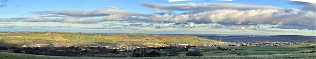
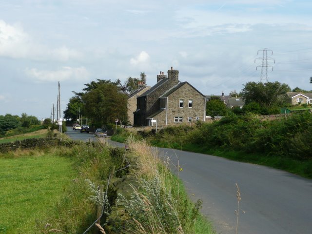
Snowden Hill is a picturesque village nestled in the heart of Yorkshire, England. Located in the district of Harrogate, it is surrounded by rolling hills and lush green landscapes, making it a popular destination for nature enthusiasts and hikers.

The village itself is small but charming, with a population of around 500 residents. It exudes a sense of tranquility and offers a peaceful retreat from the hustle and bustle of city life. The architecture is predominantly traditional, with beautiful stone houses and cottages that date back several centuries.

One of the main attractions in Snowden Hill is its close proximity to the Yorkshire Dales National Park. This vast expanse of unspoiled beauty offers stunning vistas, rugged moorlands, and picturesque valleys. It provides ample opportunities for outdoor activities such as hiking, cycling, and birdwatching.

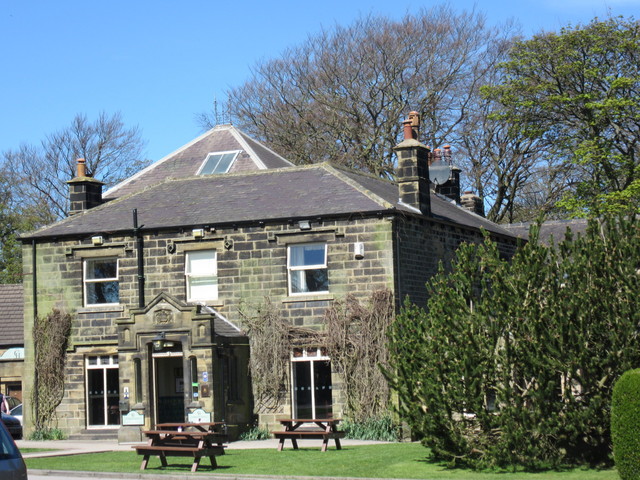
The village is also known for its friendly and welcoming community. The locals take great pride in their village and often organize events and festivals to showcase the area's rich heritage and culture. The village pub, The Snowden Arms, is a popular gathering spot for both residents and visitors, offering a warm atmosphere and traditional Yorkshire fare.

In terms of amenities, Snowden Hill has a small convenience store, a primary school, and a village hall that hosts various community activities. For more extensive shopping and entertainment options, the nearby town of Harrogate is easily accessible.

Overall, Snowden Hill offers a serene and idyllic setting, making it a perfect destination for those seeking a peaceful countryside retreat with easy access to stunning natural surroundings.

If you have any feedback on the listing, please let us know in the comments section below.

Snowden Hill Images

Images are sourced within 2km of 53.502787/-1.606471 or Grid Reference SE2600. Thanks to Geograph Open Source API. All images are credited.

Stocksbridge and Hunshelf Bank Stocksbridge and Hunshelf Bank as seen from Heads Lane.
Stocksbridge and Hunshelf Bank
Stocksbridge and Hunshelf Bank as seen from Heads Lane.
Langsett bridge Bridge to Langsett reservoir
Langsett bridge
Bridge to Langsett reservoir
A616 lay-by near Sheephouse Wood
A616 Stocksbridge Bypass
A616 Stocksbridge Bypass near Crimbles Farm
Underbank Reservoir: dam wall and run-off
The run-off at Underbank Reservoir The run-off at Underbank Reservoir, seen from Underbank Lane.
The run-off at Underbank Reservoir
The run-off at Underbank Reservoir, seen from Underbank Lane.
Green Moor Road Heading west.
Green Moor Road
Heading west.
Farmland north of Green Moor Road
Farmland and pylon off Hunshelf Hall Lane
Field entrance off Hunshelf Hall Lane
Hunshelf Hall Lane Heading north west at the junction with Dean Head Lane.
Hunshelf Hall Lane
Heading north west at the junction with Dean Head Lane.
Edgecliffe Farm Very aptly named as it sits below Hunshelf Bank with a steep hill down to Stocksbridge and the Little Don Valley
Edgecliffe Farm
Very aptly named as it sits below Hunshelf Bank with a steep hill down to Stocksbridge and the Little Don Valley
Who's got their wires crossed? High voltage electricity cables and pylons on Hunshelf Bank
Who's got their wires crossed?
High voltage electricity cables and pylons on Hunshelf Bank
Mucky by name and mucky by nature  Fly tipping on Mucky Lane
Mucky by name and mucky by nature
Fly tipping on Mucky Lane
The gateway to Underbank Hall
Path in Sheephouse Wood The path, which forms part of the Barnsley Boundary Walk, here lies on the line of a narrow gauage railway used in the construction of Langsett Reservoir at the turn of the 20th century. Behind the path is the Sheephouse works, a building over 350m in length that once produced steel wire but now lies empty following its recent closure.
Path in Sheephouse Wood
The path, which forms part of the Barnsley Boundary Walk, here lies on the line of a narrow gauage railway used in the construction of Langsett Reservoir at the turn of the 20th century. Behind the path is the Sheephouse works, a building over 350m in length that once produced steel wire but now lies empty following its recent closure.
An old sheep dip? Beside Hunshelf Hall Lane
An old sheep dip?
Beside Hunshelf Hall Lane
Show me another place!

Snowden Hill is located at Grid Ref: SE2600 (Lat: 53.502787, Lng: -1.606471)

Division: West Riding

Unitary Authority: Barnsley

Police Authority: South Yorkshire

What 3 Words

///worms.stuck.damp. Near Stocksbridge, South Yorkshire

Related Wikis

Penistone and Stocksbridge (UK Parliament constituency)

Penistone and Stocksbridge is a constituency in South Yorkshire represented in the House of Commons of the UK Parliament since 2019 by Miriam Cates, a...

Hunshelf

Hunshelf is a civil parish in the Metropolitan Borough of Barnsley. At the 2001 census it had a population of 324, reducing to 246 at the 2011 Census...

Oxspring railway station

Oxspring railway station was a short lived station built by the Sheffield, Ashton-under-Lyne and Manchester Railway to serve the village of Oxspring, South...

Oxspring

Oxspring is a village and civil parish in the Metropolitan Borough of Barnsley in South Yorkshire, England. At the 2001 census it had a population of...

Thurgoland Tunnel

Thurgoland Tunnel is a double-bore abandoned railway tunnel between Penistone and Wortley. Its total length is 924 feet (282 m). The original tunnel, a...

Cubley, South Yorkshire

Cubley is a village in the metropolitan borough of Barnsley in South Yorkshire, England. It is about a mile to the south of Penistone town centre and essentially...

Stocksbridge railway station

Stocksbridge was a small railway halt, the terminus of, and only railway station on the Stocksbridge Railway. The platform was a simple wooden affair,...

Penistone Church F.C.

Penistone Church Football Club is an English football club based in Penistone, Barnsley, South Yorkshire. They play in the Northern Counties East League...

Nearby Amenities

Located within 500m of 53.502787,-1.606471
Power: tower
Lat/Long: 53.5017865/-1.6052436
Power: tower
Lat/Long: 53.504554/-1.60682
Design: barrel
Power: tower
Lat/Long: 53.5072675/-1.6068425
Design: barrel
Power: tower
Lat/Long: 53.5012268/-1.6035542
Power: tower
Lat/Long: 53.5069463/-1.6081863
Design: barrel
Power: tower
Lat/Long: 53.5039841/-1.6050978
Snowden Hill
Place: locality
Lat/Long: 53.5026928/-1.6050932
Power: pole
Lat/Long: 53.5052013/-1.6119565
Power: pole
Lat/Long: 53.5039172/-1.6110965
Power: pole
Lat/Long: 53.501488/-1.6094543
Power: pole
Lat/Long: 53.5002965/-1.6080705
Power: pole
Lat/Long: 53.4990565/-1.606577
Barrier: stile
Lat/Long: 53.5015537/-1.6136137
Barrier: stile
Lat/Long: 53.5004749/-1.6124587
Barrier: stile
Lat/Long: 53.4989506/-1.6081836
Post Box
Collection Times: Mo-Fr 16:30; Sa 11:15
Post Box Type: lamp
Ref: S36 587
Royal Cypher: EIIR
Royal Cypher Wikidata: Q33102113
Lat/Long: 53.5014343/-1.6077199
Generator Method: wind_turbine
Generator Source: wind
Power: generator
Lat/Long: 53.4988541/-1.6094942
Barrier: stile
Lat/Long: 53.500466/-1.6009244
Barrier: stile
Lat/Long: 53.5008697/-1.6007208
Barrier: stile
Lat/Long: 53.5009472/-1.6006929
The data included in this document is from www.openstreetmap.org. The data is made available under ODbL.

Have you been to Snowden Hill?

Leave your review of Snowden Hill below (or comments, questions and feedback).