Slough

Settlement in Buckinghamshire

England

Slough

Slough Station
Slough Station Credit: Claire Ward

Slough is a town located in the county of Buckinghamshire, England. Situated just 20 miles west of London, it is part of the Greater London Urban Area. With a population of approximately 164,000 people, it is one of the most populous towns in Buckinghamshire.

Historically, Slough was a small village until the 19th century when it experienced significant growth due to its proximity to London and the establishment of the Great Western Railway. Today, it is known for its diverse and multicultural community, with a large number of immigrants from South Asia, Africa, and Eastern Europe.

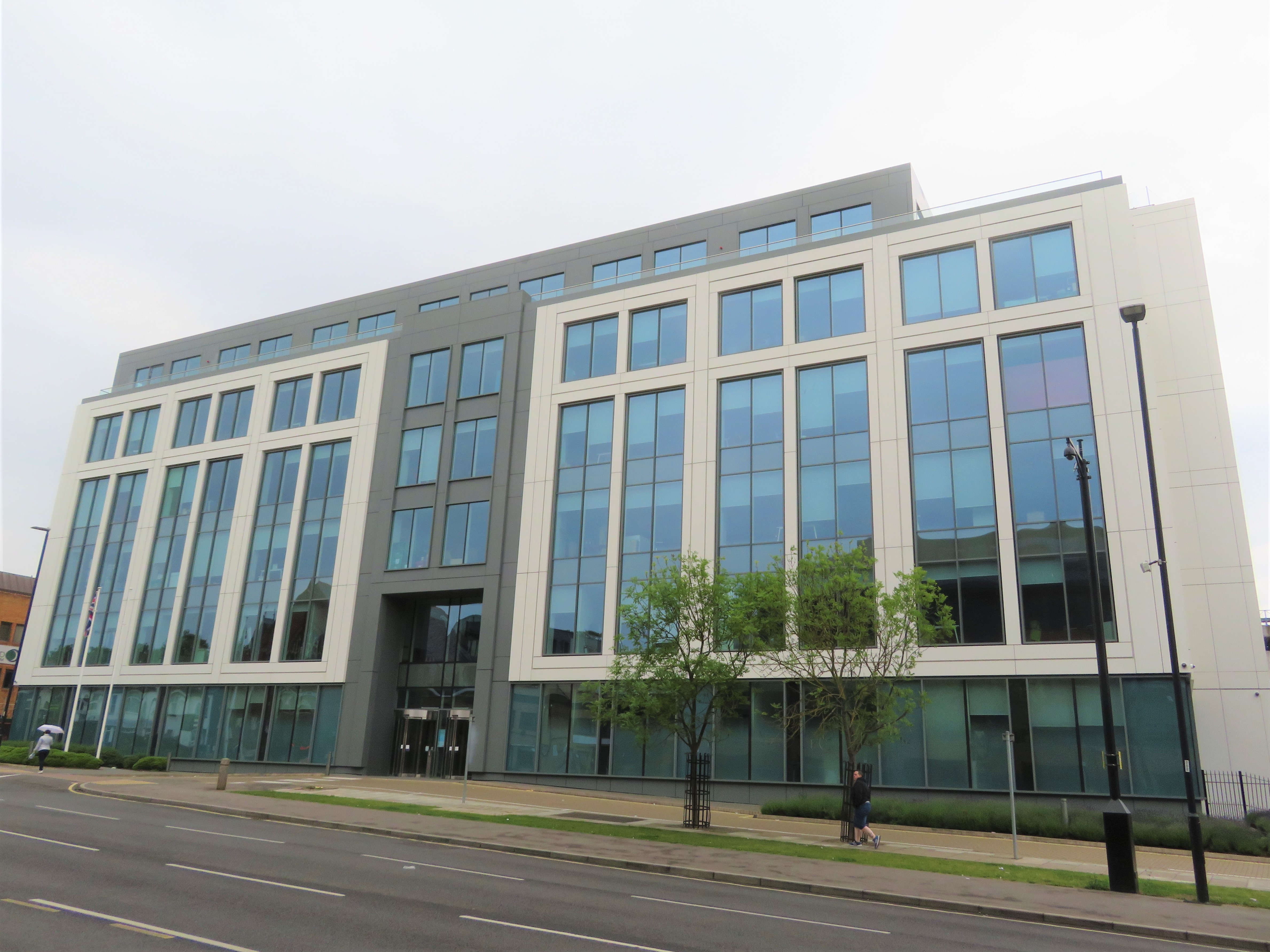
The town boasts a thriving economy, with numerous industries contributing to its success. Slough is home to the largest industrial estate in Europe, the Slough Trading Estate, which houses a wide range of businesses, including major multinational companies. Additionally, Slough is known for its significant presence in the technology and telecommunications sectors.

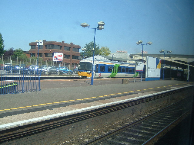
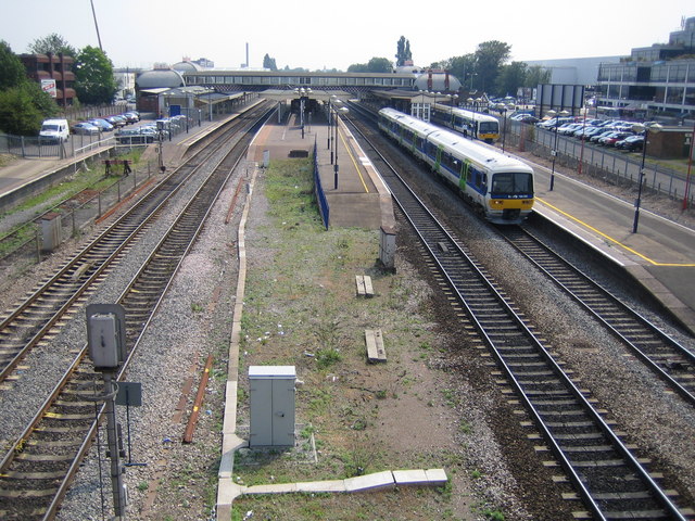
In terms of transportation, Slough benefits from excellent connectivity. It has direct train services to London Paddington, Reading, and Oxford, making it an attractive location for commuters. The town is also well-connected by road, with easy access to major motorways like the M4 and M25.

Slough is not only an industrial hub but also offers a variety of leisure and cultural amenities. It features several parks and green spaces, providing residents with opportunities for outdoor activities. The town also has a range of shopping centers, entertainment venues, and restaurants, catering to diverse tastes.

Overall, Slough is a vibrant and dynamic town with a rich cultural heritage, a strong economy, and excellent transport links, making it an attractive place to live, work, and visit.

If you have any feedback on the listing, please let us know in the comments section below.
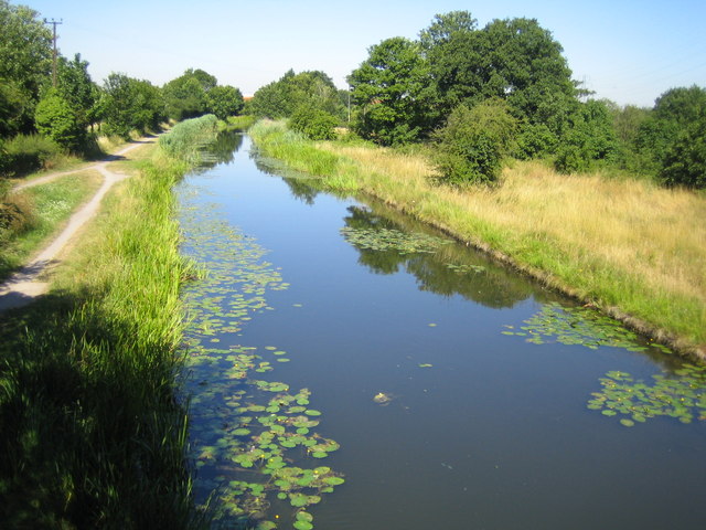
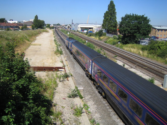
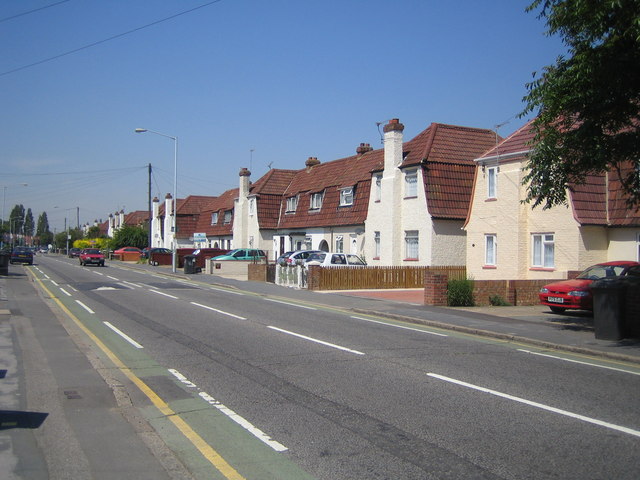
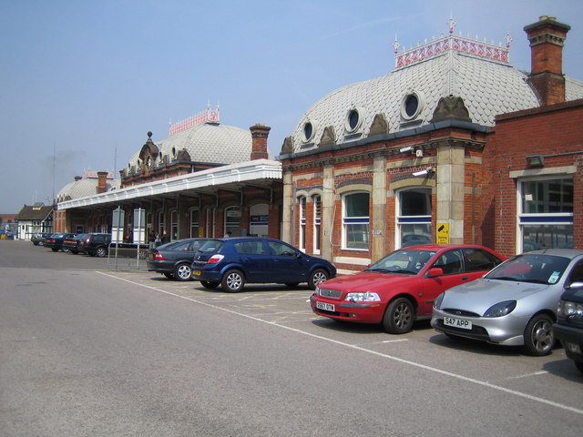
Slough Images

Images are sourced within 2km of 51.508857/-0.59295813 or Grid Reference SU9779. Thanks to Geograph Open Source API. All images are credited.

Slough Station
Slough Station
The Three Tuns The busy junction between the A4 Bath Road, and the A355 which joins the M4 at Junction 6. It is known as "The Three Tuns" after the pub shown here.
The Three Tuns
The busy junction between the A4 Bath Road, and the A355 which joins the M4 at Junction 6. It is known as "The Three Tuns" after the pub shown here.
Grand Union Canal: Slough branch Unlikely scene in the middle of Slough. Taken on a winter evening, looking east.
Grand Union Canal: Slough branch
Unlikely scene in the middle of Slough. Taken on a winter evening, looking east.
Stoke Poges Lane Once a rural lane, now a very busy road.
Stoke Poges Lane
Once a rural lane, now a very busy road.
The Frithe, Upton Lea, Slough Looking west across the end of Knolton way
The Frithe, Upton Lea, Slough
Looking west across the end of Knolton way
Grand Union Canal (Slough Arm) Viewed looking towards Slough from the Middlegreen Road bridge, this was the last branch of the Grand Union Canal to be opened, as late as 1882, and long after the railway line that parallels it to the south. The canal  also represents the boundary between the local government areas of Slough Borough Council (to the left) and South Bucks District Council (to the right).
Grand Union Canal (Slough Arm)
Viewed looking towards Slough from the Middlegreen Road bridge, this was the last branch of the Grand Union Canal to be opened, as late as 1882, and long after the railway line that parallels it to the south. The canal also represents the boundary between the local government areas of Slough Borough Council (to the left) and South Bucks District Council (to the right).
Slough: Main line railway Viewed looking towards Slough railway station from the Wexham Road bridge with a westbound First Great Western express train.
Slough: Main line railway
Viewed looking towards Slough railway station from the Wexham Road bridge with a westbound First Great Western express train.
Slough: The Horlicks factory One of Slough's iconic images, the Horlicks factory on Stoke Poges Lane was completed in 1908 at a cost of £28,000. The brand name and the site now belong to GlaxoSmithKline. Everything you ever wanted to know about Horlicks (for example that India is by far the largest market for the product) is contained in the Wikipedia article <span class="nowrap"><a title="http://en.wikipedia.org/wiki/Horlicks" rel="nofollow ugc noopener" href="http://en.wikipedia.org/wiki/Horlicks">Link</a><img style="margin-left:2px;" alt="External link" title="External link - shift click to open in new window" src="https://s1.geograph.org.uk/img/external.png" width="10" height="10"/></span> , and, for a free plug which should ensure I get a lifetime supply of the stuff, here's Horlick's own website <span class="nowrap"><a title="http://www.horlicks.co.uk/" rel="nofollow ugc noopener" href="http://www.horlicks.co.uk/">Link</a><img style="margin-left:2px;" alt="External link" title="External link - shift click to open in new window" src="https://s1.geograph.org.uk/img/external.png" width="10" height="10"/></span>
Slough: The Horlicks factory
One of Slough's iconic images, the Horlicks factory on Stoke Poges Lane was completed in 1908 at a cost of £28,000. The brand name and the site now belong to GlaxoSmithKline. Everything you ever wanted to know about Horlicks (for example that India is by far the largest market for the product) is contained in the Wikipedia article LinkExternal link , and, for a free plug which should ensure I get a lifetime supply of the stuff, here's Horlick's own website LinkExternal link
Slough: Main line railway Viewed looking away from Slough from the A355 Farnham Road bridge.
Slough: Main line railway
Viewed looking away from Slough from the A355 Farnham Road bridge.
Slough: Elliman Avenue Home of a housing estate with unusual houses built with their chimneys at the front, Elliman Avenue is named after one of Slough's municipal benefactors, James Elliman (yes, he of Elliman's Embrocation fame). Some houses along the road, such as the salmon-coloured one on the right side of the photo, have had their chimneys removed.
Slough: Elliman Avenue
Home of a housing estate with unusual houses built with their chimneys at the front, Elliman Avenue is named after one of Slough's municipal benefactors, James Elliman (yes, he of Elliman's Embrocation fame). Some houses along the road, such as the salmon-coloured one on the right side of the photo, have had their chimneys removed.
Slough railway station The Grade II listed station ticket booking hall and main entrance built in 1882.
Slough railway station
The Grade II listed station ticket booking hall and main entrance built in 1882.
Slough railway station Looking from the William Street overbridge to the west of the station with a westbound fast train approaching, the train in the far bay to the right is about to leave along the short branch line to Windsor.
Slough railway station
Looking from the William Street overbridge to the west of the station with a westbound fast train approaching, the train in the far bay to the right is about to leave along the short branch line to Windsor.
Grand Union Canal (Slough Arm) The uninspiring end of the 1882-built Slough Arm of the Grand Union Canal to the east of Stoke Road in Slough, with the boat turning head basin in the foreground. The canal was built originally to convey bricks, and then gravel, to London. Later the canal was used to fill the brick and gravel pits with London's waste.
Grand Union Canal (Slough Arm)
The uninspiring end of the 1882-built Slough Arm of the Grand Union Canal to the east of Stoke Road in Slough, with the boat turning head basin in the foreground. The canal was built originally to convey bricks, and then gravel, to London. Later the canal was used to fill the brick and gravel pits with London's waste.
Brunel Bus Station, Slough This infamous 1960s concrete landmark is Slough's bus station with a car park above
Brunel Bus Station, Slough
This infamous 1960s concrete landmark is Slough's bus station with a car park above
Slough fire station Slough fire station, Tuns Lane, Slough, Berkshire
Slough fire station
Slough fire station, Tuns Lane, Slough, Berkshire
End of the canal This is the very end of the Slough Arm of the Grand Union Canal.
End of the canal
This is the very end of the Slough Arm of the Grand Union Canal.
Bridge over the canal near Slough This bridge takes the Wexham Road over the Slough arm of the Grand Union Canal.
Bridge over the canal near Slough
This bridge takes the Wexham Road over the Slough arm of the Grand Union Canal.
Grand Union Canal, Slough arm. A view East along the canal.
Grand Union Canal, Slough arm.
A view East along the canal.
Show me another place!

Slough is located at Grid Ref: SU9779 (Lat: 51.508857, Lng: -0.59295813)

Unitary Authority: Slough

Police Authority: Thames Valley

What 3 Words

///nodded.chest.grades. Near Slough, Berkshire

Nearby Locations

Upton Park Slough

Related Wikis

Municipal Borough of Slough

Slough was, from 1863 to 1974, a local government district in southern Buckinghamshire, England. It became an urban district in 1894 and was incorporated...

St Ethelbert's Church, Slough

St Ethelbert's Church or Our Lady Immaculate and St Ethelbert's Church is a Roman Catholic parish church in Slough, Berkshire, England. It was built from...

Observatory House

Observatory House was the name of an 18th-century observatory established by William and Caroline Herschel in Windsor Street, Slough. After the original...

40-foot telescope

William Herschel's 40-foot telescope, also known as the Great Forty-Foot telescope, was a reflecting telescope constructed between 1785 and 1789 at Observatory...

Nearby Amenities

Located within 500m of 51.508857,-0.59295813
Traffic Signals
Lat/Long: 51.5133139/-0.5935958
Traffic Signals
Traffic Signals: pedestrian_crossing
Lat/Long: 51.5061402/-0.5976159
Traffic Calming: table
Lat/Long: 51.5075873/-0.592496
Parking
Lat/Long: 51.5085483/-0.5948039
Barrier: bollard
Lat/Long: 51.5088967/-0.5943645
Traffic Signals
Traffic Signals: signal
Lat/Long: 51.5097475/-0.5894576
Traffic Signals
Traffic Signals Direction: forward
Lat/Long: 51.5102306/-0.5979087
Crossing
Bicycle: yes
Crossing: traffic_signals
Crossing Ref: toucan
Lat/Long: 51.5119596/-0.5940684
Railway: switch
Lat/Long: 51.5122784/-0.5973738
Mini Roundabout
Lat/Long: 51.5097617/-0.599183
Crossing
Lat/Long: 51.5057077/-0.5959462
Slough
Phonetic En: /ˈslaʊ/
Place: town
Population: 164455
Wikidata: Q211907
Wikipedia: en:Slough
Lat/Long: 51.5111014/-0.5940682
Police
Slough Police Station
Lat/Long: 51.5071681/-0.5975215
Parking
Lat/Long: 51.5073841/-0.5928395
Pub
The Wheatsheaf
Brand: Fuller's
Brand Wikidata: Q5253950
Website: https://www.wheatsheafslough.co.uk/
Lat/Long: 51.5045593/-0.5920241
Pub
The Herschel Arms
Lat/Long: 51.5072837/-0.5912354
Pub
The Queen of England
Lat/Long: 51.5066818/-0.5914694
Check Date: 2009-12-12
Disused Amenity: pharmacy
Old Name: Lloyds Pharmacy
Lat/Long: 51.5062156/-0.5918939
Shop: convenience
Lat/Long: 51.5046262/-0.5923338
Stows Cycles Ltd
Shop: bicycle
Lat/Long: 51.5098878/-0.5969399
Bicycle Parking
Lat/Long: 51.5122968/-0.5900838
Bench
Lat/Long: 51.5123029/-0.5901447
Crossing
Bicycle: yes
Crossing: traffic_signals
Crossing Island: yes
Crossing Ref: toucan
Lat/Long: 51.5104462/-0.5922735
Fuel
Tesco
Brand: Tesco
Brand Wikidata: Q487494
Brand Wikipedia: en:Tesco
Website: https://www.tesco.com/store-locator/slough/brunel-way/petrol-filling-station
Lat/Long: 51.5100198/-0.589259
Parking
Church Street Car Park
Source: Local knowledge
Lat/Long: 51.5075531/-0.5939834
Travelodge
Brand: Travelodge
Brand Wikidata: Q9361374
Brand Wikipedia: en:Travelodge UK
Fax: +44 1753 692923
Internet Access: wlan
Internet Access Fee: customers
Internet Access Ssid: Travelodge WiFi
Phone: +44 871 984 6253
Source: Observation, Yahoo Sat
Tourism: hotel
Website: https://www.travelodge.co.uk/hotels/249/Slough-hotel
Lat/Long: 51.5082751/-0.5948867
Bicycle Parking
Slough Station bike racks
Bicycle Parking: stands
Capacity: 32
Covered: yes
Fee: no
Lat/Long: 51.512192/-0.5910757
Entrance: yes
Lat/Long: 51.511825/-0.5914675
Access: customers
Barrier: turnstile
Gate: ticket_gate
Lat/Long: 51.5118822/-0.5914485
Access: customers
Barrier: turnstile
Gate: ticket_gate
Lat/Long: 51.5123158/-0.591374
Entrance: yes
Lat/Long: 51.5123745/-0.5913481
Traffic Signals
Traffic Signals Direction: forward
Lat/Long: 51.5104813/-0.5948391
Traffic Signals
Traffic Signals: pedestrian_crossing
Lat/Long: 51.5099506/-0.5895262
Restaurant
PizzaExpress
Brand: PizzaExpress
Brand Wikidata: Q662845
Brand Wikipedia: en:PizzaExpress
Check Date: 2018-01-27
Cuisine: pizza
Internet Access: wlan
Internet Access Fee: no
Phone: +44 1753 825 893
Wheelchair: yes
Lat/Long: 51.5097564/-0.5963279
Traffic Signals
Traffic Signals Direction: forward
Lat/Long: 51.5105778/-0.5947787
Pub
The Moon and Spoon
Addr Country: GB
Addr Housenumber: 86-88
Addr Postcode: SL1 1EL
Addr Street: High Street
Brand: Wetherspoon
Brand Wikidata: Q6109362
Brand Wikipedia: en:Wetherspoons
Contact Website: https://www.jdwetherspoon.com/pubs/all-pubs/england/berkshire/the-moon-and-spoon-slough
Cuisine: regional
Smoking: no
Wheelchair: yes
Lat/Long: 51.5095021/-0.5958583
Pub
The Rising Sun
Cuisine: regional
Smoking: no
Wheelchair: yes
Lat/Long: 51.5086562/-0.5960574
Railway: switch
Lat/Long: 51.5114089/-0.5876199
Railway: switch
Lat/Long: 51.511652/-0.5878617
Railway: switch
Lat/Long: 51.5125666/-0.5962391
Railway: switch
Lat/Long: 51.5125354/-0.5946588
Railway: switch
Lat/Long: 51.512618/-0.5941391
Malinka
Shop: convenience
Lat/Long: 51.5095862/-0.5951772
Primark
Addr City: Slough
Addr Country: GB
Addr Housename: Observatory Shopping Centre
Addr Postcode: SL1 1LE
Addr Street: High Street
Addr Unit: 6-10
Brand: Primark
Brand Wikidata: Q137023
Brand Wikipedia: en:Primark
Contact Website: https://stores.primark.com/united-kingdom/slough/unit-8-the-observatory
Shop: clothes
Wheelchair: yes
Lat/Long: 51.5083299/-0.5878476
Disused Amenity: bank
Note: Closed July 2015
Old Name: Santander
Wheelchair: yes
Lat/Long: 51.5090764/-0.594229
Snappy Snaps
Brand: Snappy Snaps
Brand Wikidata: Q7547351
Brand Wikipedia: en:Snappy Snaps
Operator: Snappy Snaps
Shop: photo
Lat/Long: 51.5092407/-0.5940603
Slough
Public Transport: stop_position
Railway: stop
Ref: 3
Train: yes
Lat/Long: 51.5119/-0.5906011
Slough
Public Transport: stop_position
Railway: stop
Ref: 4
Train: yes
Lat/Long: 51.5123304/-0.5924
Railway: switch
Lat/Long: 51.5127797/-0.5949994
Orega Slough
Addr City: Slough
Addr Housenumber: 42-44
Addr Postcode: SL1 1EL
Addr Street: High Street
Office: company
Opening Hours: Mo-Fr 8:30-18:00
Phone: +44 800 840 5509
Website: https://www.orega.com/serviced-offices/slough/
Lat/Long: 51.509664/-0.596104
Telephone
Booth: KX100
Check Date: 2022-09-04
Covered: booth
Lat/Long: 51.5118501/-0.5915793
Bicycle Parking
Bicycle Parking: stands
Capacity: 16
Covered: no
Lat/Long: 51.5115488/-0.5914583
Bicycle Parking
Bicycle Parking: stands
Capacity: 10
Covered: yes
Lat/Long: 51.5118843/-0.5918085
Bicycle Parking
Bicycle Parking: stands
Capacity: 24
Covered: no
Lat/Long: 51.5118959/-0.5921113
Post Box
Check Date: 2022-09-04
Collection Plate: CP1
Collection Times: Mo-Fr 16:00; Sa 10:30
Operator: Royal Mail
Operator Wikidata: Q638098
Post Box Type: pillar
Ref: SL1 3
Royal Cypher: GR
Royal Cypher Wikidata: Q33102273
Lat/Long: 51.5118617/-0.5916555
Telephone
Booth: KX100
Check Date: 2022-09-04
Covered: booth
Lat/Long: 51.5118543/-0.5916007
Telephone
Booth: KX100
Check Date: 2022-09-04
Covered: booth
Lat/Long: 51.5118567/-0.591622
Cafe
Pumpkin
Brand: Pumpkin
Brand Wikidata: Q27825961
Brand Wikipedia: en:Pumpkin Café Shop
Cuisine: coffee_shop
Takeaway: yes
Toilets: yes
Toilets Wheelchair: yes
Wheelchair: yes
Lat/Long: 51.5118434/-0.5915416
Telephone
Booth: KX100
Check Date: 2022-09-04
Covered: booth
Lat/Long: 51.5118668/-0.591685
Bicycle Rental
Capacity: 32
Operator: Cycle Hire Slough
Website: https://www.cycleslough.com/
Lat/Long: 51.5112718/-0.5916373
Clock
Lat/Long: 51.5118451/-0.591472
Bicycle Parking
Bicycle Parking: stands
Capacity: 80
Covered: yes
Indoor: yes
Lat/Long: 51.5120004/-0.5933922
Taxi
Lat/Long: 51.5117617/-0.5912366
Atm
Brand: NatWest
Brand Wikidata: Q2740021
Operator: NatWest
Operator Wikidata: Q2740021
Wheelchair: yes
Lat/Long: 51.5117934/-0.5911957
Entrance: yes
Lat/Long: 51.511938/-0.5932069
Barrier: bollard
Lat/Long: 51.5061617/-0.5894374
Telephone
Addr City: Slough
Addr Housename: Slough Railway Station Platforms 3&4
Addr Street: Railway Terrace
Booth: KX200
Check Date: 2022-03-16
Covered: booth
Mapillary: 955216048857725
Operator: BT
Operator Wikidata: Q593786
Payment Coins: yes
Lat/Long: 51.5121816/-0.5919258
Fast Food
Burger King
Addr Street: High Street
Brand: Burger King
Brand Wikidata: Q177054
Brand Wikipedia: en:Burger King
Cuisine: burger
Takeaway: yes
Wheelchair: yes
Lat/Long: 51.5087731/-0.592705
Cafe
Starbucks
Addr Street: High Street
Brand: Starbucks
Brand Wikidata: Q37158
Brand Wikipedia: en:Starbucks
Check Date: 2018-01-27
Cuisine: coffee_shop
Internet Access: wlan
Official Name: Starbucks Coffee
Opening Hours: Mo-Sa 06:00-19:30,Su 7:00-6:30
Takeaway: yes
Wheelchair: yes
Lat/Long: 51.5087961/-0.5928644
Bus Stop
Slough Bus Station
Bus: yes
Local Ref: 4
Public Transport: platform
Lat/Long: 51.511298/-0.5929963
Bus Stop
Slough Bus Station
Bus: yes
Local Ref: 10
Public Transport: platform
Lat/Long: 51.5116569/-0.5928518
Bus Stop
Slough Bus Station
Bus: yes
Local Ref: 7
Public Transport: platform
Lat/Long: 51.5114916/-0.5929159
Bus Stop
Slough Bus Station
Bus: yes
Local Ref: 5
Public Transport: platform
Lat/Long: 51.5113614/-0.5929749
Bus Stop
Slough Bus Station
Bus: yes
Local Ref: 3
Public Transport: platform
Lat/Long: 51.5112379/-0.5930234
Bus Stop
Slough Bus Station
Bus: yes
Local Ref: 9
Public Transport: platform
Lat/Long: 51.5115983/-0.5928732
Bus Stop
Slough Bus Station
Bus: yes
Covered: yes
Local Ref: 2
Public Transport: platform
Lat/Long: 51.5111878/-0.5930382
Bus Stop
Slough Bus Station
Bus: yes
Local Ref: 8
Public Transport: platform
Lat/Long: 51.5115449/-0.5928947
Bus Stop
Slough Bus Station
Bus: yes
Local Ref: 6
Public Transport: platform
Lat/Long: 51.5114282/-0.592943
Bus Stop
Slough Bus Station
Bench: yes
Bin: yes
Bus: yes
Covered: yes
Lit: yes
Local Ref: 1
Public Transport: platform
Ref: 98000
Lat/Long: 51.5111331/-0.5930596
Bus Stop
Wellington Street
Bus: yes
Local Ref: D
Public Transport: platform
Lat/Long: 51.5102352/-0.5927499
Turning Circle
Lat/Long: 51.5079334/-0.5868414
Bus Stop
Wexham Road
Bench: yes
Bus: yes
Local Ref: L
Naptan AtcoCode: 03700345
Operator: First
Public Transport: platform
Shelter: yes
Lat/Long: 51.5075012/-0.5863342
Bus Stop
Observatory Center
Bench: yes
Bus: yes
Departures Board: realtime
Local Ref: M
Naptan AtcoCode: 03700344
Operator: First
Public Transport: platform
Shelter: yes
Lat/Long: 51.5077474/-0.5882506
Bus Stop
Queensmere Car Park
Bus: yes
Local Ref: H
Naptan AtcoCode: 03700340
Public Transport: platform
Ref: 76823
Lat/Long: 51.509892/-0.5906007
Bus Stop
Herschel Street
Bus: yes
Local Ref: N
Naptan AtcoCode: 03700347
Public Transport: platform
Lat/Long: 51.5073443/-0.5909852
Bus Stop
Queensmere Centre
Bus: yes
Departures Board: realtime
Local Ref: P
Naptan AtcoCode: 03700330
Public Transport: platform
Shelter: yes
Lat/Long: 51.5092154/-0.5942508
Bus Stop
Brunel Way
Bus: yes
Local Ref: 11
Public Transport: platform
Shelter: no
Lat/Long: 51.511733/-0.5926645
Slough
Public Transport: stop_position
Railway: stop
Ref: 1
Train: yes
Lat/Long: 51.5120118/-0.5921859
Slough
Public Transport: stop_position
Railway: stop
Ref: 2
Train: yes
Lat/Long: 51.51231/-0.5933386
Slough
Public Transport: stop_position
Railway: stop
Ref: 5
Train: yes
Lat/Long: 51.5120164/-0.5902364
Cafe
Starbucks
Brand: Starbucks
Brand Wikidata: Q37158
Brand Wikipedia: en:Starbucks
Cuisine: coffee_shop
Internet Access: wlan
Internet Access Fee: no
Official Name: Starbucks Coffee
Opening Hours: Mo-Fr 06:00-20:00; Sa 07:00-19:00; Su 08:00-18:30; PH 08:00-18:30
Takeaway: yes
Website: https://www.starbucks.com/store-locator/store/1021658/slough-23-5-degrees-brunel-way-1-brunel-way-slough-eng-sl-1-1-xl-gb
Wheelchair: yes
Lat/Long: 51.5115819/-0.5922934
Entrance: main
Lat/Long: 51.5116103/-0.5921189
Entrance: yes
Lat/Long: 51.5116454/-0.5922997
Entrance: secondary
Level: 0
Wheelchair: yes
Lat/Long: 51.5104141/-0.5918156
Cafe
The Cafe
Internet Access: wlan
Level: 1
Opening Hours: Mo-Sa 08:00-18:00; Su 09:30-16:00
Lat/Long: 51.5105509/-0.5915149
Holland & Barrett
Brand: Holland & Barrett
Brand Wikidata: Q5880870
Brand Wikipedia: en:Holland & Barrett
Level: 1
Opening Hours: Mo-We, Sa 09:00-20:00; Th-Fr 09:00-21:00; Su 10:00-16:00
Shop: health_food
Lat/Long: 51.5102823/-0.5908413
Jewels Of Dubai
Level: 1
Shop: jewelry
Lat/Long: 51.5080043/-0.5924876
Beauty Shop
Opening Hours: Mo-Sa 09:00-21:00; Su 10:00-16:00
Shop: beauty
Lat/Long: 51.5103395/-0.5911484
Gould
Brand: Gould Barbers
Brand Wikidata: Q113457937
Shop: hairdresser
Website: https://www.gouldbarbers.co.uk/locations/slough
Lat/Long: 51.5103539/-0.5912522
Vending Machine
Vending: parking_tickets
Lat/Long: 51.5123481/-0.5907813
Entrance: yes
Lat/Long: 51.5126359/-0.5916037
Pharmacy
Tesco Pharmacy
Dispensing: yes
Healthcare: pharmacy
Opening Hours: Mo-Sa 09:00-23:00; Su 10:00-16:00
Wheelchair: yes
Lat/Long: 51.510792/-0.5910805
WHSmith
Brand: WHSmith
Brand Wikidata: Q1548712
Brand Wikipedia: en:WHSmith
Shop: newsagent
Lat/Long: 51.5083247/-0.5916414
Post Office
Slough
Addr City: Slough
Addr Housenumber: 176
Addr Postcode: SL1 1JN
Addr Street: High Street
Opening Hours: Mo-Sa 09:00-17:30; Su 10:30-14:30
Operator: Post Office
Ref Pol Id: 89486
Lat/Long: 51.5082532/-0.5917611
Disused Shop: yes
Lat/Long: 51.5122606/-0.5912498
Shelter
Shelter Type: public_transport
Lat/Long: 51.5122496/-0.5911826
Cafe
Puccino’s
Diet Vegetarian: yes
Indoor Seating: no
Outdoor Seating: no
Takeaway: only
Lat/Long: 51.5122058/-0.5912104
Charging Station
Capacity: 1
Lat/Long: 51.5107105/-0.5921999
Crossing
Bicycle: yes
Crossing: traffic_signals
Crossing Ref: toucan
Lat/Long: 51.5117645/-0.5944732
Slough
Addr City: Slough
Addr Postcode: SL2 5BY
Naptan AtcoCode: 9100SLOUGH
Network: National Rail;Elizabeth Line
Network Website: https://www.nationalrail.co.uk/stations/slo/
Network Wikidata: Q26334
Operator: Great Western Railway
Operator Website: https://www.gwr.com/stations-and-destinations/stations/slough
Operator Wikidata: Q1419438
Public Transport: station
Railway: station
Ref Crs: SLO
Train: yes
Wheelchair: yes
Wikidata: Q71950
Wikipedia: en:Slough railway station
Lat/Long: 51.512103/-0.591276
Entrance: main
Lat/Long: 51.5122722/-0.5913945
Noexit: yes
Lat/Long: 51.5115608/-0.59479
Noexit: yes
Lat/Long: 51.5116944/-0.5947149
Noexit: yes
Lat/Long: 51.511434/-0.5948812
Traffic Signals
Lat/Long: 51.5119053/-0.5944012
Traffic Signals
Lat/Long: 51.5119882/-0.5942112
Barrier: bollard
Bicycle: yes
Foot: yes
Lat/Long: 51.5109421/-0.5929811
Barrier: bollard
Bicycle: yes
Foot: yes
Lat/Long: 51.5105982/-0.5931153
Barrier: bollard
Bicycle: yes
Foot: yes
Lat/Long: 51.5107254/-0.5938785
Barrier: bollard
Bicycle: yes
Foot: yes
Lat/Long: 51.5110762/-0.5937363
Parking
Access: private
Lat/Long: 51.5111187/-0.5927249
Slough Bus Station
Bus: yes
Local Ref: 3
Public Transport: stop_position
Lat/Long: 51.5112445/-0.5930799
Slough Bus Station
Bus: yes
Local Ref: 4
Public Transport: stop_position
Lat/Long: 51.5113052/-0.5930573
Slough Bus Station
Bus: yes
Local Ref: 5
Public Transport: stop_position
Lat/Long: 51.5113673/-0.5930342
Slough Bus Station
Bus: yes
Local Ref: 6
Public Transport: stop_position
Lat/Long: 51.5114365/-0.5930083
Slough Bus Station
Bus: yes
Local Ref: 9
Public Transport: stop_position
Lat/Long: 51.511603/-0.5929463
Slough Bus Station
Bus: yes
Local Ref: 1
Public Transport: stop_position
Lat/Long: 51.5111419/-0.5931181
Slough Bus Station
Bus: yes
Local Ref: 2
Public Transport: stop_position
Lat/Long: 51.5111957/-0.5930981
Slough Bus Station
Bus: yes
Local Ref: 7
Public Transport: stop_position
Lat/Long: 51.5114998/-0.5929848
Slough Bus Station
Bus: yes
Local Ref: 8
Public Transport: stop_position
Lat/Long: 51.5115587/-0.5929628
Slough Bus Station
Bus: yes
Local Ref: 10
Public Transport: stop_position
Lat/Long: 51.511666/-0.5929228
Bus Stop
Library
Bus: yes
Local Ref: W
Public Transport: platform
Shelter: yes
Lat/Long: 51.5106741/-0.5964854
Bus Stop
Library
Bus: yes
Local Ref: Y
Public Transport: platform
Shelter: yes
Lat/Long: 51.5106245/-0.5968688
Bus Stop
Library
Bus: yes
Local Ref: F
Public Transport: platform
Shelter: yes
Lat/Long: 51.5103562/-0.5968078
Bus Stop
Library
Bus: yes
Local Ref: E
Public Transport: platform
Shelter: yes
Lat/Long: 51.5104122/-0.596437
Bus Stop
Slough Railway Station
Bus: yes
Public Transport: platform
Shelter: yes
Lat/Long: 51.5117044/-0.5924427
Bus Stop
Brunel Way
Bus: yes
Local Ref: 13
Public Transport: platform
Shelter: yes
Lat/Long: 51.511787/-0.5932005
Bus Stop
Brunel Way
Bus: yes
Local Ref: 12
Public Transport: platform
Shelter: yes
Lat/Long: 51.5117683/-0.5929608
Bus Stop
Landmark Place
Bus: yes
Local Ref: V
Public Transport: platform
Shelter: yes
Lat/Long: 51.5078494/-0.5966297
Bus Stop
Landmark Place
Local Ref: S
Public Transport: platform
Shelter: yes
Lat/Long: 51.5086297/-0.5957434
Shop: hairdresser
Lat/Long: 51.5106595/-0.5994198
Afro
Shop: convenience
Lat/Long: 51.5106224/-0.5991737
Holiday Risk Travel Insurance
Office: insurance
Lat/Long: 51.5105792/-0.5989692
Ardale Brown Solicitors
Office: lawyer
Lat/Long: 51.510557/-0.5988084
Barrier: bollard
Lat/Long: 51.5097172/-0.5992783
Crossing
Bicycle: yes
Crossing: traffic_signals
Crossing Ref: toucan
Lat/Long: 51.5103485/-0.5972963
Crossing
Bicycle: yes
Crossing: traffic_signals
Crossing Ref: toucan
Lat/Long: 51.5107146/-0.5953055
Crossing
Bicycle: yes
Crossing: traffic_signals
Crossing Ref: toucan
Lat/Long: 51.5117929/-0.5942866
Crossing
Bicycle: yes
Crossing: traffic_signals
Crossing Ref: toucan
Lat/Long: 51.5102569/-0.5974817
Crossing
Bicycle: yes
Crossing: traffic_signals
Crossing Ref: toucan
Lat/Long: 51.5106212/-0.5953717
Crossing
Bicycle: yes
Crossing: traffic_signals
Crossing Ref: toucan
Lat/Long: 51.5102454/-0.5979748
Turning Circle
Lat/Long: 51.5099451/-0.5887436
Crossing
Bicycle: yes
Button Operated: yes
Crossing: traffic_signals
Crossing Ref: toucan
Lat/Long: 51.5093706/-0.5871527
Crossing
Bicycle: yes
Button Operated: yes
Crossing: traffic_signals
Crossing Ref: toucan
Lat/Long: 51.5095006/-0.5872566
Traffic Signals
Bicycle: yes
Crossing Ref: toucan
Traffic Signals: pedestrian_crossing
Lat/Long: 51.5103817/-0.5924969
Crossing
Crossing: unmarked
Crossing Markings: no
Lat/Long: 51.5114432/-0.5915008
Traffic Signals
Bicycle: yes
Crossing Ref: toucan
Traffic Signals: pedestrian_crossing
Lat/Long: 51.5102564/-0.5925031
Disused Shop: variety_store
Old Name: Wilko
Wheelchair: yes
Lat/Long: 51.5079825/-0.588924
Pub
The Brickhouse
Air Conditioning: yes
Brewery: yes;Guinness;Fosters;Carling
Smoking: no
Lat/Long: 51.507688/-0.5888947
easyGym
Leisure: fitness_centre
Sport: fitness;yoga;exercise
Lat/Long: 51.5078939/-0.5883318
Restaurant
Treatz
Air Conditioning: yes
Brand: Treatz
Cuisine: ice_cream
Lat/Long: 51.507577/-0.5877687
Restaurant
Nando's
Air Conditioning: yes
Brand: Nando's
Brand Wikidata: Q3472954
Brand Wikipedia: en:Nando's
Cuisine: chicken;portuguese
Website: https://www.nandos.co.uk/restaurants/slough-high-street
Lat/Long: 51.5074549/-0.5873045
The Queensmere
Air Conditioning: yes
Shop: mall
Lat/Long: 51.5089275/-0.5905797
Tani Sklep
Air Conditioning: yes
Shop: supermarket
Lat/Long: 51.5073975/-0.5869065
Fast Food
Papa John's
Air Conditioning: yes
Brand: Papa John's
Brand Wikidata: Q2759586
Brand Wikipedia: en:Papa John's Pizza
Cuisine: pizza
Drive Through: no
Takeaway: yes
Website: https://www.papajohns.co.uk/stores/slough
Lat/Long: 51.5073739/-0.5867568
Fast Food
Chicken Delite
Air Conditioning: yes
Brand: Chicken Delite
Cuisine: chicken
Drive Through: no
Lat/Long: 51.5077655/-0.5879085
Marketplace
Slough Foods Emporium
Building: yes
Lat/Long: 51.5075025/-0.5861022
Fast Food
Krispy Kreme
Brand: Krispy Kreme
Brand Wikidata: Q1192805
Brand Wikipedia: en:Krispy Kreme
Contact Website: https://www.krispykreme.co.uk/find-store/slough
Cuisine: donut
Takeaway: yes
Lat/Long: 51.5105733/-0.5917201
Halal Meats
Shop: butcher
Lat/Long: 51.5102606/-0.590654
Fast Food
Mr. Cod
Cuisine: fish_and_chips
Lat/Long: 51.5077405/-0.5876738
Fast Food
Smokey's
Cuisine: chicken
Lat/Long: 51.5077578/-0.5877662
Restaurant
Steakout
Cuisine: steak_house
Lat/Long: 51.5076171/-0.5866312
Cash Converters
Brand: Cash Converters
Brand Wikidata: Q5048645
Brand Wikipedia: en:Cash Converters
Shop: pawnbroker
Website: https://www.cashconverters.co.uk/stores/slough
Lat/Long: 51.5076081/-0.5880483
Fast Food
Greggs
Brand: Greggs
Brand Wikidata: Q3403981
Brand Wikipedia: en:Greggs
Contact Website: https://www.greggs.co.uk/shop-finder?shop-code=0042
Cuisine: sandwich;bakery
Takeaway: yes
Lat/Long: 51.5080991/-0.58956
Fast Food
KFC
Alt Name: Kentucky Fried Chicken
Brand: KFC
Brand Wikidata: Q524757
Brand Wikipedia: en:KFC
Contact Website: https://www.kfc.co.uk/kfc-near-me/slough-queensmere-centre
Cuisine: chicken
Drive Through: no
Takeaway: yes
Lat/Long: 51.5086591/-0.5915594
Boots
Brand: Boots
Brand Wikidata: Q6123139
Shop: chemist
Website: https://www.boots.com/stores/1038-slough-high-street-sl1-1jr
Lat/Long: 51.5083143/-0.5913417
Cafe
McCafé
Brand: McCafé
Brand Wikidata: Q3114287
Brand Wikipedia: en:McCafé
Cuisine: coffee_shop
Takeaway: yes
Lat/Long: 51.5083547/-0.5921134
Fast Food
McDonald's
Brand: McDonald's
Brand Wikidata: Q38076
Brand Wikipedia: en:McDonald's
Contact Website: https://www.mcdonalds.com/gb/en-gb/location/slough/slough/172-high-street/8260017.html
Cuisine: burger
Drive Through: no
Takeaway: yes
Lat/Long: 51.508492/-0.5920258
Fast Food
Mr. Chicken Bites
Cuisine: chicken
Lat/Long: 51.5097624/-0.596507
Railway: buffer_stop
Lat/Long: 51.512503/-0.5929872
Restaurant
Snappy Tomato Pizza
Brand: Snappy Tomato Pizza
Brand Wikidata: Q7547352
Brand Wikipedia: en:Snappy Tomato Pizza
Cuisine: pizza
Takeaway: yes
Lat/Long: 51.5076371/-0.5868185
Restaurant
Kabul Palace
Cuisine: asian
Lat/Long: 51.5076263/-0.5867522
SL Wines & Food Store
Shop: general
Lat/Long: 51.5076568/-0.5869395
Betfred
Brand: Betfred
Brand Wikidata: Q4897425
Brand Wikipedia: en:Betfred
Shop: bookmaker
Lat/Long: 51.5074344/-0.5871095
Fast Food
Pepe's
Brand: Pepe's
Brand Wikidata: Q120645662
Cuisine: chicken
Takeaway: yes
Lat/Long: 51.5075331/-0.5876513
Ladbrokes
Brand: Ladbrokes
Brand Wikidata: Q1799875
Brand Wikipedia: en:Ladbrokes Coral
Shop: bookmaker
Lat/Long: 51.5075887/-0.5878905
Restaurant
Woksta
Cuisine: noodle
Lat/Long: 51.5077878/-0.5881816
Slough QualityFishmonger Ltd.
Shop: seafood
Lat/Long: 51.5077806/-0.5880923
Restaurant
Stone Baked Pizza
Cuisine: pizza
Lat/Long: 51.5076748/-0.5884929
Traffic Signals
Traffic Signals Direction: forward
Lat/Long: 51.5105478/-0.5977828
Crossing
Bicycle: yes
Crossing: traffic_signals
Crossing Ref: toucan
Lat/Long: 51.5104943/-0.5952965
Crossing
Crossing: traffic_signals
Lat/Long: 51.5132874/-0.5934168
Crossing
Crossing: marked
Crossing Markings: yes
Lat/Long: 51.5131839/-0.5936715
Crossing
Crossing: marked
Crossing Markings: yes
Lat/Long: 51.5119357/-0.5945652
Crossing
Crossing: marked
Crossing Markings: yes
Lat/Long: 51.5108359/-0.5950347
Crossing
Crossing: marked
Crossing Markings: yes
Lat/Long: 51.5108615/-0.5947998
Crossing
Crossing: marked
Crossing Markings: yes
Lat/Long: 51.5106943/-0.594635
Crossing
Crossing: marked
Crossing Markings: yes
Lat/Long: 51.5105869/-0.5948339
Crossing
Crossing: marked
Crossing Markings: yes
Lat/Long: 51.5104824/-0.5949127
Crossing
Crossing: marked
Crossing Markings: yes
Lat/Long: 51.5103943/-0.594844
Traffic Signals
Traffic Signals: signal
Traffic Signals Direction: forward
Lat/Long: 51.5104066/-0.5948127
Crossing
Crossing: marked
Crossing Markings: yes
Lat/Long: 51.5104139/-0.5950466
Crossing
Crossing: marked
Crossing Markings: yes
Lat/Long: 51.5103837/-0.5951691
Traffic Signals
Traffic Signals: signal
Traffic Signals Direction: forward
Lat/Long: 51.5106238/-0.5954355
Direction: 195
Generator Method: photovoltaic
Generator Output Electricity: yes
Generator Solar Modules: 15
Generator Source: solar
Generator Type: solar_photovoltaic_panel
Location: roof
Power: generator
Lat/Long: 51.5070918/-0.5995203
Barrier: bollard
Lat/Long: 51.506097/-0.590359
Direction: 195
Generator Method: photovoltaic
Generator Output Electricity: yes
Generator Solar Modules: 11
Generator Source: solar
Generator Type: solar_photovoltaic_panel
Location: roof
Power: generator
Lat/Long: 51.5065433/-0.5885055
Traffic Calming: bump
Lat/Long: 51.5064465/-0.5908146
Traffic Calming: bump
Lat/Long: 51.5065545/-0.5907803
Barrier: bollard
Lat/Long: 51.5073251/-0.5915144
Crossing
Crossing: marked
Lat/Long: 51.5077633/-0.5933207
Direction: 200
Generator Method: photovoltaic
Generator Output Electricity: yes
Generator Solar Modules: 8
Generator Source: solar
Generator Type: solar_photovoltaic_panel
Location: roof
Power: generator
Lat/Long: 51.5075917/-0.5920668
Direction: 110
Generator Method: photovoltaic
Generator Output Electricity: yes
Generator Solar Modules: 9
Generator Source: solar
Generator Type: solar_photovoltaic_panel
Location: roof
Power: generator
Lat/Long: 51.5075944/-0.5919673
Direction: 195
Generator Method: photovoltaic
Generator Output Electricity: yes
Generator Solar Modules: 26
Generator Source: solar
Generator Type: solar_photovoltaic_panel
Location: roof
Power: generator
Lat/Long: 51.5078538/-0.5884893
Direction: 190
Generator Method: photovoltaic
Generator Output Electricity: yes
Generator Solar Modules: 50
Generator Source: solar
Generator Type: solar_photovoltaic_panel
Location: roof
Power: generator
Lat/Long: 51.5070628/-0.5884862
Traffic Calming: hump
Lat/Long: 51.5102952/-0.5873774
Traffic Calming: hump
Lat/Long: 51.5100756/-0.5861235
Fixme: solar panels?
Lat/Long: 51.5105404/-0.5871972
Direction: 195
Generator Method: photovoltaic
Generator Output Electricity: yes
Generator Solar Modules: 5
Generator Source: solar
Generator Type: solar_photovoltaic_panel
Location: roof
Power: generator
Lat/Long: 51.5103679/-0.5872517
Direction: 195
Generator Method: photovoltaic
Generator Output Electricity: yes
Generator Solar Modules: 5
Generator Source: solar
Generator Type: solar_photovoltaic_panel
Location: roof
Power: generator
Lat/Long: 51.5103039/-0.5868833
Bus Stop
Queensmere Centre
Bus: yes
Local Ref: G
Public Transport: platform
Lat/Long: 51.5102646/-0.5929916
Traffic Signals
Traffic Signals Direction: forward
Lat/Long: 51.5107119/-0.5953821
Traffic Signals
Traffic Signals Direction: forward
Lat/Long: 51.510339/-0.5951848
Traffic Signals
Traffic Signals Direction: forward
Lat/Long: 51.510902/-0.5947765
Traffic Signals
Traffic Signals Direction: forward
Lat/Long: 51.5093172/-0.595437
Traffic Signals
Traffic Signals Direction: forward
Lat/Long: 51.5104724/-0.5977236
Traffic Signals
Traffic Signals Direction: forward
Lat/Long: 51.510356/-0.5972172
Traffic Signals
Traffic Signals Direction: forward
Lat/Long: 51.5104398/-0.5971586
Traffic Signals
Traffic Signals Direction: forward
Lat/Long: 51.5102215/-0.5974649
Traffic Signals
Traffic Signals Direction: forward
Lat/Long: 51.5106829/-0.5973792
Walfinch Windsor and Maidenhead
Addr City: Slough
Addr Housename: Office 226, The Porter Building
Addr Housenumber: 1
Addr Postcode: SL1 1FQ
Addr Street: Brunel Way
Office: healthcare
Opening Hours: Mo-Fr 08:00-19:00; Sa-Su 08:00-17:00
Phone: +44 20 8066 6104
Website: https://walfinch.com/hourly-care/windsor-and-maidenhead/
Lat/Long: 51.5118816/-0.5913824
Traffic Signals
Traffic Signals: signal
Lat/Long: 51.5097858/-0.5899733
Elevator
Lat/Long: 51.512216/-0.5905272
Elevator
Lat/Long: 51.5119722/-0.5906241
Elevator
Lat/Long: 51.5117807/-0.5907076
Traffic Signals
Traffic Signals: signal
Lat/Long: 51.5099906/-0.5900216
Traffic Signals
Traffic Signals: signal
Lat/Long: 51.5099457/-0.5900451
Barrier: bollard
Lat/Long: 51.5065864/-0.5957701
Barrier: bollard
Lat/Long: 51.506678/-0.5961811
Crossing
Lat/Long: 51.5096733/-0.5954797
Crossing
Lat/Long: 51.5099571/-0.5895277
Crossing
Lat/Long: 51.5100331/-0.5897089
Bus Stop
1
Bus: yes
Public Transport: platform
Ref: 1
Lat/Long: 51.5106897/-0.594286
Bus Stop
2
Bus: yes
Public Transport: platform
Ref: 2
Lat/Long: 51.5106529/-0.5940636
Bus Stop
3
Bus: yes
Public Transport: platform
Ref: 3
Lat/Long: 51.5106234/-0.5938132
Door: automatic
Entrance: main
Wheelchair: yes
Lat/Long: 51.5101392/-0.5898641
Viking Cars 511
Addr City: Slough
Addr Housenumber: 3a
Addr Postcode: SL1 1PQ
Addr Street: Church Street
Email: info@vikingcars511.com
Facebook: https://www.facebook.com/vikingcars511/
Office: company
Opening Hours: 24/7
Phone: 01753511511
Website: https://vikingcars511.com/
Lat/Long: 51.5083986/-0.5930186
Crossing
Lat/Long: 51.5096418/-0.5953364
The data included in this document is from www.openstreetmap.org. The data is made available under ODbL.

Have you been to Slough?

Leave your review of Slough below (or comments, questions and feedback).