Slough

Settlement in Monmouthshire

Wales

Slough

Bridge over the A449
Bridge over the A449 Credit: Anthony Parkes

Slough is a small village located in Monmouthshire, Wales. Situated on the eastern bank of the River Wye, it is nestled in a picturesque rural setting surrounded by rolling hills and lush green countryside. The village is part of the broader Monmouthshire County, known for its natural beauty and historical significance.

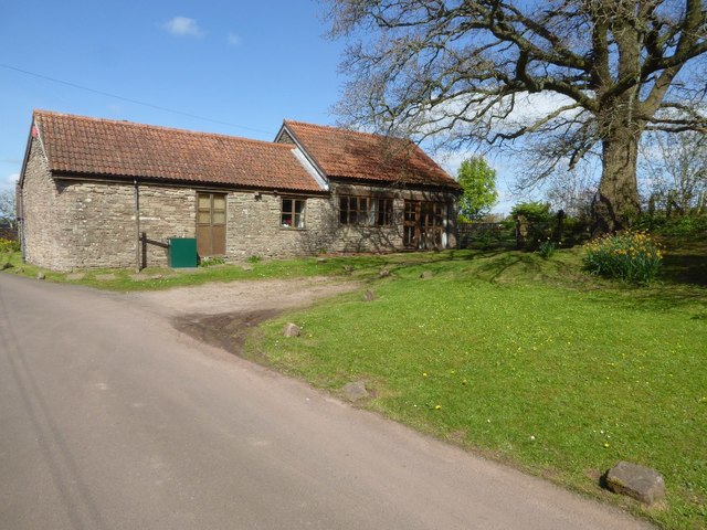
Slough has a population of around 400 residents, making it a close-knit and tightly-knit community. The village itself exudes a tranquil and peaceful atmosphere, offering a retreat from the hustle and bustle of urban life. The charming village is characterized by its quaint cottages, some of which date back several centuries, adding to its historical charm.

Despite its small size, Slough boasts a few notable landmarks. The village church, St. Cadoc's, is an architectural gem dating back to the 12th century. Its stunning stained-glass windows and intricate stonework are a testament to the village's rich history. The nearby Slough Farmhouse, a Grade II listed building, also adds to the village's historical significance.

For outdoor enthusiasts, Slough offers ample opportunities for exploration and leisure. The surrounding countryside provides numerous walking trails and scenic spots, where visitors can enjoy picnics or simply take in the idyllic views. The River Wye is a popular destination for fishing and boating, attracting both locals and tourists alike.

In summary, Slough, Monmouthshire is a charming and picturesque village with a rich historical heritage. Its tranquil setting, combined with its natural beauty and friendly community, make it an ideal destination for those seeking a peaceful retreat or a taste of rural Wales.

If you have any feedback on the listing, please let us know in the comments section below.

Slough Images

Images are sourced within 2km of 51.709888/-2.854753 or Grid Reference SO4101. Thanks to Geograph Open Source API. All images are credited.

Bridge over the A449
Lay-by and minor road crossing A449 near Lanolway Farm
Footpath bridge over A449 south of Llandenny
Ordnance Survey Flush Bracket S1370 This can be found on the wall of a building at Rhyd-y-maen Farm.
For more detail see : <span class="nowrap"><a title="http://www.bench-marks.org.uk/bm18912" rel="nofollow ugc noopener" href="http://www.bench-marks.org.uk/bm18912">Link</a><img style="margin-left:2px;" alt="External link" title="External link - shift click to open in new window" src="https://s1.geograph.org.uk/img/external.png" width="10" height="10"/></span>
Ordnance Survey Flush Bracket S1370
This can be found on the wall of a building at Rhyd-y-maen Farm. For more detail see : LinkExternal link
Footpath to Llandenny Gate into a field with a footpath sign and footpath to Llandenny.
Footpath to Llandenny
Gate into a field with a footpath sign and footpath to Llandenny.
Gwernesney church Dedicated to St Michael Gwernesney church dates from the 13th and early 14th centuries.  The church was restored in 1853-4 by JP Seddon of Pritchard and Seddon.  The church is Grade I listed.
Gwernesney church
Dedicated to St Michael Gwernesney church dates from the 13th and early 14th centuries. The church was restored in 1853-4 by JP Seddon of Pritchard and Seddon. The church is Grade I listed.
West wall of Gwernesney church Dedicated to St Michael Gwernesney church dates from the 13th and early 14th centuries.  The church was restored in 1853-4 by JP Seddon of Pritchard and Seddon.  Pictured here is the west wall of the church included the 19th century bellcote.  The church is Grade I listed.
West wall of Gwernesney church
Dedicated to St Michael Gwernesney church dates from the 13th and early 14th centuries. The church was restored in 1853-4 by JP Seddon of Pritchard and Seddon. Pictured here is the west wall of the church included the 19th century bellcote. The church is Grade I listed.
Base of a cross? This appears to be the base of a cross in Gwernesney churchyard, though I can find no reference to it to confirm this.
Base of a cross?
This appears to be the base of a cross in Gwernesney churchyard, though I can find no reference to it to confirm this.
Building opposite Gwernesney church Single storey building opposite Gwernesney church, not sure if this is a converted farm building.
Building opposite Gwernesney church
Single storey building opposite Gwernesney church, not sure if this is a converted farm building.
Trees in blossom Trees in blossom near Church Farm, Gwernesney.
Trees in blossom
Trees in blossom near Church Farm, Gwernesney.
House and farm buildings House and farm buildings at Gwernesney.
House and farm buildings
House and farm buildings at Gwernesney.
Aircraft at South Wales Gliding Club At aircraft and in the distance a glider at South Wales Gliding Club near Gwernesney.
Aircraft at South Wales Gliding Club
At aircraft and in the distance a glider at South Wales Gliding Club near Gwernesney.
Entrance to South Wales Gliding Club
View to Court-y-gollen View to Court-y-gollen with Cwrt-y-Gollen Wood in the background.
View to Court-y-gollen
View to Court-y-gollen with Cwrt-y-Gollen Wood in the background.
Milestone near Gwernesney Milestone near Gwernesney indicating 9 Miles to Monmouth and 3 Miles to Usk.
Milestone near Gwernesney
Milestone near Gwernesney indicating 9 Miles to Monmouth and 3 Miles to Usk.
Roadside milestone near Gwernesney Roadside milestone near Gwernesney, it indicates 9 Miles to Monmouth and 3 Miles to Usk.
Roadside milestone near Gwernesney
Roadside milestone near Gwernesney, it indicates 9 Miles to Monmouth and 3 Miles to Usk.
Entrance to Rhyd-y-maen Entrance to Rhyd-y-maen Farm, compare with Jonathan Billinger's same view just over ten years ago <a href="https://www.geograph.org.uk/photo/299824">SO4202 : Rhyd-y-maen Farm</a>.
Entrance to Rhyd-y-maen
Entrance to Rhyd-y-maen Farm, compare with Jonathan Billinger's same view just over ten years ago SO4202 : Rhyd-y-maen Farm.
Llangeview Lodge near Usk, Monmouthshire Dog friendly <a title="https://www.geograph.org.uk/photo/5716203" href="https://www.geograph.org.uk/photo/5716203">Link</a> country pub & restaurant with accommodation (eleven bed & breakfast rooms) alongside 
the B4235 Chepstow Road viewed in March 2018. Formerly the Rat Trap seen here <a title="https://www.geograph.org.uk/photo/1080069" href="https://www.geograph.org.uk/photo/1080069">Link</a> in 2008.
Llangeview Lodge near Usk, Monmouthshire
Dog friendly Link country pub & restaurant with accommodation (eleven bed & breakfast rooms) alongside the B4235 Chepstow Road viewed in March 2018. Formerly the Rat Trap seen here Link in 2008.
Show me another place!

Slough is located at Grid Ref: SO4101 (Lat: 51.709888, Lng: -2.854753)

Unitary Authority: Monmouthshire

Police Authority: Gwent

What 3 Words

///spelling.resembles.crouches. Near Llangwm, Monmouthshire

Related Wikis

Gwernesney

Gwernesney (Welsh: Gwernesni) is a village in Monmouthshire in southeast Wales. == Location == Gwernesney is located three miles east of Usk on the B4235...

Church of St Michael and All Angels, Gwernesney

The Church of St Michael and All Angels is the former parish church of Gwernesney, Monmouthshire, Wales. It is a Grade I listed building. In 2017, the...

Cefntilla Halt railway station

Cefntilla Halt was a request stop on the former Coleford, Monmouth, Usk and Pontypool Railway. It was opened on 27 March 1954 and was open for less than...

Allt-y-Bela

Allt-y-Bela in Llangwm, Monmouthshire, Wales, is a house of late medieval origin with additions from the sixteenth to the twenty-first centuries. During...

Cefntilla Court

Cefn Tilla Court, Llandenny, Monmouthshire, Wales, is a country house dating from the mid-19th century. Its origins date from 1616. During the English...

St David's Church, Llangeview

St David's Church, Llangeview, is a redundant church sited in a round churchyard adjacent to the junction of the A449 and A472 roads 1 mile (1.6 km) to...

Llangwm, Monmouthshire

Llangwm is a small rural village and former community, now in the community of Llantrisant Fawr, in Monmouthshire, south east Wales. It is located 3 miles...

St Jerome's Church, Llangwm

The Church of St Jerome stands in the settlement of Llangwm Uchaf, (upper) Llangwm, in a remote part of Monmouthshire, Wales. Originally constructed in...

Nearby Amenities

Located within 500m of 51.709888,-2.854753
Give Way
Direction: backward
Lat/Long: 51.7116921/-2.8554557
Give Way
Direction: backward
Lat/Long: 51.7116186/-2.8555301
Post Box
Operator: Royal Mail
Post Box Type: lamp
Ref: NP15 362
Royal Cypher: EIIR
Royal Cypher Wikidata: Q33102113
Lat/Long: 51.7115343/-2.8540682
Give Way
Direction: backward
Lat/Long: 51.7131792/-2.8511842
Telephone
Defibrillator
Booth: K6
Covered: booth
Defibrillator Location: inside old red phone box
Emergency: defibrillator
Man Made: telephone_box
Lat/Long: 51.7116672/-2.8551665
Direction: 280
Generator Method: photovoltaic
Generator Output Electricity: yes
Generator Solar Modules: 11
Generator Source: solar
Generator Type: solar_photovoltaic_panel
Location: roof
Power: generator
Lat/Long: 51.7117741/-2.8549956
Direction: 190
Generator Method: photovoltaic
Generator Output Electricity: yes
Generator Solar Modules: 8
Generator Source: solar
Generator Type: solar_photovoltaic_panel
Location: roof
Power: generator
Lat/Long: 51.7116312/-2.8542124
Direction: 190
Generator Method: photovoltaic
Generator Output Electricity: yes
Generator Solar Modules: 8
Generator Source: solar
Generator Type: solar_photovoltaic_panel
Location: roof
Power: generator
Lat/Long: 51.7116482/-2.8543532
Direction: 190
Generator Method: photovoltaic
Generator Output Electricity: yes
Generator Solar Modules: 8
Generator Source: solar
Generator Type: solar_photovoltaic_panel
Location: roof
Power: generator
Lat/Long: 51.7116648/-2.8544498
Power: pole
Lat/Long: 51.707069/-2.8589455
Power: pole
Lat/Long: 51.707404/-2.8560841
Power: pole
Lat/Long: 51.7076063/-2.8544215
Power: pole
Lat/Long: 51.7079417/-2.8514415
Power: pole
Lat/Long: 51.7082861/-2.8484948
The data included in this document is from www.openstreetmap.org. The data is made available under ODbL.

Have you been to Slough?

Leave your review of Slough below (or comments, questions and feedback).