Bleach Green

Settlement in Durham

England

Bleach Green

Class 156 Multiple Unit at Blaydon A Carlisle to Newcastle service operated by 156471 seen arriving at Blaydon.
Class 156 Multiple Unit at Blaydon Credit: David Robinson

Bleach Green, Durham is a small, residential area located in the city of Durham, England. Situated in the northern part of the city, it is known for its picturesque surroundings and historical significance.

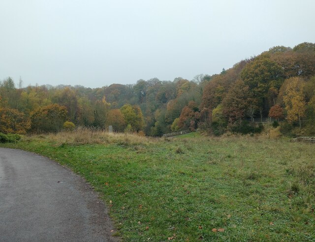
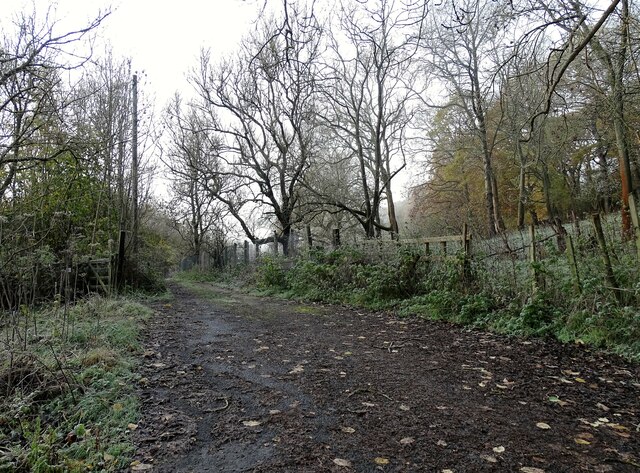
The name "Bleach Green" originates from the area's historical association with the linen industry. In the past, the green fields surrounding the area were used for drying and bleaching linen, hence the name. Today, the area still retains its green landscapes, with a mix of open fields and small woodlands, providing a peaceful and scenic environment for residents and visitors.

The community of Bleach Green primarily consists of residential houses, offering a mix of architectural styles, ranging from traditional cottages to modern homes. The neighborhood is known for its close-knit community spirit, with residents often organizing events and activities to foster a sense of belonging.

Despite its tranquil atmosphere, Bleach Green is conveniently located close to various amenities and facilities. The city center of Durham is easily accessible, offering a wide range of shops, restaurants, and entertainment venues. Additionally, there are several schools and educational institutions in the vicinity, making it an attractive location for families.

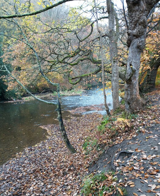
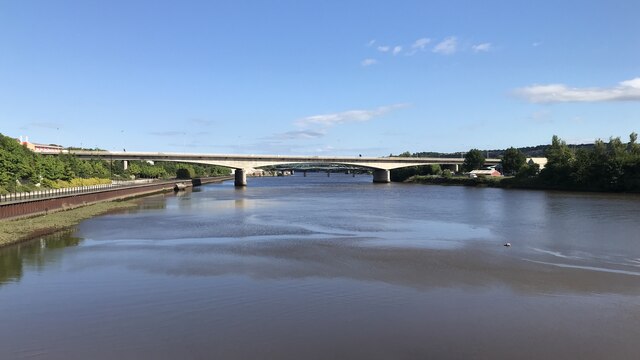
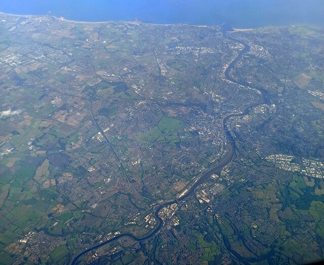
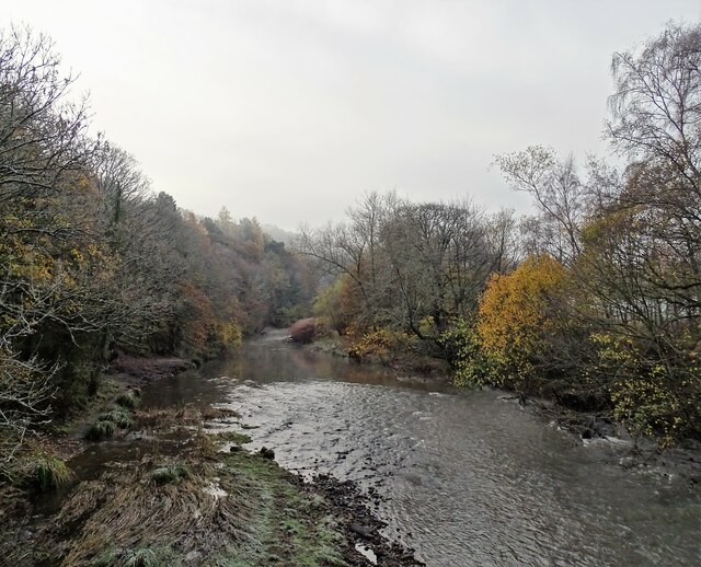
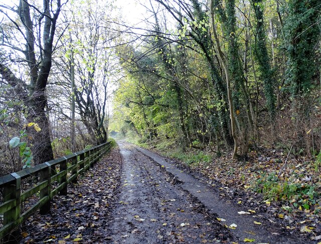
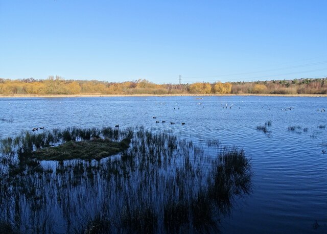
For those who enjoy exploring nature, Bleach Green is surrounded by beautiful countryside and offers easy access to walking trails and parks. The nearby River Wear provides opportunities for leisurely strolls along its banks, and the iconic Durham Cathedral and Castle are just a short distance away, offering cultural and historical attractions.

In summary, Bleach Green, Durham is a charming residential area with a rich history, stunning landscapes, and a strong community spirit.

If you have any feedback on the listing, please let us know in the comments section below.

Bleach Green Images

Images are sourced within 2km of 54.955931/-1.715764 or Grid Reference NZ1862. Thanks to Geograph Open Source API. All images are credited.

Class 156 Multiple Unit at Blaydon A Carlisle to Newcastle service operated by 156471 seen arriving at Blaydon.
Class 156 Multiple Unit at Blaydon
A Carlisle to Newcastle service operated by 156471 seen arriving at Blaydon.
Woods beside the River Derwent in autumn Autumn colours at Clockburn, near Wnlaton Mill.
Woods beside the River Derwent in autumn
Autumn colours at Clockburn, near Wnlaton Mill.
River Derwent at Scar Bank This name refers to the steep hillside on the opposite side of the river. The woods are in autumn colours here.
River Derwent at Scar Bank
This name refers to the steep hillside on the opposite side of the river. The woods are in autumn colours here.
Crossing the River Tyne at Blaydon Two more bridges further down the river - the nearer is the old Scotswood Railway Bridge while the farther one is Scotswood Road Bridge.
Crossing the River Tyne at Blaydon
Two more bridges further down the river - the nearer is the old Scotswood Railway Bridge while the farther one is Scotswood Road Bridge.
Blaydon Bridge
Blaydon Bridge
Newcastle from the air Most of the city can be seen in this view.

Taken at around 37,000 feet by mobile phone, from a Prague bound flight from Edinburgh.
Newcastle from the air
Most of the city can be seen in this view. Taken at around 37,000 feet by mobile phone, from a Prague bound flight from Edinburgh.
Autumn view of the banks of  the Derwent Looking down from the footbridge at Winlaton Mill.
Autumn view of the banks of the Derwent
Looking down from the footbridge at Winlaton Mill.
Path to Clockburn Path leading down from the road beside The Red Kite pub at Winlaton Mill to the country park.
Path to Clockburn
Path leading down from the road beside The Red Kite pub at Winlaton Mill to the country park.
Path through the woods at Clockburn Path to the Derwent Walk Country Park from the road at Winlaton Mill. Viewed on a rather misty autumn morning.
Path through the woods at Clockburn
Path to the Derwent Walk Country Park from the road at Winlaton Mill. Viewed on a rather misty autumn morning.
Shibdon Pond full again The pond dried out almost completely in the hot summer of 2022, but now in January 2023 I was pleased to find it full of water again.  The problem is the sole inflow is a small stream which is fed from old flooded mine workings. Last summer the water level in the old workings dropped and the stream stopped running. There was then no rain to keep the water level up, and the pond almost completely dried out. Thankfully the stream is now running well again.
Shibdon Pond full again
The pond dried out almost completely in the hot summer of 2022, but now in January 2023 I was pleased to find it full of water again. The problem is the sole inflow is a small stream which is fed from old flooded mine workings. Last summer the water level in the old workings dropped and the stream stopped running. There was then no rain to keep the water level up, and the pond almost completely dried out. Thankfully the stream is now running well again.
Lemington Point at low water
Blaydon Races Commemoration
Railway bridge over Blaydon Burn
Road bridge over Blaydon Burn
Path Head Water Mill
Mill Pond, Path Head Water Mill
Mill Race, Path Head Water Mill
Boundary wall crossing an un-named stream in Path Head Wood
Show me another place!

Bleach Green is located at Grid Ref: NZ1862 (Lat: 54.955931, Lng: -1.715764)

Unitary Authority: Gateshead

Police Authority: Northumbria

What 3 Words

///prep.blunt.video. Near Blaydon-on-Tyne, Tyne & Wear

Nearby Locations

Bleach Green

Related Wikis

Ottovale coke works

Ottovale coke works was a large industrial complex situated at Blaydon Burn, near Blaydon-on-Tyne, Gateshead, North East England. The complex comprised...

Blaydon (UK Parliament constituency)

Blaydon is a constituency represented in the House of Commons since 2017 by Liz Twist of the Labour Party.The seat is due to be abolished for the next...

St Thomas More Catholic School, Blaydon

St Thomas More Catholic School is a Roman Catholic secondary school with academy status in Blaydon, Tyne and Wear, England, providing teaching to 11- to...

Blaydon

Blaydon is a town in the Metropolitan Borough of Gateshead, Tyne and Wear, England, and historically in County Durham. Blaydon, and neighbouring Winlaton...

Nearby Amenities

Located within 500m of 54.955931,-1.715764
Source: www.npemap.org.uk
Uk Postcode Centroid: NE21
Lat/Long: 54.955788/-1.713264
Bus Stop
HOLE IN THE WALL ESTATE
Local Ref: E
Naptan AtcoCode: 410000013941
Naptan Bearing: E
Naptan CommonName: HOLE IN THE WALL ESTATE
Naptan Indicator: E
Naptan Landmark: OUTSIDE ENTRANCE TO SOUTH LEA
Naptan NaptanCode: twrgwgtm
Naptan PlusbusZoneRef: NWCSTLE
Naptan Street: BLENCATHRA WAY
Naptan Verified: no
Source: naptan_import
Lat/Long: 54.9527221/-1.7131491
Bus Stop
SHIBDON BANK-HAZEL ROAD-S/B
Local Ref: S
Naptan AtcoCode: 410000013058
Naptan Bearing: S
Naptan CommonName: SHIBDON BANK-HAZEL ROAD-S/B
Naptan Indicator: S
Naptan Landmark: SOUTH OF HAZEL ROAD
Naptan NaptanCode: twratwmw
Naptan PlusbusZoneRef: NWCSTLE
Naptan Street: SHIBDON BANK
Naptan Verified: no
Source: naptan_import
Lat/Long: 54.9582673/-1.7095958
Bus Stop
SHIBDON BANK-LIME STREET-W/B
Local Ref: W
Naptan AtcoCode: 410000013059
Naptan Bearing: W
Naptan CommonName: SHIBDON BANK-LIME STREET-W/B
Naptan Indicator: W
Naptan Landmark: 70M EAST OF POST OFFICE
Naptan NaptanCode: twratwpa
Naptan PlusbusZoneRef: NWCSTLE
Naptan Street: SHIBDON BANK
Naptan Verified: no
Source: naptan_import
Lat/Long: 54.9562874/-1.7121555
Bus Stop
BLEACH GREEN
Bench: yes
Covered: yes
Local Ref: W
Naptan AtcoCode: 410000013060
Naptan Bearing: W
Naptan CommonName: BLEACH GREEN
Naptan Indicator: W
Naptan Landmark: 40M WEST OF POST OFFICE
Naptan NaptanCode: twratwpd
Naptan PlusbusZoneRef: NWCSTLE
Naptan Street: CLAVERING ROAD
Naptan Verified: no
Shelter: no
Source: naptan_import
Lat/Long: 54.9559966/-1.7146092
Bus Stop
AXWELL VIEW-PARKSIDE AVENUE-S/B
Local Ref: S
Naptan AtcoCode: 410000013061
Naptan Bearing: S
Naptan CommonName: AXWELL VIEW-PARKSIDE AVENUE-S/B
Naptan Indicator: S
Naptan Landmark: OPPOSITE PARKSIDE AVENUE
Naptan NaptanCode: twratwpg
Naptan PlusbusZoneRef: NWCSTLE
Naptan Street: AXWELL VIEW
Naptan Verified: no
Source: naptan_import
Lat/Long: 54.9546843/-1.7183349
Bus Stop
AXWELL VIEW-SPORTS GROUND-S/B
Local Ref: S
Naptan AtcoCode: 410000013062
Naptan Bearing: S
Naptan CommonName: AXWELL VIEW-SPORTS GROUND-S/B
Naptan Indicator: S
Naptan Landmark: OUTSIDE WINLATON PLAYING FIELD
Naptan NaptanCode: twratwpj
Naptan PlusbusZoneRef: NWCSTLE
Naptan Street: AXWELL VIEW
Naptan Verified: no
Source: naptan_import
Lat/Long: 54.9520317/-1.7176508
Bus Stop
AXWELL VIEW-SPORTS GROUND-N/B
Local Ref: N
Naptan AtcoCode: 410000013067
Naptan Bearing: N
Naptan CommonName: AXWELL VIEW-SPORTS GROUND-N/B
Naptan Indicator: N
Naptan Landmark: OPPOSITE WINLATON PLAYING FIELD
Naptan NaptanCode: twratwtd
Naptan PlusbusZoneRef: NWCSTLE
Naptan Street: AXWELL VIEW
Naptan Verified: no
Source: naptan_import
Lat/Long: 54.952293/-1.7179769
Bus Stop
AXWELL VIEW-EAST PARK GARDENS-N/B
Local Ref: N
Naptan AtcoCode: 410000013068
Naptan Bearing: N
Naptan CommonName: AXWELL VIEW-EAST PARK GARDENS-N/B
Naptan Indicator: N
Naptan Landmark: OPPOSITE RUGBY / FOOTBALL CLUB
Naptan NaptanCode: twratwtg
Naptan PlusbusZoneRef: NWCSTLE
Naptan Street: AXWELL VIEW
Naptan Verified: no
Source: naptan_import
Lat/Long: 54.954073/-1.7182611
Bus Stop
SHIBDON BANK-HAWTHORN ROAD-NE/B
Local Ref: NE
Naptan AtcoCode: 410000013069
Naptan Bearing: NE
Naptan CommonName: SHIBDON BANK-HAWTHORN ROAD-NE/B
Naptan Indicator: NE
Naptan Landmark: OPPOSITE SPORTS GROUND
Naptan NaptanCode: twratwtj
Naptan PlusbusZoneRef: NWCSTLE
Naptan Street: CLAVERING ROAD
Naptan Verified: no
Source: naptan_import
Lat/Long: 54.9556461/-1.7184531
Bus Stop
BLEACH GREEN
Local Ref: E
Naptan AtcoCode: 410000013070
Naptan Bearing: E
Naptan CommonName: BLEACH GREEN
Naptan Indicator: E
Naptan Landmark: OUTSIDE JUNCTION WITH BEECH TERRACE
Naptan NaptanCode: twratwtm
Naptan PlusbusZoneRef: NWCSTLE
Naptan Street: SHIBDON BANK
Naptan Verified: no
Source: naptan_import
Lat/Long: 54.9560714/-1.7158267
Bus Stop
SHIBDON BANK-PARK TERRACE-SW/B
Local Ref: SW
Naptan AtcoCode: 410000013071
Naptan Bearing: SW
Naptan CommonName: SHIBDON BANK-PARK TERRACE-SW/B
Naptan Indicator: SW
Naptan Landmark: OUTSIDE NO.16 PARK TERRACE
Naptan NaptanCode: twratwtp
Naptan PlusbusZoneRef: NWCSTLE
Naptan Street: SHIBDON BANK
Naptan Verified: no
Source: naptan_import
Lat/Long: 54.9568702/-1.7116048
Bus Stop
CALIFORNIA-W/B
Local Ref: W
Naptan AtcoCode: 410000013073
Naptan Bearing: W
Naptan CommonName: CALIFORNIA-W/B
Naptan Indicator: W
Naptan Landmark: 40M EAST OF PARKLAND AVENUE
Naptan NaptanCode: twrawada
Naptan PlusbusZoneRef: NWCSTLE
Naptan Street: CALIFORNIA
Naptan Verified: no
Source: naptan_import
Lat/Long: 54.9530458/-1.7209384
Bus Stop
CALIFORNIA-E/B
Local Ref: E
Naptan AtcoCode: 410000013078
Naptan Bearing: E
Naptan CommonName: CALIFORNIA-E/B
Naptan Indicator: E
Naptan Landmark: OPPOSITE PARKHEAD SQUARE
Naptan NaptanCode: twrawadt
Naptan PlusbusZoneRef: NWCSTLE
Naptan Street: CALIFORNIA
Naptan Verified: no
Source: naptan_import
Lat/Long: 54.9533028/-1.7193908
Bus Stop
BLEACH GREEN
Local Ref: S
Naptan AtcoCode: 410000013082
Naptan Bearing: S
Naptan CommonName: BLEACH GREEN
Naptan Indicator: S
Naptan Landmark: OUTSIDE JUNCTION WITH ROCKMORE ROAD
Naptan NaptanCode: twrawagj
Naptan PlusbusZoneRef: NWCSTLE
Naptan Street: BEECH TERRACE
Naptan Verified: no
Source: naptan_import
Lat/Long: 54.9564744/-1.7152461
Bus Stop
BLAYDON BANK-CRICKET GROUND-S/B
Local Ref: S
Naptan AtcoCode: 410000013088
Naptan Bearing: S
Naptan CommonName: BLAYDON BANK-CRICKET GROUND-S/B
Naptan Indicator: S
Naptan Landmark: OUTSIDE CRICKET GROUND
Naptan NaptanCode: twrawajd
Naptan PlusbusZoneRef: NWCSTLE
Naptan Street: BLAYDON BANK
Naptan Verified: no
Source: naptan_import
Lat/Long: 54.9586332/-1.7200095
Bus Stop
BLAYDON BANK-ALICE STREET-S/B
Local Ref: S
Naptan AtcoCode: 410000013089
Naptan Bearing: S
Naptan CommonName: BLAYDON BANK-ALICE STREET-S/B
Naptan Indicator: S
Naptan Landmark: OUTSIDE ALICE STREET JUNCTION
Naptan NaptanCode: twrawajg
Naptan PlusbusZoneRef: NWCSTLE
Naptan Street: BLAYDON BANK
Naptan Verified: no
Source: naptan_import
Lat/Long: 54.9568589/-1.7221925
Bus Stop
BLAYDON BANK-ALICE STREET-N/B
Local Ref: N
Naptan AtcoCode: 410000013091
Naptan Bearing: N
Naptan CommonName: BLAYDON BANK-ALICE STREET-N/B
Naptan Indicator: N
Naptan Landmark: OPPOSITE ALICE STREET JUNCTION
Naptan NaptanCode: twrawajm
Naptan PlusbusZoneRef: NWCSTLE
Naptan Street: BLAYDON BANK
Naptan Verified: no
Source: naptan_import
Lat/Long: 54.9569576/-1.7221137
Bus Stop
BLAYDON BANK-MONARCH TERRACE-N/B
Local Ref: N
Naptan AtcoCode: 410000013092
Naptan Bearing: N
Naptan CommonName: BLAYDON BANK-MONARCH TERRACE-N/B
Naptan Indicator: N
Naptan Landmark: OPPOSITE MONARCH TERRACE
Naptan NaptanCode: twrawajp
Naptan PlusbusZoneRef: NWCSTLE
Naptan Street: BLAYDON
Naptan Verified: no
Source: naptan_import
Lat/Long: 54.9590995/-1.719569
Bus Stop
SPRINGFIELD ROAD-CHEVIOT ROAD-E/B
Local Ref: E
Naptan AtcoCode: 410000013118
Naptan Bearing: E
Naptan CommonName: SPRINGFIELD ROAD-CHEVIOT ROAD-E/B
Naptan Indicator: E
Naptan Landmark: OPPOSITE CHEVIOT ROAD
Naptan NaptanCode: twrawawg
Naptan PlusbusZoneRef: NWCSTLE
Naptan Street: SPRINGFIELD ROAD
Naptan Verified: no
Source: naptan_import
Lat/Long: 54.9569425/-1.7194747
Bus Stop
PARK AVENUE-SPRINGFIELD ROAD-W/B
Local Ref: W
Naptan AtcoCode: 410000013119
Naptan Bearing: W
Naptan CommonName: PARK AVENUE-SPRINGFIELD ROAD-W/B
Naptan Indicator: W
Naptan Landmark: OPPOSITE SURGERY
Naptan NaptanCode: twrawawj
Naptan PlusbusZoneRef: NWCSTLE
Naptan Street: PARK AVENUE
Naptan Verified: no
Source: naptan_import
Lat/Long: 54.9571522/-1.7207694
Bus Stop
TYNE STREET-E/B
Local Ref: E
Naptan AtcoCode: 410000013120
Naptan Bearing: E
Naptan CommonName: TYNE STREET-E/B
Naptan Indicator: E
Naptan Landmark: OUTSIDE LITCHFIELD CRESCENT
Naptan NaptanCode: twrawawm
Naptan PlusbusZoneRef: NWCSTLE
Naptan Street: TYNE STREET
Naptan Verified: no
Source: naptan_import
Lat/Long: 54.9552328/-1.7223911
Bus Stop
TYNE STREET-W/B
Local Ref: E
Naptan AtcoCode: 410000013121
Naptan Bearing: E
Naptan CommonName: TYNE STREET-W/B
Naptan Indicator: E
Naptan Landmark: OUTSIDE TYNE VIEW
Naptan NaptanCode: twrawawp
Naptan PlusbusZoneRef: NWCSTLE
Naptan Street: TYNE STREET
Naptan Verified: no
Source: naptan_import
Lat/Long: 54.9553966/-1.7193606
Bus Stop
LITCHFIELD TERRACE-N/B
Local Ref: N
Naptan AtcoCode: 410000013122
Naptan Bearing: N
Naptan CommonName: LITCHFIELD TERRACE-N/B
Naptan Indicator: N
Naptan Landmark: OPPOSITE WINLATON METHODIST CHURCH
Naptan NaptanCode: twrawawt
Naptan PlusbusZoneRef: NWCSTLE
Naptan Street: LITCHFIELD TERRACE
Naptan Verified: no
Source: naptan_import
Lat/Long: 54.9558547/-1.7231988
Bus Stop
HOLE IN THE WALL ESTATE
Local Ref: W
Naptan AtcoCode: 410000060029
Naptan Bearing: W
Naptan CommonName: HOLE IN THE WALL ESTATE
Naptan Indicator: W
Naptan Landmark: OPPOSITE ENTRANCE TO SOUTH LEA
Naptan NaptanCode: twrgpmdm
Naptan PlusbusZoneRef: NWCSTLE
Naptan Street: BLENCATHRA WAY
Naptan Verified: no
Source: naptan_import
Lat/Long: 54.9526945/-1.7128994
Turning Circle
Lat/Long: 54.9592205/-1.7109435
Mini Roundabout
Lat/Long: 54.9567816/-1.718276
Turning Circle
Lat/Long: 54.958007/-1.7133455
Turning Circle
Lat/Long: 54.9575765/-1.7165947
Barrier: cycle_barrier
Lat/Long: 54.9599111/-1.7192786
Gary's Barber Shop
Addr City: Blaydon on Tyne
Addr Street: Shibdon Bank
Shop: hairdresser
Lat/Long: 54.9563589/-1.7123888
Lifestyle Express
Addr City: Blaydon on Tyne
Addr Street: Shibdon Bank
Shop: convenience
Lat/Long: 54.9563281/-1.7125148
Fast Food
Pachino Pizza
Addr City: Blaydon-on-Tyne
Addr Housenumber: 22
Addr Postcode: NE21 5HH
Addr Street: Clavering Road
Addr Suburb: Bleach Green
Cuisine: pizza
Fhrs Id: 339862
Phone: +44 191 42 11 888
Source Addr: FHRS Open Data
Takeaway: only
Lat/Long: 54.9562977/-1.7127639
Fast Food
Golden Chopsticks
Addr City: Blaydon on Tyne
Addr Street: Shibdon Bank
Cuisine: chinese
Phone: +44 191 414 1318
Takeaway: yes
Lat/Long: 54.9562848/-1.7128411
We Can Group
Addr City: Blaydon on Tyne
Addr Street: Shibdon Bank
Office: estate_agent
Phone: +44 191 4 990 990
Website: www.wecangroup.co.uk
Lat/Long: 54.9561765/-1.7141181
Best-One
Addr City: Blaydon-on-Tyne
Addr Postcode: NE21 5HH
Addr Street: Clavering Road
Addr Suburb: Bleach Green
Brand Wikidata: Q4896532
Contact Website: https://stores.best-one.co.uk/best-one-7c6f78e31a1c
Fhrs Id: 339765
Shop: convenience
Source Addr: FHRS Open Data
Lat/Long: 54.9561725/-1.7145594
Community Centre
Surestart Childrens Centre
Addr City: Blaydon on Tyne
Addr Street: Shibdon Bank
Lat/Long: 54.9557925/-1.7160952
Turning Circle
Lat/Long: 54.9555314/-1.7225068
Cheryl's Barber Shop
Addr City: Blaydon on Tyne
Addr Street: Park Avenue
Shop: hairdresser
Lat/Long: 54.9571607/-1.72114
Lifestyle Express
Addr City: Blaydon on Tyne
Addr Street: Park Avenue
Shop: convenience
Lat/Long: 54.957129/-1.7210535
Fast Food
Crispy Cod
Addr City: Blaydon-on-Tyne
Addr Housenumber: 37
Addr Postcode: NE21 5DF
Addr Street: Tynevale Avenue
Addr Suburb: Winlaton
Cuisine: fish_and_chips
Fhrs Id: 904097
Phone: +44 191 414 4416
Source Addr: FHRS Open Data
Takeaway: yes
Lat/Long: 54.9571075/-1.7209321
Rendezvous Tanning & Beauty
Addr City: Blaydon on Tyne
Addr Street: Park Avenue
Phone: +44 191 447 3837
Shop: beauty
Lat/Long: 54.9572309/-1.7205912
Pub
Lat/Long: 54.9536132/-1.7178505
Winlaton Vulcans R.F.C.
Addr City: Blaydon-on-Tyne
Addr Postcode: NE21 4BW
Addr Street: Axwell View
Leisure: sports_centre
Phone: +44 191 414 2502
Website: https://www.pitchero.com/clubs/winlatonvulcans/
Lat/Long: 54.9537149/-1.7179041
Parkhead News & Off Licence
Addr City: Blaydon-on-Tyne
Addr Housenumber: 7-8
Addr Postcode: NE21 6NR
Addr Street: Parkhead Square
Addr Suburb: Winlaton
Fhrs Id: 339347
Shop: convenience
Source Addr: FHRS Open Data
Lat/Long: 54.9529513/-1.7195625
Post Box
Ref: NE21 481
Lat/Long: 54.9528593/-1.7195687
Post Box
Ref: NE21 133
Lat/Long: 54.9565337/-1.7099925
Fast Food
In A Pickle
Addr City: Blaydon-on-Tyne
Addr Housenumber: 1
Addr Postcode: NE21 5HX
Addr Street: Content Street
Addr Suburb: Bleach Green
Cuisine: sandwich
Fhrs Id: 339663
Source Addr: FHRS Open Data
Lat/Long: 54.9558885/-1.7140989
Post Box
Ref: NE21 210
Lat/Long: 54.9558788/-1.7143818
Bench
Backrest: yes
Lat/Long: 54.9559313/-1.7144599
Premier
Addr City: Winlaton
Addr Street: Tyne Street
Brand: Premier
Brand Wikidata: Q7240340
Shop: convenience
Lat/Long: 54.955152/-1.721863
Bench
Seats: 4
Lat/Long: 54.9573562/-1.718295
Bench
Seats: 4
Lat/Long: 54.9573177/-1.7182842
Noexit: yes
Lat/Long: 54.9590345/-1.7122994
Noexit: yes
Lat/Long: 54.9589802/-1.7122646
Noexit: yes
Lat/Long: 54.9591612/-1.7125395
Noexit: yes
Lat/Long: 54.9590815/-1.7126079
Noexit: yes
Lat/Long: 54.9588258/-1.7120607
The data included in this document is from www.openstreetmap.org. The data is made available under ODbL.

Have you been to Bleach Green?

Leave your review of Bleach Green below (or comments, questions and feedback).