Blashford

Settlement in Hampshire New Forest

England

Blashford

Ford near Moyles Court
Ford near Moyles Court Credit: David Martin

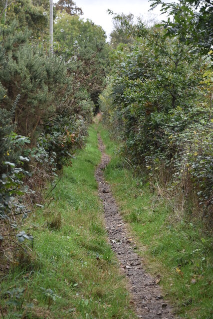
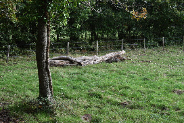
Blashford is a small village located in the county of Hampshire, England. Situated on the banks of the River Avon, it is part of the New Forest National Park, making it a popular destination for nature enthusiasts and outdoor lovers. The village is surrounded by stunning landscapes, including woodlands, meadows, and wetlands, providing ample opportunities for hiking, birdwatching, and wildlife spotting.

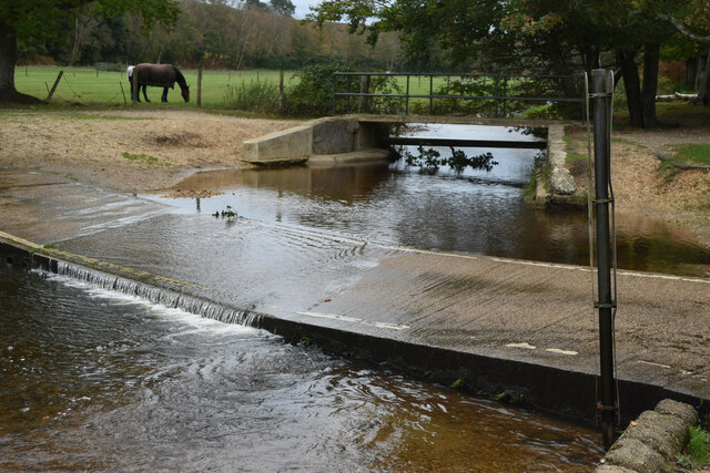
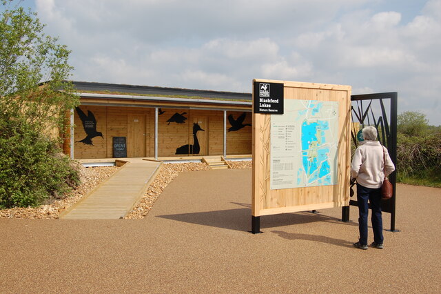
Blashford is known for its tranquility and natural beauty, offering a peaceful escape from the hustle and bustle of city life. The area is home to a diverse range of plant and animal species, making it an important conservation site. The Blashford Lakes Nature Reserve, managed by the Hampshire and Isle of Wight Wildlife Trust, is a prominent attraction in the village. With its series of flooded gravel pits, the reserve provides a haven for numerous bird species, including ospreys, kingfishers, and great crested grebes.

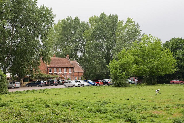
In addition to its natural attractions, Blashford offers a range of amenities for residents and visitors alike. The village has a primary school, a village hall, and a local pub, providing a sense of community and facilitating social interactions. While Blashford may be small in size, it benefits from its proximity to nearby towns and cities, such as Ringwood and Bournemouth, which offer a wider array of services, entertainment options, and transport links.

Overall, Blashford is a picturesque village nestled within the scenic New Forest National Park, offering a unique blend of natural beauty, wildlife, and community spirit.

If you have any feedback on the listing, please let us know in the comments section below.

Blashford Images

Images are sourced within 2km of 50.862069/-1.785839 or Grid Reference SU1506. Thanks to Geograph Open Source API. All images are credited.

Ford near Moyles Court
Minor road at Rockford
Dinghy sailing on Blashford Lake
Path beside Blashford Lake Despite being almost at the water’s edge, there are few clear views of the lake due to the overhanging vegetation.
Path beside Blashford Lake
Despite being almost at the water’s edge, there are few clear views of the lake due to the overhanging vegetation.
Lakeside path This path is beside the lake north of Blashford Lake, which is not named on the OS map.
Lakeside path
This path is beside the lake north of Blashford Lake, which is not named on the OS map.
Fallen tree trunk in corner of field at Rockford
Ringwood Meeting House and History Centre This is the old Presbyterian Meeting House built in 1727.  It is one of the best preserved examples in the country.  It is open for meeting friends, exploring the history archives, exhibitions and is also a wedding venue.
Ringwood Meeting House and History Centre
This is the old Presbyterian Meeting House built in 1727. It is one of the best preserved examples in the country. It is open for meeting friends, exploring the history archives, exhibitions and is also a wedding venue.
Little hut near Ellingham Lake Blashford lakes Nature Reserve
Little hut near Ellingham Lake
Blashford lakes Nature Reserve
New hide at Blashford Lakes
Road bridge - A31 northbound
Roadbridge - A31 northbound
Replacing the A31 westbound bridges at Ringwood Works on the southern bank of the Avon River.
Replacing the A31 westbound bridges at Ringwood
Works on the southern bank of the Avon River.
Replacing the A31 westbound bridges at Ringwood Works on the northern bank of the Avon river.
Replacing the A31 westbound bridges at Ringwood
Works on the northern bank of the Avon river.
Replacing the A31 westbound bridges at Ringwood Looking across the river Avon from the 1977 Jubilee Garden.
Replacing the A31 westbound bridges at Ringwood
Looking across the river Avon from the 1977 Jubilee Garden.
1977 Jubilee Garden at Ringwood Beside the River Avon.
1977 Jubilee Garden at Ringwood
Beside the River Avon.
1977 Jubilee Garden at Ringwood The plaque atop the stone pillar thanks those who contributed to funding this garden on behalf of the Rotary Club.
1977 Jubilee Garden at Ringwood
The plaque atop the stone pillar thanks those who contributed to funding this garden on behalf of the Rotary Club.
Former Ringwood Social Club refurbished The white and grey building in the centre of the photo. Earlier <a href="https://www.geograph.org.uk/photo/5300650">SU1405 : Ringwood Social Club buildings (disused)</a>.
Former Ringwood Social Club refurbished
The white and grey building in the centre of the photo. Earlier SU1405 : Ringwood Social Club buildings (disused).
Show me another place!

Blashford is located at Grid Ref: SU1506 (Lat: 50.862069, Lng: -1.785839)

Administrative County: Hampshire

District: New Forest

Police Authority: Hampshire

What 3 Words

///doctor.relies.under. Near Ringwood, Hampshire

Related Wikis

Blashford

Blashford is a small hamlet of approx. 65 dwellings situated close to the New Forest National Park in Hampshire, England. Its nearest town is Ringwood...

Linbrook Lake

Linbrook Lake, also called Linbrook East, is a lake located just west of the New Forest National Park in Hampshire, England with the village of Blashford...
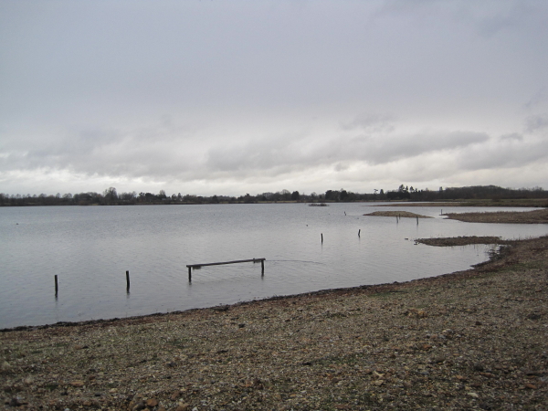
Blashford Lakes

Blashford Lakes is a 159-hectare (390-acre) nature reserve north of Ringwood in Hampshire, England, which is managed by the Hampshire and Isle of Wight...

Rockford, Hampshire

Rockford is a hamlet on the western edge of the New Forest National Park of Hampshire, England. Its nearest town is Ringwood, which lies approximately...

Nearby Amenities

Located within 500m of 50.862069,-1.785839
Blashford
Is In: Hampshire, England, UK
Odbl: clean
Place: hamlet
Source: npe
Wikidata: Q4925302
Lat/Long: 50.8620134/-1.7886248
Bus Stop
Headlands Business Park
Bench: no
Bin: no
Bus: yes
Lit: no
Naptan AtcoCode: 1900HA081015
Naptan Bearing: S
Naptan CommonName: Headlands Business Park
Naptan NaptanCode: hamadgpd
Naptan Street: A338 Salisbury Road
Naptan Verified: no
Public Transport: platform
Shelter: no
Source: naptan_import
Tactile Paving: no
Lat/Long: 50.8587197/-1.7886247
Bus Stop
Headlands Business Park
Bench: no
Bin: no
Bus: yes
Lit: no
Naptan AtcoCode: 1900HA081016
Naptan Bearing: N
Naptan CommonName: Headlands Business Park
Naptan NaptanCode: hamadgmw
Naptan Street: A338 Salisbury Road
Naptan Verified: no
Public Transport: platform
Shelter: no
Source: naptan_import
Lat/Long: 50.8579534/-1.7886934
Bus Stop
Snails Lane
Bench: no
Bin: no
Bus: yes
Lit: no
Naptan AtcoCode: 1900HA081017
Naptan Bearing: N
Naptan CommonName: Snails Lane
Naptan Crossing: Snails Lane
Naptan Landmark: O/s John Deere Sales
Naptan NaptanCode: hamadgpa
Naptan Street: A338 Salisbury Road
Naptan Verified: no
Public Transport: platform
Shelter: no
Source: naptan_import
Tactile Paving: no
Lat/Long: 50.8622459/-1.7887385
Bus Stop
Snails Lane
Bench: yes
Bin: no
Bus: yes
Lit: no
Naptan AtcoCode: 1900HA081018
Naptan Bearing: S
Naptan CommonName: Snails Lane
Naptan Crossing: Snails Lane
Naptan Landmark: John Deere Sales
Naptan NaptanCode: hamadgpg
Naptan Street: A338 Salisbury Road
Naptan Verified: no
Public Transport: platform
Shelter: yes
Source: naptan_import
Tactile Paving: no
Lat/Long: 50.8622456/-1.7885822
Post Box
Operator: Royal Mail
Operator Wikidata: Q638098
Postal Code: BH24
Ref: BH24 2000
Lat/Long: 50.8600948/-1.7867283
Post Box
Operator: Royal Mail
Operator Wikidata: Q638098
Ref: BH24 9
Lat/Long: 50.8619862/-1.7886414
Direction: 175
Fixme: module count estimated
Generator Method: photovoltaic
Generator Output Electricity: yes
Generator Solar Modules: 4
Generator Source: solar
Generator Type: solar_photovoltaic_panel
Location: roof
Power: generator
Lat/Long: 50.8578499/-1.7878654
Direction: 175
Fixme: module count estimated
Generator Method: photovoltaic
Generator Output Electricity: yes
Generator Solar Modules: 4
Generator Source: solar
Generator Type: solar_photovoltaic_panel
Location: roof
Power: generator
Lat/Long: 50.8578421/-1.7879691
Direction: 175
Fixme: module count estimated
Generator Method: photovoltaic
Generator Output Electricity: yes
Generator Solar Modules: 8
Generator Source: solar
Generator Type: solar_photovoltaic_panel
Location: roof
Power: generator
Lat/Long: 50.8578454/-1.7879249
Crossing
Crossing: unmarked
Crossing Markings: no
Lat/Long: 50.8620708/-1.7886227
Crossing
Crossing: unmarked
Crossing Markings: no
Lat/Long: 50.8607044/-1.7887382
Crossing
Crossing: unmarked
Crossing Island: no
Crossing Markings: no
Tactile Paving: yes
Lat/Long: 50.8596656/-1.7886745
Crossing
Crossing: unmarked
Crossing Island: no
Crossing Markings: no
Tactile Paving: yes
Lat/Long: 50.8590011/-1.7886262
Direction: SW
Generator Method: photovoltaic
Generator Output Electricity: yes
Generator Source: solar
Generator Type: solar_photovoltaic_panel
Location: roof
Power: generator
Lat/Long: 50.8599981/-1.7856716
Direction: W
Generator Method: photovoltaic
Generator Output Electricity: yes
Generator Source: solar
Generator Type: solar_photovoltaic_panel
Location: roof
Power: generator
Lat/Long: 50.8598187/-1.7855247
Barrier: kerb
Kerb: lowered
Tactile Paving: yes
Lat/Long: 50.8590488/-1.7886308
Barrier: kerb
Kerb: lowered
Tactile Paving: yes
Lat/Long: 50.8589482/-1.7886213
Barrier: kerb
Kerb: lowered
Tactile Paving: yes
Lat/Long: 50.8595896/-1.7886678
Barrier: kerb
Kerb: lowered
Tactile Paving: yes
Lat/Long: 50.8597443/-1.7886815
Entrance: main
Lat/Long: 50.8591987/-1.7884548
Atm
Brand: NoteMachine
Brand Wikidata: Q104368525
Cash In: no
Covered: no
Drive Through: no
Indoor: no
Operator: NoteMachine
Operator Short: NMATM
Operator Wikidata: Q104368525
Lat/Long: 50.8592062/-1.7882861
Smoking Area
Lat/Long: 50.8591493/-1.7881803
Barrier: kerb
Kerb: lowered
Tactile Paving: yes
Lat/Long: 50.8586308/-1.7886061
Barrier: kerb
Kerb: lowered
Tactile Paving: yes
Lat/Long: 50.8579617/-1.7885287
Barrier: kerb
Kerb: lowered
Tactile Paving: yes
Lat/Long: 50.8579256/-1.7885677
Parcel Locker
Brand: InPost
Brand Wikidata: Q3182097
Colour: white
Opening Hours: 24/7
Parcel Mail In: yes
Parcel Pickup: yes
Lat/Long: 50.8592139/-1.7882028
The data included in this document is from www.openstreetmap.org. The data is made available under ODbL.

Have you been to Blashford?

Leave your review of Blashford below (or comments, questions and feedback).