Blathaisbhal

Settlement in Inverness-shire

Scotland

Blathaisbhal

Track leading off the A865 The water beyond is the sea loch, Loch Blathaisbhal.
Track leading off the A865 Credit: Gordon Brown

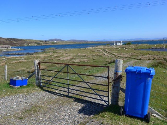
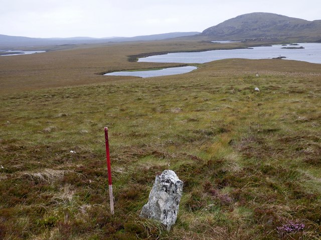
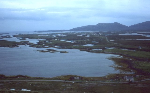
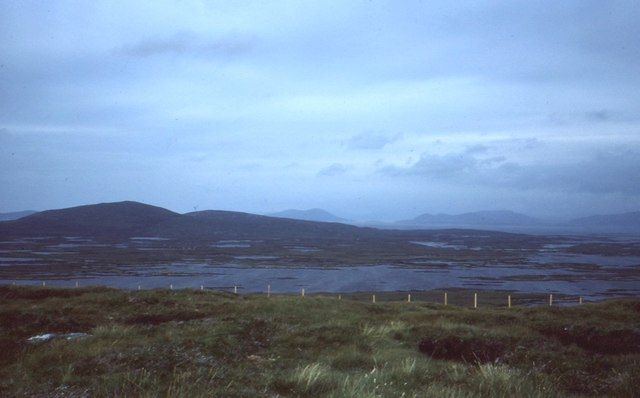
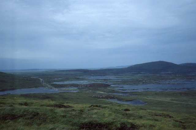
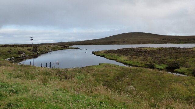
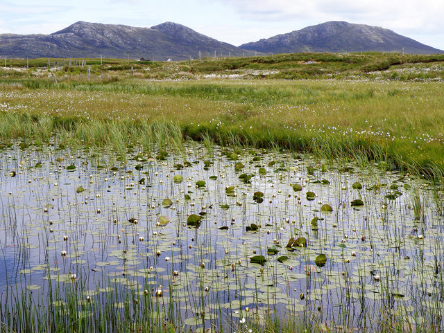
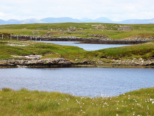
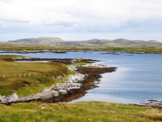
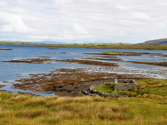
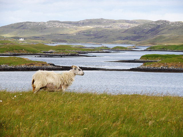
Blathaisbhal is a small village located in the county of Inverness-shire in the Scottish Highlands. Situated on the western coast of Scotland, the village boasts breathtaking views of the surrounding mountains and the nearby Loch Bhàn. Blathaisbhal is known for its peaceful and idyllic setting, making it a popular destination for those seeking tranquility and a chance to immerse themselves in nature.

The village itself consists of a handful of charming cottages and houses, giving it a quaint and picturesque feel. Its remote location means that it offers a true escape from the hustle and bustle of city life. The surrounding landscape is dominated by rugged hills and moorland, providing ample opportunities for outdoor activities such as hiking, fishing, and bird-watching.

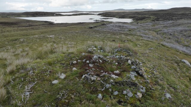
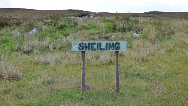
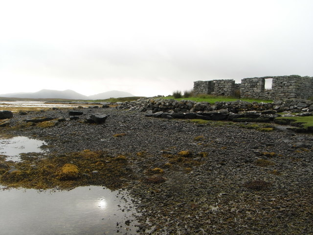
Blathaisbhal is also home to a small community of friendly and welcoming locals who take pride in their village and its heritage. The village has a rich history, with traces of ancient settlements and archaeological sites in the area. Visitors can explore these historical sites and learn about the village's past through guided tours and exhibitions.

Despite its small size, Blathaisbhal has a few amenities to cater to both residents and visitors. There is a local pub where one can enjoy a traditional Scottish meal or a pint of local ale. Additionally, there are a few guesthouses and bed and breakfast accommodations for those looking to stay overnight.

Overall, Blathaisbhal offers a tranquil retreat in the heart of the Scottish Highlands, with its stunning scenery, friendly community, and opportunities for outdoor exploration. It is a hidden gem that provides a true taste of rural Scotland.

If you have any feedback on the listing, please let us know in the comments section below.
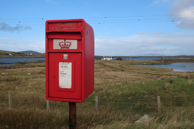
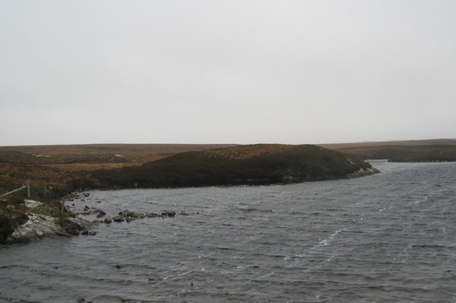
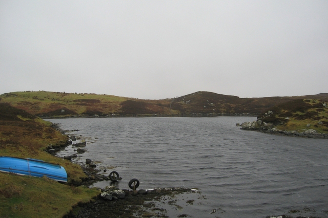
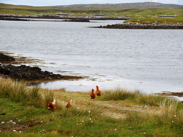
Blathaisbhal Images

Images are sourced within 2km of 57.622315/-7.2043372 or Grid Reference NF8971. Thanks to Geograph Open Source API. All images are credited.

Track leading off the A865 The water beyond is the sea loch, Loch Blathaisbhal.
Track leading off the A865
The water beyond is the sea loch, Loch Blathaisbhal.
Blathaisbhal stone row A stone row composed of three stones. Like most rows it is far from straight (Scale 1m).
<span class="nowrap"><a title="https://stonerows.wordpress.com/gazetteer/region/western-isles/blashaval/" rel="nofollow ugc noopener" href="https://stonerows.wordpress.com/gazetteer/region/western-isles/blashaval/">Link</a><img style="margin-left:2px;" alt="External link" title="External link - shift click to open in new window" src="https://s1.geograph.org.uk/img/external.png" width="10" height="10"/></span>
Blathaisbhal stone row
A stone row composed of three stones. Like most rows it is far from straight (Scale 1m). LinkExternal link
Loch Blathaisbhal View from Blathaisbhal towards Lochmaddy.
Loch Blathaisbhal
View from Blathaisbhal towards Lochmaddy.
On Blathaisbhal A fine appreciation of the mix of land and water that is North Uist.   I always think of North Uist as a reverse of the Stockholm Archipelago - more land than water, just rather than the other way around.
On Blathaisbhal
A fine appreciation of the mix of land and water that is North Uist. I always think of North Uist as a reverse of the Stockholm Archipelago - more land than water, just rather than the other way around.
A865 below Blathaisbhal
Airigh Nan Luchag shieling A ruined shieling (Scale 1m). <span class="nowrap"><a title="https://canmore.org.uk/site/123341/north-uist-airigh-nan-luchag" rel="nofollow ugc noopener" href="https://canmore.org.uk/site/123341/north-uist-airigh-nan-luchag">Link</a><img style="margin-left:2px;" alt="External link" title="External link - shift click to open in new window" src="https://s1.geograph.org.uk/img/external.png" width="10" height="10"/></span>
Airigh Nan Luchag shieling
A ruined shieling (Scale 1m). LinkExternal link
Airigh Nan Luchag shieling Shielings are often difficult to spot but this one comes with its own signpost. <span class="nowrap"><a title="https://canmore.org.uk/site/123341/north-uist-airigh-nan-luchag" rel="nofollow ugc noopener" href="https://canmore.org.uk/site/123341/north-uist-airigh-nan-luchag">Link</a><img style="margin-left:2px;" alt="External link" title="External link - shift click to open in new window" src="https://s1.geograph.org.uk/img/external.png" width="10" height="10"/></span>
Airigh Nan Luchag shieling
Shielings are often difficult to spot but this one comes with its own signpost. LinkExternal link
Sea loch at Aileodair View from the loch side picnic area.
Sea loch at Aileodair
View from the loch side picnic area.
Inlet of Loch Mhidhinis Desolate looking on a grey April day.
Inlet of Loch Mhidhinis
Desolate looking on a grey April day.
Loch an Struth Mhòir This is the narrow inlet to a substantial loch just north of Lochmaddy.
Loch an Struth Mhòir
This is the narrow inlet to a substantial loch just north of Lochmaddy.
Free range hebridean chickens Just how free range I'm not sure, the closest house was quite a way away over a Loch
Free range hebridean chickens
Just how free range I'm not sure, the closest house was quite a way away over a Loch
Lilies on a Loch I was surprised at just how many of the lochs have water lilies, this one also has Li a Tuath and Li a Deas in the distance
Lilies on a Loch
I was surprised at just how many of the lochs have water lilies, this one also has Li a Tuath and Li a Deas in the distance
Loch Midhinis In the distance can be seen the hills of the Isle of Harris
Loch Midhinis
In the distance can be seen the hills of the Isle of Harris
Loch Blathaisbhal In the distance on the left can be seen Crogearraidh na Thabha rising to 154m
Loch Blathaisbhal
In the distance on the left can be seen Crogearraidh na Thabha rising to 154m
Loch Blathaisbhal A ruined house stands on the shore and in the distance can be seen the hills of Skye
Loch Blathaisbhal
A ruined house stands on the shore and in the distance can be seen the hills of Skye
Loch Midhinis A sheep pondering life, the universe and whether the grass is greener over there?
Loch Midhinis
A sheep pondering life, the universe and whether the grass is greener over there?
Ruins of a croft house on the shore of Loch Blathaisbhal
Show me another place!

Blathaisbhal is located at Grid Ref: NF8971 (Lat: 57.622315, Lng: -7.2043372)

Unitary Authority: Na h-Eileanan an Iar

Police Authority: Highlands and Islands

Also known as: Blashaval

What 3 Words

///dubbing.sound.norms. Near Lochmaddy, Na h-Eileanan Siar

Related Wikis

Na Fir Bhrèige

Na Fir Bhrèige (pronounced [nə fiɾʲ ˈvɾʲeːkʲə]; can be translated from Gaelic into English as "The False Men") is a set of three standing stones on the...

Ceallasaigh Mòr

Ceallasaigh Mòr (or Keallasay More) is a low-lying island in Loch Maddy off North Uist in the Outer Hebrides of Scotland. This an area of shallow lagoons...

Ceallasaigh Beag

Ceallasaigh Beag (or Keallasay Beg) is a low-lying island in Loch Maddy off North Uist in the Outer Hebrides of Scotland. This an area of shallow lagoons...

Lochmaddy

Lochmaddy (Scottish Gaelic: Loch nam Madadh [l̪ˠɔx nə ˈmat̪əɣ], "Loch of the Hounds") is the administrative centre of North Uist in the Outer Hebrides...

Nearby Amenities

Located within 500m of 57.622315,-7.2043372
Passing Place
Lat/Long: 57.619826/-7.2045546
Passing Place
Lat/Long: 57.6212015/-7.205006
Bus Stop
Blashaval
Bus: yes
Naptan AtcoCode: 6010731560
Naptan Bearing: S
Naptan BusStopType: CUS
Naptan CommonName: Blashaval
Naptan Indicator: Village
Naptan Landmark: entrance to number 7
Naptan NaptanCode: 94723569
Naptan Street: Village
Naptan Verified: no
Public Transport: platform
Source: naptan_import
Lat/Long: 57.6215057/-7.2049868
Passing Place
Lat/Long: 57.6225884/-7.20593
Blathaisbhal
Name En: Blashaval
Name Gd: Blathaisbhal
Place: hamlet
Lat/Long: 57.6248227/-7.2002936
Blathaisbhal
Name En: Blashaval
Name Gd: Blathaisbhal
Natural: peak
Lat/Long: 57.625489/-7.2084958
Hiking: yes
Information: guidepost
Tourism: information
Lat/Long: 57.6223953/-7.2043879
Information: guidepost
Tourism: information
Lat/Long: 57.6238398/-7.21153
Blathaisbhal
Direction: S
Traffic Sign: city_limit
Lat/Long: 57.6217289/-7.2048131
Midhinis
Alt Name: Minish
Direction: N
Traffic Sign: city_limit
Lat/Long: 57.6217479/-7.204803
Barrier: stile
Note: broken, but still just usable: cross beam not present and two of the stands show rot
Stile: stepover
Lat/Long: 57.6259836/-7.2075841
Benchmark: yes
Man Made: survey_point
Ref: S8979
Tpuk Ref: TP1489
Triangulation Point: yes
Lat/Long: 57.6255078/-7.2085324
Power: pole
Lat/Long: 57.6190256/-7.2004196
Power: pole
Lat/Long: 57.6194378/-7.2012283
Power: pole
Lat/Long: 57.619909/-7.2021416
Power: pole
Lat/Long: 57.6207902/-7.2038528
Power: pole
Lat/Long: 57.6212262/-7.2046709
Power: pole
Lat/Long: 57.6216951/-7.2055896
Power: pole
Lat/Long: 57.6222416/-7.2050156
Power: pole
Lat/Long: 57.6228707/-7.2043075
Power: pole
Lat/Long: 57.6234697/-7.203645
Power: pole
Lat/Long: 57.6241318/-7.2029315
Power: pole
Lat/Long: 57.6247724/-7.2022006
Power: pole
Lat/Long: 57.6253806/-7.2015193
Power: pole
Lat/Long: 57.6259895/-7.2008246
Passing Place
Lat/Long: 57.6187645/-7.2026332
Passing Place
Lat/Long: 57.6190082/-7.2036065
Passing Place
Lat/Long: 57.6182667/-7.2060331
Power: pole
Lat/Long: 57.625065/-7.1989879
Power: pole
Lat/Long: 57.6247017/-7.1995417
Power: pole
Lat/Long: 57.6254039/-7.1986795
Passing Place
Lat/Long: 57.6232579/-7.2027008
Power: pole
Lat/Long: 57.6244532/-7.1999049
Power: pole
Lat/Long: 57.6252987/-7.1994844
Power: pole
Lat/Long: 57.6257447/-7.2003266
Power: pole
Lat/Long: 57.6219985/-7.20442
Power: pole
Lat/Long: 57.6214972/-7.2042617
Power: pole
Lat/Long: 57.6222384/-7.2042751
Power: pole
Lat/Long: 57.621898/-7.2041652
Turning Circle
Turning Circle: knuckle
Lat/Long: 57.6232758/-7.2063266
Power: pole
Lat/Long: 57.6214305/-7.205031
Generator Method: photovoltaic
Generator Output Electricity: small_installation
Generator Source: solar
Generator Type: solar_photovoltaic_panel
Power: generator
Lat/Long: 57.6210455/-7.2031113
Passing Place
Lat/Long: 57.6222601/-7.2043664
The data included in this document is from www.openstreetmap.org. The data is made available under ODbL.

Have you been to Blathaisbhal?

Leave your review of Blathaisbhal below (or comments, questions and feedback).