Blathaisbhal

Hill, Mountain in Inverness-shire

Scotland

Blathaisbhal

Track leading off the A865 The water beyond is the sea loch, Loch Blathaisbhal.
Track leading off the A865 Credit: Gordon Brown

Blathaisbhal, located in Inverness-shire, Scotland, is a prominent hill and mountain in the region. Rising to an elevation of approximately 1,181 meters (3,875 feet), it forms part of the impressive Torridon mountain range, renowned for its rugged beauty and breathtaking landscapes.

Blathaisbhal boasts a distinctive pyramid-like shape, with steep slopes and rocky cliffs. Its summit presents a challenging but rewarding climb for experienced hikers and mountaineers. The ascent offers panoramic views of the surrounding countryside, including the picturesque Loch Maree and the dramatic peaks of Beinn Eighe and Liathach.

The mountain is characterized by its diverse flora and fauna, showcasing the richness of Scotland's natural heritage. The lower slopes are adorned with heather, while higher up, climbers can encounter various alpine plants, including rare species like the Dwarf Willow. The area is also home to a variety of wildlife, such as red deer, mountain hares, and golden eagles, providing an opportunity for nature enthusiasts to observe and appreciate Scotland's unique ecosystem.

Blathaisbhal attracts outdoor enthusiasts throughout the year, with hiking and mountaineering being the primary activities. As the mountain is quite remote, it is recommended for visitors to be well-prepared with appropriate gear and navigational tools. The weather can be unpredictable, with strong winds and sudden changes in conditions, so caution and knowledge of the terrain are essential.

Overall, Blathaisbhal stands as a majestic and captivating natural landmark, offering a challenging adventure and unforgettable vistas for those who dare to conquer its summit.

If you have any feedback on the listing, please let us know in the comments section below.
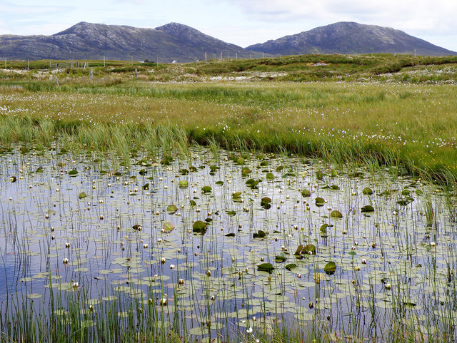
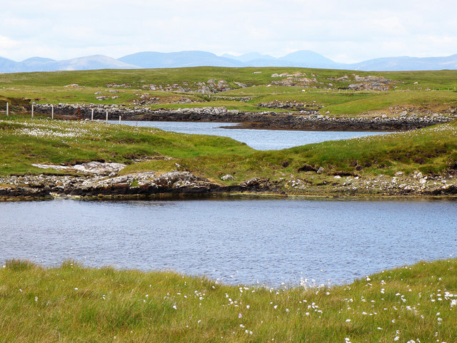
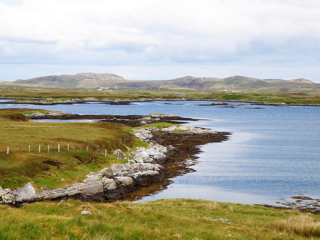
Blathaisbhal Images

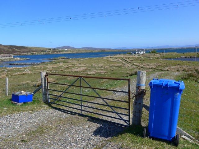
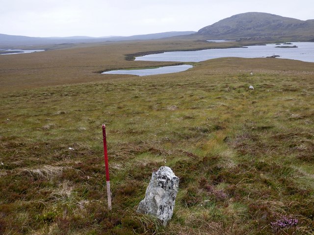
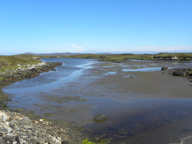
Images are sourced within 2km of 57.625516/-7.2085531 or Grid Reference NF8971. Thanks to Geograph Open Source API. All images are credited.
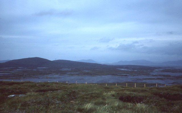
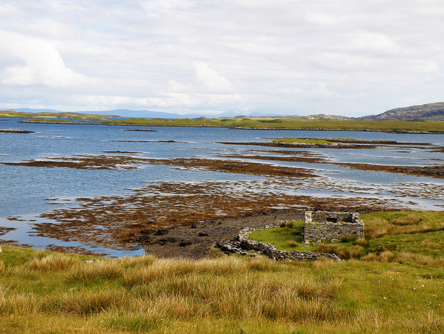
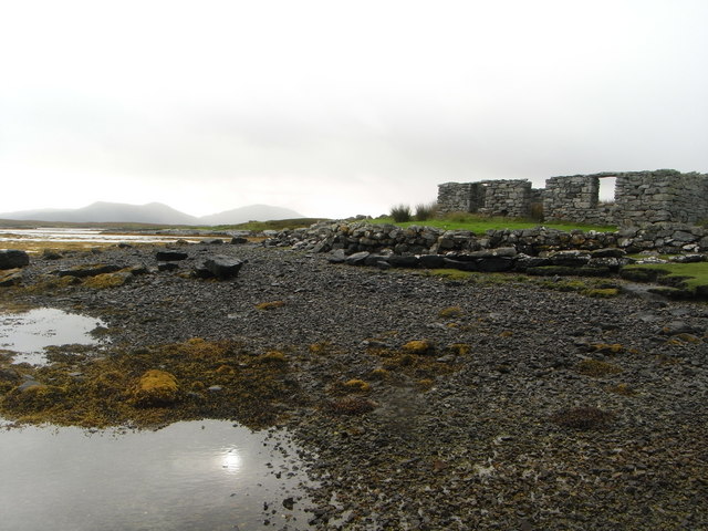
Track leading off the A865 The water beyond is the sea loch, Loch Blathaisbhal.
Track leading off the A865
The water beyond is the sea loch, Loch Blathaisbhal.
Blathaisbhal stone row A stone row composed of three stones. Like most rows it is far from straight (Scale 1m).
<span class="nowrap"><a title="https://stonerows.wordpress.com/gazetteer/region/western-isles/blashaval/" rel="nofollow ugc noopener" href="https://stonerows.wordpress.com/gazetteer/region/western-isles/blashaval/">Link</a><img style="margin-left:2px;" alt="External link" title="External link - shift click to open in new window" src="https://s1.geograph.org.uk/img/external.png" width="10" height="10"/></span>
Blathaisbhal stone row
A stone row composed of three stones. Like most rows it is far from straight (Scale 1m). LinkExternal link
View towards Loch an Duin The distant water translates as the Loch of the Dun, with the remains of Dun Torcuill in the middle distance [centre of photo]. The convoluted outline of the loch includes two other dun sites, both well out of sight from this point by the road.
View towards Loch an Duin
The distant water translates as the Loch of the Dun, with the remains of Dun Torcuill in the middle distance [centre of photo]. The convoluted outline of the loch includes two other dun sites, both well out of sight from this point by the road.
Loch Dheoir Loch Dheoir is the name given to this area of salt water where a maze of channels eventually connect with the open sea close to Lochmaddy.
Loch Dheoir
Loch Dheoir is the name given to this area of salt water where a maze of channels eventually connect with the open sea close to Lochmaddy.
Loch Blathaisbhal View from Blathaisbhal towards Lochmaddy.
Loch Blathaisbhal
View from Blathaisbhal towards Lochmaddy.
On Blathaisbhal A fine appreciation of the mix of land and water that is North Uist.   I always think of North Uist as a reverse of the Stockholm Archipelago - more land than water, just rather than the other way around.
On Blathaisbhal
A fine appreciation of the mix of land and water that is North Uist. I always think of North Uist as a reverse of the Stockholm Archipelago - more land than water, just rather than the other way around.
A865 below Blathaisbhal
Airigh Nan Luchag shieling A ruined shieling (Scale 1m). <span class="nowrap"><a title="https://canmore.org.uk/site/123341/north-uist-airigh-nan-luchag" rel="nofollow ugc noopener" href="https://canmore.org.uk/site/123341/north-uist-airigh-nan-luchag">Link</a><img style="margin-left:2px;" alt="External link" title="External link - shift click to open in new window" src="https://s1.geograph.org.uk/img/external.png" width="10" height="10"/></span>
Airigh Nan Luchag shieling
A ruined shieling (Scale 1m). LinkExternal link
Airigh Nan Luchag shieling Shielings are often difficult to spot but this one comes with its own signpost. <span class="nowrap"><a title="https://canmore.org.uk/site/123341/north-uist-airigh-nan-luchag" rel="nofollow ugc noopener" href="https://canmore.org.uk/site/123341/north-uist-airigh-nan-luchag">Link</a><img style="margin-left:2px;" alt="External link" title="External link - shift click to open in new window" src="https://s1.geograph.org.uk/img/external.png" width="10" height="10"/></span>
Airigh Nan Luchag shieling
Shielings are often difficult to spot but this one comes with its own signpost. LinkExternal link
Sea loch at Aileodair View from the loch side picnic area.
Sea loch at Aileodair
View from the loch side picnic area.
Inlet of Loch Mhidhinis Desolate looking on a grey April day.
Inlet of Loch Mhidhinis
Desolate looking on a grey April day.
Free range hebridean chickens Just how free range I'm not sure, the closest house was quite a way away over a Loch
Free range hebridean chickens
Just how free range I'm not sure, the closest house was quite a way away over a Loch
Lilies on a Loch I was surprised at just how many of the lochs have water lilies, this one also has Li a Tuath and Li a Deas in the distance
Lilies on a Loch
I was surprised at just how many of the lochs have water lilies, this one also has Li a Tuath and Li a Deas in the distance
Loch Midhinis In the distance can be seen the hills of the Isle of Harris
Loch Midhinis
In the distance can be seen the hills of the Isle of Harris
Loch Blathaisbhal In the distance on the left can be seen Crogearraidh na Thabha rising to 154m
Loch Blathaisbhal
In the distance on the left can be seen Crogearraidh na Thabha rising to 154m
Loch Blathaisbhal A ruined house stands on the shore and in the distance can be seen the hills of Skye
Loch Blathaisbhal
A ruined house stands on the shore and in the distance can be seen the hills of Skye
Ruins of a croft house on the shore of Loch Blathaisbhal
Show me another place!

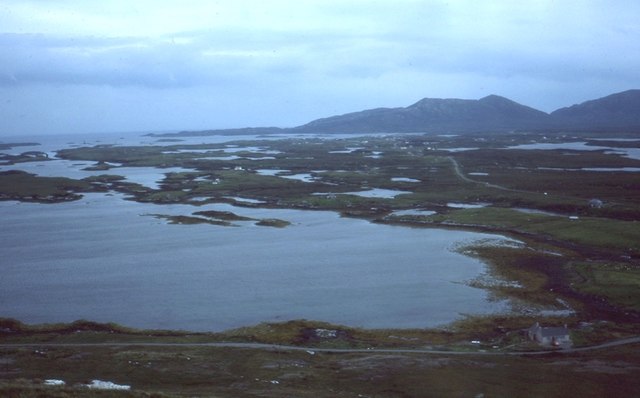
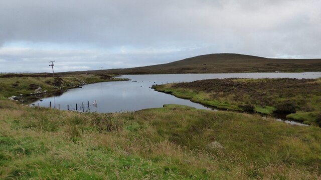
Blathaisbhal is located at Grid Ref: NF8971 (Lat: 57.625516, Lng: -7.2085531)

Unitary Authority: Na h-Eileanan an Iar

Police Authority: Highlands and Islands

What 3 Words

///intensely.gamer.hails. Near Lochmaddy, Na h-Eileanan Siar

Related Wikis

Na Fir Bhrèige

Na Fir Bhrèige (pronounced [nə fiɾʲ ˈvɾʲeːkʲə]; can be translated from Gaelic into English as "The False Men") is a set of three standing stones on the...

Ceallasaigh Mòr

Ceallasaigh Mòr (or Keallasay More) is a low-lying island in Loch Maddy off North Uist in the Outer Hebrides of Scotland. This an area of shallow lagoons...

Ceallasaigh Beag

Ceallasaigh Beag (or Keallasay Beg) is a low-lying island in Loch Maddy off North Uist in the Outer Hebrides of Scotland. This an area of shallow lagoons...

Lochmaddy

Lochmaddy (Scottish Gaelic: Loch nam Madadh [l̪ˠɔx nə ˈmat̪əɣ], "Loch of the Hounds") is the administrative centre of North Uist in the Outer Hebrides...

Nearby Amenities

Located within 500m of 57.625516,-7.2085531
Bus Stop
Blashaval
Bus: yes
Naptan AtcoCode: 6010731560
Naptan Bearing: S
Naptan BusStopType: CUS
Naptan CommonName: Blashaval
Naptan Indicator: Village
Naptan Landmark: entrance to number 7
Naptan NaptanCode: 94723569
Naptan Street: Village
Naptan Verified: no
Public Transport: platform
Source: naptan_import
Lat/Long: 57.6215057/-7.2049868
Passing Place
Lat/Long: 57.6225884/-7.20593
Na Fir Bhrèige
Archaeological Site: megalith
Historic: archaeological_site
Megalith Type: alignment
Name En: The False Men
Name Gd: Na Fir Bhrèige
Wikidata: Q5451206
Wikipedia: en:Na Fir Bhrèige
Lat/Long: 57.6275384/-7.2160328
Blathaisbhal
Name En: Blashaval
Name Gd: Blathaisbhal
Place: hamlet
Lat/Long: 57.6248227/-7.2002936
Blathaisbhal
Name En: Blashaval
Name Gd: Blathaisbhal
Natural: peak
Lat/Long: 57.625489/-7.2084958
Hiking: yes
Information: guidepost
Tourism: information
Lat/Long: 57.6223953/-7.2043879
Information: guidepost
Note: unmarked
Tourism: information
Lat/Long: 57.62825/-7.2152133
Barrier: stile
Stile: stepover
Lat/Long: 57.6277442/-7.2153542
Natural: stone
Lat/Long: 57.6275552/-7.2159317
Natural: stone
Lat/Long: 57.6274774/-7.2155819
Information: guidepost
Tourism: information
Lat/Long: 57.6273325/-7.2155665
Information: guidepost
Tourism: information
Lat/Long: 57.6254508/-7.2138319
Information: guidepost
Tourism: information
Lat/Long: 57.6244053/-7.2125292
Information: guidepost
Tourism: information
Lat/Long: 57.6238398/-7.21153
Blathaisbhal
Direction: S
Traffic Sign: city_limit
Lat/Long: 57.6217289/-7.2048131
Midhinis
Alt Name: Minish
Direction: N
Traffic Sign: city_limit
Lat/Long: 57.6217479/-7.204803
Barrier: stile
Note: broken, but still just usable: cross beam not present and two of the stands show rot
Stile: stepover
Lat/Long: 57.6259836/-7.2075841
Benchmark: yes
Man Made: survey_point
Ref: S8979
Tpuk Ref: TP1489
Triangulation Point: yes
Lat/Long: 57.6255078/-7.2085324
Power: pole
Lat/Long: 57.6216951/-7.2055896
Power: pole
Lat/Long: 57.6222416/-7.2050156
Power: pole
Lat/Long: 57.6228707/-7.2043075
Power: pole
Lat/Long: 57.6234697/-7.203645
Power: pole
Lat/Long: 57.6241318/-7.2029315
Power: pole
Lat/Long: 57.6247724/-7.2022006
Power: pole
Lat/Long: 57.6253806/-7.2015193
Power: pole
Lat/Long: 57.6259895/-7.2008246
Passing Place
Lat/Long: 57.6232579/-7.2027008
Power: pole
Lat/Long: 57.6257447/-7.2003266
Power: pole
Lat/Long: 57.6219985/-7.20442
Power: pole
Lat/Long: 57.6222384/-7.2042751
Power: pole
Lat/Long: 57.621898/-7.2041652
Turning Circle
Turning Circle: knuckle
Lat/Long: 57.6232758/-7.2063266
Power: pole
Lat/Long: 57.6214305/-7.205031
Passing Place
Lat/Long: 57.6222601/-7.2043664
The data included in this document is from www.openstreetmap.org. The data is made available under ODbL.

Have you been to Blathaisbhal?

Leave your review of Blathaisbhal below (or comments, questions and feedback).