Skidby

Settlement in Yorkshire

England

Skidby

Evidence of flytipping on Dunflat Lane Surely one of the most anti-social and despicable crimes one can witness in the countryside - causing blood to boil.
Evidence of flytipping on Dunflat Lane Credit: Neil Theasby

Skidby is a small village located in the East Riding of Yorkshire, England. Situated approximately 6 miles west of Beverley, it is nestled in the picturesque countryside of the Yorkshire Wolds. Skidby is known for its peaceful and rural atmosphere, making it a popular destination for those seeking tranquility and natural beauty.

The village is home to a population of around 600 residents and is characterized by its charming architecture, including traditional stone cottages and historic buildings. One of its notable landmarks is Skidby Mill, a Grade II listed windmill that has been converted into the Skidby Mill Museum. This museum showcases the history of milling and agriculture in the region, offering visitors an insight into the area's industrial past.

Skidby also boasts a thriving local community, with a village hall hosting various social events and gatherings throughout the year. The village is well-served by amenities, including a primary school, a church, and a local pub, providing essential services for its residents.

The surrounding countryside offers ample opportunities for outdoor activities such as walking, cycling, and horse riding. Skidby is also within easy reach of the Yorkshire Wolds Way, a long-distance footpath that stretches for 79 miles, offering stunning views of the rolling hills and picturesque landscapes.

Overall, Skidby is a charming village in Yorkshire, offering a peaceful and idyllic retreat for both residents and visitors alike. Its rich history, beautiful surroundings, and strong community spirit make it a delightful place to explore and enjoy.

If you have any feedback on the listing, please let us know in the comments section below.
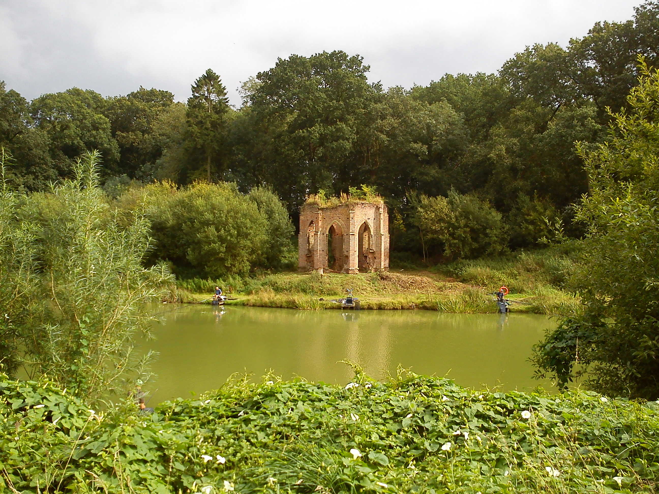
Skidby Images

Images are sourced within 2km of 53.789553/-0.460847 or Grid Reference TA0133. Thanks to Geograph Open Source API. All images are credited.

Evidence of flytipping on Dunflat Lane Surely one of the most anti-social and despicable crimes one can witness in the countryside - causing blood to boil.
Evidence of flytipping on Dunflat Lane
Surely one of the most anti-social and despicable crimes one can witness in the countryside - causing blood to boil.
Field at Ralph Nook
Field at Ralph Nook
View from Dunflat Lane towards Risby Park
Foggy November morning on the road from Little Weighton to Skidby
Riplingham Road from Bottoms Road Bridge The bridge carried the Hull, Barnsley & West Riding Junction Railway.
Riplingham Road from Bottoms Road Bridge
The bridge carried the Hull, Barnsley & West Riding Junction Railway.
Beech tree and passing place on Dunflat Lane, near Risby
Dunflat Lane Halfway between Risby and Little Weighton
Dunflat Lane
Halfway between Risby and Little Weighton
Risby fields Seen from Dunflat Lane
Risby fields
Seen from Dunflat Lane
Fields towards Risby Park
Dunflat Lane towards Risby
South of Mill Road, near Skidby Looking in the direction of Castle Hill across a newly sprouted crop. The road in the distance is the A164; the tops of the Humber Bridge towers can be made out on the horizon.
South of Mill Road, near Skidby
Looking in the direction of Castle Hill across a newly sprouted crop. The road in the distance is the A164; the tops of the Humber Bridge towers can be made out on the horizon.
New build housing, Cottingham Houses at the western end of the Persimmon Homes development off Castle Road. Cottingham's recent and ongoing expansion has tended to be, like this, on higher ground to the west of the settlement. I imagine this is partly because of flood risk on lower land, but also because development to the east or south would mean the 'village' effectively merging with Hull.

Persimmon Homes was, in 2018, granted planning permission for these 180 homes on 20 acres of surplus farmland opposite Castle Hill Hospital, which it bought from Hull & East Yorkshire NHS Trust.
New build housing, Cottingham
Houses at the western end of the Persimmon Homes development off Castle Road. Cottingham's recent and ongoing expansion has tended to be, like this, on higher ground to the west of the settlement. I imagine this is partly because of flood risk on lower land, but also because development to the east or south would mean the 'village' effectively merging with Hull. Persimmon Homes was, in 2018, granted planning permission for these 180 homes on 20 acres of surplus farmland opposite Castle Hill Hospital, which it bought from Hull & East Yorkshire NHS Trust.
'No fly-grazing', Eppleworth Despite what the sign appears to say, this site is unlikely to disappoint owners of gnats and bluebottles seeking suitable pastures for their six-legged pets. 

The pony seen here, although very small, is not a horsefly, but is on one of the sites stretching along the Raywell Valley by Westfield Road. These were constructed as part of a number of flood alleviation schemes in the area, designed to intercept and temporarily store surface water after periods of heavy rain.
'No fly-grazing', Eppleworth
Despite what the sign appears to say, this site is unlikely to disappoint owners of gnats and bluebottles seeking suitable pastures for their six-legged pets. The pony seen here, although very small, is not a horsefly, but is on one of the sites stretching along the Raywell Valley by Westfield Road. These were constructed as part of a number of flood alleviation schemes in the area, designed to intercept and temporarily store surface water after periods of heavy rain.
Toad revisited, Cottingham At the northern end of the Castle Hill Hospital site, this is one of the 'Larkin Toads' sited mainly in Hull during the Larkin 25 celebrations. This one was entitled 'Carnegie Toad' - shown at its original location in <a href="https://www.geograph.org.uk/photo/2001885">TA0728 : Larkin toads, Hull (27)</a>.
Toad revisited, Cottingham
At the northern end of the Castle Hill Hospital site, this is one of the 'Larkin Toads' sited mainly in Hull during the Larkin 25 celebrations. This one was entitled 'Carnegie Toad' - shown at its original location in TA0728 : Larkin toads, Hull (27).
Main Reception, Castle Hill Hospital
Beverley Road, Skidby
St Michael's Church, Skidby St Michael’s Church stands on land granted by Archbishop Walter de Grey of York in 1227. The present porch was added in 1777 and the tower in 1827 -situated on an older base. The original nave and bell tower were consumed by fire in 1424. The tower contains one bell with the Latin inscription “Voco, veni, precare 1706 Robert Jackson and Robert Marr Churchwardens”. Translated this means “I call, I come, I pray”.
St Michael's Church, Skidby
St Michael’s Church stands on land granted by Archbishop Walter de Grey of York in 1227. The present porch was added in 1777 and the tower in 1827 -situated on an older base. The original nave and bell tower were consumed by fire in 1424. The tower contains one bell with the Latin inscription “Voco, veni, precare 1706 Robert Jackson and Robert Marr Churchwardens”. Translated this means “I call, I come, I pray”.
On Oldgate - track north of Skidby
Show me another place!

Skidby is located at Grid Ref: TA0133 (Lat: 53.789553, Lng: -0.460847)

Division: East Riding

Unitary Authority: East Riding of Yorkshire

Police Authority: Humberside

What 3 Words

///thuds.books.reckoned. Near Skidby, East Yorkshire

Nearby Locations

Skidby Gallows Hill

Related Wikis

Skidby

Skidby is a small village and civil parish in Yorkshire Wolds of the East Riding of Yorkshire, England. It is situated about 6 miles (10 km) north-west...
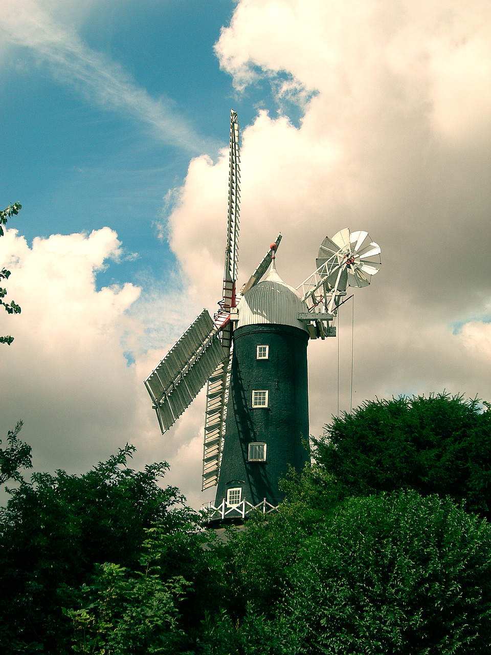
Skidby Windmill

Skidby Windmill is a Grade II* listed windmill at Skidby near Beverley, in the East Riding of Yorkshire, England.Originally built in 1821, the mill was...

Risby, East Riding of Yorkshire

Risby is the site of a deserted village and former stately home in the civil parish of Rowley in the East Riding of Yorkshire, England. It is approximately...

Eppleworth

Eppleworth is a hamlet in the East Riding of Yorkshire, England. It is situated on Westfields Road and lies 1 mile (1.6 km) to the south of Skidby and...

Nearby Amenities

Located within 500m of 53.789553,-0.460847
Skidby
Place: village
Lat/Long: 53.7893276/-0.4626607
Turning Circle
Lat/Long: 53.7890786/-0.4561039
Power: tower
Lat/Long: 53.7935931/-0.4596891
Power: tower
Lat/Long: 53.7923453/-0.4634625
Power: tower
Lat/Long: 53.7910562/-0.4676439
Post Box
Post Box Type: wall
Royal Cypher: EIIR
Royal Cypher Wikidata: Q33102113
Lat/Long: 53.7895935/-0.4579742
Bench
Lat/Long: 53.789727/-0.4597856
Bus Stop
Skidby Risby Garth
Naptan AtcoCode: 2200YEA00823
Naptan Bearing: E
Naptan CommonName: Skidby Risby Garth
Naptan Landmark: School
Naptan Street: Little Weighton Road
Note: no code on sign
Shelter: no
Source: naptan + survey
Lat/Long: 53.7895391/-0.4679175
Bus Stop
Skidby Main Street
Naptan AtcoCode: 2200YEA00824
Naptan Bearing: SW
Naptan CommonName: Skidby Main Street
Naptan Street: Main Street
Note: no code on sign
Shelter: no
Source: naptan + survey
Lat/Long: 53.7877074/-0.4651256
Bus Stop
Skidby Main Street
Naptan AtcoCode: 2200YEA00825
Naptan Bearing: NE
Naptan CommonName: Skidby Main Street
Naptan Street: Main Street
Note: no code on sign
Shelter: no
Source: naptan + survey
Lat/Long: 53.7882338/-0.4640886
Bus Stop
Skidby Main Street
Kerb: raised
Naptan AtcoCode: 2200YEA00826
Naptan Bearing: E
Naptan CommonName: Skidby Main Street
Naptan Landmark: St. Michaels Church
Naptan Street: Main Street
Note: moved E
Shelter: no
Source: naptan + survey
Lat/Long: 53.7897612/-0.4599342
Bus Stop
Skidby Main Street
Naptan AtcoCode: 2200YEA00827
Naptan Bearing: E
Naptan CommonName: Skidby Main Street
Naptan Landmark: Opposite Number 24
Naptan Street: Main Street
Shelter: no
Source: naptan + survey
Lat/Long: 53.7897003/-0.4551711
Bus Stop
Skidby Main Street
Naptan AtcoCode: 2200YEA00828
Naptan Bearing: W
Naptan CommonName: Skidby Main Street
Naptan Street: Main Street
Shelter: no
Source: naptan + survey
Lat/Long: 53.7895972/-0.454096
Historic: memorial
Memorial: war_memorial
Lat/Long: 53.789381/-0.460882
Telephone
Booth: K6
Colour: white
Covered: booth
Phone: +44 1482 876094
Lat/Long: 53.7896416/-0.4597656
Defibrillator
Defibrillator Location: outside Skidby Village Hall - opposite Church
Emergency: defibrillator
Indoor: no
Lat/Long: 53.7896971/-0.4607208
The data included in this document is from www.openstreetmap.org. The data is made available under ODbL.

Have you been to Skidby?

Leave your review of Skidby below (or comments, questions and feedback).