Skilgate

Settlement in Somerset Somerset West and Taunton

England

Skilgate

Old Milestone by the B3190, Haddon Hill Metal plate attached to stone post by the B3190, in parish of SKILGATE (WEST SOMERSET District), 400m East of entrance to Haddon Hill car park, a mile West of Upton, on grass verge by road, on North side of road. Minehead iron plate, erected by the Minehead & Bampton Road turnpike trust in the 19th century. 

Inscription reads:-
13
MILES
To
Watchet 

Grade II listed. List Entry Number: 1248032
<span class="nowrap"><a title="https://historicengland.org.uk/listing/the-list/list-entry/1248032" rel="nofollow ugc noopener" href="https://historicengland.org.uk/listing/the-list/list-entry/1248032">Link</a><img style="margin-left:2px;" alt="External link" title="External link - shift click to open in new window" src="https://s1.geograph.org.uk/img/external.png" width="10" height="10"/></span>

Milestone Society National ID: SO_WTTV13.
Old Milestone by the B3190, Haddon Hill Credit: Julia Browne

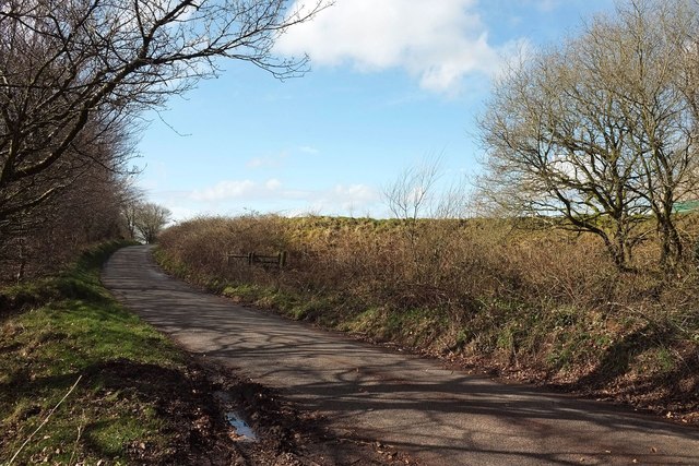
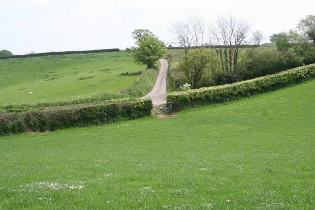
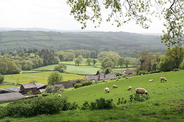
Skilgate is a small village located in the West Somerset district of Somerset, England. Situated on the eastern edge of Exmoor National Park, Skilgate is surrounded by picturesque countryside and offers a tranquil and idyllic setting for residents and visitors alike.

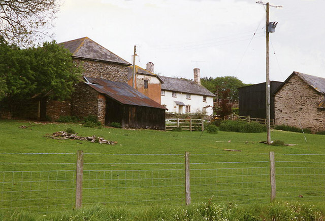
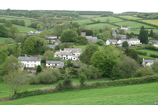
The village itself is characterized by its charming stone cottages and traditional thatched roofs, giving it a quintessentially English feel. Skilgate is home to a close-knit community, with a population of around 300 people. The village is well-connected to nearby towns and cities, with the town of Taunton approximately 13 miles to the southeast.

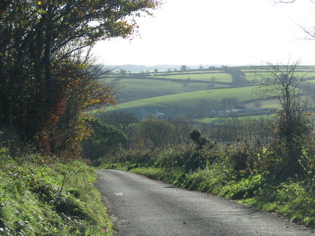
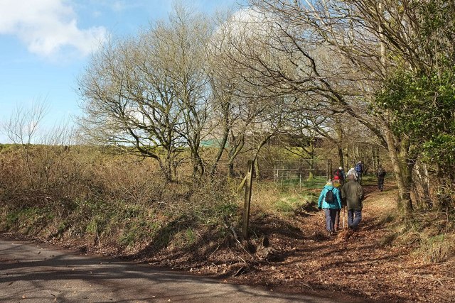
Skilgate is a haven for outdoor enthusiasts, as it is located near the stunning beauty of Exmoor National Park. The park offers a wide range of activities, including hiking, cycling, and horse riding, allowing visitors to explore its diverse landscapes and encounter its rich wildlife.

In terms of amenities, Skilgate has limited facilities within the village itself, but it benefits from being within close proximity to neighboring towns. The village has a community hall that hosts various events and gatherings, fostering a sense of community spirit.

Overall, Skilgate is a charming and picturesque village, offering a peaceful and rural lifestyle to its residents. Its stunning surroundings and close proximity to Exmoor National Park make it an attractive destination for nature lovers and those seeking a tranquil retreat in the heart of Somerset.

If you have any feedback on the listing, please let us know in the comments section below.
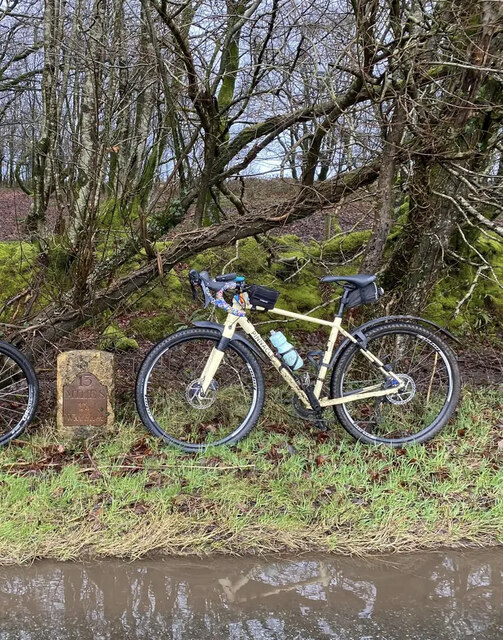
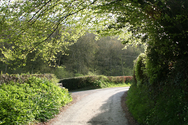
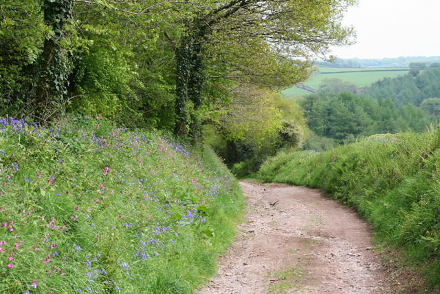
Skilgate Images

Images are sourced within 2km of 51.036189/-3.445456 or Grid Reference SS9827. Thanks to Geograph Open Source API. All images are credited.

Old Milestone by the B3190, Haddon Hill Metal plate attached to stone post by the B3190, in parish of SKILGATE (WEST SOMERSET District), 400m East of entrance to Haddon Hill car park, a mile West of Upton, on grass verge by road, on North side of road. Minehead iron plate, erected by the Minehead & Bampton Road turnpike trust in the 19th century. 

Inscription reads:-
13
MILES
To
Watchet 

Grade II listed. List Entry Number: 1248032
<span class="nowrap"><a title="https://historicengland.org.uk/listing/the-list/list-entry/1248032" rel="nofollow ugc noopener" href="https://historicengland.org.uk/listing/the-list/list-entry/1248032">Link</a><img style="margin-left:2px;" alt="External link" title="External link - shift click to open in new window" src="https://s1.geograph.org.uk/img/external.png" width="10" height="10"/></span>

Milestone Society National ID: SO_WTTV13.
Old Milestone by the B3190, Haddon Hill
Metal plate attached to stone post by the B3190, in parish of SKILGATE (WEST SOMERSET District), 400m East of entrance to Haddon Hill car park, a mile West of Upton, on grass verge by road, on North side of road. Minehead iron plate, erected by the Minehead & Bampton Road turnpike trust in the 19th century. Inscription reads:- 13 MILES To Watchet Grade II listed. List Entry Number: 1248032 LinkExternal link Milestone Society National ID: SO_WTTV13.
Upton: by the entrance to Ranscombe Farm Looking north west on the lane from Blackwell to Skilgate
Upton: by the entrance to Ranscombe Farm
Looking north west on the lane from Blackwell to Skilgate
Skilgate: the road from Lowtrow Cross Looking south-south-west
Skilgate: the road from Lowtrow Cross
Looking south-south-west
Skilgate: bridleway from Haddon End Looking east-north-east. The track leads to Dulverton Lane and Heydon Hill
Skilgate: bridleway from Haddon End
Looking east-north-east. The track leads to Dulverton Lane and Heydon Hill
Minor road drops to Haddon End
Bridleway to Post Lane Walkers taking part in the Rotary Exmoor Challenge leave the lane between Lowtrow Cross and Skilgate, following bridleway 40UF030 DU 8/17. Hello, that large barn isn't shown on satellite images or maps.
Bridleway to Post Lane
Walkers taking part in the Rotary Exmoor Challenge leave the lane between Lowtrow Cross and Skilgate, following bridleway 40UF030 DU 8/17. Hello, that large barn isn't shown on satellite images or maps.
Lane to Skilgate From the same spot as <a href="https://www.geograph.org.uk/photo/4906771">ST0028 : Bridleway to Post Lane</a>, looking to the left. There is a double row of trees on the left - does that constitute a wood?
Lane to Skilgate
From the same spot as ST0028 : Bridleway to Post Lane, looking to the left. There is a double row of trees on the left - does that constitute a wood?
Entrance driveway, Ranscombe Farm
Ranscombe
Ranscombe
Minor road to Skilgate
Skilgate: Surridge Farm The building nearest the camera was apparently a water-powered saw mill. The leat has long since been ploughed up and the millpond is now a small copse. To left of the building a large overshot waterwheel survived in 1996, in an overgrown wheelpit
Skilgate: Surridge Farm
The building nearest the camera was apparently a water-powered saw mill. The leat has long since been ploughed up and the millpond is now a small copse. To left of the building a large overshot waterwheel survived in 1996, in an overgrown wheelpit
Skilgate: St John’s church The tower dates from the 14th century; the body of the church was rebuilt in 1872
Skilgate: St John’s church
The tower dates from the 14th century; the body of the church was rebuilt in 1872
Wimbleball Reservoir This little valley is now underwater. The picture was taken shortly before it was flooded in the mid-70s, with all the conifers that grew in the valley, cut down ready for hauling out. It was a curious sensation standing at the planned waters edge looking into a space, the space of the photo and more, that was about to be transformed for the purpose of attracting more people to live in the West Country. Did those additional houses that were able to be built, account for all the water stored in this space?
Wimbleball Reservoir
This little valley is now underwater. The picture was taken shortly before it was flooded in the mid-70s, with all the conifers that grew in the valley, cut down ready for hauling out. It was a curious sensation standing at the planned waters edge looking into a space, the space of the photo and more, that was about to be transformed for the purpose of attracting more people to live in the West Country. Did those additional houses that were able to be built, account for all the water stored in this space?
Bampton: nearing Hone Cross On the footpath from Skilgate. Looking south east
Bampton: nearing Hone Cross
On the footpath from Skilgate. Looking south east
Skilgate: near Haddon End Looking south west over farmland
Skilgate: near Haddon End
Looking south west over farmland
Skilgate: hedgebanks near Haddon End Looking north west by the road from Lowtrow Cross. Beyond the second hedge or field boundary a public footpath runs roughly northwards to Bridge End, Upton
Skilgate: hedgebanks near Haddon End
Looking north west by the road from Lowtrow Cross. Beyond the second hedge or field boundary a public footpath runs roughly northwards to Bridge End, Upton
Bampton: above Quartley Farm Looking south west. The town of Bampton is beyond the first hill on the left
Bampton: above Quartley Farm
Looking south west. The town of Bampton is beyond the first hill on the left
Skilgate: towards the village Seen from the track and public footpath from Haynes Down. Looking north
Skilgate: towards the village
Seen from the track and public footpath from Haynes Down. Looking north
Show me another place!

Skilgate is located at Grid Ref: SS9827 (Lat: 51.036189, Lng: -3.445456)

Administrative County: Somerset

District: Somerset West and Taunton

Police Authority: Avon and Somerset

What 3 Words

///laptop.inspected.tickling. Near Dulverton, Somerset

Nearby Locations

Skilgate

Related Wikis

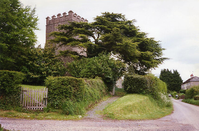
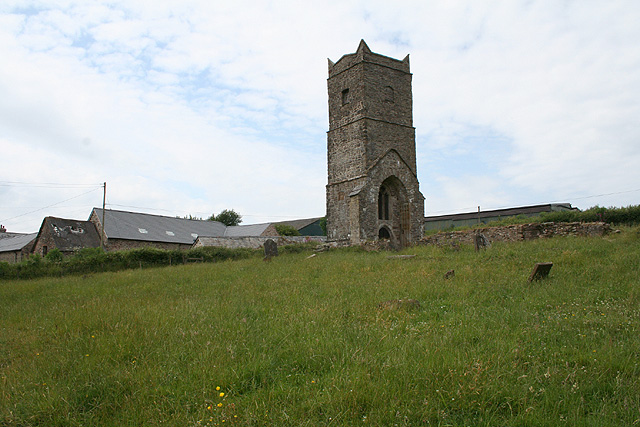
Church of St John, Skilgate

The Anglican Church of St John in Skilgate, Somerset, England was built in the 14th century. It is a Grade II* listed building. == History == The church...

Skilgate

Skilgate is a village and civil parish 5 miles (8 km) east of Dulverton and 8 miles (13 km) west of Wiveliscombe in the Somerset West and Taunton district...

Upton, Somerset

Upton is a village and civil parish north of Skilgate in Somerset, England. It is situated on a hill above the eastern end of Wimbleball Lake. == History... ==

Old Church of St James, Upton

The Old St James's Church is a former church in the village of Upton, Somerset, England, of which only the tower remains, overlooking Wimbleball Lake....

Nearby Amenities

Located within 500m of 51.036189,-3.445456
Skilgate
Is In: Somerset, England, UK
Place: village
Wikidata: Q1899637
Wikipedia: en:Skilgate
Lat/Long: 51.0355885/-3.4454387
Barrier: yes
Lat/Long: 51.0363553/-3.4451148
The data included in this document is from www.openstreetmap.org. The data is made available under ODbL.

Have you been to Skilgate?

Leave your review of Skilgate below (or comments, questions and feedback).