Skidbrooke North End

Settlement in Lincolnshire East Lindsey

England

Skidbrooke North End

Sea Bank House, Saltfleet The heart of this (well-hidden) building is a 17th century farmhouse, which has had alterations and extensions over the years - it was originally a single-storey cottage, and one of the first alterations in the mid 18th century was to add an upper floor. It was Grade II listed <span class="nowrap"><a title="https://historicengland.org.uk/listing/the-list/list-entry/1063061" rel="nofollow ugc noopener" href="https://historicengland.org.uk/listing/the-list/list-entry/1063061">Link</a><img style="margin-left:2px;" alt="External link" title="External link - shift click to open in new window" src="https://s1.geograph.org.uk/img/external.png" width="10" height="10"/></span> & <span class="nowrap"><a title="https://britishlistedbuildings.co.uk/101063061-seabank-house-skidbrooke-with-saltfleet-haven" rel="nofollow ugc noopener" href="https://britishlistedbuildings.co.uk/101063061-seabank-house-skidbrooke-with-saltfleet-haven">Link</a><img style="margin-left:2px;" alt="External link" title="External link - shift click to open in new window" src="https://s1.geograph.org.uk/img/external.png" width="10" height="10"/></span> in 1983.
Sea Bank House, Saltfleet Credit: Richard Law

Skidbrooke North End is a small village located in the county of Lincolnshire, England. Situated approximately 8 miles north-east of the town of Louth, it is nestled within the rural landscape of the Lincolnshire Wolds Area of Outstanding Natural Beauty.

The village is characterized by its quiet and peaceful atmosphere, with a population of around 200 residents. Skidbrooke North End is predominantly an agricultural community, with a number of farms dotting the surrounding countryside. The village itself is made up of a cluster of traditional cottages and houses, many of which date back several centuries.

Although small in size, Skidbrooke North End boasts a rich history. The nearby Skidbrooke church, dedicated to St. Botolph, is a Grade II listed building and is believed to have been constructed in the 13th century. Its architectural features include a striking tower and an intricately carved doorway.

The village is conveniently located near the coast, with the popular seaside resort of Mablethorpe just a short drive away. This provides residents and visitors with the opportunity to enjoy the sandy beaches and attractions of the Lincolnshire coast.

Skidbrooke North End is a close-knit community, with a strong sense of community spirit. The village hosts a number of events and activities throughout the year, including summer fairs and village fetes, which bring residents together and attract visitors from the surrounding areas.

In summary, Skidbrooke North End is a charming and idyllic village in Lincolnshire, known for its agricultural heritage, historic church, and proximity to the coast.

If you have any feedback on the listing, please let us know in the comments section below.

Skidbrooke North End Images

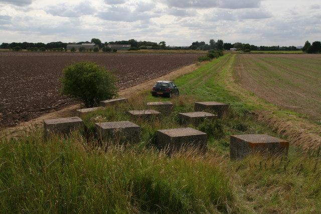
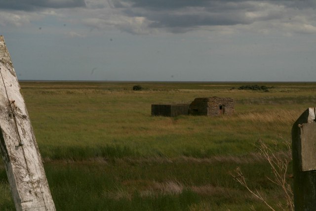
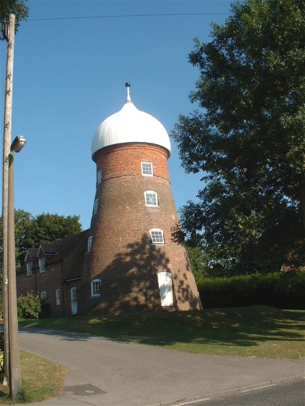
Images are sourced within 2km of 53.435929/0.163668 or Grid Reference TF4395. Thanks to Geograph Open Source API. All images are credited.

Sea Bank House, Saltfleet The heart of this (well-hidden) building is a 17th century farmhouse, which has had alterations and extensions over the years - it was originally a single-storey cottage, and one of the first alterations in the mid 18th century was to add an upper floor. It was Grade II listed <span class="nowrap"><a title="https://historicengland.org.uk/listing/the-list/list-entry/1063061" rel="nofollow ugc noopener" href="https://historicengland.org.uk/listing/the-list/list-entry/1063061">Link</a><img style="margin-left:2px;" alt="External link" title="External link - shift click to open in new window" src="https://s1.geograph.org.uk/img/external.png" width="10" height="10"/></span> & <span class="nowrap"><a title="https://britishlistedbuildings.co.uk/101063061-seabank-house-skidbrooke-with-saltfleet-haven" rel="nofollow ugc noopener" href="https://britishlistedbuildings.co.uk/101063061-seabank-house-skidbrooke-with-saltfleet-haven">Link</a><img style="margin-left:2px;" alt="External link" title="External link - shift click to open in new window" src="https://s1.geograph.org.uk/img/external.png" width="10" height="10"/></span> in 1983.
Sea Bank House, Saltfleet
The heart of this (well-hidden) building is a 17th century farmhouse, which has had alterations and extensions over the years - it was originally a single-storey cottage, and one of the first alterations in the mid 18th century was to add an upper floor. It was Grade II listed LinkExternal link & LinkExternal link in 1983.
Shingle Bank north-east of Howden's Pullover From the shore it looks like a line of sand dunes, which is probably what it once was - see <a href="https://www.geograph.org.uk/photo/3422292">TF4595 : Sand dunes in the middle of the beach</a> and  <a href="https://www.geograph.org.uk/photo/3616542">TF4595 : Off-shore sand dunes</a>.
Shingle Bank north-east of Howden's Pullover
From the shore it looks like a line of sand dunes, which is probably what it once was - see TF4595 : Sand dunes in the middle of the beach and TF4595 : Off-shore sand dunes.
Skidbrooke North End: farm track with WW2 anti-tank cubes, viewed from sea bank
Old military building, seen from the sea bank south of Donna Nook
Sign at Howden's Pullover carpark These signs are appearing at all the beach entry points along this coastline.
Sign at Howden's Pullover carpark
These signs are appearing at all the beach entry points along this coastline.
Howden's Pullover: Environment Agency sign on path in front of sea bank See <a href="https://www.geograph.org.uk/photo/4637521">TF4692 : Environment Agency sign in the sea buckthorn by Sea View carpark</a> for wording.
Howden's Pullover: Environment Agency sign on path in front of sea bank
Creek and sign in front of sea wall east of Skidbrooke North End Sign says "HUMBER WILDFOWLERS PRIVATE SHOOTING".
Creek and sign in front of sea wall east of Skidbrooke North End
Sign says "HUMBER WILDFOWLERS PRIVATE SHOOTING".
Sea wall east of Skidbrooke North End Neatly mown in front of and behind the camera.
Sea wall east of Skidbrooke North End
Neatly mown in front of and behind the camera.
Howden's Pullover: aerial 2016 For context of the term "pullover" see <a href="https://www.geograph.org.uk/photo/4637521">TF4692 : Environment Agency sign in the sea buckthorn by Sea View carpark</a>.
Howden's Pullover: aerial 2016
North Somercotes: sea wall and coastal lagoons opposite Warren Farm (aerial 2016)
Ex Methodist Chapel, North Somercotes The plaque on this building now converted into housing reads:
PRIMITIVE METHODIST
CHAPEL
ERECTED A.D. 1865
Ex Methodist Chapel, North Somercotes
The plaque on this building now converted into housing reads: PRIMITIVE METHODIST CHAPEL ERECTED A.D. 1865
Shingle bank off Howden's Pullover, near Saltfleet: aerial 2015 Extends into <a href="https://www.geograph.org.uk/gridref/TF4595">TF4595</a>.
Even at the height of one of the year's biggest tides (7.6 m) the bank is not quite submerged. Until recently there was a hut on it.
Believed to be the remains of a line of sand dunes. See <a href="https://www.geograph.org.uk/photo/4637115">TF4596 : Shingle Bank north-east of Howden's Pullover</a> for ground shot, and <a href="https://www.geograph.org.uk/photo/4641175">TF4694 : Saltfleet shingle banks shortly after high tide (7.6m): aerial September 2015</a> for the larger bank next to it at Saltfleet.
Shingle bank off Howden's Pullover, near Saltfleet: aerial 2015
Extends into TF4595. Even at the height of one of the year's biggest tides (7.6 m) the bank is not quite submerged. Until recently there was a hut on it. Believed to be the remains of a line of sand dunes. See TF4596 : Shingle Bank north-east of Howden's Pullover for ground shot, and TF4694 : Saltfleet shingle banks shortly after high tide (7.6m): aerial September 2015 for the larger bank next to it at Saltfleet.
North Somercotes to Salfleet down the beach: aerial 2016 Howden's Pullover (across the sea bank) and to the right of it the Merrikin's/Skidbrooke Farm sea access track and bank crossing.
North Somercotes to Salfleet down the beach: aerial 2016
Howden's Pullover (across the sea bank) and to the right of it the Merrikin's/Skidbrooke Farm sea access track and bank crossing.
Rusty embossed sign on the saltmarsh at Skidbrooke North End "HUMBER WILDFOWLERS PRIVATE SHOOTING". See also <a href="https://www.geograph.org.uk/photo/4637700">TF4495 : Creek and sign in front of sea wall east of Skidbrooke North End</a>.
Rusty embossed sign on the saltmarsh at Skidbrooke North End
"HUMBER WILDFOWLERS PRIVATE SHOOTING". See also TF4495 : Creek and sign in front of sea wall east of Skidbrooke North End.
Beach and shingle banks from Merrikin's Pullover to Saltfleet Haven (aerial 2016) Interesting weather - brilliant evening sunshine but a weather war was brewing, with an unmoving band of cloud running down the area, west of the camera. Beyond that, on the Wolds: more sunshine. Yet trouble is afoot, or rather aloft, for an hour after this shot a hail storm broke, followed by an series of rainbows.
Beach and shingle banks from Merrikin's Pullover to Saltfleet Haven (aerial 2016)
Interesting weather - brilliant evening sunshine but a weather war was brewing, with an unmoving band of cloud running down the area, west of the camera. Beyond that, on the Wolds: more sunshine. Yet trouble is afoot, or rather aloft, for an hour after this shot a hail storm broke, followed by an series of rainbows.
North Somercotes Warren to the sea: aerial 2016 See alaso <a href="https://www.geograph.org.uk/gridref/TF4296">TF4296</a>.
North Somercotes Warren to the sea: aerial 2016
See alaso TF4296.
North Somercotes and Warren: aerial 2016 For North Somercotes Warren see also <a href="https://www.geograph.org.uk/photo/5149453">TF4396 : North Somercotes Warren to the sea: aerial 2016</a>.
North Somercotes and Warren: aerial 2016
For North Somercotes Warren see also TF4396 : North Somercotes Warren to the sea: aerial 2016.
Show me another place!

Skidbrooke North End is located at Grid Ref: TF4395 (Lat: 53.435929, Lng: 0.163668)

Division: Parts of Lindsey

Administrative County: Lincolnshire

District: East Lindsey

Police Authority: Lincolnshire

What 3 Words

///fills.gashes.melts. Near North Somercotes, Lincolnshire

Nearby Locations

Skidbrooke North End

Related Wikis

Lincolnshire Marsh

The Lincolnshire Marsh is a belt of reclaimed salt marsh and sand dune in Lincolnshire, England, between the Lincolnshire Wolds and the North Sea coast...

Saltfleet

Saltfleet is a coastal village in the East Lindsey district of Lincolnshire, England. It is approximately 8 miles (13 km) north of Mablethorpe and 11...

St Botolph's Church, Skidbrooke

St Botolph's Church is a redundant Anglican church near the village of Skidbrooke, Lincolnshire, England. It is recorded in the National Heritage List...

North Somercotes

North Somercotes is a village near to the North Sea coast, in the district of East Lindsey and the Marshes area, of Lincolnshire, England. The village...

Nearby Amenities

Located within 500m of 53.435929,0.163668
Skidbrooke North End
Place: hamlet
Lat/Long: 53.4337656/0.1687967
Owe's Lane Farm
Place: farm
Source: Bing
Lat/Long: 53.4348352/0.1605398
Skidbrooke Farm
Place: farm
Source: Bing
Lat/Long: 53.4352699/0.1633245
Salt Box Farm
Place: farm
Source: Bing
Lat/Long: 53.439531/0.1628251
Fairfield
Place: isolated_dwelling
Source: Bing
Lat/Long: 53.4376178/0.1605856
Michael's Farm
Place: farm
Source: Bing
Lat/Long: 53.4343015/0.1664845
The data included in this document is from www.openstreetmap.org. The data is made available under ODbL.

Have you been to Skidbrooke North End?

Leave your review of Skidbrooke North End below (or comments, questions and feedback).