Blank Bank

Settlement in Staffordshire Newcastle-under-Lyme

England

Blank Bank

Rutted path in Bates Wood The deep ruts are caused by cycle wheels. The path is designated Audley FP 110.
Rutted path in Bates Wood Credit: Jonathan Hutchins

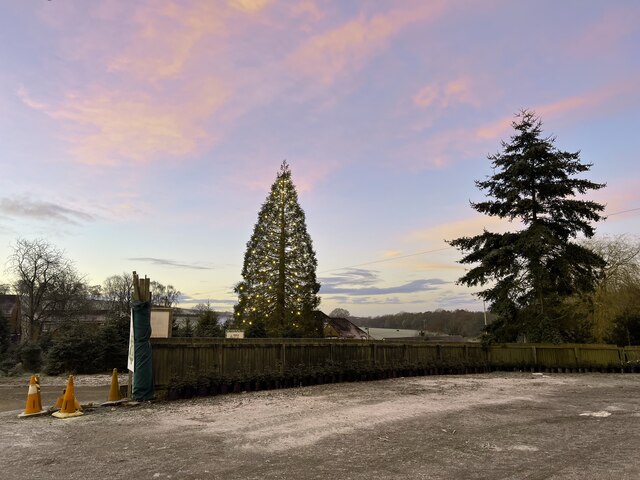
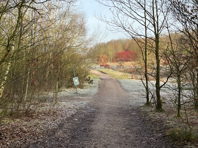
Blank Bank is a small village located in the county of Staffordshire, England. Situated in the picturesque countryside, it is part of the Staffordshire Moorlands district. The village is known for its tranquility and natural beauty, offering residents and visitors a peaceful escape from the hustle and bustle of city life.

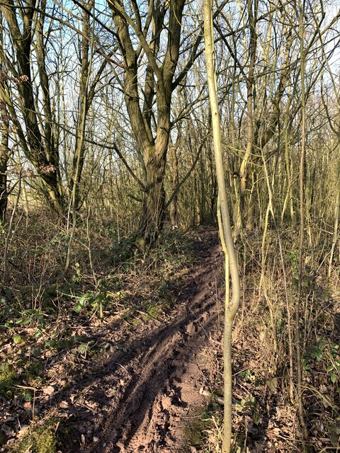
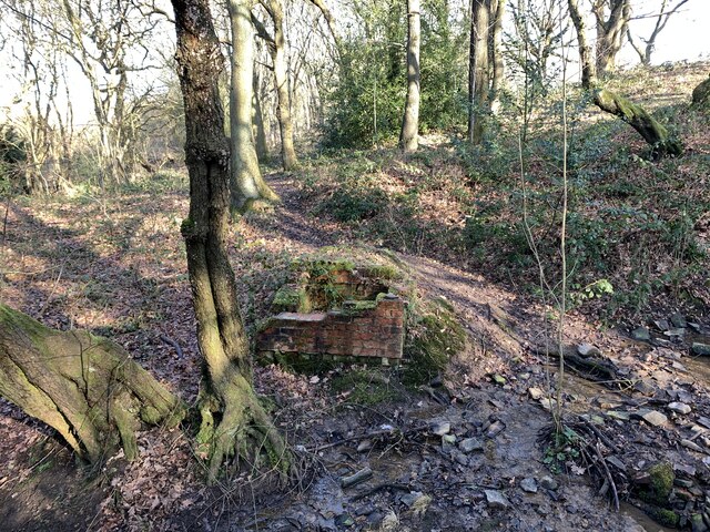
Blank Bank is characterized by its traditional English architecture, with charming stone cottages and well-maintained gardens dotting the landscape. The village is surrounded by rolling hills and lush green fields, providing ample opportunities for outdoor activities such as hiking and cycling.

Despite its small size, Blank Bank is home to a tight-knit community that takes pride in preserving the village's heritage and traditions. The village has a local pub, The Blank Bank Arms, which serves as a gathering place for residents and visitors to enjoy a pint and engage in conversation. In addition, there is a small village hall that hosts various community events throughout the year, including fairs and social gatherings.

For amenities and services, Blank Bank residents typically rely on nearby towns and villages. The village is conveniently located within a short driving distance of larger towns, providing access to schools, shops, and healthcare facilities.

Overall, Blank Bank offers a tranquil and idyllic setting for those seeking a rural lifestyle. Its natural beauty, charming architecture, and close-knit community make it a desirable place to live or visit in Staffordshire.

If you have any feedback on the listing, please let us know in the comments section below.

Blank Bank Images

Images are sourced within 2km of 53.019956/-2.2846879 or Grid Reference SJ8147. Thanks to Geograph Open Source API. All images are credited.
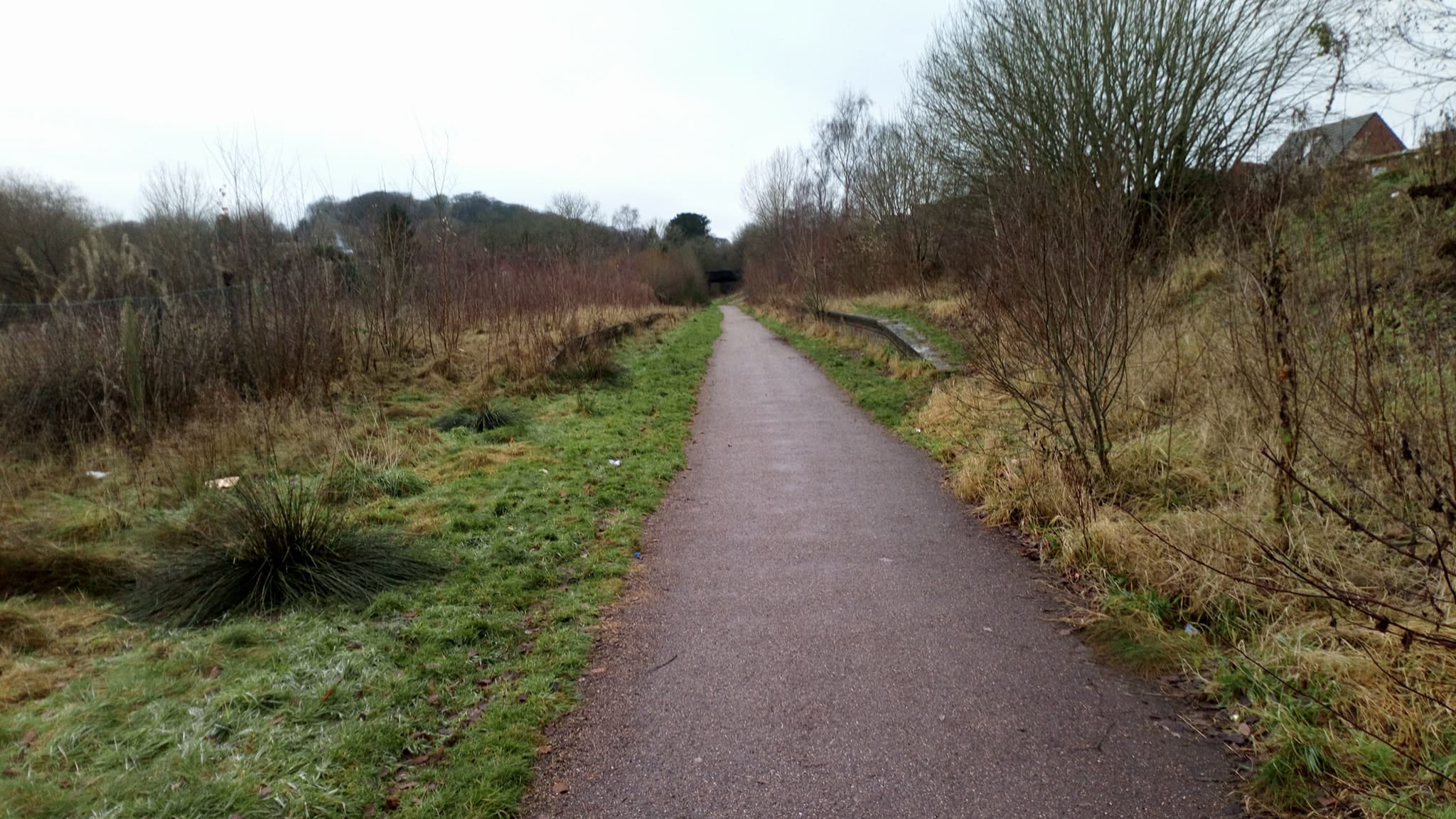
Rutted path in Bates Wood The deep ruts are caused by cycle wheels. The path is designated Audley FP 110.
Rutted path in Bates Wood
The deep ruts are caused by cycle wheels. The path is designated Audley FP 110.
Footings of former brick structure in Bates Wood This brick structure was presumably part of the mine workings which operated here.
Footings of former brick structure in Bates Wood
This brick structure was presumably part of the mine workings which operated here.
First in the queue at the tip Newcastle-under-Lyme recycling centre is situated in the hamlet of Leycett, a former mining village. 
website <span class="nowrap"><a title="https://www.staffordshire.gov.uk/Waste-and-recycling/recyclingcentres/NewcastleRecyclingCentre.aspx" rel="nofollow ugc noopener" href="https://www.staffordshire.gov.uk/Waste-and-recycling/recyclingcentres/NewcastleRecyclingCentre.aspx">Link</a><img style="margin-left:2px;" alt="External link" title="External link - shift click to open in new window" src="https://s1.geograph.org.uk/img/external.png" width="10" height="10"/></span>
First in the queue at the tip
Newcastle-under-Lyme recycling centre is situated in the hamlet of Leycett, a former mining village. website LinkExternal link
Newcastle-under-Lyme recycling centre aka 'Leycett tip'
Newcastle-under-Lyme recycling centre
aka 'Leycett tip'
Newcastle-under-Lyme recycling centre aka 'Leycett tip'
Newcastle-under-Lyme recycling centre
aka 'Leycett tip'
Trees at Keele Christmas Tree Farm
Keele Christmas Tree Farm
Muddy woodland path Bateswood Country Park, north-west of Newcastle-under-Lyme in Staffordshire and adjacent to the village of Halmer End, is designated as a Local Nature Reserve (LNR). It was developed after the cessation of opencast mining in the 1990s, which left the area as a barren wasteland with poor quality soil. Birch reforestation and the creation of a lake have improved the habitat for wildlife, while a network of footpaths and a bridle path create access to most parts of the site. In 2012 managed fishing by a local angling club was permitted, in an attempt to curb illicit fishing.

The site is managed by Newcastle Borough Council in partnership with Halmer End Wildlife Trust, a group of volunteers.

This site is not to be confused with Staffordshire Wildlife Trust's reserve immediately to the south, also called Bateswood (see <a title="https://www.geograph.org.uk/snippet/12701)" href="https://www.geograph.org.uk/snippet/12701)">Link</a>.
Muddy woodland path
Bateswood Country Park, north-west of Newcastle-under-Lyme in Staffordshire and adjacent to the village of Halmer End, is designated as a Local Nature Reserve (LNR). It was developed after the cessation of opencast mining in the 1990s, which left the area as a barren wasteland with poor quality soil. Birch reforestation and the creation of a lake have improved the habitat for wildlife, while a network of footpaths and a bridle path create access to most parts of the site. In 2012 managed fishing by a local angling club was permitted, in an attempt to curb illicit fishing. The site is managed by Newcastle Borough Council in partnership with Halmer End Wildlife Trust, a group of volunteers. This site is not to be confused with Staffordshire Wildlife Trust's reserve immediately to the south, also called Bateswood (see Link.
Track and path junction in Bateswood Country Park Bateswood Country Park, north-west of Newcastle-under-Lyme in Staffordshire and adjacent to the village of Halmer End, is designated as a Local Nature Reserve (LNR). It was developed after the cessation of opencast mining in the 1990s, which left the area as a barren wasteland with poor quality soil. Birch reforestation and the creation of a lake have improved the habitat for wildlife, while a network of footpaths and a bridle path create access to most parts of the site. In 2012 managed fishing by a local angling club was permitted, in an attempt to curb illicit fishing.

The site is managed by Newcastle Borough Council in partnership with Halmer End Wildlife Trust, a group of volunteers.

This site is not to be confused with Staffordshire Wildlife Trust's reserve immediately to the south, also called Bateswood (see <a title="https://www.geograph.org.uk/snippet/12701)" href="https://www.geograph.org.uk/snippet/12701)">Link</a>.
Track and path junction in Bateswood Country Park
Bateswood Country Park, north-west of Newcastle-under-Lyme in Staffordshire and adjacent to the village of Halmer End, is designated as a Local Nature Reserve (LNR). It was developed after the cessation of opencast mining in the 1990s, which left the area as a barren wasteland with poor quality soil. Birch reforestation and the creation of a lake have improved the habitat for wildlife, while a network of footpaths and a bridle path create access to most parts of the site. In 2012 managed fishing by a local angling club was permitted, in an attempt to curb illicit fishing. The site is managed by Newcastle Borough Council in partnership with Halmer End Wildlife Trust, a group of volunteers. This site is not to be confused with Staffordshire Wildlife Trust's reserve immediately to the south, also called Bateswood (see Link.
Foggy day at Bateswood SWT A former opencast coal mining site, the plateau at Bateswood was formed by the heavy subsoil exposed during mining. The 24.7ha site is now managed by Staffordshire Wildlife Trust, and access to the plateau itself is restricted as it is fenced for grazing. Much of the area is boggy and two shallow pools enhance the site's attractiveness to insects and amphibians. The SWT's page on Bateswood is at <span class="nowrap"><a title="http://www.staffs-wildlife.org.uk/reserves/Bateswood" rel="nofollow ugc noopener" href="http://www.staffs-wildlife.org.uk/reserves/Bateswood">Link</a><img style="margin-left:2px;" alt="External link" title="External link - shift click to open in new window" src="https://s1.geograph.org.uk/img/external.png" width="10" height="10"/></span>.

NB: This is not to be confused with Bateswood Country Park, which lies immediately to the north and is managed by Newcastle Borough Council and Halmer End Wildllife Trust.
Foggy day at Bateswood SWT
A former opencast coal mining site, the plateau at Bateswood was formed by the heavy subsoil exposed during mining. The 24.7ha site is now managed by Staffordshire Wildlife Trust, and access to the plateau itself is restricted as it is fenced for grazing. Much of the area is boggy and two shallow pools enhance the site's attractiveness to insects and amphibians. The SWT's page on Bateswood is at LinkExternal link. NB: This is not to be confused with Bateswood Country Park, which lies immediately to the north and is managed by Newcastle Borough Council and Halmer End Wildllife Trust.
Gorse in bloom on a foggy January day A former opencast coal mining site, the plateau at Bateswood was formed by the heavy subsoil exposed during mining. The 24.7ha site is now managed by Staffordshire Wildlife Trust, and access to the plateau itself is restricted as it is fenced for grazing. Much of the area is boggy and two shallow pools enhance the site's attractiveness to insects and amphibians. The SWT's page on Bateswood is at <span class="nowrap"><a title="http://www.staffs-wildlife.org.uk/reserves/Bateswood" rel="nofollow ugc noopener" href="http://www.staffs-wildlife.org.uk/reserves/Bateswood">Link</a><img style="margin-left:2px;" alt="External link" title="External link - shift click to open in new window" src="https://s1.geograph.org.uk/img/external.png" width="10" height="10"/></span>.

NB: This is not to be confused with Bateswood Country Park, which lies immediately to the north and is managed by Newcastle Borough Council and Halmer End Wildllife Trust.
Gorse in bloom on a foggy January day
A former opencast coal mining site, the plateau at Bateswood was formed by the heavy subsoil exposed during mining. The 24.7ha site is now managed by Staffordshire Wildlife Trust, and access to the plateau itself is restricted as it is fenced for grazing. Much of the area is boggy and two shallow pools enhance the site's attractiveness to insects and amphibians. The SWT's page on Bateswood is at LinkExternal link. NB: This is not to be confused with Bateswood Country Park, which lies immediately to the north and is managed by Newcastle Borough Council and Halmer End Wildllife Trust.
Viewing screen at Bateswood SWT A taller screen with viewing slots has been erected within the previous simpler viewing area, partly in an attempt to reduce ease of trespass onto the plateau by humans and dogs.
Viewing screen at Bateswood SWT
A taller screen with viewing slots has been erected within the previous simpler viewing area, partly in an attempt to reduce ease of trespass onto the plateau by humans and dogs.
Scot Hay Methodist Chapel
Tree in Winter Just another pretty tree in winter on a farm track near Finney Green. There are a lot of walks in the area, but bring your wellies!
Tree in Winter
Just another pretty tree in winter on a farm track near Finney Green. There are a lot of walks in the area, but bring your wellies!
Bateswood Opencast  1983 [1] A photo taken 25 years ago in May 1983 of the haul road into the Bateswood Opencast coal site. The road runs along an old railway line.
See subsequent pictures <a title="https://www.geograph.org.uk/search.php?i=107261538&displayclass=bigger" href="https://www.geograph.org.uk/search.php?i=107261538&displayclass=bigger">Link</a> for the site today.
Bateswood Opencast 1983 [1]
A photo taken 25 years ago in May 1983 of the haul road into the Bateswood Opencast coal site. The road runs along an old railway line. See subsequent pictures Link for the site today.
Restored opencast coal site Land next to the haul road on the old Bateswood opencast coal site. See also <a href="https://www.geograph.org.uk/photo/812277">SJ7947 : Bateswood Opencast  1983 [1]</a> and <a href="https://www.geograph.org.uk/photo/812296">SJ7947 : Bateswood opencast coal site</a>. This wood is on the mound behind the lorry: it was planted in 1983.
Restored opencast coal site
Land next to the haul road on the old Bateswood opencast coal site. See also SJ7947 : Bateswood Opencast 1983 [1] and SJ7947 : Bateswood opencast coal site. This wood is on the mound behind the lorry: it was planted in 1983.
Bateswood opencast coal site Looking back towards the site entrance down the haul road which was a former railway line. The site offices were on the left. See also <a href="https://www.geograph.org.uk/photo/812277">SJ7947 : Bateswood Opencast  1983 [1]</a> where the offices can just be made out to the left of the track.
Bateswood opencast coal site
Looking back towards the site entrance down the haul road which was a former railway line. The site offices were on the left. See also SJ7947 : Bateswood Opencast 1983 [1] where the offices can just be made out to the left of the track.
Show me another place!

Blank Bank is located at Grid Ref: SJ8147 (Lat: 53.019956, Lng: -2.2846879)

Administrative County: Staffordshire

District: Newcastle-under-Lyme

Police Authority: Staffordshire

What 3 Words

///digit.people.famous. Near Keele, Staffordshire

Nearby Locations

Black Bank Blank Bank

Related Wikis

Silverdale railway station (Staffordshire)

Silverdale railway station was a railway station that served the village of Silverdale, Staffordshire, England. It was opened by the North Staffordshire...

Apedale

Apedale is a village in Staffordshire, England. The population at the 2011 census can be found under the Holditch (Ward) of Newcastle-under-Lyme. The village...

Silverdale, Staffordshire

Silverdale is a village and civil parish in the Borough of Newcastle-under-Lyme in Staffordshire, west of Newcastle-under-Lyme. It is a self contained...

Crown Street Halt railway station

Crown Street Halt railway station (also known as Silverdale (Crown Street) Halt) is a disused railway station in Staffordshire, England. Situated on the...

Nearby Amenities

Located within 500m of 53.019956,-2.2846879
Bus Stop
Cheltenham Grove
Bus: yes
Naptan AtcoCode: 3800C506100
Naptan Bearing: NW
Naptan BusStopType: CUS
Naptan CommonName: Cheltenham Grove
Naptan Indicator: Adj
Naptan Landmark: Cheltenham Grove
Naptan PlusbusZoneRef: STOKEOT
Naptan Street: Cheddar Drive
Naptan Verified: no
Public Transport: platform
Source: naptan_import
Lat/Long: 53.0180552/-2.2897631
Bus Stop
Underwood Road
Bus: yes
Naptan AtcoCode: 3800C507001
Naptan Bearing: E
Naptan CommonName: Underwood Road
Naptan Indicator: Opp
Naptan Landmark: Underwood Road
Naptan PlusbusZoneRef: STOKEOT
Naptan Street: Pepper Street
Naptan Verified: no
Public Transport: platform
Source: naptan_import
Lat/Long: 53.0155137/-2.2850059
Bus Stop
Underwood Road
Bus: yes
Naptan AtcoCode: 3800C507002
Naptan Bearing: W
Naptan CommonName: Underwood Road
Naptan Indicator: Adj
Naptan Landmark: Underwood Road
Naptan PlusbusZoneRef: STOKEOT
Naptan Street: Pepper Street
Naptan Verified: no
Public Transport: platform
Source: naptan_import
Lat/Long: 53.015497/-2.284499
Bus Stop
Droitwich Close
Bus: yes
Naptan AtcoCode: 3800C522701
Naptan Bearing: N
Naptan CommonName: Droitwich Close
Naptan Indicator: Adj
Naptan Landmark: Droitwich Close
Naptan PlusbusZoneRef: STOKEOT
Naptan Street: Peebles Road
Naptan Verified: no
Public Transport: platform
Source: naptan_import
Lat/Long: 53.0198908/-2.287547
Bus Stop
Droitwich Close
Bus: yes
Naptan AtcoCode: 3800C522702
Naptan Bearing: S
Naptan CommonName: Droitwich Close
Naptan Indicator: Opp
Naptan Landmark: Droitwich Close
Naptan PlusbusZoneRef: STOKEOT
Naptan Street: Peebles Road
Naptan Verified: no
Public Transport: platform
Source: naptan_import
Lat/Long: 53.0198199/-2.2876603
Bus Stop
Bath Road
Bus: yes
Naptan AtcoCode: 3800C523001
Naptan Bearing: N
Naptan BusStopType: CUS
Naptan CommonName: Bath Road
Naptan Indicator: Adj
Naptan Landmark: Bath Road
Naptan PlusbusZoneRef: STOKEOT
Naptan Street: Peebles Road
Naptan Verified: no
Public Transport: platform
Source: naptan_import
Lat/Long: 53.0186561/-2.2866515
Bus Stop
Bath Road
Bus: yes
Naptan AtcoCode: 3800C523002
Naptan Bearing: S
Naptan CommonName: Bath Road
Naptan Indicator: Adj
Naptan Landmark: Bath Road (S)
Naptan PlusbusZoneRef: STOKEOT
Naptan Street: Peebles Road
Naptan Verified: no
Public Transport: platform
Source: naptan_import
Lat/Long: 53.0185844/-2.2865467
Bus Stop
Shops
Bus: yes
Naptan AtcoCode: 3800C523101
Naptan Bearing: SE
Naptan CommonName: Shops
Naptan Indicator: Opp
Naptan Landmark: Shops
Naptan PlusbusZoneRef: STOKEOT
Naptan Street: Bath Rd
Naptan Verified: no
Public Transport: platform
Source: naptan_import
Lat/Long: 53.0178999/-2.2861582
Bus Stop
Shops
Bus: yes
Naptan AtcoCode: 3800C523102
Naptan Bearing: NW
Naptan CommonName: Shops
Naptan Indicator: Adj
Naptan Landmark: Shops
Naptan PlusbusZoneRef: STOKEOT
Naptan Street: Bath Rd
Naptan Verified: no
Public Transport: platform
Source: naptan_import
Lat/Long: 53.0175796/-2.2857053
Bus Stop
Matlock Place
Bus: yes
Naptan AtcoCode: 3800C523201
Naptan Bearing: E
Naptan CommonName: Matlock Place
Naptan Indicator: Adj
Naptan Landmark: Matlock Place
Naptan PlusbusZoneRef: STOKEOT
Naptan Street: Buxton Avenue
Naptan Verified: no
Public Transport: platform
Source: naptan_import
Lat/Long: 53.0173612/-2.2836631
Bus Stop
Matlock Place
Bus: yes
Naptan AtcoCode: 3800C523202
Naptan Bearing: W
Naptan CommonName: Matlock Place
Naptan Indicator: Opp
Naptan Landmark: Matlock Place
Naptan PlusbusZoneRef: STOKEOT
Naptan Street: Buxton Avenue
Naptan Verified: no
Public Transport: platform
Source: naptan_import
Lat/Long: 53.0172794/-2.2834524
Bus Stop
High Street
Bus: yes
Naptan AtcoCode: 3800C523301
Naptan Bearing: SW
Naptan CommonName: High Street
Naptan Indicator: Adj
Naptan Landmark: High Street
Naptan PlusbusZoneRef: STOKEOT
Naptan Street: Buxton Avenue
Naptan Verified: no
Public Transport: platform
Source: naptan_import
Lat/Long: 53.0169877/-2.2813337
Bus Stop
Scot Hay Road
Bus: yes
Naptan AtcoCode: 3800C523302
Naptan Bearing: NE
Naptan CommonName: Scot Hay Road
Naptan Indicator: Adj
Naptan Landmark: Scot Hay Road
Naptan PlusbusZoneRef: STOKEOT
Naptan Street: Buxton Avenue
Naptan Verified: no
Public Transport: platform
Source: naptan_import
Lat/Long: 53.01724/-2.2810819
Bus Stop
Pepper Street
Bin: yes
Bus: yes
Departures Board: timetable
Naptan AtcoCode: 3800C528701
Naptan Bearing: SE
Naptan CommonName: Pepper Street
Naptan Indicator: Opp
Naptan Landmark: Pepper St
Naptan PlusbusZoneRef: STOKEOT
Naptan Street: Scot Hay Road
Naptan Verified: no
Public Transport: platform
Shelter: yes
Source: naptan_import;local knowledge
Lat/Long: 53.016871/-2.2799966
Bus Stop
Pepper Street
Bus: yes
Departures Board: timetable
Naptan AtcoCode: 3800C528702
Naptan Bearing: NW
Naptan CommonName: Pepper Street
Naptan Indicator: Adj
Naptan Landmark: Pepper Street
Naptan PlusbusZoneRef: STOKEOT
Naptan Street: Scot Hay Road
Naptan Verified: no
Public Transport: platform
Shelter: yes
Source: naptan_import;local knowledge
Lat/Long: 53.0170907/-2.2805455
Turning Circle
Lat/Long: 53.0196207/-2.2865121
Mini Roundabout
Direction: clockwise
Lat/Long: 53.0173139/-2.2808439
Barrier: bollard
Bollard: fixed
Material: concrete
Lat/Long: 53.0169013/-2.2843743
Parksite
Place: hamlet
Lat/Long: 53.0191321/-2.285061
Power: pole
Lat/Long: 53.0213088/-2.2861584
Power: pole
Lat/Long: 53.0214312/-2.2911059
Power: pole
Lat/Long: 53.0215953/-2.2915977
Power: pole
Lat/Long: 53.0217447/-2.2852259
Power: pole
Lat/Long: 53.0220438/-2.2836329
Power: pole
Lat/Long: 53.0204114/-2.2796576
Power: pole
Lat/Long: 53.020633/-2.278
Power: pole
Lat/Long: 53.0207631/-2.2813045
Power: pole
Lat/Long: 53.0214697/-2.2825891
Power: pole
Lat/Long: 53.0199912/-2.2920091
Power: pole
Lat/Long: 53.0207737/-2.2919474
Power: pole
Lat/Long: 53.020722/-2.2919501
Power: pole
Lat/Long: 53.019257/-2.2920708
Power: pole
Lat/Long: 53.0211054/-2.2896947
Historic: mine_shaft
Source: OS 1:25k
Lat/Long: 53.0161447/-2.2877476
Power: pole
Lat/Long: 53.0208115/-2.288343
Parking
Lat/Long: 53.0209838/-2.2903994
Parking
Lat/Long: 53.0204173/-2.2862342
Generator Method: photovoltaic
Generator Output Electricity: yes
Generator Source: solar
Generator Type: solar_photovoltaic_panel
Location: roof
Power: generator
Lat/Long: 53.0172601/-2.2820181
Bench
Lat/Long: 53.0229332/-2.2878303
Bench
Lat/Long: 53.02213/-2.2808263
Bench
Lat/Long: 53.022493/-2.2795196
Bench
Lat/Long: 53.0200663/-2.2805613
Bench
Lat/Long: 53.021148/-2.2814737
Mining wheel
Historic: memorial
Material: iron
Memorial: monument
Lat/Long: 53.0178257/-2.281451
Post Box
Post Box Design: type_c
Post Box Type: pillar
Ref: ST5 578
Royal Cypher: EIIR
Lat/Long: 53.0203436/-2.2836377
Barrier: cycle_barrier
Bicycle: yes
Foot: yes
Lat/Long: 53.0189511/-2.2846966
The data included in this document is from www.openstreetmap.org. The data is made available under ODbL.

Have you been to Blank Bank?

Leave your review of Blank Bank below (or comments, questions and feedback).