Black Bank

Hill, Mountain in Staffordshire Newcastle-under-Lyme

England

Black Bank

Rutted path in Bates Wood The deep ruts are caused by cycle wheels. The path is designated Audley FP 110.
Rutted path in Bates Wood Credit: Jonathan Hutchins

Black Bank is a prominent hill located in Staffordshire, England. Standing at an elevation of approximately 317 meters (1,040 feet), it offers breathtaking panoramic views of the surrounding countryside. The hill is situated within the Cannock Chase Area of Outstanding Natural Beauty, renowned for its picturesque landscapes and diverse wildlife.

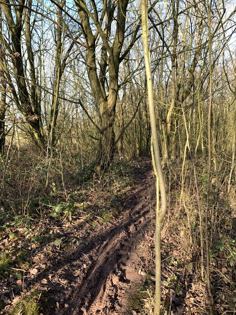
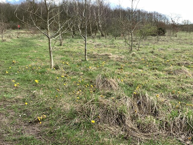
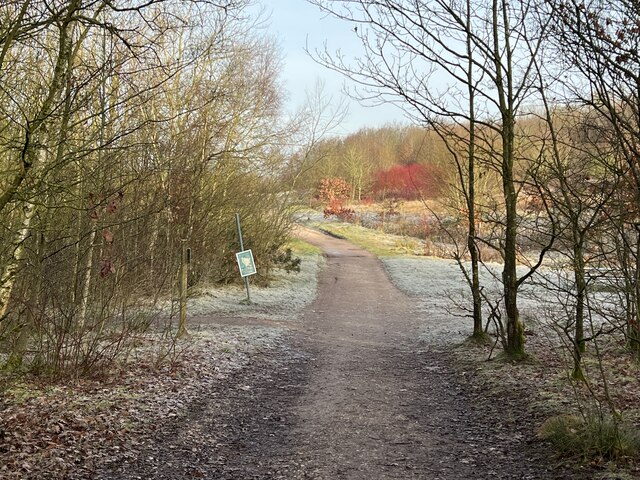
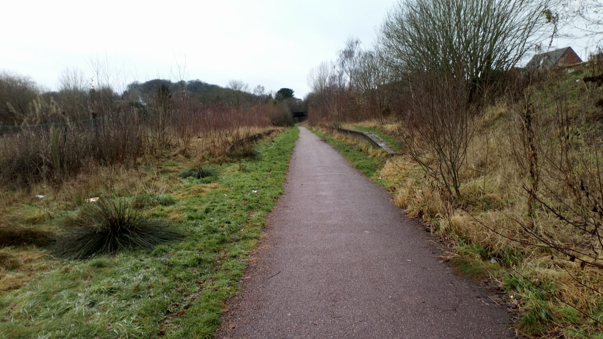
Black Bank is characterized by its steep, grassy slopes, making it a popular destination for outdoor enthusiasts and hikers. The well-maintained footpaths and trails that crisscross the hill provide visitors with opportunities to explore its natural beauty. The ascent to the summit is relatively moderate, making it accessible to people of various fitness levels.

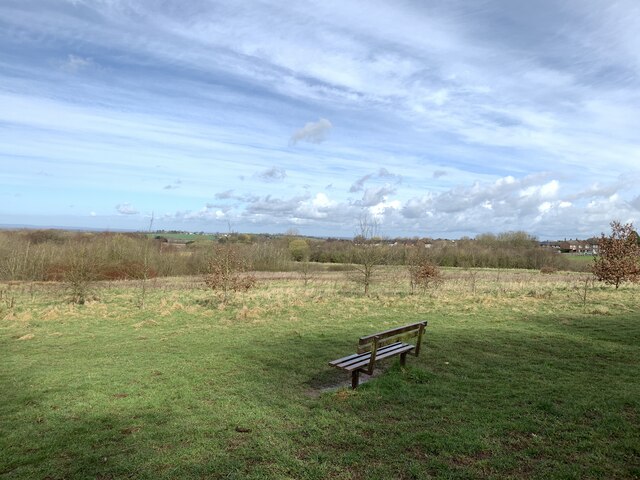
At the top of Black Bank, visitors are rewarded with uninterrupted vistas of the Staffordshire countryside. On a clear day, one can admire the rolling hills, lush woodlands, and sprawling valleys that stretch as far as the eye can see. The hill's strategic location also allows for stunning sunrises and sunsets, providing photographers and nature enthusiasts with remarkable photo opportunities.

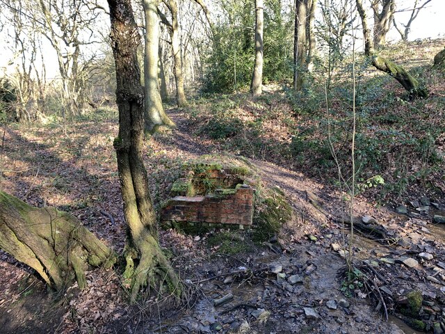
Aside from its natural allure, Black Bank boasts a rich historical significance. It is believed to have been an Iron Age fort, and remnants of its ancient ramparts can still be observed. These archaeological features add an extra layer of intrigue to the hill and attract history enthusiasts keen on exploring its past.

Overall, Black Bank in Staffordshire is a captivating destination that blends natural beauty, outdoor activities, and historical intrigue. With its stunning views and accessibility, it continues to be a cherished spot for locals and visitors alike.

If you have any feedback on the listing, please let us know in the comments section below.

Black Bank Images

Images are sourced within 2km of 53.026424/-2.2785729 or Grid Reference SJ8147. Thanks to Geograph Open Source API. All images are credited.

Rutted path in Bates Wood The deep ruts are caused by cycle wheels. The path is designated Audley FP 110.
Rutted path in Bates Wood
The deep ruts are caused by cycle wheels. The path is designated Audley FP 110.
Footings of former brick structure in Bates Wood This brick structure was presumably part of the mine workings which operated here.
Footings of former brick structure in Bates Wood
This brick structure was presumably part of the mine workings which operated here.
Bateswood Country Park in early spring Bateswood Country Park, north-west of Newcastle-under-Lyme in Staffordshire and adjacent to the village of Halmer End, is designated as a Local Nature Reserve (LNR). It was developed after the cessation of opencast mining in the 1990s, which left the area as a barren wasteland with poor quality soil. Birch reforestation and the creation of a lake have improved the habitat for wildlife, while a network of footpaths and a bridle path create access to most parts of the site. In 2012 managed fishing by a local angling club was permitted, in an attempt to curb illicit fishing.

The site is managed by Newcastle Borough Council in partnership with Halmer End Wildlife Trust, a group of volunteers.

This site is not to be confused with Staffordshire Wildlife Trust's reserve immediately to the south, also called Bateswood (see <a title="https://www.geograph.org.uk/snippet/12701)" href="https://www.geograph.org.uk/snippet/12701)">Link</a>.
Bateswood Country Park in early spring
Bateswood Country Park, north-west of Newcastle-under-Lyme in Staffordshire and adjacent to the village of Halmer End, is designated as a Local Nature Reserve (LNR). It was developed after the cessation of opencast mining in the 1990s, which left the area as a barren wasteland with poor quality soil. Birch reforestation and the creation of a lake have improved the habitat for wildlife, while a network of footpaths and a bridle path create access to most parts of the site. In 2012 managed fishing by a local angling club was permitted, in an attempt to curb illicit fishing. The site is managed by Newcastle Borough Council in partnership with Halmer End Wildlife Trust, a group of volunteers. This site is not to be confused with Staffordshire Wildlife Trust's reserve immediately to the south, also called Bateswood (see Link.
Coltsfoot at Bateswood Country Park Bateswood Country Park, north-west of Newcastle-under-Lyme in Staffordshire and adjacent to the village of Halmer End, is designated as a Local Nature Reserve (LNR). It was developed after the cessation of opencast mining in the 1990s, which left the area as a barren wasteland with poor quality soil. Birch reforestation and the creation of a lake have improved the habitat for wildlife, while a network of footpaths and a bridle path create access to most parts of the site. In 2012 managed fishing by a local angling club was permitted, in an attempt to curb illicit fishing.

The site is managed by Newcastle Borough Council in partnership with Halmer End Wildlife Trust, a group of volunteers.

This site is not to be confused with Staffordshire Wildlife Trust's reserve immediately to the south, also called Bateswood (see <a title="https://www.geograph.org.uk/snippet/12701)" href="https://www.geograph.org.uk/snippet/12701)">Link</a>.
Coltsfoot at Bateswood Country Park
Bateswood Country Park, north-west of Newcastle-under-Lyme in Staffordshire and adjacent to the village of Halmer End, is designated as a Local Nature Reserve (LNR). It was developed after the cessation of opencast mining in the 1990s, which left the area as a barren wasteland with poor quality soil. Birch reforestation and the creation of a lake have improved the habitat for wildlife, while a network of footpaths and a bridle path create access to most parts of the site. In 2012 managed fishing by a local angling club was permitted, in an attempt to curb illicit fishing. The site is managed by Newcastle Borough Council in partnership with Halmer End Wildlife Trust, a group of volunteers. This site is not to be confused with Staffordshire Wildlife Trust's reserve immediately to the south, also called Bateswood (see Link.
Gate onto Bateswood Country Park Eight years before, this entrance was guarded by a simple wooden five-bar gate <a href="https://www.geograph.org.uk/photo/4270686">SJ7948 : Bateswood Country Park: car park</a> but, following some intrusions and vandalism, one solution was to block the entrance with huge rocks. However, as this is supposed to be an access for emergency services, a lockable bar gate has been installed.
Gate onto Bateswood Country Park
Eight years before, this entrance was guarded by a simple wooden five-bar gate SJ7948 : Bateswood Country Park: car park but, following some intrusions and vandalism, one solution was to block the entrance with huge rocks. However, as this is supposed to be an access for emergency services, a lockable bar gate has been installed.
Snowy track through Bateswood Country Park Bateswood Country Park, north-west of Newcastle-under-Lyme in Staffordshire and adjacent to the village of Halmer End, is designated as a Local Nature Reserve (LNR). It was developed after the cessation of opencast mining in the 1990s, which left the area as a barren wasteland with poor quality soil. Birch reforestation and the creation of a lake have improved the habitat for wildlife, while a network of footpaths and a bridle path create access to most parts of the site. In 2012 managed fishing by a local angling club was permitted, in an attempt to curb illicit fishing.

The site is managed by Newcastle Borough Council in partnership with Halmer End Wildlife Trust, a group of volunteers.

This site is not to be confused with Staffordshire Wildlife Trust's reserve immediately to the south, also called Bateswood (see <a title="https://www.geograph.org.uk/snippet/12701)" href="https://www.geograph.org.uk/snippet/12701)">Link</a>.
Snowy track through Bateswood Country Park
Bateswood Country Park, north-west of Newcastle-under-Lyme in Staffordshire and adjacent to the village of Halmer End, is designated as a Local Nature Reserve (LNR). It was developed after the cessation of opencast mining in the 1990s, which left the area as a barren wasteland with poor quality soil. Birch reforestation and the creation of a lake have improved the habitat for wildlife, while a network of footpaths and a bridle path create access to most parts of the site. In 2012 managed fishing by a local angling club was permitted, in an attempt to curb illicit fishing. The site is managed by Newcastle Borough Council in partnership with Halmer End Wildlife Trust, a group of volunteers. This site is not to be confused with Staffordshire Wildlife Trust's reserve immediately to the south, also called Bateswood (see Link.
New fencing on Podmore Lane This is probably mainly to discourage the casual flytipping down the slope on the left.
New fencing on Podmore Lane
This is probably mainly to discourage the casual flytipping down the slope on the left.
Muddy woodland path Bateswood Country Park, north-west of Newcastle-under-Lyme in Staffordshire and adjacent to the village of Halmer End, is designated as a Local Nature Reserve (LNR). It was developed after the cessation of opencast mining in the 1990s, which left the area as a barren wasteland with poor quality soil. Birch reforestation and the creation of a lake have improved the habitat for wildlife, while a network of footpaths and a bridle path create access to most parts of the site. In 2012 managed fishing by a local angling club was permitted, in an attempt to curb illicit fishing.

The site is managed by Newcastle Borough Council in partnership with Halmer End Wildlife Trust, a group of volunteers.

This site is not to be confused with Staffordshire Wildlife Trust's reserve immediately to the south, also called Bateswood (see <a title="https://www.geograph.org.uk/snippet/12701)" href="https://www.geograph.org.uk/snippet/12701)">Link</a>.
Muddy woodland path
Bateswood Country Park, north-west of Newcastle-under-Lyme in Staffordshire and adjacent to the village of Halmer End, is designated as a Local Nature Reserve (LNR). It was developed after the cessation of opencast mining in the 1990s, which left the area as a barren wasteland with poor quality soil. Birch reforestation and the creation of a lake have improved the habitat for wildlife, while a network of footpaths and a bridle path create access to most parts of the site. In 2012 managed fishing by a local angling club was permitted, in an attempt to curb illicit fishing. The site is managed by Newcastle Borough Council in partnership with Halmer End Wildlife Trust, a group of volunteers. This site is not to be confused with Staffordshire Wildlife Trust's reserve immediately to the south, also called Bateswood (see Link.
Track and path junction in Bateswood Country Park Bateswood Country Park, north-west of Newcastle-under-Lyme in Staffordshire and adjacent to the village of Halmer End, is designated as a Local Nature Reserve (LNR). It was developed after the cessation of opencast mining in the 1990s, which left the area as a barren wasteland with poor quality soil. Birch reforestation and the creation of a lake have improved the habitat for wildlife, while a network of footpaths and a bridle path create access to most parts of the site. In 2012 managed fishing by a local angling club was permitted, in an attempt to curb illicit fishing.

The site is managed by Newcastle Borough Council in partnership with Halmer End Wildlife Trust, a group of volunteers.

This site is not to be confused with Staffordshire Wildlife Trust's reserve immediately to the south, also called Bateswood (see <a title="https://www.geograph.org.uk/snippet/12701)" href="https://www.geograph.org.uk/snippet/12701)">Link</a>.
Track and path junction in Bateswood Country Park
Bateswood Country Park, north-west of Newcastle-under-Lyme in Staffordshire and adjacent to the village of Halmer End, is designated as a Local Nature Reserve (LNR). It was developed after the cessation of opencast mining in the 1990s, which left the area as a barren wasteland with poor quality soil. Birch reforestation and the creation of a lake have improved the habitat for wildlife, while a network of footpaths and a bridle path create access to most parts of the site. In 2012 managed fishing by a local angling club was permitted, in an attempt to curb illicit fishing. The site is managed by Newcastle Borough Council in partnership with Halmer End Wildlife Trust, a group of volunteers. This site is not to be confused with Staffordshire Wildlife Trust's reserve immediately to the south, also called Bateswood (see Link.
Path on Bateswood Country Park Bateswood Country Park, north-west of Newcastle-under-Lyme in Staffordshire and adjacent to the village of Halmer End, is designated as a Local Nature Reserve (LNR). It was developed after the cessation of opencast mining in the 1990s, which left the area as a barren wasteland with poor quality soil. Birch reforestation and the creation of a lake have improved the habitat for wildlife, while a network of footpaths and a bridle path create access to most parts of the site. In 2012 managed fishing by a local angling club was permitted, in an attempt to curb illicit fishing.

The site is managed by Newcastle Borough Council in partnership with Halmer End Wildlife Trust, a group of volunteers.

This site is not to be confused with Staffordshire Wildlife Trust's reserve immediately to the south, also called Bateswood (see <a title="https://www.geograph.org.uk/snippet/12701)" href="https://www.geograph.org.uk/snippet/12701)">Link</a>.
Path on Bateswood Country Park
Bateswood Country Park, north-west of Newcastle-under-Lyme in Staffordshire and adjacent to the village of Halmer End, is designated as a Local Nature Reserve (LNR). It was developed after the cessation of opencast mining in the 1990s, which left the area as a barren wasteland with poor quality soil. Birch reforestation and the creation of a lake have improved the habitat for wildlife, while a network of footpaths and a bridle path create access to most parts of the site. In 2012 managed fishing by a local angling club was permitted, in an attempt to curb illicit fishing. The site is managed by Newcastle Borough Council in partnership with Halmer End Wildlife Trust, a group of volunteers. This site is not to be confused with Staffordshire Wildlife Trust's reserve immediately to the south, also called Bateswood (see Link.
Platform edge at former Silverdale Station Compare with this 2019 view <a href="https://www.geograph.org.uk/photo/6342297">SJ8146 : Silverdale Station (Disused)</a>
Platform edge at former Silverdale Station
Compare with this 2019 view SJ8146 : Silverdale Station (Disused)
Platform edge at former Silverdale Station
Kissing-gate onto new housing estate The site of Silverdale Colliery (closed 1998) is now mostly occupied by a housing development called Heritage Park.
Kissing-gate onto new housing estate
The site of Silverdale Colliery (closed 1998) is now mostly occupied by a housing development called Heritage Park.
Path onto new housing estate The site of Silverdale Colliery (closed 1998) is now mostly occupied by a housing development called Heritage Park.
Path onto new housing estate
The site of Silverdale Colliery (closed 1998) is now mostly occupied by a housing development called Heritage Park.
Stand of Dotted Loosestrife
St Luke's church, Silverdale St Luke's is Grade II listed, see <span class="nowrap"><a title="https://historicengland.org.uk/listing/the-list/list-entry/1291424?section=official-list-entry" rel="nofollow ugc noopener" href="https://historicengland.org.uk/listing/the-list/list-entry/1291424?section=official-list-entry">Link</a><img style="margin-left:2px;" alt="External link" title="External link - shift click to open in new window" src="https://s1.geograph.org.uk/img/external.png" width="10" height="10"/></span>
St Luke's church, Silverdale
St Luke's is Grade II listed, see LinkExternal link
Semaphore signal by former railway line The railway line here closed with the closure of the adjacent colliery in 1998. It is now a footpath, forming the western end of National Cycle Route 551.
Semaphore signal by former railway line
The railway line here closed with the closure of the adjacent colliery in 1998. It is now a footpath, forming the western end of National Cycle Route 551.
Hedge Bedstraw at Silverdale
Show me another place!

Black Bank is located at Grid Ref: SJ8147 (Lat: 53.026424, Lng: -2.2785729)

Administrative County: Staffordshire

District: Newcastle-under-Lyme

Police Authority: Staffordshire

What 3 Words

///crowds.caged.chart. Near Keele, Staffordshire

Nearby Locations

Blank Bank Black Bank

Related Wikis

Apedale

Apedale is a village in Staffordshire, England. The population at the 2011 census can be found under the Holditch (Ward) of Newcastle-under-Lyme. The village...

Apedale Community Country Park

Apedale Community Country Park is a 454-acre (184 ha) country park in the borough of Newcastle-under-Lyme, Staffordshire, England. The park is unusual...

Silverdale railway station (Staffordshire)

Silverdale railway station was a railway station that served the village of Silverdale, Staffordshire, England. It was opened by the North Staffordshire...

Apedale Heritage Centre

The Apedale Heritage Centre was created at the site of Staffordshire's Apedale Mine and is run by volunteers. It is located just outside the village of...

Alsagers Bank

Alsagers Bank is a village in the Borough of Newcastle-under-Lyme in Staffordshire. Population details at the 2011 census can be found under Audley Rural...

Crown Street Halt railway station

Crown Street Halt railway station (also known as Silverdale (Crown Street) Halt) is a disused railway station in Staffordshire, England. Situated on the...

Silverdale, Staffordshire

Silverdale is a village and civil parish in the Borough of Newcastle-under-Lyme in Staffordshire, west of Newcastle-under-Lyme. It is a self contained...

Apedale Hall

Apedale Hall was a manor house near Newcastle-under-Lyme in Staffordshire. The seat of the Heathcote family, it was rebuilt in 1826 in the Elizabethan...

Related Videos

Newcastle-under-Lyme (Staffordshire) 🇬🇧 Nighlife, Clubs, Walking tour🚶🏻‍♂️

Thanks for watching guys Instagram https://instagram.com/gaurav__munjal?igshid=YmMyMTA2M2Y= Facebook ...

Walking along Hadrians Way Segedunum to Newburn 20.8km

Hadrians Way altogether 84 miles (135km), we are going to walk on it in 2-3 months time divided 8-10 times during the Covid 19 ...

4K Travel Documentary- Episode 3- Newcastle Under-Lyme, England

Unfold the untold tales, history, and culture behind New castle Under-Lyme with Jose Gomez! ''With age, comes wisdom.

Nearby Amenities

Located within 500m of 53.026424,-2.2785729
Alsagers Bank
Man Made: tower
Tower Type: communication
Lat/Long: 53.027202/-2.2806669
Black Bank
Ele: 222
Man Made: survey_point
Natural: peak
Lat/Long: 53.0264357/-2.2785525
Denomination: methodist
Historic Amenity: place_of_worship
Religion: christian
Source: NLS-OS-1st_Series
Lat/Long: 53.024065/-2.2748371
Tourism: viewpoint
Lat/Long: 53.025925/-2.2785062
Hiking: yes
Information: guidepost
Material: wood
Tourism: information
Lat/Long: 53.0298496/-2.2768676
Bench
Backrest: yes
Material: metal;wood
Lat/Long: 53.0298923/-2.2771955
Hiking: yes
Information: guidepost
Material: wood
Tourism: information
Lat/Long: 53.0302678/-2.2784527
Barrier: bollard
Bicycle: yes
Bollard: fixed
Foot: yes
Horse: yes
Lat/Long: 53.0291705/-2.2763398
Addr Housename: Green Shutters
Lat/Long: 53.0293082/-2.2829561
The Hit Mix
Man Made: tower
Source: Bing
Tower Type: communication
Lat/Long: 53.0294149/-2.282034
Addr Housename: Red Roofs
Lat/Long: 53.0296211/-2.2823687
Addr Housename: The Uplands
Lat/Long: 53.0297697/-2.2827448
Addr Housename: Gramerci
Lat/Long: 53.029873/-2.2829862
Addr Housename: Windy Ridge
Lat/Long: 53.0298424/-2.2828762
Black Bank
Historic Place: hamlet
Source: NLS-OS-1st_Series
Lat/Long: 53.0237682/-2.2753481
Leisure: outdoor_seating
Lat/Long: 53.0287027/-2.2766137
Leisure: outdoor_seating
Lat/Long: 53.0286689/-2.2768343
Leisure: outdoor_seating
Lat/Long: 53.0289046/-2.2766728
Leisure: outdoor_seating
Lat/Long: 53.0290615/-2.2765831
Bench
Lat/Long: 53.0231237/-2.2735736
Bench
Lat/Long: 53.0252599/-2.2764165
Bench
Lat/Long: 53.0257469/-2.2785541
Tourism: artwork
Lat/Long: 53.0259028/-2.2784305
Bench
Lat/Long: 53.022493/-2.2795196
Bench
Lat/Long: 53.022368/-2.2783054
The data included in this document is from www.openstreetmap.org. The data is made available under ODbL.

Have you been to Black Bank?

Leave your review of Black Bank below (or comments, questions and feedback).