Sinderby

Settlement in Yorkshire Hambleton

England

Sinderby

Pickhill, All Saints This is one of the buttresses on the tower of All Saints church in Pickhill. This benchmark faces south west and is cut into the plinth stone.
Pickhill, All Saints Credit: Mel Towler

Sinderby is a picturesque village located in the county of Yorkshire, England. Situated in the district of Hambleton, it is nestled amidst rolling green hills and stunning countryside. The village is small in size, with a population of around 300 residents.

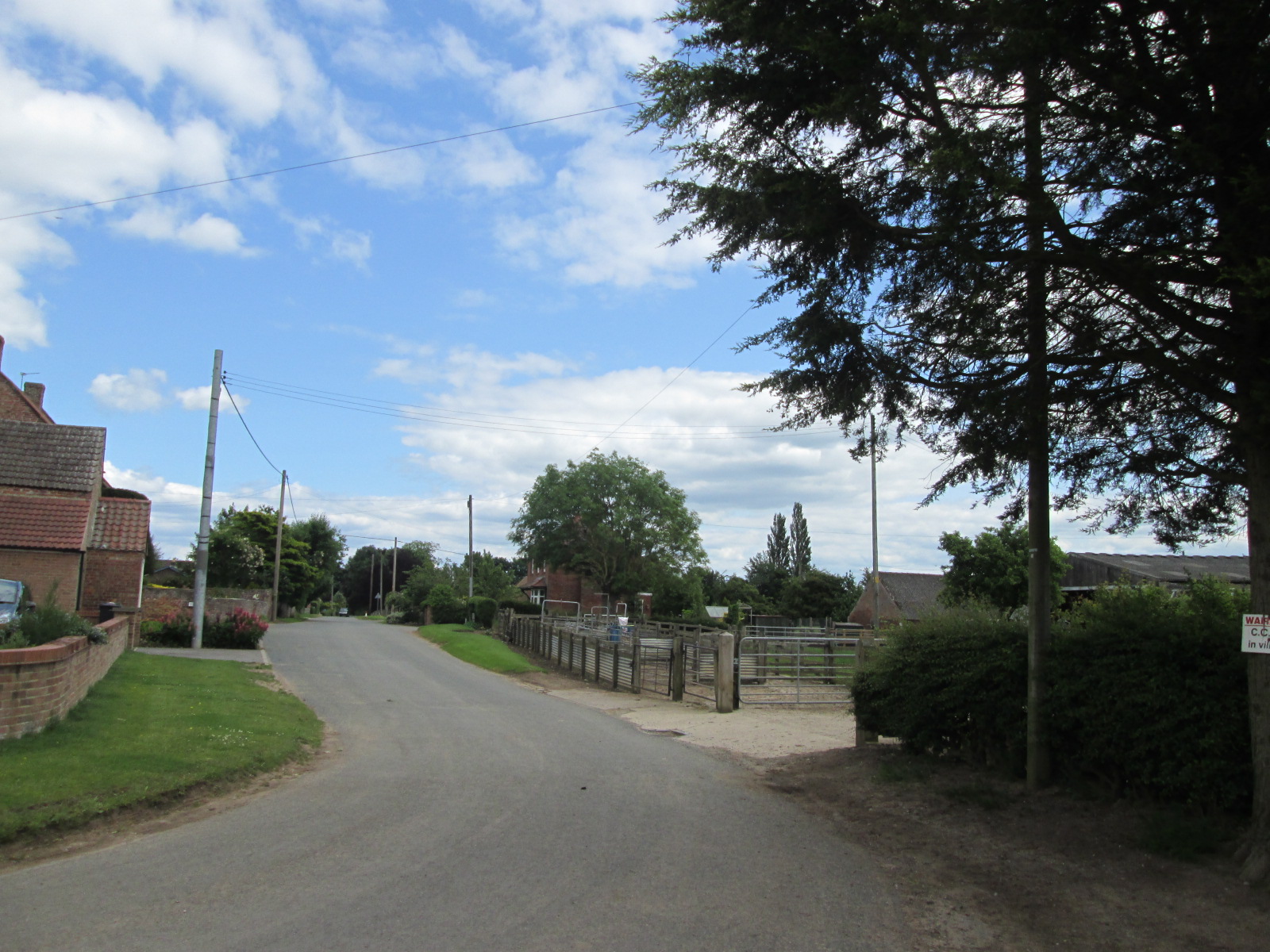
Sinderby is renowned for its traditional charm and tranquil atmosphere. The village features a collection of beautifully preserved stone cottages, giving it a timeless appeal. The surrounding landscape is dominated by lush farmland, providing a scenic backdrop for residents and visitors alike.

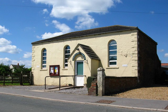
Despite its size, Sinderby boasts a close-knit community that takes pride in its heritage. The village is home to a historic church, St. John the Evangelist, which dates back several centuries. This architectural gem is a focal point for religious and cultural events in the village.

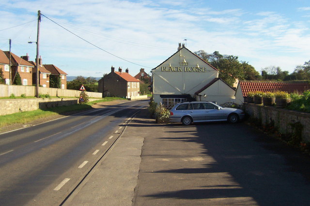
In terms of amenities, Sinderby offers some essential services for its residents. These include a local pub, providing a cozy setting for socializing and enjoying traditional Yorkshire hospitality. The village also has a primary school, ensuring that families have access to education within their community.

Sinderby's location is ideal for those seeking a peaceful and idyllic lifestyle. Surrounded by nature, it offers ample opportunities for outdoor activities such as hiking, cycling, and exploring the nearby Yorkshire Dales National Park. The village is well-connected, with good transport links to nearby towns and cities, making it a convenient base for commuters.

Overall, Sinderby is a quintessential Yorkshire village that exudes charm and tranquility. Its beautiful setting, strong community spirit, and proximity to nature make it a desirable place to live or visit for those seeking a slower pace of life.

If you have any feedback on the listing, please let us know in the comments section below.
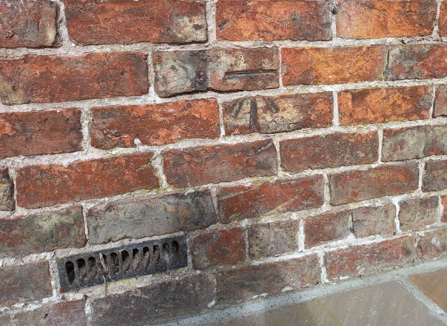
Sinderby Images

Images are sourced within 2km of 54.232116/-1.472051 or Grid Reference SE3481. Thanks to Geograph Open Source API. All images are credited.

Pickhill, All Saints This is one of the buttresses on the tower of All Saints church in Pickhill. This benchmark faces south west and is cut into the plinth stone.
Pickhill, All Saints
This is one of the buttresses on the tower of All Saints church in Pickhill. This benchmark faces south west and is cut into the plinth stone.
Pickhill, All Saints A benchmark is cut into the plinth stone of the south-west facing buttress of the church tower.
Pickhill, All Saints
A benchmark is cut into the plinth stone of the south-west facing buttress of the church tower.
Pickhill, converted Methodist Chapel The old Methodist Chapel, now converted into a private residence, is on the west side of the village street. There is a benchmark cut into the 5th and 6th course of bricks on the right of the main door.
Pickhill, converted Methodist Chapel
The old Methodist Chapel, now converted into a private residence, is on the west side of the village street. There is a benchmark cut into the 5th and 6th course of bricks on the right of the main door.
Pickhill, converted Methodist Chapel The old Methodist Chapel, now converted into a private residence, is on the west side of the village street. There is a benchmark cut into the 5th and 6th course of bricks on the right of the main door, and under the right hand window.
Pickhill, converted Methodist Chapel
The old Methodist Chapel, now converted into a private residence, is on the west side of the village street. There is a benchmark cut into the 5th and 6th course of bricks on the right of the main door, and under the right hand window.
Cast iron water pillar One of two in Pickhill.  It's actually a self closing tap rather than a pump, designed to deliver water from a pressurised supply. Not working.
Cast iron water pillar
One of two in Pickhill. It's actually a self closing tap rather than a pump, designed to deliver water from a pressurised supply. Not working.
Village water pillar Clearly well cared for and treasured, this cast iron water pillar is  actually a self closing tap rather than a pump, designed to deliver water from a pressurised supply. Sadly, it's no longer working.
Village water pillar
Clearly well cared for and treasured, this cast iron water pillar is actually a self closing tap rather than a pump, designed to deliver water from a pressurised supply. Sadly, it's no longer working.
A 1 northbound - 1980 On the A 1 near Kirklington heading north.
A 1 northbound - 1980
On the A 1 near Kirklington heading north.
Stubble field, Pickhill Harvesting is complete and the straw has been turned into round bales in this field at Pickhill.
Stubble field, Pickhill
Harvesting is complete and the straw has been turned into round bales in this field at Pickhill.
Farmland near Pickhill Arable field near Pickhill with stacked straw bales.
Farmland near Pickhill
Arable field near Pickhill with stacked straw bales.
Street Lane, Pickhill The view westwards along Street Lane is changing due to the construction of the A1 Motorway, the six lanes of which are sited a little further east than the old A1. A new bridge can be seen to the left, and this will take local traffic over the motorway to join the service road, which will use the old northbound carriageway of A1. At the time the photo was taken there was still an exit on to the A1 southbound, but no way to get off again until junction 50 at the A61 crossing.
Street Lane, Pickhill
The view westwards along Street Lane is changing due to the construction of the A1 Motorway, the six lanes of which are sited a little further east than the old A1. A new bridge can be seen to the left, and this will take local traffic over the motorway to join the service road, which will use the old northbound carriageway of A1. At the time the photo was taken there was still an exit on to the A1 southbound, but no way to get off again until junction 50 at the A61 crossing.
Coldstone Lane A1 junction
Quernhow Cafe
Quernhow Cafe
Street House Farm off the former A1 road
The new road to Pickhill over the A1M
A1(M), overbridge The A1 is the longest numbered road in the UK at 410 miles long. It connects London with Edinburgh, via the east of England. 
For much of its path it follows the Great North Road the old coaching route between London and Edinburgh. Several sections of the route are classified as motorway A1(M). The modern A1 bypasses the towns the Great North Road passed through and is dual carriageway for most of its route through England.
A1(M), overbridge
The A1 is the longest numbered road in the UK at 410 miles long. It connects London with Edinburgh, via the east of England. For much of its path it follows the Great North Road the old coaching route between London and Edinburgh. Several sections of the route are classified as motorway A1(M). The modern A1 bypasses the towns the Great North Road passed through and is dual carriageway for most of its route through England.
A1(M), northbound The A1 is the longest numbered road in the UK at 410 miles long. It connects London with Edinburgh, via the east of England. 
For much of its path it follows the Great North Road the old coaching route between London and Edinburgh. Several sections of the route are classified as motorway A1(M). The modern A1 bypasses the towns the Great North Road passed through and is dual carriageway for most of its route through England.
A1(M), northbound
The A1 is the longest numbered road in the UK at 410 miles long. It connects London with Edinburgh, via the east of England. For much of its path it follows the Great North Road the old coaching route between London and Edinburgh. Several sections of the route are classified as motorway A1(M). The modern A1 bypasses the towns the Great North Road passed through and is dual carriageway for most of its route through England.
Ramshaw Farm
Ramshaw Farm
A1(M), northbound The A1 is the longest numbered road in the UK at 410 miles long. It connects London with Edinburgh, via the east of England. 
For much of its path it follows the Great North Road the old coaching route between London and Edinburgh. Several sections of the route are classified as motorway A1(M). The modern A1 bypasses the towns the Great North Road passed through and is dual carriageway for most of its route through England.
A1(M), northbound
The A1 is the longest numbered road in the UK at 410 miles long. It connects London with Edinburgh, via the east of England. For much of its path it follows the Great North Road the old coaching route between London and Edinburgh. Several sections of the route are classified as motorway A1(M). The modern A1 bypasses the towns the Great North Road passed through and is dual carriageway for most of its route through England.
Show me another place!

Sinderby is located at Grid Ref: SE3481 (Lat: 54.232116, Lng: -1.472051)

Division: North Riding

Administrative County: North Yorkshire

District: Hambleton

Police Authority: North Yorkshire

What 3 Words

///cashier.rezoning.reporting. Near Thirsk, North Yorkshire

Nearby Locations

Sinderby Sinderby

Related Wikis

Sinderby

Sinderby is a village and civil parish in North Yorkshire, England. Sinderby is located 223 miles (359 km) north of London and 48 miles (77 km) south of...

Holme, North Yorkshire

Holme (or Holme on Swale) is a small village and civil parish in the Hambleton District of North Yorkshire, England. It is located near Pickhill, Sinderby...

Ainderby Quernhow

Ainderby Quernhow is a village and civil parish in the Hambleton District of North Yorkshire, England. The village is situated on the B6267 Thirsk to...

Pickhill railway station

Pickhill railway station served the village of Pickhill, North Yorkshire, England from 1875 to 1959 on the Leeds-Northallerton Railway. == History == The...

Nearby Amenities

Located within 500m of 54.232116,-1.472051
Sinderby
Is In: UK,England,Yorkshire,North Yorkshire
Place: hamlet
Lat/Long: 54.2311693/-1.47232
Post Box
Post Box Type: lamp
Royal Cypher: EIIR
Royal Cypher Wikidata: Q33102113
Lat/Long: 54.2320655/-1.4723069
Bench
Lat/Long: 54.2325882/-1.4718505
Waste Basket
Lat/Long: 54.2320793/-1.4722799
Defibrillator
Defibrillator Location: outside Sinderby & District Village Hall
Emergency: defibrillator
Indoor: no
Lat/Long: 54.2330417/-1.4713589
The data included in this document is from www.openstreetmap.org. The data is made available under ODbL.

Have you been to Sinderby?

Leave your review of Sinderby below (or comments, questions and feedback).