Sinderby

Civil Parish in Yorkshire Hambleton

England

Sinderby

Cast iron water pillar One of two in Pickhill.  It's actually a self closing tap rather than a pump, designed to deliver water from a pressurised supply. Not working.
Cast iron water pillar Credit: Leanmeanmo

Sinderby is a civil parish located in the Hambleton district of North Yorkshire, England. Situated approximately 4 miles south-east of Thirsk, the parish covers an area of around 1,000 acres and is home to a small population.

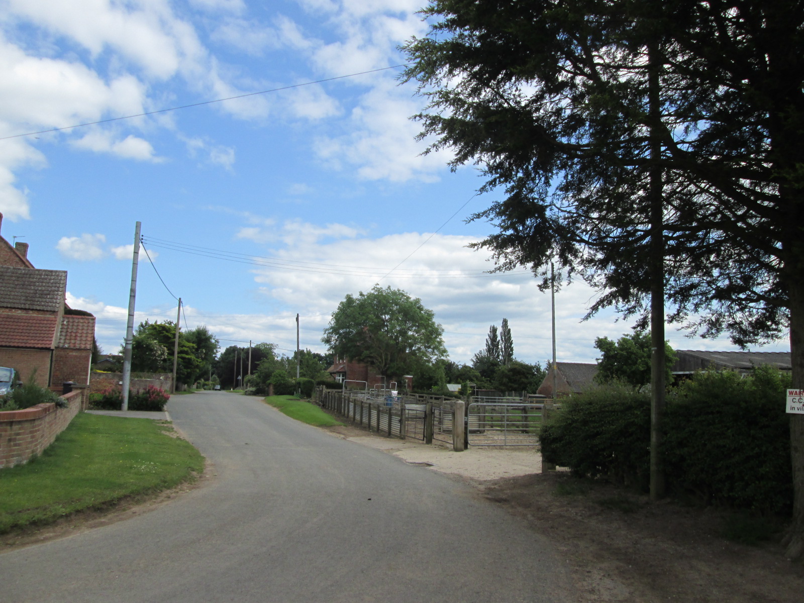
The landscape of Sinderby is characterized by rolling hills and picturesque countryside, making it an idyllic rural setting. The area is predominantly agricultural, with lush green fields and scattered farmsteads dotting the landscape. The parish benefits from a mild climate, experiencing warm summers and cool winters.

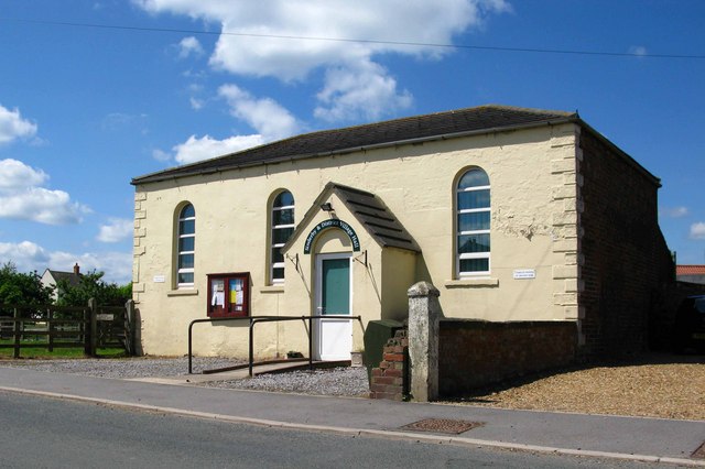
The village of Sinderby itself is small, consisting of a handful of houses and cottages. The centerpiece of the village is the historic St. John the Baptist Church, a Grade II listed building dating back to the 13th century. The church features an impressive bell tower and stained glass windows, attracting visitors interested in its architectural and historical significance.

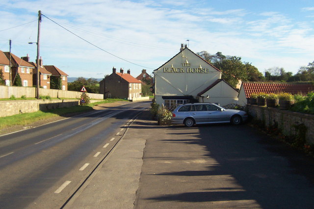
The parish is well-connected to neighboring towns and villages through a network of roads, allowing for easy transportation. Nearby amenities and services can be found in Thirsk, including shops, schools, and medical facilities.

Sinderby offers a peaceful and tranquil environment, ideal for those seeking a quiet countryside retreat. The natural beauty of the area, combined with its rich history and close-knit community, make it an attractive place to live or visit for those looking to escape the hustle and bustle of city life.

If you have any feedback on the listing, please let us know in the comments section below.

Sinderby Images

Images are sourced within 2km of 54.229491/-1.478067 or Grid Reference SE3481. Thanks to Geograph Open Source API. All images are credited.

Cast iron water pillar One of two in Pickhill.  It's actually a self closing tap rather than a pump, designed to deliver water from a pressurised supply. Not working.
Cast iron water pillar
One of two in Pickhill. It's actually a self closing tap rather than a pump, designed to deliver water from a pressurised supply. Not working.
Village water pillar Clearly well cared for and treasured, this cast iron water pillar is  actually a self closing tap rather than a pump, designed to deliver water from a pressurised supply. Sadly, it's no longer working.
Village water pillar
Clearly well cared for and treasured, this cast iron water pillar is actually a self closing tap rather than a pump, designed to deliver water from a pressurised supply. Sadly, it's no longer working.
A 1 northbound - 1980 On the A 1 near Kirklington heading north.
A 1 northbound - 1980
On the A 1 near Kirklington heading north.
Stubble field, Pickhill Harvesting is complete and the straw has been turned into round bales in this field at Pickhill.
Stubble field, Pickhill
Harvesting is complete and the straw has been turned into round bales in this field at Pickhill.
Farmland near Pickhill Arable field near Pickhill with stacked straw bales.
Farmland near Pickhill
Arable field near Pickhill with stacked straw bales.
Street Lane, Pickhill The view westwards along Street Lane is changing due to the construction of the A1 Motorway, the six lanes of which are sited a little further east than the old A1. A new bridge can be seen to the left, and this will take local traffic over the motorway to join the service road, which will use the old northbound carriageway of A1. At the time the photo was taken there was still an exit on to the A1 southbound, but no way to get off again until junction 50 at the A61 crossing.
Street Lane, Pickhill
The view westwards along Street Lane is changing due to the construction of the A1 Motorway, the six lanes of which are sited a little further east than the old A1. A new bridge can be seen to the left, and this will take local traffic over the motorway to join the service road, which will use the old northbound carriageway of A1. At the time the photo was taken there was still an exit on to the A1 southbound, but no way to get off again until junction 50 at the A61 crossing.
Green Lane, Kirklington Green lane appears to be one of those unsurfaced lanes that might be a county road or byway, but it turns out to be just a track leading towards Kirklington Grange.
Green Lane, Kirklington
Green lane appears to be one of those unsurfaced lanes that might be a county road or byway, but it turns out to be just a track leading towards Kirklington Grange.
Coldstone Lane A1 junction
Quernhow Cafe
Quernhow Cafe
Street House Farm off the former A1 road
The new road to Pickhill over the A1M
A1(M), overbridge The A1 is the longest numbered road in the UK at 410 miles long. It connects London with Edinburgh, via the east of England. 
For much of its path it follows the Great North Road the old coaching route between London and Edinburgh. Several sections of the route are classified as motorway A1(M). The modern A1 bypasses the towns the Great North Road passed through and is dual carriageway for most of its route through England.
A1(M), overbridge
The A1 is the longest numbered road in the UK at 410 miles long. It connects London with Edinburgh, via the east of England. For much of its path it follows the Great North Road the old coaching route between London and Edinburgh. Several sections of the route are classified as motorway A1(M). The modern A1 bypasses the towns the Great North Road passed through and is dual carriageway for most of its route through England.
A1(M), northbound The A1 is the longest numbered road in the UK at 410 miles long. It connects London with Edinburgh, via the east of England. 
For much of its path it follows the Great North Road the old coaching route between London and Edinburgh. Several sections of the route are classified as motorway A1(M). The modern A1 bypasses the towns the Great North Road passed through and is dual carriageway for most of its route through England.
A1(M), northbound
The A1 is the longest numbered road in the UK at 410 miles long. It connects London with Edinburgh, via the east of England. For much of its path it follows the Great North Road the old coaching route between London and Edinburgh. Several sections of the route are classified as motorway A1(M). The modern A1 bypasses the towns the Great North Road passed through and is dual carriageway for most of its route through England.
Ramshaw Farm
Ramshaw Farm
A1(M), northbound The A1 is the longest numbered road in the UK at 410 miles long. It connects London with Edinburgh, via the east of England. 
For much of its path it follows the Great North Road the old coaching route between London and Edinburgh. Several sections of the route are classified as motorway A1(M). The modern A1 bypasses the towns the Great North Road passed through and is dual carriageway for most of its route through England.
A1(M), northbound
The A1 is the longest numbered road in the UK at 410 miles long. It connects London with Edinburgh, via the east of England. For much of its path it follows the Great North Road the old coaching route between London and Edinburgh. Several sections of the route are classified as motorway A1(M). The modern A1 bypasses the towns the Great North Road passed through and is dual carriageway for most of its route through England.
A1(M) heading north
A1(M) heading north
Lorry on the old A1
Lorry on the old A1
Sinderby railway station (site), Yorkshire, 2008 Opened in 1852 by the Leeds Northern Railway on its line from Leeds to Northallerton, this station was closed to passengers in 1962 and completely in 1963. It  was demolished in 2009, about a year after this image was taken. 
View north towards Pickhill and Northallerton. The site became mostly a tarmacked parking area for a business.
Sinderby railway station (site), Yorkshire, 2008
Opened in 1852 by the Leeds Northern Railway on its line from Leeds to Northallerton, this station was closed to passengers in 1962 and completely in 1963. It was demolished in 2009, about a year after this image was taken. View north towards Pickhill and Northallerton. The site became mostly a tarmacked parking area for a business.
Show me another place!

Sinderby is located at Grid Ref: SE3481 (Lat: 54.229491, Lng: -1.478067)

Division: North Riding

Administrative County: North Yorkshire

District: Hambleton

Police Authority: North Yorkshire

What 3 Words

///contents.microchip.music. Near Thirsk, North Yorkshire

Nearby Locations

Sinderby Sinderby

Related Wikis

Sinderby

Sinderby is a village and civil parish in North Yorkshire, England. Sinderby is located 223 miles (359 km) north of London and 48 miles (77 km) south of...

Sinderby railway station

Sinderby railway station served the village of Sinderby, North Yorkshire, England from 1852 to 1963 on the Leeds-Northallerton Railway. == History == The...

Ainderby Quernhow

Ainderby Quernhow is a village and civil parish in North Yorkshire, England. The village is situated on the B6267 Thirsk to Masham road just east of the...

Holme, North Yorkshire

Holme (or Holme on Swale) is a small village and civil parish in the Hambleton District of North Yorkshire, England. It is located near Pickhill, Sinderby...

Nearby Amenities

Located within 500m of 54.229491,-1.478067
Sinderby
Is In: UK,England,Yorkshire,North Yorkshire
Place: hamlet
Lat/Long: 54.2311693/-1.47232
Post Box
Post Box Type: lamp
Royal Cypher: EIIR
Royal Cypher Wikidata: Q33102113
Lat/Long: 54.2320655/-1.4723069
Waste Basket
Lat/Long: 54.2320793/-1.4722799
The data included in this document is from www.openstreetmap.org. The data is made available under ODbL.

Have you been to Sinderby?

Leave your review of Sinderby below (or comments, questions and feedback).