Abbots Morton

Settlement in Worcestershire Wychavon

England

Abbots Morton

Farmland at Radford This grid square is predominantly farmland with footpaths crossing it.
Farmland at Radford Credit: Philip Halling

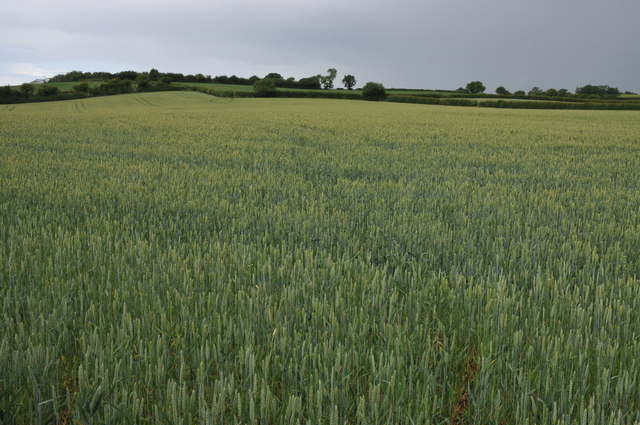
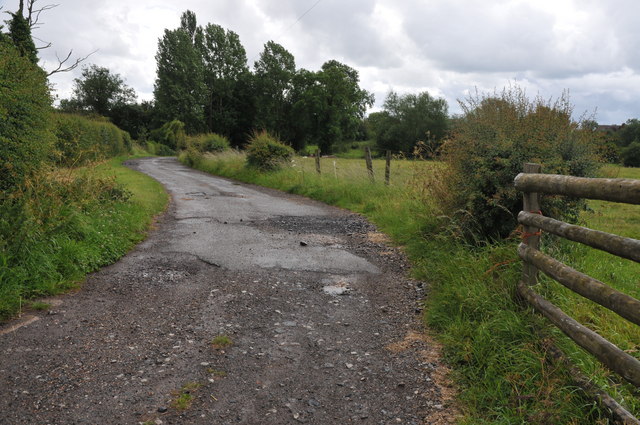
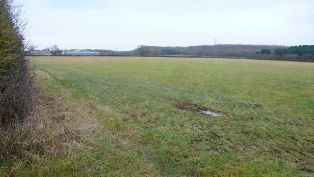
Abbots Morton is a small village located in the county of Worcestershire, England. Situated approximately 10 miles southeast of the city of Worcester, it falls within the administrative district of Wychavon. The village is nestled in a picturesque rural setting, surrounded by rolling countryside and farmland.

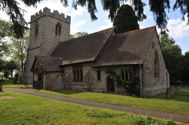
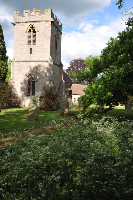
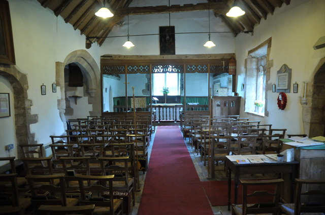
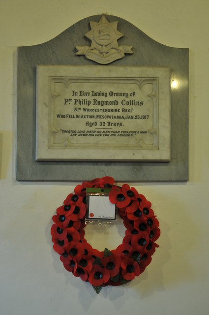
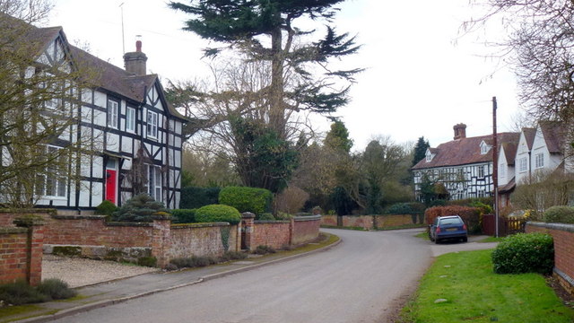
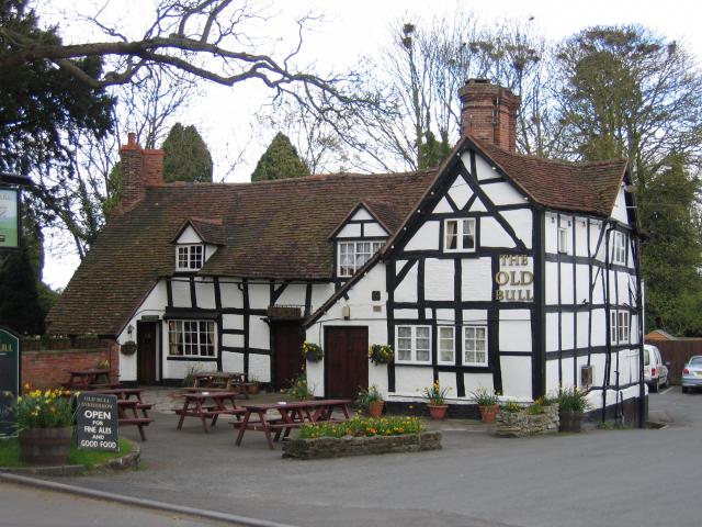
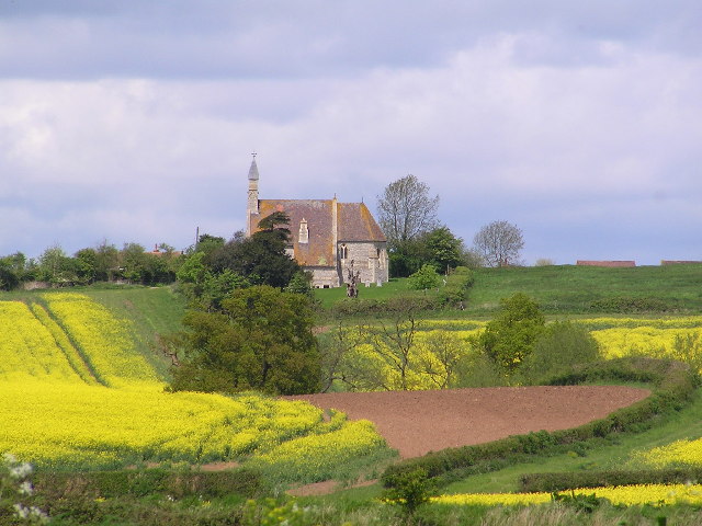
With a population of around 150 residents, Abbots Morton maintains a close-knit community atmosphere. The village is characterized by its charming thatched-roof cottages, stone houses, and historic buildings. One of the notable landmarks in Abbots Morton is the Church of St. Peter, a beautiful medieval church that dates back to the 12th century. Its stunning architecture and peaceful setting make it a popular attraction for visitors.

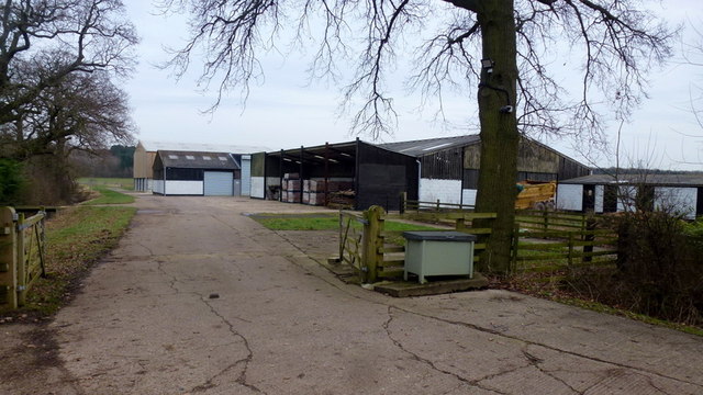
The village boasts a rich history, with evidence of human settlement dating back to Roman times. It was mentioned in the Domesday Book of 1086, indicating its importance in the medieval period. Today, Abbots Morton retains its traditional rural character, with agriculture being a significant part of the local economy.

Despite its small size, the village offers a range of amenities for its residents. These include a village hall, where various community events and gatherings take place, as well as a primary school. The surrounding countryside provides ample opportunities for outdoor activities such as walking, cycling, and horse riding.

Abbots Morton's tranquil and idyllic setting, combined with its historical charm, make it a delightful place to visit or call home for those seeking a peaceful retreat in the heart of Worcestershire.

If you have any feedback on the listing, please let us know in the comments section below.

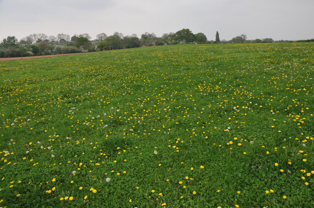
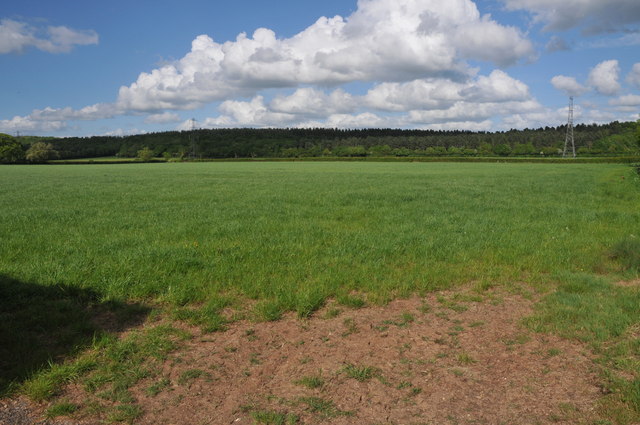
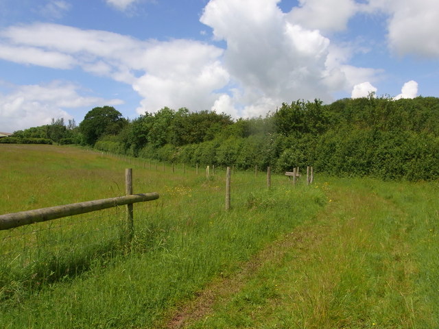
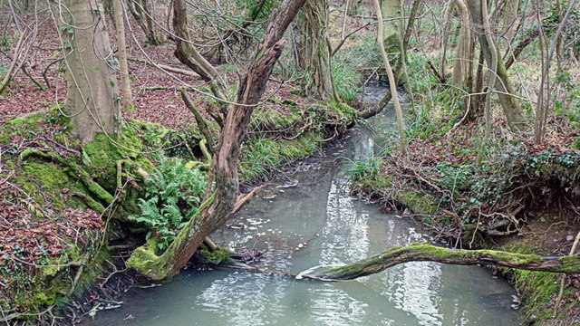
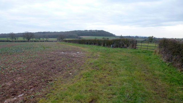
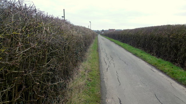
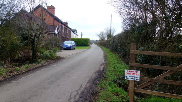
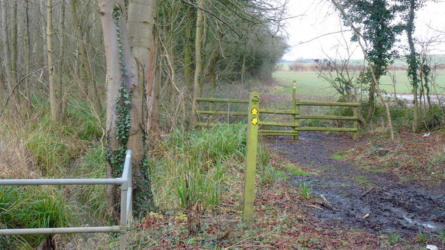
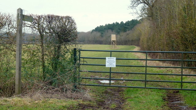
Abbots Morton Images

Images are sourced within 2km of 52.193952/-1.96038 or Grid Reference SP0255. Thanks to Geograph Open Source API. All images are credited.

Farmland at Radford This grid square is predominantly farmland with footpaths crossing it.
Farmland at Radford
This grid square is predominantly farmland with footpaths crossing it.
Arable land near Abbots Morton View across arable land to the east of Abbots Morton.
Arable land near Abbots Morton
View across arable land to the east of Abbots Morton.
Abbots Morton church
Abbots Morton church The tower of St Peter's church, Abbots Morton, dates from the 14th century.
Abbots Morton church
The tower of St Peter's church, Abbots Morton, dates from the 14th century.
Interior of Abbots Morton church View along the nave of St Peter's church, Abbots Morton.
Interior of Abbots Morton church
View along the nave of St Peter's church, Abbots Morton.
War Memorial in Abbots Morton church War memorial on the south wall of Abbots Morton church to Philip Raymond Collins who was killed in action in Mesopotamia on January 25, 1917.
War Memorial in Abbots Morton church
War memorial on the south wall of Abbots Morton church to Philip Raymond Collins who was killed in action in Mesopotamia on January 25, 1917.
Field of wheat A footpath Appletree Lane to Inkberrow is supposed to cross this field of wheat.
Field of wheat
A footpath Appletree Lane to Inkberrow is supposed to cross this field of wheat.
Farm road to Great Norbury Farm Farm road to Great Norbury Farm from Appletree Lane near Inkberrow.  For part of the way this is also a footpath.
Farm road to Great Norbury Farm
Farm road to Great Norbury Farm from Appletree Lane near Inkberrow. For part of the way this is also a footpath.
Bridleway south of Slade Wood Looks dry but lots of standing water after several days of heavy rain.
Bridleway south of Slade Wood
Looks dry but lots of standing water after several days of heavy rain.
The Ban Brook A small stream flowing south through woodland on the Warwickshire/Worcestershire border.
The Ban Brook
A small stream flowing south through woodland on the Warwickshire/Worcestershire border.
Abbots Morton A village with many large timber-framed houses in East Worcestershire.
Abbots Morton
A village with many large timber-framed houses in East Worcestershire.
Bridleway to Rous Lench This path touches the corner of Side Wood and skirts the base of the Lench Hills.
Bridleway to Rous Lench
This path touches the corner of Side Wood and skirts the base of the Lench Hills.
Morton Wood Lane - private driveway? Public road or not, this leads as a bridleway past Morton Wood farm over the county boundary to Cock Bevington and Salford Priors.
See <a href="https://www.geograph.org.uk/photo/4340714">SP0354 : Morton Wood Lane - private driveway?</a>.
Morton Wood Lane - private driveway?
Public road or not, this leads as a bridleway past Morton Wood farm over the county boundary to Cock Bevington and Salford Priors. See SP0354 : Morton Wood Lane - private driveway?.
Morton Wood Lane - private driveway? In spite of this notice, and being informed by a 'local' that I can't drive up or turn beyond here, I can't help thinking that the mapping doesn't lie.
I walked to the camera position in <a href="https://www.geograph.org.uk/photo/4340703">SP0353 : Morton Wood Lane - private driveway?</a> so as not to antagonise.
Morton Wood Lane - private driveway?
In spite of this notice, and being informed by a 'local' that I can't drive up or turn beyond here, I can't help thinking that the mapping doesn't lie. I walked to the camera position in SP0353 : Morton Wood Lane - private driveway? so as not to antagonise.
Footpath by the Ban Brook Heading north along edge of woodland at Morton Spirt.
Footpath by the Ban Brook
Heading north along edge of woodland at Morton Spirt.
Public path at Morton Spirt This path heads north alongside Weethley Wood parallel with the border of Worcestershire and Warwickshire.
Sport shooting is evident from the notice and the elevated shooting box seen here.
Public path at Morton Spirt
This path heads north alongside Weethley Wood parallel with the border of Worcestershire and Warwickshire. Sport shooting is evident from the notice and the elevated shooting box seen here.
Grass land near Morton Spirt Grown for a grass crop as there is little sign of actual grazing here.
Distant view to Weethley Wood and the Warwickshire border.
The farm buildings to the left are at Morton Spirt Farm.
Grass land near Morton Spirt
Grown for a grass crop as there is little sign of actual grazing here. Distant view to Weethley Wood and the Warwickshire border. The farm buildings to the left are at Morton Spirt Farm.
Morton Spirit Farm A large modern farming enterprise.
Morton Spirit Farm
A large modern farming enterprise.
Show me another place!

Abbots Morton is located at Grid Ref: SP0255 (Lat: 52.193952, Lng: -1.96038)

Administrative County: Worcestershire

District: Wychavon

Police Authority: West Mercia

What 3 Words

///elaborate.punctual.tilting. Near Inkberrow, Worcestershire

Nearby Locations

Abbots Morton

Related Wikis

Abbots Morton

Abbots Morton is a village and civil parish in the English county of Worcestershire. It consists of approximately 70 dwellings and 250 people. It retains...

Goom's Hill

Goom's Hill is a location near Abbots Morton in Worcestershire, England.

Radford, Worcestershire

Radford is a hamlet in the Wychavon district of Worcestershire, England. It is 1 mile SSW of Inkberrow. In 2013, Landscan population maps show there to...

Inkberrow Castle

Inkberrow Castle was situated in the village of Inkberrow in Worcestershire, some 10 km south of Redditch (grid reference SP017572). It was a castle built...

Inkberrow

Inkberrow is a village in Worcestershire, England, often thought to be the model for Ambridge, the setting of BBC Radio 4's long-running series The Archers...

Sporting Club Inkberrow F.C.

Sporting Club Inkberrow Football Club is a football club based in Inkberrow, England. They are currently members of the Hellenic League Division One and...

Weethley

Weethley is a village and former civil parish on the B4088 road, now in the parish of Arrow with Weethley, in the Stratford-on-Avon district, in the county...

Cookhill Priory

Cookhill Priory was a Cistercian nunnery near Cookhill in Worcestershire, England. == History == The Priory is believed to be founded by Isabel de Mauduit...

Related Videos

The Millennium Way - Coughton to Inkberrow

This stage of the Millennium Way saw us walk 7.6 miles between Coughton and Inkberrow. It was pretty walking with lovely ...

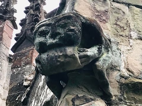
Inkberrow, St Peter’s Church Tour, Worcestershire

Fantastic Grotesques & Gargoyles outside this church with Knight Templar markings on the font. The tower contains a set of six ...

Ep. 7. Rous Lench

Rous Lench is a small village in rural Worcestershire with, at least, three place of historical interest. I rode there, on a fabulous, ...

Driving From Flyford Flavell, Worcestershire Through Radford To Dunnington, Warwickshire, England

Driving from Flyford Flavell, Worcestershire (with a brief stop at The Boot Inn) through Radford (Alcester Road), Goom's Hill, ...

Nearby Amenities

Located within 500m of 52.193952,-1.96038
Bus Stop
Church
Bus: yes
Naptan AtcoCode: 2000G081600
Naptan Bearing: SW
Naptan CommonName: Church
Naptan Indicator: Opp
Naptan Landmark: Church
Naptan NaptanCode: wocdgjpa
Naptan Street: Main Street
Naptan Verified: no
Public Transport: platform
Source: naptan_import
Lat/Long: 52.1935492/-1.9606023
Abbots Morton Turn
Naptan AtcoCode: 2000G081601
Naptan Bearing: N
Naptan BusStopType: CUS
Naptan CommonName: Abbots Morton Turn
Naptan Indicator: Adj
Naptan Landmark: Village Road
Naptan NaptanCode: wocdgjpd
Naptan Street: Village Road
Naptan Verified: no
Source: naptan_import
Lat/Long: 52.1898272/-1.9584442
Post Box
Brand: Royal Mail
Brand Wikidata: Q638098
Brand Wikipedia: en:Royal Mail
Collection Times: Mo-Fr 09:00; Sa 07:00
Operator: Royal Mail
Operator Wikidata: Q638098
Post Box Type: wall
Ref: WR7 106D
Royal Cypher: EIIR
Royal Cypher Wikidata: Q33102113
Source: survey
Lat/Long: 52.1932711/-1.9609144
Post Box
Brand: Royal Mail
Brand Wikidata: Q638098
Brand Wikipedia: en:Royal Mail
Collection Times: Mo-Fr 16:15; Sa 10:00
Operator: Royal Mail
Operator Wikidata: Q638098
Post Box Type: lamp
Ref: WR7 143
Royal Cypher: EIIR
Royal Cypher Wikidata: Q33102113
Source: survey
Lat/Long: 52.1949748/-1.9557069
Abbots Morton
Place: village
Source: OS OpenData StreetView
Wikidata: Q2584125
Lat/Long: 52.192664/-1.9614732
Power: pole
Lat/Long: 52.1922887/-1.9661469
Power: pole
Lat/Long: 52.1912403/-1.9643332
Power: pole
Lat/Long: 52.1905568/-1.9637723
Power: pole
Lat/Long: 52.1929081/-1.9672324
Power: pole
Lat/Long: 52.1917003/-1.9651099
Parking
Village Hall car park
Capacity: 15
Lat/Long: 52.1924101/-1.9609732
Telephone
Addr City: Abbots Morton
Addr Postcode: WR7 4NA
Booth: K6
Covered: booth
Listed Status: Grade II
Phone: +44 1386 792511
Source: survey
Lat/Long: 52.1929087/-1.9612841
Bench
Backrest: yes
Source: survey
Lat/Long: 52.1929814/-1.9613266
Power: pole
Lat/Long: 52.1961349/-1.9580756
Home Farm
Power: pole
Transformer: distribution
Voltage Primary: 11000
Lat/Long: 52.1949963/-1.9598928
Power: pole
Lat/Long: 52.1956597/-1.9591525
Power: pole
Lat/Long: 52.1954403/-1.959583
Power: pole
Lat/Long: 52.1959154/-1.9585598
Power: pole
Lat/Long: 52.1963215/-1.9576666
Power: pole
Lat/Long: 52.1957765/-1.9566903
Abbots Morton
Power: pole
Transformer: distribution
Voltage Primary: 11000
Lat/Long: 52.1953696/-1.9559419
Power: pole
Lat/Long: 52.1901434/-1.9622954
Power: pole
Lat/Long: 52.190728/-1.9616228
Gooms Hill East
Power: pole
Transformer: distribution
Voltage Primary: 11000
Lat/Long: 52.1901019/-1.9591686
Power: pole
Lat/Long: 52.1903703/-1.960389
Power: pole
Lat/Long: 52.1908628/-1.9608651
Power: pole
Lat/Long: 52.1910461/-1.9596595
Abbots Morton West
Power: pole
Transformer: distribution
Voltage Primary: 11000
Lat/Long: 52.1934081/-1.9603984
Location Transition: yes
Power: pole
Lat/Long: 52.1916595/-1.9585919
Power: pole
Lat/Long: 52.1922555/-1.9575486
Power: pole
Lat/Long: 52.1926164/-1.9569263
Power: pole
Lat/Long: 52.1930085/-1.9562584
Power: pole
Lat/Long: 52.1932963/-1.9555771
Power: pole
Lat/Long: 52.1935865/-1.9548482
Power: pole
Lat/Long: 52.1941118/-1.9546303
Power: pole
Lat/Long: 52.1946955/-1.9545633
Power: pole
Lat/Long: 52.1953293/-1.9544949
The data included in this document is from www.openstreetmap.org. The data is made available under ODbL.

Have you been to Abbots Morton?

Leave your review of Abbots Morton below (or comments, questions and feedback).