Adsborough

Settlement in Somerset Somerset West and Taunton

England

Adsborough

Ordnance Survey Cut Mark This OS cut mark can be found on the porch of St Giles Church. It marks a point 81.292m above mean sea level.
Ordnance Survey Cut Mark Credit: Adrian Dust

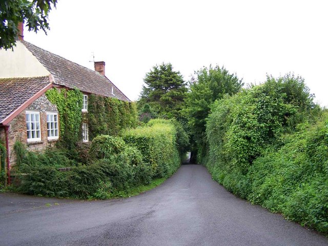
Adsborough is a small village located in the county of Somerset, England. Situated approximately 3 miles southwest of the town of Taunton, Adsborough is nestled in the picturesque countryside of the Taunton Deane district. With a population of around 500 residents, the village offers a peaceful and close-knit community atmosphere.

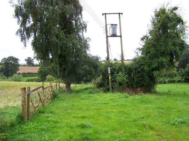
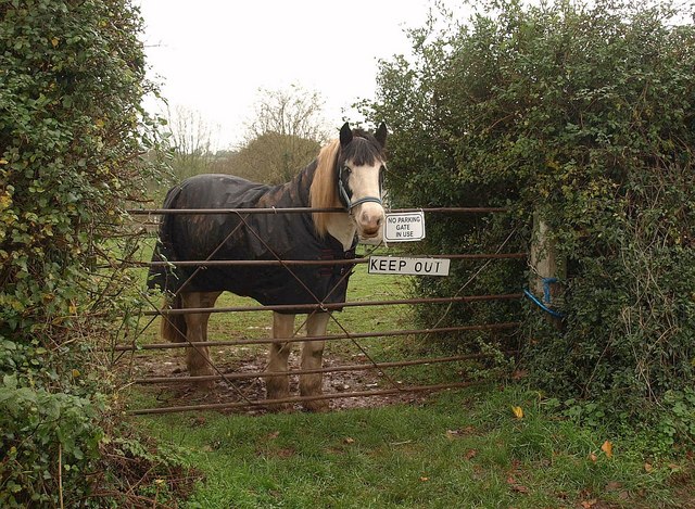
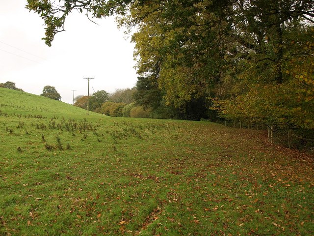
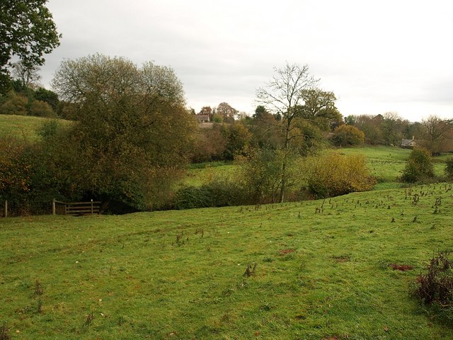
The village is known for its charming rural setting, with rolling hills, meandering streams, and lush green fields. It is surrounded by beautiful countryside, making it an ideal location for nature enthusiasts and those seeking a tranquil retreat. The nearby Quantock Hills, designated as an Area of Outstanding Natural Beauty, provide ample opportunities for hiking, cycling, and exploring the great outdoors.

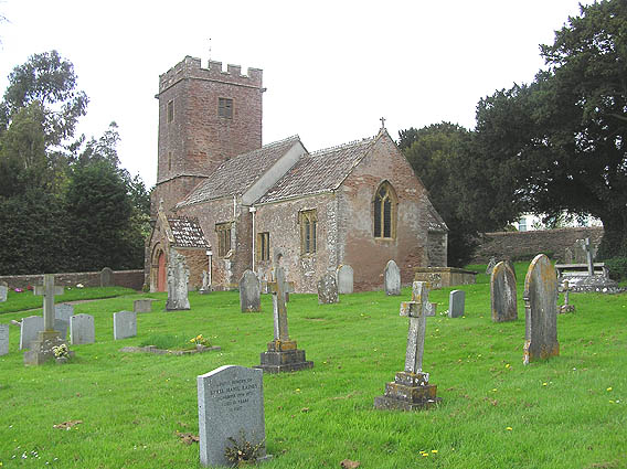
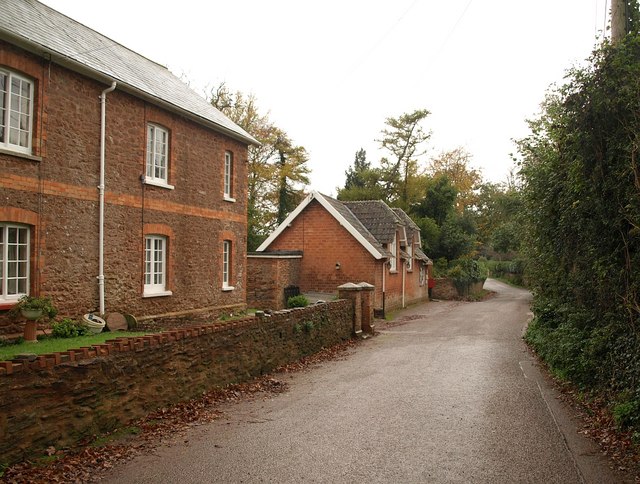
Adsborough is home to a handful of historic buildings, including St. Mary's Church, which dates back to the 13th century. The church's exquisite architecture and stained glass windows attract visitors from near and far. The village also boasts a local pub, The Adsborough Inn, where residents and visitors can enjoy a pint of locally brewed ale or indulge in traditional British pub fare.

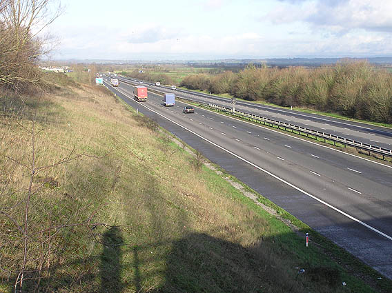
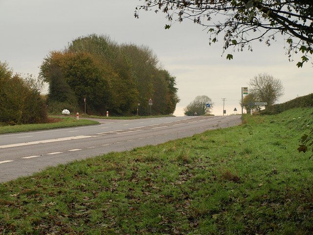
Although small in size, Adsborough benefits from its proximity to Taunton, where residents can access a wider range of amenities, including shops, supermarkets, schools, and healthcare facilities. Taunton also offers excellent transport links, with a mainline railway station and access to major road networks such as the M5 motorway.

In summary, Adsborough is a charming village in Somerset, offering a tranquil and picturesque setting amidst the beautiful English countryside. With its rich history, natural beauty, and close proximity to Taunton, Adsborough is an idyllic place to reside or visit for a peaceful retreat.

If you have any feedback on the listing, please let us know in the comments section below.
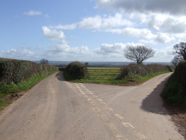
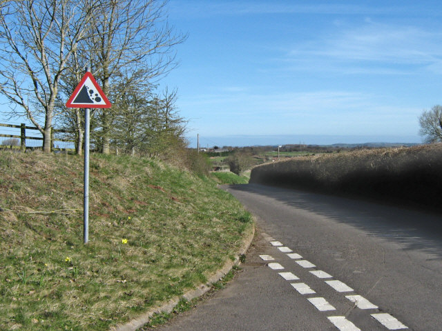
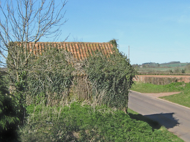
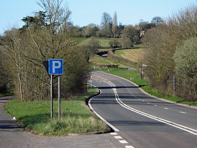
Adsborough Images

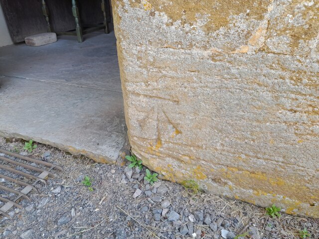
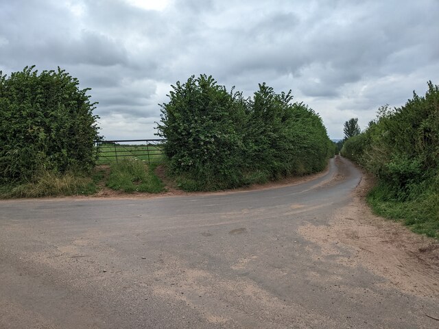
Images are sourced within 2km of 51.057977/-3.031476 or Grid Reference ST2729. Thanks to Geograph Open Source API. All images are credited.

Ordnance Survey Cut Mark This OS cut mark can be found on the porch of St Giles Church. It marks a point 81.292m above mean sea level.
Ordnance Survey Cut Mark
This OS cut mark can be found on the porch of St Giles Church. It marks a point 81.292m above mean sea level.
Looking east down Adder Lane
St. Giles church, Thurloxton Looking NW from the corner of the churchyard
St. Giles church, Thurloxton
Looking NW from the corner of the churchyard
North bound M5 near North Newton The flat lands of the Somerset Levels are evident and the Mendip hills can just be made out in the distance
North bound M5 near North Newton
The flat lands of the Somerset Levels are evident and the Mendip hills can just be made out in the distance
Chapel Hill Farm, Shearston A very large lump of mistletoe in the fruit tree.
Chapel Hill Farm, Shearston
A very large lump of mistletoe in the fruit tree.
St. Giles' Thurloxton A pretty setting for this village church. A man is strimming between the gravestones.
St. Giles' Thurloxton
A pretty setting for this village church. A man is strimming between the gravestones.
Left or right Take your pick - left is Boez Lane to Thurloxton and right is Whiteleaze Lane to Adsborough.
Left or right
Take your pick - left is Boez Lane to Thurloxton and right is Whiteleaze Lane to Adsborough.
Rocks falling on Moon Lane
Barn on Moon Lane
Barn on Moon Lane
Lay by on the A38 Near Thurloxton
Lay by on the A38
Near Thurloxton
Lane Signed To Taunton, Thurloxton
Footpath From Thurloxton Church
Gate in use, Thurloxton This gate on Knotcroft Lane in Thurloxton certainly is in use.
Gate in use, Thurloxton
This gate on Knotcroft Lane in Thurloxton certainly is in use.
Junction on the A38 Just up the hill from <a href="https://www.geograph.org.uk/photo/1586787">ST2729 : Junction on the A38</a>, with Knotcroft Lane turning off to the left for Thurloxton. Taken from the northern end of the layby shown in <a href="https://www.geograph.org.uk/photo/1218086">ST2830 : Lay by on the A38</a>, with the main road readjusting to the original course of the C18 turnpike.
Junction on the A38
Just up the hill from ST2729 : Junction on the A38, with Knotcroft Lane turning off to the left for Thurloxton. Taken from the northern end of the layby shown in ST2830 : Lay by on the A38, with the main road readjusting to the original course of the C18 turnpike.
Buildings in Thurloxton Beyond the pair of red stone semis is the village hall. "A village hall for the use of the inhabitants of the parish of Thurloxton without distinction of political, religious or other opinions including use for meetings lectures and classes and for other forms of recreation and leisure-time occupation with the object of improving the conditions of life for the said inhabitants" is how its function is described on the public register of charities. <span class="nowrap"><a title="http://www.guidestar.org.uk/gs_summary.aspx?CCReg=290720" rel="nofollow ugc noopener" href="http://www.guidestar.org.uk/gs_summary.aspx?CCReg=290720">Link</a><img style="margin-left:2px;" alt="External link" title="External link - shift click to open in new window" src="https://s1.geograph.org.uk/img/external.png" width="10" height="10"/></span>
Buildings in Thurloxton
Beyond the pair of red stone semis is the village hall. "A village hall for the use of the inhabitants of the parish of Thurloxton without distinction of political, religious or other opinions including use for meetings lectures and classes and for other forms of recreation and leisure-time occupation with the object of improving the conditions of life for the said inhabitants" is how its function is described on the public register of charities. LinkExternal link
Manor House, Thurloxton The mid-C19 manor house, perched at the west end of the village above a steep-sided valley, and built for the Colthurst family, of Colthurst Symons, producers of Bridgwater brick, of which the house is constructed <span class="nowrap"><a title="http://webapp1.somerset.gov.uk/her/details.asp?prn=13693" rel="nofollow ugc noopener" href="http://webapp1.somerset.gov.uk/her/details.asp?prn=13693">Link</a><img style="margin-left:2px;" alt="External link" title="External link - shift click to open in new window" src="https://s1.geograph.org.uk/img/external.png" width="10" height="10"/></span> . Seen from footpath BW33/11.
Manor House, Thurloxton
The mid-C19 manor house, perched at the west end of the village above a steep-sided valley, and built for the Colthurst family, of Colthurst Symons, producers of Bridgwater brick, of which the house is constructed LinkExternal link . Seen from footpath BW33/11.
Meadow near Thurloxton Taken close to the point where footpath BW33/11 crosses the stream in the valley which runs across the south side of the village.
Meadow near Thurloxton
Taken close to the point where footpath BW33/11 crosses the stream in the valley which runs across the south side of the village.
Valley, Thurloxton Taken in the same meadow as <a href="https://www.geograph.org.uk/photo/1586942">ST2730 : Meadow near Thurloxton</a>, from footpath BW33/11, looking back towards the largely hidden village. Such was my haste to take advantage of the sun's only appearance of the day that the result is slightly blurred, and there seems to be very little evidence of sunshine anyway.
Valley, Thurloxton
Taken in the same meadow as ST2730 : Meadow near Thurloxton, from footpath BW33/11, looking back towards the largely hidden village. Such was my haste to take advantage of the sun's only appearance of the day that the result is slightly blurred, and there seems to be very little evidence of sunshine anyway.
Show me another place!

Adsborough is located at Grid Ref: ST2729 (Lat: 51.057977, Lng: -3.031476)

Administrative County: Somerset

District: Somerset West and Taunton

Police Authority: Avon and Somerset

What 3 Words

///emulating.outgrown.frock. Near Creech St Michael, Somerset

Related Wikis

Nearby Amenities

Located within 500m of 51.057977,-3.031476
Power: tower
Lat/Long: 51.0567183/-3.0247575
Adsborough
Place: hamlet
Lat/Long: 51.0564407/-3.0325136
Bus Stop
Maypole Inn (NE-bound)
Bus: yes
Network: The Buses of Somerset
Network Wikidata: Q17018973
Network Wikipedia: en:The Buses of Somerset
Operator: First South West
Operator Wikidata: Q5454172
Public Transport: platform
Ref: 21, 21A
Lat/Long: 51.0612858/-3.0327893
Give Way
Direction: backward
Lat/Long: 51.0590314/-3.0365634
Post Box
Brand: Royal Mail
Brand Wikidata: Q638098
Brand Wikipedia: en:Royal Mail
Operator: Royal Mail
Operator Wikidata: Q638098
Post Box Type: lamp
Ref: TA2 540
Royal Cypher: EIIR
Royal Cypher Wikidata: Q33102113
Lat/Long: 51.0561743/-3.0323034
Give Way
Direction: forward
Lat/Long: 51.0579592/-3.0371508
Give Way
Direction: forward
Lat/Long: 51.0585047/-3.0352619
Give Way
Direction: forward
Lat/Long: 51.0587098/-3.0352444
Give Way
Direction: forward
Lat/Long: 51.0578193/-3.0371598
Give Way
Direction: backward
Lat/Long: 51.0578842/-3.0373476
Post Box
Check Date Collection Times: 2023-03-23
Collection Times: Mo-Fr 09:00; Sa 07:00
Operator: Royal Mail
Operator Wikidata: Q638098
Post Box Type: lamp
Ref: TA2 171D
Royal Cypher: EIIR
Royal Cypher Wikidata: Q33102113
Lat/Long: 51.0578867/-3.0372027
Bus Stop
Maypole Inn (SW-bound)
Bus: yes
Network: The Buses of Somerset
Network Wikidata: Q17018973
Network Wikipedia: en:The Buses of Somerset
Operator: First South West
Operator Wikidata: Q5454172
Public Transport: platform
Ref: 21, 21A
Lat/Long: 51.061241/-3.0326222
Bus: yes
Operator: First South West
Public Transport: stop_position
Ref: 21, 21A
Lat/Long: 51.0612629/-3.0326986
The data included in this document is from www.openstreetmap.org. The data is made available under ODbL.

Have you been to Adsborough?

Leave your review of Adsborough below (or comments, questions and feedback).