Shrewsbury

Settlement in Shropshire

England

Shrewsbury

Princess Street, Shrewsbury A quiet, early Sunday morning view along Princess Street in Shrewsbury, Shropshire
Princess Street, Shrewsbury Credit: Peter Evans

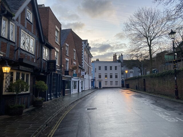
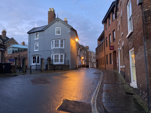
Shrewsbury is a historic town located in the county of Shropshire, England. Situated on the banks of the River Severn, it is the county town and has a population of around 72,000 people. The town is known for its rich history, medieval architecture, and picturesque setting.

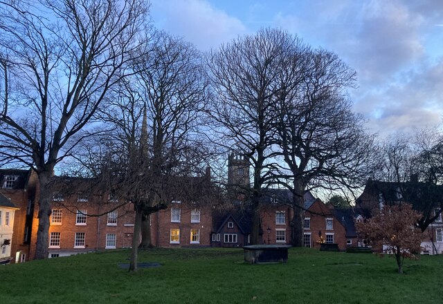
One of Shrewsbury's notable features is its well-preserved medieval town center, which includes over 660 listed buildings. The town is dominated by its iconic sandstone castle, which dates back to 1074 and offers panoramic views of the surrounding area. Another architectural gem is the Shrewsbury Abbey, founded in 1083 and famous for being the final resting place of Saint Winifred.

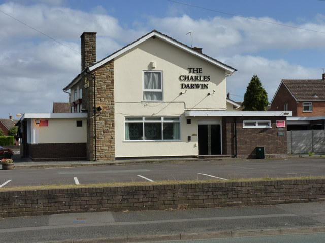
Shrewsbury boasts a vibrant cultural scene with various museums, galleries, and theaters. The Theatre Severn is a modern venue that hosts a wide range of performances, including theater productions, musicals, and concerts. The town also celebrates its literary heritage as the birthplace of renowned naturalist Charles Darwin.

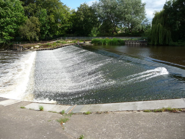
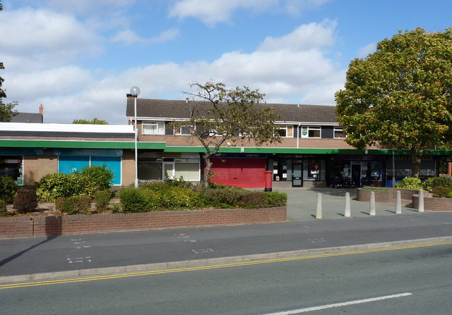
In addition to its historical attractions, Shrewsbury offers a variety of shopping and dining experiences. The town center is home to a mix of independent shops, charming cafes, and traditional pubs. The Quarry Park, located by the river, provides a tranquil green space for recreational activities and hosts the annual Shrewsbury Flower Show.

Transport links in Shrewsbury are well-developed, with the town serving as a hub for regional rail services. It is approximately 45 minutes by train from Birmingham, making it an accessible destination for visitors.

Overall, Shrewsbury is a captivating town that seamlessly combines its rich heritage with a bustling modern atmosphere, making it a popular destination for tourists and residents alike.

If you have any feedback on the listing, please let us know in the comments section below.
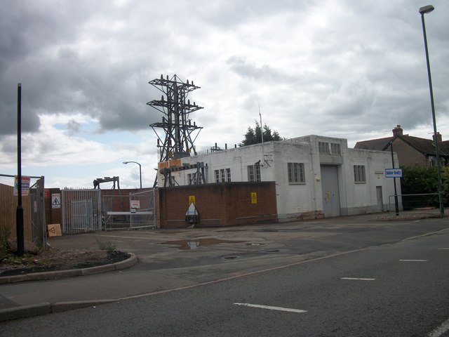
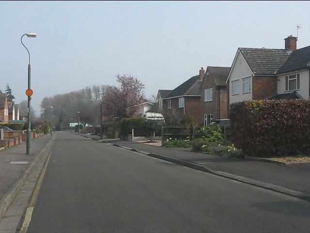
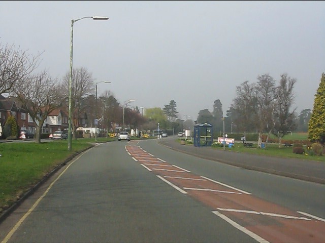
Shrewsbury Images

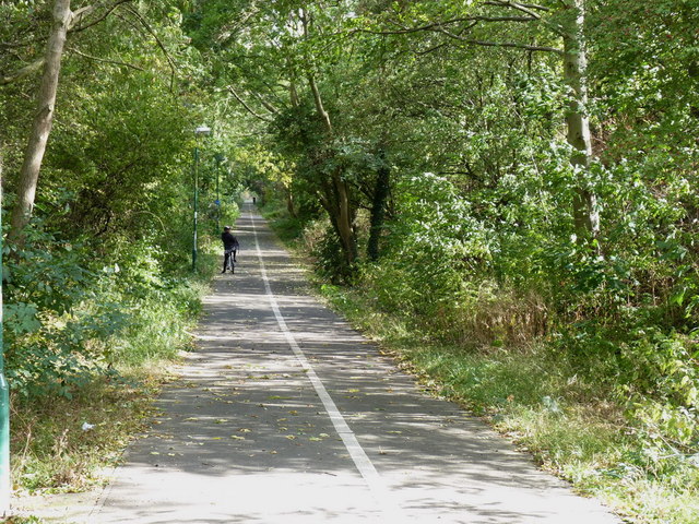
Images are sourced within 2km of 52.707637/-2.742091 or Grid Reference SJ4912. Thanks to Geograph Open Source API. All images are credited.

Princess Street, Shrewsbury A quiet, early Sunday morning view along Princess Street in Shrewsbury, Shropshire
Princess Street, Shrewsbury
A quiet, early Sunday morning view along Princess Street in Shrewsbury, Shropshire
College Hill, Shrewsbury Sunday morning on College Hill in Shrewsbury, Shropshire
College Hill, Shrewsbury
Sunday morning on College Hill in Shrewsbury, Shropshire
Princess Street, Shrewsbury A view across the green and churchyard of the Old St. Chad’s to the properties along Princess Street in Shrewsbury. The spire of St. Alkmund’s Church and tower of St. Julian's can be seen in the further distance.
Princess Street, Shrewsbury
A view across the green and churchyard of the Old St. Chad’s to the properties along Princess Street in Shrewsbury. The spire of St. Alkmund’s Church and tower of St. Julian's can be seen in the further distance.
Disused electricity pylon
Electricity Substation Now out of use
Electricity Substation
Now out of use
Removing the Overhead Cables At last the overhead cables have been removed from over these houses
Removing the Overhead Cables
At last the overhead cables have been removed from over these houses
Now out of use pylon
Removing the Overhead Cables
Weir on the River Severn in Shrewsbury A splendid weir on a summer's day.
Weir on the River Severn in Shrewsbury
A splendid weir on a summer's day.
Local shops and facilities, Sutton Farm estate A small shopping precinct, Co-op food store, Post Office etc in the middle of the Sutton Farm housing estate.
Local shops and facilities, Sutton Farm estate
A small shopping precinct, Co-op food store, Post Office etc in the middle of the Sutton Farm housing estate.
The Charles Darwin, Sutton Farm estate A public house on Sutton Road
The Charles Darwin, Sutton Farm estate
A public house on Sutton Road
The former railway line into Shrewsbury The route of the former line from the Severn Valley direction (Bridgnorth, Ironbridge, Buildwas, Cressage etc) into Shrewsbury; now used as a shared cycle and pedestrian route.
The former railway line into Shrewsbury
The route of the former line from the Severn Valley direction (Bridgnorth, Ironbridge, Buildwas, Cressage etc) into Shrewsbury; now used as a shared cycle and pedestrian route.
The former railway line out of Shrewsbury The route of the former line towards the Severn Valley direction (Bridgnorth, Ironbridge, Buildwas, Cressage etc) from Shrewsbury; now used as a shared cycle and pedestrian route.
The former railway line out of Shrewsbury
The route of the former line towards the Severn Valley direction (Bridgnorth, Ironbridge, Buildwas, Cressage etc) from Shrewsbury; now used as a shared cycle and pedestrian route.
The Rea Brook, Sutton Farm A glimpse of the Rea Brook through the trees as it winds its way through fields near the Sutton estate.
The Rea Brook, Sutton Farm
A glimpse of the Rea Brook through the trees as it winds its way through fields near the Sutton estate.
A weir on the Rea Brook
Footpath west of Sutton Farm estate A footpath through fields and over a drainage ditch in fields west of the Sutton Farm estate.
Footpath west of Sutton Farm estate
A footpath through fields and over a drainage ditch in fields west of the Sutton Farm estate.
New College Road
New College Road
London Road at New College Road
Show me another place!

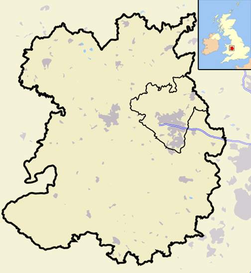
Shrewsbury is located at Grid Ref: SJ4912 (Lat: 52.707637, Lng: -2.742091)

Unitary Authority: Shropshire

Police Authority: West Mercia

What 3 Words

///souk.falls.good. Near Shrewsbury, Shropshire

Related Wikis

Shrewsbury Abbey railway station

Shrewsbury Abbey was a railway station in Shrewsbury, Shropshire, England part of the Shropshire and Montgomeryshire Railway. It was named after the nearby...

Shrewsbury Abbey

The Abbey Church of the Holy Cross (commonly known as Shrewsbury Abbey) is an ancient foundation in Shrewsbury, the county town of Shropshire, England...

Shropshire Wildlife Trust

The Shropshire Wildlife Trust (SWT) is a wildlife trust covering the geographic county of Shropshire, England. == Nature reserves == The trust cares for...

Abbey Foregate railway station

Abbey Foregate railway station was in Shrewsbury, Shropshire, south-east of Shrewsbury station, to the east of Severn Bridge Junction, on what is today...

Nearby Amenities

Located within 500m of 52.707637,-2.742091
Railway: switch
Lat/Long: 52.7095506/-2.7450716
Traffic Signals
Lat/Long: 52.7066148/-2.7396897
Mini Roundabout
Lat/Long: 52.7052477/-2.745295
Coleham Pump Station
Operator: Severn Trent
Lat/Long: 52.7045445/-2.7465281
Pub
Cross Foxes
Addr Postcode: SY3 7DE
Lat/Long: 52.7042947/-2.7464265
Railway: switch
Lat/Long: 52.7101128/-2.746978
Railway: switch
Lat/Long: 52.7101636/-2.7468062
Bus Stop
Bench: no
Bin: no
Bus: yes
Network: Arriva
Network Wikidata: Q680991
Network Wikipedia: en:Arriva
Operator: Arriva
Public Transport: platform
Ref: Outbound
Route Ref: 1;11
Shelter: no
Lat/Long: 52.7091382/-2.737813
Bus Stop
Bus: yes
Network: Arriva
Network Wikidata: Q680991
Network Wikipedia: en:Arriva
Operator: Arriva
Public Transport: platform
Ref: Outbound
Shelter: yes
Lat/Long: 52.7073828/-2.7445534
Post Box
Brand: Royal Mail
Brand Wikidata: Q638098
Brand Wikipedia: en:Royal Mail
Collection Times: Mo-Fr 09:00; Sa 07:00
Operator: Royal Mail
Operator Wikidata: Q638098
Post Box Design: penfold
Post Box Type: pillar
Postal Code: SY2
Ref: SY2 4D
Royal Cypher: VR
Royal Cypher Wikidata: Q33102356
Lat/Long: 52.707337/-2.7449632
Bicycle Parking
Access: yes
Bicycle Parking: stands
Capacity: 6
Covered: no
Fee: no
Lat/Long: 52.7073694/-2.7448574
Telephone
HE Ref: 1271370
Booth: K6
Covered: booth
Listed Status: Grade II
Phone: +44 1743 247222
Lat/Long: 52.7073873/-2.7449029
Symmetry: memorial to Wilfred Owen
Artist Name: Paul de Monchaux
Artwork Name: Symmetry
Historic: memorial
Start Date: 1993-06-12
Subject Wikidata: Q212719
Subject Wikipedia: Wilfred Owen
Tourism: artwork
Lat/Long: 52.7076619/-2.7425254
Noexit: yes
Lat/Long: 52.7077851/-2.7455934
Railway: buffer_stop
Lat/Long: 52.7103538/-2.7461239
Give Way
Direction: forward
Lat/Long: 52.7033394/-2.7413056
Crossing
Crossing: unmarked
Crossing Island: yes
Crossing Markings: no
Tactile Paving: yes
Lat/Long: 52.7056647/-2.7436198
Recycling
Recycling Cans: yes
Recycling Cardboard: yes
Recycling Cartons: yes
Recycling Clothes: yes
Recycling Glass Bottles: yes
Recycling Paper: yes
Recycling Plastic Bottles: yes
Recycling Small Appliances: yes
Recycling Type: container
Lat/Long: 52.7063123/-2.7426593
Crossing
Crossing: zebra
Lat/Long: 52.7051079/-2.742917
Crossing
Crossing: zebra
Lat/Long: 52.7051744/-2.7427298
Railway: railway_crossing
Lat/Long: 52.7098293/-2.7464617
Mini Roundabout
Direction: clockwise
Lat/Long: 52.7033462/-2.740166
Post Box
Collection Times: Mo-Fr 17:15, Sa 12:15
Operator: Royal Mail
Operator Wikidata: Q638098
Post Box Type: pillar
Postal Code: SY2
Ref: SY2 26
Royal Cypher: GVIR
Royal Cypher Wikidata: Q33102169
Lat/Long: 52.7066563/-2.7402043
Post Office
Abbey Foregate Post Office
Addr City: Shrewsbury
Addr Country: GB
Addr County: Shropshire
Addr Housenumber: 166
Addr Postcode: SY2 6AL
Addr Street: Abbey Foregate
Brand: Post Office
Brand Wikidata: Q1783168
Check Date: 2022-05-27
Check Date Opening Hours: 2022-05-27
Contact Website: https://www.postoffice.co.uk/branch-finder/1516418/abbey-foregate
Opening Hours: Mo-Fr 09:00-17:30
Ref Pol Id: 2900
Lat/Long: 52.7065956/-2.7402715
Home Bargains
Addr City: Shrewsbury
Addr Country: GB
Addr Housenumber: 172-175
Addr Postcode: SY2 6AL
Addr Street: Abbey Foregate
Brand: Home Bargains
Brand Wikidata: Q5888229
Brand Wikipedia: en:Home Bargains
Contact Website: https://storelocator.homebargains.co.uk/store/A354/Abbey+Foregate,+Shrewsbury,+Shropshire
Fhrs Authority: Shropshire
Fhrs Id: 1616062
Fhrs Local Authority Id: 200861
Operator: Home Bargains
Postal Code: SY2 6AL
Shop: variety_store
Lat/Long: 52.7067227/-2.7414084
Post Box
Postal Code: SY3
Ref: SY3 265
Source: survey
Lat/Long: 52.7051044/-2.7423133
Lifestyle Express
Addr City: Shrewsbury
Addr Country: GB
Addr Housenumber: 32-36
Addr Postcode: SY2 5AR
Addr Street: Monkmoor Road
Brand: Lifestyle Express
Brand Wikidata: Q61994869
Fhrs Authority: Shropshire
Fhrs Id: 1003948
Fhrs Local Authority Id: 17/00438/COMM
Shop: convenience
Lat/Long: 52.7098544/-2.7370953
Post Box
Post Box Type: wall
Ref: SY2 31
Royal Cypher: GR
Royal Cypher Wikidata: Q33102273
Lat/Long: 52.7097889/-2.7371811
Post Box
Created By: Potlatch 0.10f
Ref: SY3 34
Source: survey
Lat/Long: 52.7045614/-2.7447949
Street Lamp
Source: survey
Lat/Long: 52.7091925/-2.7406449
Street Lamp
Source: survey
Lat/Long: 52.7090522/-2.740939
Street Lamp
Source: survey
Lat/Long: 52.7089137/-2.7412523
Post Box
Ref: SY2 179
Source: survey
Lat/Long: 52.7078254/-2.7356473
Atm
Operator: Asda
Lat/Long: 52.7053352/-2.7423379
Atm
Operator: Asda
Lat/Long: 52.7053233/-2.7423706
Bicycle Parking
Access: yes
Bicycle Parking: wall_loops
Capacity: 9
Covered: no
Fee: no
Lat/Long: 52.7049744/-2.7423935
Pub
The Dun Cow
Addr City: Shrewsbury
Addr Country: GB
Addr Housenumber: 171
Addr Postcode: SY2 6AL
Addr Street: Abbey Foregate
Fhrs Authority: Shropshire
Fhrs Id: 103021
Fhrs Local Authority Id: 34439
Source Addr: FHRS Open Data
Wikidata: Q26538861
Lat/Long: 52.7067397/-2.7408208
Railway: switch
Lat/Long: 52.7094343/-2.7450767
Railway: switch
Lat/Long: 52.7090424/-2.7464775
Railway: crossing
Lat/Long: 52.7097113/-2.7463795
Railway: switch
Lat/Long: 52.7096296/-2.7412047
Railway: buffer_stop
Lat/Long: 52.7099292/-2.7453588
Railway: buffer_stop
Lat/Long: 52.7102408/-2.7465714
Railway: switch
Lat/Long: 52.7097287/-2.7435908
Railway: switch
Lat/Long: 52.70975/-2.7423058
Railway: railway_crossing
Lat/Long: 52.7095769/-2.7414514
Bicycle Parking
Capacity: 6
Lat/Long: 52.7073429/-2.7420793
Cherry Orchard
Place: suburb
Lat/Long: 52.7077821/-2.7367421
Coleham
Place: suburb
Lat/Long: 52.7044721/-2.7458198
Railway: switch
Lat/Long: 52.7095858/-2.7417106
Anton Guest House
Tourism: guest_house
Lat/Long: 52.70918/-2.7374806
House Clearance Emporium
Name En: House Clearance Emporium
Shop: antiques
Lat/Long: 52.7054495/-2.7452213
Railway: railway_crossing
Lat/Long: 52.7077059/-2.7458704
Railway: railway_crossing
Lat/Long: 52.7096357/-2.7423109
Railway: switch
Lat/Long: 52.7101683/-2.7472966
Railway: switch
Lat/Long: 52.7102151/-2.7473598
Crossing
Bicycle: yes
Crossing: traffic_signals
Crossing Island: no
Crossing Ref: toucan
Kerb: flush
Segregated: no
Tactile Paving: yes
Traffic Signals Sound: walk
Lat/Long: 52.7072004/-2.7451953
Traffic Signals
Traffic Signals Direction: forward
Lat/Long: 52.7063241/-2.746291
Telephone
Addr Country: GB
Addr Postcode: SY3 7DX
Addr State: England
Addr Street: Belle Vue Road
Booth: KX100
Covered: booth
Operator: BT
Operator Wikidata: Q593786
Lat/Long: 52.7036145/-2.7450211
Place Of Worship
Seventh Day Adventist Church
Denomination: seventh_day_adventist
Religion: christian
Source: OS_OpenData_StreetView
Lat/Long: 52.7082902/-2.7432658
Shrewsbury Abbey
Disused Railway: station
Historic Railway: station
Wikidata: Q7503659
Wikipedia: en:Shrewsbury Abbey railway station
Lat/Long: 52.7070504/-2.743269
Railway: buffer_stop
Lat/Long: 52.7041648/-2.7432319
Railway: switch
Lat/Long: 52.7073313/-2.7456885
Railway: switch
Lat/Long: 52.7037552/-2.7430363
Railway: switch
Lat/Long: 52.7041306/-2.7431278
Railway: switch
Lat/Long: 52.7078314/-2.7459234
Railway: switch
Lat/Long: 52.7082295/-2.7461027
Railway: buffer_stop
Lat/Long: 52.7102129/-2.7466123
Railway: switch
Lat/Long: 52.7102123/-2.746764
Railway: switch
Lat/Long: 52.7096151/-2.7441446
Railway: switch
Lat/Long: 52.710138/-2.7470133
Railway: railway_crossing
Lat/Long: 52.7099218/-2.7469498
Railway: switch
Lat/Long: 52.7096994/-2.7439679
Railway: switch
Lat/Long: 52.7095949/-2.7448978
Railway: switch
Lat/Long: 52.7098661/-2.7460099
Railway: switch
Lat/Long: 52.7095562/-2.7408446
Railway: switch
Lat/Long: 52.7097126/-2.7429137
Railway: switch
Lat/Long: 52.7095779/-2.7467032
Railway: switch
Lat/Long: 52.7095872/-2.7408446
Railway: switch
Lat/Long: 52.7082795/-2.7461138
Railway: switch
Lat/Long: 52.7097539/-2.7431894
Railway: switch
Lat/Long: 52.708538/-2.7461228
Railway: buffer_stop
Lat/Long: 52.7099773/-2.7452736
Railway: switch
Lat/Long: 52.709709/-2.7419429
Railway: switch
Lat/Long: 52.7097928/-2.742789
Railway: switch
Lat/Long: 52.708239/-2.7460511
Railway: switch
Lat/Long: 52.7095077/-2.7440936
Railway: switch
Lat/Long: 52.709162/-2.7463249
Railway: switch
Lat/Long: 52.7096143/-2.7416638
Railway: buffer_stop
Lat/Long: 52.7102625/-2.7465332
Railway: buffer_stop
Lat/Long: 52.709794/-2.7442607
Railway: switch
Lat/Long: 52.7098076/-2.743166
Railway: buffer_stop
Lat/Long: 52.7099002/-2.7453809
Railway: switch
Lat/Long: 52.7095761/-2.7395509
Railway: buffer_stop
Lat/Long: 52.7095374/-2.7372814
Railway: railway_crossing
Lat/Long: 52.7096032/-2.7463235
Railway: railway_crossing
Lat/Long: 52.7096455/-2.7463439
Railway: railway_crossing
Lat/Long: 52.7097515/-2.7465865
Crossing
Bicycle: yes
Button Operated: yes
Crossing: traffic_signals
Crossing Island: no
Crossing Markings: dots
Crossing Ref: toucan
Tactile Paving: yes
Lat/Long: 52.7051878/-2.743309
Crossing
Crossing: traffic_signals
Crossing Island: no
Crossing Light: yes
Crossing Ref: puffin
Tactile Paving: yes
Lat/Long: 52.7078253/-2.738716
Bus Stop
Bus: yes
Naptan AtcoCode: 3500B268102
Naptan NaptanCode: shrawdgp
Network: Arriva
Network Wikidata: Q680991
Network Wikipedia: en:Arriva
Operator: Arriva
Public Transport: platform
Ref: Outbound
Shelter: yes
Source: Bing;local knowledge
Lat/Long: 52.7070339/-2.7410585
Cycleway: asl
Direction: forward
Lat/Long: 52.7071811/-2.7454434
Crossing
Crossing: marked
Crossing Island: no
Crossing Markings: yes
Kerb: flush
Tactile Paving: yes
Traffic Calming: table
Lat/Long: 52.7070947/-2.7460401
Traffic Signals
Traffic Signals Direction: forward
Lat/Long: 52.706274/-2.7462029
Bus Stop
Bench: no
Bin: yes
Bus: yes
Departures Board: no
Naptan AtcoCode: 3500B071405
Naptan NaptanCode: shragpdm
Network: Arriva
Network Wikidata: Q680991
Network Wikipedia: en:Arriva
Operator: Arriva
Public Transport: platform
Ref: Inbound
Shelter: yes
Lat/Long: 52.7097078/-2.7372529
Ferndell B&B
Tourism: guest_house
Lat/Long: 52.7106436/-2.7393596
Crossing
Crossing: unmarked
Crossing Island: yes
Crossing Markings: no
Kerb: flush
Tactile Paving: yes
Lat/Long: 52.7073403/-2.742186
Waste Basket
Check Date: 2021-08-10
Lat/Long: 52.706476/-2.7484608
Bench
Backrest: yes
Lat/Long: 52.7070996/-2.7474427
Bench
Backrest: yes
Lat/Long: 52.7072348/-2.7475467
Bench
Backrest: yes
Lat/Long: 52.7073908/-2.7477831
Bench
Backrest: yes
Lat/Long: 52.7073946/-2.7475575
Bench
Backrest: yes
Colour: brown
Material: wood
Lat/Long: 52.7074355/-2.7432005
Bench
Backrest: yes
Lat/Long: 52.7070241/-2.7471123
Bus Stop
Bus: yes
Public Transport: platform
Lat/Long: 52.7060418/-2.7374321
Traffic Calming: bump
Lat/Long: 52.7034691/-2.7401313
Traffic Calming: bump
Lat/Long: 52.7036132/-2.7398646
Traffic Calming: bump
Lat/Long: 52.7037192/-2.7401313
Traffic Calming: bump
Lat/Long: 52.7038118/-2.7394858
Traffic Calming: bump
Lat/Long: 52.7042071/-2.7399819
Charging Station
Lat/Long: 52.7046225/-2.7421923
Charging Station
Lat/Long: 52.7046399/-2.7421382
Railway: switch
Lat/Long: 52.709516/-2.7387706
Crossing
Bicycle: yes
Crossing: traffic_signals
Crossing Island: no
Crossing Ref: toucan
Kerb: flush
Segregated: no
Tactile Paving: yes
Traffic Signals Sound: yes
Lat/Long: 52.7072521/-2.7453149
Crossing
Bicycle: yes
Crossing: traffic_signals
Crossing Island: no
Crossing Ref: toucan
Kerb: flush
Segregated: no
Tactile Paving: yes
Traffic Signals Sound: walk
Lat/Long: 52.7071565/-2.7453498
Crossing
Crossing: marked
Crossing Island: no
Crossing Markings: yes
Tactile Paving: yes
Traffic Calming: table
Lat/Long: 52.7073539/-2.7451063
Bench
Lat/Long: 52.7070404/-2.7416426
Bicycle Parking
Access: permissive
Bicycle Parking: stands
Capacity: 4
Covered: no
Fee: no
Surface: paved
Lat/Long: 52.706728/-2.7415961
Entrance: yes
Lat/Long: 52.7075643/-2.7442376
Noexit: yes
Lat/Long: 52.7074346/-2.7446846
Atm
Lat/Long: 52.7069384/-2.7413719
Pharmacy
Asda
Brand: Asda
Brand Wikidata: Q297410
Brand Wikipedia: en:Asda
Contact Phone: +44 1743 276810
Contact Website: https://storelocator.asda.com/west-midlands/shrewsbury/old-potts-way/pharmacy
Healthcare: pharmacy
Opening Hours Covid19: Mo-Th, Sa 08:00-22:00; Fr 09:00-18:00; Su 10:00-16:00
Operator: Asda Stores Ltd
Lat/Long: 52.7051857/-2.7422816
Noexit: yes
Lat/Long: 52.7064107/-2.7409616
Samaritans
Addr City: Shrewsbury
Addr Housename: Swan House
Addr Postcode: SY3 7BJ
Office: charity
Lat/Long: 52.7065227/-2.7464103
Veterinary
Abbey Vets
Lat/Long: 52.7085518/-2.7416473
Über Hair
Contact Facebook: https://www.facebook.com/uberhairsalon/
Phone: +44 1743 232276
Shop: hairdresser
Lat/Long: 52.7061875/-2.7486306
Talbot Plan
Addr City: Shrewsbury
Addr Housenumber: 47
Addr Postcode: SY1 1XJ
Addr Street: Wyle Cop
Opening Hours: Mo-Fr 09:00-17:00
Phone: +44 1743 343740
Shop: copyshop
Website: http://www.talbotplanprinting.com/
Lat/Long: 52.7061708/-2.7487003
Crossing
Crossing: unmarked
Crossing Island: yes
Crossing Markings: no
Kerb: flush
Tactile Paving: yes
Lat/Long: 52.7050919/-2.7454871
Crossing
Crossing: zebra
Crossing Island: no
Crossing Ref: belisha_beacon
Tactile Paving: yes
Lat/Long: 52.705025/-2.7450972
Barrier: kerb
Kerb: flush
Tactile Paving: yes
Lat/Long: 52.7067974/-2.7466162
Traffic Signals
Lat/Long: 52.7062358/-2.746407
Give Way
Lat/Long: 52.7066088/-2.7449326
Symmetry
Artist Name: Wilfred Owen
Artwork Type: poem
Check Date: 2021-11-02
Description: Shows two poems written by local War Poet Wilfred Owen
Information: board
Tourism: artwork
Lat/Long: 52.7074197/-2.7426687
Railway: switch
Lat/Long: 52.7073064/-2.7457338
Railway: switch
Lat/Long: 52.7101773/-2.7472398
English Bridge Junction
Railway: junction
Wikidata: Q124372570
Lat/Long: 52.7073272/-2.7457175
Abbey Foregate Junction
Railway: junction
Wikidata: Q124372573
Lat/Long: 52.7095766/-2.7409896
Severn Bridge Junction
Alt Name: Wellington Junction
Railway: junction
Lat/Long: 52.7100499/-2.7469079
Generator Method: photovoltaic
Generator Output Electricity: yes
Generator Source: solar
Generator Type: solar_photovoltaic_panel
Location: roof
Power: generator
Lat/Long: 52.7101352/-2.7373096
Bus Stop
Outbound
Bus: yes
Description: Stop sign attached to lamp post
Fixme: check name as likely to be more descriptive
Lit: yes
Network: Arriva
Network Wikidata: Q680991
Network Wikipedia: en:Arriva
Operator: Arriva
Pole: yes
Public Transport: platform
Ref: shrajgtj
Shelter: no
Lat/Long: 52.7038931/-2.7449293
Bus Stop
Bin: no
Bus: yes
Naptan AtcoCode: 3500B019201
Naptan NaptanCode: shradjmp
Network: Arriva
Network Wikidata: Q680991
Network Wikipedia: en:Arriva
Operator: Arriva
Pole: yes
Public Transport: platform
Ref: Inbound
Shelter: no
Lat/Long: 52.7060859/-2.7463624
Bus Stop
English Bridge
Bench: yes
Bus: yes
Local Ref: L
Network: Arriva
Network Wikidata: Q680991
Network Wikipedia: en:Arriva
Operator: Arriva
Public Transport: platform
Shelter: yes
Lat/Long: 52.7064073/-2.7452982
Bus Stop
Old Potts Way (north bound)
Bench: yes
Bus: yes
Operator: Various
Public Transport: platform
Shelter: yes
Lat/Long: 52.7053132/-2.7435898
Bus Stop
Old Potts Way (south bound)
Bench: yes
Bin: no
Bus: yes
Operator: Various
Public Transport: platform
Shelter: yes
Lat/Long: 52.704892/-2.7429666
Bus Stop
Bus: yes
Naptan AtcoCode: 3500B268103
Naptan NaptanCode: shrawdgt
Network: Arriva
Network Wikidata: Q680991
Network Wikipedia: en:Arriva
Operator: Arriva
Public Transport: platform
Ref: Inbound
Shelter: yes
Lat/Long: 52.7068301/-2.7408444
Bus Stop
Bus: yes
Network: Arriva
Network Wikidata: Q680991
Network Wikipedia: en:Arriva
Operator: Arriva
Public Transport: platform
Ref: Inbound
Shelter: yes
Lat/Long: 52.7073115/-2.7440406
Bus Stop
Bench: no
Bin: no
Bus: yes
Layer: 1
Operator: Various
Pole: yes
Public Transport: platform
Ref: Outbound
Shelter: no
Lat/Long: 52.7064876/-2.7481199
Kindergarten
Club 0-14
Lat/Long: 52.7042166/-2.7439522
Monkmoor Road 442
Power: substation
Lat/Long: 52.7090924/-2.7379047
Telephone
Booth: KX100
Covered: booth
Operator: BT
Operator Wikidata: Q593786
Lat/Long: 52.7101219/-2.7369577
Bus Stop
Bench: no
Bin: no
Bus: yes
Naptan AtcoCode: 3500B071401
Naptan NaptanCode: shragpaw
Network: Arriva
Network Wikidata: Q680991
Network Wikipedia: en:Arriva
Operator: Arriva
Pole: yes
Public Transport: platform
Ref: Inbound
Shelter: no
Lat/Long: 52.7076216/-2.7387582
Crossing
Bicycle: yes
Button Operated: yes
Crossing: traffic_signals
Crossing Island: no
Crossing Ref: toucan
Tactile Paving: yes
Traffic Signals Sound: yes
Traffic Signals Vibration: no
Lat/Long: 52.7102166/-2.7370323
Crossing
Crossing: unmarked
Crossing Island: yes
Crossing Markings: no
Kerb: flush
Tactile Paving: yes
Lat/Long: 52.7070339/-2.7413289
Crossing
Crossing: unmarked
Crossing Island: yes
Crossing Markings: no
Kerb: flush
Tactile Paving: yes
Lat/Long: 52.7073657/-2.7438114
Barrier: kerb
Kerb: flush
Tactile Paving: yes
Lat/Long: 52.7068001/-2.7466946
Crossing
Bicycle: yes
Button Operated: yes
Crossing: traffic_signals
Crossing Island: no
Crossing Ref: toucan
Kerb: flush
Segregated: no
Tactile Paving: yes
Traffic Signals Sound: walk
Lat/Long: 52.7067569/-2.7467709
Crossing
Crossing: marked
Crossing Island: no
Crossing Markings: yes
Crossing Ref: pelican
Kerb: flush
Tactile Paving: yes
Lat/Long: 52.7062517/-2.746233
Crossing
Crossing: marked
Crossing Island: no
Crossing Markings: yes
Crossing Ref: pelican
Kerb: flush
Tactile Paving: yes
Lat/Long: 52.7063342/-2.7463356
Traffic Signals
Lat/Long: 52.7072604/-2.7451541
Crossing
Bicycle: yes
Button Operated: yes
Crossing: traffic_signals
Crossing Island: no
Crossing Ref: toucan
Kerb: flush
Segregated: no
Tactile Paving: yes
Traffic Signals Sound: walk
Lat/Long: 52.7068001/-2.7466474
Crossing
Bicycle: yes
Button Operated: yes
Crossing: traffic_signals
Crossing Island: no
Crossing Ref: toucan
Kerb: flush
Segregated: no
Tactile Paving: yes
Traffic Signals Sound: walk
Lat/Long: 52.7068289/-2.7467698
Crossing
Crossing: marked
Crossing Island: no
Crossing Markings: yes
Crossing Ref: pelican
Kerb: flush
Tactile Paving: yes
Lat/Long: 52.7062574/-2.7464184
Crossing
Crossing: marked
Crossing Island: yes
Crossing Markings: yes
Crossing Ref: puffin
Tactile Paving: yes
Lat/Long: 52.7066763/-2.7399355
Crossing
Crossing: marked
Crossing Island: yes
Crossing Markings: yes
Crossing Ref: puffin
Tactile Paving: yes
Lat/Long: 52.7067738/-2.7395491
Crossing
Crossing: marked
Crossing Island: yes
Crossing Markings: yes
Crossing Ref: puffin
Tactile Paving: yes
Lat/Long: 52.7065548/-2.7394661
Generator Method: photovoltaic
Generator Output Electricity: yes
Generator Source: solar
Generator Type: solar_photovoltaic_panel
Location: roof
Power: generator
Lat/Long: 52.7054013/-2.7377039
Generator Method: photovoltaic
Generator Output Electricity: yes
Generator Source: solar
Generator Type: solar_photovoltaic_panel
Location: roof
Power: generator
Lat/Long: 52.7055508/-2.7376637
Generator Method: photovoltaic
Generator Output Electricity: yes
Generator Source: solar
Generator Type: solar_photovoltaic_panel
Location: roof
Power: generator
Lat/Long: 52.7056597/-2.7376315
Generator Method: photovoltaic
Generator Output Electricity: yes
Generator Source: solar
Generator Type: solar_photovoltaic_panel
Location: roof
Power: generator
Lat/Long: 52.7081527/-2.7367544
Generator Method: photovoltaic
Generator Output Electricity: yes
Generator Source: solar
Generator Type: solar_photovoltaic_panel
Location: roof
Power: generator
Lat/Long: 52.7083493/-2.7353919
Railway: switch
Lat/Long: 52.7095393/-2.7402756
Railway: switch
Lat/Long: 52.7095412/-2.7394676
Abbey Foregate
Abandoned Railway: station
Railway: site
Wikidata: Q4664003
Wikipedia: en:Abbey Foregate railway station
Lat/Long: 52.7095462/-2.7393367
Crossing
Crossing: unmarked
Crossing Island: yes
Crossing Markings: no
Tactile Paving: yes
Lat/Long: 52.703563/-2.7414741
Crossing
Crossing: unmarked
Crossing Island: yes
Crossing Markings: no
Tactile Paving: yes
Lat/Long: 52.706241/-2.7382378
Cycleway: asl
Direction: forward
Lat/Long: 52.7065503/-2.7394489
Cycleway: asl
Direction: backward
Lat/Long: 52.7066812/-2.7399529
Cafe
The Condor
Addr City: Shrewsbury
Addr Housenumber: 44
Addr Postcode: SY1 1XF
Addr Street: Wyle Cop
Contact Facebook: condorshrewsbury
Cuisine: coffee_shop
Fhrs Authority: Shropshire
Fhrs Id: 1672644
Fhrs Local Authority Id: 23/00804/COMM
Level: 0
Opening Hours: Mo-Su 08:00-15:00
Outdoor Seating: no
Source Addr: FHRS Open Data
Lat/Long: 52.7063962/-2.7485559
Telephone
HE Ref: 1246197
Booth: K6
Covered: booth
Listed Status: Grade II
Phone: +44 1743 247793
Lat/Long: 52.7071147/-2.7413544
Railway: crossing
Lat/Long: 52.7100895/-2.7466973
Railway: crossing
Lat/Long: 52.7100799/-2.7469289
Noexit: yes
Lat/Long: 52.707518/-2.745972
Crossing
Lat/Long: 52.7098982/-2.7471947
Man Made: mast
Tower Construction: lattice
Lat/Long: 52.7089651/-2.7466104
Railway: crossing
Lat/Long: 52.7095904/-2.7462875
Railway: crossing
Lat/Long: 52.7096324/-2.7463062
Railway: crossing
Lat/Long: 52.7099051/-2.7466331
Crossing
Crossing: unmarked
Crossing Island: yes
Crossing Markings: no
Tactile Paving: yes
Lat/Long: 52.7053715/-2.7453828
Give Way
Direction: backward
Lat/Long: 52.7037162/-2.7449101
Give Way
Direction: backward
Lat/Long: 52.7037207/-2.7450188
Give Way
Direction: forward
Lat/Long: 52.7050891/-2.7441197
Barrier: kerb
Kerb: flush
Tactile Paving: yes
Lat/Long: 52.7051571/-2.7434176
Barrier: kerb
Kerb: flush
Tactile Paving: yes
Lat/Long: 52.7051975/-2.743272
Cycleway: asl
Direction: forward
Lat/Long: 52.7068121/-2.7468313
Cycleway: asl
Direction: forward
Lat/Long: 52.7067359/-2.746707
Cycleway: asl
Direction: forward
Lat/Long: 52.7067506/-2.7466541
Cycleway: asl
Direction: forward
Lat/Long: 52.7072227/-2.7454053
Cycleway: asl
Direction: forward
Lat/Long: 52.7072623/-2.7451419
Cycleway: asl
Direction: forward
Lat/Long: 52.706318/-2.7462591
Cycleway: asl
Direction: forward
Lat/Long: 52.7062194/-2.7463994
Cycleway: asl
Direction: forward
Lat/Long: 52.7062901/-2.7461805
Barrier: kerb
Kerb: flush
Tactile Paving: yes
Lat/Long: 52.7032339/-2.7408341
Crossing
Crossing: zebra
Crossing Island: no
Kerb: flush
Surface: sett
Tactile Paving: yes
Lat/Long: 52.7070033/-2.7415708
Barrier: kerb
Kerb: flush
Tactile Paving: yes
Lat/Long: 52.7072709/-2.7453273
Barrier: kerb
Kerb: flush
Tactile Paving: yes
Lat/Long: 52.7072272/-2.7452939
Barrier: kerb
Kerb: flush
Tactile Paving: yes
Lat/Long: 52.7072089/-2.745247
Barrier: kerb
Kerb: flush
Tactile Paving: yes
Lat/Long: 52.7071941/-2.745161
Barrier: kerb
Kerb: flush
Tactile Paving: yes
Lat/Long: 52.7071409/-2.7453753
Barrier: kerb
Kerb: flush
Tactile Paving: yes
Lat/Long: 52.7071827/-2.7453203
Give Way
Direction: backward
Lat/Long: 52.7070798/-2.7460355
Bench
Backrest: yes
Direction: 90
Lat/Long: 52.7062062/-2.7465094
Bench
Backrest: yes
Direction: 240
Lat/Long: 52.7059222/-2.7465821
Waste Basket
Waste: trash
Lat/Long: 52.7059047/-2.7465787
Bench
Direction: 350
Lat/Long: 52.7049133/-2.7453582
Waste Basket
Waste: trash
Lat/Long: 52.7049176/-2.7453348
Railway: railway_crossing
Lat/Long: 52.7086005/-2.7461906
Railway: crossing
Lat/Long: 52.7099979/-2.747089
Railway: crossing
Lat/Long: 52.7100855/-2.7467047
Railway: railway_crossing
Lat/Long: 52.7096924/-2.7465437
Railway: crossing
Lat/Long: 52.710007/-2.7470713
Railway: crossing
Lat/Long: 52.7100192/-2.7470473
Railway: crossing
Lat/Long: 52.710027/-2.7470319
Railway: crossing
Lat/Long: 52.7101264/-2.7466325
Railway: crossing
Lat/Long: 52.710129/-2.7466279
Railway: crossing
Lat/Long: 52.7101484/-2.7465939
Railway: switch
Lat/Long: 52.7098249/-2.7431601
Give Way
Direction: forward
Lat/Long: 52.7082807/-2.7355296
Give Way
Direction: backward
Lat/Long: 52.7082163/-2.7355307
Give Way
Direction: forward
Lat/Long: 52.7077206/-2.7355087
Give Way
Direction: forward
Lat/Long: 52.7069805/-2.7356103
Give Way
Direction: backward
Lat/Long: 52.7088772/-2.7354904
Give Way
Direction: backward
Lat/Long: 52.7084941/-2.7381623
Bench
Backrest: yes
Lat/Long: 52.7081582/-2.7477255
Bench
Backrest: yes
Lat/Long: 52.7089318/-2.7477601
Barrier: lift_gate
Lat/Long: 52.7074073/-2.7461372
Social Facility
Shrewsbury Foodbank
Addr City: Shrewsbury
Addr Housename: Community Projects Building Barnabas Church Centre
Addr Postcode: SY3 7DN
Addr Street: Longden Coleham
Address: Community Projects Building Barnabas Church Centre Longden Coleham Shrewsbury SY3 7DN
Email: shrewfoodbank@gmail.com
Fhrs Authority: Shropshire
Fhrs Id: 1563025
Fhrs Local Authority Id: 20/00195/COMM
Network: independent
Parliamentary Constituency: Shrewsbury and Atcham
Phone: 01743343336
Social Facility: food_bank
Social Facility For: underprivileged
Source: give_food
Url: https://www.givefood.org.uk/needs/at/shrewsbury/
Lat/Long: 52.7047691/-2.7463406
Railway: crossing
Lat/Long: 52.7100785/-2.7469314
Life Ring
Emergency: life_ring
Ref: 26
Lat/Long: 52.7064669/-2.7484575
Barrier: bollard
Bicycle: yes
Bollard: removable
Foot: yes
Material: metal
Motor Vehicle: private
Lat/Long: 52.7062521/-2.7442066
Barrier: height_restrictor
Maxheight: 2.2
Lat/Long: 52.7063154/-2.7439163
Barrier: height_restrictor
Maxheight: 2.2
Lat/Long: 52.7064329/-2.7440532
Barrier: height_restrictor
Maxheight: 2.2
Lat/Long: 52.7065677/-2.744162
Barrier: height_restrictor
Maxheight: 2.2
Lat/Long: 52.7067215/-2.7441858
Barrier: height_restrictor
Maxheight: 2.2
Lat/Long: 52.7061926/-2.7438106
Barrier: height_restrictor
Maxheight: 2.2
Lat/Long: 52.7062648/-2.7434439
Fountain
Drinking Water: no
Fountain: decorative
Lit: no
Lat/Long: 52.7053372/-2.7463968
Fountain
Drinking Water: no
Fountain: decorative
Lit: no
Lat/Long: 52.7052462/-2.7458644
Entrance: main
Lat/Long: 52.7044994/-2.7465804
Recycling
Recycling Clothes: yes
Recycling Type: container
Lat/Long: 52.7056038/-2.7418236
Addr City: Shrewsbury
Addr Street: Whitehall Street
Level: 0
Old Name: Cotton Print
Shop: vacant
Lat/Long: 52.7081992/-2.7409719
Pearson Professional Centre
Addr City: Shrewsbury
Addr Housename: Canon Court West
Addr Postcode: SY2 5DE
Addr Street: Abbey Lawn
Addr Suite: 2
Lat/Long: 52.7091013/-2.7427375
Craft: sculptor
Lat/Long: 52.7091296/-2.7424164
Barrier: kerb
Kerb: flush
Tactile Paving: yes
Lat/Long: 52.7068581/-2.7467891
Barrier: kerb
Kerb: flush
Tactile Paving: yes
Lat/Long: 52.7068126/-2.7467549
Give Way
Lat/Long: 52.7062814/-2.7484974
Give Way
Direction: backward
Lat/Long: 52.7063004/-2.7383489
Fountain
Drinking Water: no
Fountain: decorative
Lat/Long: 52.7058025/-2.7384473
Abbey Court House
Addr City: Shrewsbury
Addr Housenumber: 134
Addr Postcode: SY2 6AU
Addr Street: Abbey Foregate
Tourism: guest_house
Lat/Long: 52.7054837/-2.7358439
Barrier: yes
Lat/Long: 52.7052699/-2.7362664
Shrewsbury Foot, Laser & Chiropractic Clinic
Addr City: Shrewsbury
Addr Postcode: SY2 5AP
Addr Street: Monkmoor Road
Healthcare: podiatrist
Website: https://www.shrewsburyfootclinic.co.uk/
Lat/Long: 52.7086851/-2.7376974
Barrier: bollard
Foot: yes
Motor Vehicle: no
Lat/Long: 52.7072909/-2.7434772
Abbey Foregate Yard
Railway: yard
Lat/Long: 52.7098105/-2.744683
A Evans and Son
Addr City: Shrewsbury
Addr Housenumber: 35
Addr Street: Wyle Cop
Level: 0
Shop: carpet
Lat/Long: 52.7062605/-2.7491236
Restaurant
Alaturka BBQ
Addr City: Shrewsbury
Addr Housename: Alaturka BBQ Restaurant
Addr Housenumber: 36
Addr Postcode: SY1 1XF
Addr Street: Wyle Cop
Cuisine: barbecue;turkish
Fhrs Authority: Shropshire
Fhrs Id: 1577339
Fhrs Local Authority Id: 22/00584/COMM
Level: 0
Opening Hours: Mo-Sa 12:00-22:30
Phone: +44 1743 537327
Source Addr: FHRS Open Data
Website: https://alaturkabbqrestaurantshrewsbury.com/
Lat/Long: 52.7062829/-2.7490527
MJ & Co Accountants
Addr City: Shrewsbury
Addr Housename: Ironmaster House
Addr Housenumber: 37
Addr Postcode: SY1 1XF
Addr Street: Wyle Cop
Level: 0
Office: accountant
Phone: +44 1743 271071
Website: https://www.morganjones.co.uk/
Lat/Long: 52.7063119/-2.7489772
Perfect10
Beauty: nails
Level: 0
Shop: beauty
Lat/Long: 52.7063921/-2.748589
REZolution
Addr City: Shrewsbury
Addr Housenumber: 42
Addr Street: Wyle Cop
Level: 0
Shop: hairdresser
Unisex: yes
Lat/Long: 52.7063828/-2.7486368
Shropshire Aesthetics
Addr City: Shrewsbury
Addr Housenumber: 41
Addr Postcode: SY1 1XF
Addr Street: Wyle Cop
Level: 0
Opening Hours: Mo-Sa 09:00-17:00
Phone: +44 7725 181059
Shop: beauty
Website: https://shropshireaesthetics.co.uk/
Lat/Long: 52.7063729/-2.7486902
One For Sorrow
Shop: tattoo
Lat/Long: 52.7056211/-2.7361494
Give Way
Direction: backward
Lat/Long: 52.7091247/-2.7376739
Shrewsbury Railway Heritage Trust
Addr City: Shrewsbury
Addr Housenumber: 192A
Addr Street: Abbey Foregate
Office: charity
Lat/Long: 52.7072552/-2.7432196
PONT
Addr City: Shrewsbury
Addr Housenumber: 40
Addr Street: Wyle Cop
Coffee: yes
Contact Instagram: https://www.instagram.com/pontbakery/
Fhrs Authority: Shropshire
Fhrs Id: 1626059
Fhrs Local Authority Id: 23/00296/COMM
Level: 0
Opening Hours: We-Sa 08:00-16:00; Su 09:00-15:00; PH off
Shop: bakery
Website: https://www.pontbakery.com/
Lat/Long: 52.7063693/-2.7487282
Entrance: main
Lat/Long: 52.7070843/-2.7466899
Crossing
Button Operated: yes
Crossing: traffic_signals
Crossing Island: no
Crossing Markings: dots
Tactile Paving: yes
Lat/Long: 52.7035742/-2.7451984
The data included in this document is from www.openstreetmap.org. The data is made available under ODbL.

Have you been to Shrewsbury?

Leave your review of Shrewsbury below (or comments, questions and feedback).