Shoreham

Settlement in Kent Sevenoaks

England

Shoreham

M25 Clockwise Situated just behind the Polhill Arms on the A224 this spectacular bridge - a landmark for thousands of travellers each day - carries a small track over the M25 where the motorway itself crosses over the London to Sevenoaks railway
M25 Clockwise Credit: rafflesbear

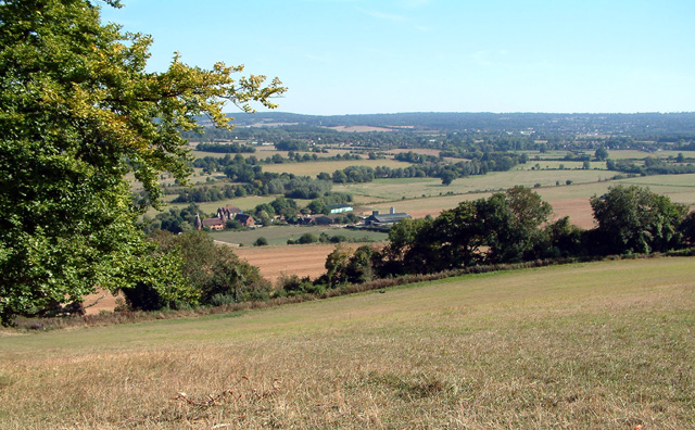
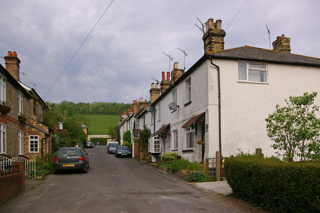
Shoreham is a small village located in the county of Kent, England. Situated approximately 30 miles southeast of London, it falls within the Sevenoaks district. The village is nestled on the banks of the River Darent, surrounded by picturesque countryside and rolling hills.

Shoreham is renowned for its historic charm and rich heritage. The village is steeped in history, with evidence of human habitation dating back to the Stone Age. Its name is derived from the Old English words "sceorf" and "ham," meaning "a shed or shelter by the shore." This suggests that Shoreham was once a settlement near the riverbank.

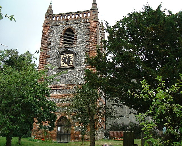
The village boasts a range of architectural styles, reflecting its long history. The Grade I listed St. Peter and St. Paul Church, dating back to the 11th century, is a notable landmark. Shoreham also features several timber-framed buildings, some of which date back to the 15th century.

Despite its small size, Shoreham offers a range of amenities for its residents and visitors. The village has a primary school, a village hall, and a pub, providing a sense of community. Its idyllic setting makes it a popular destination for outdoor enthusiasts, with various walking and cycling routes nearby.

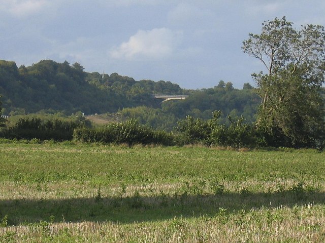
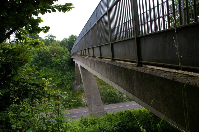
Shoreham's location makes it an ideal base for exploring the surrounding area. The village is within easy reach of the North Downs, a designated Area of Outstanding Natural Beauty, offering stunning landscapes and panoramic views. Additionally, Shoreham is well-connected to nearby towns and cities, with excellent transport links via road and rail.

In summary, Shoreham is a charming village in Kent with a rich history, architectural beauty, and a tranquil setting. It provides a peaceful retreat while offering convenient access to nearby attractions and amenities.

If you have any feedback on the listing, please let us know in the comments section below.

Shoreham Images

Images are sourced within 2km of 51.333317/0.179882 or Grid Reference TQ5161. Thanks to Geograph Open Source API. All images are credited.

M25 Clockwise Situated just behind the Polhill Arms on the A224 this spectacular bridge - a landmark for thousands of travellers each day - carries a small track over the M25 where the motorway itself crosses over the London to Sevenoaks railway
M25 Clockwise
Situated just behind the Polhill Arms on the A224 this spectacular bridge - a landmark for thousands of travellers each day - carries a small track over the M25 where the motorway itself crosses over the London to Sevenoaks railway
The Hop Shop Lavender fields The enterprising owner of Castle Farm has hopped to lavender ! <span class="nowrap"><a title="www.hopshop.co.uk" rel="nofollow ugc noopener" href="http://www.hopshop.co.uk">Link</a><img style="margin-left:2px;" alt="External link" title="External link - shift click to open in new window" src="https://s1.geograph.org.uk/img/external.png" width="10" height="10"/></span>
The Hop Shop Lavender fields
The enterprising owner of Castle Farm has hopped to lavender ! LinkExternal link
St Peter and St Paul Church at Shoreham, Kent Opposite "Ye Olde George Inne" in the pretty village of Shoreham, Kent. Notice the local flintstone used to provide weathering on the walls
St Peter and St Paul Church at Shoreham, Kent
Opposite "Ye Olde George Inne" in the pretty village of Shoreham, Kent. Notice the local flintstone used to provide weathering on the walls
Poppy Field A view from Filston Lane towards the Darent Valley and the downs beyond
Poppy Field
A view from Filston Lane towards the Darent Valley and the downs beyond
Filston Farm Looking over towards Filston Farm and Hall.
Filston Farm
Looking over towards Filston Farm and Hall.
Shoreham Woods, near M25 junction 4 Shoreham Woods (467 acres) lie to the western side of the Darent Valley. They comprise five different woodlands, linked together by rolling downland grazed by sheep. This is a view looking south, with Meenfield Wood to the left, Andrew's Wood to the right. The area is managed by Sevenoaks District Council.
Shoreham Woods, near M25 junction 4
Shoreham Woods (467 acres) lie to the western side of the Darent Valley. They comprise five different woodlands, linked together by rolling downland grazed by sheep. This is a view looking south, with Meenfield Wood to the left, Andrew's Wood to the right. The area is managed by Sevenoaks District Council.
Meenfield Wood Shoreham Woods (467 acres) lie to the western side of the Darent Valley. They comprise five different woodlands, linked together by rolling downland grazed by sheep. The area is managed by Sevenoaks District Council. This view is of the northern part of Meenfield Wood, in its Autumn finery.
Meenfield Wood
Shoreham Woods (467 acres) lie to the western side of the Darent Valley. They comprise five different woodlands, linked together by rolling downland grazed by sheep. The area is managed by Sevenoaks District Council. This view is of the northern part of Meenfield Wood, in its Autumn finery.
Shoreham Village, Kent View from Meenfield Wood, to the west of the village.
Shoreham Village, Kent
View from Meenfield Wood, to the west of the village.
Timberden Bottom & Farm, near Shoreham, Kent View from the south.
Timberden Bottom & Farm, near Shoreham, Kent
View from the south.
Darent Valley showing Filston Hall & Farm View looking south-east from the hillside between Meenfield Wood and Pilot's Wood, showing the Darent Valley which lies to the north of Sevenoaks, Kent.
Darent Valley showing Filston Hall & Farm
View looking south-east from the hillside between Meenfield Wood and Pilot's Wood, showing the Darent Valley which lies to the north of Sevenoaks, Kent.
Shoreham Village Shoreham looking across the Darenth Valley
Shoreham Village
Shoreham looking across the Darenth Valley
Darenth Bridge in Shoreham
Shoreham Station Shoreham Station, Kent.  Looking "down" toward Otford.   The line carries South-Eastern Blackfriars to Sevenoaks, and Victoria to Ashford via Maidstone East services.
Shoreham Station
Shoreham Station, Kent. Looking "down" toward Otford. The line carries South-Eastern Blackfriars to Sevenoaks, and Victoria to Ashford via Maidstone East services.
M25 hidden by trees
M25 hidden by trees
Bridge Over The   M25 This sweeping span carries a bridle path across the M25 near Halstead and Shoreham Kent
Bridge Over The M25
This sweeping span carries a bridle path across the M25 near Halstead and Shoreham Kent
A Stile near Greenhill Wood Nearby to this stile is a mobile phone transmitter mast. The stile is of the modern style being dog friendly.
A Stile near Greenhill Wood
Nearby to this stile is a mobile phone transmitter mast. The stile is of the modern style being dog friendly.
Bridle Path Span This bridge carries a bridle path over the M25 it is the only bridge in this area of the Motorway with the supporting arch type of construction. You can see a view of it from the road at <a href="https://www.geograph.org.uk/photo/10406">TQ5060 : M25 Clockwise</a>.
Bridle Path Span
This bridge carries a bridle path over the M25 it is the only bridge in this area of the Motorway with the supporting arch type of construction. You can see a view of it from the road at TQ5060 : M25 Clockwise.
View From The Bridle Path Bridge This is the M25 looking southbound viewed from the bridle path bridge that can be seen in  <a href="https://www.geograph.org.uk/photo/10406">TQ5060 : M25 Clockwise</a>.
View From The Bridle Path Bridge
This is the M25 looking southbound viewed from the bridle path bridge that can be seen in TQ5060 : M25 Clockwise.
Show me another place!

Shoreham is located at Grid Ref: TQ5161 (Lat: 51.333317, Lng: 0.179882)

Administrative County: Kent

District: Sevenoaks

Police Authority: Kent

What 3 Words

///places.bond.volume. Near Otford, Kent

Nearby Locations

Shoreham Meenfield Wood

Related Wikis

Shoreham Aircraft Museum

The Shoreham Aircraft Museum is located in the village of Shoreham near Sevenoaks in Kent, England, on the south-east edge of Greater London. It was founded...

Sevenoaks (UK Parliament constituency)

Sevenoaks is a constituency in Kent represented in the House of Commons of the UK Parliament since 2019 by Laura Trott, a Conservative who has served as...

Shoreham, Kent

Shoreham is a village and civil parish in the Sevenoaks District of Kent, England. It is located 5.2 miles north of Sevenoaks. The probable derivation...

Shoreham Memorial Cross

The Shoreham Memorial Cross is a Christian cross hill figure carved into a chalk escarpment above the village of Shoreham, Kent. The concept of the cross...

Nearby Amenities

Located within 500m of 51.333317,0.179882
Barrier: kissing_gate
Bicycle: no
Foot: yes
Material: wood
Source: survey
Lat/Long: 51.3344618/0.1737879
Shoreham
Place: village
Wikidata: Q2257157
Wikipedia: en:Shoreham, Kent
Lat/Long: 51.3336903/0.1788722
Post Box
Collection Times: Mo-Fr 16:45; Sa 09:00
Operator: Royal Mail
Post Box Type: wall
Ref: TN14 265
Royal Cypher: GR
Royal Cypher Wikidata: Q33102273
Lat/Long: 51.3335223/0.1806669
Pub
The Two Brewers
Addr Housenumber: 30
Addr Postcode: TN14 7TD
Addr Street: High Street
Fhrs Id: 266384
Source Addr: FHRS Open Data
Lat/Long: 51.3348234/0.1778332
Post Office
Shoreham Village Store
Addr Housenumber: 35
Addr Postcode: TN14 7TB
Addr Street: High Street
Addr Suburb: Shoreham
Fhrs Id: 1065391
Notice Board: yes
Shop: convenience
Source: OS OpenData StreetView
Source Addr: FHRS Open Data
Website: http://shorehamvillage.co.uk/village-store/
Lat/Long: 51.3352959/0.1777179
Information: map
Tourism: information
Lat/Long: 51.3324707/0.177889
Recycling
Recycling Clothes: yes
Lat/Long: 51.3323528/0.1779871
Recycling
Recycling Paper: yes
Lat/Long: 51.3323416/0.1780215
Recycling
Recycling Glass: yes
Lat/Long: 51.3323595/0.1780441
Barrier: kissing_gate
Foot: yes
Lat/Long: 51.3360505/0.1821275
Barrier: kissing_gate
Bicycle: no
Foot: yes
Lat/Long: 51.337437/0.1808605
Bus Stop
Post Office
Naptan AtcoCode: 240092138
Naptan Bearing: S
Naptan CommonName: Post Office
Naptan Indicator: opp
Naptan Landmark: Post Office
Naptan NaptanCode: kntwtwpa
Naptan Street: High Street
Naptan Verified: no
Public Transport: platform
Source: naptan_import
Lat/Long: 51.3355788/0.1780799
Bus Stop
Mill Lane Allotments
Naptan AtcoCode: 240092140
Naptan Bearing: S
Naptan CommonName: Mill Lane Allotments
Naptan Indicator: Adj
Naptan Landmark: Allotment Gardens
Naptan NaptanCode: kntgjtgd
Naptan Street: High Street
Naptan Verified: no
Public Transport: platform
Source: naptan_import
Lat/Long: 51.3363707/0.1783747
Bus Stop
Mill Lane Allotments
Flag: no
Naptan AtcoCode: 2400A072660A
Naptan Bearing: N
Naptan BusStopType: CUS
Naptan CommonName: Mill Lane Allotments
Naptan Indicator: Opp
Naptan Landmark: Junc Crown Rd
Naptan NaptanCode: kntgdwdt
Naptan Street: High Street
Naptan Verified: no
Public Transport: platform
Source: naptan_import
Lat/Long: 51.3376073/0.1781318
Bench
Lat/Long: 51.3354841/0.1860587
Historic: memorial
Lat/Long: 51.3336321/0.1813199
Bench
Lat/Long: 51.3336138/0.1813394
Bench
Lat/Long: 51.3345371/0.1805462
Cafe
The Honey Pot
Addr Housenumber: 4
Addr Postcode: TN14 7TD
Addr Street: High Street
Fhrs Id: 1093125
Opening Hours: We-Fr 09:00-16:00; Sa,Su 10:00-16:00
Source Addr: FHRS Open Data
Lat/Long: 51.3335665/0.1779271
Turning Circle
Lat/Long: 51.3335076/0.1763118
Barrier: bollard
Foot: yes
Lat/Long: 51.3320621/0.185969
Turning Circle
Lat/Long: 51.3324772/0.1753774
Toilets
Lat/Long: 51.3346763/0.1773351
Barrier: kissing_gate
Lat/Long: 51.3328512/0.1849922
Shoreham Aircraft Museum
Addr County: Kent
Addr Housenumber: 13
Addr Postcode: TN14 7TB
Addr Street: High Street
Addr Village: Shoreham
Fhrs Id: 1395931
Opening Hours: Sa,Su 09:00-16:30
Source Addr: FHRS Open Data
Tourism: museum
Website: http://www.shoreham-aircraft-museum.co.uk/
Wikidata: Q7501419
Lat/Long: 51.3339527/0.1771127
Leisure: picnic_table
Lat/Long: 51.3376654/0.1786026
Leisure: picnic_table
Lat/Long: 51.3376624/0.1786576
Leisure: picnic_table
Lat/Long: 51.3376206/0.1786433
Bench
Lat/Long: 51.335033/0.180272
Bench
Lat/Long: 51.3352804/0.1800951
Barrier: kissing_gate
Bicycle: no
Foot: yes
Material: metal
Source: survey
Lat/Long: 51.3342791/0.175205
Board Type: notice
Information: board
Lat/Long: 51.3328477/0.1833437
Board Type: notice
Information: board
Lat/Long: 51.3374561/0.1783011
Board Type: notice
Information: board
Lat/Long: 51.334671/0.1775688
Board Type: notice
Information: board
Lat/Long: 51.3335946/0.1778413
Bench
Lat/Long: 51.3345949/0.176193
Bench
Lat/Long: 51.3344573/0.1761233
Bench
Lat/Long: 51.3345066/0.1774933
Turning Circle
Lat/Long: 51.3345925/0.1794729
Shop: vacant
Lat/Long: 51.3328838/0.1830003
Entrance: yes
Lat/Long: 51.3375187/0.1783905
Addr Housenumber: 1
Addr Street: Church Street
Lat/Long: 51.3330419/0.1834884
Addr Housenumber: 5
Addr Street: Church Street
Lat/Long: 51.3330701/0.1832899
Post Box
Collection Times: Mo-Fr 09:00; Sa 07:00
Operator: Royal Mail
Operator Wikidata: Q638098
Post Box Type: lamp
Ref: TN14 286D
Royal Cypher: EIIR
Royal Cypher Wikidata: Q33102113
Lat/Long: 51.3352724/0.1778
Cafe
Shoreham Aircraft Museum
Addr County: Kent
Addr Housenumber: 13
Addr Postcode: TN14 7TB
Addr Street: High Street
Addr Village: Shoreham
Fhrs Id: 1395931
Opening Hours: Sa,Su 09:00-16:30
Source Addr: FHRS Open Data
Lat/Long: 51.3339281/0.1774154
Telephone
Booth: K6
Covered: booth
Listed Status: Grade II
Lat/Long: 51.3352504/0.1780812
The data included in this document is from www.openstreetmap.org. The data is made available under ODbL.

Have you been to Shoreham?

Leave your review of Shoreham below (or comments, questions and feedback).