Shepton Montague

Settlement in Somerset South Somerset

England

Shepton Montague

Hill View House
Hill View House Credit: Roger Cornfoot

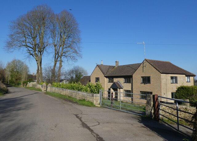
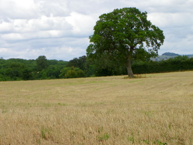
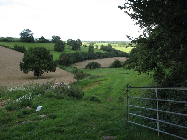
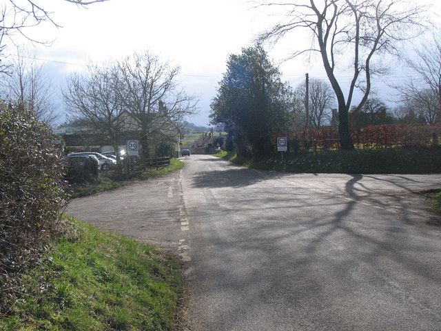
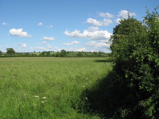
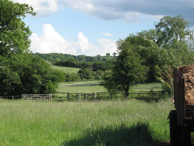
Shepton Montague is a small village located in the county of Somerset, England. Situated in the picturesque countryside, it lies approximately 6 miles southwest of the town of Wincanton. The village is nestled within the Blackmore Vale, an area known for its rolling hills, lush green fields, and charming rural landscapes.

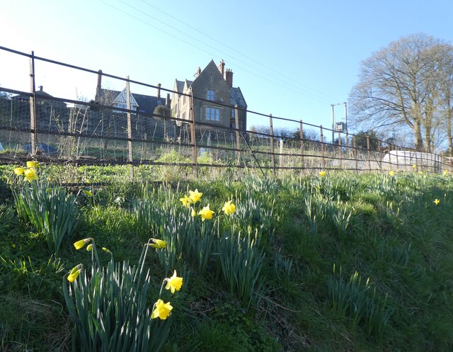
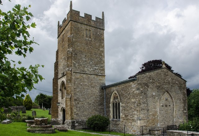
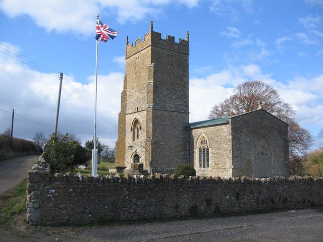
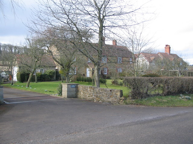
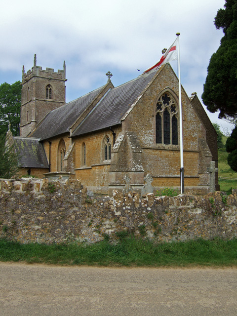
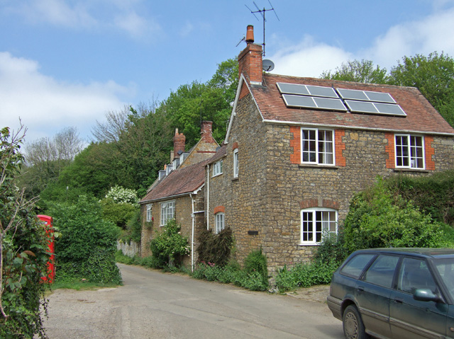
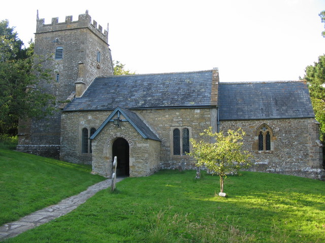
With a population of just over 100 residents, Shepton Montague exudes a quaint and peaceful atmosphere. The village is characterized by its historic buildings, many of which date back several centuries. The prominent landmark is the Church of St. Peter and St. Paul, a beautiful Grade II listed building that showcases stunning architecture and serves as a focal point for the community.

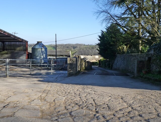
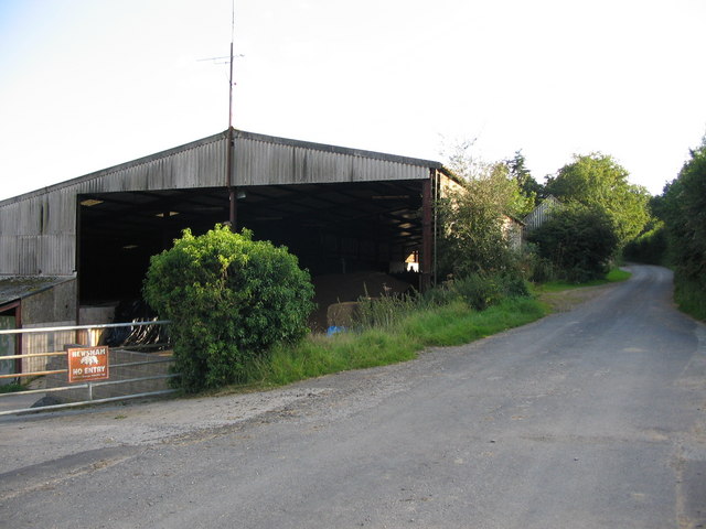
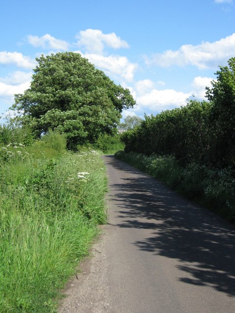
Surrounded by stunning natural beauty, Shepton Montague offers ample opportunities for outdoor activities. The nearby countryside provides scenic walking and cycling routes, allowing visitors to explore the bucolic surroundings. The village is also close to a number of popular tourist attractions, including the ancient stone circle of Stonehenge and the historic city of Bath.

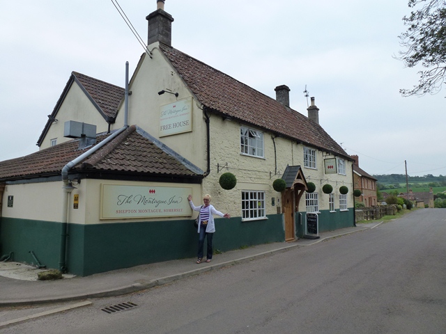
Shepton Montague boasts a strong sense of community, with various events and activities taking place throughout the year. The village pub, The Half Moon Inn, offers a warm and convivial atmosphere, serving traditional food and drinks to locals and visitors alike.

Overall, Shepton Montague is a charming village that offers a tranquil escape from the hustle and bustle of modern life. Its idyllic setting, rich history, and welcoming community make it a delightful place to visit or call home.

If you have any feedback on the listing, please let us know in the comments section below.

Shepton Montague Images

Images are sourced within 2km of 51.083227/-2.465587 or Grid Reference ST6731. Thanks to Geograph Open Source API. All images are credited.

Hill View House
Hill View House
Bratton House
Bratton House
Bratton Park Farm
Bratton Park Farm
Barn at Hill View House, Bratton Seymour A view looking south from Church Walk towards a barn at Hill View House, Bratton Seymour.
Barn at Hill View House, Bratton Seymour
A view looking south from Church Walk towards a barn at Hill View House, Bratton Seymour.
Arable land near Bratton Seymour The grass field has recently been cut.  The image is taken from the track to Cray Hill Copse which is part of a DEFRA walk.
Arable land near Bratton Seymour
The grass field has recently been cut. The image is taken from the track to Cray Hill Copse which is part of a DEFRA walk.
Burdock near Cray Hill Copse Young burdock growing beside the track to Cray Hill Copse.  The track is part of a DEFRA walk.

This plant was included in Hippocrates' list of useful plants.  It has been found to contain antibiotic substances which aid resistance to infection and can help to cure skin complaints. 
 
In spring, country people whose diet had been deficient in vitamins over the winter months used to make a drink made from burdock and dandelion roots which acted as a blood purifier and cleared up skin troubles.  I think dandelion and burdock is still available as a fizzy drink.

The very young stalks may be peeled and chopped into salads and later can be cooked as a vegetable.
Burdock near Cray Hill Copse
Young burdock growing beside the track to Cray Hill Copse. The track is part of a DEFRA walk. This plant was included in Hippocrates' list of useful plants. It has been found to contain antibiotic substances which aid resistance to infection and can help to cure skin complaints. In spring, country people whose diet had been deficient in vitamins over the winter months used to make a drink made from burdock and dandelion roots which acted as a blood purifier and cleared up skin troubles. I think dandelion and burdock is still available as a fizzy drink. The very young stalks may be peeled and chopped into salads and later can be cooked as a vegetable.
The Montague Inn, Shepton Montague Award winning food pub.
The Montague Inn, Shepton Montague
Award winning food pub.
Small valley next to the A359
Shepton Montague: Church of Saint Peter The Parish Church of Saint Peter has 13th century origins and has been designated as a Grade II listed building. It was seriously damaged by a fire in 1964 and restored two years later.
Shepton Montague: Church of Saint Peter
The Parish Church of Saint Peter has 13th century origins and has been designated as a Grade II listed building. It was seriously damaged by a fire in 1964 and restored two years later.
St. Peters, Lower Shepton A view looking northwest to the church of St. Peter at lower shepton. Partially rebuilt after a fire on 27 November 1964 which destroyed the chancel, it now consists of the nave and original perpendicular tower.
St. Peters, Lower Shepton
A view looking northwest to the church of St. Peter at lower shepton. Partially rebuilt after a fire on 27 November 1964 which destroyed the chancel, it now consists of the nave and original perpendicular tower.
Shepton Montague A view looking south to the crossroads at the northern end of the village of Shepton Montague.
Shepton Montague
A view looking south to the crossroads at the northern end of the village of Shepton Montague.
Cottages at Castle Hill A view looking northwest across a minor road to a pair of cottages at Castle Hill. The 1:50,000 OS map appears to call this Cattle Hill.
Cottages at Castle Hill
A view looking northwest across a minor road to a pair of cottages at Castle Hill. The 1:50,000 OS map appears to call this Cattle Hill.
Church of St Leonard - Pitcombe The church of St. Leonard, was with the exception of the tower rebuilt in 1857-8 to designs by G. E. Street.
Church of St Leonard - Pitcombe
The church of St. Leonard, was with the exception of the tower rebuilt in 1857-8 to designs by G. E. Street.
Pitcombe
Pitcombe
Minor road
Minor road
Field adjacent to minor road
View from road Looking south.  Taken adjacent to old farm buildings.
View from road
Looking south. Taken adjacent to old farm buildings.
Old barns Somewhat derelict, but I think still in use!
Old barns
Somewhat derelict, but I think still in use!
Show me another place!

Shepton Montague is located at Grid Ref: ST6731 (Lat: 51.083227, Lng: -2.465587)

Administrative County: Somerset

District: South Somerset

Police Authority: Avon and Somerset

What 3 Words

///sang.dolly.homework. Near Redlynch, Somerset

Related Wikis

Shepton Montague

Shepton Montague is a village and civil parish in Somerset, England, United Kingdom. It is situated on the River Pitt in the South Somerset district midway...

Shepton Montague Railway Cutting

Shepton Montague Railway Cutting (grid reference ST686316) is a 1.61 hectare geological Site of Special Scientific Interest at Shepton Montague in Somerset...

Church of St Nicholas, Bratton Seymour

The Anglican Church of St Nicholas in Bratton Seymour, Somerset, England, was built in the 13th century. It is a Grade II* listed building. == History... ==

Bruton School for Girls

Bruton School for Girls was an independent day and boarding school for girls aged 2 to 18, near Pitcombe in Bruton in south east Somerset, England. By...

Cole (for Bruton) railway station

Cole (for Bruton) railway station was a station on the Somerset and Dorset Railway in South Somerset, serving the village of Cole, which is now virtually...

Pitcombe

Pitcombe is a village and civil parish 1 mile (2 km) south-west of Bruton and 5 miles (8 km) from Wincanton in Somerset, England. It has a population of...

Bratton Seymour

Bratton Seymour is a village and civil parish in Somerset, England, situated on a tributary of the River Brue 4 miles (6.4 km) south-east of Castle Cary...

Hadspen House

Hadspen House of Hadspen, Somerset, England is built of Cary stone, mined from Hadspen Quarry. The stone is a soft limestone known for its deep burnt-orange...

Nearby Amenities

Located within 500m of 51.083227,-2.465587
Shepton Montague
Place: hamlet
Source: npe
Lat/Long: 51.0830454/-2.4622328
Post Box
Operator: Royal Mail
Operator Wikidata: Q638098
Post Box Type: lamp
Ref: BA9 84
Royal Cypher: EIIR
Royal Cypher Wikidata: Q33102113
Lat/Long: 51.0807906/-2.4663878
Power: pole
Lat/Long: 51.0874502/-2.467179
Power: pole
Lat/Long: 51.0867746/-2.4690565
Power: pole
Lat/Long: 51.0840047/-2.4588856
Power: pole
Switch: mechanical
Lat/Long: 51.083666/-2.4598083
Power: pole
Lat/Long: 51.083324/-2.4607202
Power: pole
Lat/Long: 51.0829752/-2.461651
Power: pole
Lat/Long: 51.0826416/-2.4626139
Power: pole
Lat/Long: 51.082249/-2.4636224
Shepton Montague
Place: village
Lat/Long: 51.0821074/-2.4659962
Telephone
Booth: K6
Covered: booth
Man Made: telephone_box
Lat/Long: 51.0808514/-2.4665422
Poles: bipole
Power: pole
Source: bing
Transformer: distribution
Lat/Long: 51.0815143/-2.4663314
Power: pole
Source: bing
Lat/Long: 51.0815278/-2.467474
Power: pole
Source: bing
Lat/Long: 51.081548/-2.4686381
Power: pole
Source: bing
Lat/Long: 51.0815716/-2.4697968
Power: pole
Source: bing
Lat/Long: 51.0815868/-2.4708805
Power: pole
Source: bing
Lat/Long: 51.0816171/-2.4719426
The data included in this document is from www.openstreetmap.org. The data is made available under ODbL.

Have you been to Shepton Montague?

Leave your review of Shepton Montague below (or comments, questions and feedback).