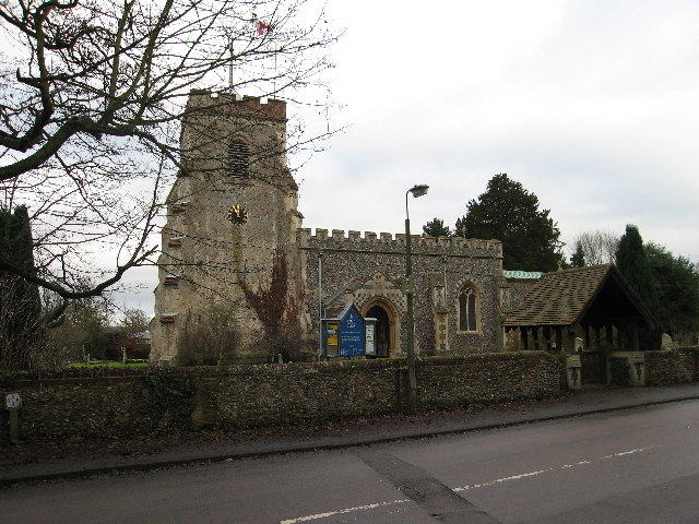
Shephall

Settlement in Hertfordshire Stevenage

England

Shephall

Hydean Way Shops Typical of local shops in Stevenage new town.  Above a parade of shops including a small supermarket, take away food outlet and Post Office there are maisonettes accessed from the rear.  To the right there are 2/3 bedroomed homes.
Hydean Way Shops Credit: Robin Hall

Shephall is a small suburban area located in the county of Hertfordshire, England. It is part of the larger town of Stevenage and is situated towards the north-eastern side of the town. With a population of around 10,000 residents, Shephall is a vibrant and close-knit community.

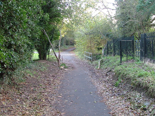
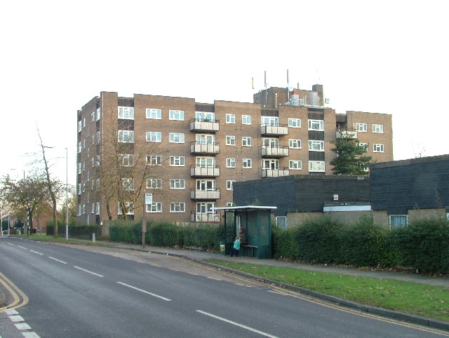
The area is predominantly residential, consisting of a mix of housing estates, including both council housing and privately owned properties. The architecture of Shephall is varied, ranging from modern developments to more traditional style homes. There are also several green spaces in the area, providing residents with recreational areas and opportunities for outdoor activities.

Shephall benefits from excellent transport links, with easy access to major roads and motorways, such as the A1(M) and the A602. This allows for convenient commuting to nearby towns and cities, including London, which is approximately 30 miles away.

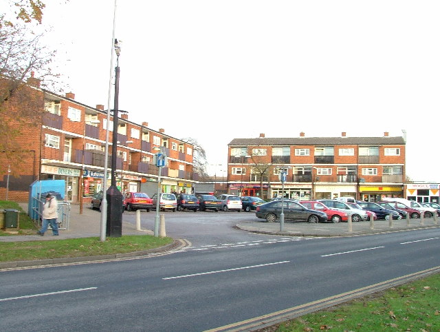
Within Shephall, there are a few local amenities, including a small shopping precinct with a range of shops and services, as well as a community center and a primary school. For additional shopping and entertainment options, residents can easily access the larger town center of Stevenage, which is just a short drive away.

Overall, Shephall offers a peaceful and family-friendly environment, with a strong sense of community. Its convenient location and range of amenities make it an attractive place to live for those seeking a suburban lifestyle within close proximity to larger urban centers.

If you have any feedback on the listing, please let us know in the comments section below.
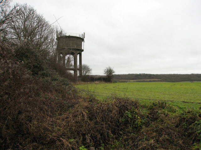
Shephall Images

Images are sourced within 2km of 51.891988/-0.175224 or Grid Reference TL2523. Thanks to Geograph Open Source API. All images are credited.

Hydean Way Shops Typical of local shops in Stevenage new town.  Above a parade of shops including a small supermarket, take away food outlet and Post Office there are maisonettes accessed from the rear.  To the right there are 2/3 bedroomed homes.
Hydean Way Shops
Typical of local shops in Stevenage new town. Above a parade of shops including a small supermarket, take away food outlet and Post Office there are maisonettes accessed from the rear. To the right there are 2/3 bedroomed homes.
South end of Fairlands Valley Park. This photograph was taken facing north into Fairlands Valley Park from the car park used for Stevenage Borough FC (see TL2422).  This park is also used for travelling fairs and circuses.
South end of Fairlands Valley Park.
This photograph was taken facing north into Fairlands Valley Park from the car park used for Stevenage Borough FC (see TL2422). This park is also used for travelling fairs and circuses.
Stevenage Borough FC Taken from the club's car park across the Hertford Road.
Stevenage Borough FC
Taken from the club's car park across the Hertford Road.
Fairlands Valley Park This large lake is used by sailors and fishermen.  This photo is taken facing south.  To the rear there are two smaller lakes.  The park is very popular in the summer.
Fairlands Valley Park
This large lake is used by sailors and fishermen. This photo is taken facing south. To the rear there are two smaller lakes. The park is very popular in the summer.
Silam Rd. To the right are houses not untypical of Stevenage new town.  Looming over Silam Rd is one of a pair of high rise flats close to the town centre.
Silam Rd.
To the right are houses not untypical of Stevenage new town. Looming over Silam Rd is one of a pair of high rise flats close to the town centre.
Parishes Mead. Parishes mead is a newer development on the east side of Stevenage.  There is a mixture of private and social housing here.
Parishes Mead.
Parishes mead is a newer development on the east side of Stevenage. There is a mixture of private and social housing here.
Ferrier Rd This could be any road in this area.  Plans seem to have been bought as a job lot.
Ferrier Rd
This could be any road in this area. Plans seem to have been bought as a job lot.
Ridlins Athletics Track This photo of the Ridlins Athletics track shows the west corner and the Bert Hill stand.  The back of the stand has space for community groups such as playgroups.
Ridlins Athletics Track
This photo of the Ridlins Athletics track shows the west corner and the Bert Hill stand. The back of the stand has space for community groups such as playgroups.
Football pitches These are to the north west of the running track.
Football pitches
These are to the north west of the running track.
Footbridge over Stevenage Brook. This footpath runs parallel to and within 30 yards of the main Stevenage - Hertford Road.
Footbridge over Stevenage Brook.
This footpath runs parallel to and within 30 yards of the main Stevenage - Hertford Road.
Church of St Peter, Broadwater. One of a series of three photos taken from within a couple of hundred yards of each other.  Church shops and flats.  A whole community?
Church of St Peter, Broadwater.
One of a series of three photos taken from within a couple of hundred yards of each other. Church shops and flats. A whole community?
Flats on Broadwater Avenue Most housing in this area consists of two storey houses but there are a number of blocks of flats like this.
Flats on Broadwater Avenue
Most housing in this area consists of two storey houses but there are a number of blocks of flats like this.
Broadwater Avenue shops Very busy local shops in the same style as several other Stevenage neighbourhood centres.
Broadwater Avenue shops
Very busy local shops in the same style as several other Stevenage neighbourhood centres.
Longmeadow Evangelical Church Many of Stevenage's churche seem to thrive and this is one of them.
Longmeadow Evangelical Church
Many of Stevenage's churche seem to thrive and this is one of them.
Neglected milestone Well.  That will be er um miles to aaah hmm, and um er miles  to aaaaah.  Yes well it's probably a long way anyway.
Neglected milestone
Well. That will be er um miles to aaah hmm, and um er miles to aaaaah. Yes well it's probably a long way anyway.
St Mary's Church, Aston The church is built of flint with stone dressings on the nave and chancel and the roofs are covered with copper.
St Mary's Church, Aston
The church is built of flint with stone dressings on the nave and chancel and the roofs are covered with copper.
Aston Water Tower The Water Tower and surrounding countryside from the lane to Aston End
Aston Water Tower
The Water Tower and surrounding countryside from the lane to Aston End
The Crown, Aston End
Show me another place!

Shephall is located at Grid Ref: TL2523 (Lat: 51.891988, Lng: -0.175224)

Administrative County: Hertfordshire

District: Stevenage

Police Authority: Hertfordshire

What 3 Words

///trend.social.kite. Near Stevenage, Hertfordshire

Related Wikis

Shephall

Shephall (SHEP-all) is a neighbourhood of the new town of Stevenage in Hertfordshire. It was formerly a separate village and parish, being absorbed into...

Barnwell School

Barnwell School is a coeducational secondary school and sixth form that was established in 1959 and is situated in the south of Stevenage, Hertfordshire...

The Heathcote School

The Heathcote School was an 11-18 comprehensive school in Stevenage, Hertfordshire. The school was founded in the 1950s. It was awarded Specialist Engineering...

Shephall Manor

Shephall Manor, also known as Shephalbury Manor, is a Grade II listed building in Stevenage, a town in Hertfordshire, England. The house was designed by...

Ridlins Mire

Ridlins Mire is a 1.6-hectare (4.0-acre) nature reserve managed by the Herts and Middlesex Wildlife Trust in Stevenage, Hertfordshire, England.This wetland...

Stevenage (UK Parliament constituency)

Stevenage is a constituency in Hertfordshire represented in the House of Commons of the UK Parliament since 2010 by Stephen McPartland, a member of the...

Broadhall Way

Broadhall Way, known as the Lamex Stadium for sponsorship purposes, is an association football stadium in Stevenage, Hertfordshire. It has been the home...

Marriotts School

Marriotts School is a secondary school in Stevenage, Hertfordshire, England. The school was rebuilt along with Lonsdale School (for special needs children...

Nearby Amenities

Located within 500m of 51.891988,-0.175224
Mini Roundabout
Lat/Long: 51.891915/-0.1681332
Traffic Calming: table
Lat/Long: 51.8919301/-0.1764941
Created By: osmeditor2
Lat/Long: 51.8878723/-0.1765938
Created By: osmeditor2
Lat/Long: 51.8877287/-0.1729016
Bus Stop
The Hyde Centre
Bench: no
Bin: yes
Bus: yes
Lit: yes
Naptan AtcoCode: 210021201360
Naptan Bearing: W
Naptan CommonName: The Hyde Centre
Naptan Crossing: Breakspear
Naptan Indicator: opp
Naptan Landmark: Breakspear
Naptan NaptanCode: hrtgadtd
Naptan PlusbusZoneRef: STEVNGE
Naptan ShortCommonName: NA
Naptan Street: Hydean Way
Naptan Verified: no
Public Transport: platform
Shelter: no
Source: naptan_import
Tactile Paving: no
Lat/Long: 51.8919401/-0.1693001
Bus Stop
Barnwell
Bench: no
Bin: yes
Lit: yes
Local Ref: NR
Naptan AtcoCode: 210021201380
Naptan Bearing: W
Naptan CommonName: Barnwell
Naptan Crossing: opp Wigram Way
Naptan Indicator: nr
Naptan Landmark: opp Wigram Way
Naptan NaptanCode: hrtgadgw
Naptan PlusbusZoneRef: STEVNGE
Naptan ShortCommonName: NA
Naptan Street: Hydean Way
Naptan Verified: no
Shelter: yes
Source: naptan_import
Tactile Paving: no
Lat/Long: 51.892049/-0.1734086
Bus Stop
Shephall Green
Bench: yes
Bin: yes
Lit: yes
Local Ref: NR
Naptan AtcoCode: 210021201400
Naptan Bearing: W
Naptan CommonName: Shephall Green
Naptan Crossing: opp Peartree Way
Naptan Indicator: nr
Naptan Landmark: opp Peartree Way
Naptan NaptanCode: hrtgadja
Naptan PlusbusZoneRef: STEVNGE
Naptan ShortCommonName: NA
Naptan Street: Hydean Way
Naptan Verified: no
Shelter: yes
Source: naptan_import
Tactile Paving: yes
Lat/Long: 51.8917106/-0.1800059
Bus Stop
School Close
Bench: no
Bin: no
Bus: yes
Lit: yes
Local Ref: NR
Naptan AtcoCode: 210021201465
Naptan Bearing: N
Naptan CommonName: School Close
Naptan Crossing: Peartree Park
Naptan Indicator: nr
Naptan Landmark: Peartree Park
Naptan NaptanCode: hrtgadjp
Naptan PlusbusZoneRef: STEVNGE
Naptan ShortCommonName: NA
Naptan Street: Paddocks Close
Naptan Verified: no
Public Transport: platform
Shelter: no
Source: naptan_import
Tactile Paving: no
Lat/Long: 51.8948023/-0.1746777
Bus Stop
The Hyde
Bench: no
Bin: no
Lit: yes
Naptan AtcoCode: 210021201480
Naptan Bearing: N
Naptan CommonName: The Hyde
Naptan Crossing: Randals Hill
Naptan Indicator: o/s
Naptan Landmark: Randals Hill
Naptan NaptanCode: hrtgadjw
Naptan PlusbusZoneRef: STEVNGE
Naptan ShortCommonName: NA
Naptan Street: Shephall Way
Naptan Verified: no
Shelter: no
Source: naptan_import
Tactile Paving: no
Lat/Long: 51.8923995/-0.1681914
Bus Stop
The Hyde
Bench: no
Bin: no
Lit: yes
Naptan AtcoCode: 210021203200
Naptan Bearing: S
Naptan CommonName: The Hyde
Naptan Crossing: Featherston Road
Naptan Indicator: opp
Naptan Landmark: Featherston Road
Naptan NaptanCode: hrtdwmaj
Naptan PlusbusZoneRef: STEVNGE
Naptan ShortCommonName: NA
Naptan Street: Shephall Way
Naptan Verified: no
Shelter: no
Source: naptan_import
Tactile Paving: no
Lat/Long: 51.8928205/-0.1680871
Bus Stop
Shephall Green
Bench: yes
Bin: yes
Lit: yes
Naptan AtcoCode: 210021203260
Naptan Bearing: E
Naptan CommonName: Shephall Green
Naptan Crossing: Peatree Way
Naptan Indicator: opp
Naptan Landmark: Peatree Way
Naptan NaptanCode: hrtdwmat
Naptan PlusbusZoneRef: STEVNGE
Naptan ShortCommonName: NA
Naptan Street: Hydean Way
Naptan Verified: no
Shelter: yes
Source: naptan_import
Tactile Paving: yes
Lat/Long: 51.8918222/-0.1781865
Bus Stop
Barnwell
Bench: yes
Bin: yes
Lit: yes
Naptan AtcoCode: 210021203280
Naptan Bearing: E
Naptan CommonName: Barnwell
Naptan Crossing: Wigram Way
Naptan Indicator: opp
Naptan Landmark: Wigram Way
Naptan NaptanCode: hrtdwmaw
Naptan PlusbusZoneRef: STEVNGE
Naptan ShortCommonName: NA
Naptan Street: Hydean Way
Naptan Verified: no
Shelter: yes
Source: naptan_import
Tactile Paving: no
Lat/Long: 51.8921882/-0.1719496
Bus Stop
The Hyde Centre
Bench: yes
Bin: yes
Lit: yes
Naptan AtcoCode: 210021203300
Naptan Bearing: E
Naptan CommonName: The Hyde Centre
Naptan Crossing: Shephall Way
Naptan Indicator: adj
Naptan Landmark: Shephall Way
Naptan NaptanCode: hrtdwmda
Naptan PlusbusZoneRef: STEVNGE
Naptan ShortCommonName: NA
Naptan Street: Hydean Way
Naptan Verified: no
Shelter: yes
Source: naptan_import
Tactile Paving: no
Lat/Long: 51.8920727/-0.1691494
Bus Stop
Wigram Way
Bench: no
Bin: no
Bus: yes
Lit: yes
Naptan AtcoCode: 210021204625
Naptan Bearing: W
Naptan CommonName: Wigram Way
Naptan Crossing: Bradshaw Court
Naptan Indicator: W-bound
Naptan Landmark: Bradshaw Court
Naptan NaptanCode: hrtdwgpd
Naptan PlusbusZoneRef: STEVNGE
Naptan ShortCommonName: NA
Naptan Street: The Paddocks
Naptan Verified: no
Public Transport: platform
Shelter: no
Source: naptan_import
Tactile Paving: no
Lat/Long: 51.8938015/-0.1721894
Bus Stop
Hyde Green North
Bench: no
Bin: no
Bus: yes
Lit: yes
Naptan AtcoCode: 210021204630
Naptan Bearing: NW
Naptan CommonName: Hyde Green North
Naptan Crossing: School Close
Naptan Indicator: W-bound
Naptan Landmark: School Close
Naptan NaptanCode: hrtdwgpg
Naptan PlusbusZoneRef: STEVNGE
Naptan ShortCommonName: NA
Naptan Street: The Paddocks
Naptan Verified: no
Public Transport: platform
Shelter: no
Source: naptan_import
Tactile Paving: no
Lat/Long: 51.8938618/-0.1737566
Traffic Calming: cushion
Lat/Long: 51.8921659/-0.1713068
Barrier: bollard
Lat/Long: 51.8932123/-0.1738296
Barrier: bollard
Lat/Long: 51.8945362/-0.1735471
Post Box
Collection Times: Mo-Fr 18:45; Sa 12:00
Post Box Type: pillar
Ref: SG2 322
Lat/Long: 51.892189/-0.169231
Post Box
Collection Times: Mo-Fr 09:00, Sa 07:00
Post Box Type: lamp
Ref: SG2 112
Lat/Long: 51.890331/-0.176736
Post Box
Collection Times: Mo-Fr 09:00; Sa 07:00
Post Box Type: pillar
Ref: SG2 303
Royal Cypher: EIIR
Royal Cypher Wikidata: Q33102113
Lat/Long: 51.895241/-0.180067
Post Box
Collection Times: Mo-Fr 09:00; Sa 07:00
Post Box Type: pillar
Ref: SG2 312
Lat/Long: 51.895138/-0.174738
Barrier: bollard
Lat/Long: 51.8959159/-0.1736811
The Co-operative
Shop: convenience
Lat/Long: 51.8924675/-0.1690437
Pub
The Vincent Motorcycle
Lat/Long: 51.8924873/-0.1684428
Atm
Fee: no
Operator: Co-Operative Bank
Lat/Long: 51.8924377/-0.1690595
Shop: alcohol
Lat/Long: 51.8927555/-0.1691346
Crossing
Crossing: marked
Crossing Island: no
Crossing Ref: zebra
Kerb: flush
Tactile Paving: yes
Traffic Calming: table
Lat/Long: 51.8930666/-0.1682671
Mini Roundabout
Lat/Long: 51.893291/-0.1682571
Traffic Calming: table
Lat/Long: 51.8917926/-0.1774093
Bench
Backrest: yes
Lat/Long: 51.8955858/-0.1770169
Wheels motor factors
Addr City: Stevenage
Addr Housenumber: 29
Addr Postcode: SG2 9SD
Addr Street: The Hyde
Name En: Wheels motor factors
Phone: +44 1438365514
Shop: car_parts
Website: https://wheelsmotorfactors.com/
Lat/Long: 51.8929119/-0.1690399
Crossing
Crossing: marked
Crossing Island: no
Crossing Ref: zebra
Kerb: lowered
Tactile Paving: yes
Traffic Calming: table
Lat/Long: 51.891765/-0.1787066
Bench
Backrest: yes
Lat/Long: 51.8956115/-0.1765539
Crossing
Crossing: marked
Crossing Island: no
Kerb: flush
Tactile Paving: yes
Traffic Calming: table
Lat/Long: 51.8920425/-0.1754364
Waste Basket
Lat/Long: 51.8880211/-0.1782757
Waste Basket
Lat/Long: 51.8878588/-0.1739346
Crossing
Crossing: unmarked
Kerb: flush
Traffic Calming: table
Lat/Long: 51.8922773/-0.1679761
Crossing
Crossing: unmarked
Crossing Island: yes
Tactile Paving: no
Lat/Long: 51.8919255/-0.1683378
Crossing
Crossing: unmarked
Crossing Island: no
Kerb: flush
Tactile Paving: no
Traffic Calming: table
Lat/Long: 51.8921578/-0.1681269
Waste Basket
Lat/Long: 51.8932421/-0.1683435
Crossing
Crossing: unmarked
Crossing Island: yes
Tactile Paving: no
Lat/Long: 51.8918045/-0.1681324
Waste Basket
Lat/Long: 51.8919361/-0.1823795
Waste Basket
Lat/Long: 51.8917101/-0.1799628
Waste Basket
Lat/Long: 51.891821/-0.178104
Traffic Calming: cushion
Lat/Long: 51.8917556/-0.1790978
Waste Basket
Lat/Long: 51.8918997/-0.1769775
Waste Basket
Lat/Long: 51.89209/-0.1755184
Traffic Calming: table
Lat/Long: 51.8920706/-0.1744802
Traffic Calming: table
Lat/Long: 51.8920926/-0.1737083
Waste Basket
Lat/Long: 51.8920495/-0.1734437
Crossing
Crossing: unmarked
Crossing Island: no
Kerb: flush
Tactile Paving: yes
Traffic Calming: table
Lat/Long: 51.8921332/-0.1725495
Traffic Calming: cushion
Lat/Long: 51.8919483/-0.1685973
Waste Basket
Lat/Long: 51.8920586/-0.1690623
Traffic Calming: cushion
Lat/Long: 51.8920978/-0.1699221
Waste Basket
Lat/Long: 51.8921885/-0.1718666
Bus Stop
Hydean Road
Bench: no
Bin: no
Bus: yes
Lit: yes
Naptan AtcoCode: 210021204620
Naptan NaptanCode: hrtgtdjt
Public Transport: platform
Shelter: no
Tactile Paving: no
Lat/Long: 51.8926603/-0.172277
Waste Basket
Lat/Long: 51.892849/-0.1718692
Waste Basket
Lat/Long: 51.8933298/-0.1715876
Waste Basket
Lat/Long: 51.8938744/-0.1733767
Waste Basket
Lat/Long: 51.8941326/-0.1743785
Waste Basket
Lat/Long: 51.8955847/-0.1770432
Bench
Backrest: yes
Colour: black
Material: metal
Lat/Long: 51.8899927/-0.1766087
Bench
Backrest: yes
Colour: black
Material: metal
Lat/Long: 51.8905009/-0.1767522
Barrier: bollard
Lat/Long: 51.8902766/-0.176105
Barrier: bollard
Lat/Long: 51.8902283/-0.1761109
The data included in this document is from www.openstreetmap.org. The data is made available under ODbL.

Have you been to Shephall?

Leave your review of Shephall below (or comments, questions and feedback).