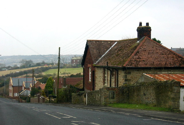
Sheep Hill
Settlement in Durham
England
Sheep Hill
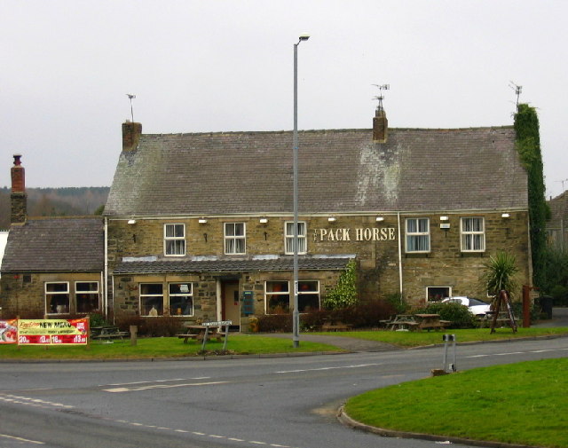
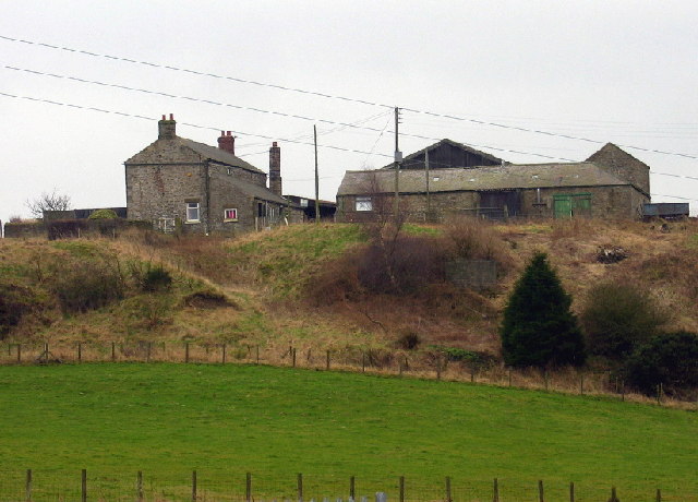
Sheep Hill is a picturesque village located in Durham, England. Situated in the heart of the county, it is known for its idyllic countryside setting and charming character. The village is nestled on a gentle slope, surrounded by lush green fields and rolling hills, offering breathtaking views of the rural landscape.
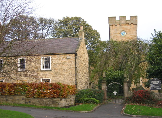
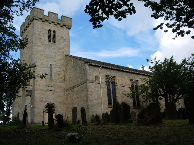
The origins of Sheep Hill can be traced back to medieval times, and evidence of its rich history can be seen in the architecture of the village. Traditional stone cottages with thatched roofs line the narrow streets, creating a quaint and timeless atmosphere. The local church, St. Mary's, stands proudly in the center of the village, dating back to the 12th century and showcasing stunning medieval craftsmanship.
Sheep Hill is a close-knit community with a friendly and welcoming atmosphere. The villagers take great pride in their surroundings, maintaining beautiful flower gardens and neatly manicured lawns. There is a strong sense of community spirit, with regular events and activities organized throughout the year, such as summer fairs and Christmas markets.
The village is an ideal base for exploring the surrounding countryside, with numerous walking and cycling trails that lead to nearby nature reserves and historic landmarks. Visitors can enjoy leisurely strolls along the riverbanks, picnics in the meadows, or even spot local wildlife, including sheep grazing in the fields.
Sheep Hill is a hidden gem in Durham, offering a tranquil retreat from the bustling city life. Its natural beauty, historic charm, and warm community make it a truly special place to visit.
If you have any feedback on the listing, please let us know in the comments section below.
Sheep Hill Images
Images are sourced within 2km of 54.90553/-1.721578 or Grid Reference NZ1756. Thanks to Geograph Open Source API. All images are credited.


Sheep Hill is located at Grid Ref: NZ1756 (Lat: 54.90553, Lng: -1.721578)
Unitary Authority: County Durham
Police Authority: Durham
What 3 Words
///rules.nicknames.tasks. Near Burnopfield, Co. Durham
Nearby Locations
Related Wikis

Crookgate Bank
Crookgate Bank is a village in County Durham, in England. It is situated to the east of Burnopfield. == References ==
Burnopfield
Burnopfield is a village in County Durham, in England. It is situated north of Stanley and Annfield Plain, close to the River Derwent and is 564 feet above...
Byermoor
Byermoor is a village near Burnopfield and Sunniside in England. The village has a population of around 100 and contains a school (Sacred Heart) and a...
Hobson, County Durham
Hobson is a village in County Durham, in England. It is situated to the south of Burnopfield, north of Stanley and Annfield Plain. Hobson was a pit village...

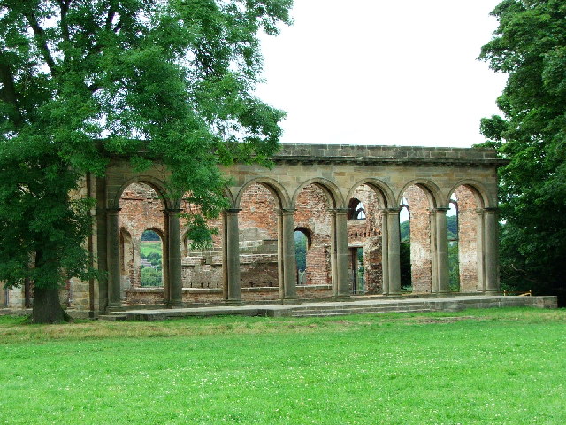
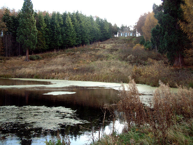
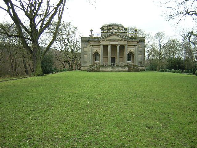
Banqueting House, Gibside
The Banqueting House is an 18th-century building, part of the Gibside estate, near Newcastle upon Tyne, England. Its style has been described as "Gothick...
Pickering Nook
Pickering Nook is a small village in County Durham, in England. It is situated a few miles north of Annfield Plain and Stanley, on the A692 between Consett...

Tanfield, County Durham
Tanfield is a village and former civil parish, now in the parish of Stanley, in the County Durham district, in the ceremonial county of Durham, England...
High Friarside
High Friarside is a village in County Durham, England. It is situated a short distance to the west of Burnopfield. == References ==
Nearby Amenities
Located within 500m of 54.90553,-1.721578Have you been to Sheep Hill?
Leave your review of Sheep Hill below (or comments, questions and feedback).