Sector

Settlement in Devon East Devon

England

Sector

St Mary's Church in Axminster The front of St Mary's Church in Axminster, East Devon.
St Mary's Church in Axminster Credit: John P Reeves

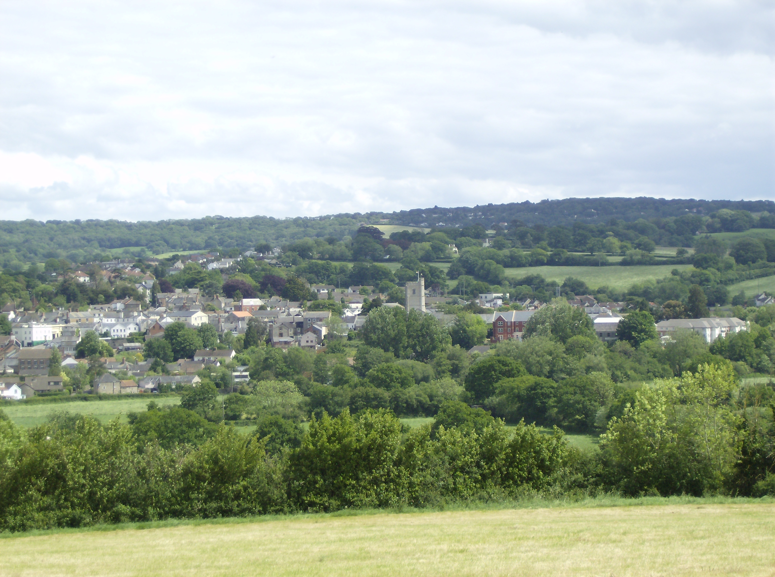
Sector is a small village located in the county of Devon, in southwest England. Situated in the South Hams district, Sector is nestled among the rolling hills and picturesque countryside that characterizes the region. The village is situated about 9 miles northeast of the coastal town of Salcombe and approximately 4 miles northwest of Kingsbridge, the nearest town.

Sector is known for its peaceful and idyllic setting, making it a popular destination for those seeking tranquility and a break from the hustle and bustle of city life. The village is surrounded by lush green fields, woodlands, and meandering streams, providing ample opportunities for outdoor activities such as walking, hiking, and birdwatching.

The village itself is small but charming, with a close-knit community that adds to its welcoming atmosphere. It features a handful of traditional stone cottages and a quaint village green, where locals and visitors can enjoy picnics or simply take in the serene surroundings.

Despite its rural location, Sector is well-connected to nearby towns and attractions. The A381 road runs close to the village, providing easy access to Kingsbridge and the wider road network. Additionally, the stunning Devon coastline is just a short drive away, offering opportunities for beach visits, water sports, and coastal walks.

Overall, Sector, Devon is a hidden gem in the heart of the South Hams, offering a peaceful retreat amidst beautiful natural scenery.

If you have any feedback on the listing, please let us know in the comments section below.

Sector Images

Images are sourced within 2km of 50.779666/-2.977255 or Grid Reference SY3198. Thanks to Geograph Open Source API. All images are credited.

St Mary's Church in Axminster The front of St Mary's Church in Axminster, East Devon.
St Mary's Church in Axminster
The front of St Mary's Church in Axminster, East Devon.
West Street Looking along West Street in Axminster, East Devon.
West Street
Looking along West Street in Axminster, East Devon.
St Mary's Church in Axminster The side view of St Mary's Church as seen from Church Street in Axminster, East Devon.
St Mary's Church in Axminster
The side view of St Mary's Church as seen from Church Street in Axminster, East Devon.
St. Mary's church, Axminster Central tower and central to the town.
War memorial to the left.
St. Mary's church, Axminster
Central tower and central to the town. War memorial to the left.
The Queen, honoured and remembered, 1 A display in the porch of St. Mary's, left over from the Platinum Jubilee celebrations of June 2022.
The Queen, honoured and remembered, 1
A display in the porch of St. Mary's, left over from the Platinum Jubilee celebrations of June 2022.
The Queen, honoured and remembered, 2 St. Mary's Axminster.
A simple book of condolences set up for members of the public, like myself, to commemorate the monarch, two days after her death.
The Queen, honoured and remembered, 2
St. Mary's Axminster. A simple book of condolences set up for members of the public, like myself, to commemorate the monarch, two days after her death.
Castle Garage, Axminster A very traditional business in the back streets of this East Devon town.
Castle Garage, Axminster
A very traditional business in the back streets of this East Devon town.
We Serve You Two old but possibly still working pumps at Castle Garage.
We Serve You
Two old but possibly still working pumps at Castle Garage.
On the A35 south of Axminster, heading east
Jurassic Coaster bus at Axminster railway station On the x51 route to Dorchester.
Jurassic Coaster bus at Axminster railway station
On the x51 route to Dorchester.
Axminster station Opened in 1860 by the London & South Western Railway.
Axminster station
Opened in 1860 by the London & South Western Railway.
Bushes and trees at Axminster, Change here for Jurassic Coast
Roundabout at the bottom of West Street, Axminster looking south-west towards the bridge over the railway
Roundabout at the bottom of West Street, Axminster
looking south-west towards the bridge over the railway
Axminster Fire Station Axminster Fire Station, Lyme Close, Axminster, Devon.
Axminster Fire Station
Axminster Fire Station, Lyme Close, Axminster, Devon.
Coombe Street meets South Street Taken from the car park.
Coombe Street meets South Street
Taken from the car park.
River Axe at Weycroft Looking upstream from Weycroft Bridge on the Fosse Way. The cottage backs on to the mill stream which supplied the adjacent mills.
River Axe at Weycroft
Looking upstream from Weycroft Bridge on the Fosse Way. The cottage backs on to the mill stream which supplied the adjacent mills.
Axminster Railway Station This mock Gothic style building was designed by LSWR architect Sir William Tite and opened on 19 July 1860.
Once painted in light pastel colours in the 1990s it has now been fully restored to its original brick finish.
To see some 360° Panoramas of Devon please visit this <span class="nowrap"><a title="http://www.360panoramas.co.uk" rel="nofollow ugc noopener" href="http://www.360panoramas.co.uk">Link</a><img style="margin-left:2px;" alt="External link" title="External link - shift click to open in new window" src="https://s1.geograph.org.uk/img/external.png" width="10" height="10"/></span>
Axminster Railway Station
This mock Gothic style building was designed by LSWR architect Sir William Tite and opened on 19 July 1860. Once painted in light pastel colours in the 1990s it has now been fully restored to its original brick finish. To see some 360° Panoramas of Devon please visit this LinkExternal link
A backstreet in Axminster A view of the church from a little lane in Axminster.
 To see some 360° Panoramas of Devon please visit this <span class="nowrap"><a title="http://www.360panoramas.co.uk" rel="nofollow ugc noopener" href="http://www.360panoramas.co.uk">Link</a><img style="margin-left:2px;" alt="External link" title="External link - shift click to open in new window" src="https://s1.geograph.org.uk/img/external.png" width="10" height="10"/></span>
A backstreet in Axminster
A view of the church from a little lane in Axminster. To see some 360° Panoramas of Devon please visit this LinkExternal link
Show me another place!

Sector is located at Grid Ref: SY3198 (Lat: 50.779666, Lng: -2.977255)

Administrative County: Devon

District: East Devon

Police Authority: Devon and Cornwall

What 3 Words

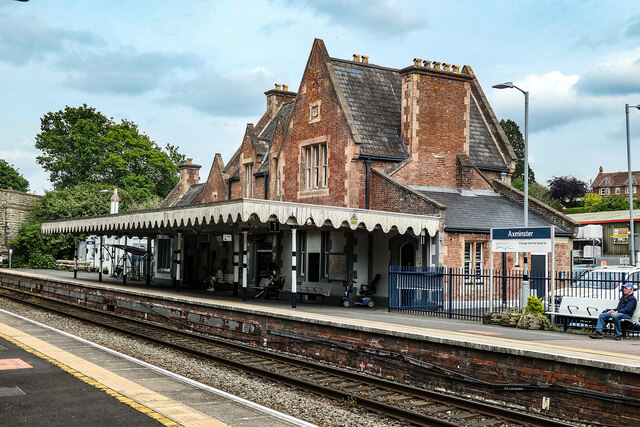
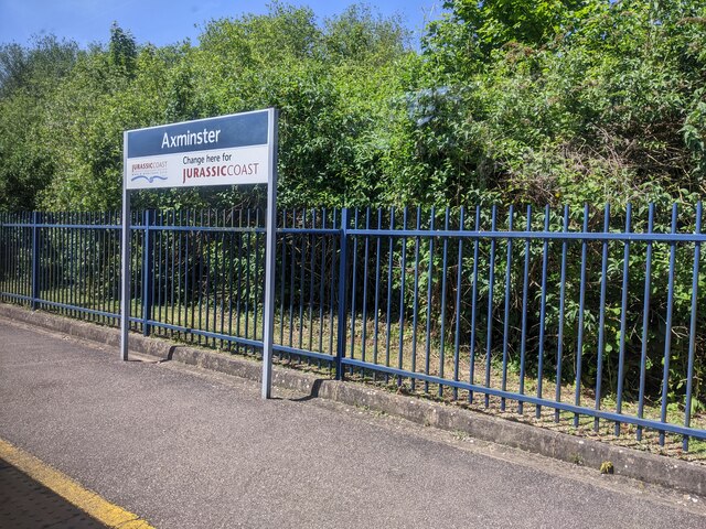
///defensive.laser.hunk. Near Axminster, Devon

Related Wikis

Axe Valley Academy

Axe Valley Academy, previously known as The Axe Valley Community College, is a coeducational secondary school and sixth form located in Axminster, Devon...

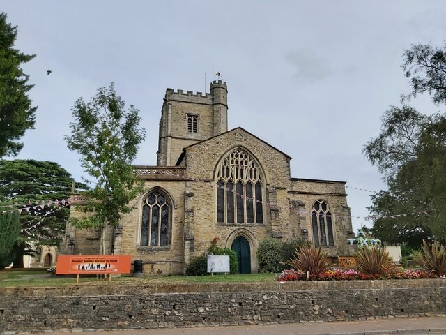
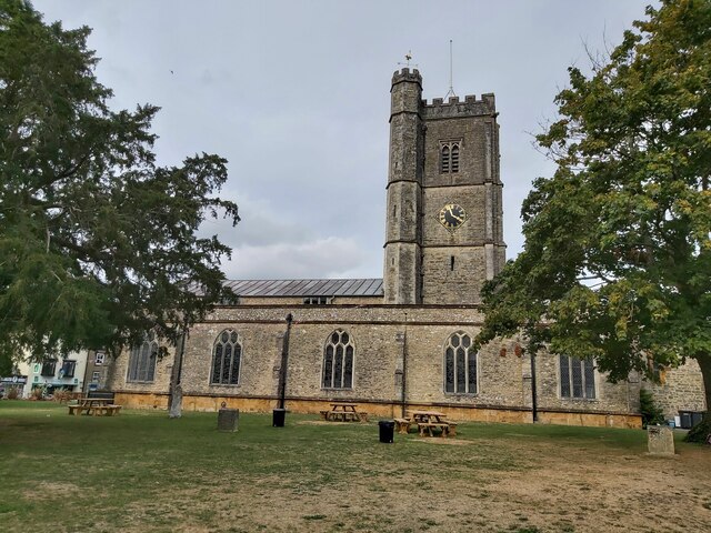
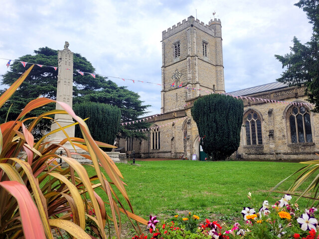
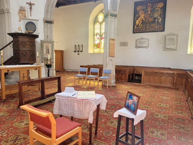
St Mary's Church, Axminster

St Mary's Church is a Church of England church in Axminster, Devon, England. The church has Norman origins, although much of the building dates from the...

Axminster Monastery

Axminster Monastery was a monastery in Devon, England. Cyneheard the Ætheling was buried in the minster. == References ==

Axminster Museum

Axminster Museum is a town museum situated in the Old Police Station and Courthouse opposite St. Mary's Church in the centre of the town of Axminster,...

Axminster Town A.F.C.

Axminster Town Association Football Club is a football club based in Axminster, Devon, England. They are currently members of the South West Peninsula...
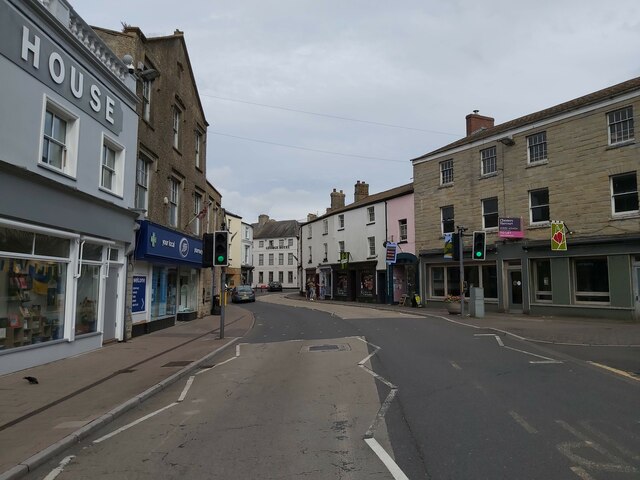
Axminster

Axminster is a market town and civil parish on the eastern border of the county of Devon in England. It is 28 miles (45 km) from the county town of Exeter...

Axminster Rural District

Axminster Rural District is a former district council area based around Axminster, Devon. It was administered by Axminster Rural District Council. It was...

Newenham Abbey

Newenham Abbey (alias Newnham) was a Cistercian abbey founded in 1247 by Reginald II de Mohun (1206–1258) on land within his manor of Axminster in Devon...

Nearby Amenities

Located within 500m of 50.779666,-2.977255
Sector
Is In: Devon, England, UK
Place: hamlet
Lat/Long: 50.7793221/-2.9783911
Post Box
Letters Only: yes
Post Box Type: wall
Ref: EX13 73
Royal Cypher: EVIIR
Royal Cypher Wikidata: Q33102324
Lat/Long: 50.7789449/-2.9750526
Power: pole
Source: bing
Lat/Long: 50.7797317/-2.9732944
Power: pole
Source: bing
Lat/Long: 50.7800056/-2.972141
Power: pole
Source: bing
Lat/Long: 50.7797012/-2.9746918
Power: pole
Source: bing
Lat/Long: 50.7796427/-2.9760089
Power: pole
Source: bing
Lat/Long: 50.7795842/-2.9776704
Power: pole
Source: bing
Lat/Long: 50.7793111/-2.9790008
Power: pole
Source: bing
Transformer: distribution
Lat/Long: 50.779094/-2.9789793
Power: pole
Source: bing
Lat/Long: 50.778369/-2.9709595
Power: pole
Source: bing
Lat/Long: 50.7781926/-2.9724509
Power: pole
Source: bing
Lat/Long: 50.7779942/-2.974142
Power: pole
Source: bing
Lat/Long: 50.7776007/-2.9753369
Power: pole
Source: bing
Lat/Long: 50.7770274/-2.9770924
Power: pole
Source: bing
Lat/Long: 50.7764626/-2.9787862
Power: pole
Source: bing
Lat/Long: 50.7759309/-2.9803499
Power: pole
Source: bing
Lat/Long: 50.7796859/-2.9813263
Power: pole
Source: bing
Lat/Long: 50.7802159/-2.98278
Power: pole
Source: bing
Lat/Long: 50.7814726/-2.9819754
Power: pole
Source: bing
Lat/Long: 50.7806568/-2.9825172
Power: pole
Source: bing
Lat/Long: 50.7802261/-2.9835525
Power: pole
Source: bing
Lat/Long: 50.7799327/-2.9820129
Power: pole
Source: bing
Lat/Long: 50.7794375/-2.9806423
Power: pole
Source: bing
Lat/Long: 50.7791305/-2.979843
Power: pole
Source: bing
Transformer: distribution
Lat/Long: 50.7790855/-2.9736136
Power: pole
Source: bing
Lat/Long: 50.780288/-2.9709113
Power: pole
Source: bing
Lat/Long: 50.7767035/-2.9811493
Power: pole
Source: bing
Lat/Long: 50.7766429/-2.9825223
Power: pole
Source: bing
Lat/Long: 50.7760734/-2.9804264
The data included in this document is from www.openstreetmap.org. The data is made available under ODbL.

Have you been to Sector?

Leave your review of Sector below (or comments, questions and feedback).