Alder Grove

Wood, Forest in Devon East Devon

England

Alder Grove

Axminster Fire Station Axminster Fire Station, Lyme Close, Axminster, Devon.
Axminster Fire Station Credit: Kevin Hale

Alder Grove, located in Devon, England, is a picturesque woodland area known for its beautiful alder trees. Spanning over a vast area, this woodland is often referred to as Alder Forest due to its dense foliage and abundance of wildlife.

The grove is situated in a serene and tranquil setting, making it an ideal destination for nature enthusiasts and those seeking a peaceful escape from the bustling city life. Its proximity to the River Dart adds to its charm, as the gentle flow of water can be heard throughout the forest, creating a soothing ambiance.

The alder trees, which give the grove its name, dominate the landscape with their slender trunks and vibrant green leaves. These trees are known for their ability to thrive in wet and boggy conditions, making them well-suited for the marshy areas surrounding the river.

Alder Grove is teeming with wildlife, serving as a habitat for a wide range of species. Birdwatchers can spot various avian species, including woodpeckers, kingfishers, and herons. The forest is also home to deer, foxes, and other woodland creatures, providing ample opportunities for wildlife enthusiasts to observe and appreciate nature.

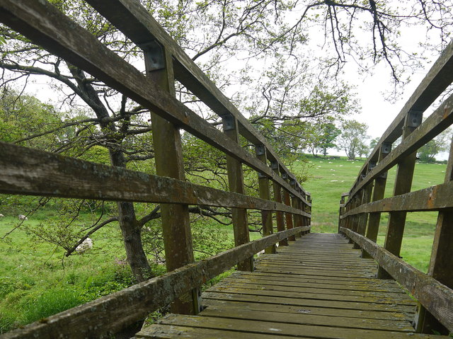
Visitors to Alder Grove can explore the area through a network of walking trails, allowing them to immerse themselves fully in the natural beauty of the forest. The grove is open to the public year-round, and its accessibility makes it an attractive destination for both locals and tourists alike.

In summary, Alder Grove in Devon offers a tranquil and enchanting experience for nature lovers, with its dense alder trees, vibrant wildlife, and serene surroundings.

If you have any feedback on the listing, please let us know in the comments section below.

Alder Grove Images

Images are sourced within 2km of 50.78436/-2.969567 or Grid Reference SY3198. Thanks to Geograph Open Source API. All images are credited.

Axminster Fire Station Axminster Fire Station, Lyme Close, Axminster, Devon.
Axminster Fire Station
Axminster Fire Station, Lyme Close, Axminster, Devon.
River Axe at Weycroft Looking upstream from Weycroft Bridge on the Fosse Way. The cottage backs on to the mill stream which supplied the adjacent mills.
River Axe at Weycroft
Looking upstream from Weycroft Bridge on the Fosse Way. The cottage backs on to the mill stream which supplied the adjacent mills.
Power lines Parallel with Greatwood Lane, west of Weycroft.
Power lines
Parallel with Greatwood Lane, west of Weycroft.
Looking across the Axe valley A view from a bend on Lodge Lane, looking obliquely up the Axe valley. The field is crossed to the left by Axminster Footpath 4. The trees framing the view are alongside the drive to Bagley Hill Farm.
Looking across the Axe valley
A view from a bend on Lodge Lane, looking obliquely up the Axe valley. The field is crossed to the left by Axminster Footpath 4. The trees framing the view are alongside the drive to Bagley Hill Farm.
View from Tudhay A view across the square from Hawkchurch Footpath 47. The shallow valley is of a tributary of the River Axe.
View from Tudhay
A view across the square from Hawkchurch Footpath 47. The shallow valley is of a tributary of the River Axe.
Axminster: South Street Looking south-south-west with the town’s Royal Mail sorting office on the right. Note the roofline of a vanished building evident on the end wall of this structure
Axminster: South Street
Looking south-south-west with the town’s Royal Mail sorting office on the right. Note the roofline of a vanished building evident on the end wall of this structure
Axminster: George Hotel The hotel stands within a triangle of roads – Lyme Street, seen here, George Street and Victoria Place. Looking north-north-west
Axminster: George Hotel
The hotel stands within a triangle of roads – Lyme Street, seen here, George Street and Victoria Place. Looking north-north-west
Chard Street, Axminster
Footpath approaching woods near Weycroft Hall
Footpath through woods near Weycroft Hall
Footpath approaching electricity transmission lines
Type 24 Pillbox, Bagley Hill Second world War hexagonal pillbox made of breeze blocks, clay brick and concrete forming part of the Taunton Stop Line.
Type 24 Pillbox, Bagley Hill
Second world War hexagonal pillbox made of breeze blocks, clay brick and concrete forming part of the Taunton Stop Line.
Power lines and Pylons The Pylons and Power lines follow this dead end lane which leads to Greatwood farm.
Power lines and Pylons
The Pylons and Power lines follow this dead end lane which leads to Greatwood farm.
Minor Road Junction
Minor Road Junction
Watery Lane The lane from Greatwood Farm to the outside world, running roughly parallel to a power line.
Watery Lane
The lane from Greatwood Farm to the outside world, running roughly parallel to a power line.
River Axe at Weycroft A sunny summer version of the scene in <a href="https://www.geograph.org.uk/photo/242182">ST3000 : River Axe at Weycroft</a>.
River Axe at Weycroft
A sunny summer version of the scene in ST3000 : River Axe at Weycroft.
Road and Rail at Weycroft On the left is the A358 Chard to Axminster road which is crossing the bridge over the Crewkerne to Axminster railway line just north of Axminster
Road and Rail at Weycroft
On the left is the A358 Chard to Axminster road which is crossing the bridge over the Crewkerne to Axminster railway line just north of Axminster
Footbridge Across the River Axe This wooden footbridge carries a footpath from the railway near Small ridge to the minor road that leads from Weycroft to Payne's Place and Cuthays.
Footbridge Across the River Axe
This wooden footbridge carries a footpath from the railway near Small ridge to the minor road that leads from Weycroft to Payne's Place and Cuthays.
Show me another place!

Alder Grove is located at Grid Ref: SY3198 (Lat: 50.78436, Lng: -2.969567)

Administrative County: Devon

District: East Devon

Police Authority: Devon and Cornwall

What 3 Words

///flicks.voltages.terms. Near Axminster, Devon

Related Wikis

Axminster Town A.F.C.

Axminster Town Association Football Club is a football club based in Axminster, Devon, England. They are currently members of the South West Peninsula...

Axe Valley Academy

Axe Valley Academy, previously known as The Axe Valley Community College, is a coeducational secondary school and sixth form located in Axminster, Devon...

St Mary's Church, Axminster

St Mary's Church is a Church of England church in Axminster, Devon, England. The church has Norman origins, although much of the building dates from the...

Axminster Monastery

Axminster Monastery was a monastery in Devon, England. Cyneheard the Ætheling was buried in the minster. == References ==

Axminster Museum

Axminster Museum is a town museum situated in the Old Police Station and Courthouse opposite St. Mary's Church in the centre of the town of Axminster,...
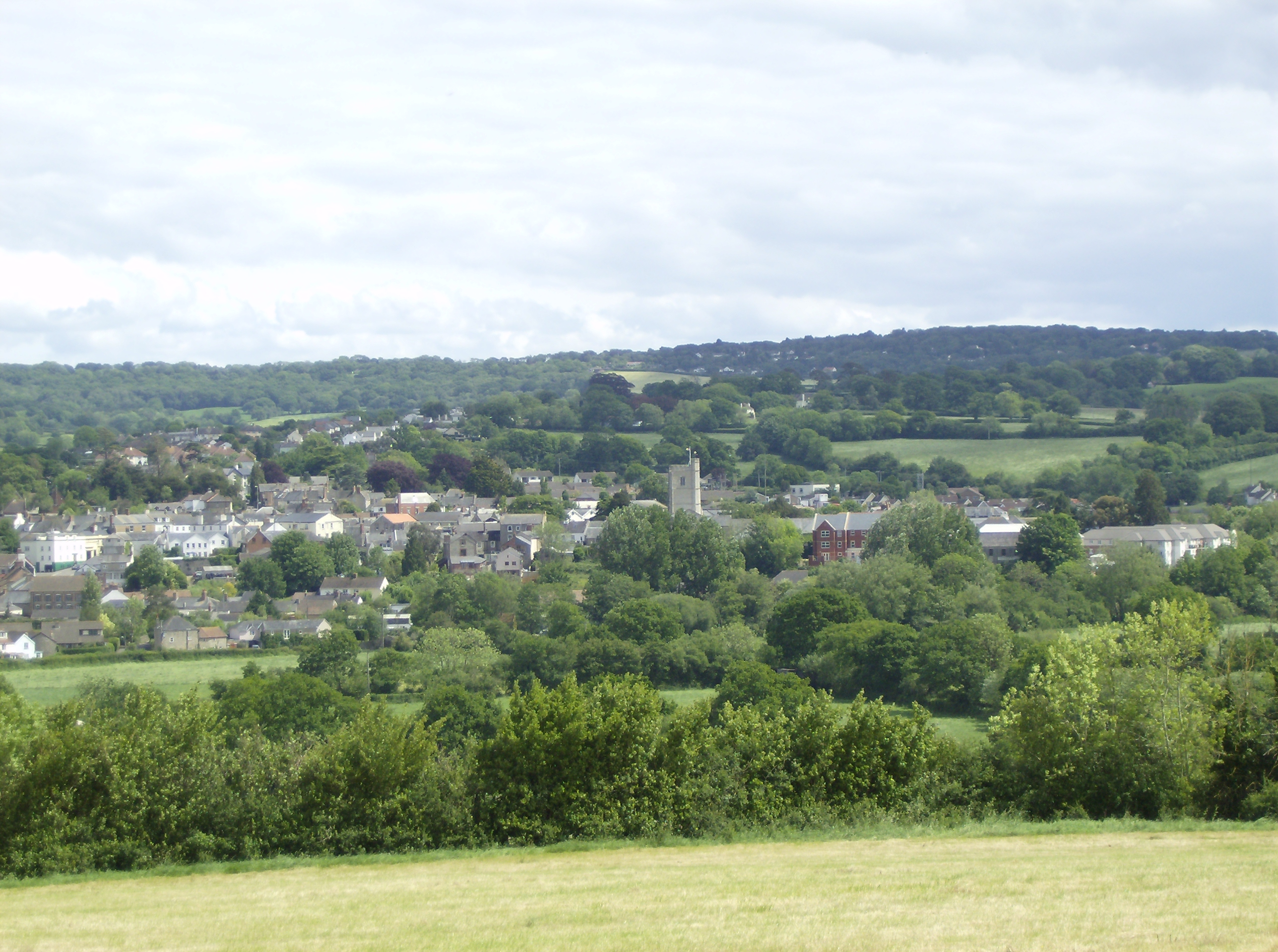
Axminster

Axminster is a market town and civil parish on the eastern border of the county of Devon in England. It is 28 miles (45 km) from the county town of Exeter...

Axminster Rural District

Axminster Rural District is a former district council area based around Axminster, Devon. It was administered by Axminster Rural District Council. It was...

Newenham Abbey

Newenham Abbey (alias Newnham) was a Cistercian abbey founded in 1247 by Reginald II de Mohun (1206–1258) on land within his manor of Axminster in Devon...

Nearby Amenities

Located within 500m of 50.78436,-2.969567
Power: pole
Source: bing
Lat/Long: 50.7814836/-2.9655026
Power: pole
Source: bing
Lat/Long: 50.7811699/-2.9669323
Power: pole
Source: bing
Lat/Long: 50.7809647/-2.967863
Power: pole
Source: bing
Lat/Long: 50.7805611/-2.9696627
Power: pole
Source: bing
Lat/Long: 50.780288/-2.9709113
Power: pole
Source: bing
Lat/Long: 50.7807018/-2.9690257
Power: pole
Source: bing
Lat/Long: 50.7820365/-2.9645705
Power: pole
Source: bing
Transformer: distribution
Lat/Long: 50.7824638/-2.9638691
Power: pole
Source: bing
Lat/Long: 50.7829853/-2.9630578
Power: pole
Source: bing
Lat/Long: 50.7814624/-2.9651794
The data included in this document is from www.openstreetmap.org. The data is made available under ODbL.

Have you been to Alder Grove?

Leave your review of Alder Grove below (or comments, questions and feedback).