Scotland End

Settlement in Oxfordshire Cherwell

England

Scotland End

Hook Norton Brewery The Victorian tower of Hook Norton is the only brewery still driven by steam. On the ground floor of the brewery is a fine 25 horsepower steam engine, supplying through a series of belts, cogs and shafts some of the motive power the brewery needs to produce its beer.
Hook Norton Brewery Credit: Alan Simkins

Scotland End is a quaint village located in the county of Oxfordshire, England. Situated in the picturesque countryside, this charming hamlet is known for its serene and idyllic surroundings. With a population of around 500 residents, Scotland End offers a peaceful and close-knit community atmosphere.

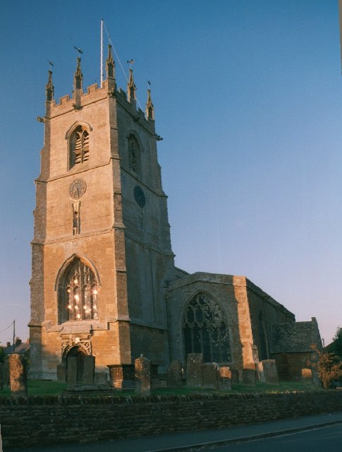
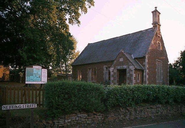
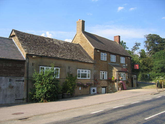
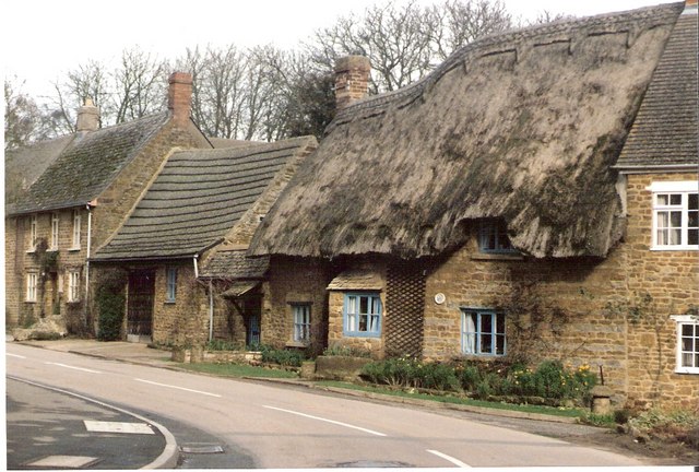
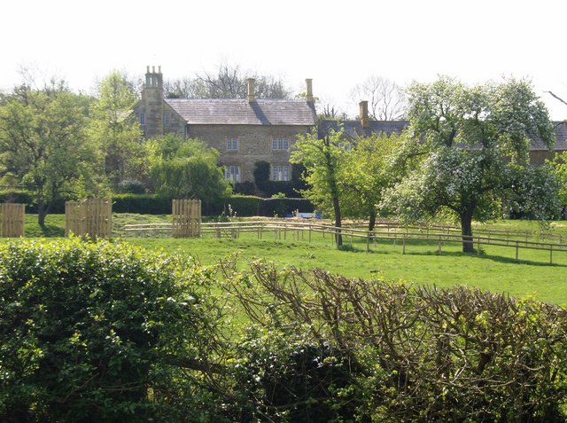
The village is characterized by its traditional stone-built cottages, which add to its quintessential English charm. The streets are lined with beautiful gardens and well-preserved architecture, reflecting the village's rich history. The local church, St. Mary's, stands as a prominent landmark, showcasing stunning medieval craftsmanship.

Despite its small size, Scotland End boasts a strong sense of community spirit. The village hosts various events throughout the year, including summer fairs and festive celebrations, which bring the residents together and attract visitors from across Oxfordshire.

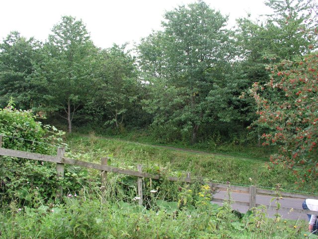
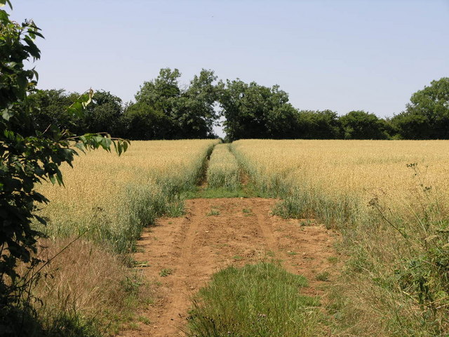
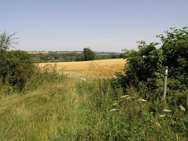
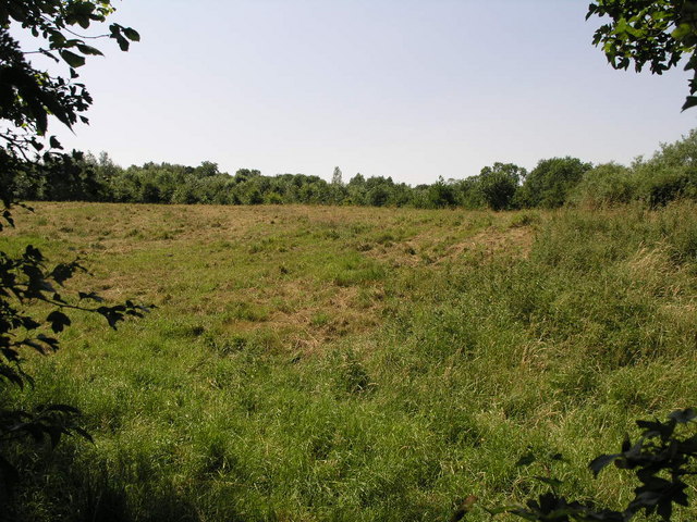
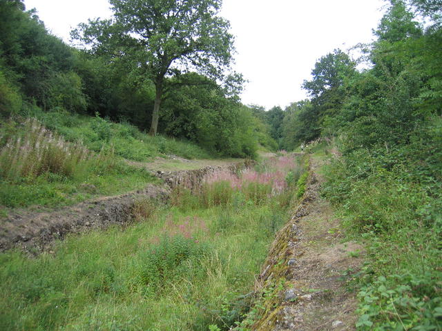
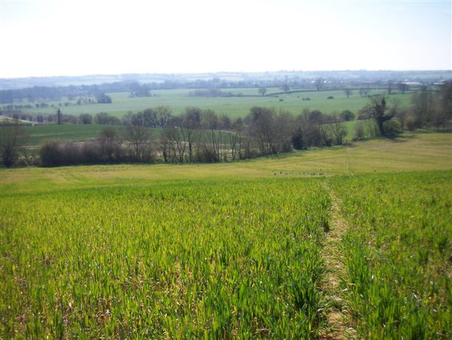
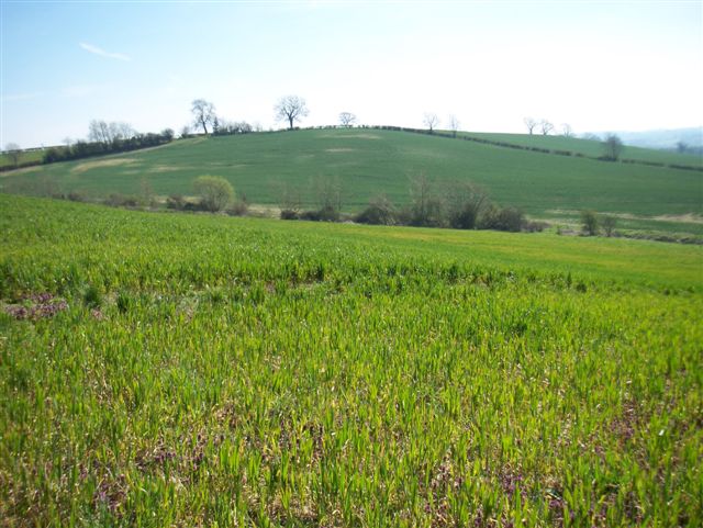
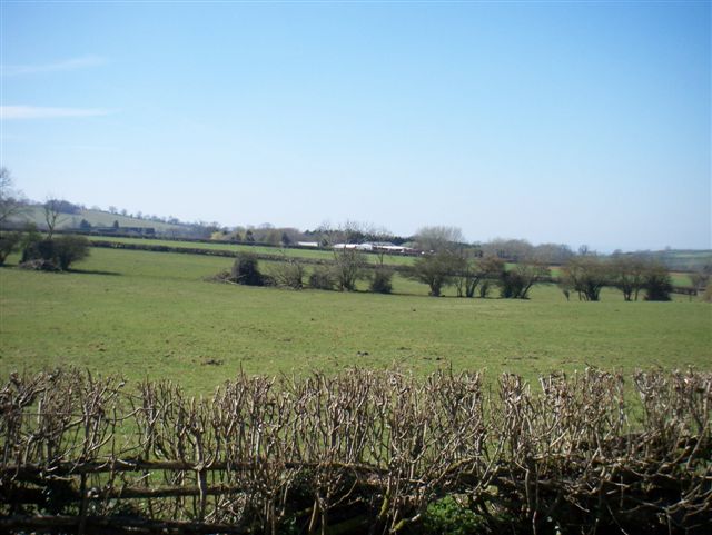
Surrounded by lush green fields and rolling hills, Scotland End offers ample opportunities for outdoor activities. The nearby countryside provides scenic walking trails and cycling routes, allowing residents and visitors to explore the natural beauty of the area. The village is also renowned for its thriving wildlife, making it a popular destination for nature enthusiasts and birdwatchers.

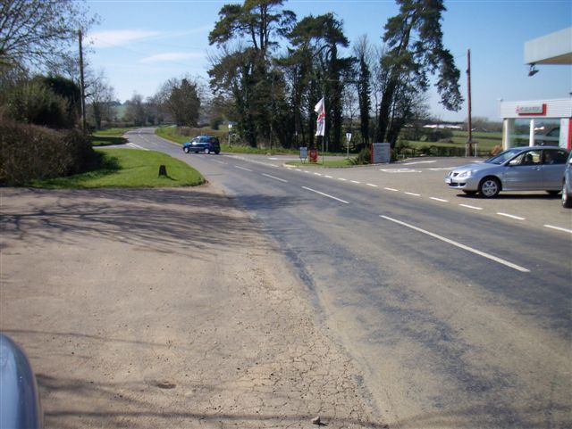
Although there are limited amenities within the village itself, Scotland End is conveniently located near larger towns, such as Banbury and Bicester, where residents can access a wider range of services, including shops, schools, and healthcare facilities.

In summary, Scotland End is a picturesque village in Oxfordshire, known for its tranquil setting, traditional architecture, and strong community spirit. It offers a peaceful retreat for those seeking a slower pace of life in a beautiful rural setting.

If you have any feedback on the listing, please let us know in the comments section below.
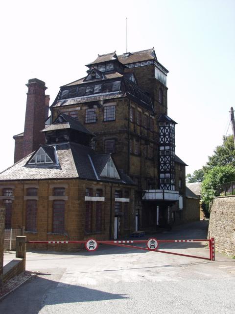
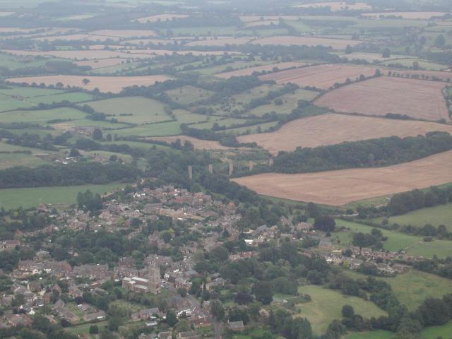
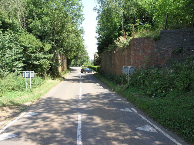
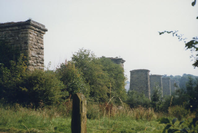
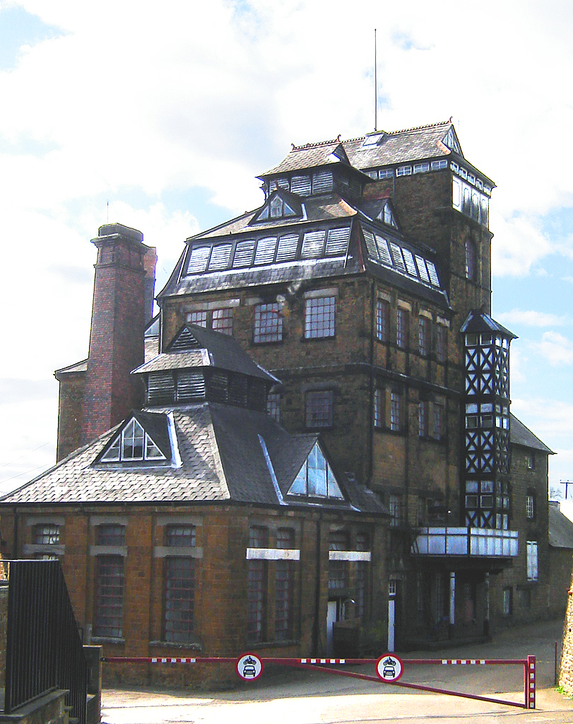
Scotland End Images

Images are sourced within 2km of 51.996728/-1.489451 or Grid Reference SP3533. Thanks to Geograph Open Source API. All images are credited.

Hook Norton Brewery The Victorian tower of Hook Norton is the only brewery still driven by steam. On the ground floor of the brewery is a fine 25 horsepower steam engine, supplying through a series of belts, cogs and shafts some of the motive power the brewery needs to produce its beer.
Hook Norton Brewery
The Victorian tower of Hook Norton is the only brewery still driven by steam. On the ground floor of the brewery is a fine 25 horsepower steam engine, supplying through a series of belts, cogs and shafts some of the motive power the brewery needs to produce its beer.
Hook Norton The village as seen from a hot air balloon.  The pillars in the distance carried a viaduct for the Cheltenham and Banbury Railway.
Hook Norton
The village as seen from a hot air balloon. The pillars in the distance carried a viaduct for the Cheltenham and Banbury Railway.
Scotland End, Hook Norton
St Peters Church Hook Norton
The Baptist Church Hall, Hook Norton
Bridleway to Whichford This well marked bridleway leads to Whichford Hill.
Bridleway to Whichford
This well marked bridleway leads to Whichford Hill.
Footpath to Southrop This well marked footpath leads to Southrop, a suburb of Hook Norton.
Footpath to Southrop
This well marked footpath leads to Southrop, a suburb of Hook Norton.
Lost Footpath The footpath that runs across this field is not very well marked or walked for that matter.  It joins with another path from the same road and then leads on to Church End.
Lost Footpath
The footpath that runs across this field is not very well marked or walked for that matter. It joins with another path from the same road and then leads on to Church End.
East End Railway This former bridge once carried the railway from Hook Norton towards the east.  The former station was just to the right.
East End Railway
This former bridge once carried the railway from Hook Norton towards the east. The former station was just to the right.
View from Oatley Hill Looking across the SE corner of the square with the buildings and church of Hook Norton just visible in the distance.  The renowned brewery is unfortunately hidden by the oak tree in the foreground.
View from Oatley Hill
Looking across the SE corner of the square with the buildings and church of Hook Norton just visible in the distance. The renowned brewery is unfortunately hidden by the oak tree in the foreground.
The Gate Hangs High An unusually named pub, shown on the OS map at the crossroads north of Hook Norton.
The Gate Hangs High
An unusually named pub, shown on the OS map at the crossroads north of Hook Norton.
Hook Norton Cutting
Hook Norton Cutting
Hook Norton Viaduct Only the piers remain of the disused railway viaduct of the former Banbury & Cheltenham Railway
Hook Norton Viaduct
Only the piers remain of the disused railway viaduct of the former Banbury & Cheltenham Railway
Roofing variations Cottages in Hook Norton village centre.
Roofing variations
Cottages in Hook Norton village centre.
D'Arcy Dalton Way
D'Arcy Dalton Way
Farmland
Farmland
Crossroads
Crossroads
Farmland
Farmland
Show me another place!

Scotland End is located at Grid Ref: SP3533 (Lat: 51.996728, Lng: -1.489451)

Administrative County: Oxfordshire

District: Cherwell

Police Authority: Thames Valley

What 3 Words

///clocking.backfired.scored. Near Hook Norton, Oxfordshire

Related Wikis

Related Videos

VISITING MUSEUM 🍺🍻 / PINAY IN THE UK

Hey everyone! Thanks for watching my videos I'm using my iPhone11 for my Vlogs! Don't forget to like and subscribe many thanks ...

D'arcy Dalton Highway

Hiking in the Cotswolds.

I TOOK MY MUM GLAMPING

Day trip and over night stay to the beautiful area of Swerford, just outside Banbury and Oxford. Found this lovely location/stay on ...

FIRST TIME RUNNING THE HOOKY 6 MILE RACE 2023

Welcome back to Raley Adventures We both took part in “HOOKY 6” a great little local race in the Oxfordshire village of Hook ...

Nearby Amenities

Located within 500m of 51.996728,-1.489451
Bus Stop
Church
Bus: yes
Naptan AtcoCode: 340000408OPP
Naptan Bearing: W
Naptan CommonName: Church
Naptan Indicator: Opposite
Naptan Landmark: Church
Naptan NaptanCode: oxfajwtd
Naptan Street: High Street
Naptan Verified: no
Public Transport: platform
Source: naptan_import
Lat/Long: 51.9952651/-1.4837429
Bus Stop
Church
Bus: yes
Naptan AtcoCode: 340000408OUT
Naptan Bearing: E
Naptan CommonName: Church
Naptan Indicator: Outside
Naptan Landmark: Church
Naptan NaptanCode: oxfajwta
Naptan Street: High Street
Naptan Verified: no
Public Transport: platform
Source: naptan_import
Lat/Long: 51.9953277/-1.4838608
Scotland End
Is In: Hook Norton
Place: hamlet
Source: OS_OpenData_StreetView
Lat/Long: 51.9957917/-1.4909235
Hook Norton Brewery
Building: brewery
Craft: brewery
Landuse: industrial
Source: survey
Tourism: attraction
Website: http://www.hooknortonbrewery.co.uk
Wikidata: Q26298422
Lat/Long: 51.9968959/-1.4942152
Library
Hook Norton Library
Addr Postcode: OX15 5NH
Addr Street: High Street
Source: local_knowledge
Wikidata: Q55112963
Lat/Long: 51.9953945/-1.4850968
Pub
The Pear Tree
Operator: Hook Norton Brewery
Source: local_knowledge
Lat/Long: 51.9963504/-1.4906252
Post Box
Brand: Royal Mail
Brand Wikidata: Q638098
Brand Wikipedia: en:Royal Mail
Operator: Royal Mail
Operator Wikidata: Q638098
Post Box Type: wall
Ref: OX15 1002D
Royal Cypher: EIIR
Royal Cypher Wikidata: Q33102113
Lat/Long: 51.9953547/-1.4860464
Fire Station
Lat/Long: 51.997585/-1.4837729
Bus Stop
Pear Tree Inn
Bus: yes
Public Transport: platform
Lat/Long: 51.9962108/-1.4902984
Walton Croft
Landuse: residential
Lat/Long: 51.9973897/-1.4837143
The Hollies
Landuse: residential
Lat/Long: 51.9972732/-1.4836505
Addr Housename: Pemberley
Addr Street: The Bourne
Landuse: residential
Lat/Long: 51.9971086/-1.4865651
Addr Housename: Old Police House
Addr Street: The Bourne
Landuse: residential
Lat/Long: 51.9973069/-1.4888886
The Barn
Landuse: residential
Lat/Long: 51.9972437/-1.48983
Clay Bank Farmhouse
Landuse: residential
Lat/Long: 51.9972873/-1.4901556
Addr Housename: Scotland End Farmhouse
Addr Street: The Bourne
Landuse: residential
Lat/Long: 51.9974736/-1.4900176
Scotland Bungalow
Landuse: residential
Lat/Long: 51.9971432/-1.4908117
Scotland House
Landuse: residential
Wikidata: Q26572515
Lat/Long: 51.9971991/-1.4915257
Scotland Mount
Landuse: residential
Lat/Long: 51.9969366/-1.4922952
Scotland Mount Cottage
Landuse: residential
Lat/Long: 51.9970764/-1.4920353
Addr Housename: Sunnybank Farmhouse
Addr Street: Netting Street
Landuse: residential
Lat/Long: 51.9961821/-1.4894452
Addr Housename: The Nettings
Addr Street: Netting Street
Landuse: residential
Lat/Long: 51.9955922/-1.4872596
Addr Housename: The Paddocks
Addr Street: Netting Street
Building: residential
Lat/Long: 51.9951746/-1.4855077
Church House
Building: residential
Lat/Long: 51.9954107/-1.4837892
Addr Housename: Cherry Bank
Addr Street: The Bourne
Building: house
Lat/Long: 51.997444/-1.4894935
Addr Housename: Moonrakers
Addr Street: The Bourne
Building: house
Lat/Long: 51.9974143/-1.4892527
Addr Housename: Springfields
Addr Street: The Bourne
Building: house
Lat/Long: 51.9973276/-1.48866
Addr Housename: Little Bowden
Addr Street: The Bourne
Building: house
Lat/Long: 51.9972772/-1.4883354
Addr Housename: Linden
Addr Street: The Bourne
Building: house
Lat/Long: 51.9972624/-1.4881141
Addr Housename: Mayfield
Addr Street: The Bourne
Building: house
Lat/Long: 51.997236/-1.4878808
Addr Housename: Milton
Addr Street: The Bourne
Building: house
Lat/Long: 51.9972252/-1.487461
Addr Housename: Hollyberries
Addr Street: The Bourne
Building: house
Lat/Long: 51.9972417/-1.4872491
Four Winds
Building: house
Lat/Long: 51.9972739/-1.484579
Glenavon
Building: house
Lat/Long: 51.9972954/-1.4842196
Haytimisia
Building: house
Lat/Long: 51.9973862/-1.4831655
Eastlyn
Building: house
Lat/Long: 51.9971418/-1.4840881
Cartref
Building: house
Lat/Long: 51.9968859/-1.4839728
The Rookery
Building: house
Lat/Long: 51.9966547/-1.483954
The New House
Building: house
Lat/Long: 51.9963128/-1.4834551
Trinity Orchard
Building: house
Lat/Long: 51.9961377/-1.4833747
Well House
Building: house
Lat/Long: 51.9963128/-1.4841069
Low Beams
Building: house
Lat/Long: 51.9960015/-1.4837824
Talbot House
Building: house
Lat/Long: 51.996018/-1.4840117
The Old Butchers
Building: house
Lat/Long: 51.995568/-1.4834525
The TV Shop
Building: house
Lat/Long: 51.9954293/-1.4830515
Holly House
Building: house
Lat/Long: 51.9969337/-1.4833505
Pigeon Cottage
Building: house
Lat/Long: 51.99707/-1.4830086
Addr Housename: Netting Cottage
Addr Street: Netting Street
Building: house
Wikidata: Q26572542
Lat/Long: 51.9954524/-1.486022
Addr Housename: Rosebank
Addr Street: Netting Street
Building: house
Lat/Long: 51.9956506/-1.4863144
Addr Housename: Penlan
Addr Street: Netting Street
Building: house
Lat/Long: 51.9956762/-1.4864793
Addr Housename: The Cottage
Addr Street: Netting Street
Building: house
Lat/Long: 51.9957744/-1.4871217
The Cottage
Building: house
Lat/Long: 51.9953847/-1.4828704
Addr Housename: Compass House
Addr Street: Netting Street
Building: house
Lat/Long: 51.9957232/-1.487516
Addr Housename: Hare Cottage
Addr Street: Netting Street
Building: house
Lat/Long: 51.9958182/-1.4873122
Addr Housename: Manor Cottage
Addr Street: Netting Street
Building: house
Lat/Long: 51.9960114/-1.4883073
Addr Housename: The Old Sweet Shop
Addr Street: Netting Street
Building: house
Wikidata: Q26298395
Lat/Long: 51.9958504/-1.4874878
Addr Housename: Petra
Addr Street: Netting Street
Building: house
Wikidata: Q26494722
Lat/Long: 51.99589/-1.4876313
Addr Housename: Priory Cottage
Addr Street: Netting Street
Building: house
Lat/Long: 51.9959792/-1.4877802
Addr Housename: The Nook
Addr Street: Netting Street
Building: house
Lat/Long: 51.9960684/-1.4880162
Addr Housename: The Old Police House
Addr Street: Netting Street
Building: house
Lat/Long: 51.9960874/-1.4881289
Addr Housename: Hook Norton Manor
Addr Street: Netting Street
Building: house
Wikidata: Q26298396
Lat/Long: 51.9958661/-1.4885983
Wheelwrights Cottage
Building: house
Lat/Long: 51.9956365/-1.4906663
Harwood Farmhouse
Building: house
Lat/Long: 51.9951642/-1.4916587
The Barn
Building: house
Lat/Long: 51.9954103/-1.491774
Danvers
Building: house
Lat/Long: 51.9978767/-1.491019
Scotland End Barn
Building: house
Lat/Long: 51.9995809/-1.489592
Hathaway Cottage
Building: terrace
Lat/Long: 51.9963809/-1.4822917
Thimble Cottage
Addr Housenumber: 5
Addr Street: High Street
Building: terrace
Lat/Long: 51.9965395/-1.4823588
Kilnstone
Building: house
Lat/Long: 51.9966749/-1.4828617
Brambles
Building: house
Lat/Long: 51.9964131/-1.482914
Hilltop
Building: house
Lat/Long: 51.996286/-1.4825613
Corner House
Building: house
Lat/Long: 51.9969342/-1.482399
The Blackbirds
Building: house
Wikidata: Q26298425
Lat/Long: 51.9971621/-1.4826418
Dentist
Lion House Dental Practise
Healthcare: dentist
Lat/Long: 51.9960147/-1.4822676
Pear Tree House
Building: house
Wikidata: Q26572617
Lat/Long: 51.9961699/-1.4906415
Hayway
Building: house
Lat/Long: 51.9979089/-1.490451
Addr Housename: Nettings Close
Addr Street: Netting Street
Building: house
Lat/Long: 51.9957942/-1.4867093
Addr Housenumber: 1 New Cottage
Addr Street: Netting Street
Building: house
Lat/Long: 51.9959429/-1.4869561
Addr Housename: 2 New Cottage
Addr Street: Netting Street
Building: house
Lat/Long: 51.9960007/-1.4870768
Power: pole
Source: Bing
Lat/Long: 51.9972925/-1.4937541
Power: pole
Source: Bing
Lat/Long: 51.9974461/-1.494009
Power: pole
Source: Bing
Lat/Long: 51.99738/-1.4930192
Power: pole
Source: Bing
Lat/Long: 51.9997155/-1.48875
Scotland House Farm Buildings
Power: pole
Source: Bing
Transformer: distribution
Voltage Primary: 11000
Lat/Long: 51.9997771/-1.4897219
Power: pole
Source: Bing
Lat/Long: 52.0003579/-1.489398
Power: pole
Source: Bing
Lat/Long: 52.0009549/-1.4900243
High Wiend
Addr Housename: High Wiend
Addr Postcode: OX15 5NX
Addr Street: Brewery Lane
Building: house
Building Levels: 2
Lat/Long: 51.9971063/-1.4932903
Location Transition: yes
Power: pole
Lat/Long: 51.9991992/-1.4882553
Post Box
Brand: Royal Mail
Brand Wikidata: Q638098
Brand Wikipedia: en:Royal Mail
Operator: Royal Mail
Operator Wikidata: Q638098
Post Box Type: lamp
Ref: OX15 1064D
Royal Cypher: EIIR
Royal Cypher Wikidata: Q33102113
Lat/Long: 51.99737/-1.4872044
Post Box
Brand: Royal Mail
Brand Wikidata: Q638098
Brand Wikipedia: en:Royal Mail
Operator: Royal Mail
Operator Wikidata: Q638098
Post Box Type: pillar
Ref: OX15 1082D
Royal Cypher: EIIR
Royal Cypher Wikidata: Q33102113
Lat/Long: 51.997043/-1.4822182
Access: no
Barrier: bollard
Bicycle: yes
Bollard: fixed
Foot: yes
Lat/Long: 51.9950418/-1.4832471
Post Box
Brand: Royal Mail
Brand Wikidata: Q638098
Collection Times: Mo-Fr 16:15; Sa 11:00
Operator: Royal Mail
Operator Wikidata: Q638098
Ref: OX15 1004
Website: https://www.royalmail.com/services-near-you/postbox/hook-norton-village-shop-ox15-5ln/00OX151004
Lat/Long: 51.9956919/-1.4829462
Bench
Lat/Long: 51.9961874/-1.4903123
Information: guidepost
Tourism: information
Lat/Long: 51.9961814/-1.4902471
Post Office
Hook Norton Post Office
Addr City: Banbury
Addr Postcode: OX15 5NQ
Brand: Post Office
Brand Wikidata: Q1783168
Check Date: 2023-09-27
Check Date Opening Hours: 2023-09-27
Opening Hours: Mo-Sa 08:00-20:00; Su 09:00-18:00
Ref Pol Id: 134138
Website: https://www.postoffice.co.uk/branch-finder/3981371/hook-norton
Lat/Long: 51.9957317/-1.4829746
The Village Shop
Addr City: Banbury
Addr Postcode: OX15 5NQ
Check Date: 2022-12-04
Shop: convenience
Lat/Long: 51.9957028/-1.4830309
The data included in this document is from www.openstreetmap.org. The data is made available under ODbL.

Have you been to Scotland End?

Leave your review of Scotland End below (or comments, questions and feedback).