Scorton

Settlement in Lancashire Wyre

England

Scorton

Station Lane at Scorton View from West Coast Main Line Railway
Station Lane at Scorton Credit: Raymond Knapman

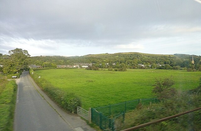
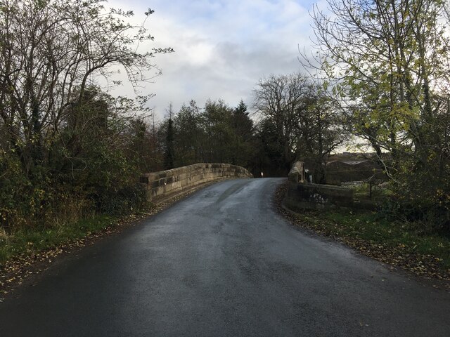
Scorton is a small village located in the county of Lancashire, in the northwest of England. Situated between the cities of Lancaster and Preston, Scorton is part of the Wyre district and lies within the Forest of Bowland Area of Outstanding Natural Beauty.

With a population of around 600 people, Scorton is known for its picturesque setting and charming rural atmosphere. The village is surrounded by rolling hills, lush farmland, and scenic countryside, making it a popular destination for nature lovers and walkers.

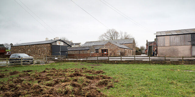
Scorton is home to a few local amenities, including a village shop, post office, and a couple of traditional pubs. The village also boasts a primary school, making it an attractive place for families to settle down.

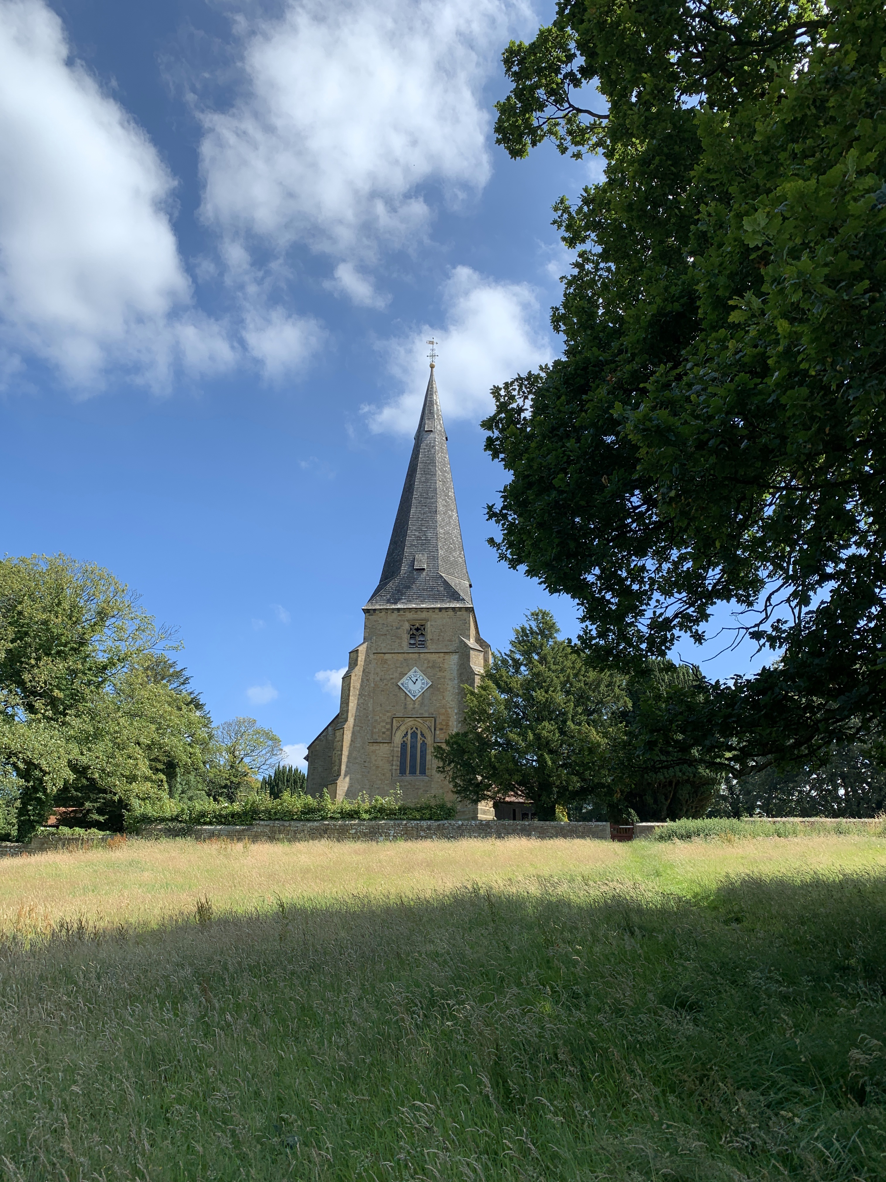
One of the notable landmarks in Scorton is the St. Peter's Church, which dates back to the 19th century. The church is a fine example of Victorian architecture and serves as a focal point for the local community.

The village is also well-known for its annual Scorton Steam Fair, a popular event that attracts visitors from far and wide. The fair showcases a variety of vintage steam-powered vehicles, as well as offering entertainment, food stalls, and family-friendly activities.

Overall, Scorton offers a tranquil and idyllic setting, perfect for those seeking a peaceful retreat in the heart of Lancashire's beautiful countryside.

If you have any feedback on the listing, please let us know in the comments section below.
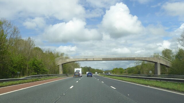
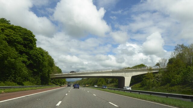
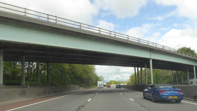
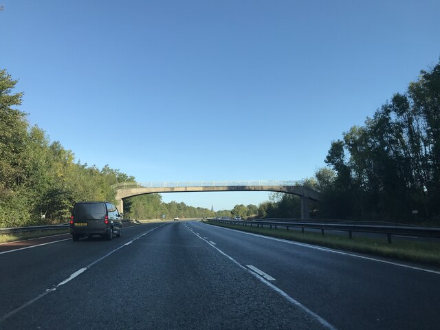
Scorton Images

Images are sourced within 2km of 53.933352/-2.762142 or Grid Reference SD5048. Thanks to Geograph Open Source API. All images are credited.

Station Lane at Scorton View from West Coast Main Line Railway
Station Lane at Scorton
View from West Coast Main Line Railway
Modern Milestone, Lancaster Canal NW of Cabus Nook Bridge, in the parish of Cabus.

Inscription reads: Garstang / 2 // 1819 / 2019 // Lancaster / 11

Milestone Society National ID: LAN-19
Modern Milestone, Lancaster Canal
NW of Cabus Nook Bridge, in the parish of Cabus. Inscription reads: Garstang / 2 // 1819 / 2019 // Lancaster / 11 Milestone Society National ID: LAN-19
Old Holly Farm Old Holly Farm is a family-run working organic dairy farm, which until recently was open to the public with visitor attractions of a nature no longer specified on the farm's website. This aspect of the farm's work was a victim of the Coronavirus Covid-19 pandemic as the owners made the difficult decision not to reopen after the third national lockdown in March 2021.
Old Holly Farm
Old Holly Farm is a family-run working organic dairy farm, which until recently was open to the public with visitor attractions of a nature no longer specified on the farm's website. This aspect of the farm's work was a victim of the Coronavirus Covid-19 pandemic as the owners made the difficult decision not to reopen after the third national lockdown in March 2021.
OS Bench Mark OS flush bracket bench mark on old building on E side of A6. 29.46 m above datum.
OS Bench Mark
OS flush bracket bench mark on old building on E side of A6. 29.46 m above datum.
Milestone Marker 36-21 F (between bridges 74-73), Lancaster Canal Milestone located by the side of the Lancaster Canal
This milestone is 21 miles from the centre of Preston and 36 miles from Kendal

Inscription reads:- 
Garstang / 4 :: Lancaster / 9 

Milestone Society National ID: LAN-21R
Milestone Marker 36-21 F (between bridges 74-73), Lancaster Canal
Milestone located by the side of the Lancaster Canal This milestone is 21 miles from the centre of Preston and 36 miles from Kendal Inscription reads:- Garstang / 4 :: Lancaster / 9 Milestone Society National ID: LAN-21R
Minor road crossing Gubberford Bridge
Old Milestone by the A6, Garstang Road, Cabus Metal plates (one missing) attached to stone post by the A6, in parish of Cabus (Wyre District), Garstang Road; Fowlers Hill where old curve forms a lay-by, in hedge between road and lay-by, beside lamp-post behind wide grass verge, on West side of road. Lancaster twin iron plate, erected by the Garstang & Heronsyke turnpike trust in the 19th century. 

Inscription reads:-
: (LANCASTER / IX / MILES) : : (CABUS) : : GARSTANG / 1¾ / MILES : 
Pivot benchmark on top. 

Milestone Society National ID: LA_LAGS09
Old Milestone by the A6, Garstang Road, Cabus
Metal plates (one missing) attached to stone post by the A6, in parish of Cabus (Wyre District), Garstang Road; Fowlers Hill where old curve forms a lay-by, in hedge between road and lay-by, beside lamp-post behind wide grass verge, on West side of road. Lancaster twin iron plate, erected by the Garstang & Heronsyke turnpike trust in the 19th century. Inscription reads:- : (LANCASTER / IX / MILES) : : (CABUS) : : GARSTANG / 1¾ / MILES : Pivot benchmark on top. Milestone Society National ID: LA_LAGS09
Old Boundary Marker on the A6 Parish Boundary Marker on the west side of the A6 70 metres north of the junction with Middle Holly. On the boundary of Cabus and Cleveley parishes. Cleveley parish became part of Forton parish in 1935. Grade II Listed details <span class="nowrap"><a title="https://historicengland.org.uk/listing/the-list/list-entry/1163288" rel="nofollow ugc noopener" href="https://historicengland.org.uk/listing/the-list/list-entry/1163288">Link</a><img style="margin-left:2px;" alt="External link" title="External link - shift click to open in new window" src="https://s1.geograph.org.uk/img/external.png" width="10" height="10"/></span>. See also <a title="https://www.geograph.org.uk/photo/6038627" href="https://www.geograph.org.uk/photo/6038627">Link</a> for an older photo.

Milestone Society National ID: LA_LAGS07pb
Old Boundary Marker on the A6
Parish Boundary Marker on the west side of the A6 70 metres north of the junction with Middle Holly. On the boundary of Cabus and Cleveley parishes. Cleveley parish became part of Forton parish in 1935. Grade II Listed details LinkExternal link. See also Link for an older photo. Milestone Society National ID: LA_LAGS07pb
Glasshouses
Glasshouses
Daisy Clough Nursery
Footbridge over M6
Footbridge over M6
Bridge over M6 at Scorton
Bridge over M6 northbound
Footbridge - M6 northbound
Snowhill Lane bridge - M6 northbound
Factory Brow bridge - M6 northbound
Wyresdale Lake Part of the estate associated with Wyresdale Park country house.
Wyresdale Lake
Part of the estate associated with Wyresdale Park country house.
Entrance to Wyresdale Park
Show me another place!

Scorton is located at Grid Ref: SD5048 (Lat: 53.933352, Lng: -2.762142)

Administrative County: Lancashire

District: Wyre

Police Authority: Lancashire

What 3 Words

///skidding.alpha.mourner. Near Garstang, Lancashire

Related Wikis

Scorton, Lancashire

Scorton is a small village near the River Wyre, in the Wyre district of Lancashire, England. It is located north of Garstang. The name means "farmstead...

St Peter's Church, Scorton

St Peter's Church is in the village of Scorton, Lancashire, England. It is an active Anglican parish church in the deanery of Garstang, the archdeaconry...

Scorton railway station (Lancashire)

Scorton railway station served the village of Scorton, Lancashire, England, from 1840 to 1939 on the Lancaster and Preston Junction Railway. == History... ==
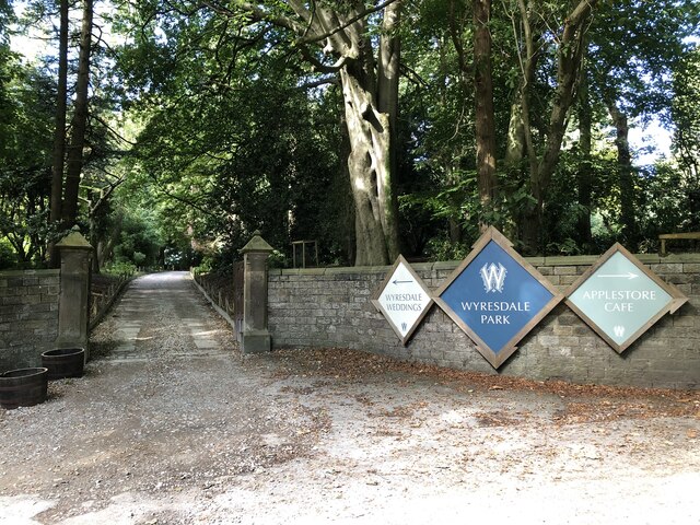
Wyresdale Park

Wyresdale Park is an English country house and licensed wedding ceremony venue located within the Forest of Bowland, to the northeast of Scorton, Lancashire...
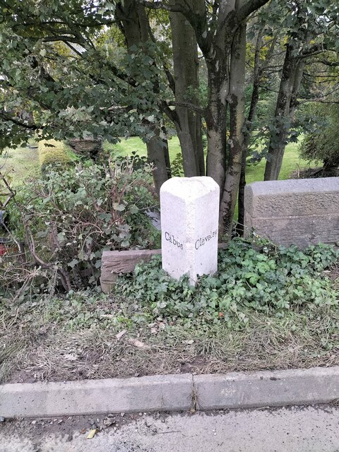
Cabus

Cabus is a village and civil parish in Lancashire, England. It lies 12 miles north of Preston, 9 miles south of Lancaster and 16 miles north east of Blackpool...

Hollins Lane

Hollins Lane is a village near the village of Forton, in the Wyre District, in the English county of Lancashire. The village has the Lancaster and Preston...

Shireshead

Shireshead is a hamlet near Forton, Lancashire. It includes an Anglican church, St James', which was designed by the Leeds-based architectural firm Kelly...

Forton, Lancashire

Forton is a village and civil parish in the Wyre district of the English county of Lancashire near the Forest of Bowland. It is near the A6 road, between...

Nearby Amenities

Located within 500m of 53.933352,-2.762142
Scorton
Place: village
Source: npe
Lat/Long: 53.9325293/-2.7595152
Post Office
Scorton Post Office
Addr Country: GB
Addr Postcode: PR3 1AU
Brand: Post Office
Brand Wikidata: Q1783168
Contact Website: https://www.postoffice.co.uk/branch-finder/2364271/scorton
Ref Pol Id: 9157
Wheelchair: yes
Lat/Long: 53.9331366/-2.759977
Post Box
Collection Times: Mo-Fr 16:45, Sa 10:45
Post Box Type: wall
Postal Code: PR3
Ref: PR3 257
Lat/Long: 53.933135/-2.7599341
Noexit: yes
Lat/Long: 53.9340554/-2.7577601
Noexit: yes
Lat/Long: 53.931306/-2.7617213
Power: tower
Source: Bing
Lat/Long: 53.9330751/-2.7673107
Power: tower
Source: Bing
Lat/Long: 53.9351216/-2.7667957
Restaurant
The Barn, Cafe, Garden Centre and Gift Shop
Addr City: Preston
Addr Postcode: PR3 1AU
Addr Street: The Square
Addr Village: Scorton
Check Date Opening Hours: 2020-07-27
Cuisine: coffee_shop;regional
Indoor Seating: yes
Opening Hours: Mo-Fr 09:00-16:30; Sa 09:00-17:00; Su 10:00-17:00
Outdoor Seating: yes
Website: https://www.plantsandgifts.co.uk/
Lat/Long: 53.932745/-2.7601996
Restaurant
The Priory
Indoor Seating: yes
Outdoor Seating: yes
Lat/Long: 53.9329945/-2.7592475
Barrier: kissing_gate
Lat/Long: 53.9312625/-2.7617609
Barrier: stile
Material: wood
Stile: stepover
Lat/Long: 53.9303811/-2.7670954
Barrier: stile
Material: wood
Stile: stepover
Lat/Long: 53.9304128/-2.7670236
Recycling
Recycling Clothes: yes
Recycling Type: container
Lat/Long: 53.9326568/-2.7593647
Defibrillator
Booth: K6
Covered: booth
Defibrillator Location: Inside old red phone box
Disused Amenity: telephone
Emergency: defibrillator
Indoor: yes
Man Made: telephone_box
Lat/Long: 53.933008/-2.7596354
Grit Bin
Lat/Long: 53.932941/-2.7578512
Grit Bin
Lat/Long: 53.9325023/-2.7564974
Bench
Backrest: yes
Direction: 15
Material: wood
Seats: 3
Lat/Long: 53.9325661/-2.7563231
The Forest of Bowland
Board Type: welcome_sign
Direction: 270
Information: board
Subject Wikidata: Q1406920
Subject Wikipedia: en:Forest of Bowland
Tourism: information
Lat/Long: 53.9325247/-2.7560714
Entrance: main
Lat/Long: 53.9333358/-2.7586616
Historic: memorial
Material: stone
Memorial: war_memorial
Lat/Long: 53.9327498/-2.7592436
Give Way
Direction: backward
Lat/Long: 53.9329248/-2.7598348
Phone
Emergency: phone
Lat/Long: 53.9339662/-2.7573605
Give Way
Direction: forward
Lat/Long: 53.9333602/-2.7598246
Give Way
Direction: forward
Lat/Long: 53.9333426/-2.7597057
The data included in this document is from www.openstreetmap.org. The data is made available under ODbL.

Have you been to Scorton?

Leave your review of Scorton below (or comments, questions and feedback).