Blackwell

Settlement in Durham

England

Blackwell

A repair train seen from Darlington railway station
A repair train seen from Darlington railway station Credit: habiloid

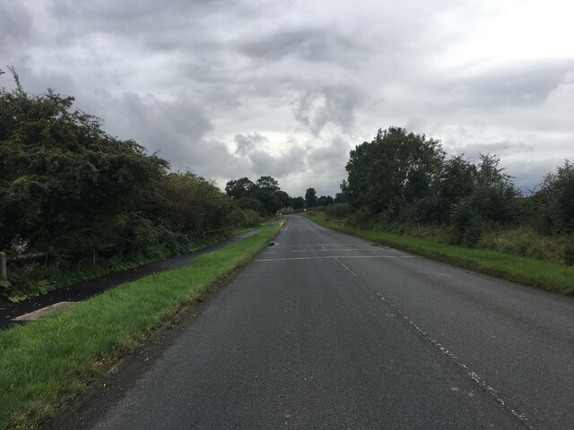
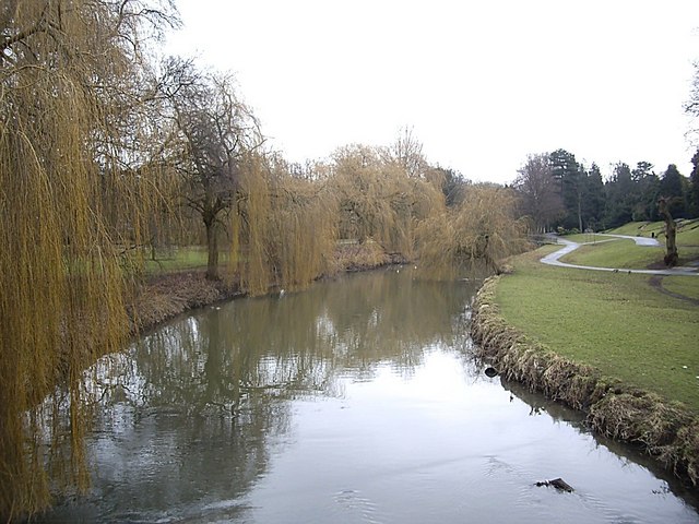
Blackwell is a small village located in County Durham, in the northeast of England. Situated on the outskirts of the city of Durham, Blackwell is known for its picturesque setting and serene atmosphere. The village is nestled in the Wear Valley, surrounded by rolling green hills and countryside, providing residents and visitors with stunning views and a tranquil environment.

Blackwell itself is a close-knit community with a population of around 500 people. It is a predominantly residential area, characterized by traditional stone-built homes and charming cottages. The village maintains a sense of history and heritage, with some of the buildings dating back to the 18th century.

Despite its small size, Blackwell offers a range of amenities to its residents. There is a local church, village hall, and a primary school, providing essential services and a sense of community spirit. For more extensive amenities, residents can easily access nearby Durham City, which offers a variety of shops, restaurants, and leisure facilities.

The surrounding natural beauty of Blackwell provides ample opportunities for outdoor activities. The village is situated near the River Wear, allowing residents to enjoy riverside walks and fishing. Additionally, the nearby countryside offers numerous trails for hiking and cycling enthusiasts.

Overall, Blackwell is a charming village that offers a peaceful and idyllic lifestyle to its residents. Its proximity to Durham City ensures that residents have easy access to urban amenities while enjoying the tranquility of a rural setting.

If you have any feedback on the listing, please let us know in the comments section below.

Blackwell Images

Images are sourced within 2km of 54.510224/-1.575073 or Grid Reference NZ2712. Thanks to Geograph Open Source API. All images are credited.
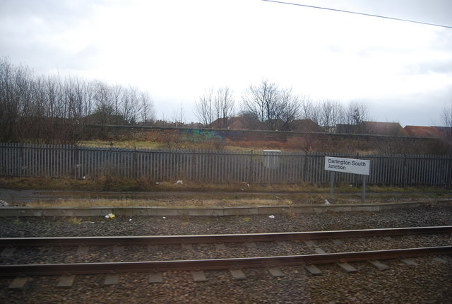
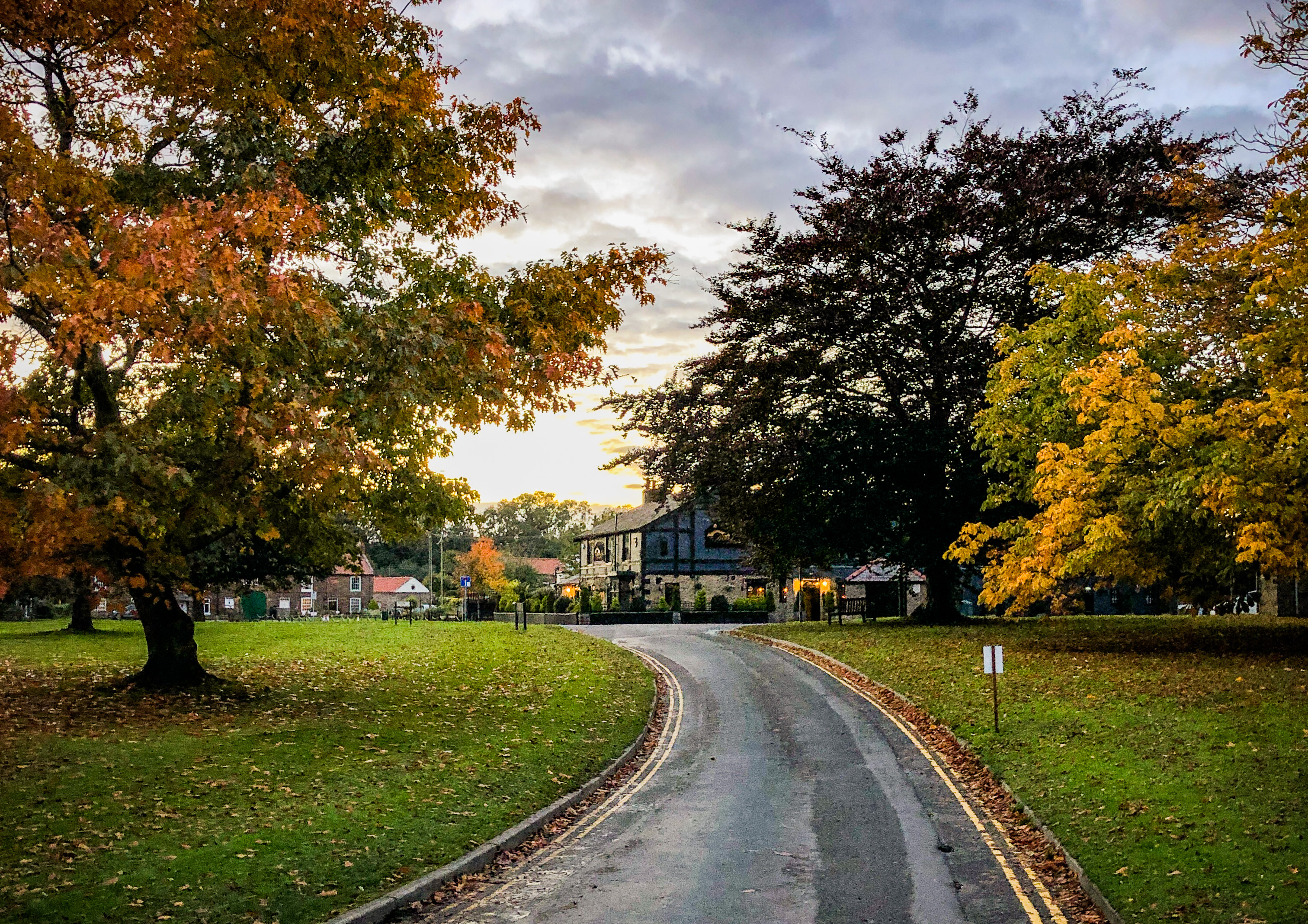
A repair train seen from Darlington railway station
A66 near Darlington
A66 near Darlington
ROBEL Mobile Maintenance Train - units 3 and 2 This one is at Darlington. Network Rail have eight around their system. They are self-propelled and each consists of three units <span class="nowrap"><a title="https://www.robel.com/en/systems-vehicles/information/mobile-maintenance-system/," rel="nofollow ugc noopener" href="https://www.robel.com/en/systems-vehicles/information/mobile-maintenance-system/,">Link</a><img style="margin-left:2px;" alt="External link" title="External link - shift click to open in new window" src="https://s1.geograph.org.uk/img/external.png" width="10" height="10"/></span> and for a video see <span class="nowrap"><a title="https://www.bing.com/videos/search?q=robel+mobile+maintenance+train&&view=detail&mid=B34D68F966240E2AAE37B34D68F966240E2AAE37&&FORM=VRDGAR&ru=%2Fvideos%2Fsearch%3Fq%3Drobel%2520mobile%2520maintenance%2520train%26%26FORM%3DVDVVXX" rel="nofollow ugc noopener" href="https://www.bing.com/videos/search?q=robel+mobile+maintenance+train&&view=detail&mid=B34D68F966240E2AAE37B34D68F966240E2AAE37&&FORM=VRDGAR&ru=%2Fvideos%2Fsearch%3Fq%3Drobel%2520mobile%2520maintenance%2520train%26%26FORM%3DVDVVXX">Link</a><img style="margin-left:2px;" alt="External link" title="External link - shift click to open in new window" src="https://s1.geograph.org.uk/img/external.png" width="10" height="10"/></span>. They allow track maintenance to take place in a protected environment.  This image shows two of the three units; another image shows the third <a href="https://www.geograph.org.uk/photo/7317482">NZ2913 : ROBEL Mobile Maintenance Train - unit 1</a>.
Their identification seems complex, with at least three different sets of numbers e.g., the left-hand unit of this one is:-
69-70 ROBEL Mobile Maintenance Train, and 69-60 Mobile Maintenance Unit
DR 97804
99 70 9580 504-8

The right-hand [middle] unit also has id, but not readable in the photo.

In the other image, which shows the right-hand of the three units, DR97604 is just visible, and then for the right-hand end of the train, the equivalent is :-
69-70 ROBEL Mobile Maintenance Train, and 69-40 Traction and Supply Unit
DR97504
99 70 9481 004-8

All very complex!
ROBEL Mobile Maintenance Train - units 3 and 2
This one is at Darlington. Network Rail have eight around their system. They are self-propelled and each consists of three units LinkExternal link and for a video see LinkExternal link. They allow track maintenance to take place in a protected environment. This image shows two of the three units; another image shows the third NZ2913 : ROBEL Mobile Maintenance Train - unit 1. Their identification seems complex, with at least three different sets of numbers e.g., the left-hand unit of this one is:- 69-70 ROBEL Mobile Maintenance Train, and 69-60 Mobile Maintenance Unit DR 97804 99 70 9580 504-8 The right-hand [middle] unit also has id, but not readable in the photo. In the other image, which shows the right-hand of the three units, DR97604 is just visible, and then for the right-hand end of the train, the equivalent is :- 69-70 ROBEL Mobile Maintenance Train, and 69-40 Traction and Supply Unit DR97504 99 70 9481 004-8 All very complex!
Darlington - Blackwellgate
Blackwell Bridge Cottage, Blackwell Bridge, A66 Ex Toll House on the bridge over the River Tees. Originally serving the Darlington to Middleton Tyas Turnpike Trust.

Milestone Society National ID: YN.STA
Blackwell Bridge Cottage, Blackwell Bridge, A66
Ex Toll House on the bridge over the River Tees. Originally serving the Darlington to Middleton Tyas Turnpike Trust. Milestone Society National ID: YN.STA
Old Milestone by A67, Conniscliffe Road, Broken Brae carpark, near pumping station The Milestone is located on grass verge on the South of the road.  Parish of Low Coniscliffe And Merrybent (Darlington District). Carved stone post, BC/D stone design, erected by the Stockton & Barnard Castle turnpike trust in the 18th Century, part buried underground. An earlier photograph can be found here: <a title="https://www.geograph.org.uk/photo/5624048" href="https://www.geograph.org.uk/photo/5624048">Link</a> 

Inscription reads:-  
BC / (14)  : : D / (2)  

Milestone Society National ID: DU_DABC02
Old Milestone by A67, Conniscliffe Road, Broken Brae carpark, near pumping station
The Milestone is located on grass verge on the South of the road.  Parish of Low Coniscliffe And Merrybent (Darlington District). Carved stone post, BC/D stone design, erected by the Stockton & Barnard Castle turnpike trust in the 18th Century, part buried underground. An earlier photograph can be found here: Link  Inscription reads:- BC / (14) : : D / (2) Milestone Society National ID: DU_DABC02
A rare sight For the benefit of our younger readers this is a "department store", a retail outlet containing a wide mixture of goods offered in room settings or browsable display.  It does not require an internet connection, and if purchased in an instant you can take the goods with you.

This is the only remaining Binns store.  Although the House of Frser purchased the chain in 1953, many retained the original branding.  But now this is the last one.
A rare sight
For the benefit of our younger readers this is a "department store", a retail outlet containing a wide mixture of goods offered in room settings or browsable display. It does not require an internet connection, and if purchased in an instant you can take the goods with you. This is the only remaining Binns store. Although the House of Frser purchased the chain in 1953, many retained the original branding. But now this is the last one.
Beaumont House A modern office block in Darlington
Beaumont House
A modern office block in Darlington
Road towards Stapleton
Road towards Cleasby
Junction with Leafield Road Looking along Park Lane at the junction with Leafield Road.
Junction with Leafield Road
Looking along Park Lane at the junction with Leafield Road.
Bridge on Smithfield Road Traffic lights control traffic passing under the East Coast Mainline south of Darlington Station.
Bridge on Smithfield Road
Traffic lights control traffic passing under the East Coast Mainline south of Darlington Station.
Refurfished Beaumont House Darlington Recently completed refurbishment of office block formerly used by RAC Insurance
Refurfished Beaumont House Darlington
Recently completed refurbishment of office block formerly used by RAC Insurance
Darlington South Junction sign
Darlington South Junction Line to Middlesbrough leaves the East Coast Main Line.
Darlington South Junction
Line to Middlesbrough leaves the East Coast Main Line.
Woodland by the East Coast Main Line south of Darlington South Junction
Woodland by the ECML south of Darlington
Darlington South Junction
Show me another place!

Blackwell is located at Grid Ref: NZ2712 (Lat: 54.510224, Lng: -1.575073)

Unitary Authority: Darlington

Police Authority: Durham

What 3 Words

///that.visit.petal. Near Darlington, Co. Durham

Nearby Locations

Blackwell

Related Wikis

Blackwell Grange Golf Club

Blackwell Grange Golf Club is a golf club situated in the Blackwell area of Darlington, County Durham, in the North East of England. == History == Blackwell...

Blackwell, County Durham

Blackwell is a suburb in the borough of Darlington and the ceremonial county of County Durham, England. It is situated towards the edge of the West End...

Darlington F.C.

Darlington Football Club is an association football club based in Darlington, County Durham, England. As of the 2023–24 season, the team competes in the...

South Park, Darlington

South Park is a historic park in Darlington, County Durham, England. It is Grade II listed with Historic England. == History == The earliest record of...

Polam Hall School

Polam Hall School is a mixed all-through school located in Darlington, County Durham, England. Polam Hall was founded as a Quaker "boarding school" for...

Stapleton-on-Tees

Stapleton or Stapleton-on-Tees (locally [stepəltən], ˈsteɪpltən), is a small village and civil parish on the River Tees, North Yorkshire, England. Historically...

Skerne Park

Skerne Park is a predominantly council owned housing estate in the southern part of the borough of Darlington and the ceremonial county of County Durham...

Feethams

Feethams is a cricket and former football grounds in Darlington, England. The cricket ground has hosted Durham CCC matches.The football ground was the...

Nearby Amenities

Located within 500m of 54.510224,-1.575073
Crossing
Crossing: uncontrolled
Lat/Long: 54.5077561/-1.5715255
Crossing
Crossing: uncontrolled
Lat/Long: 54.507733/-1.5713823
Crossing
Crossing: uncontrolled
Lat/Long: 54.5080682/-1.5706291
Crossing
Crossing: uncontrolled
Lat/Long: 54.5079869/-1.5720186
Crossing
Crossing: uncontrolled
Lat/Long: 54.5079163/-1.5721206
Crossing
Crossing: unmarked
Lat/Long: 54.5079123/-1.5718973
Crossing
Crossing: uncontrolled
Lat/Long: 54.5082228/-1.5705981
Crossing
Crossing: unmarked
Lat/Long: 54.5084309/-1.570768
Blackwell
Place: village
Wikidata: Q4923575
Lat/Long: 54.5102308/-1.5755018
Turning Circle
Lat/Long: 54.5111525/-1.5723073
Turning Circle
Lat/Long: 54.5122205/-1.5725827
Turning Circle
Lat/Long: 54.5140081/-1.574136
Turning Circle
Lat/Long: 54.5085165/-1.5761305
Post Office
Blackwell Post Office
Addr City: Darlington
Addr Postcode: DL3 8QN
Brand: Post Office
Brand Wikidata: Q1783168
Contact Website: https://www.postoffice.co.uk/branch-finder/1573098/blackwell
Opening Hours: Mo-Sa 06:00-21:00; Su 07:00-20:00
Ref Pol Id: 3399
Lat/Long: 54.5122774/-1.5745397
Waste Basket
Lat/Long: 54.5123136/-1.5744116
Post Box
Brand: Royal Mail
Brand Wikidata: Q638098
Operator: Royal Mail
Operator Wikidata: Q638098
Post Box Type: pillar
Ref: DL3 186
Lat/Long: 54.5123521/-1.5744917
Crossing
Crossing: unmarked
Lat/Long: 54.507765/-1.576802
Crossing
Crossing: unmarked
Crossing Island: yes
Tactile Paving: yes
Lat/Long: 54.5113176/-1.5734087
Post Box
Ref: DL3 65
Lat/Long: 54.509228/-1.5779372
Waste Basket
Lat/Long: 54.5125971/-1.5745237
Bicycle Parking
Bicycle Parking: stands
Capacity: 4
Lat/Long: 54.5123485/-1.5744624
Blackwell Store
Addr City: Darlington
Addr Housenumber: 98
Addr Postcode: DL3 8QN
Addr Street: Carmel Road South
Brand: Mace
Brand Wikidata: Q75240338
Fhrs Id: 764246
Shop: convenience
Lat/Long: 54.512251/-1.5745071
Waste Basket
Lat/Long: 54.5117431/-1.5776325
Crossing
Crossing: unmarked
Lat/Long: 54.5080145/-1.5719324
Bus Stop
Naptan AtcoCode: 07605022
Naptan NaptanCode: dloadama
Lat/Long: 54.5069561/-1.5720479
Crossing
Crossing: unmarked
Lat/Long: 54.5084924/-1.5709571
Crossing
Crossing: unmarked
Crossing Island: yes
Lat/Long: 54.5129801/-1.5747091
Crossing
Crossing Island: yes
Tactile Paving: yes
Lat/Long: 54.5143804/-1.5757069
Give Way
Direction: backward
Lat/Long: 54.5124997/-1.5750352
Information: guidepost
Tourism: information
Lat/Long: 54.5126664/-1.5746328
Crossing
Crossing: unmarked
Tactile Paving: yes
Lat/Long: 54.5106367/-1.5731233
The data included in this document is from www.openstreetmap.org. The data is made available under ODbL.

Have you been to Blackwell?

Leave your review of Blackwell below (or comments, questions and feedback).