Salford

Settlement in Lancashire

England

Salford

Entering Mode Wheel Locks – 1978 Taken during one of the Mersey Ferries regular cruises along the Manchester Ship Canal. The locks effectively marked the change from canal to docks. No sign yet of the redevelopment of the area as Salford Quays!
Entering Mode Wheel Locks – 1978 Credit: Alan Murray-Rust

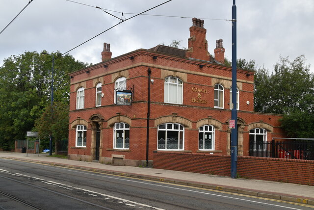
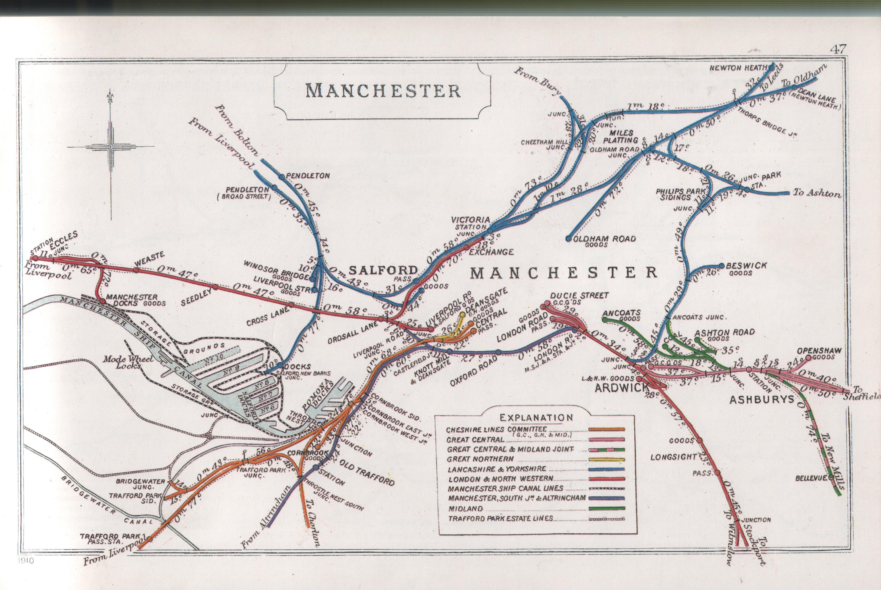
Salford is a city and metropolitan borough located in Greater Manchester, England. It lies approximately 2.5 miles west of Manchester city center, and is bordered by the River Irwell. Historically, Salford was a part of Lancashire, before becoming a separate county borough in 1889. Today, it is one of the oldest industrial areas in the United Kingdom, with a rich history dating back to the Industrial Revolution.

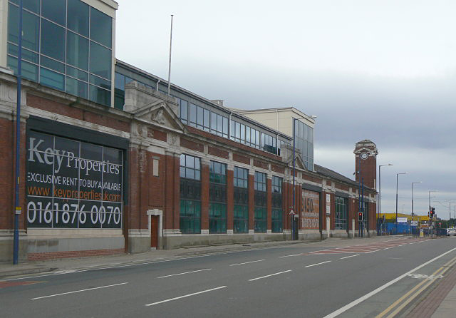
Salford is known for its strong ties to the textile industry, having been a major center for cotton and silk production in the 19th century. This industrial heritage is still visible in its architecture, with numerous old mills and warehouses scattered throughout the city. However, in recent years, Salford has undergone significant regeneration and transformation, attracting new businesses, residential developments, and cultural institutions.

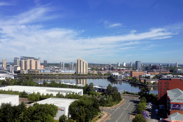
The city is home to several notable landmarks, including the Lowry Theatre and Gallery, named after the renowned artist L.S. Lowry, who famously depicted the industrial landscapes of Salford and Manchester in his paintings. The MediaCityUK complex, located in Salford Quays, has also become a thriving hub for media and creative industries, housing the studios of the BBC and other major broadcasters.

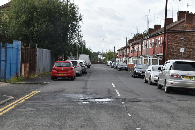
Salford offers a diverse range of housing options, from modern waterfront apartments to traditional Victorian terraces. It is well-connected to other parts of Greater Manchester through an extensive transport network, including tram, bus, and rail services. In terms of education, the University of Salford is a prominent institution, renowned for its courses in science, engineering, and the arts.

Overall, Salford is a city that combines its industrial past with a vibrant present, offering a mix of history, culture, and modern amenities.

If you have any feedback on the listing, please let us know in the comments section below.

Salford Images

Images are sourced within 2km of 53.480643/-2.2949982 or Grid Reference SJ8098. Thanks to Geograph Open Source API. All images are credited.

Entering Mode Wheel Locks – 1978 Taken during one of the Mersey Ferries regular cruises along the Manchester Ship Canal. The locks effectively marked the change from canal to docks. No sign yet of the redevelopment of the area as Salford Quays!
Entering Mode Wheel Locks – 1978
Taken during one of the Mersey Ferries regular cruises along the Manchester Ship Canal. The locks effectively marked the change from canal to docks. No sign yet of the redevelopment of the area as Salford Quays!
Kerrera Drive
Kerrera Drive
Coach & Horses
Coach & Horses
Mole Wheel Rd
Mole Wheel Rd
Foster St
Foster St
Brough Rd
Brough Rd
Weaste Metrolink station Weaste is a tram stop on the Eccles Line of Greater Manchester's light rail Metrolink system. It opened in 1999 as part of Phase 2 of the network's expansion, and is located the Weaste area of the City of Salford.
Weaste Metrolink station
Weaste is a tram stop on the Eccles Line of Greater Manchester's light rail Metrolink system. It opened in 1999 as part of Phase 2 of the network's expansion, and is located the Weaste area of the City of Salford.
Humber St
Humber St
Weaste Metrolink Station Weaste is a tram stop on the Eccles Line of Greater Manchester's light rail Metrolink system. It opened in 1999 as part of Phase 2 of the network's expansion, and is located the Weaste area of the City of Salford.
Weaste Metrolink Station
Weaste is a tram stop on the Eccles Line of Greater Manchester's light rail Metrolink system. It opened in 1999 as part of Phase 2 of the network's expansion, and is located the Weaste area of the City of Salford.
Eccles New Rd The A57 is a major road. It runs east from Liverpool to Lincoln, via Warrington, Salford and Manchester, then through the Pennines over the Snake Pass, around the Ladybower Reservoir, through Sheffield and past Worksop. Within Manchester a short stretch becomes the A57(M) motorway (the Mancunian Way).
Wikipedia: <span class="nowrap"><a title="http://en.wikipedia.org/wiki/A57_road" rel="nofollow ugc noopener" href="http://en.wikipedia.org/wiki/A57_road">Link</a><img style="margin-left:2px;" alt="External link" title="External link - shift click to open in new window" src="https://s1.geograph.org.uk/img/external.png" width="10" height="10"/></span>
Eccles New Rd
The A57 is a major road. It runs east from Liverpool to Lincoln, via Warrington, Salford and Manchester, then through the Pennines over the Snake Pass, around the Ladybower Reservoir, through Sheffield and past Worksop. Within Manchester a short stretch becomes the A57(M) motorway (the Mancunian Way). Wikipedia: LinkExternal link
Hessel St
Hessel St
End of B5228
End of B5228
Glow Apartments Manchester
Westlink Business Park
James Corbett Rd
James Corbett Rd
Sheldar Drive
Sheldar Drive
Eccles New Rd The A57 is a major road. It runs east from Liverpool to Lincoln, via Warrington, Salford and Manchester, then through the Pennines over the Snake Pass, around the Ladybower Reservoir, through Sheffield and past Worksop. Within Manchester a short stretch becomes the A57(M) motorway (the Mancunian Way).
Wikipedia: <span class="nowrap"><a title="http://en.wikipedia.org/wiki/A57_road" rel="nofollow ugc noopener" href="http://en.wikipedia.org/wiki/A57_road">Link</a><img style="margin-left:2px;" alt="External link" title="External link - shift click to open in new window" src="https://s1.geograph.org.uk/img/external.png" width="10" height="10"/></span>
Eccles New Rd
The A57 is a major road. It runs east from Liverpool to Lincoln, via Warrington, Salford and Manchester, then through the Pennines over the Snake Pass, around the Ladybower Reservoir, through Sheffield and past Worksop. Within Manchester a short stretch becomes the A57(M) motorway (the Mancunian Way). Wikipedia: LinkExternal link
Show me another place!

Salford is located at Grid Ref: SJ8098 (Lat: 53.480643, Lng: -2.2949982)

Unitary Authority: Salford

Police Authority: Greater Manchester

What 3 Words

///remark.gravel.ripe. Near Salford, Manchester

Nearby Locations

Salford Weaste

Related Wikis

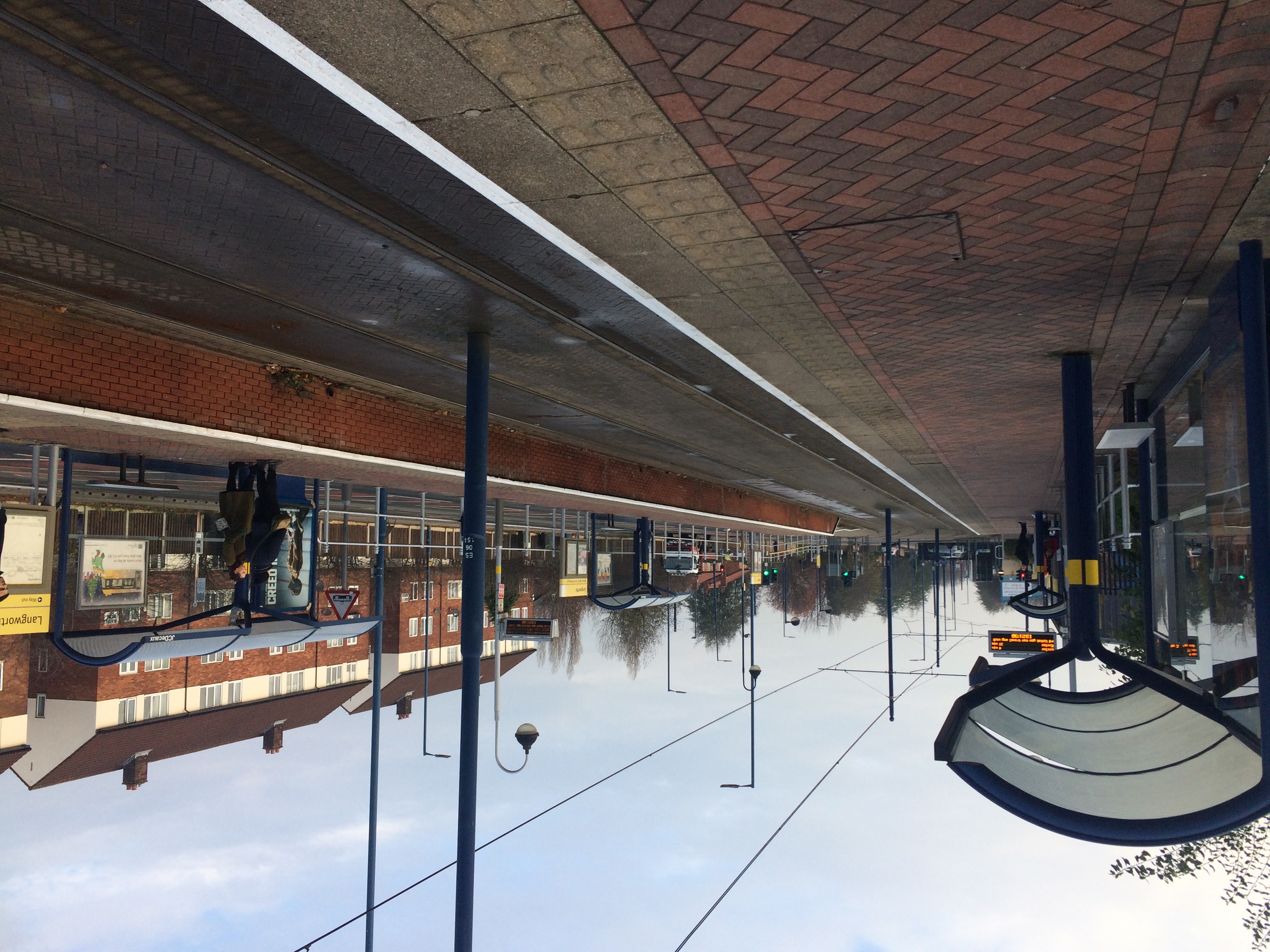
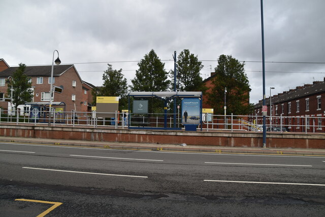
Langworthy tram stop

Langworthy is a tram stop on the Eccles Line of Greater Manchester's light rail Metrolink system. It opened to passengers on 12 June 1999, as part of Phase...

Seedley railway station

Seedley railway station is a disused station located in the Seedley area of Salford, on the former Liverpool and Manchester Railway. The station was opened...

Salford

Salford ( SOL-fərd) is a city in Greater Manchester, England. The city is situated in a meander on the western bank of the River Irwell which forms its...

Weaste

Weaste () is an inner-city suburb of Salford, Greater Manchester, England. In 2014, Weaste and Seedley ward had a population of 12,616. == History == Historically...

Langworthy, Salford

Langworthy is an area of Salford, Greater Manchester. Weaste lies to the west of Langworthy and Pendleton to the east. In 2001 the population of Langworthy...

Aldridge UTC@MediaCityUK

AldridgeUTC@MediaCityUK is a University Technical College for students aged 14–18 (Key Stage 4 and 5) at MediaCityUK Salford Quays, England. The college...

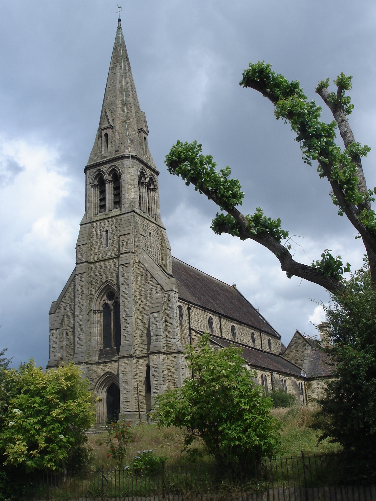
St Luke's Church, Pendleton

St Luke's Church is an Anglican church that stands on raised ground in Liverpool Street, Pendleton, Salford. The church, in the parish of Weaste, Seedley...

Broadway tram stop

Broadway is a tram stop on the Eccles Line of Greater Manchester's light rail Metrolink system. It opened to passengers on 12 June 1999 as part of Phase...

Nearby Amenities

Located within 500m of 53.480643,-2.2949982
Langworthy
Network: Manchester Metrolink
Network Wikidata: Q18548
Operator: Transport for Greater Manchester
Operator Wikidata: Q7834921
Public Transport: stop_position
Railway: tram_stop
Tram: yes
Zone: 2
Lat/Long: 53.4806525/-2.2961659
Traffic Signals
Traffic Signals: signal
Traffic Signals Direction: both
Lat/Long: 53.4835868/-2.2903319
Traffic Signals
Odbl: clean
Lat/Long: 53.4840165/-2.2986042
Bus Stop
Liverpool Street/Knutsford Street
Bus: yes
Naptan AtcoCode: 1800NF04621
Naptan Bearing: E
Naptan CommonName: Liverpool Street/Knutsford Street
Naptan Indicator: Wasteland
Naptan Landmark: HOUSE 468
Naptan NaptanCode: mangjpda
Naptan PlusbusZoneRef: MNCRPIC
Naptan ShortCommonName: Knutsford Street
Naptan Street: Liverpool Street
Naptan Verified: no
Network: TfGM
Public Transport: platform
Source: naptan_import
Lat/Long: 53.4840469/-2.2978115
Bus Stop
Langworthy, South Langworthy Road / Eccles New Road (Stop D)
Bus: yes
Local Ref: D
Naptan AtcoCode: 1800NF09691
Naptan Bearing: S
Naptan CommonName: South Langworthy Road/Eccles New Road
Naptan Indicator: Brooklands House
Naptan Landmark: Brooklands House
Naptan NaptanCode: mantpamd
Naptan Notes: NEW METROLINK REPLACEMENT STOP
Naptan ShortCommonName: Eccles New Road
Naptan Street: South Langworthy Road
Naptan Verified: no
Network: TfGM
Operator: TfGM
Public Transport: platform
Ref: D
Source: naptan_import
Lat/Long: 53.4800407/-2.2949091
Bus Stop
Langworthy, South Langworth Road (Stop E)
Bus: yes
Local Ref: E
Naptan AtcoCode: 1800NF09711
Naptan Bearing: N
Naptan CommonName: South Langworth Road/Carolina Way
Naptan Indicator: Pennington House
Naptan Landmark: PENNINGTON HSE
Naptan NaptanCode: mantpama
Naptan Notes: NEW METROLINK REPLACEMENT STOP
Naptan ShortCommonName: Carolina Way
Naptan Street: South Langworthy Road
Naptan Verified: no
Network: TfGM
Operator: TfGM
Public Transport: platform
Ref: E
Source: naptan_import
Lat/Long: 53.4790773/-2.2955605
Bus Stop
Langworthy Road/Liverpool Street
Bus: yes
Naptan AtcoCode: 1800NF30641
Naptan Bearing: N
Naptan CommonName: Langworthy Road/Liverpool Street
Naptan Indicator: Chemist
Naptan Landmark: CHEMIST
Naptan NaptanCode: mangmpwj
Naptan PlusbusZoneRef: MNCRPIC
Naptan ShortCommonName: Liverpool Street
Naptan Street: LANGWORTHY ROAD
Naptan Verified: no
Network: TfGM
Public Transport: platform
Source: naptan_import
Lat/Long: 53.4841781/-2.2947832
Bus Stop
Liverpool Street/Littlewood Street
Bus: yes
Naptan AtcoCode: 1800NF30651
Naptan Bearing: W
Naptan CommonName: Liverpool Street/Littlewood Street
Naptan Indicator: House 463
Naptan Landmark: HOUSE 467
Naptan NaptanCode: mangmpwm
Naptan PlusbusZoneRef: MNCRPIC
Naptan ShortCommonName: Littlewood Street
Naptan Street: Liverpool Street
Naptan Verified: no
Network: TfGM
Public Transport: platform
Source: naptan_import
Lat/Long: 53.4838179/-2.2958206
Bus Stop
Eccles New Road/Kirkham Street
Bus: yes
Naptan AtcoCode: 1800NF29681
Naptan Bearing: W
Naptan CommonName: Eccles New Road/Kirkham Street
Naptan Indicator: Grassland
Naptan Landmark: GRASSLAND
Naptan NaptanCode: mangmjdm
Naptan PlusbusZoneRef: MNCRPIC
Naptan ShortCommonName: Kirkham Street
Naptan Street: ECCLES NEW ROAD
Naptan Verified: no
Network: TfGM
Public Transport: platform
Source: naptan_import
Lat/Long: 53.4812002/-2.3003081
Bus Stop
Eccles New Road/Kirkham Street
Bus: yes
Naptan AtcoCode: 1800NF29691
Naptan Bearing: E
Naptan CommonName: Eccles New Road/Kirkham Street
Naptan Indicator: Opp The Royal
Naptan Landmark: OPP THE ROYAL
Naptan NaptanCode: mangmjdp
Naptan PlusbusZoneRef: MNCRPIC
Naptan ShortCommonName: Kirkham Street
Naptan Street: ECCLES NEW ROAD
Naptan Verified: no
Network: TfGM
Public Transport: platform
Source: naptan_import
Lat/Long: 53.4814122/-2.3005091
Bus Stop
Eccles New Rd/Langworthy Tram Stop (A)
Bus: yes
Local Ref: A
Naptan AtcoCode: 1800NF29701
Naptan Bearing: E
Naptan CommonName: Eccles New Rd/Langworthy Tram Stop (A)
Naptan Indicator: Stop A
Naptan Landmark: STOWELL HOUSE
Naptan NaptanCode: mangmjdt
Naptan PlusbusZoneRef: MNCRPIC
Naptan ShortCommonName: Langworthy Tram
Naptan Street: ECCLES NEW ROAD
Naptan Verified: no
Network: TfGM
Public Transport: platform
Source: naptan_import
Lat/Long: 53.4808687/-2.2962673
Bus Stop
Langworthy, Langworthy Road (Stop B)
Bus: yes
Local Ref: B
Naptan AtcoCode: 1800NF29711
Naptan Bearing: S
Naptan CommonName: Langworthy Rd/Eccles New Rd (Stop B)
Naptan Indicator: Stop B
Naptan Landmark: OP HOUSE 30
Naptan NaptanCode: mangmjga
Naptan PlusbusZoneRef: MNCRPIC
Naptan ShortCommonName: Eccles New Rd
Naptan Street: LANGWORTHY ROAD
Naptan Verified: no
Network: TfGM
Operator: TfGM
Public Transport: platform
Source: naptan_import
Lat/Long: 53.481268/-2.2946477
Bus Stop
Eccles New Rd/South Langworthy Rd (C)
Bus: yes
Local Ref: C
Naptan AtcoCode: 1800NF29721
Naptan Bearing: W
Naptan CommonName: Eccles New Rd/South Langworthy Rd (C)
Naptan Indicator: Stop C
Naptan Landmark: CARLTON HOUSE
Naptan NaptanCode: mangmjgd
Naptan PlusbusZoneRef: MNCRPIC
Naptan ShortCommonName: South Langworthy
Naptan Street: ECCLES NEW ROAD
Naptan Verified: no
Network: TfGM
Public Transport: platform
Source: naptan_import
Lat/Long: 53.4803534/-2.2938004
Bus Stop
Eccles New Road/Kielder Square
Bus: yes
Naptan AtcoCode: 1800NF29731
Naptan Bearing: E
Naptan CommonName: Eccles New Road/Kielder Square
Naptan Indicator: Flats
Naptan Landmark: FLATS 1-21
Naptan NaptanCode: mangmjgj
Naptan PlusbusZoneRef: MNCRPIC
Naptan ShortCommonName: Kielder Square
Naptan Street: ECCLES NEW ROAD
Naptan Verified: no
Network: TfGM
Public Transport: platform
Source: naptan_import
Lat/Long: 53.4803037/-2.2921044
Bus Stop
Eccles New Road/St. James Park
Bus: yes
Naptan AtcoCode: 1800NF29741
Naptan Bearing: E
Naptan CommonName: Eccles New Road/St. James Park
Naptan Indicator: Op Ta
Naptan Landmark: FLATS
Naptan NaptanCode: mangmjgm
Naptan PlusbusZoneRef: MNCRPIC
Naptan ShortCommonName: St. James Park
Naptan Street: ECCLES NEW ROAD
Naptan Verified: no
Network: TfGM
Public Transport: platform
Source: naptan_import
Lat/Long: 53.479762/-2.2880546
Bus Stop
Eccles New Road/St. James Park
Bus: yes
Naptan AtcoCode: 1800NF29751
Naptan Bearing: W
Naptan CommonName: Eccles New Road/St. James Park
Naptan Indicator: Nr The Waverley
Naptan Landmark: HALDANE BARRCKS
Naptan NaptanCode: mangmjgp
Naptan PlusbusZoneRef: MNCRPIC
Naptan ShortCommonName: St. James Park
Naptan Street: ECCLES NEW ROAD
Naptan Verified: no
Network: TfGM
Public Transport: platform
Shelter: no
Source: naptan_import
Lat/Long: 53.4795944/-2.2880612
Bus Stop
Liverpool Street/Fitzwarren Street
Bus: yes
Naptan AtcoCode: 1800NF29831
Naptan Bearing: E
Naptan CommonName: Liverpool Street/Fitzwarren Street
Naptan Indicator: Op Lees Mission
Naptan Landmark: PRIMARY SCHOOL
Naptan NaptanCode: mangmjmt
Naptan PlusbusZoneRef: MNCRPIC
Naptan ShortCommonName: Fitzwarren Street
Naptan Street: Liverpool Street
Naptan Verified: no
Network: TfGM
Public Transport: platform
Source: naptan_import
Lat/Long: 53.4836003/-2.2894325
Bus Stop
Pendleton, Liverpool Street / adjacent Langworthy Road
Bus: yes
Naptan AtcoCode: 1800NF29841
Naptan Bearing: E
Naptan CommonName: Liverpool Street/Langworthy Road
Naptan Indicator: Op Community Cn
Naptan Landmark: BOWLING GREEN
Naptan NaptanCode: mangmjmw
Naptan PlusbusZoneRef: MNCRPIC
Naptan ShortCommonName: Langworthy Road
Naptan Street: Liverpool Street
Naptan Verified: no
Network: TfGM
Operator: TfGM
Public Transport: platform
Source: naptan_import
Lat/Long: 53.4838055/-2.2935744
Bus Stop
Seedley, Langworthy Road / near Liverpool Street
Bus: yes
Naptan AtcoCode: 1800NF29851
Naptan Bearing: S
Naptan CommonName: Langworthy Road/Liverpool Street
Naptan Indicator: Os House 58
Naptan Landmark: HOUSE 60
Naptan NaptanCode: mangmjpa
Naptan Notes: NAME AMENDED
Naptan PlusbusZoneRef: MNCRPIC
Naptan ShortCommonName: LiverpooL Street
Naptan Street: LANGWORTHY ROAD
Naptan Verified: no
Network: TfGM
Operator: TfGM
Public Transport: platform
Source: naptan_import
Lat/Long: 53.4832548/-2.2945646
Bus Stop
Langford, South Langworthy Road / opposite Montford Street
Bus: yes
Naptan AtcoCode: 1800NF01751
Naptan Bearing: N
Naptan CommonName: South Langworthy Road/Montford Street
Naptan Indicator: Cromadex
Naptan Landmark: CROMADEX
Naptan NaptanCode: mangjgmw
Naptan PlusbusZoneRef: MNCRPIC
Naptan ShortCommonName: Montford Street
Naptan Street: S Langworthy Road
Naptan Verified: no
Network: TfGM
Operator: TfGM
Public Transport: platform
Source: naptan_import
Lat/Long: 53.4783341/-2.295825
Noexit: yes
Lat/Long: 53.4795301/-2.2898084
Noexit: yes
Lat/Long: 53.4780999/-2.2903233
Noexit: yes
Lat/Long: 53.4784803/-2.2894032
Turning Circle
Lat/Long: 53.4796681/-2.3016938
Traffic Calming: hump
Lat/Long: 53.48258/-2.2938732
Noexit: yes
Lat/Long: 53.477722/-2.2951558
Noexit: yes
Lat/Long: 53.4771984/-2.2953328
Noexit: yes
Lat/Long: 53.4766109/-2.2936966
Crossing
Crossing: marked
Lat/Long: 53.4781777/-2.2991951
Traffic Signals
Traffic Signals: signal
Traffic Signals Direction: forward
Lat/Long: 53.4802082/-2.2951574
Bus Stop
Langworthy, South Langworthy Road / opposite Dakota Avenue
Bus: yes
Departures Board: timetable
Naptan AtcoCode: 1800NF10381
Naptan Bearing: N
Naptan Landmark: UK ASSISTANCE
Naptan NaptanCode: MANTWMJD
Naptan Street: S Langworthy Road
Network: TfGM
Operator: TfGM
Public Transport: platform
Shelter: yes
Lat/Long: 53.4767283/-2.2964385
Railway: level_crossing
Lat/Long: 53.4812124/-2.2997856
Railway: crossing
Lat/Long: 53.4804123/-2.2952499
Noexit: yes
Lat/Long: 53.4773587/-2.2922442
Noexit: yes
Lat/Long: 53.4786524/-2.2915488
Noexit: yes
Lat/Long: 53.4791021/-2.2900604
Noexit: yes
Lat/Long: 53.4791108/-2.2895015
Noexit: yes
Lat/Long: 53.4791586/-2.2915801
Noexit: yes
Lat/Long: 53.4792412/-2.292161
Noexit: yes
Lat/Long: 53.4792825/-2.2903819
Noexit: yes
Lat/Long: 53.4793086/-2.2927053
Noexit: yes
Lat/Long: 53.4796979/-2.2914678
Crossing
Crossing: traffic_signals
Crossing Ref: pelican
Lat/Long: 53.4797989/-2.2890151
Noexit: yes
Lat/Long: 53.47985/-2.2919345
Noexit: yes
Lat/Long: 53.4798565/-2.2924971
Noexit: yes
Lat/Long: 53.4802186/-2.2969235
Noexit: yes
Lat/Long: 53.478677/-2.2958694
Noexit: yes
Lat/Long: 53.4790326/-2.2957371
Noexit: yes
Lat/Long: 53.4798631/-2.2959932
Noexit: yes
Lat/Long: 53.4800815/-2.2958737
Noexit: yes
Lat/Long: 53.4800866/-2.2945892
Noexit: yes
Lat/Long: 53.4776753/-2.2928422
Noexit: yes
Lat/Long: 53.4766634/-2.2917436
Noexit: yes
Lat/Long: 53.476823/-2.293223
Noexit: yes
Lat/Long: 53.4762298/-2.2940674
Noexit: yes
Lat/Long: 53.4782279/-2.2984921
Noexit: yes
Lat/Long: 53.4799128/-2.2948798
Noexit: yes
Lat/Long: 53.4800505/-2.2948305
Noexit: yes
Lat/Long: 53.479966/-2.2941395
Noexit: yes
Lat/Long: 53.479777/-2.2949446
Noexit: yes
Lat/Long: 53.479654/-2.2949724
Noexit: yes
Lat/Long: 53.478173/-2.2906377
Noexit: yes
Lat/Long: 53.478203/-2.2896943
Noexit: yes
Lat/Long: 53.4784895/-2.2907777
Noexit: yes
Lat/Long: 53.4763598/-2.2954075
Noexit: yes
Lat/Long: 53.4764115/-2.2959914
Noexit: yes
Lat/Long: 53.4766445/-2.2956125
Noexit: yes
Lat/Long: 53.4767905/-2.2953454
Noexit: yes
Lat/Long: 53.476809/-2.2944415
Traffic Calming: hump
Lat/Long: 53.4821702/-2.2942562
Social Facility
Salford ATC
Operator: Air Training Corps
Lat/Long: 53.4807436/-2.2918502
Traffic Signals
Traffic Signals: signal
Traffic Signals Direction: forward
Lat/Long: 53.4807064/-2.2954728
Crossing
Crossing: uncontrolled
Kerb: lowered
Tactile Paving: yes
Lat/Long: 53.4795529/-2.2951912
Fast Food
How How
Addr City: Salford
Addr Housenumber: 553
Addr Postcode: M6 5GY
Addr Street: Liverpool Street
Cuisine: chinese
Description: Chinese Takeaway/Chip Shop
Fhrs Id: 120447
Fixme Addr2: 553 Liverpool Street
Opening Hours: Tu,We 11:30-13:30,17:00-23:30; Th,Fr 11:30-13:30,16:30-23:30; Sa,Su 17:00-23:30
Phone: +44 1617371769
Source Addr: FHRS Open Data
Lat/Long: 53.4839449/-2.2988494
Street Lamp
Lamp Model: Philips MA60
Lamp Type: SOX
Source: Personal memory
Lat/Long: 53.4809075/-2.2876664
Street Lamp
Lamp Model: Philips MA60
Lamp Type: SOX
Source: Personal memory
Lat/Long: 53.4809764/-2.2881824
Street Lamp
Lamp Model: Philips MA60
Lamp Type: SOX
Source: Personal memory
Lat/Long: 53.4810428/-2.2887035
Street Lamp
Lamp Model: Philips MA60
Lamp Type: SOX
Source: Personal memory
Lat/Long: 53.4811093/-2.2892162
Street Lamp
Lamp Model: Philips MA60
Lamp Type: SOX
Source: Personal memory
Lat/Long: 53.4811769/-2.2897368
Street Lamp
Lamp Model: Philips MA60
Lamp Type: SOX
Source: Personal memory
Lat/Long: 53.4813097/-2.2907554
Street Lamp
Lamp Model: Philips MA60
Lamp Type: SOX
Source: Personal memory
Lat/Long: 53.481377/-2.2912681
Street Lamp
Lamp Model: Philips MA60
Lamp Type: SOX
Source: Personal memory
Lat/Long: 53.4814437/-2.291783
Street Lamp
Lamp Model: Philips MA60
Lamp Type: SOX
Source: Personal memory
Lat/Long: 53.4815108/-2.2923002
Street Lamp
Lamp Model: Philips MA60
Lamp Type: SOX
Source: Personal memory
Lat/Long: 53.4816433/-2.2933284
Street Lamp
Lamp Model: Philips MA60
Lamp Type: SOX
Source: Personal memory
Lat/Long: 53.4815765/-2.2928167
Street Lamp
Lamp Model: Philips MA60
Lamp Type: SOX
Source: Personal memory
Lat/Long: 53.4817111/-2.2938494
Street Lamp
Lamp Model: Philips MA60
Lamp Type: SOX
Source: Personal memory
Lat/Long: 53.4817795/-2.294362
Street Lamp
Lamp Model: Philips MA60
Lamp Type: SOX
Source: Personal memory
Lat/Long: 53.481846/-2.2948841
Street Lamp
Lamp Model: Philips MA60
Lamp Type: SOX
Source: Personal memory
Lat/Long: 53.4819202/-2.2954567
Street Lamp
Lamp Model: Philips MA60
Lamp Type: SOX
Source: Personal memory
Lat/Long: 53.481985/-2.2959551
Street Lamp
Lamp Model: Philips MA60
Lamp Type: SOX
Source: Personal memory
Lat/Long: 53.4820507/-2.2964693
Street Lamp
Lamp Model: Philips MA60
Lamp Type: SOX
Source: Personal memory
Lat/Long: 53.4821255/-2.2970256
Street Lamp
Lamp Model: Philips MA60
Lamp Type: SOX
Source: Personal memory
Lat/Long: 53.4821929/-2.2975519
Street Lamp
Lamp Model: Philips MA60
Lamp Type: SOX
Source: Personal memory
Lat/Long: 53.4822619/-2.2980815
Street Lamp
Lamp Model: Philips MA60
Lamp Type: SOX
Source: Personal memory
Lat/Long: 53.4823329/-2.2986241
Street Lamp
Lamp Model: Philips MA60
Lamp Type: SOX
Source: Personal memory
Lat/Long: 53.4823985/-2.2991376
Street Lamp
Lamp Model: Philips MA60
Lamp Type: SOX
Source: Personal memory
Lat/Long: 53.4824691/-2.2996827
Street Lamp
Lamp Model: Philips MA60
Lamp Type: SOX
Source: Personal memory
Lat/Long: 53.4825383/-2.3002218
Street Lamp
Lamp Model: Philips MA60
Lamp Type: SOX
Source: Personal memory
Lat/Long: 53.4826076/-2.3007536
Street Lamp
Lamp Model: Philips MA60
Lamp Type: SOX
Source: Personal memory
Lat/Long: 53.4826764/-2.3012932
Crossing Barrier: no
Railway: level_crossing
Lat/Long: 53.4809586/-2.2975172
Langworthy
Network: Manchester Metrolink
Network Wikidata: Q18548
Operator: Transport for Greater Manchester
Operator Wikidata: Q7834921
Public Transport: stop_position
Railway: tram_stop
Tram: yes
Zone: 2
Lat/Long: 53.480623/-2.2961742
Bus Stop
Langworthy, South Langworthy Avenue / opposite Kansas Avenue
Bus: yes
Departures Board: timetable
Naptan AtcoCode: 1800NF01711
Naptan Bearing: S
Naptan Landmark: CITY COLLEGE
Naptan NaptanCode: MANGJGMD
Naptan Street: S Langworthy Road
Network: TfGM
Operator: TfGM
Public Transport: platform
Shelter: yes
Lat/Long: 53.4776933/-2.2958233
Noexit: yes
Lat/Long: 53.4809/-2.2904397
Traffic Signals
Traffic Signals: signal
Traffic Signals Direction: forward
Lat/Long: 53.4804528/-2.2946782
Railway: crossing
Lat/Long: 53.4805102/-2.2954216
Railway: crossing
Lat/Long: 53.4805501/-2.2954096
Crossing
Crossing: traffic_signals
Crossing Barrier: no
Railway: crossing
Lat/Long: 53.4807595/-2.2971319
Crossing
Crossing: traffic_signals
Crossing Barrier: no
Railway: crossing
Lat/Long: 53.4807922/-2.2971012
Traffic Signals
Traffic Signals: signal
Traffic Signals Direction: forward
Lat/Long: 53.4810118/-2.2972783
Traffic Signals
Traffic Signals: signal
Traffic Signals Direction: forward
Lat/Long: 53.481009/-2.2978929
Traffic Signals
Traffic Signals: signal
Traffic Signals Direction: backward
Lat/Long: 53.480742/-2.2973646
Noexit: yes
Lat/Long: 53.481872/-2.2900417
Noexit: yes
Lat/Long: 53.4775973/-2.2983568
Noexit: yes
Lat/Long: 53.4779413/-2.2982335
Noexit: yes
Lat/Long: 53.478046/-2.2981544
Crossing
Crossing: uncontrolled
Kerb: lowered
Tactile Paving: yes
Lat/Long: 53.4762485/-2.2962908
Crossing
Crossing: uncontrolled
Kerb: lowered
Tactile Paving: yes
Lat/Long: 53.4792728/-2.2955206
Crossing
Kerb: lowered
Lat/Long: 53.480118/-2.2952881
Crossing
Crossing: uncontrolled
Kerb: lowered
Tactile Paving: yes
Lat/Long: 53.4769618/-2.2960785
Crossing
Crossing: uncontrolled
Kerb: lowered
Tactile Paving: yes
Lat/Long: 53.4786045/-2.2955229
Crossing
Crossing: uncontrolled
Kerb: lowered
Tactile Paving: no
Lat/Long: 53.476344/-2.2934161
Crossing
Crossing: traffic_signals
Crossing Ref: pelican
Kerb: lowered
Tactile Paving: yes
Lat/Long: 53.4840748/-2.2995656
Noexit: yes
Lat/Long: 53.4776188/-2.2989683
Noexit: yes
Lat/Long: 53.4775025/-2.2923554
Noexit: yes
Lat/Long: 53.4773629/-2.2924069
Noexit: yes
Lat/Long: 53.4777402/-2.2923126
Generator Method: photovoltaic
Generator Output Electricity: yes
Generator Source: solar
Generator Type: solar_photovoltaic_panel
Location: roof
Power: generator
Lat/Long: 53.4786431/-2.2892708
Noexit: yes
Lat/Long: 53.4769604/-2.2909782
Crossing Barrier: no
Railway: level_crossing
Lat/Long: 53.4808323/-2.2973348
Crossing Barrier: no
Railway: level_crossing
Lat/Long: 53.4808837/-2.2973179
Post Box
Brand: Royal Mail
Brand Wikidata: Q638098
Brand Wikipedia: en:Royal Mail
Drive Through: no
Operator: Royal Mail
Operator Wikidata: Q638098
Ref: M5 138
Lat/Long: 53.4817269/-2.3020247
Post Box
Brand: Royal Mail
Brand Wikidata: Q638098
Brand Wikipedia: en:Royal Mail
Drive Through: no
Operator: Royal Mail
Operator Wikidata: Q638098
Ref: M5 244
Lat/Long: 53.4803032/-2.2930124
Post Box
Brand: Royal Mail
Brand Wikidata: Q638098
Brand Wikipedia: en:Royal Mail
Drive Through: no
Operator: Royal Mail
Operator Wikidata: Q638098
Ref: M5 847
Lat/Long: 53.4818977/-2.2884902
Waste Basket
Waste: trash
Lat/Long: 53.4840576/-2.2948042
Restaurant
Food Cycle Salford Langworthy
Addr City: Salford
Addr Housename: Langworthy Cornerstone
Addr Housenumber: 451
Addr Postcode: M6 5QQ
Addr Street: Liverpool Street
Email: langworthy@foodcycle.org.uk
Fhrs Id: 1039104
Microbrewery: no
Opening Hours: Tu 18:00-21:00
Opening Hours Kitchen: Tu 18:00-21:00
Operator: Food Cycle
Outdoor Seating: no
Website: https://www.foodcycle.org.uk/location/langworthy/
Wheelchair: yes
Lat/Long: 53.4836638/-2.2941913
Fast Food
Flame and Grill
Addr City: Salford
Addr Housenumber: 457
Addr Postcode: M6 5QQ
Addr Street: Liverpool Road
Fhrs Id: 621008
Lat/Long: 53.4838705/-2.2975335
Fast Food
Spice Palace
Addr City: Salford
Addr Housenumber: 485
Addr Postcode: M6 5QQ
Addr Street: Liverpool Road
Fhrs Id: 56127
Lat/Long: 53.4838656/-2.2974439
Beauty Life Salon
Addr City: Salford
Addr Housenumber: 515
Addr Postcode: M6 5QQ
Addr Street: Liverpool Road
Shop: beauty
Lat/Long: 53.4839154/-2.2982715
Fast Food
Tandoori House
Addr City: Salford
Addr Housenumber: 513
Addr Postcode: M6 5QQ
Addr Street: Liverpool Road
Cuisine: indian
Fhrs Id: 99572
Outdoor Seating: yes
Lat/Long: 53.4839116/-2.2981989
Fast Food
The Chippy
Addr City: Salford
Addr Housenumber: 511
Addr Postcode: M6 5QQ
Addr Street: Liverpool Road
Cuisine: fish_and_chips
Fhrs Id: 65822
Outdoor Seating: yes
Lat/Long: 53.483907/-2.2981253
Fast Food
Tuckers Sandwiches
Addr City: Salford
Addr Housenumber: 509
Addr Postcode: M6 5QQ
Addr Street: Liverpool Road
Cuisine: sandwich
Fhrs Id: 129914
Outdoor Seating: yes
Lat/Long: 53.4839033/-2.2980516
William Hill
Addr City: Salford
Addr Housenumber: 507
Addr Postcode: M6 5QQ
Addr Street: Liverpool Road
Brand: William Hill
Brand Wikidata: Q4053147
Brand Wikipedia: en:William Hill (bookmaker)
Operator: William Hill
Shop: bookmaker
Lat/Long: 53.4838958/-2.2979393
Cafe
Chimney Pots Cafe
Addr City: Salford
Addr Housename: Langworthy Cornerstone
Addr Housenumber: 451
Addr Postcode: M6 5QQ
Addr Street: Liverpool Street
Fhrs Id: 51221
Lat/Long: 53.483542/-2.2944335
Noexit: yes
Lat/Long: 53.4833313/-2.2916702
Noexit: yes
Lat/Long: 53.4834074/-2.2930817
Noexit: yes
Lat/Long: 53.4833866/-2.2926222
Traffic Calming: hump
Lat/Long: 53.4820015/-2.293614
Give Way
Lat/Long: 53.4816606/-2.2880877
Noexit: yes
Lat/Long: 53.4799731/-2.2912721
Railway: crossing
Lat/Long: 53.4815531/-2.3023937
Crossing
Crossing: traffic_signals
Crossing Ref: pelican
Lat/Long: 53.4815738/-2.3023864
Railway: crossing
Lat/Long: 53.4815874/-2.3023815
Street Lamp
Lamp Model: Philips MA60
Lamp Type: SOX
Source: Personal memory
Lat/Long: 53.4812441/-2.2902482
Bus Stop
ATHOLE Street/Primrose Close
Bus: yes
Naptan AtcoCode: 1800NF02961
Naptan Bearing: N
Naptan NaptanCode: MANGJMDJ
Naptan Street: Athole Street
Network: TfGM
Public Transport: platform
Lat/Long: 53.4828671/-2.2904929
Bus Stop
Langworthy, Langworthy Road (Stop D)
Bus: yes
Local Ref: D
Naptan AtcoCode: 1800NF09931
Naptan Bearing: N
Naptan Landmark: HOUSE 32
Naptan NaptanCode: MANTPTGJ
Naptan Street: Langworthy Road
Network: TfGM
Operator: TfGM
Public Transport: platform
Lat/Long: 53.4811394/-2.2949112
Cycleway: asl
Lat/Long: 53.4835773/-2.2901459
Cycleway: asl
Lat/Long: 53.4835983/-2.2905501
Crossing
Crossing: traffic_signals
Crossing Island: no
Kerb: lowered
Tactile Paving: yes
Wheelchair: yes
Lat/Long: 53.4834803/-2.2903441
Barrier: kerb
Kerb: lowered
Tactile Paving: yes
Wheelchair: yes
Lat/Long: 53.4834829/-2.2903847
Barrier: kerb
Kerb: lowered
Tactile Paving: yes
Wheelchair: yes
Lat/Long: 53.4834777/-2.2902955
Noexit: yes
Lat/Long: 53.483382/-2.2894792
Traffic Calming: hump
Lat/Long: 53.4819649/-2.2925871
Give Way
Lat/Long: 53.4819704/-2.292028
Give Way
Lat/Long: 53.4820087/-2.2929853
Give Way
Lat/Long: 53.4821623/-2.2945414
Give Way
Lat/Long: 53.482163/-2.2940044
Traffic Calming: hump
Lat/Long: 53.4832397/-2.293298
Give Way
Lat/Long: 53.4831907/-2.2928938
Traffic Calming: hump
Lat/Long: 53.4831737/-2.2922679
Traffic Calming: hump
Lat/Long: 53.4831455/-2.2916656
Give Way
Lat/Long: 53.4831371/-2.2919829
Traffic Calming: hump
Lat/Long: 53.4831804/-2.2903967
Give Way
Lat/Long: 53.4830644/-2.2904711
Give Way
Lat/Long: 53.4825018/-2.2904723
Give Way
Lat/Long: 53.4819206/-2.290628
Traffic Calming: hump
Lat/Long: 53.4819105/-2.2910903
Traffic Calming: hump
Lat/Long: 53.4819346/-2.2917396
Give Way
Lat/Long: 53.4819504/-2.2914345
Traffic Calming: hump
Lat/Long: 53.4826535/-2.2911517
Give Way
Direction: forward
Lat/Long: 53.4830788/-2.2910188
Entrance: yes
Lat/Long: 53.4834175/-2.2896917
Entrance: yes
Lat/Long: 53.4834218/-2.2897618
Entrance: yes
Lat/Long: 53.4834277/-2.2898577
Entrance: yes
Lat/Long: 53.483432/-2.2899283
Entrance: yes
Lat/Long: 53.4834379/-2.2900241
Entrance: yes
Lat/Long: 53.4834422/-2.2900933
Entrance: yes
Lat/Long: 53.4834464/-2.2901625
Entrance: yes
Lat/Long: 53.4827883/-2.2903311
Entrance: yes
Lat/Long: 53.482834/-2.2903232
Entrance: yes
Lat/Long: 53.4828796/-2.2903153
Entrance: yes
Lat/Long: 53.4829253/-2.2903074
Entrance: yes
Lat/Long: 53.4829817/-2.2902976
Entrance: yes
Lat/Long: 53.4830273/-2.2902897
Entrance: yes
Lat/Long: 53.4830729/-2.2902818
Entrance: yes
Lat/Long: 53.4831185/-2.2902739
Entrance: yes
Lat/Long: 53.483254/-2.2902505
Entrance: yes
Lat/Long: 53.483213/-2.2902576
Entrance: yes
Lat/Long: 53.483172/-2.2902647
Crossing
Crossing: unmarked
Crossing Island: no
Kerb: lowered
Tactile Paving: yes
Wheelchair: yes
Lat/Long: 53.4825005/-2.2904479
Barrier: kerb
Kerb: lowered
Tactile Paving: yes
Wheelchair: yes
Lat/Long: 53.4825356/-2.2904408
Barrier: kerb
Kerb: lowered
Tactile Paving: yes
Wheelchair: yes
Lat/Long: 53.4824672/-2.2904546
Noexit: yes
Lat/Long: 53.4819436/-2.2905535
Noexit: yes
Lat/Long: 53.4824392/-2.2899252
Barrier: kerb
Kerb: lowered
Tactile Paving: yes
Wheelchair: yes
Lat/Long: 53.4819903/-2.2905713
Barrier: kerb
Kerb: lowered
Tactile Paving: yes
Wheelchair: yes
Lat/Long: 53.4820763/-2.2930129
Barrier: kerb
Kerb: lowered
Tactile Paving: yes
Wheelchair: yes
Lat/Long: 53.4820739/-2.2929448
Barrier: kerb
Kerb: lowered
Tactile Paving: yes
Wheelchair: yes
Lat/Long: 53.4820426/-2.2920575
Barrier: kerb
Kerb: lowered
Tactile Paving: yes
Wheelchair: yes
Lat/Long: 53.4820403/-2.2919911
Barrier: kerb
Kerb: lowered
Tactile Paving: yes
Wheelchair: yes
Lat/Long: 53.4820212/-2.29145
Barrier: kerb
Kerb: lowered
Tactile Paving: yes
Wheelchair: yes
Lat/Long: 53.4820188/-2.2913816
Barrier: kerb
Kerb: lowered
Tactile Paving: yes
Wheelchair: yes
Lat/Long: 53.4819936/-2.2906642
Crossing
Crossing: unmarked
Crossing Island: no
Kerb: lowered
Tactile Paving: yes
Wheelchair: yes
Lat/Long: 53.4819919/-2.2906159
Crossing
Crossing: unmarked
Crossing Island: no
Kerb: lowered
Tactile Paving: yes
Wheelchair: yes
Lat/Long: 53.48202/-2.2914141
Crossing
Crossing: unmarked
Crossing Island: no
Kerb: lowered
Tactile Paving: yes
Wheelchair: yes
Lat/Long: 53.4820415/-2.2920253
Crossing
Crossing: unmarked
Crossing Island: no
Kerb: lowered
Tactile Paving: yes
Wheelchair: yes
Lat/Long: 53.4820751/-2.2929802
Crossing
Crossing: unmarked
Crossing Island: no
Kerb: lowered
Tactile Paving: yes
Wheelchair: yes
Lat/Long: 53.4818988/-2.2907875
Barrier: kerb
Kerb: lowered
Tactile Paving: yes
Wheelchair: yes
Lat/Long: 53.4818722/-2.2907896
Barrier: kerb
Kerb: lowered
Tactile Paving: yes
Wheelchair: yes
Lat/Long: 53.4819221/-2.2907857
Crossing
Crossing: unmarked
Crossing Island: no
Kerb: lowered
Tactile Paving: yes
Wheelchair: yes
Lat/Long: 53.4819177/-2.2912783
Barrier: kerb
Kerb: lowered
Tactile Paving: yes
Wheelchair: yes
Lat/Long: 53.4818937/-2.2912812
Barrier: kerb
Kerb: lowered
Tactile Paving: yes
Wheelchair: yes
Lat/Long: 53.481944/-2.291275
Barrier: kerb
Kerb: lowered
Tactile Paving: yes
Wheelchair: yes
Lat/Long: 53.4819248/-2.2921761
Barrier: kerb
Kerb: lowered
Tactile Paving: yes
Wheelchair: yes
Lat/Long: 53.4819757/-2.2921722
Crossing
Crossing: unmarked
Crossing Island: no
Kerb: lowered
Tactile Paving: yes
Wheelchair: yes
Lat/Long: 53.4819501/-2.2921742
Crossing
Crossing: unmarked
Crossing Island: no
Kerb: lowered
Tactile Paving: yes
Wheelchair: yes
Lat/Long: 53.4819733/-2.2928409
Barrier: kerb
Kerb: lowered
Tactile Paving: yes
Wheelchair: yes
Lat/Long: 53.4819477/-2.2928427
Barrier: kerb
Kerb: lowered
Tactile Paving: yes
Wheelchair: yes
Lat/Long: 53.4819991/-2.2928391
Crossing
Crossing: unmarked
Crossing Island: no
Kerb: lowered
Tactile Paving: yes
Wheelchair: yes
Lat/Long: 53.4820958/-2.2939444
Barrier: kerb
Kerb: lowered
Tactile Paving: yes
Wheelchair: yes
Lat/Long: 53.4820875/-2.2939878
Crossing
Crossing: unmarked
Crossing Island: no
Kerb: lowered
Tactile Paving: yes
Wheelchair: yes
Lat/Long: 53.4821715/-2.2941565
Barrier: kerb
Kerb: lowered
Tactile Paving: yes
Wheelchair: yes
Lat/Long: 53.4822058/-2.2941565
Barrier: kerb
Kerb: lowered
Tactile Paving: yes
Wheelchair: yes
Lat/Long: 53.4821371/-2.2941564
Crossing
Crossing: unmarked
Crossing Island: no
Kerb: lowered
Tactile Paving: yes
Wheelchair: yes
Lat/Long: 53.4831458/-2.290925
Noexit: yes
Lat/Long: 53.4833083/-2.2908935
Crossing
Crossing: unmarked
Crossing Island: no
Kerb: lowered
Tactile Paving: yes
Wheelchair: yes
Lat/Long: 53.483162/-2.291452
Crossing
Crossing: unmarked
Crossing Island: no
Kerb: lowered
Tactile Paving: yes
Wheelchair: yes
Lat/Long: 53.4832531/-2.2928881
Barrier: kerb
Kerb: lowered
Tactile Paving: yes
Wheelchair: yes
Lat/Long: 53.4832556/-2.2929548
Barrier: kerb
Kerb: lowered
Tactile Paving: yes
Wheelchair: yes
Lat/Long: 53.4832516/-2.2928502
Barrier: kerb
Kerb: lowered
Tactile Paving: yes
Wheelchair: yes
Lat/Long: 53.4831654/-2.291505
Barrier: kerb
Kerb: lowered
Tactile Paving: yes
Wheelchair: yes
Lat/Long: 53.4831586/-2.2914011
Barrier: kerb
Kerb: lowered
Tactile Paving: yes
Wheelchair: yes
Lat/Long: 53.4831483/-2.2909629
Barrier: kerb
Kerb: lowered
Tactile Paving: yes
Wheelchair: yes
Lat/Long: 53.4831433/-2.2908875
Barrier: kerb
Kerb: lowered
Tactile Paving: yes
Wheelchair: yes
Lat/Long: 53.4821036/-2.2939033
Crossing
Crossing: unmarked
Crossing Island: no
Kerb: lowered
Tactile Paving: yes
Wheelchair: yes
Lat/Long: 53.4831718/-2.2928986
Crossing
Crossing: unmarked
Crossing Island: no
Kerb: lowered
Tactile Paving: yes
Wheelchair: yes
Lat/Long: 53.4831216/-2.2919835
Crossing
Crossing: unmarked
Crossing Island: no
Kerb: lowered
Tactile Paving: yes
Wheelchair: yes
Lat/Long: 53.4830644/-2.2910209
Noexit: yes
Lat/Long: 53.4832277/-2.2936837
Barrier: kerb
Kerb: lowered
Tactile Paving: yes
Wheelchair: yes
Lat/Long: 53.4831754/-2.292938
Barrier: kerb
Kerb: lowered
Tactile Paving: yes
Wheelchair: yes
Lat/Long: 53.483169/-2.2928334
Barrier: kerb
Kerb: lowered
Tactile Paving: yes
Wheelchair: yes
Lat/Long: 53.4831231/-2.2920328
Barrier: kerb
Kerb: lowered
Tactile Paving: yes
Wheelchair: yes
Lat/Long: 53.4831199/-2.2919322
Barrier: kerb
Kerb: lowered
Tactile Paving: yes
Wheelchair: yes
Lat/Long: 53.4830665/-2.2910745
Barrier: kerb
Kerb: lowered
Tactile Paving: yes
Wheelchair: yes
Lat/Long: 53.4830621/-2.2909632
Crossing
Crossing: unmarked
Crossing Island: no
Kerb: lowered
Tactile Paving: yes
Wheelchair: yes
Lat/Long: 53.4830669/-2.2905053
Barrier: kerb
Kerb: lowered
Tactile Paving: yes
Wheelchair: yes
Lat/Long: 53.4830972/-2.2904992
Barrier: kerb
Kerb: lowered
Tactile Paving: yes
Wheelchair: yes
Lat/Long: 53.4830405/-2.2905106
Traffic Calming: hump
Lat/Long: 53.4830793/-2.2906803
Entrance: yes
Lat/Long: 53.4827588/-2.2897532
Entrance: yes
Lat/Long: 53.4828036/-2.2897454
Entrance: yes
Lat/Long: 53.4828483/-2.2897377
Entrance: yes
Lat/Long: 53.4829031/-2.2897282
Entrance: yes
Lat/Long: 53.4829478/-2.2897205
Entrance: yes
Lat/Long: 53.4829925/-2.2897127
Entrance: yes
Lat/Long: 53.4830372/-2.289705
Entrance: yes
Lat/Long: 53.4830907/-2.2896958
Entrance: yes
Lat/Long: 53.4831371/-2.2896877
Entrance: yes
Lat/Long: 53.4831835/-2.2896797
Traffic Calming: hump
Lat/Long: 53.4827151/-2.2929306
Traffic Calming: hump
Lat/Long: 53.4826855/-2.2920003
Traffic Calming: hump
Lat/Long: 53.4828837/-2.2904448
Traffic Calming: hump
Lat/Long: 53.4820589/-2.2906037
Entrance: yes
Lat/Long: 53.4825873/-2.2903318
Entrance: yes
Lat/Long: 53.4825833/-2.2902611
Entrance: yes
Lat/Long: 53.4825794/-2.2901904
Entrance: yes
Lat/Long: 53.4825755/-2.2901197
Entrance: yes
Lat/Long: 53.48257/-2.2900214
Entrance: yes
Lat/Long: 53.4825662/-2.289952
Entrance: yes
Lat/Long: 53.4825623/-2.2898825
Entrance: yes
Lat/Long: 53.4825585/-2.2898131
Noexit: yes
Lat/Long: 53.4829366/-2.2900271
Noexit: yes
Lat/Long: 53.4831297/-2.2899936
Noexit: yes
Lat/Long: 53.4832708/-2.2900965
Noexit: yes
Lat/Long: 53.4830816/-2.2899822
Noexit: yes
Lat/Long: 53.4828939/-2.29001
Noexit: yes
Lat/Long: 53.4827486/-2.2900399
Noexit: yes
Lat/Long: 53.4827443/-2.290058
Noexit: yes
Lat/Long: 53.4833249/-2.289827
Noexit: yes
Lat/Long: 53.4833351/-2.2899939
Noexit: yes
Lat/Long: 53.4822645/-2.2901397
Noexit: yes
Lat/Long: 53.4823278/-2.2902532
Entrance: yes
Lat/Long: 53.4824119/-2.290406
Entrance: yes
Lat/Long: 53.4823661/-2.2904135
Entrance: yes
Lat/Long: 53.4822173/-2.2904378
Entrance: yes
Lat/Long: 53.482263/-2.2904303
Entrance: yes
Lat/Long: 53.4823087/-2.2904229
Entrance: yes
Lat/Long: 53.4824152/-2.2900727
Entrance: yes
Lat/Long: 53.4824117/-2.2899903
Noexit: yes
Lat/Long: 53.4820982/-2.2902445
Entrance: yes
Lat/Long: 53.4819901/-2.2900602
Entrance: yes
Lat/Long: 53.4819928/-2.290133
Entrance: yes
Lat/Long: 53.4819956/-2.2902059
Entrance: yes
Lat/Long: 53.4819993/-2.2903048
Entrance: yes
Lat/Long: 53.4820021/-2.290378
Entrance: yes
Lat/Long: 53.4820233/-2.290486
Noexit: yes
Lat/Long: 53.48218/-2.2902732
Noexit: yes
Lat/Long: 53.479545/-2.2914427
Fast Food
Burgerism
Addr City: Salford
Addr Postcode: M50 2GR
Addr Street: Vere Street
Addr Unit: Unit 13
Cuisine: burger
Delivery: yes
Fhrs Authority: Salford
Fhrs Id: 1088242
Fhrs Local Authority Id: 123772
Opening Hours: Mo-Th 17:30-23:00; Fr-Su 17:30-24:00
Outdoor Seating: no
Phone: +44 7545 156489
Takeaway: only
Website: https://www.burgerism.co.uk/
Lat/Long: 53.4796854/-2.291792
Noexit: yes
Lat/Long: 53.4796731/-2.2906809
Fast Food
Papas Cafe
Addr Housenumber: 241a
Addr Postcode: M5 4QG
Addr Street: Eccles New Road
Fhrs Authority: Salford
Fhrs Id: 211012
Fhrs Local Authority Id: 141350
Lat/Long: 53.4801715/-2.2927603
Fast Food
Taste Of Portugal
Addr City: Salford
Addr Postcode: M50 2GR
Addr Street: Vere Street
Addr Unit: Unit 6
Fhrs Authority: Salford
Fhrs Id: 138146
Fhrs Local Authority Id: 7335
Lat/Long: 53.4797812/-2.2922748
Fast Food
Willan Cafe
Addr City: Salford
Addr Postcode: M50 2GR
Addr Street: Vere Street
Addr Unit: Unit 22
Fhrs Authority: Salford
Fhrs Id: 69353
Fhrs Local Authority Id: 155859
Lat/Long: 53.4792609/-2.2918792
Fast Food
Magazin
Addr City: Salford
Addr Postcode: M50 2GR
Addr Street: Vere Street
Addr Unit: Unit 20
Fhrs Authority: Salford
Fhrs Id: 87242
Fhrs Local Authority Id: 22473
Lat/Long: 53.4793526/-2.291843
Fast Food
Marvel Kitchen
Addr City: Salford
Addr Postcode: M50 2GR
Addr Street: Vere Street
Addr Unit: Unit 25
Fhrs Authority: Salford
Fhrs Id: 1280077
Fhrs Local Authority Id: 137782
Lat/Long: 53.4791204/-2.2921273
Fast Food
Keney News
Addr Housenumber: 237
Addr Postcode: M5 4QG
Addr Street: Eccles New Road
Fhrs Authority: Salford
Fhrs Id: 90109
Fhrs Local Authority Id: 244
Lat/Long: 53.4801154/-2.292468
Fast Food
Ali'S Kebab and Grill House Ltd
Addr Housenumber: 229
Addr Postcode: M5 4QG
Addr Street: Eccles New Road
Fhrs Authority: Salford
Fhrs Id: 117662
Fhrs Local Authority Id: 4690
Lat/Long: 53.4801009/-2.2923593
Fast Food
Salford Curry King
Addr Housenumber: 239
Addr Postcode: M5 4QG
Addr Street: Eccles New Road
Fhrs Authority: Salford
Fhrs Id: 139445
Fhrs Local Authority Id: 7511
Lat/Long: 53.48013/-2.2925766
Fast Food
Roots
Addr Housenumber: 229
Addr Postcode: M5 4QG
Addr Street: Eccles New Road
Fhrs Authority: Salford
Fhrs Id: 89850
Fhrs Local Authority Id: 242
Lat/Long: 53.4800863/-2.2922507
Fast Food
Afro Caribbean Food Store
Addr Housenumber: 225
Addr Postcode: M5 4QG
Addr Street: Eccles New Road
Fhrs Authority: Salford
Fhrs Id: 190367
Fhrs Local Authority Id: 8918
Lat/Long: 53.4800717/-2.2921421
Give Way
Direction: backward
Lat/Long: 53.4805108/-2.2939909
Give Way
Lat/Long: 53.4797192/-2.2887388
Noexit: yes
Lat/Long: 53.478189/-2.2890227
Give Way
Lat/Long: 53.4795559/-2.295215
Give Way
Lat/Long: 53.4786081/-2.2955479
Give Way
Lat/Long: 53.4769643/-2.2961009
Give Way
Lat/Long: 53.4801138/-2.2952587
Give Way
Lat/Long: 53.4792688/-2.2954878
Give Way
Lat/Long: 53.4773798/-2.2961408
Crossing
Crossing: uncontrolled
Kerb: lowered
Tactile Paving: yes
Lat/Long: 53.477383/-2.2961746
Give Way
Lat/Long: 53.4762519/-2.296267
Crossing
Crossing: uncontrolled
Kerb: lowered
Tactile Paving: no
Lat/Long: 53.4764112/-2.2927805
Give Way
Lat/Long: 53.4763896/-2.2927805
Give Way
Lat/Long: 53.47632/-2.2934073
Noexit: yes
Lat/Long: 53.4790454/-2.2908989
Noexit: yes
Lat/Long: 53.4772591/-2.2915298
Noexit: yes
Lat/Long: 53.477313/-2.2916733
Crossing
Crossing: traffic_signals
Lat/Long: 53.4835804/-2.2902064
Doctors
Cornerstone Medical Practice
Addr City: Salford
Addr Housename: Langworthy Cornerstone
Addr Housenumber: 451
Addr Postcode: M6 5QQ
Addr Street: Liverpool Street
Healthcare: doctor
Lat/Long: 53.4836378/-2.2943412
Direction: both
Surface: asphalt
Traffic Calming: hump
Lat/Long: 53.4832297/-2.2954339
Direction: both
Surface: asphalt
Traffic Calming: hump
Lat/Long: 53.4833991/-2.2960245
Direction: both
Surface: asphalt
Traffic Calming: hump
Lat/Long: 53.4833794/-2.2966188
Direction: both
Surface: asphalt
Traffic Calming: hump
Lat/Long: 53.4834292/-2.2972726
Direction: both
Surface: asphalt
Traffic Calming: hump
Lat/Long: 53.4834987/-2.2978817
Direction: both
Surface: asphalt
Traffic Calming: hump
Lat/Long: 53.4825467/-2.2955266
Direction: both
Surface: asphalt
Traffic Calming: hump
Lat/Long: 53.4826218/-2.2961848
Direction: both
Surface: asphalt
Traffic Calming: hump
Lat/Long: 53.4826359/-2.2969223
Direction: both
Surface: asphalt
Traffic Calming: hump
Lat/Long: 53.4827592/-2.2976507
Direction: both
Surface: asphalt
Traffic Calming: hump
Lat/Long: 53.4827944/-2.2982748
Direction: both
Traffic Calming: choker
Lat/Long: 53.4821077/-2.295034
Direction: both
Traffic Calming: choker
Lat/Long: 53.4828869/-2.2949263
Barrier: kerb
Kerb: lowered
Tactile Paving: yes
Lat/Long: 53.4821153/-2.2948149
Barrier: kerb
Kerb: lowered
Tactile Paving: yes
Lat/Long: 53.4820653/-2.2948275
Crossing
Crossing: unmarked
Lat/Long: 53.4829447/-2.2950776
Crossing
Crossing: unmarked
Lat/Long: 53.4834377/-2.2953274
Crossing
Crossing: traffic_signals
Lat/Long: 53.483696/-2.294688
Crossing
Crossing: unmarked
Lat/Long: 53.4820855/-2.2948224
Barrier: kerb
Kerb: flush
Tactile Paving: yes
Lat/Long: 53.483774/-2.2949202
Barrier: kerb
Kerb: flush
Tactile Paving: yes
Lat/Long: 53.4838644/-2.2949132
Crossing
Button Operated: yes
Crossing: traffic_signals
Crossing Island: no
Tactile Paving: yes
Traffic Signals Sound: yes
Traffic Signals Vibration: yes
Lat/Long: 53.4838172/-2.2949168
Barrier: kerb
Kerb: flush
Tactile Paving: yes
Lat/Long: 53.4839284/-2.2947915
Barrier: kerb
Kerb: flush
Tactile Paving: yes
Lat/Long: 53.4839266/-2.2946159
Crossing
Button Operated: yes
Crossing: traffic_signals
Crossing Island: no
Tactile Paving: yes
Traffic Signals Sound: yes
Traffic Signals Vibration: yes
Lat/Long: 53.4839275/-2.2946979
Crossing
Crossing: traffic_signals
Lat/Long: 53.4837943/-2.2944466
Crossing
Crossing: unmarked
Lat/Long: 53.4828763/-2.2947317
Crossing
Crossing: unmarked
Lat/Long: 53.4840275/-2.2999377
Crossing
Lat/Long: 53.4830546/-2.3007896
Crossing
Lat/Long: 53.4830088/-2.3001131
Crossing
Crossing: unmarked
Lat/Long: 53.484696/-2.294825
Entrance: yes
Lat/Long: 53.4825397/-2.2947492
Crossing
Crossing: unmarked
Lat/Long: 53.4843873/-2.2971111
Crossing
Crossing: unmarked
Lat/Long: 53.4848559/-2.2971512
Crossing
Crossing: unmarked
Lat/Long: 53.4838997/-2.2954432
Crossing
Crossing: unmarked
Lat/Long: 53.484308/-2.2971042
Crossing
Crossing: unmarked
Lat/Long: 53.4843719/-2.2971701
Crossing
Crossing: unmarked
Lat/Long: 53.4843659/-2.2970386
Crossing
Crossing: unmarked
Lat/Long: 53.4839894/-2.297077
Crossing
Crossing: unmarked
Lat/Long: 53.484046/-2.2982004
Crossing
Crossing: unmarked
Lat/Long: 53.4840678/-2.2985759
Crossing
Crossing: unmarked
Lat/Long: 53.4840991/-2.299175
Crossing
Crossing: unmarked
Lat/Long: 53.4841398/-2.2997356
Crossing
Crossing: unmarked
Lat/Long: 53.4837912/-2.2953577
Crossing
Crossing: unmarked
Lat/Long: 53.4838219/-2.2959538
Crossing
Crossing: unmarked
Lat/Long: 53.4838523/-2.2965534
Crossing
Crossing: unmarked
Lat/Long: 53.4838876/-2.2971963
Crossing
Crossing: unmarked
Lat/Long: 53.4839202/-2.2978214
Crossing
Crossing: unmarked
Lat/Long: 53.4839569/-2.2986339
Crossing
Crossing: unmarked
Lat/Long: 53.4843552/-2.2990139
Crossing
Crossing: unmarked
Lat/Long: 53.4842945/-2.2990556
Crossing
Lat/Long: 53.4831834/-2.3008247
Crossing
Crossing: unmarked
Lat/Long: 53.4836758/-2.2910353
Crossing
Crossing: traffic_signals
Lat/Long: 53.4835952/-2.2904917
Crossing
Crossing: traffic_signals
Lat/Long: 53.4836851/-2.2903205
Crossing
Crossing: unmarked
Lat/Long: 53.4848286/-2.2922225
Crossing
Crossing: unmarked
Lat/Long: 53.4848041/-2.2928226
Crossing
Crossing: unmarked
Lat/Long: 53.4847806/-2.2933929
Crossing
Crossing: unmarked
Lat/Long: 53.4847566/-2.2939771
Crossing
Crossing: unmarked
Lat/Long: 53.4814565/-2.2946194
Crossing
Crossing: traffic_signals
Lat/Long: 53.480791/-2.2948259
Crossing
Crossing: traffic_signals
Lat/Long: 53.480855/-2.2949583
Traffic Signals
Traffic Signals: signal
Traffic Signals Direction: forward
Lat/Long: 53.4805117/-2.2945697
Traffic Signals
Traffic Signals: signal
Traffic Signals Direction: forward
Lat/Long: 53.4808289/-2.2969315
Railway: level_crossing
Lat/Long: 53.4810343/-2.2984266
Crossing
Crossing: traffic_signals
Lat/Long: 53.4806917/-2.2953502
Crossing
Crossing: traffic_signals
Lat/Long: 53.4806395/-2.2954652
Direction: both
Traffic Calming: hump
Lat/Long: 53.4822187/-2.2960618
Direction: both
Traffic Calming: hump
Lat/Long: 53.4824868/-2.2981661
Direction: both
Traffic Calming: hump
Lat/Long: 53.4831874/-2.2988171
Direction: both
Traffic Calming: hump
Lat/Long: 53.4830623/-2.2980892
Direction: both
Traffic Calming: hump
Lat/Long: 53.4830062/-2.2970989
Direction: both
Traffic Calming: hump
Lat/Long: 53.4829423/-2.2959443
Crossing
Lat/Long: 53.4808461/-2.2970532
Crossing
Lat/Long: 53.4808934/-2.2970352
Crossing
Crossing: traffic_signals
Crossing Barrier: no
Railway: crossing
Lat/Long: 53.4809522/-2.2978003
Crossing
Lat/Long: 53.4809952/-2.2977855
Crossing
Crossing: traffic_signals
Crossing Barrier: no
Railway: crossing
Lat/Long: 53.481002/-2.2977832
Crossing
Crossing: traffic_signals
Lat/Long: 53.4804265/-2.2947652
Crossing
Crossing: traffic_signals
Lat/Long: 53.4804514/-2.294934
Crossing
Crossing: traffic_signals
Lat/Long: 53.4805091/-2.2950845
Railway: crossing
Lat/Long: 53.4805044/-2.2952255
Crossing
Crossing: traffic_signals
Lat/Long: 53.4805303/-2.2946976
Crossing
Crossing: traffic_signals
Lat/Long: 53.4805829/-2.2946013
Crossing
Crossing: marked
Lat/Long: 53.4807567/-2.2973597
Barrier: bollard
Lat/Long: 53.4803882/-2.2951966
Barrier: bollard
Lat/Long: 53.480407/-2.2951921
Barrier: bollard
Lat/Long: 53.4804176/-2.2951894
Barrier: bollard
Lat/Long: 53.4804321/-2.2951859
Barrier: bollard
Lat/Long: 53.4804458/-2.2951825
Crossing
Crossing: unmarked
Lat/Long: 53.4805255/-2.2939854
Crossing
Crossing: unmarked
Lat/Long: 53.4802512/-2.2918077
Crossing
Crossing: unmarked
Lat/Long: 53.4822205/-2.2955709
Crossing
Crossing: unmarked
Lat/Long: 53.4822877/-2.2962328
Direction: both
Traffic Calming: choker
Lat/Long: 53.4823525/-2.2971101
Crossing
Crossing: unmarked
Lat/Long: 53.4824807/-2.2976903
Crossing
Crossing: unmarked
Crossing Markings: no
Lat/Long: 53.482558/-2.2983081
Crossing
Crossing: unmarked
Lat/Long: 53.4823897/-2.2969505
Crossing
Crossing: unmarked
Lat/Long: 53.4828685/-2.2954829
Crossing
Crossing: unmarked
Lat/Long: 53.4830005/-2.2960912
Crossing
Crossing: unmarked
Lat/Long: 53.4829029/-2.2961438
Crossing
Crossing: unmarked
Lat/Long: 53.4830308/-2.296667
Crossing
Crossing: unmarked
Lat/Long: 53.4829416/-2.2968873
Crossing
Crossing: unmarked
Lat/Long: 53.4830711/-2.2973321
Crossing
Crossing: unmarked
Crossing Markings: no
Lat/Long: 53.4829819/-2.2976189
Crossing
Crossing: unmarked
Lat/Long: 53.4831021/-2.2979399
Crossing
Crossing: unmarked
Crossing Markings: no
Lat/Long: 53.4830164/-2.2982406
Crossing
Crossing: unmarked
Crossing Markings: no
Lat/Long: 53.4830984/-2.2987565
Crossing
Crossing: unmarked
Lat/Long: 53.4834562/-2.2986981
Crossing
Crossing: unmarked
Crossing Markings: no
Lat/Long: 53.4836429/-2.2988213
Crossing
Crossing: unmarked
Lat/Long: 53.4833017/-2.2988711
Crossing
Crossing: unmarked
Lat/Long: 53.482917/-2.2989347
Crossing
Crossing: unmarked
Lat/Long: 53.4834133/-2.2979322
Crossing
Crossing: unmarked
Lat/Long: 53.4829671/-2.2954695
Noexit: yes
Lat/Long: 53.4830321/-2.2933177
Noexit: yes
Lat/Long: 53.4829011/-2.2933741
Noexit: yes
Lat/Long: 53.482927/-2.2933909
Crossing
Crossing: unmarked
Lat/Long: 53.4822194/-2.3016733
Crossing
Crossing: unmarked
Lat/Long: 53.4815968/-2.301944
Traffic Signals
Traffic Signals: signal
Traffic Signals Direction: backward
Lat/Long: 53.4815668/-2.3023325
Cycleway: asl
Lat/Long: 53.4837926/-2.2944142
Cycleway: asl
Lat/Long: 53.4836701/-2.2946871
Cycleway: asl
Lat/Long: 53.4839847/-2.2947008
Cycleway: asl
Lat/Long: 53.483819/-2.2949563
Crossing
Crossing: unmarked
Crossing Markings: no
Lat/Long: 53.4826056/-2.2988547
Barrier: bollard
Lat/Long: 53.4821929/-2.295143
Barrier: bollard
Lat/Long: 53.4821931/-2.2951645
Barrier: bollard
Lat/Long: 53.4821931/-2.2951828
Man Made: utility_pole
Material: metal
Utility: telecom
Lat/Long: 53.4821752/-2.295195
Barrier: bollard
Lat/Long: 53.4828437/-2.2951042
Barrier: bollard
Lat/Long: 53.4828443/-2.2950912
Barrier: bollard
Lat/Long: 53.4828446/-2.2950785
Telephone
Booth: KX100
Covered: booth
Lat/Long: 53.480385/-2.2947243
Direction: both
Traffic Calming: choker
Lat/Long: 53.4839036/-2.2986603
Traffic Signals
Traffic Signals: signal
Traffic Signals Direction: forward
Lat/Long: 53.4808235/-2.2948178
Crossing
Crossing: unmarked
Lat/Long: 53.4813257/-2.3000941
Crossing
Crossing: unmarked
Lat/Long: 53.4813589/-2.3012092
Crossing
Crossing: unmarked
Lat/Long: 53.4811586/-2.2998067
Give Way
Direction: forward
Lat/Long: 53.4811785/-2.2997989
Crossing
Crossing: unmarked
Lat/Long: 53.4809806/-2.297288
Crossing
Crossing: unmarked
Lat/Long: 53.4809933/-2.2984535
Traffic Signals
Traffic Signals: signal
Traffic Signals Direction: forward
Lat/Long: 53.4838184/-2.2949438
Traffic Signals
Traffic Signals: signal
Traffic Signals Direction: backward
Lat/Long: 53.4837935/-2.2944304
Traffic Signals
Traffic Signals: signal
Traffic Signals Direction: backward
Lat/Long: 53.4839777/-2.2947004
Traffic Signals
Traffic Signals: signal
Traffic Signals Direction: forward
Lat/Long: 53.4836763/-2.2946873
Generator Method: photovoltaic
Generator Output Electricity: yes
Generator Source: solar
Generator Type: solar_photovoltaic_panel
Location: roof
Power: generator
Lat/Long: 53.4833081/-2.2955409
Langworthy
Public Transport: station
Lat/Long: 53.4806366/-2.2961671
Weaste
Place: suburb
Lat/Long: 53.4802694/-2.2995505
Railway: crossing
Lat/Long: 53.4802072/-2.2951923
Cycleway: asl
Lat/Long: 53.4806952/-2.2953797
Cycleway: asl
Lat/Long: 53.48052/-2.2946266
Communication Mobile Phone: yes
Man Made: mast
Tower Type: communication
Lat/Long: 53.4798615/-2.2972497
Railway: level_crossing
Lat/Long: 53.4812933/-2.3001064
Seedley
Historic Railway: station
Railway: site
Wikidata: Q7445675
Wikipedia: en:Seedley railway station
Lat/Long: 53.4817676/-2.2961463
Bicycle Rental
Eccles New Road West
Bicycle Rental: docking_station
Capacity: 8
Email: support@beryl.cc
Fee: yes
Network: tfgm_cycle_hire
Operator: Beryl
Operator Wikidata: Q106575369
Payment App: yes
Payment Cash: no
Payment Credit Cards: no
Payment Cryptocurrencies: no
Payment Debit Cards: no
Payment Electronic Purses: no
Phone: +44 20 3003 5044
Ref Gbfs: beryl_greater_manchester:4046
Rental: city_bike;ebike
Website: https://beryl.cc/scheme/greater-manchester
Lat/Long: 53.4803719/-2.2926572
Bicycle Rental
Langworthy Park/Liverpool Street
Bicycle Rental: docking_station
Capacity: 8
Email: support@beryl.cc
Fee: yes
Network: tfgm_cycle_hire
Operator: Beryl
Operator Wikidata: Q106575369
Payment App: yes
Payment Cash: no
Payment Credit Cards: no
Payment Cryptocurrencies: no
Payment Debit Cards: no
Payment Electronic Purses: no
Phone: +44 20 3003 5044
Ref Gbfs: beryl_greater_manchester:5170
Rental: city_bike;ebike
Website: https://beryl.cc/scheme/greater-manchester
Lat/Long: 53.483954/-2.294834
ECU Tech Tune
Addr City: Salford
Addr Housenumber: 12a
Addr Postcode: M50 2NP
Addr Street: Missouri Trading Estate
Phone: +44795000113
Shop: car_repair
Website: https://ecutechtune.co.uk
Lat/Long: 53.4802645/-2.298717
Fast Food
Stackd
Addr City: Salford
Addr Housenumber: 485
Addr Street: Liverpool Street
Cuisine: burger
Drive Through: no
Lat/Long: 53.4838405/-2.2968385
Fast Food
Taj Curry
Addr City: Salford
Addr Housenumber: 487
Addr Street: Liverpool Street
Lat/Long: 53.4838442/-2.2969143
Tatu
Addr City: Salford
Addr Housenumber: 489
Addr Street: Liverpool Street
Shop: tattoo
Lat/Long: 53.4838476/-2.2969883
Five Star Convenience Store
Addr City: Salford
Addr Housenumber: 451
Addr Street: Liverpool Street
Shop: convenience
Lat/Long: 53.4838512/-2.2970671
Door: automatic
Entrance: main
Level: 0
Wheelchair: yes
Lat/Long: 53.4836205/-2.2944385
Fab Barber
Addr City: Salford
Addr Housenumber: 68
Addr Street: Langworthy Road
Shop: hairdresser
Lat/Long: 53.4834066/-2.2945117
SS Convenience Store
Addr City: Salford
Addr Street: Langworthy Road
Shop: convenience
Lat/Long: 53.4832654/-2.2945023
Give Way
Direction: forward
Lat/Long: 53.4841174/-2.2997439
The data included in this document is from www.openstreetmap.org. The data is made available under ODbL.

Have you been to Salford?

Leave your review of Salford below (or comments, questions and feedback).