Blackstone

Settlement in Worcestershire Wyre Forest

England

Blackstone

Bewdley, including Severn Valley Guest House Part of the town of Bewdley taken from 'Bewdley North' railway viaduct looking towards the river. In view is the Severn Valley Guest House and part of the 'Red Lion'
Bewdley, including Severn Valley Guest House Credit: Rob Newman

Blackstone is a small village located in the county of Worcestershire, England. Situated in the West Midlands region, it lies approximately 7 miles southwest of the city of Kidderminster. The village is part of the Wyre Forest District and falls within the civil parish of Bewdley.

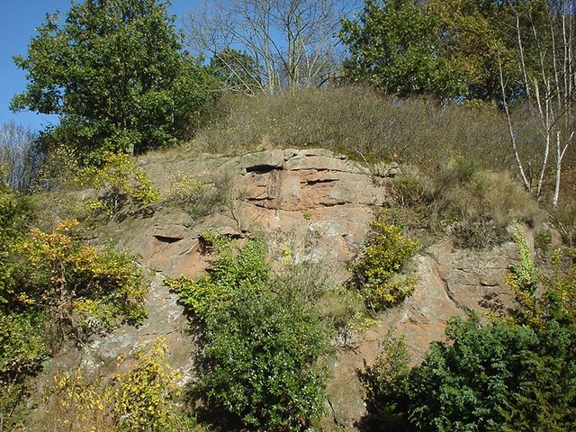
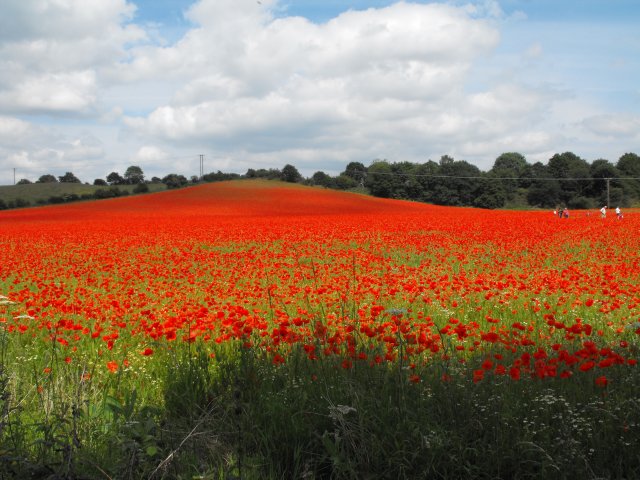
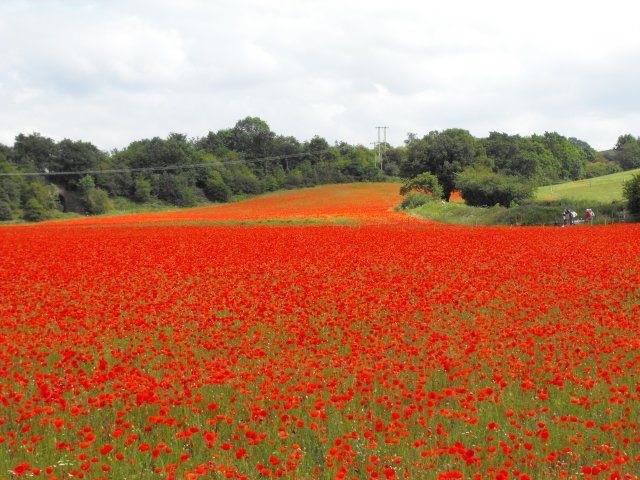
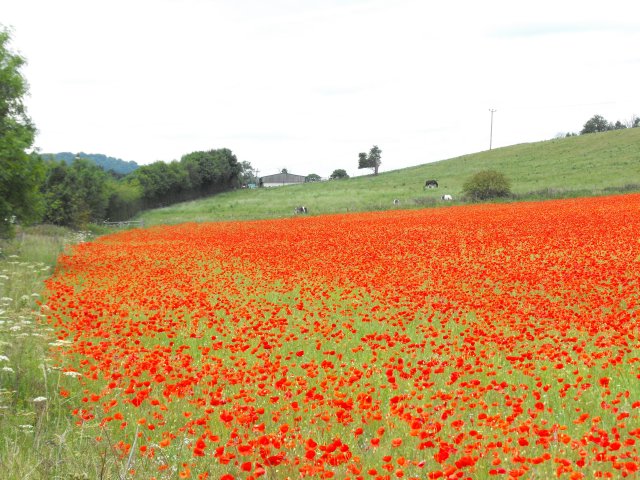
With a population of around 300 residents, Blackstone boasts a tranquil and picturesque setting. Surrounded by lush green fields and rolling hills, the village offers a peaceful retreat from the hustle and bustle of city life. The River Severn flows nearby, adding to the area's natural beauty and providing opportunities for water-based activities such as fishing and boating.

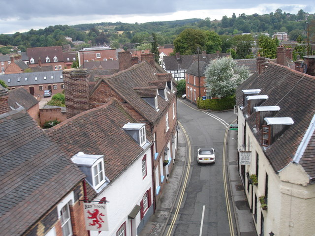
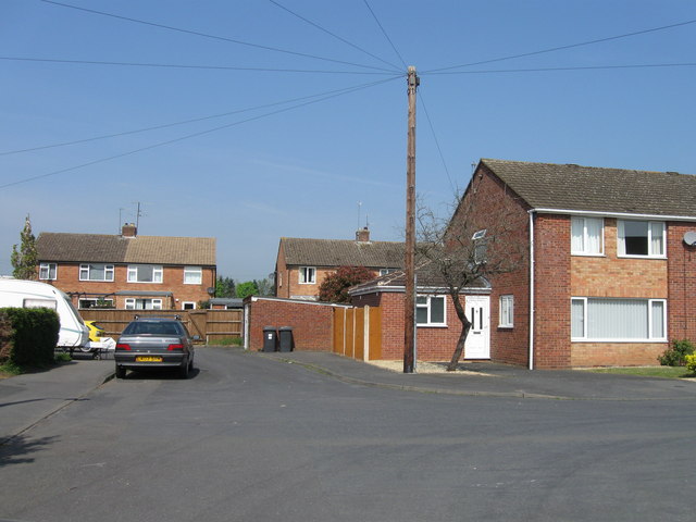
The architecture in Blackstone reflects its rural character, featuring traditional English cottages and farmhouses. The village is known for its charming appearance, with well-maintained gardens and flower-filled streets adding to its visual appeal.

Although Blackstone is primarily a residential area, it benefits from its proximity to nearby towns and cities. Residents have easy access to the amenities and services of Kidderminster and Bewdley, including shops, schools, healthcare facilities, and transport links. Additionally, the village is surrounded by stunning countryside, making it an excellent base for outdoor enthusiasts. The nearby Wyre Forest offers miles of walking and cycling trails, while the Severn Valley Railway provides a nostalgic way to explore the region's scenic landscapes.

Overall, Blackstone is a delightful village that combines a tranquil atmosphere with convenient access to urban centers and beautiful natural surroundings.

If you have any feedback on the listing, please let us know in the comments section below.
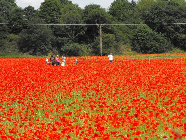
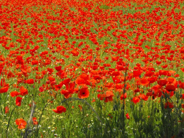
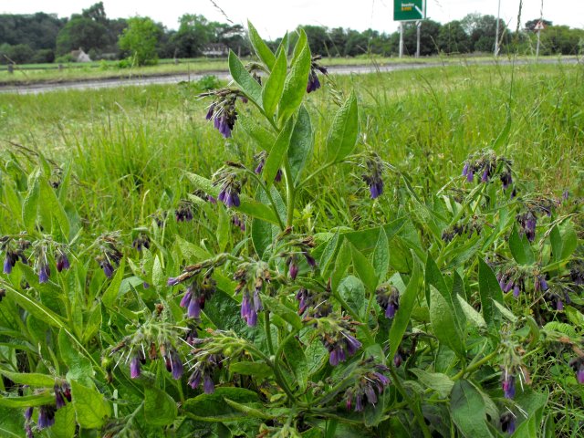
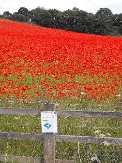
Blackstone Images

Images are sourced within 2km of 52.366423/-2.301925 or Grid Reference SO7974. Thanks to Geograph Open Source API. All images are credited.
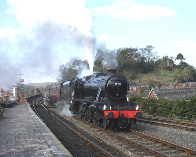
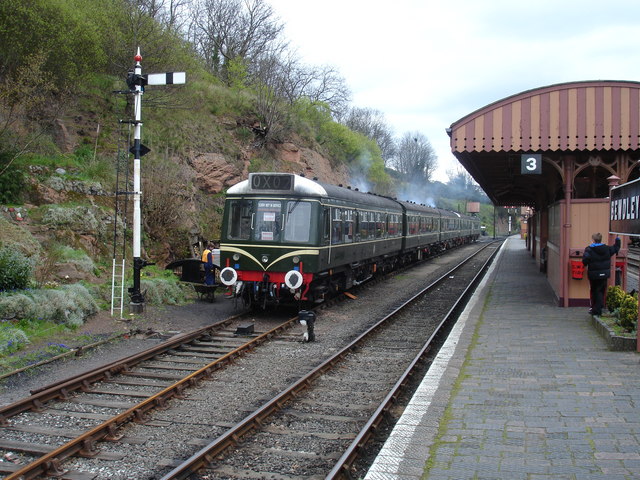
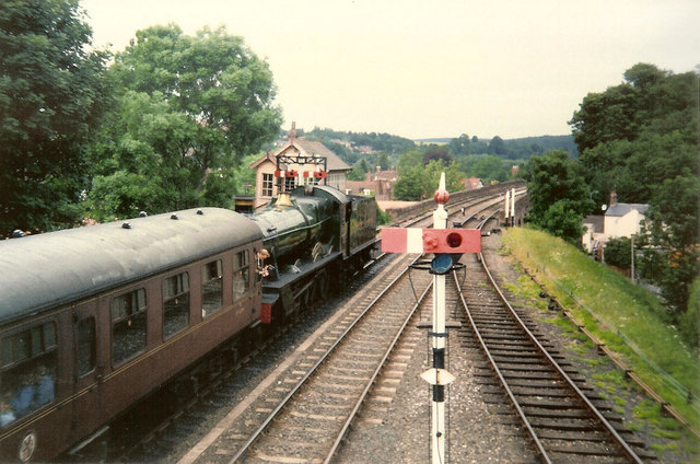
Bewdley, including Severn Valley Guest House Part of the town of Bewdley taken from 'Bewdley North' railway viaduct looking towards the river. In view is the Severn Valley Guest House and part of the 'Red Lion'
Bewdley, including Severn Valley Guest House
Part of the town of Bewdley taken from 'Bewdley North' railway viaduct looking towards the river. In view is the Severn Valley Guest House and part of the 'Red Lion'
48773 entering Bewdley Station, SVR Stanier 8F 2-8-0 No 48773, owned by the Stanier 8F Locomotive Society who bought the locomotive from British Railways in 1968, enters Bewdley Station with a Severn Valley Railway train from Bridgnorth to Kidderminster Town. The train is crossing Bewdley North Viaduct on its way into the station.
48773 entering Bewdley Station, SVR
Stanier 8F 2-8-0 No 48773, owned by the Stanier 8F Locomotive Society who bought the locomotive from British Railways in 1968, enters Bewdley Station with a Severn Valley Railway train from Bridgnorth to Kidderminster Town. The train is crossing Bewdley North Viaduct on its way into the station.
Rock Siding, Bewdley Station A diesel multiple unit occupies the track known as 'Rock Siding' at Bewdley Station, Severn Valley Railway
Rock Siding, Bewdley Station
A diesel multiple unit occupies the track known as 'Rock Siding' at Bewdley Station, Severn Valley Railway
Elephant Enclosure, West Midlands Safari Park Viewed from the railway line beside the Safari Park, this is the elephant enclosure.
Elephant Enclosure, West Midlands Safari Park
Viewed from the railway line beside the Safari Park, this is the elephant enclosure.
St David's Close, Lickhill
Bewdley Bridge in 1987 The bridge carries the B4195 road over the River Severn. The large red brick house over the bridge on the left hand side stands in Severn Street South. The church tower is that of St Anne's.
Bewdley Bridge in 1987
The bridge carries the B4195 road over the River Severn. The large red brick house over the bridge on the left hand side stands in Severn Street South. The church tower is that of St Anne's.
Rock Outcrop, Bewdley This outcrop of sandstone rock forms the northern boundary of Bewdley station
Rock Outcrop, Bewdley
This outcrop of sandstone rock forms the northern boundary of Bewdley station
Trains Pass at Bewdley BR Standard Pacific No 71000 "Duke of Gloucester" [left] and 'Manor' class 4-6-0 No 7812 "Erlestoke Manor" pass at Bewdley station.
Trains Pass at Bewdley
BR Standard Pacific No 71000 "Duke of Gloucester" [left] and 'Manor' class 4-6-0 No 7812 "Erlestoke Manor" pass at Bewdley station.
Bewdley station on the Severn Valley Railway
Poppies at Blackstone, Worcestershire I was not alone in finding the sight of this field bright red with poppies difficult to drive past, the Blackstone car park opposite was full.

A poster on the fence says,
"This is one of three fields owned by Worcestershire Wildlife Trust. This year it is being left fallow.
Its diverse and colourful weeds are indicative of low input agriculture. By using minimal herbicides we get this beautiful flush of annual wildflowers such as the poppy. We'll leave the field fallow in rotation to help reduce the nutrient levels in the soil. This will allow the land to gradually become heathland, a very threatened habitat in the county.
Several rare arable plants have been recorded in these fields and insects are abundant."
A report on this site from the Worcestershire Wildlife Trust website <span class="nowrap"><a title="https://web.archive.org/web/20110614140450/http://www.worcswildlifetrust.co.uk/index.php?section=news&id=3740" rel="nofollow ugc noopener" href="https://web.archive.org/web/20110614140450/http://www.worcswildlifetrust.co.uk/index.php?section=news&id=3740">Archive Link</a><img style="margin-left:2px;" alt="External link" title="External link - shift click to open in new window" src="https://s1.geograph.org.uk/img/external.png" width="10" height="10"/></span>
Poppies at Blackstone, Worcestershire
I was not alone in finding the sight of this field bright red with poppies difficult to drive past, the Blackstone car park opposite was full. A poster on the fence says, "This is one of three fields owned by Worcestershire Wildlife Trust. This year it is being left fallow. Its diverse and colourful weeds are indicative of low input agriculture. By using minimal herbicides we get this beautiful flush of annual wildflowers such as the poppy. We'll leave the field fallow in rotation to help reduce the nutrient levels in the soil. This will allow the land to gradually become heathland, a very threatened habitat in the county. Several rare arable plants have been recorded in these fields and insects are abundant." A report on this site from the Worcestershire Wildlife Trust website Archive LinkExternal link
Poppies at Blackstone, Worcestershire An area on one side of the field has been roped off for use by visitors so they can feel they are surrounded by the poppies.
Poppies at Blackstone, Worcestershire
An area on one side of the field has been roped off for use by visitors so they can feel they are surrounded by the poppies.
Poppies at Blackstone, Worcestershire I was not alone in finding the sight of this field bright red with poppies difficult to drive past, the Blackstone car park opposite was full.

A poster on the fence says,
"This is one of three fields owned by Worcestershire Wildlife Trust. This year it is being left fallow.
Its diverse and colourful weeds are indicative of low input agriculture. By using minimal herbicides we get this beautiful flush of annual wildflowers such as the poppy. We'll leave the field fallow in rotation to help reduce the nutrient levels in the soil. This will allow the land to gradually become heathland, a very threatened habitat in the county.
Several rare arable plants have been recorded in these fields and insects are abundant."
A report on this site from the Worcestershire Wildlife Trust website <span class="nowrap"><a title="https://web.archive.org/web/20110614140450/http://www.worcswildlifetrust.co.uk/index.php?section=news&id=3740" rel="nofollow ugc noopener" href="https://web.archive.org/web/20110614140450/http://www.worcswildlifetrust.co.uk/index.php?section=news&id=3740">Archive Link</a><img style="margin-left:2px;" alt="External link" title="External link - shift click to open in new window" src="https://s1.geograph.org.uk/img/external.png" width="10" height="10"/></span>
Poppies at Blackstone, Worcestershire
I was not alone in finding the sight of this field bright red with poppies difficult to drive past, the Blackstone car park opposite was full. A poster on the fence says, "This is one of three fields owned by Worcestershire Wildlife Trust. This year it is being left fallow. Its diverse and colourful weeds are indicative of low input agriculture. By using minimal herbicides we get this beautiful flush of annual wildflowers such as the poppy. We'll leave the field fallow in rotation to help reduce the nutrient levels in the soil. This will allow the land to gradually become heathland, a very threatened habitat in the county. Several rare arable plants have been recorded in these fields and insects are abundant." A report on this site from the Worcestershire Wildlife Trust website Archive LinkExternal link
Comfrey by the A456 at Blackstone It wasn't just the poppies <a title="https://www.geograph.org.uk/snippet/5338" href="https://www.geograph.org.uk/snippet/5338">Link</a> which caught my eye.
Comfrey by the A456 at Blackstone
It wasn't just the poppies Link which caught my eye.
I can see them quite well from here... I was not alone in finding the sight of this field bright red with poppies difficult to drive past, the Blackstone car park opposite was full.

A poster on the fence says,
"This is one of three fields owned by Worcestershire Wildlife Trust. This year it is being left fallow.
Its diverse and colourful weeds are indicative of low input agriculture. By using minimal herbicides we get this beautiful flush of annual wildflowers such as the poppy. We'll leave the field fallow in rotation to help reduce the nutrient levels in the soil. This will allow the land to gradually become heathland, a very threatened habitat in the county.
Several rare arable plants have been recorded in these fields and insects are abundant."
A report on this site from the Worcestershire Wildlife Trust website <span class="nowrap"><a title="https://web.archive.org/web/20110614140450/http://www.worcswildlifetrust.co.uk/index.php?section=news&id=3740" rel="nofollow ugc noopener" href="https://web.archive.org/web/20110614140450/http://www.worcswildlifetrust.co.uk/index.php?section=news&id=3740">Archive Link</a><img style="margin-left:2px;" alt="External link" title="External link - shift click to open in new window" src="https://s1.geograph.org.uk/img/external.png" width="10" height="10"/></span>
I can see them quite well from here...
I was not alone in finding the sight of this field bright red with poppies difficult to drive past, the Blackstone car park opposite was full. A poster on the fence says, "This is one of three fields owned by Worcestershire Wildlife Trust. This year it is being left fallow. Its diverse and colourful weeds are indicative of low input agriculture. By using minimal herbicides we get this beautiful flush of annual wildflowers such as the poppy. We'll leave the field fallow in rotation to help reduce the nutrient levels in the soil. This will allow the land to gradually become heathland, a very threatened habitat in the county. Several rare arable plants have been recorded in these fields and insects are abundant." A report on this site from the Worcestershire Wildlife Trust website Archive LinkExternal link
Poppies at Blackstone, Worcestershire
Poppies at Blackstone, Worcestershire The horses in the next field seem unimpressed.
Poppies at Blackstone, Worcestershire
The horses in the next field seem unimpressed.
Pedestrian crossing on A456 at Blackstone The crossing (a fairly recent development for National Cycle Route 45 I think) was getting a lot of use as people parked in the Blackstone Country Park car park and crossed the road to view the poppies.
Pedestrian crossing on A456 at Blackstone
The crossing (a fairly recent development for National Cycle Route 45 I think) was getting a lot of use as people parked in the Blackstone Country Park car park and crossed the road to view the poppies.
Show me another place!

Blackstone is located at Grid Ref: SO7974 (Lat: 52.366423, Lng: -2.301925)

Administrative County: Worcestershire

District: Wyre Forest

Police Authority: West Mercia

What 3 Words

///author.manly.nimbly. Near Bewdley, Worcestershire

Related Wikis

The Bewdley School

The Bewdley School is a senior school and sixth form in Bewdley, serving north-west Worcestershire, England. Its campus is very close to the River Severn...

Rifle Range Halt railway station

Rifle Range Halt was a short-lived unstaffed request stop on the GWR Kidderminster to Bewdley loop line which now forms part of the Severn Valley Railway...
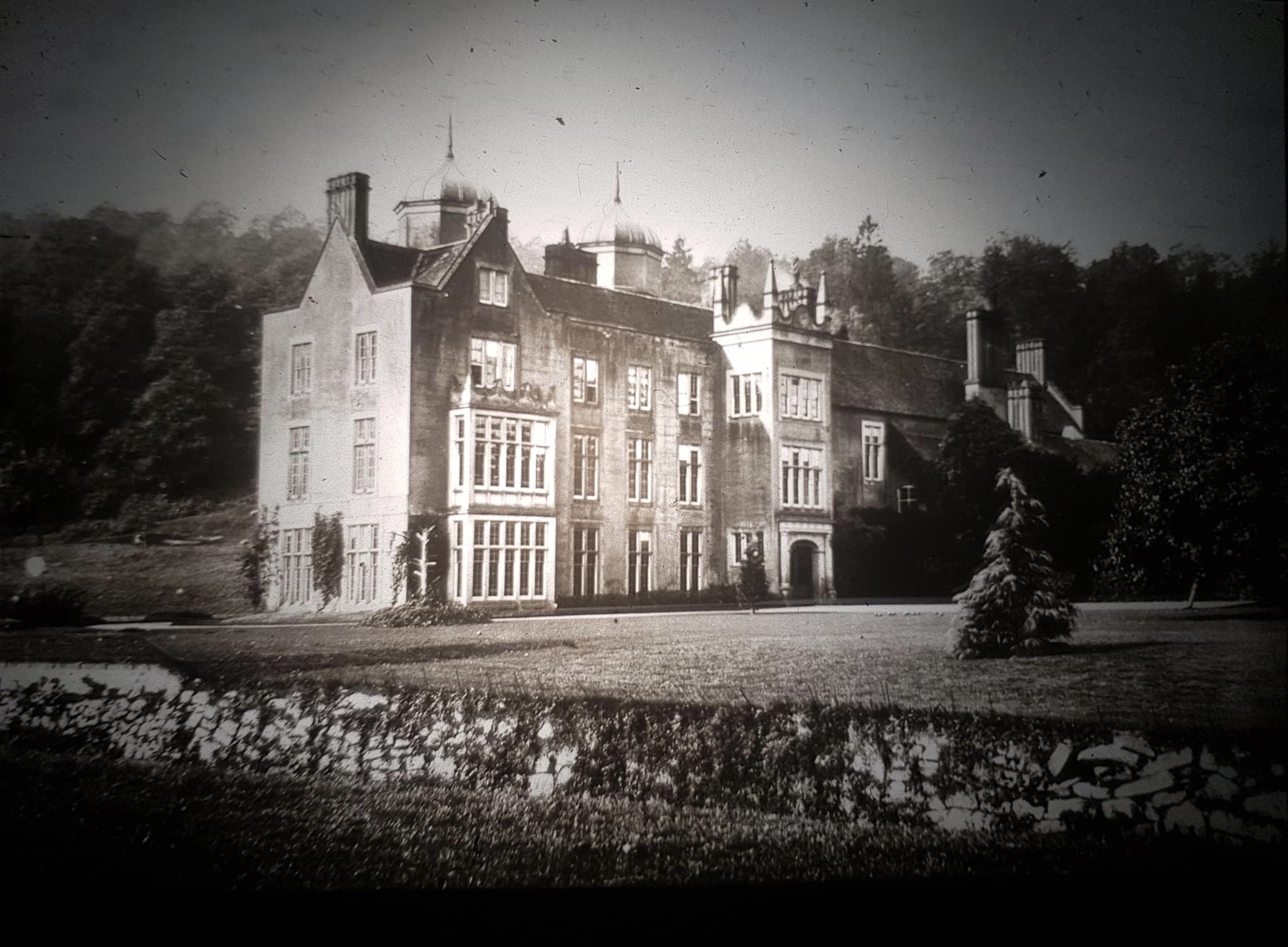
Ribbesford House

Ribbesford House is a historic English mansion in Ribbesford, near Bewdley, Worcestershire. The house and its surrounding estate have a history dating...

Bewdley railway station

Bewdley railway station serves the town of Bewdley in Worcestershire, England. Until 2014, it was the administrative headquarters of the Severn Valley...

Nearby Amenities

Located within 500m of 52.366423,-2.301925
Traffic Signals
Bicycle: yes
Crossing: traffic_signals
Crossing Ref: toucan
Lat/Long: 52.3679947/-2.300442
Bus Stop
Blackstone Picnic Site
Bus: yes
Naptan AtcoCode: 2000G105100
Naptan Bearing: NW
Naptan CommonName: Blackstone Picnic Site
Naptan Crossing: Netherton Lane
Naptan Indicator: Adj
Naptan NaptanCode: wocgdgad
Naptan PlusbusZoneRef: KDRMNST
Naptan Street: Stourport Road
Naptan Verified: no
Public Transport: platform
Source: naptan_import
Lat/Long: 52.3676505/-2.3004578
Barrier: stile
Foot: yes
Lat/Long: 52.3621085/-2.303465
Barrier: stile
Foot: yes
Lat/Long: 52.3625405/-2.3024742
Power: pole
Lat/Long: 52.3671494/-2.2960198
Information: map
Tourism: information
Lat/Long: 52.3672303/-2.3009969
Power: pole
Lat/Long: 52.3672434/-2.2962637
Power: pole
Lat/Long: 52.3685388/-2.2970139
Power: pole
Lat/Long: 52.3698729/-2.2977853
Traffic Signals
Lat/Long: 52.3697654/-2.3008727
Traffic Signals
Lat/Long: 52.369584/-2.30072
Fire Hydrant
Emergency: fire_hydrant
Fire Hydrant Type: underground
Source: survey
Lat/Long: 52.3677195/-2.3001185
Information: board
Source: survey
Tourism: information
Lat/Long: 52.367896/-2.2991568
Leisure: picnic_table
Lat/Long: 52.3659286/-2.3081481
Leisure: picnic_table
Lat/Long: 52.3656731/-2.3073113
Leisure: picnic_table
Lat/Long: 52.3671839/-2.3005763
Leisure: picnic_table
Lat/Long: 52.3674132/-2.3005883
Traffic Signals
Lat/Long: 52.3700295/-2.3006782
Location Transition: yes
Power: pole
Lat/Long: 52.3626861/-2.3026831
Blackstone Cottage
Power: pole
Transformer: distribution
Voltage Primary: 11000
Lat/Long: 52.36251/-2.3031418
Power: pole
Lat/Long: 52.3622176/-2.3035871
The data included in this document is from www.openstreetmap.org. The data is made available under ODbL.

Have you been to Blackstone?

Leave your review of Blackstone below (or comments, questions and feedback).