Ruspidge

Settlement in Gloucestershire Forest of Dean

England

Ruspidge

Cycleway and former railway Cycleway and former railway trackbed passing through Crabtreehill Plantation in the Forest of Dean.
Cycleway and former railway Credit: Philip Halling

Ruspidge is a small village located in the Forest of Dean district of Gloucestershire, England. Situated on the eastern edge of the forest, it lies just south of Cinderford and north of the River Severn. Ruspidge is a part of the civil parish of Cinderford and has a population of approximately 1,500 residents.

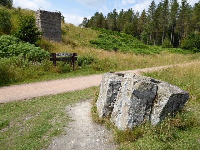
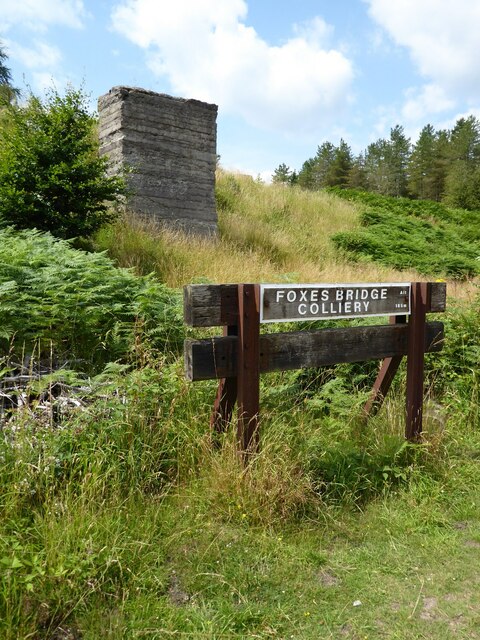
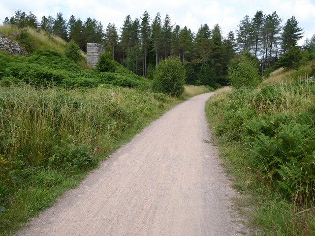
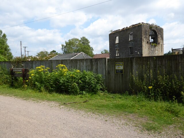
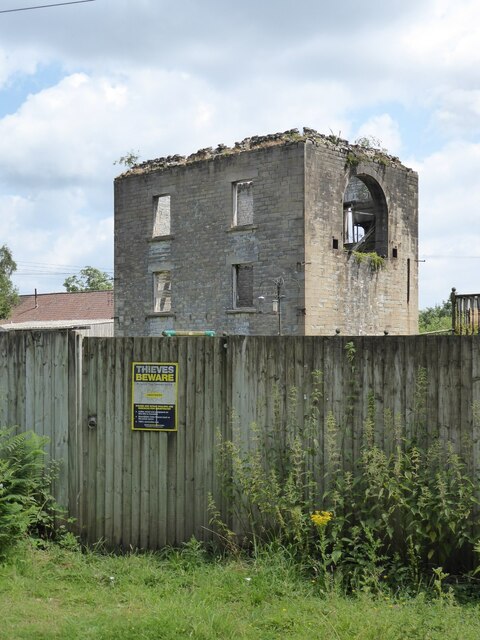
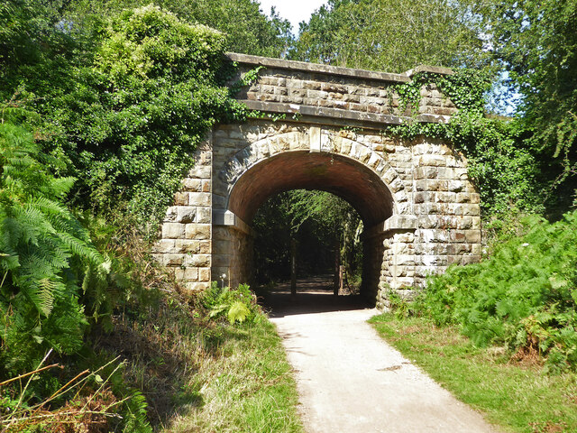
The village was historically known for its coal mining industry, with several collieries operating in the area from the 19th century until the mid-20th century. This mining heritage is still evident in the village today, with some remnants of the former industry visible.

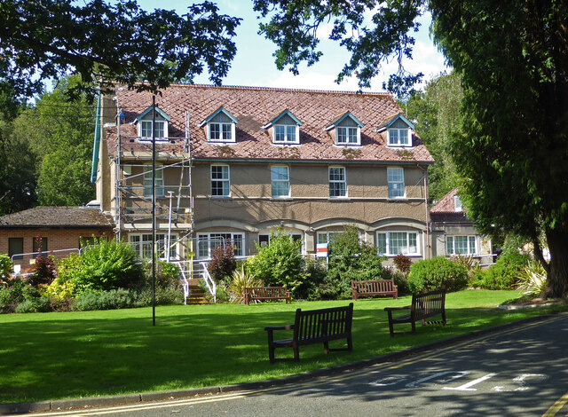
Ruspidge is primarily residential, with a mix of housing styles ranging from traditional stone cottages to more modern developments. There are also a few local amenities including a primary school, a village hall, and a small convenience store.

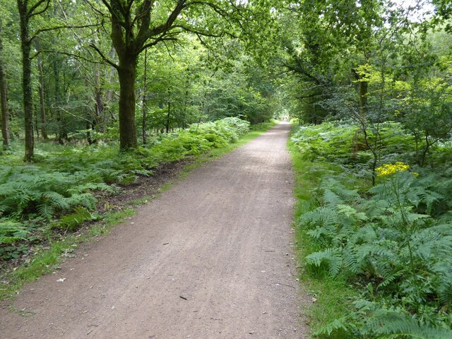
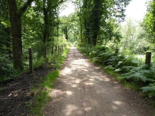
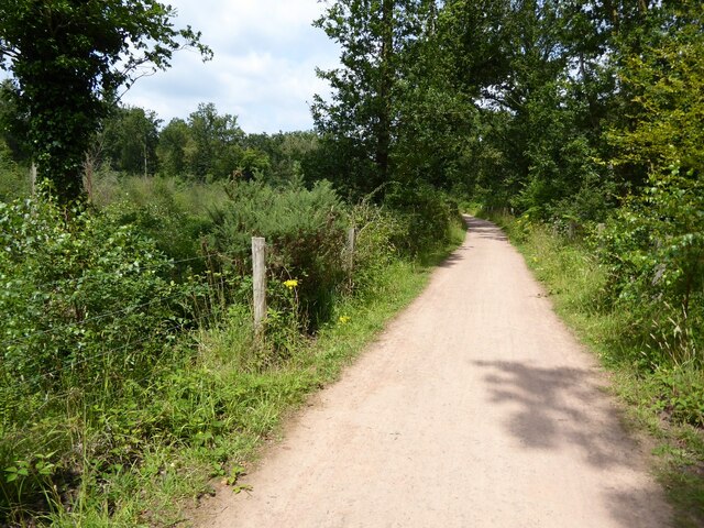
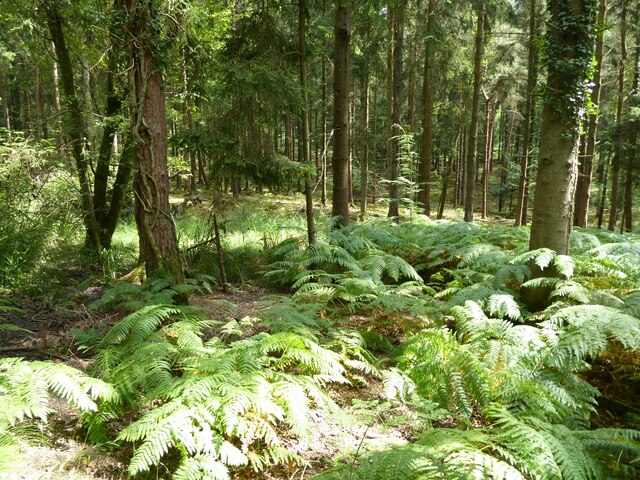
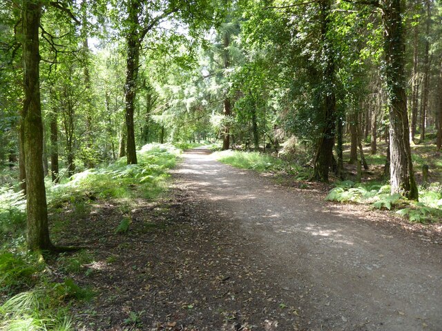
The village is surrounded by picturesque countryside, offering opportunities for outdoor activities such as walking, cycling, and horse riding. The Forest of Dean itself provides ample opportunities for exploration, with its extensive woodland, nature reserves, and various trails.

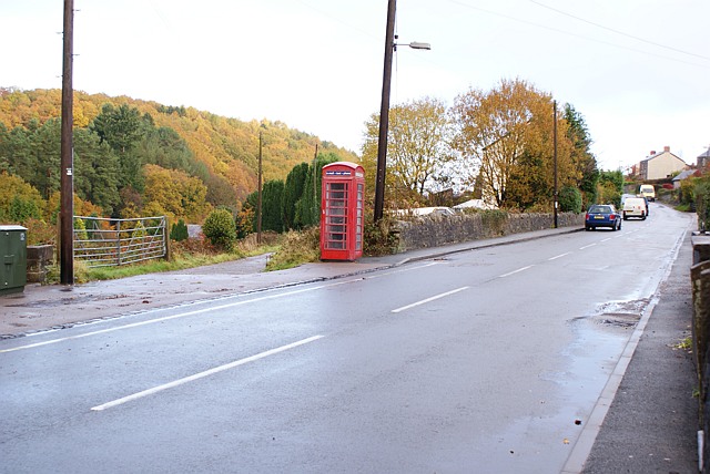
Ruspidge benefits from its proximity to the town of Cinderford, which provides a wider range of amenities including shops, supermarkets, restaurants, and leisure facilities. The village is also well-connected, with good road links to nearby towns and cities such as Gloucester, Cheltenham, and Bristol.

If you have any feedback on the listing, please let us know in the comments section below.

Ruspidge Images

Images are sourced within 2km of 51.805798/-2.507266 or Grid Reference SO6512. Thanks to Geograph Open Source API. All images are credited.

Cycleway and former railway Cycleway and former railway trackbed passing through Crabtreehill Plantation in the Forest of Dean.
Cycleway and former railway
Cycleway and former railway trackbed passing through Crabtreehill Plantation in the Forest of Dean.
Site of Foxes Bridge Colliery Former railway track and now a cycleway passing through the site of Foxes Bridge Colliery.  Trees have been felled since I last photographed this site just over seven years ago <a href="https://www.geograph.org.uk/photo/3954592">SO6313 : Foxes Bridge Colliery</a>.
Site of Foxes Bridge Colliery
Former railway track and now a cycleway passing through the site of Foxes Bridge Colliery. Trees have been felled since I last photographed this site just over seven years ago SO6313 : Foxes Bridge Colliery.
Site of Foxes Bridge Colliery The site of Foxes Bridge Colliery viewed from a former railway track and now cycleway.
Site of Foxes Bridge Colliery
The site of Foxes Bridge Colliery viewed from a former railway track and now cycleway.
Site of Foxes Bridge Colliery Former railway track and now a cycleway passing through the site of Foxes Bridge Colliery.
Site of Foxes Bridge Colliery
Former railway track and now a cycleway passing through the site of Foxes Bridge Colliery.
Cycleway passing through Crabtreehill Plantation Cycleway on a former railway trackbed passing through Crabtreehill Plantation.
Cycleway passing through Crabtreehill Plantation
Cycleway on a former railway trackbed passing through Crabtreehill Plantation.
Cycleway near Dilke Hospital Cycleway and former railway trackbed near Dilke Hospital in the Forest of Dean.
Cycleway near Dilke Hospital
Cycleway and former railway trackbed near Dilke Hospital in the Forest of Dean.
Dilke Hospital Dilke Memorial Hospital opened in 1921 and is named after Sir Charles Dilke, 2nd Baronet who was a Liberal MP for the Forest of Dean and died in 1911.
Dilke Hospital
Dilke Memorial Hospital opened in 1921 and is named after Sir Charles Dilke, 2nd Baronet who was a Liberal MP for the Forest of Dean and died in 1911.
Former Lightmoor Colliery Engine House The derelict engine house of the former Lightmoor Colliery viewed from the cycleway which passes by following a former railway.
Former Lightmoor Colliery Engine House
The derelict engine house of the former Lightmoor Colliery viewed from the cycleway which passes by following a former railway.
Forestry at Great Palescot Ferns and trees at Great Palescot in the Forest of Dean.
Forestry at Great Palescot
Ferns and trees at Great Palescot in the Forest of Dean.
Cycleway near Great Saintlow Cycleway and former railway trackbed near Great Saintlow.
Cycleway near Great Saintlow
Cycleway and former railway trackbed near Great Saintlow.
Pump bob - Foxes Bridge Colliery near Cinderford This inverted tee bob was undoubtedly associated with a steam pumping engine for draining this colliery and has been retained on site on a specially made concrete pad. Unfortunately it is being reclaimed by nature and is fairly well hidden although there is a well established path to it. It took me a while of hunting to find it from the nearby cycle trail.
Pump bob - Foxes Bridge Colliery near Cinderford
This inverted tee bob was undoubtedly associated with a steam pumping engine for draining this colliery and has been retained on site on a specially made concrete pad. Unfortunately it is being reclaimed by nature and is fairly well hidden although there is a well established path to it. It took me a while of hunting to find it from the nearby cycle trail.
Dilke Memorial Hospital near Cinderford
Trig point near Crabtree Hill, forest of Dean
Entrance to Forest of Dean Crematorium
Remains of Foxes Bridge Colliery near Cinderford Some large lumps of masonry adjoining a cycle trail through the site. There are other interesting foundations and the remains of a pumping bob nearby but they do take a little hunting for.
Remains of Foxes Bridge Colliery near Cinderford
Some large lumps of masonry adjoining a cycle trail through the site. There are other interesting foundations and the remains of a pumping bob nearby but they do take a little hunting for.
Site of Foxes Bridge Colliery The cycle way passing through behind the large lump of masonry is on the track bed of a former railway serving the colliery. There are quite a few remains in the undergrowth including an inverted tee bob from a pumping engine.
Site of Foxes Bridge Colliery
The cycle way passing through behind the large lump of masonry is on the track bed of a former railway serving the colliery. There are quite a few remains in the undergrowth including an inverted tee bob from a pumping engine.
Dilke Bridge near Cinderford Carrying Speech House Road over a former railway line that is now a cycleway and foot path.
Dilke Bridge near Cinderford
Carrying Speech House Road over a former railway line that is now a cycleway and foot path.
Show me another place!

Ruspidge is located at Grid Ref: SO6512 (Lat: 51.805798, Lng: -2.507266)

Administrative County: Gloucestershire

District: Forest of Dean

Police Authority: Gloucestershire

What 3 Words

///beard.unfounded.revamping. Near Cinderford, Gloucestershire

Related Wikis

Ruspidge

Ruspidge is a village in the Forest of Dean district of west Gloucestershire, England. The civil parish includes Soudley It is located near the town of...

Buckshraft Mine & Bradley Hill Railway Tunnel

Buckshaft Mine & Bradley Hill Railway Tunnel (SO655121 and SO662104) is a 5.66-hectare (14.0-acre) biological Site of Special Scientific Interest in Gloucestershire...

Staple Edge Halt railway station

Staple Edge Halt railway station is a disused railway station opened by the Great Western Railway (GWR) on the former Bullo Pill Railway, later known as...

Ruspidge Halt railway station

Ruspidge Halt railway station is a disused railway station opened by the Great Western Railway (GWR) on the former Bullo Pill Railway, later known as the...

Eastern United Colliery

Eastern United Colliery was a drift mine in the Forest of Dean, Gloucestershire, England served by the Great Western Railway's Forest of Dean Branch. The...

Cinderford Ironworks

Cinderford Ironworks, also known as Cinderford Furnace, was a coke-fired blast furnace, built in 1795, just west of Cinderford, in the Forest of Dean,...

Soudley Ponds

Lying close to the village of Soudley in the Forest of Dean, west Gloucestershire, Soudley Ponds (grid reference SO662112), also known as Sutton Ponds...

Soudley

Soudley, including Upper Soudley, is a village to the west of Cinderford, in the Forest of Dean, Gloucestershire, England. It joins with Ruspidge to form...

Nearby Amenities

Located within 500m of 51.805798,-2.507266
Ruspidge
Is In: Gloucestershire, England, UK
Place: village
Wikidata: Q7381084
Lat/Long: 51.8035643/-2.5056315
Bus Stop
Dean View
Naptan AtcoCode: 1600GL1212
Naptan Bearing: SW
Naptan CommonName: Dean View
Naptan NaptanCode: gloajgwd
Naptan Street: Buckshaft Rd
Naptan Verified: no
Source: naptan_import
Lat/Long: 51.8062443/-2.5036085
Bus Stop
Lower Ruspidge Stores
Naptan AtcoCode: 1600GL4063
Naptan Bearing: SW
Naptan CommonName: Lower Ruspidge Stores
Naptan Indicator: Opp
Naptan NaptanCode: gloajgdj
Naptan Street: Ruspidge Rd
Naptan Verified: no
Source: naptan_import
Lat/Long: 51.8059957/-2.5070577
Bus Stop
Lower Ruspidge Stores
Naptan AtcoCode: 1600GL4064
Naptan Bearing: NE
Naptan CommonName: Lower Ruspidge Stores
Naptan NaptanCode: gloajgda
Naptan Street: Ruspidge Rd
Naptan Verified: no
Source: naptan_import
Lat/Long: 51.8060764/-2.5071166
Bus Stop
Rising Sun
Naptan AtcoCode: 1600GL4065
Naptan Bearing: S
Naptan CommonName: Rising Sun
Naptan Indicator: Opp
Naptan NaptanCode: gloajdwg
Naptan Street: Ruspidge Rd
Naptan Verified: no
Source: naptan_import
Lat/Long: 51.8018778/-2.5091144
Bus Stop
Rising Sun
Naptan AtcoCode: 1600GL4066
Naptan Bearing: N
Naptan CommonName: Rising Sun
Naptan NaptanCode: gloajdwa
Naptan Street: Ruspidge Rd
Naptan Verified: no
Source: naptan_import
Lat/Long: 51.8018773/-2.5092159
Bus Stop
Forest View
Naptan AtcoCode: 1600GLF387
Naptan Bearing: S
Naptan CommonName: Forest View
Naptan NaptanCode: gloajmap
Naptan Street: Buckshaft Rd
Naptan Verified: no
Source: naptan_import
Lat/Long: 51.8083438/-2.502544
Forest View
Naptan AtcoCode: 1600GLF388
Naptan Bearing: N
Naptan BusStopType: CUS
Naptan CommonName: Forest View
Naptan Indicator: Opp
Naptan NaptanCode: gloajmaj
Naptan Street: Buckshaft Rd
Naptan Verified: no
Source: naptan_import
Lat/Long: 51.8082893/-2.5026885
Bus Stop
Recreation Ground
Naptan AtcoCode: 1600GLF427
Naptan Bearing: SW
Naptan CommonName: Recreation Ground
Naptan Indicator: Opp
Naptan NaptanCode: gloajgpa
Naptan Street: Ruspidge Rd
Naptan Verified: no
Source: naptan_import
Lat/Long: 51.8080992/-2.5050796
Bus Stop
Recreation Ground
Naptan AtcoCode: 1600GLF428
Naptan Bearing: NE
Naptan CommonName: Recreation Ground
Naptan NaptanCode: gloajgmt
Naptan Street: Ruspidge Rd
Naptan Verified: no
Source: naptan_import
Lat/Long: 51.8081167/-2.5051959
Turning Circle
Lat/Long: 51.8067216/-2.5026477
Turning Circle
Lat/Long: 51.8059799/-2.5083513
Bar
The New Inn
Addr Housenumber: 170
Addr Postcode: GL14 3AR
Addr Street: Ruspidge Road
Description: Very much a "local" pub. There are other community activities that take place here - regular musical sessions and a group of ladies who meet once a month for a coffee morning.
Lat/Long: 51.8019903/-2.5089753
Access: no
Barrier: bollard
Bicycle: yes
Foot: yes
Horse: yes
Motor Vehicle: no
Lat/Long: 51.8071308/-2.5076819
Power: pole
Lat/Long: 51.8087413/-2.5116694
Power: pole
Lat/Long: 51.8081963/-2.5121247
Power: pole
Lat/Long: 51.8074069/-2.5127298
Power: pole
Lat/Long: 51.8066647/-2.5139038
Power: pole
Lat/Long: 51.8030173/-2.5105908
Power: pole
Lat/Long: 51.8055941/-2.5105885
Power: pole
Lat/Long: 51.8073653/-2.512603
Power: pole
Lat/Long: 51.8039969/-2.5101942
Power: pole
Lat/Long: 51.8064989/-2.5132951
Power: pole
Lat/Long: 51.809508/-2.510712
Power: pole
Lat/Long: 51.8095181/-2.5109404
Power: pole
Lat/Long: 51.8087998/-2.5113422
Power: pole
Lat/Long: 51.8021161/-2.5106824
Power: pole
Lat/Long: 51.8080735/-2.5119834
Telephone
Booth: K6
Covered: booth
Phone: +44 1594 822280
Lat/Long: 51.8031568/-2.5086421
Defibrillator
Emergency: defibrillator
Indoor: no
Lat/Long: 51.8067655/-2.5063905
The data included in this document is from www.openstreetmap.org. The data is made available under ODbL.

Have you been to Ruspidge?

Leave your review of Ruspidge below (or comments, questions and feedback).