Rookhope

Settlement in Durham

England

Rookhope

Narrow walled enclosure beside Boltslaw Incline The enclosure surely has no current use. The slope beyond it descends to the fields and village of Rookhope. The flattish area above the break of slope rises gradually to the summit area of Bolt's Law. Boltslaw Incline is just out of view to the right of the image.
Narrow walled enclosure beside Boltslaw Incline Credit: Trevor Littlewood

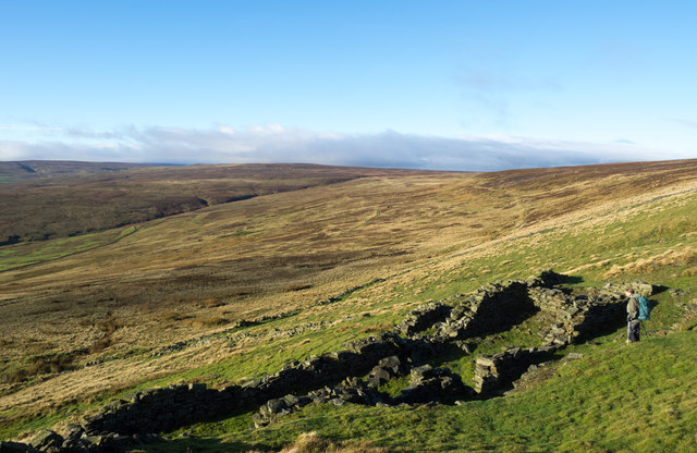
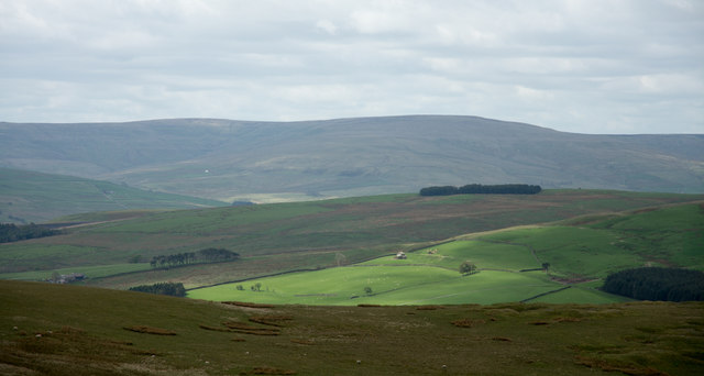
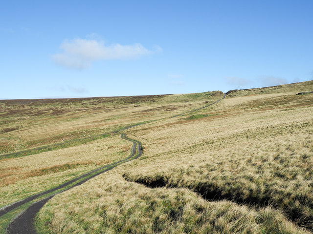
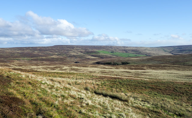
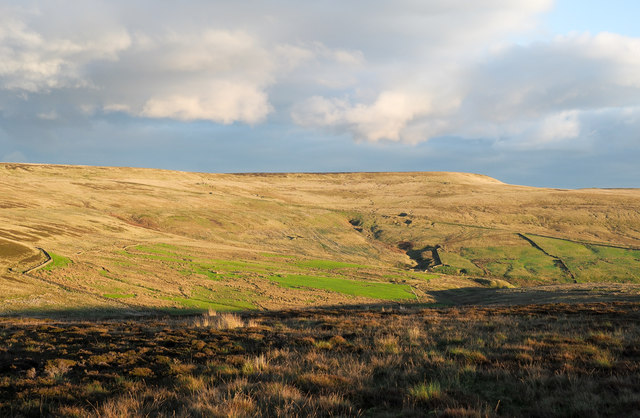
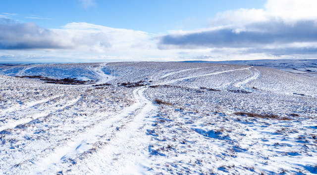
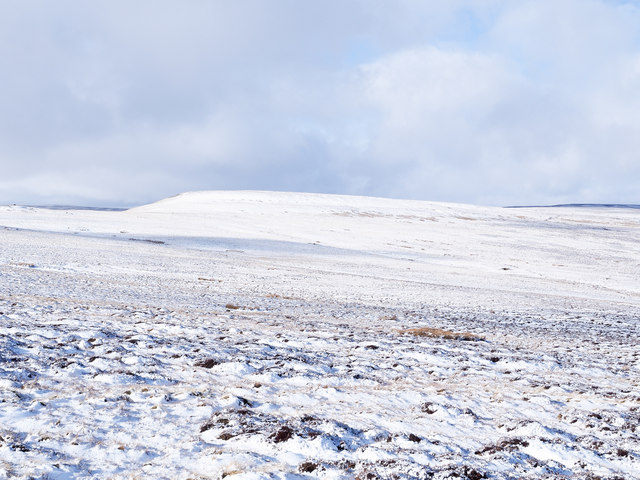
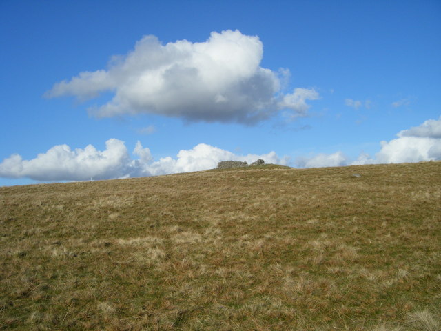
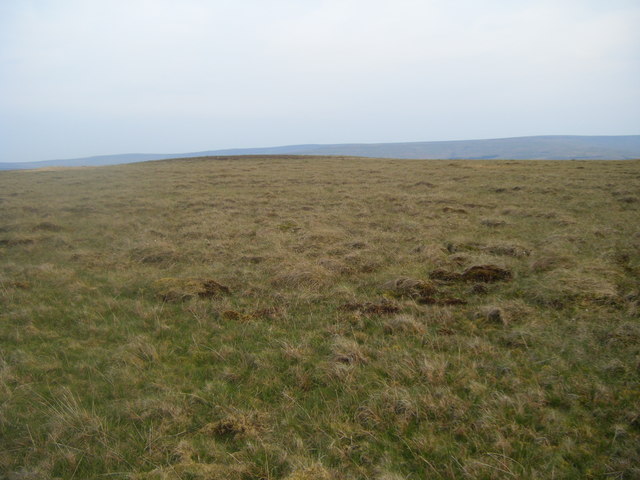
Rookhope is a small village located in the county of Durham, England. Situated in the upper Weardale valley, it lies approximately 20 miles southwest of the city of Durham. The village is nestled amidst the picturesque landscape of the North Pennines Area of Outstanding Natural Beauty.

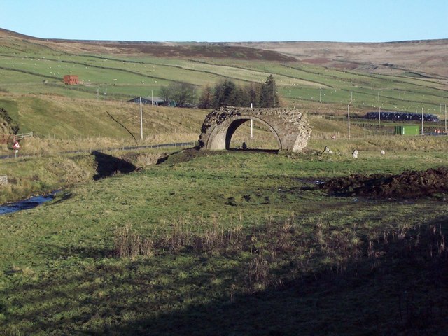
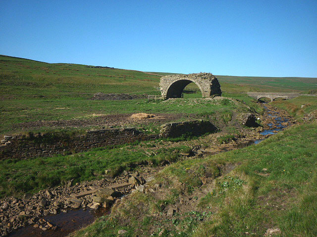
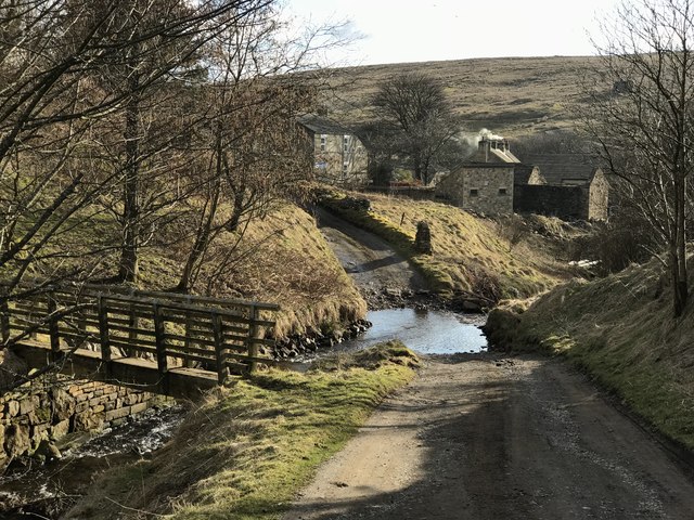
Historically, Rookhope was a mining village, with lead mining being the main industry during the 18th and 19th centuries. The remnants of this industrial heritage can still be seen in the form of old mine buildings and spoil heaps scattered across the surrounding hillsides.

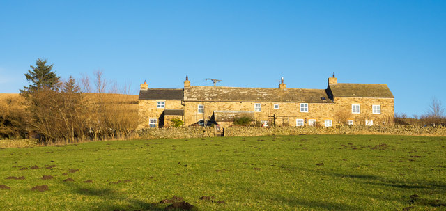
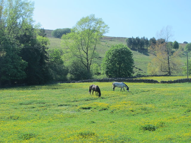
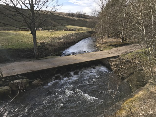
Today, Rookhope is a tranquil and close-knit community, with a population of around 200 residents. The village is known for its stunning natural surroundings, offering ample opportunities for outdoor activities such as hiking, cycling, and birdwatching. The nearby Rookhope Burn is a popular spot for fishing enthusiasts.

Although modest in size, Rookhope boasts some amenities for its residents and visitors. These include a village hall, a pub, and a primary school. The village also hosts various events throughout the year, including the Rookhope Show, which showcases local agriculture and crafts.

Overall, Rookhope is a charming village that offers a peaceful escape from the hustle and bustle of city life. Its rich mining history, coupled with its breathtaking natural beauty, make it an attractive destination for those seeking a taste of rural England.

If you have any feedback on the listing, please let us know in the comments section below.
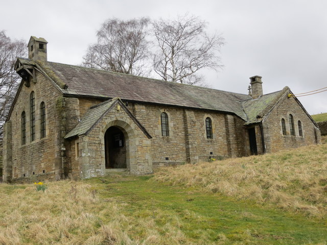
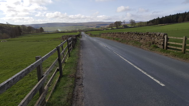
Rookhope Images

Images are sourced within 2km of 54.777935/-2.092469 or Grid Reference NY9442. Thanks to Geograph Open Source API. All images are credited.

Narrow walled enclosure beside Boltslaw Incline The enclosure surely has no current use. The slope beyond it descends to the fields and village of Rookhope. The flattish area above the break of slope rises gradually to the summit area of Bolt's Law. Boltslaw Incline is just out of view to the right of the image.
Narrow walled enclosure beside Boltslaw Incline
The enclosure surely has no current use. The slope beyond it descends to the fields and village of Rookhope. The flattish area above the break of slope rises gradually to the summit area of Bolt's Law. Boltslaw Incline is just out of view to the right of the image.
Slope descending from Long Hill The view is from a cairn, west from the high point of the moorland summit, Long Hill. Beyond, the sunlit ground is on the far side of Rook Hope and most distant are Fendrith Hill and Chapel Fell, seen across both Rook Hope and Weardale.
Slope descending from Long Hill
The view is from a cairn, west from the high point of the moorland summit, Long Hill. Beyond, the sunlit ground is on the far side of Rook Hope and most distant are Fendrith Hill and Chapel Fell, seen across both Rook Hope and Weardale.
Lintzgarth Arch
Lintzgarth Arch
High Brandon High Brandon has the appearance of being a terrace of several homes but according to an offer for sale in 2011 (at £450 000), it's a single house with an attached cottage. It sits high on the eastern slope of the valley of Rook Hope and is described as a "Traditional dales long house".
High Brandon
High Brandon has the appearance of being a terrace of several homes but according to an offer for sale in 2011 (at £450 000), it's a single house with an attached cottage. It sits high on the eastern slope of the valley of Rook Hope and is described as a "Traditional dales long house".
Road descending down to the Rookhope valley at Redburn
The now closed and derelict Church of St John at Rookhope Viewed from the south-west. A notice within the porch of the church indicates how the contents were dispersed upon closure in 2014. One can hope that it will find a new use as a dwelling.
The now closed and derelict Church of St John at Rookhope
Viewed from the south-west. A notice within the porch of the church indicates how the contents were dispersed upon closure in 2014. One can hope that it will find a new use as a dwelling.
Road between Rookhope and Eastgate
Horses grazing in a buttercup meadow south of Rookhope
Rookhope Arch Not built by the Romans, this is the last surviving arch of six that were built by lead miners to carry a flue from smelting hearths nearby.
Rookhope Arch
Not built by the Romans, this is the last surviving arch of six that were built by lead miners to carry a flue from smelting hearths nearby.
Hill road and Boltslaw Incline The incline descends from the notch on the skyline heading down to Rookhope. The road leaves the incline and makes its way across a ridge, (to the right, out of the image), descending into the valley of the Stanhope Burn.
Hill road and Boltslaw Incline
The incline descends from the notch on the skyline heading down to Rookhope. The road leaves the incline and makes its way across a ridge, (to the right, out of the image), descending into the valley of the Stanhope Burn.
Eastern slope of Long Law The slope is descending into the drainage regime of the Stanhope Burn. The flat-topped moorland on the central skyline is Horseshoe Hill.
Eastern slope of Long Law
The slope is descending into the drainage regime of the Stanhope Burn. The flat-topped moorland on the central skyline is Horseshoe Hill.
Moorland lit by low-angled sunshine The foreground moorland looks almost to have been burnt - much heather moorland is as part of management for grouse shooting - but this hasn't, the appearance is down to the low angled autumnal sunshine.
The flat-topped moorland hill at the centre of the image is Long Law; the oblique line crossing it is the Boltslaw Incline.
Moorland lit by low-angled sunshine
The foreground moorland looks almost to have been burnt - much heather moorland is as part of management for grouse shooting - but this hasn't, the appearance is down to the low angled autumnal sunshine. The flat-topped moorland hill at the centre of the image is Long Law; the oblique line crossing it is the Boltslaw Incline.
Multiple tracks on East Slate Quarry Hill The tracks have been formed by years of passage by vehicles, mainly quad bikes but also perhaps, occasional tractors.
Multiple tracks on East Slate Quarry Hill
The tracks have been formed by years of passage by vehicles, mainly quad bikes but also perhaps, occasional tractors.
Snow on slope north of Long Hill Fresh snow lying on the north side of Long Hill with Long Law in the distance.
Snow on slope north of Long Hill
Fresh snow lying on the north side of Long Hill with Long Law in the distance.
Bolt's Burn Ford This ford is found at Bolt's Burn near Rook Hope. A video of the ford can be seen at:
<span class="nowrap"><a title="https://youtu.be/gZGAAH_NoGs" rel="nofollow ugc noopener" href="https://youtu.be/gZGAAH_NoGs">Link</a><img style="margin-left:2px;" alt="External link" title="External link - shift click to open in new window" src="https://s1.geograph.org.uk/img/external.png" width="10" height="10"/></span>
Bolt's Burn Ford
This ford is found at Bolt's Burn near Rook Hope. A video of the ford can be seen at: LinkExternal link
Church House Farm Ford This irish bridge ford is found on the driveway to Church House Farm.
Church House Farm Ford
This irish bridge ford is found on the driveway to Church House Farm.
Sheepfold, Stanhope Common
Reahope Moor
Reahope Moor
Show me another place!

Rookhope is located at Grid Ref: NY9442 (Lat: 54.777935, Lng: -2.092469)

Unitary Authority: County Durham

Police Authority: Durham

What 3 Words

///furniture.decoded.topics. Near Stanhope, Co. Durham

Related Wikis

Rookhope

Rookhope is a village in the civil parish of Stanhope, in County Durham, England. A former lead and fluorspar mining community, it first existed as a group...

Lintzgarth

Lintzgarth is a village in the civil parish of Stanhope, in County Durham, England. It is situated to the west of Rookhope. The Lintzgarth smeltmill was...

Eastgate, County Durham

Eastgate is a village in the civil parish of Stanhope, in County Durham, England. It is situated in Weardale, a few miles west of Stanhope. In the 2001...

Weardale campaign

The Weardale campaign, part of the First War of Scottish Independence, occurred during July and August 1327 in Weardale, England. A Scottish force under...

Nearby Amenities

Located within 500m of 54.777935,-2.092469
Rookhope
Place: village
Source: npe
Wikidata: Q7366215
Wikipedia: en:Rookhope
Lat/Long: 54.7807916/-2.0971588
The Vicarage
Tourism: camp_site
Lat/Long: 54.7749592/-2.0920791
Post Box
Fixme: Fix location!
Ref: DL13 65
Lat/Long: 54.7753261/-2.0919808
Bench
Lat/Long: 54.7755007/-2.0921843
Bench
Lat/Long: 54.7795464/-2.0954143
Telephone
Booth: KX100
Covered: booth
Lat/Long: 54.7803939/-2.0958777
Post Box
Post Box Type: wall
Ref: DL13 97
Lat/Long: 54.7808347/-2.0967026
Parking
Lat/Long: 54.7806726/-2.0974323
Bus Stop
Village
Naptan AtcoCode: 13004511F
Naptan Bearing: SW
Naptan CommonName: Village
Naptan Indicator: south west bound
Naptan Landmark: Landmark not known
Naptan NaptanCode: durdaptj
Naptan Notes: Rookhope Inn- Front Street- Rookhope
Naptan Street: Unclassified Road
Naptan Verified: no
Shelter: yes
Source: naptan_import
Lat/Long: 54.7808202/-2.0970508
Bus Stop
Village
Naptan AtcoCode: 13004511H
Naptan Bearing: NW
Naptan CommonName: Village
Naptan Indicator: north west bound
Naptan Landmark: Landmark not known
Naptan NaptanCode: durdaptm
Naptan Notes: Opposite Spar House- Front Street- Rookhope.
Naptan Street: Front Street
Naptan Verified: no
Source: naptan_import
Lat/Long: 54.7798956/-2.0956959
Turning Circle
Lat/Long: 54.7800364/-2.0971911
Access: private
Barrier: lift_gate
Foot: no
Lat/Long: 54.7803501/-2.0987959
Ford: stepping_stones
Lat/Long: 54.7760612/-2.0944212
Barrier: stile
Lat/Long: 54.7735113/-2.0924199
Barrier: kissing_gate
Source: survey;gps
Lat/Long: 54.7739014/-2.0897574
Barrier: stile
Material: wood
Source: survey;gps
Stile: stepover
Lat/Long: 54.7803439/-2.0911853
Barrier: stile
Material: wood
Source: survey;gps
Stile: stepover
Lat/Long: 54.7813048/-2.0922267
Barrier: stile
Material: wood
Source: survey;gps
Stile: stepover
Lat/Long: 54.7814772/-2.0910114
Ford: yes
Lat/Long: 54.7816436/-2.0963801
Barrier: stile
Material: wood
Source: survey;gps
Stile: stepover
Lat/Long: 54.7736485/-2.0946473
Rookhope War Memorial
Heritage: yes
Historic: memorial
Memorial: war_memorial
Wikidata: Q66478150
Wikimedia Commons: File:The War Memorial at Rookhope - geograph.org.uk - 2939361.jpg
Lat/Long: 54.7809053/-2.0979667
Bench
Lat/Long: 54.7811401/-2.0966677
Bench
Lat/Long: 54.7811247/-2.0966463
Bench
Lat/Long: 54.7810999/-2.0966275
Defibrillator
Access: yes
Defibrillator Location: outside Rookhope Inn
Emergency: defibrillator
Indoor: no
Opening Hours: 24/7
Lat/Long: 54.7806392/-2.0974153
Man Made: mast
Lat/Long: 54.7806179/-2.0909174
Power: pole
Lat/Long: 54.7740974/-2.0929994
Power: pole
Lat/Long: 54.7747676/-2.0932214
Power: pole
Lat/Long: 54.7757883/-2.0935654
Power: pole
Lat/Long: 54.7767923/-2.0941615
Power: pole
Lat/Long: 54.7773802/-2.0944954
Power: pole
Lat/Long: 54.7780562/-2.0948857
Power: pole
Lat/Long: 54.7784623/-2.0961396
Power: pole
Lat/Long: 54.7788784/-2.0974338
Power: pole
Lat/Long: 54.7793355/-2.0988359
Noexit: yes
Lat/Long: 54.7783718/-2.0948254
Post Office
Rookhope Newsagent
Lat/Long: 54.7808998/-2.0966895
Fixme: Line continued?
Lat/Long: 54.7811894/-2.0975626
The data included in this document is from www.openstreetmap.org. The data is made available under ODbL.

Have you been to Rookhope?

Leave your review of Rookhope below (or comments, questions and feedback).