Addlestone

Settlement in Surrey Runnymede

England

Addlestone

Flat Landscape, Wey Manor Farm The undramatic landscape of the lower Wey valley near New Haw.
Flat Landscape, Wey Manor Farm Credit: Des Blenkinsopp

Addlestone is a town located in the county of Surrey, England. It lies within the borough of Runnymede and is situated approximately 20 miles southwest of central London. The town has a population of around 18,000 residents.

Historically, Addlestone was a rural village, but it experienced significant growth and development during the 19th and 20th centuries. Today, it is a thriving suburban area with a mix of residential, commercial, and industrial properties.

The town benefits from its proximity to major transport links, including the M25 motorway, which provides easy access to London and other parts of the country. Addlestone also has its own railway station, offering regular services to London Waterloo and other surrounding areas.

One of the notable landmarks in Addlestone is the Crouch Oak, an ancient tree believed to be over 1,000 years old. It is a symbol of the town's heritage and is surrounded by a small park that serves as a recreational area for residents.

The town center features a range of amenities, including shops, supermarkets, restaurants, and pubs, catering to the needs of the local community. There are also several schools, healthcare facilities, and leisure centers in the area, providing a good quality of life for residents.

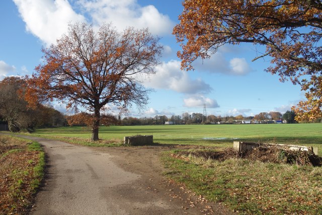
Addlestone is well-connected to the surrounding green spaces, with nearby attractions such as Chertsey Meads, Bourneside Nature Reserve, and the River Thames, offering opportunities for outdoor activities and relaxation.

Overall, Addlestone is a vibrant and well-connected town that offers a mix of urban amenities and natural beauty, making it an attractive place to live and work in Surrey.

If you have any feedback on the listing, please let us know in the comments section below.
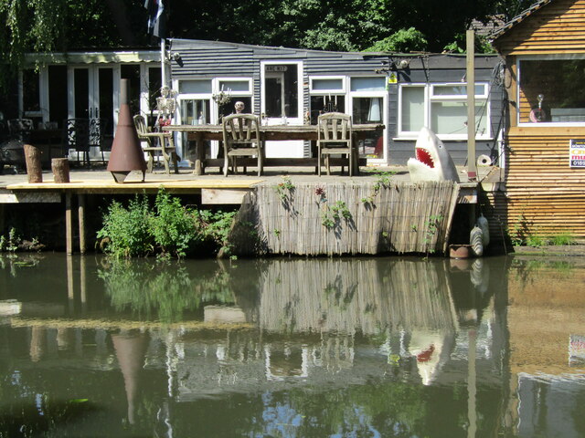
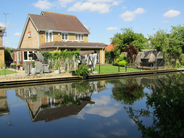
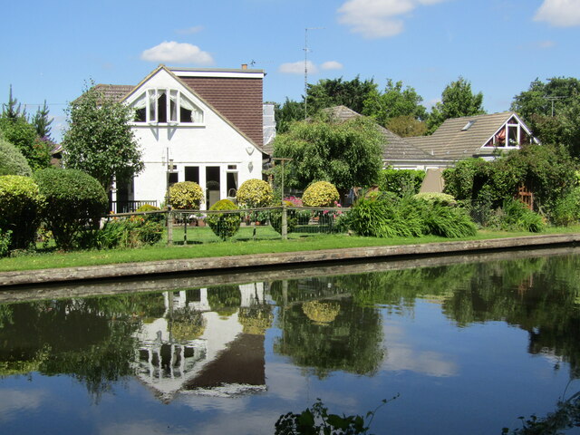
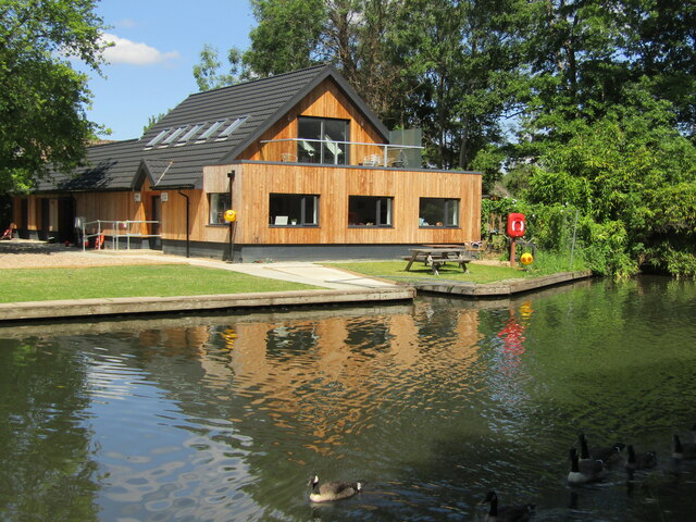
Addlestone Images

Images are sourced within 2km of 51.368936/-0.495167 or Grid Reference TQ0464. Thanks to Geograph Open Source API. All images are credited.

Flat Landscape, Wey Manor Farm The undramatic landscape of the lower Wey valley near New Haw.
Flat Landscape, Wey Manor Farm
The undramatic landscape of the lower Wey valley near New Haw.
Coxes Lock Mills The converted Mills at Coxes Lock, Weybridge.
Coxes Lock Mills
The converted Mills at Coxes Lock, Weybridge.
New Haw - Lock Keeper's Cottage Historic house on the River Wey Navigation, probably early 19th century building.
New Haw - Lock Keeper's Cottage
Historic house on the River Wey Navigation, probably early 19th century building.
New Haw - River Wey Navigation A line of pleasure boats moored south of New Haw Lock.
New Haw - River Wey Navigation
A line of pleasure boats moored south of New Haw Lock.
New Haw Lock The narrowboat "Wey Otter" passing the early 19th century lock keeper's house on the River Wey Navigation.
New Haw Lock
The narrowboat "Wey Otter" passing the early 19th century lock keeper's house on the River Wey Navigation.
New Haw - River Wey Navigation Narrowboat "Wey Otter" heading sedately south from New Haw Lock.
New Haw - River Wey Navigation
Narrowboat "Wey Otter" heading sedately south from New Haw Lock.
New Haw - White Hart Beer Garden The lull before the lunchtime storm beside an arm of the River Wey Navigation.
New Haw - White Hart Beer Garden
The lull before the lunchtime storm beside an arm of the River Wey Navigation.
New Haw - Captain Jack Sparrow Pirate of the Wey Navigation with a topical placard saying "Johnny Depp is Innocent. OK".
New Haw - Captain Jack Sparrow
Pirate of the Wey Navigation with a topical placard saying "Johnny Depp is Innocent. OK".
New Haw - Jaws A scene on the River Wey Navigation bringing a smile to the face - Jolly Roger, skeletons and shark.
New Haw - Jaws
A scene on the River Wey Navigation bringing a smile to the face - Jolly Roger, skeletons and shark.
New Haw - River Wey Navigation Reflective riverside scene north of New Haw Lock.
New Haw - River Wey Navigation
Reflective riverside scene north of New Haw Lock.
New Haw - River Wey Navigation An attractive riverside residential area north of New Haw Lock.
New Haw - River Wey Navigation
An attractive riverside residential area north of New Haw Lock.
New Haw - Addlestone Canoe Club Modern boat- and clubhouse with moorings on the River Wey Navigation.
New Haw - Addlestone Canoe Club
Modern boat- and clubhouse with moorings on the River Wey Navigation.
Addlestone - Coxes Lock Mill Mill on the River Wey Navigation, first built 1776, rebuilt 1901, finally closed 1983. It has been an iron mill, silk mill and a flour mill before being converted to residential use.
<span class="nowrap"><a title="www.weyriver.co.uk" rel="nofollow ugc noopener" href="http://www.weyriver.co.uk">Link</a><img style="margin-left:2px;" alt="External link" title="External link - shift click to open in new window" src="https://s1.geograph.org.uk/img/external.png" width="10" height="10"/></span>
Addlestone - Coxes Lock Mill
Mill on the River Wey Navigation, first built 1776, rebuilt 1901, finally closed 1983. It has been an iron mill, silk mill and a flour mill before being converted to residential use. LinkExternal link
Addlestone - Coxes Mill Mill on the River Wey Navigation, first built 1776, rebuilt 1901, finally closed 1983. It has been an iron mill, silk mill and a flour mill before being converted to residential use.
<span class="nowrap"><a title="www.weyriver.co.uk" rel="nofollow ugc noopener" href="http://www.weyriver.co.uk">Link</a><img style="margin-left:2px;" alt="External link" title="External link - shift click to open in new window" src="https://s1.geograph.org.uk/img/external.png" width="10" height="10"/></span>
Addlestone - Coxes Mill
Mill on the River Wey Navigation, first built 1776, rebuilt 1901, finally closed 1983. It has been an iron mill, silk mill and a flour mill before being converted to residential use. LinkExternal link
Addlestone - Coxes Mill Pond On the River Wey Navigation immediately upstream of Coxes Lock and Coxes Mill. The large pond resolved fluctuating river levels caused by the lock operations.
<span class="nowrap"><a title="www.weyriver.co.uk" rel="nofollow ugc noopener" href="http://www.weyriver.co.uk">Link</a><img style="margin-left:2px;" alt="External link" title="External link - shift click to open in new window" src="https://s1.geograph.org.uk/img/external.png" width="10" height="10"/></span>
Addlestone - Coxes Mill Pond
On the River Wey Navigation immediately upstream of Coxes Lock and Coxes Mill. The large pond resolved fluctuating river levels caused by the lock operations. LinkExternal link
Addlestone - Coxes Lock and Mill Mill on the River Wey Navigation, first built 1776, rebuilt 1901, finally closed 1983. It had been an iron mill, silk mill and a flour mill before being converted to residential use.
<span class="nowrap"><a title="www.weyriver.co.uk" rel="nofollow ugc noopener" href="http://www.weyriver.co.uk">Link</a><img style="margin-left:2px;" alt="External link" title="External link - shift click to open in new window" src="https://s1.geograph.org.uk/img/external.png" width="10" height="10"/></span>
Addlestone - Coxes Lock and Mill
Mill on the River Wey Navigation, first built 1776, rebuilt 1901, finally closed 1983. It had been an iron mill, silk mill and a flour mill before being converted to residential use. LinkExternal link
Addlestone - Coxes Mill Mill on the River Wey Navigation, first built 1776, rebuilt 1901, finally closed 1983. It has been an iron mill, silk mill and a flour mill before being converted to residential use.
<span class="nowrap"><a title="www.weyriver.co.uk" rel="nofollow ugc noopener" href="http://www.weyriver.co.uk">Link</a><img style="margin-left:2px;" alt="External link" title="External link - shift click to open in new window" src="https://s1.geograph.org.uk/img/external.png" width="10" height="10"/></span>
Addlestone - Coxes Mill
Mill on the River Wey Navigation, first built 1776, rebuilt 1901, finally closed 1983. It has been an iron mill, silk mill and a flour mill before being converted to residential use. LinkExternal link
Show me another place!

Addlestone is located at Grid Ref: TQ0464 (Lat: 51.368936, Lng: -0.495167)

Administrative County: Surrey

District: Runnymede

Police Authority: Surrey

What 3 Words

///wrong.haven.means. Near Addlestone, Surrey

Nearby Locations

Addlestone

Related Wikis

Addlestone

Addlestone ( or ) is a town in Surrey, England. It is located approximately 18.6 mi (29.9 km) southwest of London. The town is the administrative centre...

Jubilee High School

Jubilee High School is a coeducational secondary school with academy status, located in Addlestone, Surrey, England. The school holds Artsmark Gold Award...

Addlestone railway station

Addlestone railway station serves the town of Addlestone in the Runnymede District of Surrey, England. It is located on the Chertsey Branch Line and is...
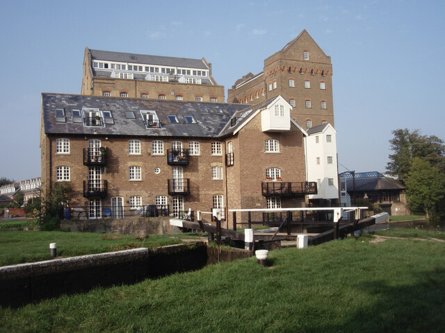
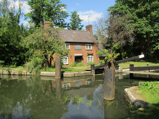
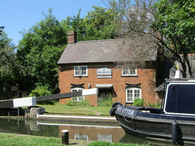
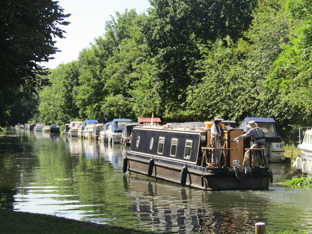
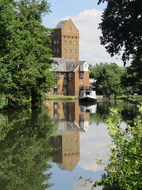
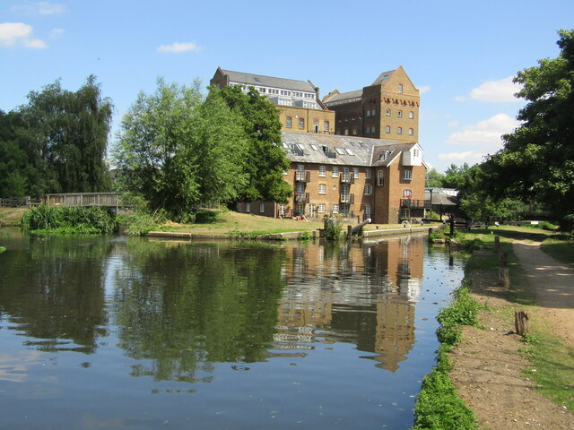
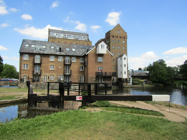
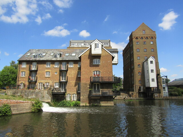
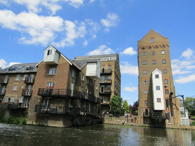
Coxes Lock

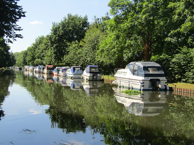
Coxes Lock is towards the northern end of the Wey Navigation parallel to the River Wey in Addlestone, Surrey, Most parts of the navigation are canal sections...
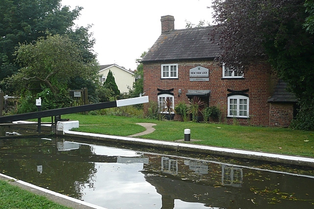
New Haw

New Haw is a village which is part of the Borough of Runnymede in Surrey, England. It is located approximately 1 mile (1.6 km) south of Addlestone and...

St George's College, Weybridge

St George's Weybridge is an independent mixed Roman Catholic co-educational Josephite day school in Surrey, taking pupils from 3 to 18. St George's Weybridge...

Abbey Rangers F.C.

Abbey Rangers Football Club is a football club based in Addlestone, England. The club are currently members of the Combined Counties League Premier Division...

Chertsey High School

Chertsey High School is a co-educational secondary free school located on Chertsey Road in Addlestone, Surrey, England. The school was opened on 6 September...

Nearby Amenities

Located within 500m of 51.368936,-0.495167
Post Box
Collection Plate: CP1
Collection Times: Mo-Fr 17:30; Sa 13:00
Last Checked: 2021-08-29
Operator: Royal Mail
Operator Wikidata: Q638098
Post Box Apertures: 2
Post Box Design: type_c
Post Box Type: pillar
Ref: KT15 50;KT15 5001
Royal Cypher: EIIR
Royal Cypher Wikidata: Q33102113
Source: survey
Lat/Long: 51.3713647/-0.4893465
Barrier: cycle_barrier
Foot: yes
Lat/Long: 51.3718178/-0.4898762
Bus Stop
Crockford Park Road
Bench: no
Flag: yes
Lit: no
Naptan AtcoCode: 40004401083A
Naptan Bearing: NW
Naptan CommonName: Crockford Park Road
Naptan Indicator: Just Before
Naptan Landmark: Crockford Park Road
Naptan NaptanCode: suramdmt
Naptan Street: New Haw Road
Naptan Verified: no
Public Transport: platform
Shelter: no
Source: naptan_import
Lat/Long: 51.3668429/-0.4903586
Bus Stop
Crockford Park Road
Naptan AtcoCode: 40004401083B
Naptan Bearing: SE
Naptan CommonName: Crockford Park Road
Naptan Indicator: Just after
Naptan Landmark: Crockford Park Road
Naptan NaptanCode: suramdmw
Naptan Street: New Haw Road
Naptan Verified: no
Public Transport: platform
Shelter: yes
Source: naptan_import
Lat/Long: 51.3669563/-0.4902971
Bus Stop
Birchfield Close
Naptan AtcoCode: 40004401110A
Naptan Bearing: E
Naptan CommonName: Birchfield Close
Naptan Indicator: Just Before
Naptan Landmark: Birchfield Close
Naptan NaptanCode: surapdap
Naptan Street: Church Road
Naptan Verified: no
Public Transport: platform
Source: naptan_import
Lat/Long: 51.3695017/-0.4981398
Bus Stop
Birchfield Close
Naptan AtcoCode: 40004401110B
Naptan Bearing: W
Naptan CommonName: Birchfield Close
Naptan Indicator: Just after
Naptan Landmark: Birchfield Close
Naptan NaptanCode: surapdmw
Naptan Street: Church Road
Naptan Verified: no
Public Transport: platform
Source: naptan_import
Lat/Long: 51.3693379/-0.4983455
Bus Stop
Church Road
Local Ref: A
Naptan AtcoCode: 40004401111A
Naptan Bearing: SW
Naptan CommonName: Library
Naptan Indicator: O/s
Naptan Landmark: Addlestone Library
Naptan NaptanCode: surapgdm
Naptan Street: Church Road
Naptan Verified: no
Public Transport: platform
Shelter: yes
Source: naptan_import
Toilets Wheelchair: no
Website: http://nextbuses.mobi/WebView/BusStopSearch/BusStopSearchResults/surapgdm?currentPage=0
Wheelchair: yes
Wheelchair Description: Step-free to all nearby stops via controlled crossings at Station Road crossroads, 100m to east.
Lat/Long: 51.3703993/-0.4939009
Bus Stop
Dukes Court
Bench: yes
Flag: yes
Lit: yes
Local Ref: C
Naptan AtcoCode: 40004401111B
Naptan Bearing: SE
Naptan CommonName: Library
Naptan Indicator: Opp
Naptan Landmark: Dukes Court
Naptan NaptanCode: surapgdp
Naptan Street: Brighton Road
Naptan Verified: no
Public Transport: platform
Shelter: yes
Source: naptan_import
Toilets Wheelchair: no
Website: http://nextbuses.mobi/WebView/BusStopSearch/BusStopSearchResults/surapgdp?currentPage=0
Wheelchair: yes
Wheelchair Description: Raised kerb. Step-free to all nearby stops via controlled crossings at Station Road crossroads.
Lat/Long: 51.3703344/-0.49254
Bus Stop
Crouch Oak Lane
Local Ref: D
Naptan AtcoCode: 40004401111C
Naptan Bearing: NE
Naptan CommonName: Library
Naptan Indicator: Just after
Naptan Landmark: Crouch oak lane
Naptan NaptanCode: surapgma
Naptan Street: Station Road
Naptan Verified: no
Public Transport: platform
Source: naptan_import
Toilets Wheelchair: no
Website: http://nextbuses.mobi/WebView/BusStopSearch/BusStopSearchResults/surapgma?currentPage=0
Wheelchair: yes
Wheelchair Description: Step-free to all nearby stops via controlled crossings at High Street crossroads, 100m to west. Tactile island crossing just to east.
Lat/Long: 51.370956/-0.4920703
Bus Stop
Holly Tree
Local Ref: B
Naptan AtcoCode: 40004401111D
Naptan Bearing: N
Naptan CommonName: High Street
Naptan Indicator: N-bound
Naptan Landmark: Holly Tree
Naptan NaptanCode: surapgmd
Naptan Street: High Street
Naptan Verified: no
Public Transport: platform
Source: naptan_import;voice
Toilets Wheelchair: no
Website: http://nextbuses.mobi/WebView/BusStopSearch/BusStopSearchResults/surapgmd?currentPage=0
Wheelchair: yes
Wheelchair Description: Step-free to all nearby stops via controlled crossings at Station Road crossroads, 150m to south.
Lat/Long: 51.3717465/-0.4936418
Bus Stop
High Street
Naptan AtcoCode: 40004401111E
Naptan Bearing: S
Naptan CommonName: High Street
Naptan Indicator: S-bound
Naptan Landmark: High Street
Naptan NaptanCode: surapgwd
Naptan Street: High Street
Naptan Verified: no
Public Transport: platform
Source: naptan_import
Lat/Long: 51.3729914/-0.4933533
[not a stop 2018]
Naptan AtcoCode: 40004401111F
Naptan Bearing: N
Naptan CommonName: Library
Naptan Indicator: adj
Naptan Landmark: Addlestone Library
Naptan NaptanCode: surapjga
Naptan Street: Brighton Road
Naptan Verified: no
Source: naptan_import
Wheelchair: no
Lat/Long: 51.3704473/-0.4928332
Crossing
Crossing: marked
Source: survey
Tactile Paving: yes
Lat/Long: 51.3684979/-0.5022246
Pub
The Waggon & Horses
Source: survey
Lat/Long: 51.3717235/-0.4984943
Bus Stop
Addlestone Library
Public Transport: platform
Shelter: yes
Source: survey
Lat/Long: 51.3701766/-0.4953108
Crossing
Button Operated: yes
Crossing: traffic_signals
Crossing Ref: pelican
Kerb: lowered
Sloped Curb: yes
Tactile Paving: yes
Lat/Long: 51.3707829/-0.493001
Crossing
Button Operated: yes
Crossing: traffic_signals
Crossing Ref: pelican
Kerb: lowered
Sloped Curb: yes
Tactile Paving: yes
Lat/Long: 51.3706573/-0.4930734
Crossing
Button Operated: yes
Crossing: traffic_signals
Crossing Ref: pelican
Kerb: lowered
Sloped Curb: yes
Tactile Paving: yes
Lat/Long: 51.370598/-0.4928554
Crossing
Button Operated: yes
Crossing: traffic_signals
Crossing Ref: pelican
Kerb: lowered
Sloped Curb: yes
Tactile Paving: yes
Lat/Long: 51.3707388/-0.4927002
Traffic Signals
Source: Local Knowledge
Traffic Signals Direction: backward
Lat/Long: 51.3673449/-0.4909238
Addlestone
Place: town
Source: OS_OpenData_StreetView
Wikidata: Q353307
Wikipedia: en:Addlestone
Lat/Long: 51.3711193/-0.4895776
Turning Circle
Lat/Long: 51.365303/-0.4929074
Turning Circle
Lat/Long: 51.3658961/-0.4948025
Give Way
Lat/Long: 51.3700159/-0.4894987
Traffic Signals
Source: Local Knowledge
Traffic Signals Direction: forward
Lat/Long: 51.3673003/-0.4906444
Barrier: block
Bicycle: yes
Foot: yes
Lat/Long: 51.3674118/-0.4889878
Mini Roundabout
Direction: clockwise
Lat/Long: 51.3683546/-0.4884251
Crossing
Crossing: uncontrolled
Crossing Ref: zebra
Kerb: lowered
Sloped Curb: yes
Source: Bing
Lat/Long: 51.3691898/-0.4895925
Noexit: yes
Lat/Long: 51.3716132/-0.4930966
Police
Addlestone Police
Addr City: Addlestone
Addr Street: Station Road
Note: Desk locations (Police and Borough) moved following refurbishment and new entrance
Wheelchair: yes
Wheelchair Description: In Civic Offices. Step-free from street via powered door (opens outward). High counter. [Loop signage but no working Loop Feb 2018]
Lat/Long: 51.3708355/-0.4911148
Library
Addlestone Library
Addr City: Addlestone
Addr Street: Station Road
Wheelchair: yes
Wheelchair Description: Step-free from street via powered door (opens outward). Working Hearing Loops at low counters - Feb 2018.
Wikidata: Q55121861
Lat/Long: 51.370925/-0.4908648
Post Box
Collection Times: Mo-Fr 17:15; Sa 12:15
Operator: Royal Mail
Post Box Type: pillar
Ref: KT15 159
Royal Cypher: GR
Royal Cypher Wikidata: Q33102273
Lat/Long: 51.3714446/-0.4969671
Defibrillator
Emergency: defibrillator
Indoor: no
Source: survey
Lat/Long: 51.3711948/-0.4913017
Townhall
Runnymede Borough Council
Addr City: Addlestone
Addr Housename: Runnymede Civic Centre
Addr Postcode: KT15 2AH
Addr Street: Station Road
Note: Desk locations (Police and Borough) moved following refurbishment and new entrance
Wheelchair: yes
Wheelchair Description: Step-free from street via powered door (opens outward). [No hearing loops 2/2018]
Lat/Long: 51.3708395/-0.4910288
Place Of Worship
Addlestone Baptist Church
Building: yes
Denomination: baptist
Religion: christian
Lat/Long: 51.3713564/-0.4919514
Crossing
Button Operated: yes
Crossing: traffic_signals
Crossing Ref: pelican
Kerb: lowered
Sloped Curb: yes
Source: survey
Lat/Long: 51.3713199/-0.4902624
Traffic Signals
Source: Local Knowledge
Traffic Signals Direction: forward
Lat/Long: 51.3671383/-0.4910443
Traffic Signals
Source: Local Knowledge
Traffic Signals Direction: forward
Lat/Long: 51.3671053/-0.4906975
Restaurant
Beijing
Addr City: Addlestone
Addr Street: Station Road
Cuisine: chinese
Source: Local Knowledge
Wheelchair: no
Wheelchair Description: Footway outside has kerb all around, so pavement inaccessible = doors inaccessible from street. Toilet not yet checked.
Lat/Long: 51.3710441/-0.4920919
Pharmacy
Lloyds Pharmacy
Addr City: Addlestone
Addr Street: Station Road
Brand: Lloyds Pharmacy
Brand Wikidata: Q6662870
Brand Wikipedia: en:LloydsPharmacy
Healthcare: pharmacy
Source: Local Knowledge
Wheelchair: yes
Wheelchair Description: Ramp to wide doorway.
Lat/Long: 51.3715157/-0.4899268
Fast Food
Papa John's
Addr City: Addlestone
Addr Street: Station Road
Brand: Papa John's
Brand Wikidata: Q2759586
Brand Wikipedia: en:Papa John's Pizza
Cuisine: pizza
Source: Local Knowledge
Takeaway: yes
Website: https://www.papajohns.co.uk/stores/addlestone
Wheelchair: yes
Wheelchair Description: Step-free entrance.
Lat/Long: 51.3712735/-0.4896837
Leightons Opticians
Addr City: Addlestone
Addr Housenumber: 76
Addr Street: Station Road
Brand: Leightons
Brand Wikidata: Q117867339
Contact Website: https://www.leightons.co.uk/branches/addlestone
Phone: +44 800 40 20 20
Shop: optician
Source: Local Knowledge
Source 1: survey
Wheelchair: no
Wheelchair Description: Wide entrance with step.
Lat/Long: 51.3713061/-0.4892999
Fast Food
The Marlin
Addr City: Addlestone
Addr Street: Station Road
Cuisine: fish_and_chips
Drive Through: no
Source: Local Knowledge
Wheelchair: yes
Lat/Long: 51.3712593/-0.4898409
Cooperative Funeralcare
Addr City: Addlestone
Addr Street: Station Road
Phone: +44 1932 831210
Shop: funeral_directors
Wheelchair Description: Narrow doorway.
Lat/Long: 51.3713002/-0.4894854
Crossing
Crossing: unmarked
Kerb: lowered
Sloped Curb: yes
Source: Bing
Lat/Long: 51.3682075/-0.4912254
Fast Food
Bokays
Addr City: Addlestone
Addr Housenumber: 116
Addr Postcode: KT15 1SG
Addr Street: Church Road
Cuisine: chinese
Lat/Long: 51.3693114/-0.4994497
Cafe
Bread & Roses Cafe
Addr City: Addlestone
Addr Street: Station Road
Source: survey
Wheelchair: yes
Wheelchair Description: Outside seating and step free entrance. Toilet not checked.
Lat/Long: 51.3712795/-0.4896093
Post Box
Check Date: 2021-08-11
Operator: Royal Mail
Post Box Type: pillar
Ref: KT15 42
Royal Cypher: GR
Royal Cypher Wikidata: Q33102273
Lat/Long: 51.3670206/-0.4910897
Dentist
Premier Dental Care
Addr City: Addlestone
Addr Street: Station Road
Source: Local Knowledge
Wheelchair: no
Wheelchair Description: Entrance has a step.
Lat/Long: 51.3715031/-0.4900653
Addlestone Food & Wine
Addr City: Addlestone
Addr Street: Station Road
Shop: alcohol
Source: Local Knowledge
Wheelchair Description: Shutters down when visited 6th February 2018
Lat/Long: 51.371255/-0.4898992
Oxfam
Brand: Oxfam
Brand Wikidata: Q267941
Brand Wikipedia: en:Oxfam
Contact Website: https://www.oxfam.org.uk/shops/oxfam-shop-addlestone/
Shop: charity
Source: Local Knowledge
Wheelchair: yes
Lat/Long: 51.37135/-0.4891024
Crossing
Crossing: traffic_signals
Crossing Ref: pelican
Kerb: lowered
Sloped Curb: yes
Lat/Long: 51.3672783/-0.4906918
Crossing
Crossing: traffic_signals
Crossing Ref: pelican
Kerb: lowered
Sloped Curb: yes
Lat/Long: 51.3671553/-0.4909987
Crossing
Crossing: traffic_signals
Crossing Ref: pelican
Kerb: lowered
Sloped Curb: yes
Lat/Long: 51.3673127/-0.4909037
Crossing
Crossing: traffic_signals
Crossing Ref: pelican
Kerb: lowered
Sloped Curb: yes
Lat/Long: 51.3671443/-0.4907661
Traffic Signals
Source: SAS
Traffic Signals Direction: backward
Lat/Long: 51.3713362/-0.4901839
Traffic Signals
Source: SAS
Traffic Signals Direction: forward
Lat/Long: 51.371302/-0.4903422
Traffic Signals
Source: SAS
Traffic Signals Direction: forward
Lat/Long: 51.3705132/-0.4927841
Traffic Signals
Source: SAS
Traffic Signals Direction: backward
Lat/Long: 51.3708256/-0.493036
Traffic Signals
Source: SAS
Traffic Signals Direction: forward
Lat/Long: 51.3706467/-0.4931166
Traffic Signals
Source: SAS
Traffic Signals Direction: backward
Lat/Long: 51.3707577/-0.4926238
Parking Entrance
Lat/Long: 51.370829/-0.4891788
QEF
Addr City: Addlestone
Addr Housenumber: 72
Addr Street: Station Road
Phone: +44 1932 854268
Second Hand: yes
Shop: charity
Wheelchair: yes
Lat/Long: 51.3712942/-0.4895453
Pandrol
Office: yes
Lat/Long: 51.3716046/-0.4900238
Barrier: bollard
Bollard: rising
Foot: yes
Motor Vehicle: permissive
Lat/Long: 51.3706116/-0.4911624
Euronics
Branch: F T Refrigeration Services
Brand: Euronics
Brand Wikidata: Q184860
Brand Wikipedia: en:Euronics
Shop: electronics
Lat/Long: 51.3718865/-0.49369
Euronics
Branch: F T Refrigeration Services
Brand: Euronics
Brand Wikidata: Q184860
Brand Wikipedia: en:Euronics
Shop: electronics
Lat/Long: 51.3716571/-0.4932742
Euronics
Branch: F T Refrigeration Services
Brand: Euronics
Brand Wikidata: Q184860
Brand Wikipedia: en:Euronics
Shop: electronics
Lat/Long: 51.3712904/-0.4935237
Ashley Flooring
Shop: carpet
Lat/Long: 51.3717525/-0.4933091
Fast Food
Little Japan
Addr City: Addlestone
Addr Street: High Street
Cuisine: japanese
Drive Through: no
Takeaway: only
Wheelchair: no
Wheelchair Description: Narrow doorway and step.
Lat/Long: 51.3712385/-0.4934674
Fast Food
Loon Hing
Addr City: Addlestone
Addr Street: High Street
Cuisine: chinese
Drive Through: no
Takeaway: only
Wheelchair: no
Wheelchair Description: Step.
Lat/Long: 51.3711648/-0.4934164
Fast Food
Thai Yum Yum
Addr City: Addlestone
Addr Street: High Street
Cuisine: thai
Drive Through: no
Takeaway: yes
Wheelchair: no
Wheelchair Description: Narrow doorway and step inside.
Lat/Long: 51.3710777/-0.493352
The Laundry Basket
Shop: laundry
Lat/Long: 51.3709639/-0.4932608
Crossing
Crossing: uncontrolled
Crossing Island: yes
Kerb: lowered
Sloped Curb: yes
Source: survey
Tactile Paving: yes
Lat/Long: 51.3709642/-0.4917797
Anytime Fitness
Brand: Anytime Fitness
Brand Wikidata: Q4778364
Brand Wikipedia: en:Anytime Fitness
Leisure: fitness_centre
Website: https://www.anytimefitness.co.uk/gyms/uk-0353/addlestone-south-east-kt15-2gb/
Lat/Long: 51.3699528/-0.4896966
Entrance: yes
Lat/Long: 51.3705686/-0.491623
Bench
Lat/Long: 51.3713266/-0.4897982
Bicycle Parking
Bicycle Parking: stands
Lat/Long: 51.371335/-0.4897177
Bicycle Parking
Bicycle Parking: stands
Lat/Long: 51.371273/-0.4901496
Crossing
Crossing: uncontrolled
Crossing Island: yes
Kerb: lowered
Sloped Curb: yes
Source: survey
Lat/Long: 51.371448/-0.4893771
Bicycle Parking
Bicycle Parking: stands
Lat/Long: 51.3701478/-0.4901201
Barrier: lift_gate
Lat/Long: 51.3701808/-0.4916952
Barrier: lift_gate
Lat/Long: 51.3702365/-0.4914802
Bicycle Parking
Bicycle Parking: stands
Lat/Long: 51.3706987/-0.4913029
Entrance: yes
Wheelchair: yes
Lat/Long: 51.3708585/-0.4916813
Entrance: yes
Lat/Long: 51.3706645/-0.4917665
Addr City: Addlestone
Addr Street: Station Road
Entrance: yes
Note: Automatic sliding door
Wheelchair: yes
Lat/Long: 51.3708209/-0.4918282
Parking
Access: customers
Lat/Long: 51.3716018/-0.4904871
Parking
Access: customers
Addr City: Addlestone
Addr Street: Off Crouch Oak Lane
Fee: no
Parking: surface
Wheelchair: yes
Wheelchair Description: Dedicated Blue Badge space is nearest to Centre entrance.
Lat/Long: 51.3713272/-0.491104
Addr City: Addlestone
Addr Street: Station Road
Office: yes
Lat/Long: 51.3710828/-0.4919543
Entrance: main
Note: Entrance/Exit: Revolving Door and button operated powered door - opens outward
Lat/Long: 51.3709558/-0.4912242
Parking
CAB
Access: customers
Addr City: Addlestone
Addr Street: Church Road
Capacity: 2
Fee: no
Note: Blue Badge only
Operator: CAB
Parking: surface
Wheelchair: yes
Wheelchair Description: 2x Dedicated Blue Badge spaces near entrance to CAB. No other parking.
Lat/Long: 51.3704089/-0.4937772
Weybridge Police War Memorial
Addr City: Addlestone
Addr Housenumber: Council Offices
Addr Street: Station Road
Historic: memorial
Note: on inside of building
Wheelchair: yes
Wheelchair Description: On wall inside Civil Offices, next to Police Counter. Access via powered door from street during opening hours.
Lat/Long: 51.3708686/-0.4912524
Parcel Locker
Amazon Hub Locker
Brand: Amazon Hub
Brand Wikidata: Q16974764
Brand Wikipedia: en:Amazon Locker
Operator: Amazon
Parcel Mail In: yes
Lat/Long: 51.3708729/-0.4891848
Crossing
Crossing: unmarked
Kerb: lowered
Sloped Curb: yes
Lat/Long: 51.3701992/-0.4898623
Cinema
The Light
Lat/Long: 51.3707171/-0.4897469
Access: no
Barrier: lift_gate
Foot: yes
Locked: yes
Motor Vehicle: permissive
Lat/Long: 51.370277/-0.4902043
Boots Opticians
Brand: Boots Opticians
Brand Wikidata: Q4944037
Brand Wikipedia: en:Boots Opticians
Operator: Boots
Shop: optician
Short Name: Boots
Lat/Long: 51.3708694/-0.4899629
Shop: vacant
Lat/Long: 51.3708272/-0.4899278
Restaurant
Smith and Western
Cuisine: american
Website: https://www.smith-western.co.uk/addlestone
Lat/Long: 51.3704089/-0.4898667
Crossing
Crossing: unmarked
Kerb: lowered
Sloped Curb: yes
Lat/Long: 51.3700834/-0.4896326
Barrier: kerb
Lat/Long: 51.3714692/-0.4897062
Crossing
Crossing: unmarked
Crossing Island: no
Kerb: lowered
Sloped Curb: yes
Lat/Long: 51.3710757/-0.4915997
Restaurant
Nando's
Brand: Nando's
Brand Wikidata: Q3472954
Brand Wikipedia: en:Nando's
Cuisine: chicken;portuguese
Website: https://www.nandos.co.uk/restaurants/addlestone
Lat/Long: 51.3711088/-0.4900381
Post Box
Collection Times: Mo-Fr 17:00; Sa 12:15
Operator: Royal Mail
Post Box Type: pillar
Ref: KT15 202
Royal Cypher: EVIIR
Royal Cypher Wikidata: Q33102324
Lat/Long: 51.3703923/-0.49426
Post Box
Collection Times: Mo-Fr 16:30; Sa 11:30
Operator: Royal Mail
Post Box Type: pillar
Ref: KT15 93
Royal Cypher: EIIR
Royal Cypher Wikidata: Q33102113
Lat/Long: 51.3672973/-0.4982852
Waitrose
Brand: Waitrose
Brand Wikidata: Q771734
Brand Wikipedia: en:Waitrose
Shop: convenience
Website: https://www.waitrose.com/find-a-store/addlestone
Lat/Long: 51.3707495/-0.4915831
Dentist
Dental and Facial Aesthetic Addlestone
Healthcare: dentist
Website: https://dfa-addlestone.com/
Lat/Long: 51.3706035/-0.4913601
Cafe
Esquires Cafe
Outdoor Seating: yes
Lat/Long: 51.3705331/-0.4897536
Restaurant
Terra Brazil Brazilian Steakhouse Rozidio
Cuisine: brazilian;steak_house
Lat/Long: 51.3707549/-0.4898741
Addlestone Gent
Shop: hairdresser
Lat/Long: 51.3722495/-0.4934516
Simply Convenience
Shop: convenience
Lat/Long: 51.3723219/-0.49345
Inkorium
Shop: tattoo
Lat/Long: 51.3723727/-0.4934485
Noexit: yes
Lat/Long: 51.3708365/-0.4905865
Entrance: yes
Lat/Long: 51.3714699/-0.4905224
Entrance: main
Lat/Long: 51.3714303/-0.4905806
The data included in this document is from www.openstreetmap.org. The data is made available under ODbL.

Have you been to Addlestone?

Leave your review of Addlestone below (or comments, questions and feedback).