Riverside

Settlement in Stirlingshire

Scotland

Riverside

River Forth Passing Stirling County Cricket Club
River Forth Credit: Eirian Evans

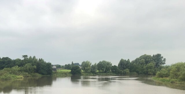
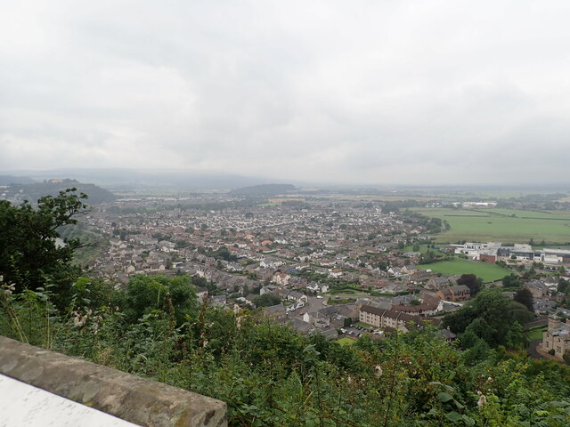
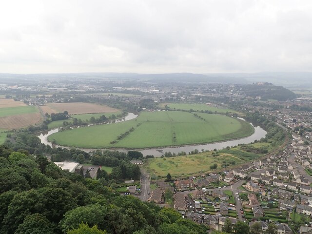
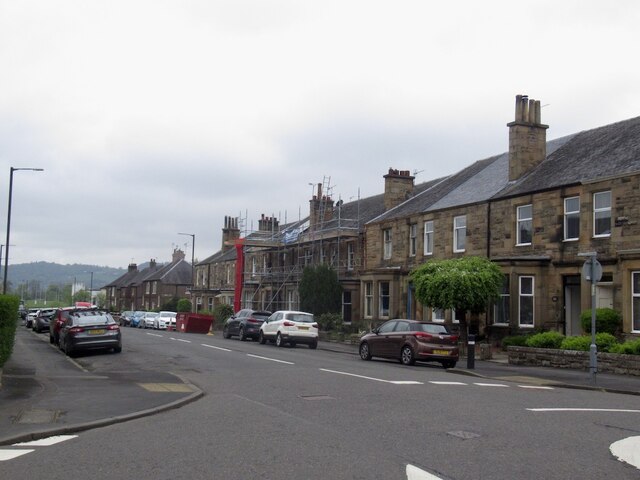
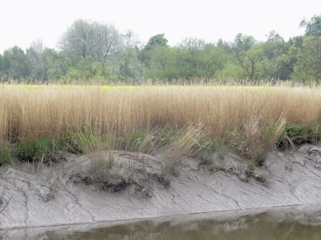
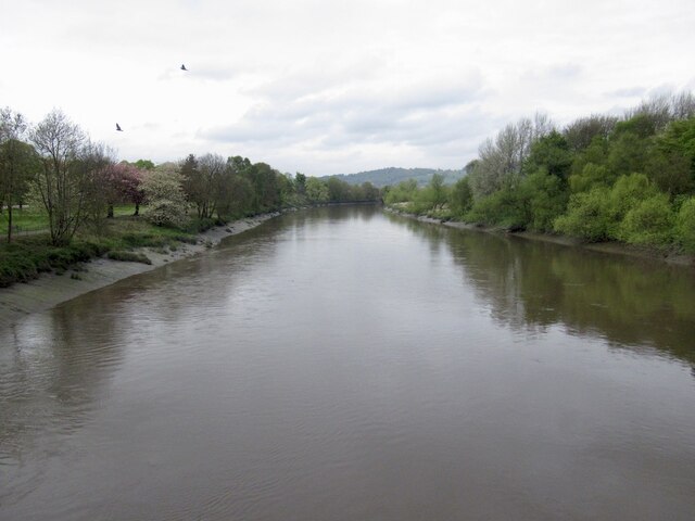
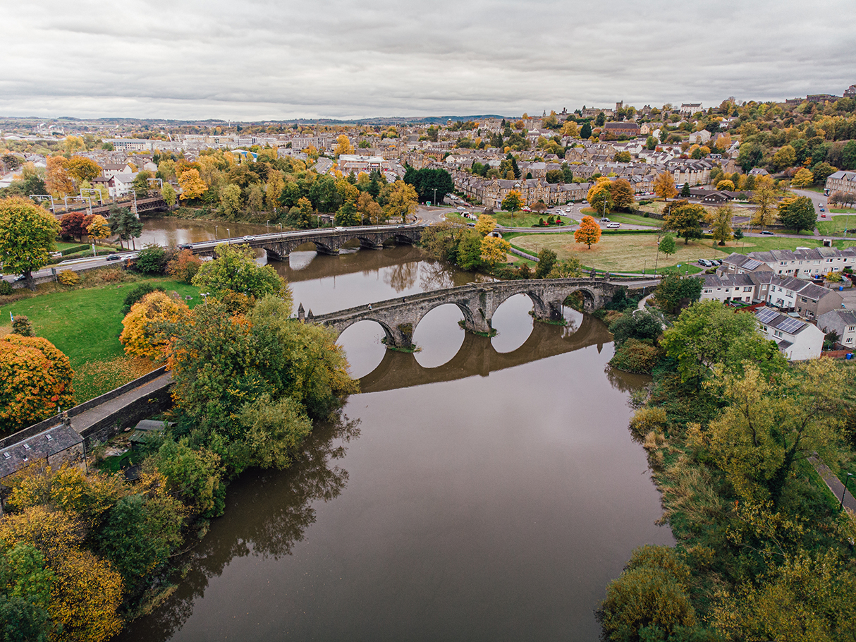
Riverside is a small village located in the county of Stirlingshire, Scotland. Situated on the banks of the River Forth, it offers picturesque views and a tranquil atmosphere for residents and visitors alike. With a population of around 500 people, Riverside is known for its tight-knit community and friendly atmosphere.

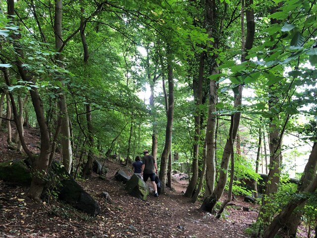
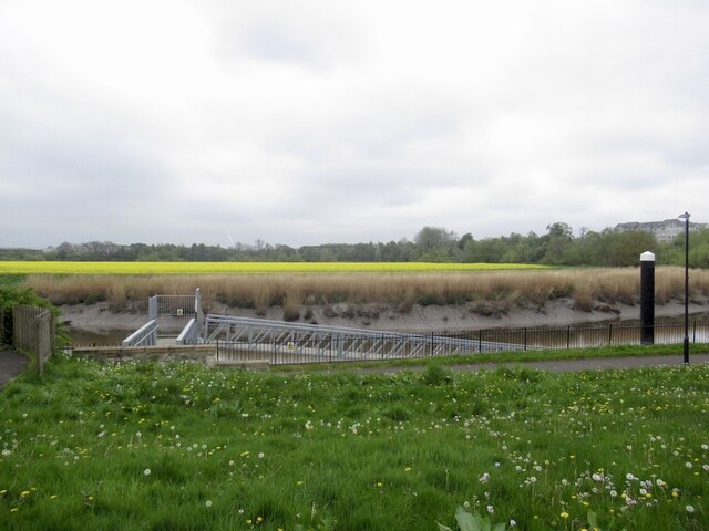
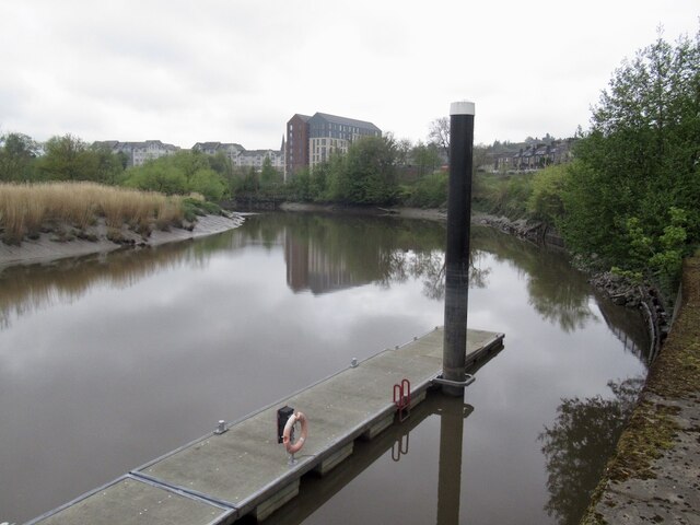
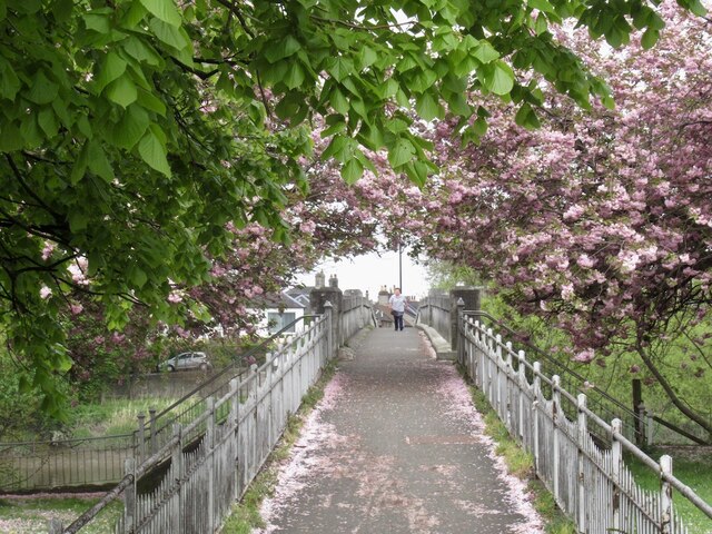
The village is surrounded by stunning natural beauty, with rolling hills and lush green landscapes that are perfect for outdoor activities such as hiking, cycling, and fishing. The River Forth itself provides opportunities for boating and water sports, attracting enthusiasts from all over the region.

Riverside is well-connected to nearby towns and cities, with good transportation links to Stirling, Falkirk, and Edinburgh. This makes it an ideal location for commuters who prefer a quieter lifestyle while still having access to urban amenities.

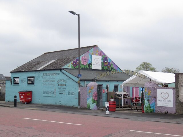
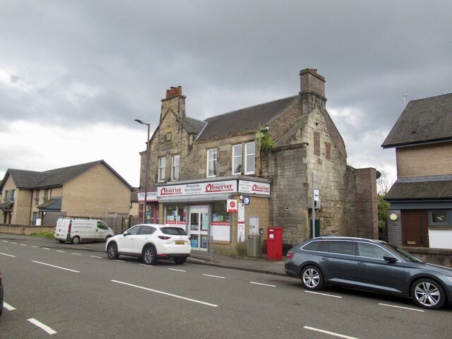
In terms of amenities, Riverside boasts a few local shops and a charming village pub, where residents can gather and socialize. The village also has a primary school, ensuring that families with young children have access to educational facilities within the community.

For those seeking cultural experiences, nearby attractions include the historic Stirling Castle, the Falkirk Wheel, and the famous Kelpies sculptures. Riverside also hosts various community events throughout the year, such as summer fairs and festive celebrations, which further contribute to its vibrant community spirit.

Overall, Riverside offers a peaceful and scenic living environment, making it an attractive place for those seeking a balance between rural and urban lifestyles.

If you have any feedback on the listing, please let us know in the comments section below.
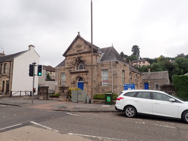
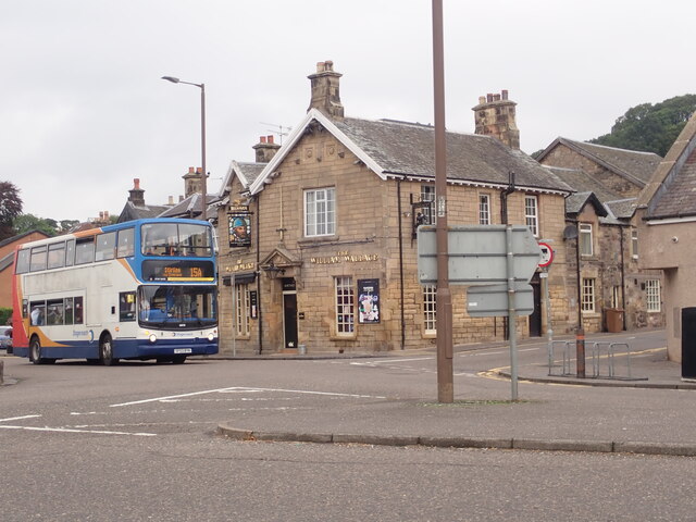
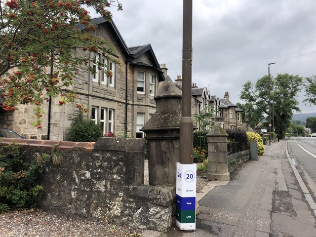
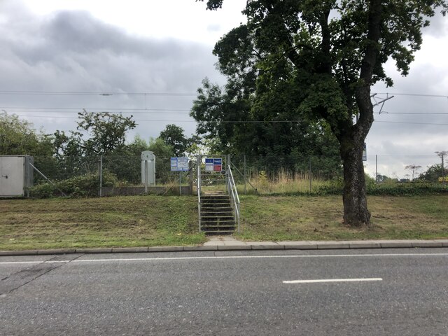
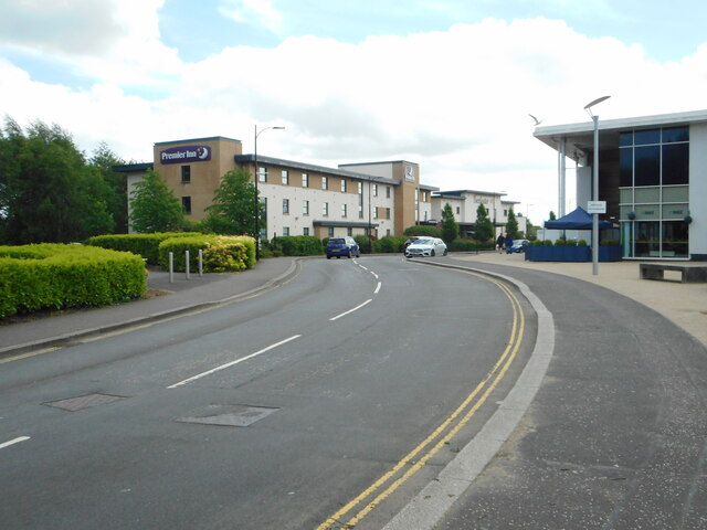
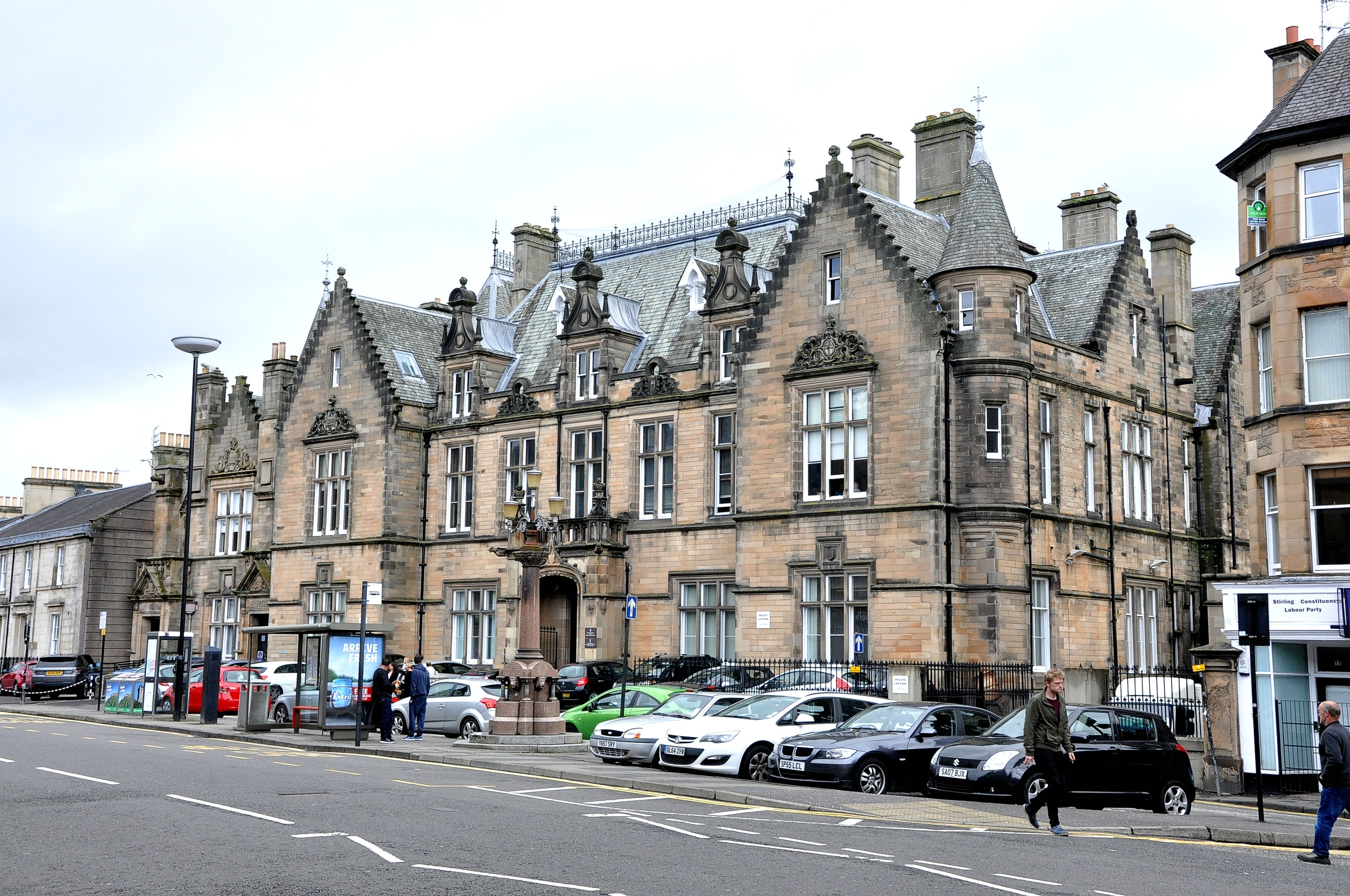
Riverside Images

Images are sourced within 2km of 56.125432/-3.9293051 or Grid Reference NS8094. Thanks to Geograph Open Source API. All images are credited.

River Forth Passing Stirling County Cricket Club
River Forth
Passing Stirling County Cricket Club
Looking down on Stirling from the Wallace Memorial
The National Wallace Memorial A 67 metre tower on Abbey Craig, a hilltop overlooking Stirling. It commemorates Sir William Wallace, a 13th- and 14th-century Scottish hero, whose statue is on the corner of the tower. It was sculpted by David Watson Stevenson.
The National Wallace Memorial
A 67 metre tower on Abbey Craig, a hilltop overlooking Stirling. It commemorates Sir William Wallace, a 13th- and 14th-century Scottish hero, whose statue is on the corner of the tower. It was sculpted by David Watson Stevenson.
A loop in the Forth The suburb of Causewayhead to the right of the river, and Stirling Castle atop its hill in the distance. Taken from the top of Abbey Craig.
A loop in the Forth
The suburb of Causewayhead to the right of the river, and Stirling Castle atop its hill in the distance. Taken from the top of Abbey Craig.
A path through Causewayhead Park woodland
Logie Kirk Hall On Alloa Street
Logie Kirk Hall
On Alloa Street
The William Wallace  Public house at the junction of Airthrey Road and Logie Road.
The William Wallace
Public house at the junction of Airthrey Road and Logie Road.
House on Causewayhead Road
Network Rail access point on Causewayhead Road Not a footpath for the general public but for maintenance work to be carried out on the railway
Network Rail access point on Causewayhead Road
Not a footpath for the general public but for maintenance work to be carried out on the railway
Millar Place, Riverside
Abbey Road Market Shop and cafe, Riverside.
Abbey Road Market
Shop and cafe, Riverside.
Oilseed rape, Cambuskenneth View across the Forth from by the Stirling Council pontoon which is apparently little used.
Oilseed rape, Cambuskenneth
View across the Forth from by the Stirling Council pontoon which is apparently little used.
River Forth, Stirling View from near the pontoon built to encourage traffic up the river.
River Forth, Stirling
View from near the pontoon built to encourage traffic up the river.
Mud, River Forth View from Shore Road, Stirling at low water.
Mud, River Forth
View from Shore Road, Stirling at low water.
Post Office, Riverside On Abbey Road.
Post Office, Riverside
On Abbey Road.
Bridge to Cambuskenneth Linking Stirling's Riverside with Cambuskenneth. The inhabitants of Cambuskenneth did not want a road bridge.
Bridge to Cambuskenneth
Linking Stirling's Riverside with Cambuskenneth. The inhabitants of Cambuskenneth did not want a road bridge.
River Forth On a flood tide, view from the Cambuskenneth bridge.
River Forth
On a flood tide, view from the Cambuskenneth bridge.
Premier Inn, Stirling City Centre On Forthside Way.
Premier Inn, Stirling City Centre
On Forthside Way.
Show me another place!

Riverside is located at Grid Ref: NS8094 (Lat: 56.125432, Lng: -3.9293051)

Unitary Authority: Stirling

Police Authority: Forth Valley

What 3 Words

///graphics.cries.juggle. Near Stirling

Nearby Locations

Riverside Cambuskenneth

Related Wikis

Stirling Rowing Club

Stirling Rowing Club is a rowing club on the River Forth, based at the intersection between Dean Crescent and Queenshaugh Drive, Riverside, Stirling, Scotland...

Battle of Stirling Bridge

The Battle of Stirling Bridge (Scottish Gaelic: Blàr Drochaid Shruighlea) was fought during the First War of Scottish Independence. On 11 September 1297...

Stirling railway station (Scotland)

Stirling railway station is a railway station located in Stirling, Scotland. It is located on the former Caledonian Railway main line between Glasgow and...

Cambuskenneth

Cambuskenneth (Scottish Gaelic: Camas Choinnich [ˈkʰaməs̪ ˈxɤɲɪç]) is a village in the city of Stirling, Scotland. It has a population of 250 and is the...

Stirling Sheriff Court

Stirling Sheriff Court is a judicial building in Viewfield Place, Barnton Street, Stirling, Scotland. The building, which remains in use as a courthouse...

Cambuskenneth Abbey

Cambuskenneth Abbey is an Augustinian monastery located on an area of land enclosed by a meander of the River Forth near Stirling in Scotland. The abbey...

Blackfriars, Stirling

The Church of the Friars Preachers of St Laurence, Stirling, commonly called Blackfriars, was a mendicant friary of the Dominican Order founded in the...

Princes Street drill hall, Stirling

The Princes Street drill hall is a former military installation in Stirling, Scotland. == History == The building was designed as the headquarters of the...

Nearby Amenities

Located within 500m of 56.125432,-3.9293051
Railway: switch
Lat/Long: 56.1237377/-3.9365477
Source: Landsat photo
Lat/Long: 56.1274893/-3.9360753
Source: Landsat photo
Lat/Long: 56.1271475/-3.935458
Source: Landsat photo
Lat/Long: 56.1269267/-3.9348142
Source: Landsat photo
Lat/Long: 56.1267527/-3.9340895
Source: Landsat photo
Lat/Long: 56.1265875/-3.9330716
Source: Landsat photo
Lat/Long: 56.1265104/-3.9320579
Source: Landsat photo
Lat/Long: 56.1265353/-3.9312006
Source: Landsat photo
Lat/Long: 56.1266236/-3.9302507
Source: Landsat photo
Lat/Long: 56.1267998/-3.9295126
Source: Landsat photo
Lat/Long: 56.1270127/-3.9288269
Source: Landsat photo
Lat/Long: 56.1272625/-3.9282324
Source: Landsat photo
Lat/Long: 56.1275832/-3.9277348
Source: Landsat photo
Lat/Long: 56.1279696/-3.9273759
Source: Landsat photo
Lat/Long: 56.1283373/-3.927144
Source: Landsat photo
Lat/Long: 56.1286694/-3.927064
Source: Landsat photo
Lat/Long: 56.1290308/-3.9271282
Source: Landsat photo
Lat/Long: 56.1218495/-3.9263688
Source: Landsat photo
Lat/Long: 56.1221129/-3.9268912
Source: Landsat photo
Lat/Long: 56.1227202/-3.9277936
Source: Landsat photo
Lat/Long: 56.1229924/-3.9283601
Source: Landsat photo
Lat/Long: 56.1232016/-3.9292094
Source: Landsat photo
Lat/Long: 56.1232614/-3.9300387
Source: Landsat photo
Lat/Long: 56.1232162/-3.930589
Source: Landsat photo
Lat/Long: 56.1230841/-3.9310751
Mini Roundabout
Direction: clockwise
Source: survey
Lat/Long: 56.126277/-3.9295817
Mini Roundabout
Direction: clockwise
Source: survey
Lat/Long: 56.1237156/-3.9252424
Mini Roundabout
Direction: clockwise
Source: survey
Lat/Long: 56.124693/-3.9290948
Traffic Signals
Traffic Signals: signal
Lat/Long: 56.126033/-3.9368328
Traffic Signals
Traffic Signals: signal
Lat/Long: 56.1260665/-3.9366779
Riverside Mini Market
Addr City: Stirling
Addr Housenumber: 36
Addr Place: Riverside
Addr Postcode: FK8 1LJ
Addr Street: Abbey Road
Contact Phone: +44 1786 472119
Fhrs Id: 767
Opening Hours: Mo-Su 06:00-22:00
Shop: convenience
Source Addr: fhrs opendata
Lat/Long: 56.1236525/-3.9263148
Post Box
Collection Times: Mo-Fr 16:45; Sa 12:30
Drive Through: no
Operator: Royal Mail
Post Box Type: pillar
Ref: FK8 8
Royal Cypher: scottish_crown
Source: survey
Lat/Long: 56.1237286/-3.9264181
Bicycle Parking
Bicycle Parking: stands
Capacity: 6
Covered: no
Lat/Long: 56.1245732/-3.9371656
Post Box
Collection Times: Mo-Fr 09:00; Sa 07:00
Operator: Royal Mail
Post Box Manufacturer: Carron Company, Stirlingshire
Post Box Type: pillar
Ref: FK8 115D
Royal Cypher: GR
Royal Cypher Wikidata: Q33102273
Source: survey
Lat/Long: 56.1264868/-3.9289295
Railway: switch
Lat/Long: 56.1235144/-3.9365021
Stirling Harbour
Lat/Long: 56.1230569/-3.9318201
Bench
Backrest: yes
Lat/Long: 56.1264051/-3.9339833
Bench
Backrest: yes
Lat/Long: 56.1225476/-3.933058
Board Type: history
Information: board
Tourism: information
Lat/Long: 56.1225458/-3.9330233
Defibrillator
Defibrillator Location: attached to outside wall on left hand side of the main entrance
Emergency: defibrillator
Indoor: no
Lat/Long: 56.1258533/-3.933481
Entrance: yes
Lat/Long: 56.1258234/-3.9334942
Stirling Wood Centre
Shop: building_materials
Lat/Long: 56.1244296/-3.9355415
Addr City: Stirling
Addr Housenumber: 5
Addr Postcode: FK8 1UH
Addr Street: Forrest Road
Entrance: yes
Source Addr Postcode: inference
Lat/Long: 56.1248326/-3.9331106
Addr City: Stirling
Addr Housenumber: 7
Addr Postcode: FK8 1UH
Addr Street: Forrest Road
Entrance: yes
Source Addr Postcode: companieshouse opendata
Lat/Long: 56.1248736/-3.93312
Addr City: Stirling
Addr Housenumber: 7
Addr Postcode: FK8 1UH
Addr Street: Forrest Road
Entrance: yes
Source Addr Postcode: interence
Lat/Long: 56.1249108/-3.9331294
Addr City: Stirling
Addr Housenumber: 9
Addr Postcode: FK8 1UH
Addr Street: Forrest Road
Entrance: yes
Source Addr Postcode: interence
Lat/Long: 56.1249453/-3.933138
Riverside
Place: suburb
Lat/Long: 56.1248785/-3.930255
The Guildry of Stirling
Board Type: history
Direction: 0
Information: board
Inscription: Site of the old Stirling Harbour circa 1600
Tourism: information
Lat/Long: 56.1234091/-3.9306275
Bus Stop
Bench: no
Bus: yes
Naptan AtcoCode: 66004890073
Naptan NaptanCode: 78423964
Shelter: no
Surface: asphalt
Lat/Long: 56.1237391/-3.9265191
Waste Basket
Lat/Long: 56.1237426/-3.9265693
Post Office
Riverside Post Office
Addr City: Stirling
Addr Housenumber: 36
Addr Postcode: FK8 1LJ
Addr Street: Abbey Road
Branch: Riverside
Brand: Post Office
Brand Wikidata: Q1783168
Check Date: 2020-02-20
Contact Website: https://www.postoffice.co.uk/branch-finder/2308681/riverside
Ref Pol Id: 145793
Lat/Long: 56.1236613/-3.9263692
The Repair Centre
Addr City: Stirling
Addr Housenumber: 40
Addr Postcode: FK8 1LJ
Addr Street: Abbey Road
Shop: spare_parts;repair
Source: survey
Lat/Long: 56.1236411/-3.9262273
Cambuskenneth Bridge
Board Type: history
Direction: 270
Information: board
Operator: Xplore Stirling Heritage Trails
Tourism: information
Lat/Long: 56.1240172/-3.9240496
Bus Stop
Riverside Drive at Cambuskenneth Bridge
Bench: yes
Bin: yes
Lit: yes
Naptan AtcoCode: 66004890072
Naptan NaptanCode: 78423965
Shelter: yes
Tactile Paving: no
Lat/Long: 56.1239634/-3.9240114
Riverside News
Shop: convenience
Lat/Long: 56.1240252/-3.9293663
Bus Stop
Millar Place at No. 1
Bench: yes
Bin: yes
Lit: yes
Naptan AtcoCode: 66004890066
Naptan NaptanCode: 78423967
Shelter: yes
Tactile Paving: no
Lat/Long: 56.124177/-3.9291162
Defibrillator
Emergency: defibrillator
Indoor: no
Lat/Long: 56.1239388/-3.929583
Dentist
Riverside Dental Practice
Healthcare: dentist
Lat/Long: 56.1239724/-3.9296733
Generator Method: photovoltaic
Generator Output Electricity: yes
Generator Source: solar
Generator Type: solar_photovoltaic_panel
Power: generator
Lat/Long: 56.1250916/-3.9301827
Bus Stop
Bus: yes
Public Transport: platform
Lat/Long: 56.128563/-3.9343424
The data included in this document is from www.openstreetmap.org. The data is made available under ODbL.

Have you been to Riverside?

Leave your review of Riverside below (or comments, questions and feedback).