Riverside

Settlement in Worcestershire Redditch

England

Riverside

Arrow Valley Lake The 27 acres (11 ha) Arrow Valley Lake is part of the Arrow Valley Country Park.
Arrow Valley Lake Credit: Mat Fascione

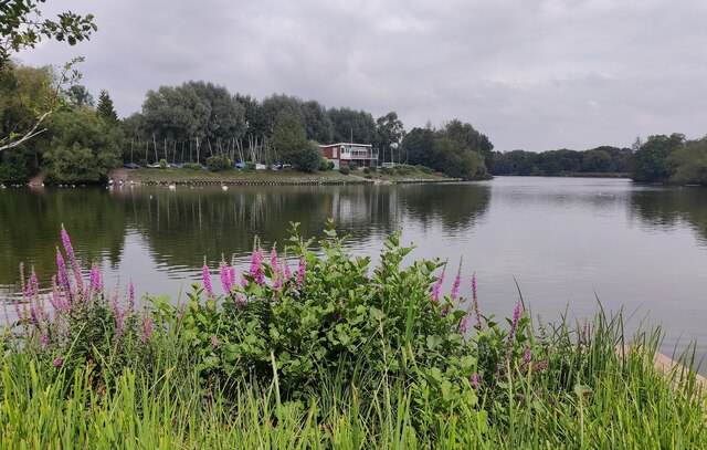
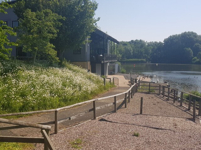
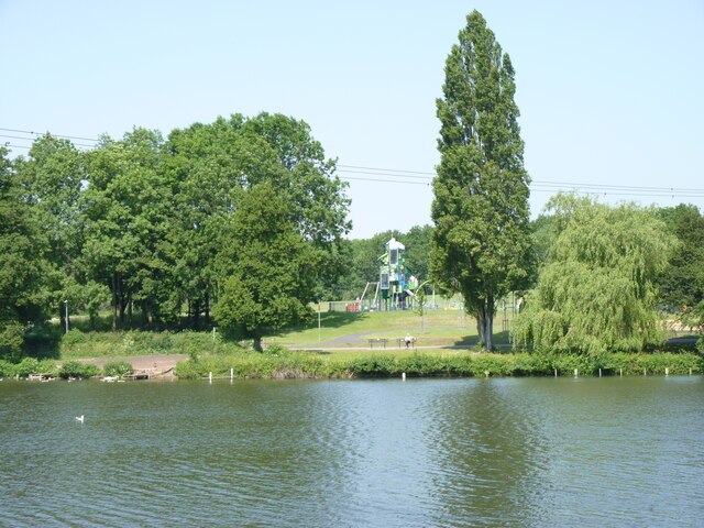
Riverside is a charming village located in the county of Worcestershire, England. Situated on the banks of the River Severn, it is known for its picturesque setting and tranquil atmosphere. The village is surrounded by lush countryside, offering breathtaking views and a peaceful environment.

Riverside is a small community with a population of around 1,000 residents. Despite its small size, the village has a strong sense of community and a friendly atmosphere. The residents take pride in maintaining the village's natural beauty and preserving its historic character.

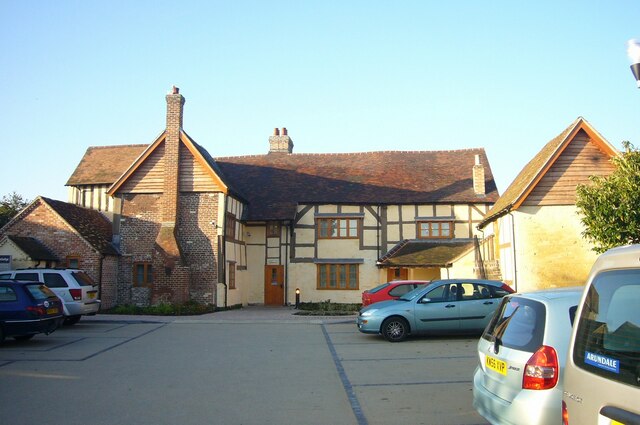
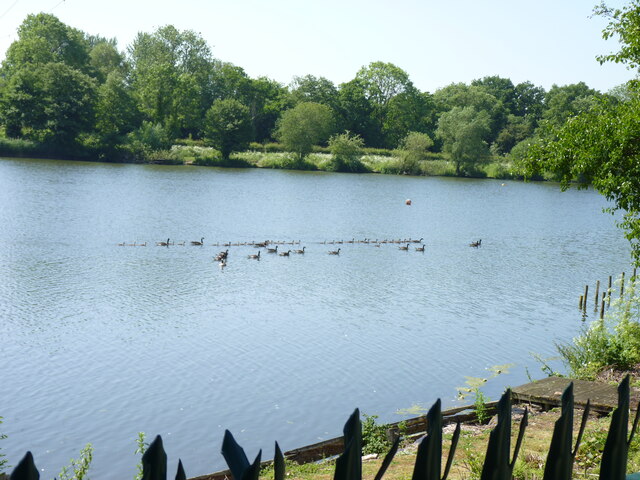
The village is home to a few amenities, including a local pub, a village hall, and a small convenience store. Residents can also enjoy leisurely walks along the riverbank, taking in the scenic views and observing the local wildlife. The river itself offers opportunities for boating and fishing, attracting enthusiasts from the surrounding areas.

For those seeking a taste of history, Riverside is in close proximity to several notable landmarks. Worcester Cathedral, a magnificent example of medieval architecture, is just a short drive away. The nearby town of Pershore is also worth a visit, with its charming streets, historic buildings, and bustling market.

Riverside is well-connected to the rest of Worcestershire, with good transport links to nearby towns and cities. The village is a popular choice for those looking to escape the hustle and bustle of urban life and enjoy the tranquility of rural England.

If you have any feedback on the listing, please let us know in the comments section below.

Riverside Images

Images are sourced within 2km of 52.312406/-1.93101 or Grid Reference SP0468. Thanks to Geograph Open Source API. All images are credited.

Arrow Valley Lake The 27 acres (11 ha) Arrow Valley Lake is part of the Arrow Valley Country Park.
Arrow Valley Lake
The 27 acres (11 ha) Arrow Valley Lake is part of the Arrow Valley Country Park.
Meadows Farm Previously owned by Travelodge but now by Marston Inns.
Meadows Farm
Previously owned by Travelodge but now by Marston Inns.
Station parking and Kingfisher Shopping Centre, Redditch
Forge Mill
Forge Mill
Bordesley Abbey
Bordesley Abbey
Entrance to sailing club Arrow Valley Country Park, Redditch, Worcestershire.
Entrance to sailing club
Arrow Valley Country Park, Redditch, Worcestershire.
A flotilla of ducks  Arrow Valley Country Park, Redditch, Worcestershire.
A flotilla of ducks
Arrow Valley Country Park, Redditch, Worcestershire.
Lake, Arrow Valley Country Park, Redditch, Worcestershire
Footbridge across the River Arrow Arrow Valley Country Park, Redditch, Worcestershire.
Footbridge across the River Arrow
Arrow Valley Country Park, Redditch, Worcestershire.
Footpath through the trees by the River Arrow Arrow Valley Country Park, Redditch, Worcestershire.
Footpath through the trees by the River Arrow
Arrow Valley Country Park, Redditch, Worcestershire.
Sailing club, Arrow Valley Country Park, Redditch, Worcestershire
Arrow Valley Country Park cafe from across the lake
Bank of flowers by the lake Arrow Valley Country Park, Redditch, Worcestershire.
Bank of flowers by the lake
Arrow Valley Country Park, Redditch, Worcestershire.
Divergent paths, Arrow Valley Country Park, Redditch, Worcestershire
Play space at Arrow Valley Country Park, Redditch, Worcestershire
Reed bed, Arrow Valley Country Park, Redditch, Worcestershire
Redditch station - looking south The end of the cross-city line, with passengers leaving a train that has just arrived from Lichfield Trent Valley via Birmingham New St.
Redditch station - looking south
The end of the cross-city line, with passengers leaving a train that has just arrived from Lichfield Trent Valley via Birmingham New St.
Redditch station - looking north
Show me another place!

Riverside is located at Grid Ref: SP0468 (Lat: 52.312406, Lng: -1.93101)

Administrative County: Worcestershire

District: Redditch

Police Authority: West Mercia

What 3 Words

///intent.store.guard. Near Redditch, Worcestershire

Nearby Locations

Riverside

Related Wikis

Forge Mill Needle Museum

The Forge Mill Needle Museum in Redditch, Worcestershire, is a historic museum depicting Redditch's Industrial Heritage. Opened in 1983 by Queen Elizabeth...

Trinity High School and Sixth Form Centre

Trinity High School and Sixth Form Centre is a 13-18 co-educational academy school located in central Redditch, Worcestershire, England. == Admissions... ==

Bordesley Abbey

Bordesley Abbey was a 12th-century Cistercian abbey near the town of Redditch, in Worcestershire, England. The abbey's foundation was an act of Waleran...

Our Lady of Mount Carmel Church, Redditch

Our Lady of Mount Carmel Church is a Roman Catholic parish church in Redditch, Worcestershire, England. It was built from 1833 to 1834 and designed by...

Nearby Amenities

Located within 500m of 52.312406,-1.93101
Source: bing
Traffic Calming: hump
Lat/Long: 52.3124469/-1.9291863
Source: bing
Traffic Calming: hump
Lat/Long: 52.3121926/-1.9300504
Source: bing
Traffic Calming: hump
Lat/Long: 52.3119253/-1.9310153
Source: bing
Traffic Calming: hump
Lat/Long: 52.3113886/-1.9329349
Turning Circle
Lat/Long: 52.3110933/-1.9377188
Traffic Signals
Lat/Long: 52.3110342/-1.9354378
Source: bing
Traffic Calming: hump
Lat/Long: 52.3101865/-1.9348415
Post Box
Ref: B98 95
Lat/Long: 52.3094588/-1.936069
Post Box
Ref: B97 123
Lat/Long: 52.311733/-1.9322402
Mini Roundabout
Direction: clockwise
Lat/Long: 52.3135242/-1.9363898
Bus Stop
Forge Mill Road
Bus: yes
Naptan AtcoCode: 2000G023300
Naptan Bearing: E
Naptan CommonName: Forge Mill Road
Naptan Indicator: Adj
Naptan NaptanCode: wocdtmtj
Naptan PlusbusZoneRef: RDIT
Naptan Street: Forge Mill Road
Naptan Verified: no
Public Transport: platform
Source: naptan_import
Lat/Long: 52.3144625/-1.9319427
Bus Stop
Arthur Jobson House
Bus: yes
Naptan AtcoCode: 2000G023400
Naptan Bearing: N
Naptan CommonName: Arthur Jobson House
Naptan Indicator: Adj
Naptan Landmark: Arthur Jobson House
Naptan NaptanCode: wocdtmtm
Naptan PlusbusZoneRef: RDIT
Naptan Street: Sedgley Close
Naptan Verified: no
Public Transport: platform
Source: naptan_import
Lat/Long: 52.3109776/-1.9281397
Bus Stop
Gibbs Road Community Centre
Bus: yes
Naptan AtcoCode: 2000G323079
Naptan Bearing: SE
Naptan CommonName: Gibbs Road Community Centre
Naptan Indicator: Opp
Naptan Landmark: Community Centre
Naptan NaptanCode: wocdtjag
Naptan PlusbusZoneRef: RDIT
Naptan Street: Gibbs Road
Naptan Verified: no
Public Transport: platform
Source: naptan_import
Lat/Long: 52.3115869/-1.9263639
Bus Stop
Sedgley Close
Bus: yes
Naptan AtcoCode: 2000G323080
Naptan Bearing: SW
Naptan CommonName: Sedgley Close
Naptan Indicator: Opp
Naptan Landmark: Sedgley Close
Naptan NaptanCode: wocdtdgt
Naptan PlusbusZoneRef: RDIT
Naptan Street: Gibbs Road
Naptan Verified: no
Public Transport: platform
Source: naptan_import
Lat/Long: 52.3104827/-1.9274217
Bus Stop
Lady Harriet's Lane
Bus: yes
Naptan AtcoCode: 2000G323134
Naptan Bearing: NE
Naptan CommonName: Lady Harriet's Lane
Naptan Indicator: Opp
Naptan Landmark: Lady Harriet's Lane
Naptan NaptanCode: wocdpdjp
Naptan PlusbusZoneRef: RDIT
Naptan Street: Easemore Road
Naptan Verified: no
Public Transport: platform
Source: naptan_import
Lat/Long: 52.3101331/-1.9350412
Bus Stop
Lady Harriet's Lane
Bus: yes
Naptan AtcoCode: 2000G323135
Naptan Bearing: SW
Naptan CommonName: Lady Harriet's Lane
Naptan Indicator: Adj
Naptan Landmark: Lady Harriet's Lane
Naptan NaptanCode: wocdpdjt
Naptan PlusbusZoneRef: RDIT
Naptan Street: Easemore Road
Naptan Verified: no
Public Transport: platform
Source: naptan_import
Lat/Long: 52.3101902/-1.9346389
Bus Stop
Meadowhill Road
Bus: yes
Naptan AtcoCode: 2000G323136
Naptan Bearing: NE
Naptan CommonName: Meadowhill Road
Naptan Indicator: Adj
Naptan Landmark: Meadowhill Road
Naptan NaptanCode: wocdpdjw
Naptan PlusbusZoneRef: RDIT
Naptan Street: Easemore Road
Naptan Verified: no
Public Transport: platform
Source: naptan_import
Lat/Long: 52.3116988/-1.9321194
Bus Stop
Meadowhill Road
Bus: yes
Naptan AtcoCode: 2000G323137
Naptan Bearing: SW
Naptan CommonName: Meadowhill Road
Naptan Indicator: Opp
Naptan Landmark: Meadowhill Road
Naptan NaptanCode: wocdpdma
Naptan PlusbusZoneRef: RDIT
Naptan Street: Easemore Road
Naptan Verified: no
Public Transport: platform
Source: naptan_import
Lat/Long: 52.3116021/-1.9320002
Bus Stop
Gibbs Road
Bus: yes
Naptan AtcoCode: 2000G631006
Naptan Bearing: N
Naptan CommonName: Gibbs Road
Naptan Indicator: Opp
Naptan Landmark: Gibbs Road
Naptan NaptanCode: wocdmgmg
Naptan PlusbusZoneRef: RDIT
Naptan Street: Easemore Rd
Naptan Verified: no
Public Transport: platform
Source: naptan_import
Lat/Long: 52.3139344/-1.9264186
Bus Stop
Gibbs Road
Bus: yes
Naptan AtcoCode: 2000G631098
Naptan Bearing: W
Naptan CommonName: Gibbs Road
Naptan Indicator: Adj
Naptan Landmark: Gibbs Road
Naptan NaptanCode: wocdmgpd
Naptan PlusbusZoneRef: RDIT
Naptan Street: Easemoor Road
Naptan Verified: no
Public Transport: platform
Source: naptan_import
Lat/Long: 52.3130862/-1.9276485
Barrier: kissing_gate
Source: survey
Lat/Long: 52.3154877/-1.9345083
Post Box
Ref: B97 40
Lat/Long: 52.3116679/-1.9377212
Crossing
Crossing: uncontrolled
Crossing Type: zebra
Crossing Ref: zebra
Kerb: flush
Sloping Curb: both
Source: survey
Tactile Paving: yes
Wheelchair: yes
Lat/Long: 52.3128739/-1.9376681
Entrance: main
Source: bing;survey
Wheelchair: yes
Lat/Long: 52.3149996/-1.9340481
Parking
Access: permissive
Capacity: 2
Designation: Visitors Only
Operator: Royal Mail
Parking: surface
Source: Bing
Lat/Long: 52.3116797/-1.9373591
Access: customers
Addr City: Redditch
Addr Street: Fishing Line Road
Entrance: main
Source: bing;survey
Wheelchair: yes
Lat/Long: 52.3116776/-1.9376918
Bicycle Parking
Access: permissive
Covered: yes
Fee: no
Operator: Royal Mail
Source: Bing
Lat/Long: 52.3116461/-1.9375375
Parking
Access: customers
Capacity: 7
Capacity Disabled: 3
Fee: no
Operator: Royal Mail
Parking: surface
Source: Bing
Wheelchair: yes
Lat/Long: 52.3116035/-1.937516
Parking
Capacity: 2
Capacity Motorcycle: 2
Operator: Royal Mail
Parking: surface
Source: Bing
Lat/Long: 52.3116609/-1.9374208
Barrier: lift_gate
Lat/Long: 52.3110815/-1.9375631
Entrance: main
Source: bing;survey
Wheelchair: yes
Lat/Long: 52.3153744/-1.9339894
Crossing
Crossing: uncontrolled
Crossing Type: zebra
Crossing Ref: zebra
Kerb: flush
Sloping Curb: both
Source: survey
Tactile Paving: yes
Wheelchair: yes
Lat/Long: 52.3127766/-1.9381887
Source: bing
Traffic Calming: hump
Lat/Long: 52.3094431/-1.9362734
Source: bing
Traffic Calming: hump
Lat/Long: 52.3108284/-1.9337621
Source: bing
Traffic Calming: hump
Lat/Long: 52.3116591/-1.9319728
Source: bing
Traffic Calming: hump
Lat/Long: 52.3128107/-1.928338
Riverside
Is In: Redditch
Place: suburb
Source: OS OpenData StreetView
Lat/Long: 52.3148701/-1.9364571
Entrance: exit
Lat/Long: 52.3151296/-1.9342197
Barrier: entrance
Bicycle: no
Foot: yes
Horse: no
Motorcar: no
Motorcycle: no
Lat/Long: 52.3080948/-1.9317209
Entrance: main
Lat/Long: 52.3089074/-1.9356114
Entrance: main
Lat/Long: 52.3091921/-1.9358822
Board Type: history
Information: board
Tourism: information
Lat/Long: 52.3154897/-1.9344509
Barrier: kissing_gate
Lat/Long: 52.3154399/-1.9278277
Turning Circle
Source: bing
Lat/Long: 52.3103694/-1.9310993
Shop: convenience
Lat/Long: 52.3112101/-1.9264476
Post Box
Ref: B98 124
Lat/Long: 52.3110707/-1.9265656
Generator Method: photovoltaic
Generator Output Electricity: yes
Generator Source: solar
Generator Type: solar_photovoltaic_panel
Location: roof
Power: generator
Lat/Long: 52.3142524/-1.9291037
Generator Method: photovoltaic
Generator Output Electricity: yes
Generator Source: solar
Generator Type: solar_photovoltaic_panel
Location: roof
Power: generator
Lat/Long: 52.3141983/-1.9290394
Barrier: kissing_gate
Lat/Long: 52.3157724/-1.9326238
Barrier: kissing_gate
Lat/Long: 52.3156709/-1.9307936
Cafe
Mill View coffee bar
Cuisine: coffee_shop;ice_cream
Internet Access: wlan
Internet Access Fee: no
Opening Hours: Tu-Su 10:00-15:00
Outdoor Seating: yes
Website: https://www.forgemill.org.uk/web/coffee-bar/
Lat/Long: 52.3153566/-1.9337916
Barrier: kissing_gate
Lat/Long: 52.3149211/-1.9353969
The data included in this document is from www.openstreetmap.org. The data is made available under ODbL.

Have you been to Riverside?

Leave your review of Riverside below (or comments, questions and feedback).