Blackbrook

Settlement in Derbyshire High Peak

England

Blackbrook

War memorial in Chapel-en-le-Frith Situated in the Market Place.
War memorial in Chapel-en-le-Frith Credit: Bill Boaden

Blackbrook is a small village located in the county of Derbyshire, England. Situated in the Amber Valley district, it lies approximately 9 miles northeast of the city of Derby and 2 miles southeast of Belper. The village is nestled in a scenic rural area, surrounded by rolling hills and picturesque countryside.

Historically, Blackbrook was primarily an agricultural community, with farming being the main source of livelihood for its residents. Over the years, however, the village has evolved and diversified its economic activities. Today, it is home to a mix of residential and commercial properties. The village has a small but thriving local economy, with a handful of shops, a post office, and a few local businesses serving the needs of the community.

Blackbrook has a close-knit community that takes pride in preserving its heritage and promoting a strong sense of belonging. The village has a community center, where various events and activities are organized throughout the year, fostering a sense of community spirit and engagement.

The surrounding area offers a range of recreational opportunities. Blackbrook is located near the stunning Peak District National Park, known for its beautiful landscapes, hiking trails, and outdoor activities. Additionally, the nearby River Derwent provides opportunities for fishing and boating enthusiasts.

Overall, Blackbrook, Derbyshire, offers a tranquil and scenic setting with a strong community spirit, making it an attractive place to live for those seeking a peaceful rural lifestyle within easy reach of urban amenities.

If you have any feedback on the listing, please let us know in the comments section below.
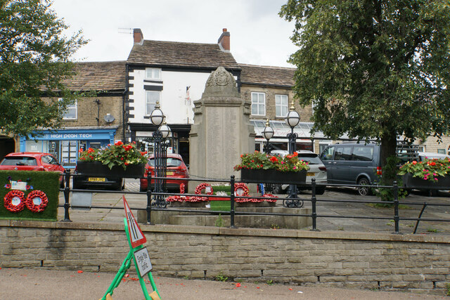
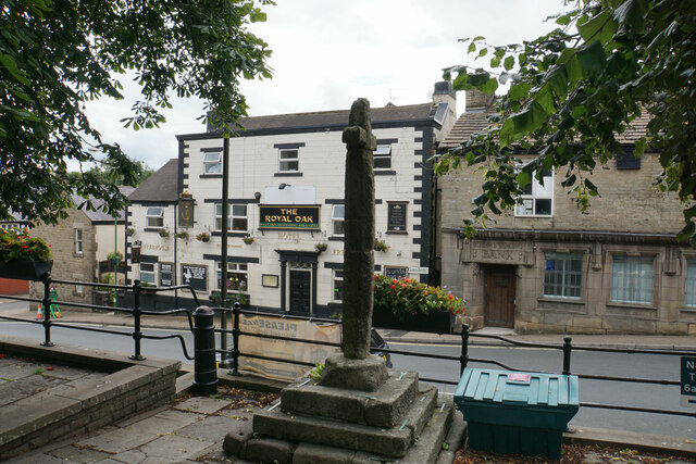
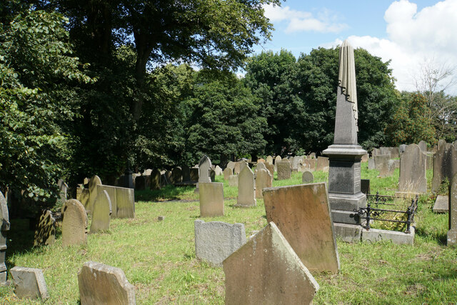
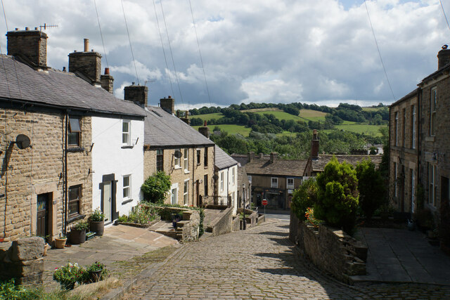
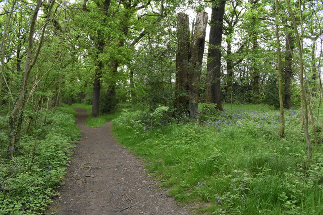
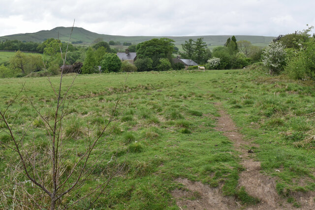
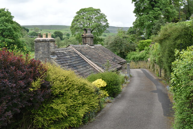
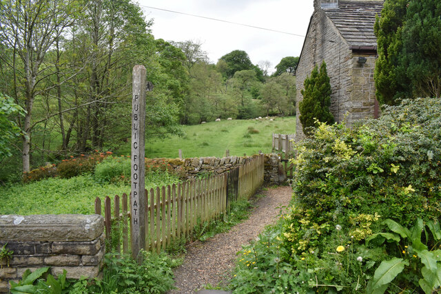
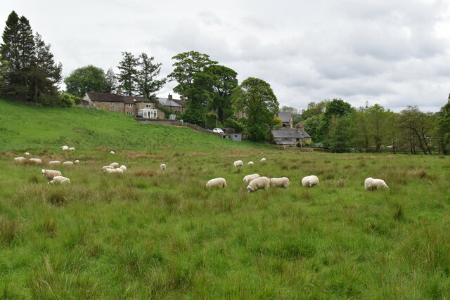
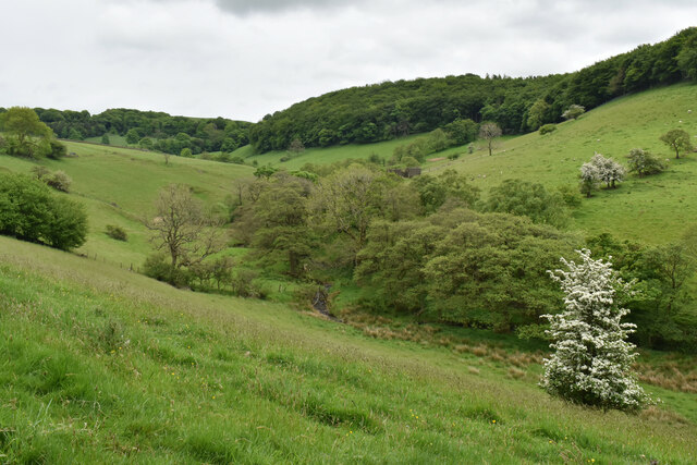
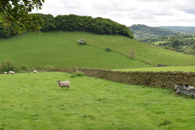
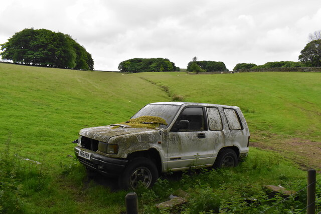
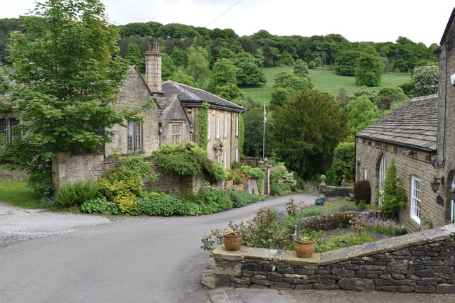
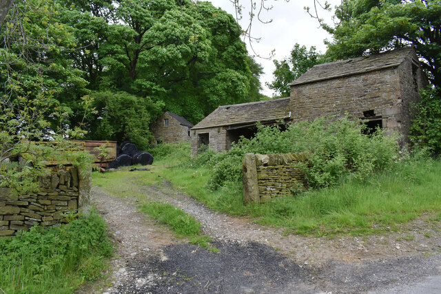
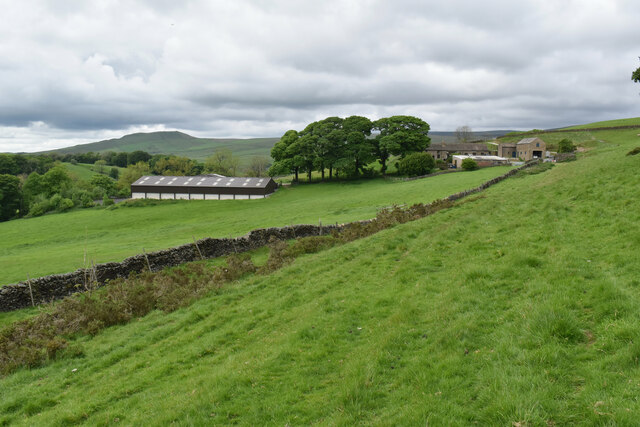
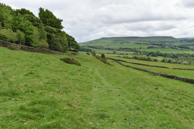
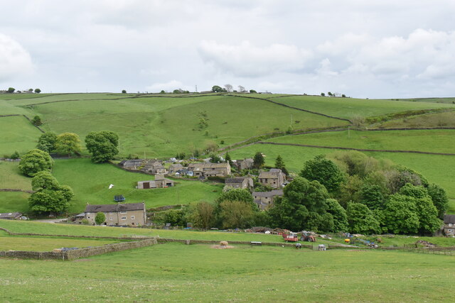
Blackbrook Images

Images are sourced within 2km of 53.322537/-1.896379 or Grid Reference SK0780. Thanks to Geograph Open Source API. All images are credited.

War memorial in Chapel-en-le-Frith Situated in the Market Place.
War memorial in Chapel-en-le-Frith
Situated in the Market Place.
Market Cross, Chapel-en-le-Frith Grade II listed and said to date from 1643. It is situated in Market Place overlooking Market Street which runs below.
Market Cross, Chapel-en-le-Frith
Grade II listed and said to date from 1643. It is situated in Market Place overlooking Market Street which runs below.
Churchyard of St Thomas Becket, Chapel-en-le-Frith Quite a large churchyard which extends down the hill to the left.
Churchyard of St Thomas Becket, Chapel-en-le-Frith
Quite a large churchyard which extends down the hill to the left.
Church Brow A largely unspoilt road in Chapel-en-le-Frith though there are a lot of telegraph wires.
Church Brow
A largely unspoilt road in Chapel-en-le-Frith though there are a lot of telegraph wires.
Hillside near Sparrowpit
Woodland path off Bowden Lane The surface of the path is nice and dry but I am sure it isn't always. The path leads to Wash.
Woodland path off Bowden Lane
The surface of the path is nice and dry but I am sure it isn't always. The path leads to Wash.
Footpath to Wash Passing through a field of sheep. Some of the houses of the small village of Wash are seen ahead. South Head is seen on the skyline.
Footpath to Wash
Passing through a field of sheep. Some of the houses of the small village of Wash are seen ahead. South Head is seen on the skyline.
Small road in Wash Wash is a very small village with traditional cottages.
Small road in Wash
Wash is a very small village with traditional cottages.
Footpath leaving Wash The path goes up the valley of Hockham Brook.
Footpath leaving Wash
The path goes up the valley of Hockham Brook.
Sheep near Wash The sheep are grazing in the valley of Hockham Brook. Some of the houses of Wash are behind.
Sheep near Wash
The sheep are grazing in the valley of Hockham Brook. Some of the houses of Wash are behind.
The valley of Hockham Brook Looking up the valley from the land below Malcoff.
The valley of Hockham Brook
Looking up the valley from the land below Malcoff.
Sheep near Malcoff Looking into the valley of Hockham Brook. Eccles Pike shows up round the corner.
Sheep near Malcoff
Looking into the valley of Hockham Brook. Eccles Pike shows up round the corner.
Going nowhere An abandoned vehicle that has been there some time.
Going nowhere
An abandoned vehicle that has been there some time.
Ford Hall The Grade II listed hall is now divided into apartments. A couple of other listed cottages combine to make this an attractive little hamlet.
Ford Hall
The Grade II listed hall is now divided into apartments. A couple of other listed cottages combine to make this an attractive little hamlet.
Old farm buildings at Slackhall The hamlet of Slackhall is not much more than a farm.
Old farm buildings at Slackhall
The hamlet of Slackhall is not much more than a farm.
Maglow Farm On the western slope of the Pennines with a view down to Chapel-en-le-Frith. South Head is the prominent peak behind.
Maglow Farm
On the western slope of the Pennines with a view down to Chapel-en-le-Frith. South Head is the prominent peak behind.
Footpath to Bagshaw Traversing a hillside with Chapel-en-le-Frith down to the right. Ahead you can see Combs Moss on its plateau.
Footpath to Bagshaw
Traversing a hillside with Chapel-en-le-Frith down to the right. Ahead you can see Combs Moss on its plateau.
Bagshaw A small upland Peak District village.
Bagshaw
A small upland Peak District village.
Show me another place!

Blackbrook is located at Grid Ref: SK0780 (Lat: 53.322537, Lng: -1.896379)

Administrative County: Derbyshire

District: High Peak

Police Authority: Derbyshire

What 3 Words

///springing.breath.ghost. Near Chapel en le Frith, Derbyshire

Nearby Locations

Blackbrook

Related Wikis

Chapel inclined plane

The Chapel Inclined Plane is an inclined plane immediately to the south of Chapel-en-le-Frith, High Peak, Derbyshire. The ground here rises sharply and...

High Peak Radio

High Peak Radio was an Independent Local Radio station broadcasting to the Peak District, Derbyshire, from studios in Chapel-en-le-Frith. It broadcast...

Bagshaw

Bagshaw is a hamlet in Derbyshire, England. The hamlet falls within the civil parish of Chapel-en-le-Frith. It is about 1.2 km or 0.75 miles east of Chapel...

Chapel-en-le-Frith Town Hall

Chapel-en-le-Frith Town Hall is a municipal building in Market Street, Chapel-en-le-Frith, Derbyshire, England. The structure operates as a community events...

Chapel-en-le-Frith

Chapel-en-le-Frith () is a town and civil parish in the Borough of High Peak in Derbyshire, England. It has been dubbed the "Capital of the Peak", in...

Slackhall

Slackhall is a hamlet in Derbyshire, England. The hamlet falls within the civil parish of Chapel-en-le-Frith. It is about 1.2 km (or 0.75 miles) east of...

Chestnut Centre

The Chestnut Centre (or in full, Chestnut Centre Otter, Owl and Wildlife Park) was a wildlife park near Chapel-en-le-Frith, Derbyshire, UK. It opened in...

Chapel-en-le-Frith Central railway station

Chapel-en-le-Frith Central railway station was an intermediate stop on the Derby–Manchester line of the Midland Railway. It served the Derbyshire town...

Nearby Amenities

Located within 500m of 53.322537,-1.896379
Power: tower
Lat/Long: 53.3255979/-1.8976918
Power: tower
Lat/Long: 53.3190304/-1.8964231
Power: tower
Lat/Long: 53.3220874/-1.8983657
Power: pole
Lat/Long: 53.319096/-1.9001789
Power: pole
Lat/Long: 53.3187237/-1.8993171
Power: pole
Lat/Long: 53.3182409/-1.8983688
Power: pole
Lat/Long: 53.3213636/-1.8943221
Power: pole
Lat/Long: 53.3210519/-1.8970477
Power: pole
Lat/Long: 53.3208987/-1.8982256
Power: pole
Lat/Long: 53.3208043/-1.8992843
Power: pole
Lat/Long: 53.3217591/-1.9007395
Power: pole
Lat/Long: 53.3220334/-1.9011182
Power: pole
Lat/Long: 53.3214367/-1.9006053
Power: pole
Lat/Long: 53.3188894/-1.8983837
Power: pole
Lat/Long: 53.318314/-1.8979006
Generator Method: photovoltaic
Generator Output Electricity: yes
Generator Source: solar
Generator Type: solar_photovoltaic_panel
Location: roof
Power: generator
Lat/Long: 53.3212862/-1.9029166
Generator Method: photovoltaic
Generator Output Electricity: yes
Generator Source: solar
Generator Type: solar_photovoltaic_panel
Location: roof
Power: generator
Lat/Long: 53.3215265/-1.9024552
Generator Method: photovoltaic
Generator Output Electricity: yes
Generator Source: solar
Generator Type: solar_photovoltaic_panel
Location: roof
Power: generator
Lat/Long: 53.3229266/-1.9035549
Generator Method: photovoltaic
Generator Output Electricity: yes
Generator Source: solar
Generator Type: solar_photovoltaic_panel
Location: roof
Power: generator
Lat/Long: 53.3234248/-1.901216
Generator Method: photovoltaic
Generator Output Electricity: yes
Generator Source: solar
Generator Type: solar_photovoltaic_panel
Location: roof
Power: generator
Lat/Long: 53.3247433/-1.9028012
Generator Method: photovoltaic
Generator Output Electricity: yes
Generator Source: solar
Generator Type: solar_photovoltaic_panel
Location: roof
Power: generator
Lat/Long: 53.3243332/-1.9027878
Generator Method: photovoltaic
Generator Output Electricity: yes
Generator Source: solar
Generator Type: solar_photovoltaic_panel
Location: roof
Power: generator
Lat/Long: 53.322816/-1.8999715
Generator Method: photovoltaic
Generator Output Electricity: yes
Generator Source: solar
Generator Type: solar_photovoltaic_panel
Location: roof
Power: generator
Lat/Long: 53.3232997/-1.8994358
Generator Method: photovoltaic
Generator Output Electricity: yes
Generator Source: solar
Generator Type: solar_photovoltaic_panel
Location: roof
Power: generator
Lat/Long: 53.323238/-1.899582
Bus Stop
Chapel en le Frith, Sheffield Road / adjacent Frith Knoll Road
Bus: yes
Naptan AtcoCode: 100000008381
Naptan NaptanCode: dbsgmgwg
Network: Derbyshire County Council
Operator: Derbyshire County Council
Public Transport: platform
Lat/Long: 53.3257617/-1.9010679
Bus Stop
Chapel en le Frith, Buxton Road / opposite Jolly Carter
Bus: yes
Network: Derbyshire County Council
Operator: Derbyshire County Council
Public Transport: platform
Lat/Long: 53.3236333/-1.898818
Barrier: stile
Material: wood
Stile: ladder
Lat/Long: 53.3210195/-1.897022
Barrier: stile
Material: stone
Stile: stepover
Lat/Long: 53.3207549/-1.8990651
The data included in this document is from www.openstreetmap.org. The data is made available under ODbL.

Have you been to Blackbrook?

Leave your review of Blackbrook below (or comments, questions and feedback).