Blackbrook

Settlement in Derbyshire Amber Va

England

Blackbrook

Belper North Mill & River Gardens Mills in Belper were constructed by Jedediah Strutt from 1776. The original North Mill was built in 1786 but the building was destroyed by fire in 1803. Now part of Derwent Valley Mills World Heritage Site, the new mill built in 1804 is a forerunner of the modern skyscraper. Another member of the Strutt family, George Herbert created the gardens in 1905.
Belper North Mill & River Gardens Credit: Garth Newton

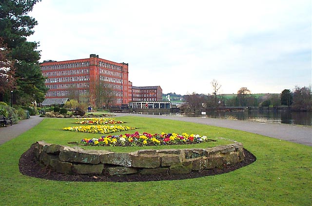
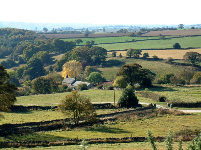
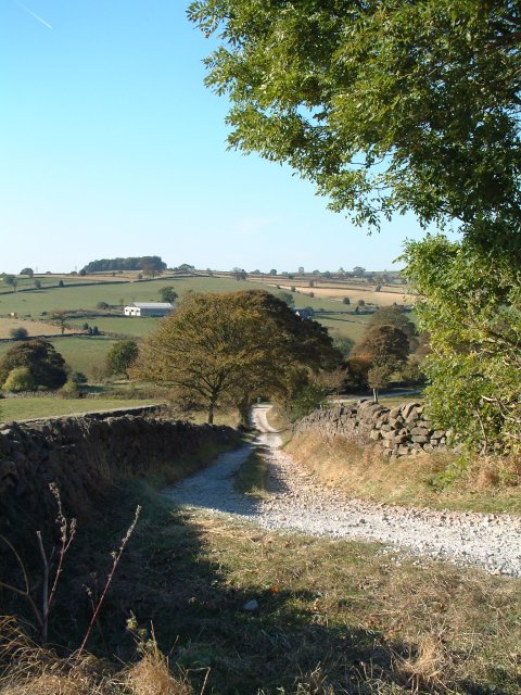
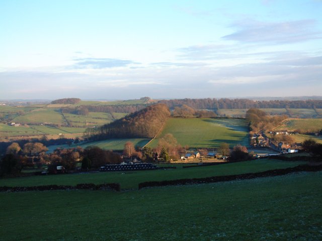
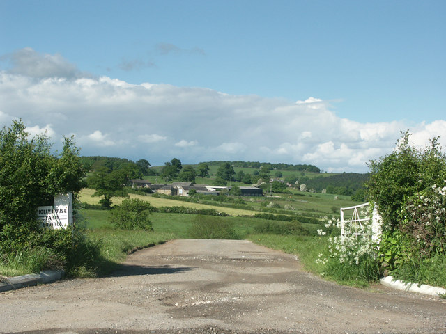
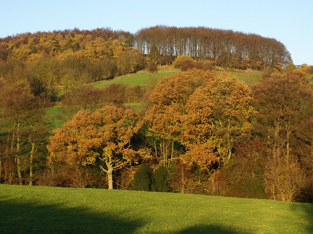
Blackbrook is a small village located in the county of Derbyshire, England. Situated in the Amber Valley district, it lies approximately 10 miles northeast of Derby city center. The village is nestled in a picturesque rural setting, surrounded by rolling hills and lush green fields, making it an ideal destination for nature lovers and outdoor enthusiasts.

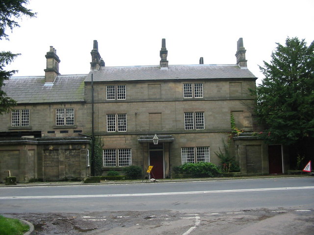
The origins of Blackbrook can be traced back to the medieval period, and its name is derived from the nearby brook that runs through the village, which is lined with blackthorn bushes. The village itself is characterized by a mix of traditional stone-built cottages and more modern houses, giving it a charming and eclectic atmosphere.

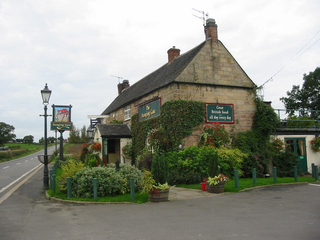
Despite its small size, Blackbrook is well-served by a range of amenities and facilities. It has a local primary school, providing education for the village's younger residents, and a community center that hosts various events and activities. Additionally, there is a village pub, offering a cozy spot for locals and visitors to enjoy a drink or a meal.

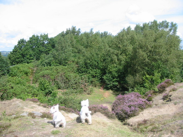
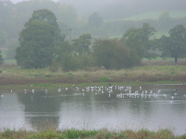
For those seeking outdoor pursuits, Blackbrook is surrounded by beautiful countryside, with numerous walking and cycling trails to explore. The nearby Blackbrook Reservoir provides opportunities for fishing and birdwatching, while the nearby Peak District National Park offers stunning landscapes and outdoor activities such as hiking and rock climbing.

Overall, Blackbrook is a hidden gem in Derbyshire, offering a tranquil and idyllic setting for residents and visitors alike to enjoy the beauty of the English countryside.

If you have any feedback on the listing, please let us know in the comments section below.
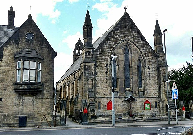
Blackbrook Images

Images are sourced within 2km of 53.026657/-1.509343 or Grid Reference SK3347. Thanks to Geograph Open Source API. All images are credited.

Belper North Mill & River Gardens Mills in Belper were constructed by Jedediah Strutt from 1776. The original North Mill was built in 1786 but the building was destroyed by fire in 1803. Now part of Derwent Valley Mills World Heritage Site, the new mill built in 1804 is a forerunner of the modern skyscraper. Another member of the Strutt family, George Herbert created the gardens in 1905.
Belper North Mill & River Gardens
Mills in Belper were constructed by Jedediah Strutt from 1776. The original North Mill was built in 1786 but the building was destroyed by fire in 1803. Now part of Derwent Valley Mills World Heritage Site, the new mill built in 1804 is a forerunner of the modern skyscraper. Another member of the Strutt family, George Herbert created the gardens in 1905.
Farm buildings near Belper SK328493. Looking south-west from Longwalls Lane. The northern tip of Handley Wood is visible to the left.
Farm buildings near Belper
SK328493. Looking south-west from Longwalls Lane. The northern tip of Handley Wood is visible to the left.
Looking south along Longwalls Lane, part of the Midshires Way
View south-east of Belper Lane End Grid reference given is of the centre of the village; photographer position is the slightly off-square SK333494 (sorry!)
View south-east of Belper Lane End
Grid reference given is of the centre of the village; photographer position is the slightly off-square SK333494 (sorry!)
Fungi near Wyver Lane footpath Earth Star (Geastrum triplex). The reserve is not just about birds.
Fungi near Wyver Lane footpath
Earth Star (Geastrum triplex). The reserve is not just about birds.
Hank winder in Belper North Mill Museum I was expecting someone to have posted "main" pics for here and this to be a supplemental - I suppose I had better take a shot of the building proper later this week!
Anyway still adding associated interiors of museum.
Hank winder in Belper North Mill Museum
I was expecting someone to have posted "main" pics for here and this to be a supplemental - I suppose I had better take a shot of the building proper later this week! Anyway still adding associated interiors of museum.
Hosiery knitting exhibit  in the museum
Hosiery knitting exhibit in the museum
Hosiery exhibits in North Mill Museum Brettles hosiery on display - a local Belper company
Hosiery exhibits in North Mill Museum
Brettles hosiery on display - a local Belper company
Near Shottlegate Picture shows the gateway to Holly House farm.
Near Shottlegate
Picture shows the gateway to Holly House farm.
East Mill, Belper Built 1912 but with a magnificent chimney from 1854. This was demolished in 1990 after suffering damage in a gale. The base is just visible. The engine house contained a turbine and is much smaller than you would expect. The site still uses water turbines on the Derwent to produce power for the grid.
East Mill, Belper
Built 1912 but with a magnificent chimney from 1854. This was demolished in 1990 after suffering damage in a gale. The base is just visible. The engine house contained a turbine and is much smaller than you would expect. The site still uses water turbines on the Derwent to produce power for the grid.
Belper Fire Station Belper Fire Station, Matlock Road, Belper, Derbyshire.
Belper Fire Station
Belper Fire Station, Matlock Road, Belper, Derbyshire.
Quarry on Firestone Hill This disused quarry is on the top of Firestone Hill - a high ridge overlooking the Derwent valley near Belper.
Quarry on Firestone Hill
This disused quarry is on the top of Firestone Hill - a high ridge overlooking the Derwent valley near Belper.
The Hanging Gate at Shottlegate A very popular pub and restaurant on the main road between Belper and Ashbourne.
The Hanging Gate at Shottlegate
A very popular pub and restaurant on the main road between Belper and Ashbourne.
Crossroads Farm at Blackbrook As the name suggests this farm sits on a busy crossroads on the main road between Belper and Ashbourne.
Crossroads Farm at Blackbrook
As the name suggests this farm sits on a busy crossroads on the main road between Belper and Ashbourne.
Former Thorntons Factory at Belper This is the former Thorntons chocolates factory in Belper.  The business was relocated to new premises at Alfreton in 1999 although the name is still closely associated with its original home in Belper where it provided employment for many local people.
Former Thorntons Factory at Belper
This is the former Thorntons chocolates factory in Belper. The business was relocated to new premises at Alfreton in 1999 although the name is still closely associated with its original home in Belper where it provided employment for many local people.
Round Wood near Shottlegate The trees on the hilltop are known as Round Wood
Round Wood near Shottlegate
The trees on the hilltop are known as Round Wood
St John the Evangelist church and graveyard, Hazelwood
Handley Wood The footpath from Plains Lane leads down over Black Brook, shown by the first line of trees, up to Handley Woods. Further north, Plains Lane appears to end in a farmyard. Had I been brave enough to open the gate, maybe I would have found my way to Lambhouse Lane!
Handley Wood
The footpath from Plains Lane leads down over Black Brook, shown by the first line of trees, up to Handley Woods. Further north, Plains Lane appears to end in a farmyard. Had I been brave enough to open the gate, maybe I would have found my way to Lambhouse Lane!
Show me another place!

Blackbrook is located at Grid Ref: SK3347 (Lat: 53.026657, Lng: -1.509343)

Administrative County: Derbyshire

District: Amber Va

Police Authority: Derbyshire

What 3 Words

///couple.sometimes.earplugs. Near Belper, Derbyshire

Related Wikis

Nearby Amenities

Located within 500m of 53.026657,-1.509343
Blackbrook
Is In Country: UK
Is In County: Derbyshire
Place: village
Wikidata: Q4922627
Lat/Long: 53.027458/-1.5058778
wp044
Ele: 183
Lat/Long: 53.0308912/-1.5069772
Ford: yes
Lat/Long: 53.0261284/-1.5078291
Barrier: stile
Material: stone
Stile: squeezer
Lat/Long: 53.0225367/-1.5093616
Note: 50 mph speed limit sign SW-bound
Lat/Long: 53.0241838/-1.512575
Passing Place
Lat/Long: 53.0274269/-1.5064416
Barrier: stile
Stile: squeezer
Lat/Long: 53.0268117/-1.5144486
Barrier: stile
Stile: squeezer
Lat/Long: 53.022953/-1.5103219
Barrier: stile
Steps: 0
Stile: stepover
Lat/Long: 53.0243654/-1.5124026
Barrier: stile
Steps: 2
Stile: wall
Lat/Long: 53.0247923/-1.5109835
Barrier: stile
Steps: 3
Stile: wall
Lat/Long: 53.02422/-1.5123208
Barrier: stile
Stile: squeezer
Lat/Long: 53.0265621/-1.5124034
Barrier: stile
Steps: 1
Stile: stepover
Lat/Long: 53.0239806/-1.5112093
Barrier: stile
Steps: 0
Stile: stepover
Lat/Long: 53.0260543/-1.5126611
Post Box
Ref: DE56 431
Lat/Long: 53.0268452/-1.5064119
Bus Stop
Plains Lane
Bench: no
Bus: yes
Public Transport: platform
Shelter: no
Tactile Paving: no
Lat/Long: 53.0262567/-1.5081525
Bus Stop
Plains Lane
Bench: no
Bus: yes
Naptan AtcoCode: 100053410
Naptan NaptanCode: dbsjdjga
Public Transport: platform
Shelter: no
Tactile Paving: no
Lat/Long: 53.0262519/-1.5083007
Defibrillator
Emergency: defibrillator
Lat/Long: 53.0266444/-1.5069538
Barrier: stile
Lat/Long: 53.030084/-1.5055199
Barrier: stile
Lat/Long: 53.0295381/-1.5059124
Barrier: stile
Material: stone
Source: survey;gps
Stile: squeezer
Lat/Long: 53.0225959/-1.5094063
Barrier: stile
Material: stone
Source: survey;gps
Stile: stepover
Lat/Long: 53.0287331/-1.5067899
Barrier: stile
Material: stone
Source: survey;gps
Stile: stepover
Lat/Long: 53.0287334/-1.5066961
Barrier: stile
Material: stone
Source: survey;gps
Stile: squeezer
Lat/Long: 53.0307671/-1.5102115
Barrier: stile
Material: stone
Source: survey;gps
Stile: squeezer
Lat/Long: 53.0291588/-1.5112928
Addr Housenumber: 6A
Lat/Long: 53.0269129/-1.5091422
Addr Housenumber: 6B
Lat/Long: 53.0269177/-1.5092281
Addr Housenumber: 6C
Lat/Long: 53.0269129/-1.5093447
Addr Housenumber: 6D
Lat/Long: 53.0269177/-1.5094534
Addr Housenumber: 5
Lat/Long: 53.0269427/-1.5086862
Addr Housenumber: 4
Lat/Long: 53.0269363/-1.508583
The data included in this document is from www.openstreetmap.org. The data is made available under ODbL.

Have you been to Blackbrook?

Leave your review of Blackbrook below (or comments, questions and feedback).