Redbridge

Settlement in Dorset

England

Redbridge

National Cycle Route 2 towards Dorchester
National Cycle Route 2 towards Dorchester Credit: JThomas

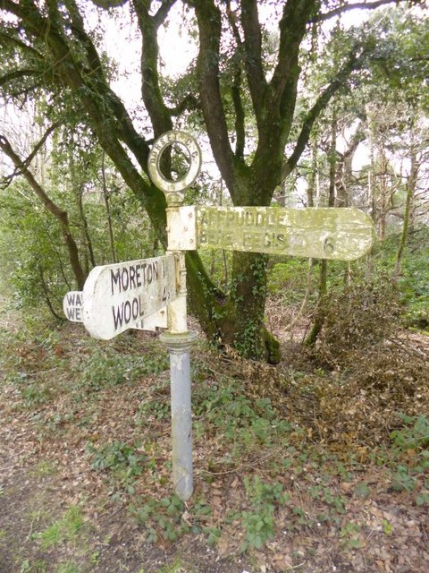
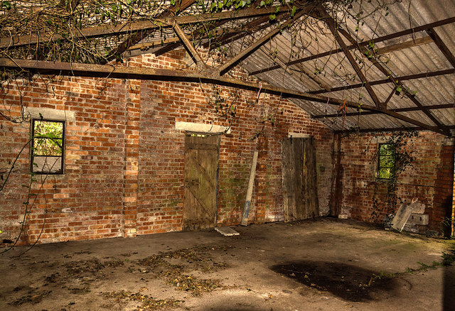
Redbridge is a small village located in the county of Dorset, England. Situated on the eastern bank of the River Frome, it is part of the rural district of West Dorset. Redbridge is approximately 3 miles south of the market town of Beaminster and 10 miles northwest of the coastal town of Bridport.

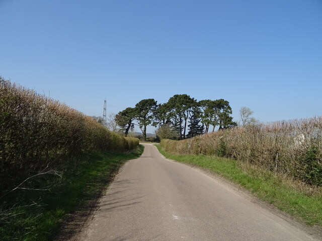
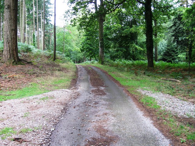
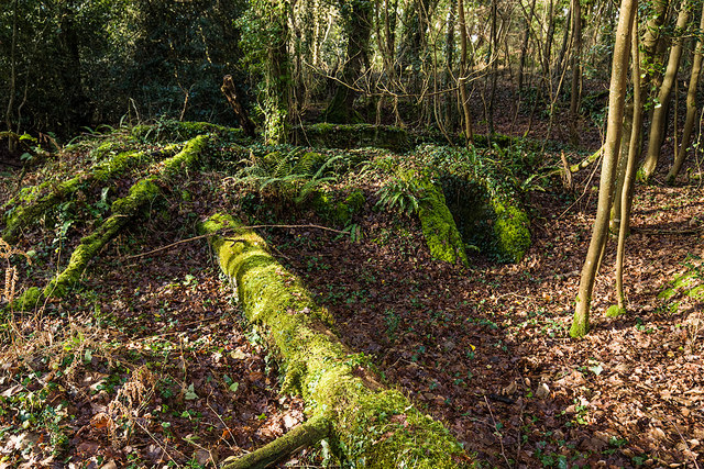
The village is known for its picturesque countryside and charming rural character. It is surrounded by rolling hills, green meadows, and fields, offering breathtaking views of the Dorset landscape. Redbridge is a popular destination for those seeking a peaceful retreat away from the hustle and bustle of city life.

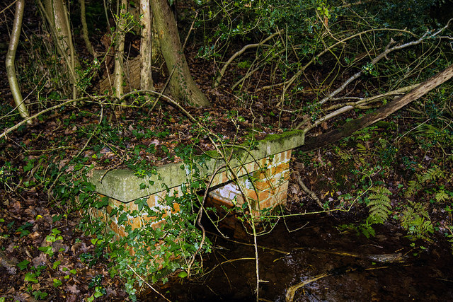
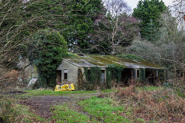
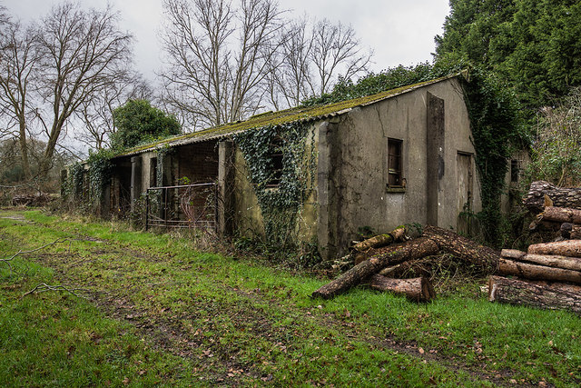
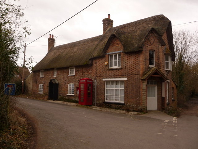
Historically, Redbridge has been an important crossing point over the River Frome, with a bridge dating back to the medieval period. The village has a rich heritage, and evidence of its past can be seen in the traditional architecture of its buildings. There are several historic landmarks in the area, including St. Mary's Church, which dates back to the 13th century.

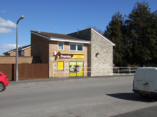
Despite its small size, Redbridge offers basic amenities to its residents and visitors. There is a village hall that hosts community events and gatherings, and a local pub that serves traditional English food and beverages. The village is also well-connected to nearby towns and cities via a network of roads, making it easily accessible for travelers.

Overall, Redbridge, Dorset is a tranquil and scenic village, perfect for those seeking a peaceful getaway in the heart of the English countryside.

If you have any feedback on the listing, please let us know in the comments section below.

Redbridge Images

Images are sourced within 2km of 50.695029/-2.3072225 or Grid Reference SY7888. Thanks to Geograph Open Source API. All images are credited.

National Cycle Route 2 towards Dorchester
Moreton Village Hall, demolished
Moigne Combe Wood
Moigne Combe Wood
Moigne Combe Wood
Moigne Combe Wood
Moigne Combe Wood
Moigne Combe Wood
Moigne Combe Wood
Moigne Combe Wood
Road junction
Road junction
Old Direction Sign - Signpost by the B3390, at Moreton Cross Annulus finial - 3 arms; Dorset halo without NGR by the B3390, in parish of Moreton (Purbeck District), Moreton Cross, junction with UC roads to Woodsford and Moreton, on verge.

Surveyed

Milestone Society National ID: DO_SY7889
Old Direction Sign - Signpost by the B3390, at Moreton Cross
Annulus finial - 3 arms; Dorset halo without NGR by the B3390, in parish of Moreton (Purbeck District), Moreton Cross, junction with UC roads to Woodsford and Moreton, on verge. Surveyed Milestone Society National ID: DO_SY7889
WWII Dorset: discovering RAF Warmwell (1) -
Cinema/Gymnasium

Today this is Crossway's village hall that during the war served a dual purpose as RAF Warmwell's Station Cinema and Gymnasium. The lower attached building fronting the car park comprised both officer's and men's changing rooms, and two store rooms.

<a href="https://www.geograph.org.uk/photo/6365964">SY7688 : WWII Dorset: discovering RAF Warmwell (2)</a>

OVERVIEW

RAF Warmwell was opened in May 1937 as 6 Armament Training Camp, a gunnery school. It was known then as RAF Woodsford, but was renamed the following year as RAF Warmwell due to the possibility of it being confused with Woodford, near Manchester. By July 1940 it came under the control of Fighter Command's 10 Group, to become a satellite of RAF Middle Wallop. Dorset's only RAF fighter station during the Battle of Britain, its airfield would play a major role in the defence of the naval base at Portland, as well as providing protection for other important south coast areas. The three runways were of grass, and remained so for the duration of the war. The airfield came under attack by the Luftwaffe on several occasions, one in particular in the spring of 1941 left several personnel dead.

Inevitably as the war progressed, the role emphasis changed when offensive operations into German occupied Europe were undertaken with Spitfires, Hurricanes, Tempests, and the Westland Whirlwind, the RAF's first twin engined heavy fighter. Although RAF Warmwell was mainly an RAF station, the USAAF also made use of the airfield for brief periods during 1942, and again in March 1944 when the station came under USAAF control completely to become USAAF Station AAF-454. When the 474th Fighter Group with their Lockheed P-38 Lightnings departed for continental Europe in August 1944, the station reverted back to the RAF. The last RAF squadrons left in October 1945, and the following month the station entered a period under Care and Maintenance before closing down in 1946.
WWII Dorset: discovering RAF Warmwell (1)
- Cinema/Gymnasium Today this is Crossway's village hall that during the war served a dual purpose as RAF Warmwell's Station Cinema and Gymnasium. The lower attached building fronting the car park comprised both officer's and men's changing rooms, and two store rooms. SY7688 : WWII Dorset: discovering RAF Warmwell (2) OVERVIEW RAF Warmwell was opened in May 1937 as 6 Armament Training Camp, a gunnery school. It was known then as RAF Woodsford, but was renamed the following year as RAF Warmwell due to the possibility of it being confused with Woodford, near Manchester. By July 1940 it came under the control of Fighter Command's 10 Group, to become a satellite of RAF Middle Wallop. Dorset's only RAF fighter station during the Battle of Britain, its airfield would play a major role in the defence of the naval base at Portland, as well as providing protection for other important south coast areas. The three runways were of grass, and remained so for the duration of the war. The airfield came under attack by the Luftwaffe on several occasions, one in particular in the spring of 1941 left several personnel dead. Inevitably as the war progressed, the role emphasis changed when offensive operations into German occupied Europe were undertaken with Spitfires, Hurricanes, Tempests, and the Westland Whirlwind, the RAF's first twin engined heavy fighter. Although RAF Warmwell was mainly an RAF station, the USAAF also made use of the airfield for brief periods during 1942, and again in March 1944 when the station came under USAAF control completely to become USAAF Station AAF-454. When the 474th Fighter Group with their Lockheed P-38 Lightnings departed for continental Europe in August 1944, the station reverted back to the RAF. The last RAF squadrons left in October 1945, and the following month the station entered a period under Care and Maintenance before closing down in 1946.
WWII Dorset: discovering RAF Warmwell (2) -
Cinema/Gymnasium

This extension on the end was the cinema projection booth.

<a href="https://www.geograph.org.uk/photo/6365980">SY7687 : WWII Dorset: discovering RAF Warmwell (3)</a>
WWII Dorset: discovering RAF Warmwell (2)
- Cinema/Gymnasium This extension on the end was the cinema projection booth. SY7687 : WWII Dorset: discovering RAF Warmwell (3)
WWII Dorset: discovering RAF Warmwell (3) -
Communal Site No. 1 - Blast Shelter

One of several brick built blast shelters on this dispersed site in woodland for the protection of its personnel. They were an alternative to the more substantial Stanton type air raid shelter; a wartime expedient, they were simply a series of dog-legged brick walls in a rectangular configuration with blast protected entrances on two sides. Plan view of a blast shelter at RAF Tain in Scotland <a title="https://www.geograph.org.uk/photo/5928822" href="https://www.geograph.org.uk/photo/5928822">Link</a> . There are reputed to be as many as ten of these shelters in the woods, I counted just four of them, all are heavily overgrown.

<a href="https://www.geograph.org.uk/photo/6365988">SY7687 : WWII Dorset: discovering RAF Warmwell (4)</a>
WWII Dorset: discovering RAF Warmwell (3)
- Communal Site No. 1 - Blast Shelter One of several brick built blast shelters on this dispersed site in woodland for the protection of its personnel. They were an alternative to the more substantial Stanton type air raid shelter; a wartime expedient, they were simply a series of dog-legged brick walls in a rectangular configuration with blast protected entrances on two sides. Plan view of a blast shelter at RAF Tain in Scotland Link . There are reputed to be as many as ten of these shelters in the woods, I counted just four of them, all are heavily overgrown. SY7687 : WWII Dorset: discovering RAF Warmwell (4)
WWII Dorset: discovering RAF Warmwell (4) -
Communal Site No. 1 - Blast Shelter

A second group of shelters lie further south. As well as blast shelters, there are also two static water tanks on the site, each holding about 20,000 gallons (too overgrown to photograph).

<a href="https://www.geograph.org.uk/photo/6365992">SY7687 : WWII Dorset: discovering RAF Warmwell (5)</a>
WWII Dorset: discovering RAF Warmwell (4)
- Communal Site No. 1 - Blast Shelter A second group of shelters lie further south. As well as blast shelters, there are also two static water tanks on the site, each holding about 20,000 gallons (too overgrown to photograph). SY7687 : WWII Dorset: discovering RAF Warmwell (5)
WWII Dorset: discovering RAF Warmwell (5) -
Communal Site No. 1 - Sewer Outlet?

<a href="https://www.geograph.org.uk/photo/6366000">SY7787 : WWII Dorset: discovering RAF Warmwell (6)</a>
WWII Dorset: discovering RAF Warmwell (5)
- Communal Site No. 1 - Sewer Outlet? SY7787 : WWII Dorset: discovering RAF Warmwell (6)
WWII Dorset: discovering RAF Warmwell (6) -
Communal Site No. 4 - Sergeant's & Airmen's Ablutions

<a href="https://www.geograph.org.uk/photo/6366004">SY7787 : WWII Dorset: discovering RAF Warmwell (7)</a>
WWII Dorset: discovering RAF Warmwell (6)
- Communal Site No. 4 - Sergeant's & Airmen's Ablutions SY7787 : WWII Dorset: discovering RAF Warmwell (7)
WWII Dorset: discovering RAF Warmwell (7) -
Communal Site No. 4 - Sergeant's & Airmen's Ablutions

<a href="https://www.geograph.org.uk/photo/6366006">SY7787 : WWII Dorset: discovering RAF Warmwell (8)</a>
WWII Dorset: discovering RAF Warmwell (7)
- Communal Site No. 4 - Sergeant's & Airmen's Ablutions SY7787 : WWII Dorset: discovering RAF Warmwell (8)
WWII Dorset: discovering RAF Warmwell (8) -
Communal Site No. 4 - Sergeant's & Airmen's Ablutions

<a href="https://www.geograph.org.uk/photo/6366008">SY7787 : WWII Dorset: discovering RAF Warmwell (9)</a>
WWII Dorset: discovering RAF Warmwell (8)
- Communal Site No. 4 - Sergeant's & Airmen's Ablutions SY7787 : WWII Dorset: discovering RAF Warmwell (9)
WWII Dorset: discovering RAF Warmwell (9) -
Communal Site No. 4 - Sergeant's & Airmen's Ablutions

<a href="https://www.geograph.org.uk/photo/6366012">SY7787 : WWII Dorset: discovering RAF Warmwell (10)</a>
WWII Dorset: discovering RAF Warmwell (9)
- Communal Site No. 4 - Sergeant's & Airmen's Ablutions SY7787 : WWII Dorset: discovering RAF Warmwell (10)
WWII Dorset: discovering RAF Warmwell (10) -
Communal Site No. 4 - Air Raid Shelter

A Stanton type air raid shelter, one of at least three in the vicinity of the ablutions building.

<a href="https://www.geograph.org.uk/photo/6366017">SY7787 : WWII Dorset: discovering RAF Warmwell (11)</a>
WWII Dorset: discovering RAF Warmwell (10)
- Communal Site No. 4 - Air Raid Shelter A Stanton type air raid shelter, one of at least three in the vicinity of the ablutions building. SY7787 : WWII Dorset: discovering RAF Warmwell (11)
Show me another place!

Redbridge is located at Grid Ref: SY7888 (Lat: 50.695029, Lng: -2.3072225)

Unitary Authority: Dorset

Police Authority: Dorset

What 3 Words

///reunion.airfields.amplified. Near Bovington Camp, Dorset

Related Wikis

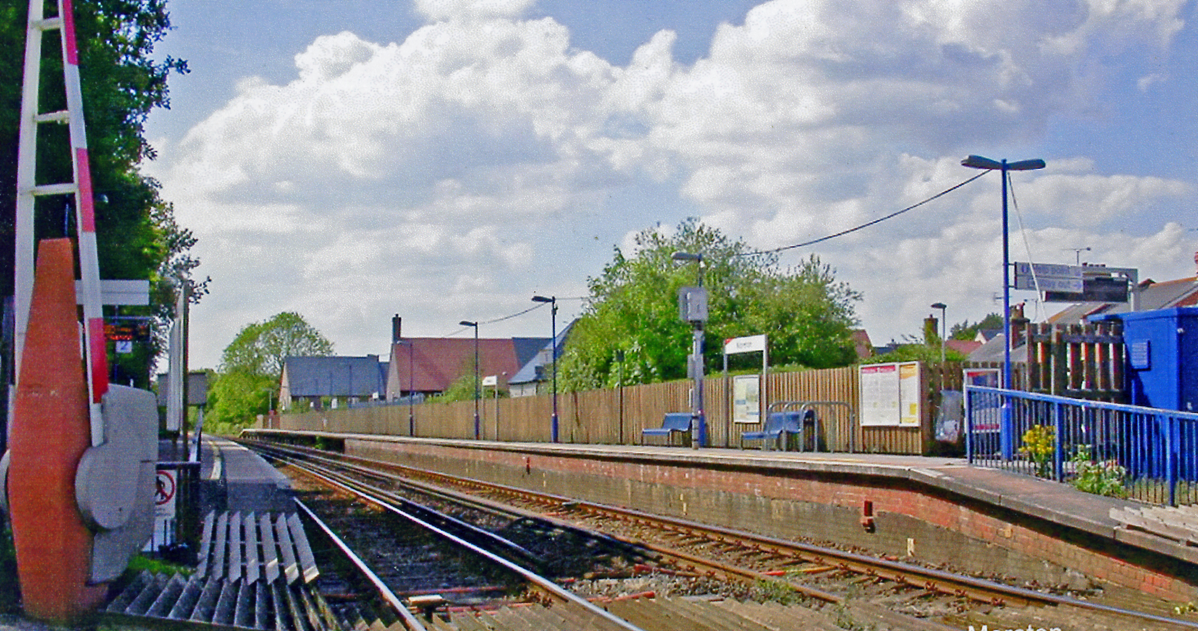
Moreton railway station (Dorset)

Moreton railway station serves the villages of Moreton and Crossways in Dorset, England. It is operated by South Western Railway and is served by their...

Crossways, Dorset

Crossways is a village and civil parish in the English county of Dorset. It lies 6 miles (9.7 km) east of the county town Dorchester. In the 2011 census...

Moreton, Dorset

Moreton is a village and civil parish in Dorset, England, situated on the River Frome about 8 miles (13 km) east of Dorchester. In the 2011 census the...

St Nicholas' Church, Moreton

St Nicholas' is a Church of England parish church at Moreton, Dorset, England. It is known for its thirteen windows, engraved by the poet and artist Sir...

Warmwell

Warmwell is a small village and civil parish in south west Dorset, England, situated on the B3390 road about 5 miles (8.0 km) southeast of Dorchester....
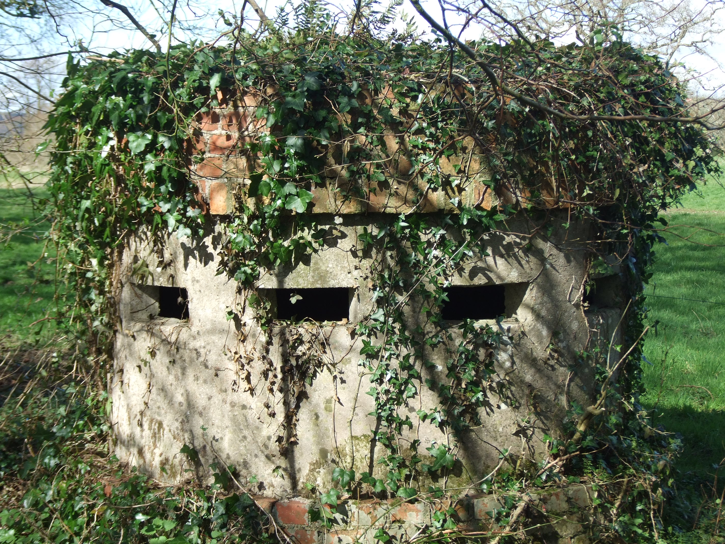
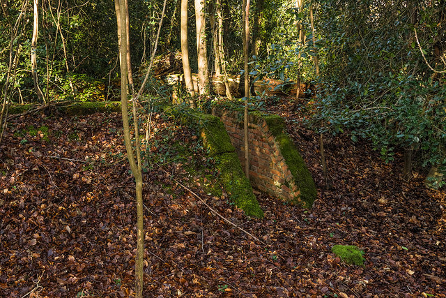
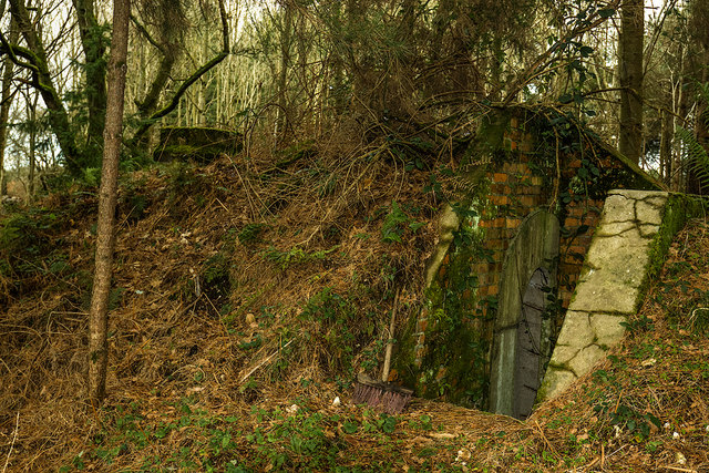
Norcon pillbox

The Norcon pillbox is a type of hardened field fortification built in Britain during the invasion crisis of 1940–1941. It was a small circular pillbox...

RAF Warmwell

Royal Air Force Warmwell or more simply RAF Warmwell is a former Royal Air Force station near Warmwell in Dorset, England from 1937 to 1946, located about...

Tadnoll and Winfrith Heath

Tadnoll and Winfrith Heath is a nature reserve of the Dorset Wildlife Trust, near the village of Winfrith Newburgh in Dorset, England. There is heathland...

Nearby Amenities

Located within 500m of 50.695029,-2.3072225
Red Bridge
Place: locality
Source: OS Historic
Lat/Long: 50.6942715/-2.3030415
Location Transition: yes
Material: wood
Power: pole
Source: survey
Transformer: distribution
Voltage Primary: 11000
Voltage Secondary: 400
Voltage Tertiary: 230
Lat/Long: 50.6935551/-2.3089258
Material: wood
Power: pole
Source: bing
Lat/Long: 50.6943077/-2.3082121
Material: wood
Power: pole
Source: bing
Lat/Long: 50.6945271/-2.3021415
Material: wood
Power: pole
Source: bing
Lat/Long: 50.6945692/-2.3027401
Material: wood
Power: pole
Source: bing
Lat/Long: 50.6946192/-2.3033445
Location Transition: yes
Material: wood
Power: pole
Source: bing
Switch: mechanical
Lat/Long: 50.6948576/-2.3076891
Colour: gray
Man Made: street_cabinet
Operator: Network Rail
Street Cabinet: power
Lat/Long: 50.695146/-2.3017913
Fire Hydrant
Emergency: fire_hydrant
Fire Hydrant Diameter: 63
Fire Hydrant Type: underground
Ref: 10889
Source: survey
Lat/Long: 50.695268/-2.3023961
Power: pole
Source: bing
Lat/Long: 50.6946805/-2.3039331
Colour: green
Man Made: street_cabinet
Street Cabinet: power
Lat/Long: 50.6934792/-2.3096475
Material: wood
Power: pole
Ref: 2;50604162
Source: survey
Source Ref: survey
Lat/Long: 50.6926551/-2.3109537
Material: wood
Power: pole
Ref: 3;50604163
Source: survey
Source Ref: survey
Lat/Long: 50.6924122/-2.3119971
Power: pole
Ref: 1
Source: survey
Source Ref: interpolation
Lat/Long: 50.6929024/-2.3102134
Location: outdoor
Operator: SSE Power Distribution
Power: switch
Switch: mechanical
Voltage: 11000
Lat/Long: 50.6948353/-2.3043947
Location: outdoor
Operator: SSE Power Distribution
Power: switch
Switch: mechanical
Voltage: 11000
Lat/Long: 50.6948402/-2.3043964
Colour: gray
Man Made: street_cabinet
Manufacturer: Schneider Electric
Operator: SSE Power Distribution
Street Cabinet: power
Lat/Long: 50.6948393/-2.3044363
Frequency: 50
Location: outdoor
Manufacturer: Brush
Operator: SSE Power Distribution
Power: transformer
Transformer: distribution
Voltage Primary: 11000
Voltage Secondary: 400
Voltage Tertiary: 230
Lat/Long: 50.6948217/-2.3044205
Give Way
Lat/Long: 50.6952378/-2.3020421
The data included in this document is from www.openstreetmap.org. The data is made available under ODbL.

Have you been to Redbridge?

Leave your review of Redbridge below (or comments, questions and feedback).