Redbournbury

Settlement in Hertfordshire St. Albans

England

Redbournbury

Punch Bowl Lane, Redbournbury
Punch Bowl Lane, Redbournbury Credit: David Howard

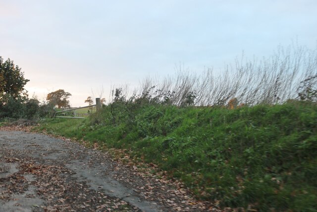
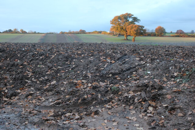
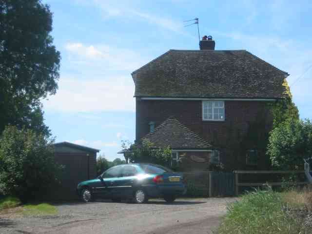
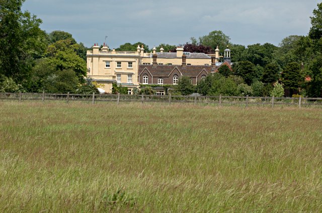
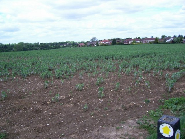
Redbournbury is a small village located in the county of Hertfordshire, England. Situated near the River Ver, it is positioned about 3 miles east of the town of Hemel Hempstead and approximately 20 miles north-west of London. The village is known for its picturesque and idyllic countryside setting, surrounded by rolling hills, lush green fields, and charming rural landscapes.

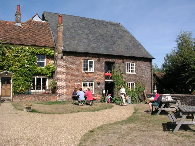
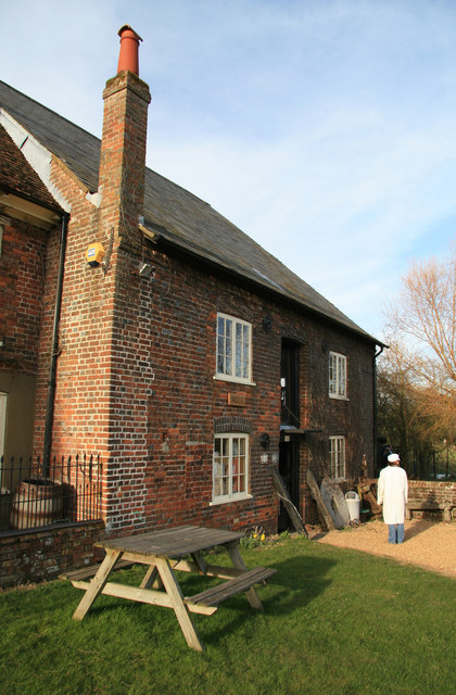
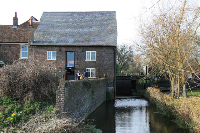
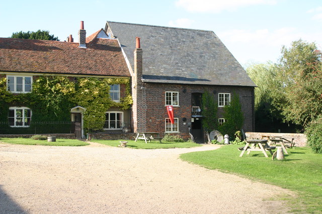
One of the notable features of Redbournbury is its historical significance. The village is home to Redbournbury Mill, a working watermill that dates back to the 18th century. This beautifully preserved mill stands as a testament to the area's rich industrial heritage. Visitors can explore the mill and witness the traditional milling process in action, as it continues to produce stone-ground flour.

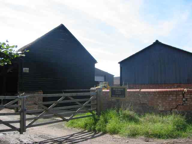
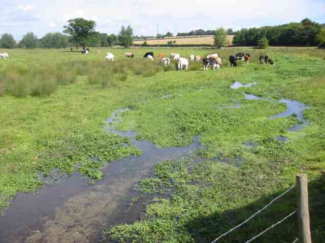
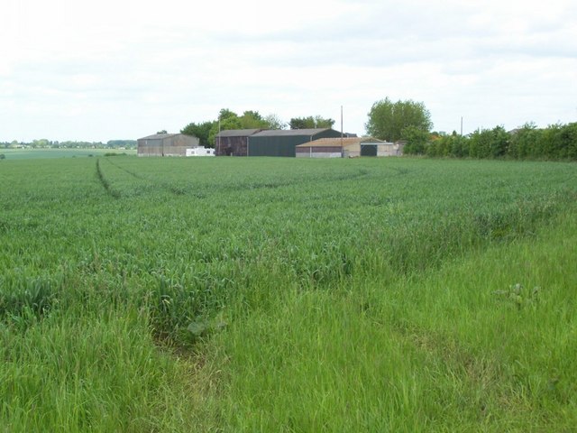
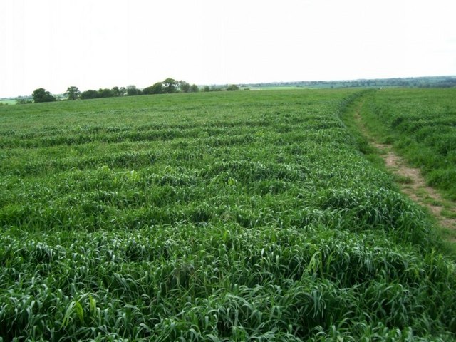
Redbournbury also boasts a thriving farming community, with several farms and agricultural enterprises in the vicinity. The fertile land provides an ideal environment for the cultivation of various crops and the rearing of livestock. Local produce, including fresh fruits, vegetables, and dairy products, can often be found at the village's farm shops and markets.

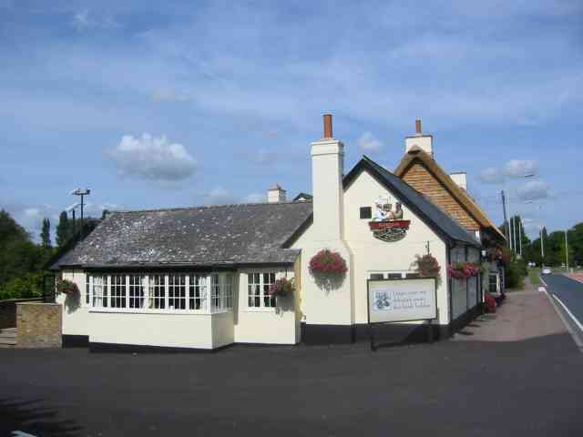
The village itself is small but charming, with a scattering of traditional cottages and a parish church that dates back to the 12th century. It offers a peaceful and tranquil atmosphere, making it a popular destination for those seeking a break from the hustle and bustle of city life.

Overall, Redbournbury is a picturesque village that combines natural beauty, historical significance, and rural charm, making it a delightful place to visit or reside in Hertfordshire.

If you have any feedback on the listing, please let us know in the comments section below.

Redbournbury Images

Images are sourced within 2km of 51.777471/-0.3779856 or Grid Reference TL1210. Thanks to Geograph Open Source API. All images are credited.

Punch Bowl Lane, Redbournbury
Grass and field by Punch Bowl Lane, Redbournbury
Field by Punch Bowl Lane, Redbournbury
Redbournbury Mill
Redbournbury Mill
Beaumont Hall Farm Farm buildings painted black and with the sun behind them
Beaumont Hall Farm
Farm buildings painted black and with the sun behind them
House at Gate to Dane End Farm Gates operated by digital locks. Sun at the wrong time.
House at Gate to Dane End Farm
Gates operated by digital locks. Sun at the wrong time.
Onyx recycling at Redbournbury Onyx vehicles are tankers so the recycling is of liquids but that is the extent of my knowledge.
Onyx recycling at Redbournbury
Onyx vehicles are tankers so the recycling is of liquids but that is the extent of my knowledge.
River Ver with cattle at Redbournbury The recycling works are just to the right of the picture so I hope they never have an accidental spillage.
River Ver with cattle at Redbournbury
The recycling works are just to the right of the picture so I hope they never have an accidental spillage.
Petrol filling station at Redbourn My chariot is also in the picture.
Petrol filling station at Redbourn
My chariot is also in the picture.
Chef and Brewer Pub   Redbourn The pub is right next door to the filling station. They cater for travellers more than locals.
Chef and Brewer Pub Redbourn
The pub is right next door to the filling station. They cater for travellers more than locals.
Childwickbury Manor House Childwickbury manor, formerly Stanley Kubrick's house.
Childwickbury Manor House
Childwickbury manor, formerly Stanley Kubrick's house.
Dane End farm Some of the buildings of Dane End farm, taken looking NE from the footpath junction at TL103103.
Dane End farm
Some of the buildings of Dane End farm, taken looking NE from the footpath junction at TL103103.
Dane End farm Although the approaching road is closed by locked gates with digital keypads, various public footpaths cross the farm. This is the farmhouse at TL105105.
Dane End farm
Although the approaching road is closed by locked gates with digital keypads, various public footpaths cross the farm. This is the farmhouse at TL105105.
Footpath and field Looking west from the footpath junction at TL128115, the path will eventually take you to Redbourn.
Footpath and field
Looking west from the footpath junction at TL128115, the path will eventually take you to Redbourn.
Houses beyond the fields Looking NE from the footpath junction at TL128115, over the fields we can see the houses which just creep into the NE corner of the square.
Houses beyond the fields
Looking NE from the footpath junction at TL128115, over the fields we can see the houses which just creep into the NE corner of the square.
Dusty Miller - Redbournbury Mill The miller/baker appears for a breath of fresh air.
Mill not open today but milling using electric power. This is unusual as the three stones are driven by bevels off a layshaft rather than being grouped around a single great spur wheel.
Dusty Miller - Redbournbury Mill
The miller/baker appears for a breath of fresh air. Mill not open today but milling using electric power. This is unusual as the three stones are driven by bevels off a layshaft rather than being grouped around a single great spur wheel.
Redbournbury Mill Overshot wheel is visible.
Redbournbury Mill
Overshot wheel is visible.
Redbournbury watermill This mill was rebuilt completely after a fire, and now once more mills wheat to make flour, although the lack of water in the river Ver means that it now uses electricity rather than waterpower
Redbournbury watermill
This mill was rebuilt completely after a fire, and now once more mills wheat to make flour, although the lack of water in the river Ver means that it now uses electricity rather than waterpower
Show me another place!

Redbournbury is located at Grid Ref: TL1210 (Lat: 51.777471, Lng: -0.3779856)

Administrative County: Hertfordshire

District: St. Albans

Police Authority: Hertfordshire

What 3 Words

///cross.twice.marble. Near Redbourn, Hertfordshire

Nearby Locations

Caws Wood Redbournbury

Related Wikis

Redbournbury Mill

Redbournbury Mill, is a Grade II* listed flour mill in Redbournbury, Hertfordshire, England, which is thought to have been first built in the early 11th...

Redbournbury

Redbournbury is a hamlet in the county of Hertfordshire. It is located near the A5 road in between the city of St Albans and the large village of Redbourn...
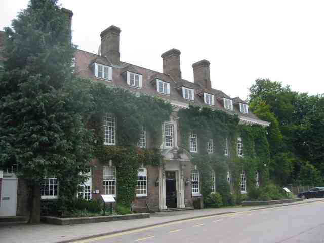
Batchwood Hall

Batchwood Hall is a manor house in St Albans, Hertfordshire == History == The house was designed in the Queen Anne style and built for Edmund Beckett,...

Childwickbury Manor

Childwickbury Manor is a manor house in the hamlet of Childwickbury, Hertfordshire, England, between St Albans and Harpenden. == History == The Lomax family...

Childwickbury

Childwickbury is a hamlet in Hertfordshire, England lying to the north of St Albans in the parish of St Michael. Childwickbury Manor was home to Stanley...
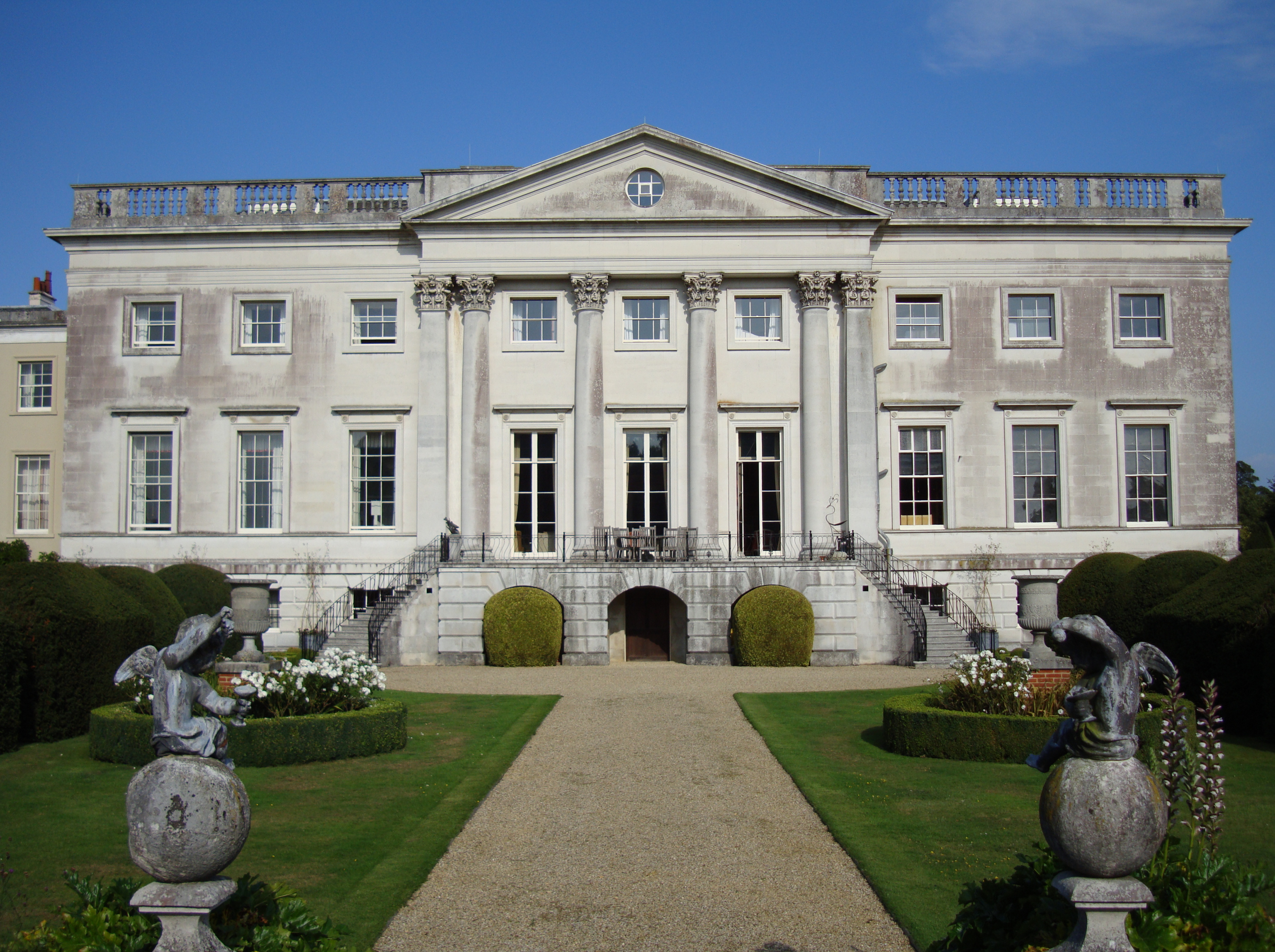
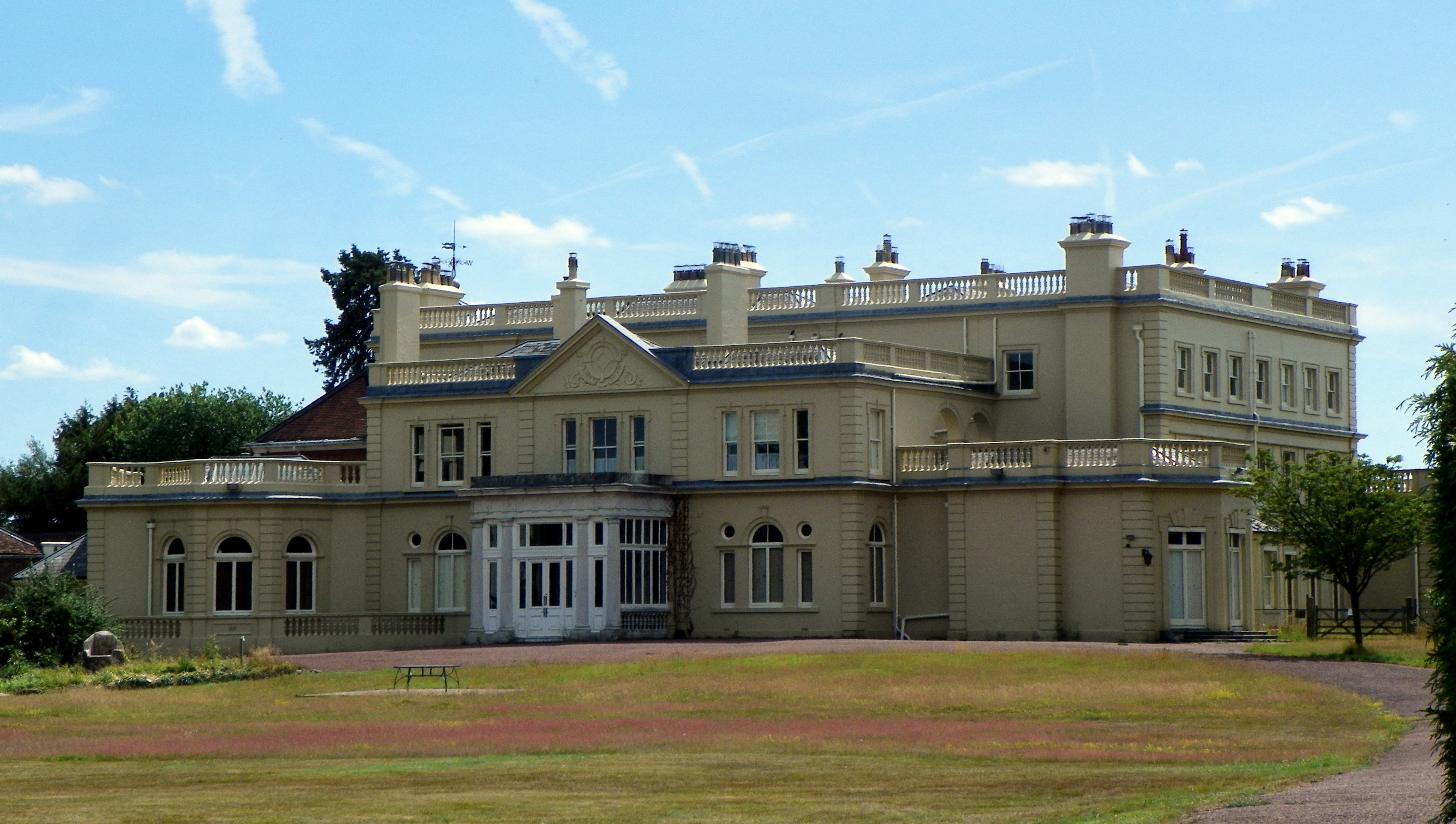
Gorhambury House

Gorhambury House is a Palladian-style house near St Albans, Hertfordshire, England. It was built between 1777 and 1784 to replace Old Gorhambury House...

Childwickbury Stud

Childwickbury Stud is a Thoroughbred horse breeding farm near St Albans, Hertfordshire, England. Originally built in 1888 by Sir John Blundell Maple as...

Redbourn railway station

Redbourn railway station served the village of Redbourn, Hertfordshire, England from 1887 to 1964 on the Nickey Line. == History == The station opened...

Nearby Amenities

Located within 500m of 51.777471,-0.3779856
Barrier: kissing_gate
Lat/Long: 51.7808756/-0.3747004
Bus Stop
Punch Bowl Lane
Naptan AtcoCode: 210021502680
Naptan Bearing: SE
Naptan CommonName: Punch Bowl Lane
Naptan Crossing: Fudge Nightclub
Naptan Indicator: opp
Naptan Landmark: Fudge Nightclub
Naptan NaptanCode: hrtawtwd
Naptan PlusbusZoneRef: STALBCY
Naptan ShortCommonName: NA
Naptan Street: Redbourn Road
Naptan Verified: no
Public Transport: platform
Source: naptan_import
Lat/Long: 51.7796107/-0.3808388
Bus Stop
Punch Bowl Lane
Naptan AtcoCode: 210021509040
Naptan Bearing: NW
Naptan CommonName: Punch Bowl Lane
Naptan Crossing: opp Fudge Nightclub
Naptan Indicator: adj
Naptan Landmark: opp Fudge Nightclub
Naptan NaptanCode: hrtatpwj
Naptan PlusbusZoneRef: STALBCY
Naptan ShortCommonName: NA
Naptan Street: Redbourn Road
Naptan Verified: no
Public Transport: platform
Source: naptan_import
Lat/Long: 51.7789418/-0.3805873
Crossing: uncontrolled
Source: Bing, observation
Lat/Long: 51.7790975/-0.3743103
Barrier: kissing_gate
Foot: yes
Source: GPS, observation
Lat/Long: 51.7801102/-0.3743177
Ford: yes
Lat/Long: 51.7806124/-0.375472
The data included in this document is from www.openstreetmap.org. The data is made available under ODbL.

Have you been to Redbournbury?

Leave your review of Redbournbury below (or comments, questions and feedback).