Redbourn

Settlement in Hertfordshire St. Albans

England

Redbourn

Matrix gantry M1 northbound
Matrix gantry M1 northbound Credit: Dave Thompson

Redbourn is a picturesque village located in the county of Hertfordshire, England. Situated approximately 25 miles north-west of London, it lies within close proximity to the larger towns of St Albans and Hemel Hempstead. With a population of around 5,000 residents, Redbourn maintains a strong sense of community and offers a charming and peaceful atmosphere.

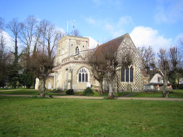
The village is renowned for its historic buildings, many of which date back to the medieval period. The 12th-century St Mary's Church, with its striking flint and stone exterior, stands as a prominent landmark and is a testament to the village's rich heritage. Other notable structures include the 16th-century Redbournbury Watermill, a fully operational flour mill that provides insight into the area's agricultural past.

Redbourn's picturesque High Street is lined with an array of independent shops, traditional pubs, and quaint cottages, creating an idyllic setting for locals and visitors alike. The village also boasts several well-regarded schools, making it an attractive choice for families.

Surrounded by lush countryside, Redbourn offers ample opportunities for outdoor activities and exploration. The nearby Redbourn Golf Club is a popular destination for golf enthusiasts, while the surrounding countryside provides scenic walking and cycling routes. The village is also home to numerous parks and green spaces, providing residents with ample opportunities to relax and enjoy the natural surroundings.

With its rich history, strong community spirit, and beautiful surroundings, Redbourn offers a quintessentially English village experience.

If you have any feedback on the listing, please let us know in the comments section below.
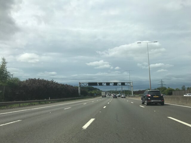
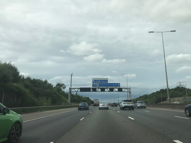
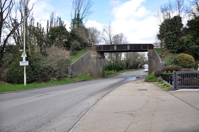
Redbourn Images

Images are sourced within 2km of 51.79985/-0.3962394 or Grid Reference TL1012. Thanks to Geograph Open Source API. All images are credited.

Matrix gantry M1 northbound
Footbridge crossing M1 northbound
Matrix gantry M1 northbound
Luton Lane looking towards Kinsbourne Green Lane
Conifers by Luton Lane, Redbourn
House on Luton Lane, Redbourn
Aubrey Park Hotel, Hemel Hempstead Road
Bridge over Redbourn High Street The disused railway bridge crossing Redbourn High Street, once the A5.  The single line ran from Harpenden to Hemel Hempstead and was built by the Midland Railway.  Passenger services ceased in 1947, but the full length of the line was not closed and removed until 1982.  Nowadays a large part of the line is used as a cycleway and footpath, known as the 'Nickey Line'.
Bridge over Redbourn High Street
The disused railway bridge crossing Redbourn High Street, once the A5. The single line ran from Harpenden to Hemel Hempstead and was built by the Midland Railway. Passenger services ceased in 1947, but the full length of the line was not closed and removed until 1982. Nowadays a large part of the line is used as a cycleway and footpath, known as the 'Nickey Line'.
Nickey Line M1 tunnel Since the widening of the M1, the Nickey Line path goes through this concrete tunnel, far less photogenic than the old 'original M1 style' bridge which is now encased beneath the roadway above.
Nickey Line M1 tunnel
Since the widening of the M1, the Nickey Line path goes through this concrete tunnel, far less photogenic than the old 'original M1 style' bridge which is now encased beneath the roadway above.
Nickey Line tunnel The south end of the new Nickey Line tunnel beneath the widened M1 motorway.  During the widening the old original railway bridge was lined and extended with this less elegant concrete tunnel.
Nickey Line tunnel
The south end of the new Nickey Line tunnel beneath the widened M1 motorway. During the widening the old original railway bridge was lined and extended with this less elegant concrete tunnel.
Southbound M1 near to Redbourn The M1 is a north–south motorway connecting London to Leeds, where it joins the A1(M) near Aberford. It was the first motorway to be completed in the United Kingdom.
The motorway is 193 miles long and was constructed in four phases. Most of the motorway was opened between 1959 and 1968 but the southern end was extended in 1977 and the northern end was extended in 1999.
Southbound M1 near to Redbourn
The M1 is a north–south motorway connecting London to Leeds, where it joins the A1(M) near Aberford. It was the first motorway to be completed in the United Kingdom. The motorway is 193 miles long and was constructed in four phases. Most of the motorway was opened between 1959 and 1968 but the southern end was extended in 1977 and the northern end was extended in 1999.
Bungalows at end of Gaddesden Lane When the road became a river these bungalows were flooded and had to be protected by sandbag barricades
Bungalows at end of Gaddesden Lane
When the road became a river these bungalows were flooded and had to be protected by sandbag barricades
M1 Motorway near Redbourn Viewed looking north from the Flamsteadbury Farm overbridge, this section of the motorway, between Junctions 8 and 9, is about to be widened to four lanes in each direction. Two wide swathes of land on either side have already been cleared of vegetation. The motorway currently carries an average of 160,000 vehicles per day between these junctions and is often subject to delays. The total cost of the improvement works is estimated to be about £214 million.
M1 Motorway near Redbourn
Viewed looking north from the Flamsteadbury Farm overbridge, this section of the motorway, between Junctions 8 and 9, is about to be widened to four lanes in each direction. Two wide swathes of land on either side have already been cleared of vegetation. The motorway currently carries an average of 160,000 vehicles per day between these junctions and is often subject to delays. The total cost of the improvement works is estimated to be about £214 million.
M1 Motorway near Redbourn The southbound carriageway looking northwards from the Flamsteadbury Farm overbridge, with the outside lane coned off, and the swathe of land to the right for the widening already cleared of vegetation.
M1 Motorway near Redbourn
The southbound carriageway looking northwards from the Flamsteadbury Farm overbridge, with the outside lane coned off, and the swathe of land to the right for the widening already cleared of vegetation.
M1 Motorway near Redbourn The northbound carriageway looking northwards from the Flamsteadbury Farm overbridge, with the outside lane coned off, and the swathe of land to the left for the widening already cleared of vegetation.
M1 Motorway near Redbourn
The northbound carriageway looking northwards from the Flamsteadbury Farm overbridge, with the outside lane coned off, and the swathe of land to the left for the widening already cleared of vegetation.
Redbourn: Lybury Lane & the M1 Motorway bridge Viewed looking westwards, with the earthworks for the motorway widening in the foreground.
Redbourn: Lybury Lane & the M1 Motorway bridge
Viewed looking westwards, with the earthworks for the motorway widening in the foreground.
Redbourn: Gaddesden Lane & the M1 Motorway bridge A temporary construction plant compound for the M1 Motorway widening scheme, on the west side of the motorway and on the north side of Gaddesden Lane.
Redbourn: Gaddesden Lane & the M1 Motorway bridge
A temporary construction plant compound for the M1 Motorway widening scheme, on the west side of the motorway and on the north side of Gaddesden Lane.
Show me another place!

Redbourn is located at Grid Ref: TL1012 (Lat: 51.79985, Lng: -0.3962394)

Administrative County: Hertfordshire

District: St. Albans

Police Authority: Hertfordshire

What 3 Words

///snow.onion.cage. Near Redbourn, Hertfordshire

Nearby Locations

Redbourn

Related Wikis

Redbourn

Redbourn is a village and civil parish in Hertfordshire, England, lying on Watling Street, three miles (4.8 km) from Harpenden, four miles (6.4 km) from...

Redbourn railway station

Redbourn railway station served the village of Redbourn, Hertfordshire, England from 1887 to 1964 on the Nickey Line. == History == The station opened...

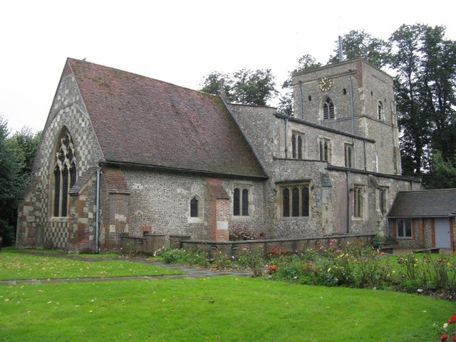
St Mary's Church, Redbourn

St Mary's Church is an active Grade I listed parish church in the Church of England in Redbourn, Hertfordshire, England. The building is Grade I listed...

Beaumont's Halt railway station

Beaumont's Halt railway station was in Hertfordshire, England from 1905 to 1963 on the Nickey Line. == History == The station opened on 9 August 1905...

Harpenden RFC

Harpenden Rugby Football Club is a rugby club based in Harpenden. They play in Regional 1 South East - a league at tier 5 of the English rugby union system...
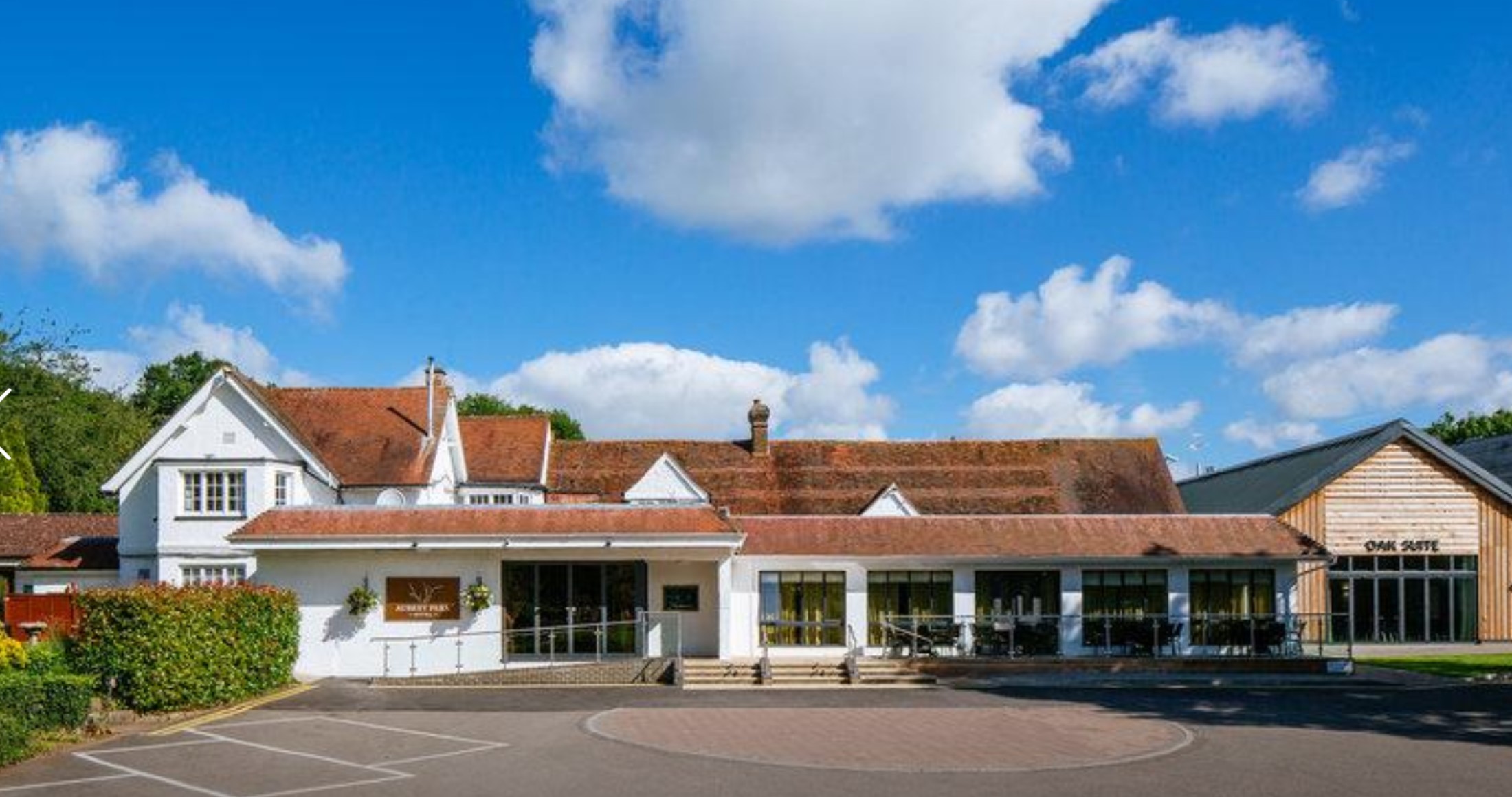
Aubrey Park Hotel

Aubrey Park, Redbourn in Hertfordshire is a building of historical significance and is listed on the English Heritage Register. Parts of the building date...

Rothamsted Manor

Rothamsted Manor is a former manor and current manor house, situated in Harpenden Rural in the English county of Hertfordshire. A Grade I listed building...

Redbournbury

Redbournbury is a hamlet in the county of Hertfordshire. It is located near the A5 road in between the city of St Albans and the large village of Redbourn...

Related Videos

Showbus 2021

The Showbus bus rally at the Hertfordshire Showground near Redbourn on 26th September 2021. In addition to the vehicles on ...

Showbus 50 - Part 2 of 2

The Showbus 50 bus rally at the Hertfordshire Showground in Redbourn on 25th September 2022. Part 2 of this video includes a ...

Nearby Amenities

Located within 500m of 51.79985,-0.3962394
Turning Circle
Lat/Long: 51.8011237/-0.3915196
Turning Circle
Lat/Long: 51.7987373/-0.393032
Redbourn
Place: village
Population: 5344
Wikidata: Q19853
Wikipedia: en:Redbourn
Lat/Long: 51.7985104/-0.3951486
War Memorial
Historic: memorial
Lat/Long: 51.7966199/-0.3971356
Post Box
Created By: Potlatch 0.7b
Lat/Long: 51.7994387/-0.3957882
Clinic
Health Centre
Healthcare: clinic
Lat/Long: 51.7985476/-0.3965225
The Bull Inn
Disused Amenity: pub
Wikidata: Q26630686
Lat/Long: 51.7986797/-0.3951529
Pub
The George
Addr City: Redbourn
Addr Housenumber: 37
Addr Postcode: AL3 7LW
Addr Street: High Street
Fhrs Authority: St Albans City
Fhrs Id: 305639
Wikidata: Q26396999
Lat/Long: 51.7984041/-0.3949239
Parking
Redbourn Village Hall
Access: yes
Created By: Potlatch 0.7
Fee: no
Parking: surface
Lat/Long: 51.7990996/-0.3950719
School
Redbourn House Nursery School
Lat/Long: 51.7961162/-0.3968727
Enchanted Tearoom
Shop: tea
Lat/Long: 51.7993856/-0.3957367
Pub
The Bell & Shears
Created By: Potlatch 0.7
Wikidata: Q26469590
Lat/Long: 51.7997198/-0.3959778
Post Box
Created By: Potlatch 0.7a
Lat/Long: 51.8020987/-0.4016799
Turning Circle
Lat/Long: 51.7978917/-0.4020464
School
Redbourn Junior School
Created By: Potlatch 0.7b
Lat/Long: 51.8007208/-0.4030764
Bus Stop
Ver Road
Bus: yes
Local Ref: NR
Naptan AtcoCode: 210021500880
Naptan Bearing: SW
Naptan CommonName: Ver Road
Naptan Crossing: Ver Road
Naptan Indicator: nr
Naptan Landmark: Ver Road
Naptan NaptanCode: hrtdajma
Naptan PlusbusZoneRef: HRPNDN;STALBCY
Naptan ShortCommonName: NA
Naptan Street: Harpenden Lane
Naptan Verified: no
Public Transport: platform
Shelter: no
Source: naptan_import
Lat/Long: 51.80157/-0.3933376
Bus Stop
Aysgarth Road
Bus: yes
Naptan AtcoCode: 210021502420
Naptan Bearing: SE
Naptan CommonName: Aysgarth Road
Naptan Crossing: opp Aysgarth Road
Naptan Indicator: opp
Naptan Landmark: opp Aysgarth Road
Naptan NaptanCode: hrtdadjw
Naptan PlusbusZoneRef: HRPNDN;STALBCY
Naptan ShortCommonName: NA
Naptan Street: Dunstable Road
Naptan Verified: no
Public Transport: platform
Source: naptan_import
Lat/Long: 51.8029532/-0.3984954
Bus Stop
Bell and Shears PH
Bus: yes
Naptan AtcoCode: 210021502440
Naptan Bearing: SE
Naptan CommonName: Bell and Shears PH
Naptan Crossing: Crown Street
Naptan Indicator: adj
Naptan Landmark: Crown Street
Naptan NaptanCode: hrtdadma
Naptan PlusbusZoneRef: HRPNDN;STALBCY
Naptan ShortCommonName: NA
Naptan Street: High Street
Naptan Verified: no
Public Transport: platform
Source: naptan_import
Lat/Long: 51.7993243/-0.3957418
Bus Stop
High Street
Bench: yes
Bus: yes
Naptan AtcoCode: 210021502460
Naptan Bearing: SE
Naptan CommonName: High Street
Naptan Crossing: Waterend Lane
Naptan Indicator: SE-bound
Naptan Landmark: Waterend Lane
Naptan NaptanCode: hrtdadad
Naptan PlusbusZoneRef: HRPNDN;STALBCY
Naptan ShortCommonName: NA
Naptan Street: High Street
Naptan Verified: no
Public Transport: platform
Shelter: yes
Source: naptan_import
Lat/Long: 51.7978462/-0.3945722
Bus Stop
Fish Street Farm
Bus: yes
Naptan AtcoCode: 210021502465
Naptan Bearing: SE
Naptan CommonName: Fish Farm Street
Naptan Crossing: Industrial Estate
Naptan Indicator: opp
Naptan Landmark: Industrial Estate
Naptan NaptanCode: hrtdadag
Naptan PlusbusZoneRef: HRPNDN;STALBCY
Naptan ShortCommonName: NA
Naptan Street: High Street
Naptan Verified: no
Public Transport: platform
Source: naptan_import
Lat/Long: 51.7963921/-0.3934491
Bus Stop
Lords Meadow
Bus: yes
Naptan AtcoCode: 210021502480
Naptan Bearing: SW
Naptan CommonName: Lords Meadow
Naptan Crossing: North Common
Naptan Indicator: opp
Naptan Landmark: North Common
Naptan NaptanCode: hrtdadam
Naptan PlusbusZoneRef: HRPNDN;STALBCY
Naptan ShortCommonName: NA
Naptan Street: North Common Road
Naptan Verified: no
Public Transport: platform
Shelter: no
Source: naptan_import
Lat/Long: 51.7977754/-0.3992735
Bus Stop
Monks Close
Bus: yes
Naptan AtcoCode: 210021502485
Naptan Bearing: SE
Naptan CommonName: Monks Close
Naptan Crossing: Fish Street
Naptan Indicator: adj
Naptan Landmark: Fish Street
Naptan NaptanCode: hrtdadap
Naptan PlusbusZoneRef: HRPNDN;STALBCY
Naptan ShortCommonName: NA
Naptan Street: Cottonmill Lane
Naptan Verified: no
Public Transport: platform
Source: naptan_import
Lat/Long: 51.7969128/-0.3966792
Bus Stop
Fish Street Farm
Bus: yes
Local Ref: NR
Naptan AtcoCode: 210021509125
Naptan Bearing: NW
Naptan CommonName: Fish Farm Street
Naptan Crossing: opp Industrial Estate
Naptan Indicator: nr
Naptan Landmark: opp Industrial Estate
Naptan NaptanCode: hrtatwag
Naptan PlusbusZoneRef: HRPNDN;STALBCY
Naptan ShortCommonName: NA
Naptan Street: High Street
Naptan Verified: no
Public Transport: platform
Source: naptan_import
Lat/Long: 51.7959855/-0.3933041
Bus Stop
Monks Close
Bus: yes
Naptan AtcoCode: 210021509205
Naptan Bearing: NW
Naptan CommonName: Monks Close
Naptan Crossing: War Memorial
Naptan Indicator: opp
Naptan Landmark: War Memorial
Naptan NaptanCode: hrtatptm
Naptan PlusbusZoneRef: HRPNDN;STALBCY
Naptan ShortCommonName: NA
Naptan Street: Fish Street
Naptan Verified: no
Public Transport: platform
Shelter: no
Source: naptan_import
Lat/Long: 51.7967772/-0.396626
Bus Stop
Lords Meadow
Bus: yes
Naptan AtcoCode: 210021509300
Naptan Bearing: NE
Naptan CommonName: Lords Meadow
Naptan Crossing: opp North Common
Naptan Indicator: adj
Naptan Landmark: opp North Common
Naptan NaptanCode: hrtatpja
Naptan PlusbusZoneRef: HRPNDN;STALBCY
Naptan ShortCommonName: NA
Naptan Street: North Common Road
Naptan Verified: no
Public Transport: platform
Shelter: no
Source: naptan_import
Lat/Long: 51.7975721/-0.4001944
Bus Stop
High Street
Bus: yes
Naptan AtcoCode: 210021509320
Naptan Bearing: NW
Naptan CommonName: High Street
Naptan Crossing: opp Pondsmeade
Naptan Indicator: NW-bound
Naptan Landmark: opp Pondsmeade
Naptan NaptanCode: hrtatpjd
Naptan PlusbusZoneRef: HRPNDN;STALBCY
Naptan ShortCommonName: NA
Naptan Street: High Street
Naptan Verified: no
Public Transport: platform
Shelter: no
Source: naptan_import
Lat/Long: 51.7977313/-0.3946818
Bus Stop
Bell and Shears PH
Bus: yes
Naptan AtcoCode: 210021509340
Naptan Bearing: NW
Naptan CommonName: Bell and Shears PH
Naptan Crossing: Lamb Lane
Naptan Indicator: opp
Naptan Landmark: Lamb Lane
Naptan NaptanCode: hrtatpjg
Naptan PlusbusZoneRef: HRPNDN;STALBCY
Naptan ShortCommonName: NA
Naptan Street: High Street
Naptan Verified: no
Public Transport: platform
Shelter: no
Source: naptan_import
Lat/Long: 51.7997542/-0.3962106
Bus Stop
Aysgarth Road
Bus: yes
Local Ref: NR
Naptan AtcoCode: 210021509360
Naptan Bearing: NW
Naptan CommonName: Aysgarth Road
Naptan Crossing: Linden Road
Naptan Indicator: nr
Naptan Landmark: Linden Road
Naptan NaptanCode: hrtatpjm
Naptan PlusbusZoneRef: HRPNDN;STALBCY
Naptan ShortCommonName: NA
Naptan Street: Dunstable Road
Naptan Verified: no
Public Transport: platform
Shelter: no
Source: naptan_import
Lat/Long: 51.8033462/-0.3989602
Bus Stop
Ver Road
Bus: yes
Naptan AtcoCode: 210021510880
Naptan Bearing: E
Naptan CommonName: Ver Road
Naptan Crossing: Footpath
Naptan Indicator: opp
Naptan Landmark: Footpath
Naptan NaptanCode: hrtatjgw
Naptan PlusbusZoneRef: HRPNDN;STALBCY
Naptan ShortCommonName: NA
Naptan Street: Harpenden Lane
Naptan Verified: no
Public Transport: platform
Shelter: no
Source: naptan_import
Lat/Long: 51.8020918/-0.3923812
Weymans (NISA)
Addr City: Redbourn
Addr Housenumber: 27
Addr Postcode: AL3 7LE
Addr Street: High Street
Fhrs Authority: St Albans City
Fhrs Id: 305638
Shop: convenience
Lat/Long: 51.7974095/-0.394266
Shop: hairdresser
Lat/Long: 51.7992026/-0.395876
Shop: convenience
Lat/Long: 51.7994116/-0.396045
Shop: florist
Lat/Long: 51.7992955/-0.3959377
Redbourn Barber Shop
Shop: hairdresser
Lat/Long: 51.7985731/-0.3954066
Post Box
Lat/Long: 51.7975021/-0.3942758
W Hall
Shop: butcher
Lat/Long: 51.7971748/-0.3940896
Restaurant
Indian Nights
Lat/Long: 51.7989754/-0.3956641
Traffic Calming: table
Lat/Long: 51.7982889/-0.3949977
Toilets
Fee: no
Source: gps
Lat/Long: 51.799043/-0.3952866
Shop: hairdresser
Source: gps
Lat/Long: 51.7998138/-0.3962316
Veterinary
Nine Lives Veterinary Centre
Lat/Long: 51.7976467/-0.3947212
The Hub
Shop: bicycle
Lat/Long: 51.7970635/-0.3944126
Cafe
The Hub
Addr City: Redbourn
Addr Housenumber: 22
Addr Postcode: AL3 7LL
Addr Street: High Street
Email: hubmeister@hubcoffeebikes.com
Fhrs Authority: St Albans City
Fhrs Id: 405724
Opening Hours: Mo-Su 08:30-16:30
Phone: +44 1582 792389
Theme: bicycle
Website: https://www.hubcoffeebikes.com
Lat/Long: 51.7970784/-0.3943751
Bicycle Parking
Bicycle Parking: stands
Capacity: 4
Covered: no
Lat/Long: 51.7971612/-0.3943055
Barrier: bollard
Bicycle: no
Foot: yes
Lat/Long: 51.7984871/-0.3905359
Redbourn Eyecare
Addr City: Redbourn
Addr Housenumber: 78
Addr Postcode: AL3 7LN
Addr Street: High Street
Shop: optician
Website: https://redbourneyecare.co.uk/
Wikidata: Q26469648
Lat/Long: 51.7997076/-0.3962414
Ford: yes
Lat/Long: 51.7982891/-0.3924041
Crossing
Crossing: marked
Lat/Long: 51.7963182/-0.3992155
Crossing
Crossing: marked
Lat/Long: 51.7976338/-0.3945141
Direction: 170
Generator Method: photovoltaic
Generator Output Electricity: yes
Generator Solar Modules: 16
Generator Source: solar
Generator Type: solar_photovoltaic_panel
Location: roof
Power: generator
Lat/Long: 51.7970665/-0.3957431
Direction: 170
Generator Method: photovoltaic
Generator Output Electricity: yes
Generator Solar Modules: 21
Generator Source: solar
Generator Type: solar_photovoltaic_panel
Location: roof
Power: generator
Lat/Long: 51.7972594/-0.3961956
Direction: 205
Generator Method: photovoltaic
Generator Output Electricity: yes
Generator Solar Modules: 21
Generator Source: solar
Generator Type: solar_photovoltaic_panel
Location: roof
Power: generator
Lat/Long: 51.7977034/-0.3959729
Direction: 250
Generator Method: photovoltaic
Generator Output Electricity: yes
Generator Solar Modules: 14
Generator Source: solar
Generator Type: solar_photovoltaic_panel
Location: roof
Power: generator
Lat/Long: 51.8004647/-0.3977451
Direction: 150
Generator Method: photovoltaic
Generator Output Electricity: yes
Generator Solar Modules: 3
Generator Source: solar
Generator Type: solar_photovoltaic_panel
Location: roof
Power: generator
Lat/Long: 51.8029999/-0.4011359
Direction: 60
Generator Method: photovoltaic
Generator Output Electricity: yes
Generator Solar Modules: 3
Generator Source: solar
Generator Type: solar_photovoltaic_panel
Location: roof
Power: generator
Lat/Long: 51.8030341/-0.4011359
Direction: 240
Generator Method: photovoltaic
Generator Output Electricity: yes
Generator Solar Modules: 3
Generator Source: solar
Generator Type: solar_photovoltaic_panel
Location: roof
Power: generator
Lat/Long: 51.8030086/-0.401196
Direction: 235
Generator Method: photovoltaic
Generator Output Electricity: yes
Generator Solar Modules: 3
Generator Source: solar
Generator Type: solar_photovoltaic_panel
Location: roof
Power: generator
Lat/Long: 51.8000689/-0.3955887
Direction: 235
Generator Method: photovoltaic
Generator Output Electricity: yes
Generator Solar Modules: 3
Generator Source: solar
Generator Type: solar_photovoltaic_panel
Location: roof
Power: generator
Lat/Long: 51.8000398/-0.3955518
Direction: 235
Generator Method: photovoltaic
Generator Output Electricity: yes
Generator Solar Modules: 5
Generator Source: solar
Generator Type: solar_photovoltaic_panel
Location: roof
Power: generator
Lat/Long: 51.7999624/-0.3955084
Direction: 235
Generator Method: photovoltaic
Generator Output Electricity: yes
Generator Solar Modules: 5
Generator Source: solar
Generator Type: solar_photovoltaic_panel
Location: roof
Power: generator
Lat/Long: 51.7998988/-0.3954418
Direction: 180
Generator Method: photovoltaic
Generator Output Electricity: yes
Generator Solar Modules: 14
Generator Source: solar
Generator Type: solar_photovoltaic_panel
Location: roof
Power: generator
Lat/Long: 51.799539/-0.3927066
Direction: 270
Generator Method: photovoltaic
Generator Output Electricity: yes
Generator Solar Modules: 10
Generator Source: solar
Generator Type: solar_photovoltaic_panel
Location: roof
Power: generator
Lat/Long: 51.8003613/-0.3928014
Direction: 90
Generator Method: photovoltaic
Generator Output Electricity: yes
Generator Solar Modules: 8
Generator Source: solar
Generator Type: solar_photovoltaic_panel
Location: roof
Power: generator
Lat/Long: 51.8003622/-0.3927425
Direction: 150
Generator Method: photovoltaic
Generator Output Electricity: yes
Generator Solar Modules: 16
Generator Source: solar
Generator Type: solar_photovoltaic_panel
Location: roof
Power: generator
Lat/Long: 51.8004419/-0.3912175
Direction: 220
Generator Method: photovoltaic
Generator Output Electricity: yes
Generator Solar Modules: 16
Generator Source: solar
Generator Type: solar_photovoltaic_panel
Location: roof
Power: generator
Lat/Long: 51.8006104/-0.3910005
Direction: 125
Generator Method: photovoltaic
Generator Output Electricity: yes
Generator Solar Modules: 7
Generator Source: solar
Generator Type: solar_photovoltaic_panel
Location: roof
Power: generator
Lat/Long: 51.8011071/-0.3911498
Direction: 215
Generator Method: photovoltaic
Generator Output Electricity: yes
Generator Solar Modules: 8
Generator Source: solar
Generator Type: solar_photovoltaic_panel
Location: roof
Power: generator
Lat/Long: 51.8011183/-0.3910897
Direction: 180
Generator Method: photovoltaic
Generator Output Electricity: yes
Generator Solar Modules: 2
Generator Source: solar
Generator Type: solar_photovoltaic_panel
Location: roof
Power: generator
Lat/Long: 51.8021625/-0.3904762
Direction: 145
Generator Method: photovoltaic
Generator Output Electricity: yes
Generator Solar Modules: 10
Generator Source: solar
Generator Type: solar_photovoltaic_panel
Location: roof
Power: generator
Lat/Long: 51.7982475/-0.3935739
Direction: 145
Generator Method: photovoltaic
Generator Output Electricity: yes
Generator Solar Modules: 11
Generator Source: solar
Generator Type: solar_photovoltaic_panel
Location: roof
Power: generator
Lat/Long: 51.7976868/-0.3925778
The data included in this document is from www.openstreetmap.org. The data is made available under ODbL.

Have you been to Redbourn?

Leave your review of Redbourn below (or comments, questions and feedback).