Addingham
Settlement in Yorkshire
England
Addingham

Addingham is a charming village located in the county of North Yorkshire, England. Nestled in the picturesque landscape of the Wharfedale Valley, it is situated approximately four miles west of the market town of Ilkley. The village is part of the Bradford Metropolitan District and lies within close proximity to the stunning Yorkshire Dales National Park.
Steeped in history, Addingham boasts a rich heritage that dates back to the medieval period. Its ancient roots are evident in the architectural gems that adorn the village, including the Grade I listed St. Peter's Church, which dates back to the 12th century. The village is also home to numerous stone-built cottages and houses that exude character and charm.
Today, Addingham is a thriving community with a population of around 3,000 residents. It offers a wide range of amenities, including a post office, grocery stores, pubs, restaurants, and a primary school. The village has a strong sense of community spirit, which is reflected in the various local events and activities organized throughout the year.
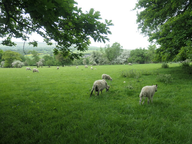
Nature enthusiasts are drawn to Addingham due to its proximity to the stunning Yorkshire Dales. The village is a gateway to beautiful countryside, with walking and cycling trails that take visitors through rolling hills, lush meadows, and picturesque riverside paths. The nearby Ilkley Moor also provides ample opportunities for outdoor pursuits.
With its idyllic location, rich history, and strong sense of community, Addingham is a truly delightful place to visit or call home.
If you have any feedback on the listing, please let us know in the comments section below.
Addingham Images
Images are sourced within 2km of 53.944/-1.882763 or Grid Reference SE0749. Thanks to Geograph Open Source API. All images are credited.


![High Laithe, from the north This farm building is shown on the large-scale OS map surveyed in 1850. It is now next to Bracken Ghyll golf course [founded 1993].](https://s2.geograph.org.uk/geophotos/07/49/65/7496554_49898d85.jpg)


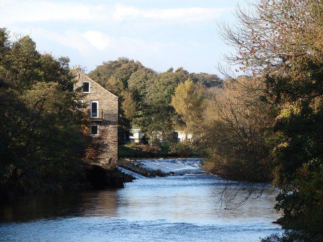
![The west bank of the River Wharfe The field edge public footpath forms part of the Dales Way. The river forms the county boundary between West and North Yorkshire. The far bank [North Yorkshire] is in the Yorkshire Dales national park. The near bank is not.](https://s2.geograph.org.uk/geophotos/07/49/78/7497870_a2eec583.jpg)


Addingham is located at Grid Ref: SE0749 (Lat: 53.944, Lng: -1.882763)
Division: West Riding
Unitary Authority: Bradford
Police Authority: West Yorkshire
What 3 Words
///ruled.topic.chitchat. Near Addingham, West Yorkshire
Nearby Locations
Related Wikis

Addingham railway station
Addingham railway station was on the Midland Railway route from Skipton to Ilkley. It served the village of Addingham in West Yorkshire, England. ��2...

St Peter's Church, Addingham
St Peter's Church is a Church of England parish church in Addingham, West Yorkshire. It is a Grade I listed building, with the main structure dating to...
Addingham
Addingham (formerly Haddincham c. 972, Odingehem 1086) is a village and civil parish in the City of Bradford in West Yorkshire, England. It is situated...

Nesfield
Nesfield is a small village, 2 miles (3.2 km) north-west of Ilkley on the north bank of the River Wharfe, in the civil parish of Nesfield with Langbar...

Farfield Friends Meeting House
Farfield Friends Meeting House is a Quaker meeting house no longer regularly in use by a Quaker meeting and now owned by the Historic Chapels Trust. It...

Ilkley Golf Club
Ilkley Golf Club is a golf club in North Yorkshire, England, just outside the town of Ilkley in West Yorkshire. It is located about a mile to the northwest...
Beamsley
Beamsley is a village and civil parish in the Craven district of North Yorkshire, England. It is just within the boundary of the Yorkshire Dales National...

Chelker Reservoir
Chelker Reservoir is a man-made lake in North Yorkshire, England. It lies in the parish of Draughton, immediately north of the A65 road, between Skipton...
Nearby Amenities
Located within 500m of 53.944,-1.882763Have you been to Addingham?
Leave your review of Addingham below (or comments, questions and feedback).